.author-name { display: none; }
APRIL 24, 2015 UPDATE – CENTRAL & NORTHERN MOUNTAINS, FRONT RANGE

APRIL 24, 2015 UPDATE – CENTRAL & NORTHERN MOUNTAINS, FRONT RANGE

APRIL 27, 2015 UPDATE – CENTRAL & NORTHERN MOUNTAINS, FRONT RANGE

SUMMARY

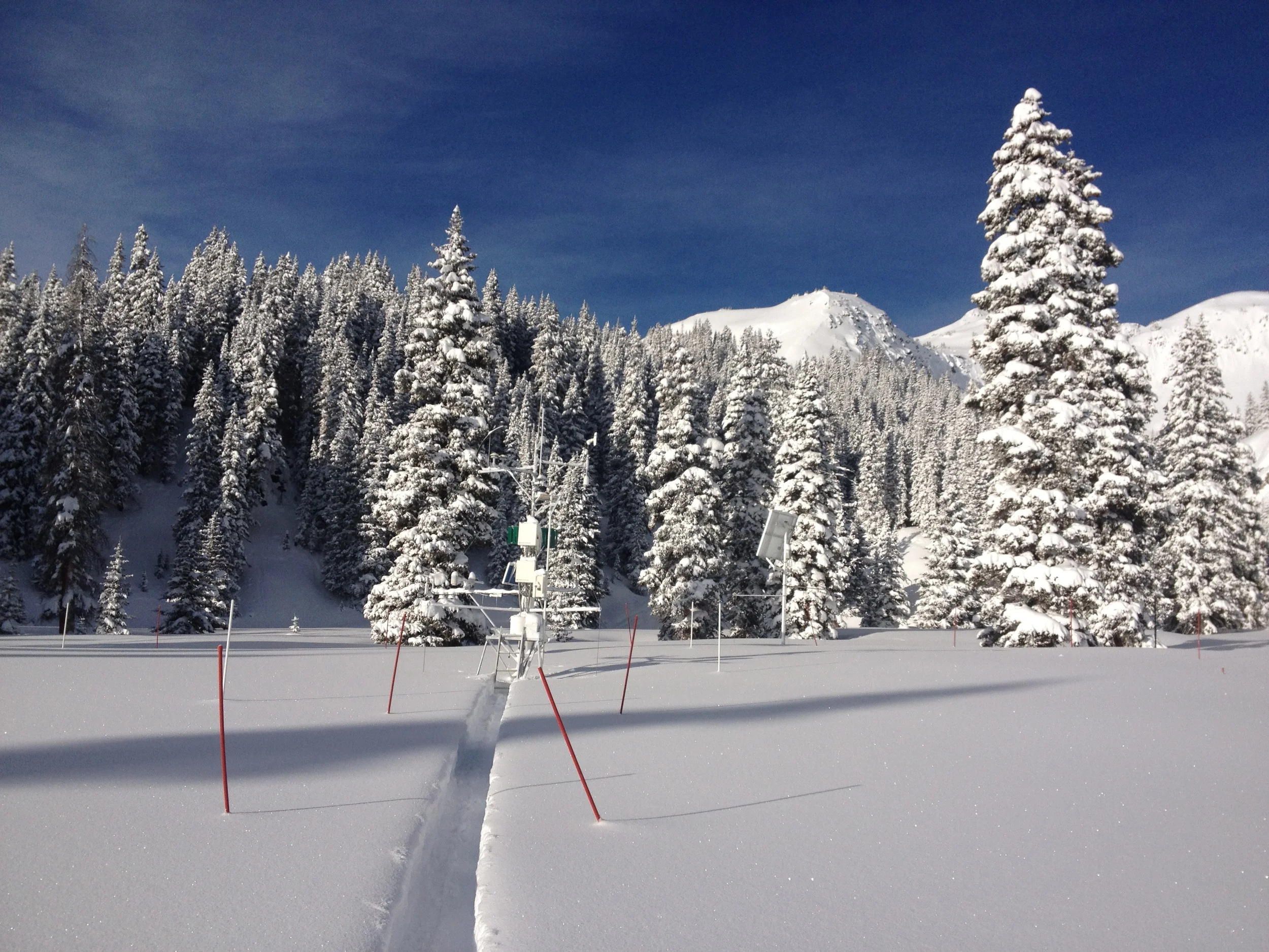
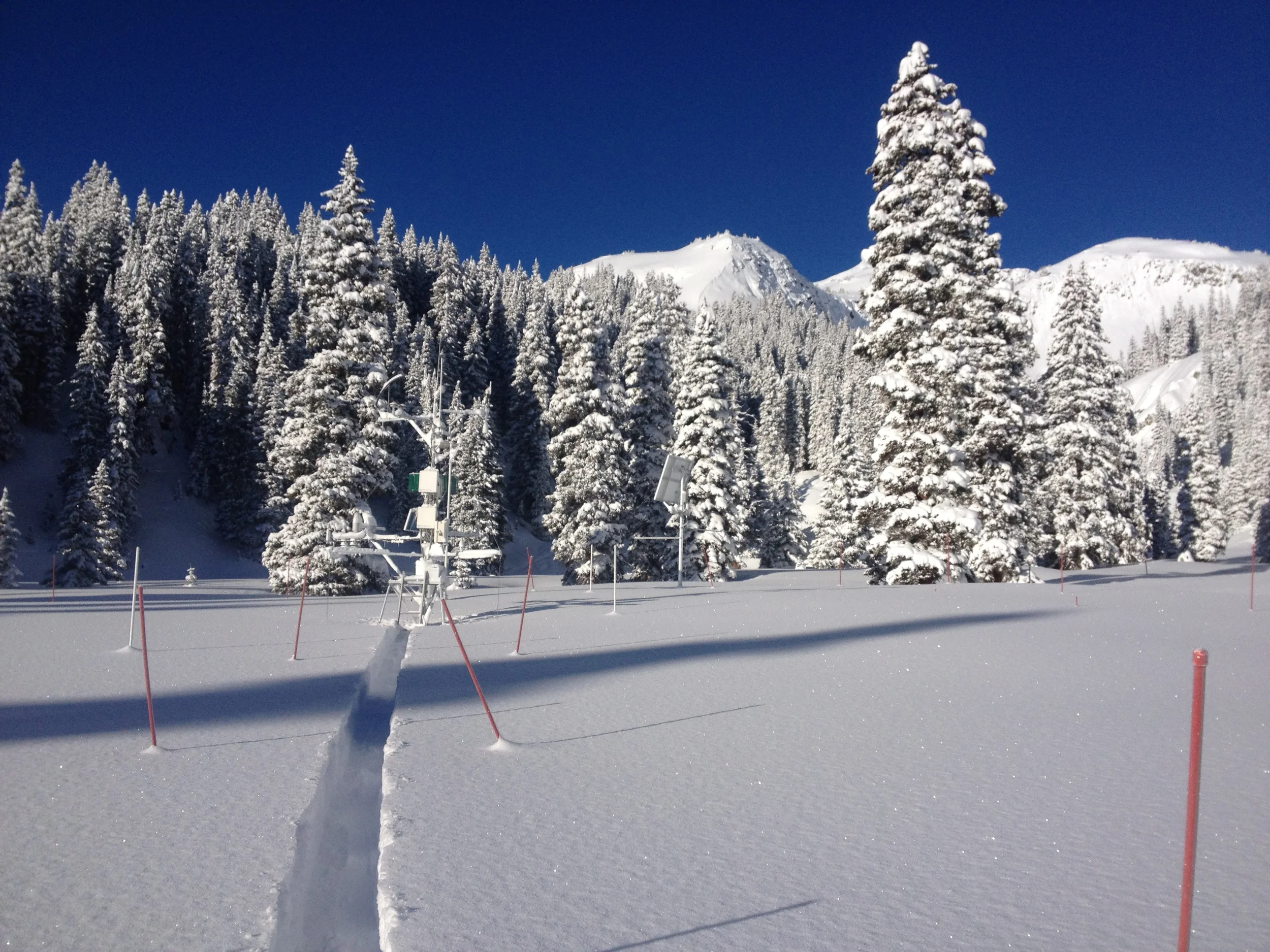
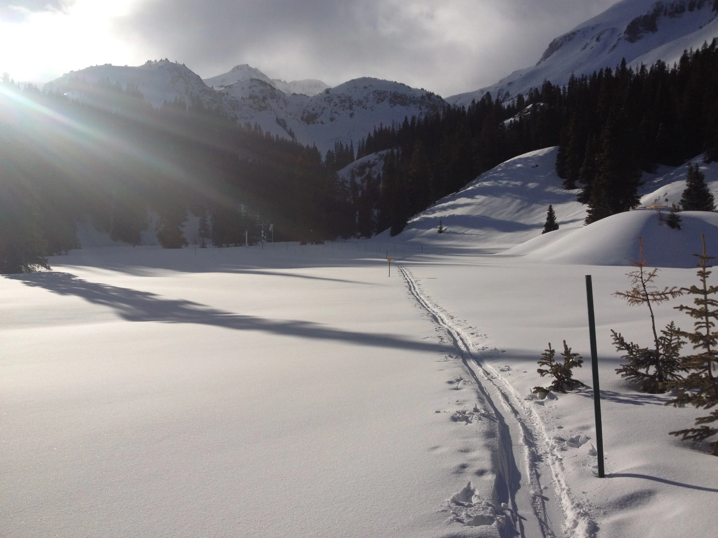
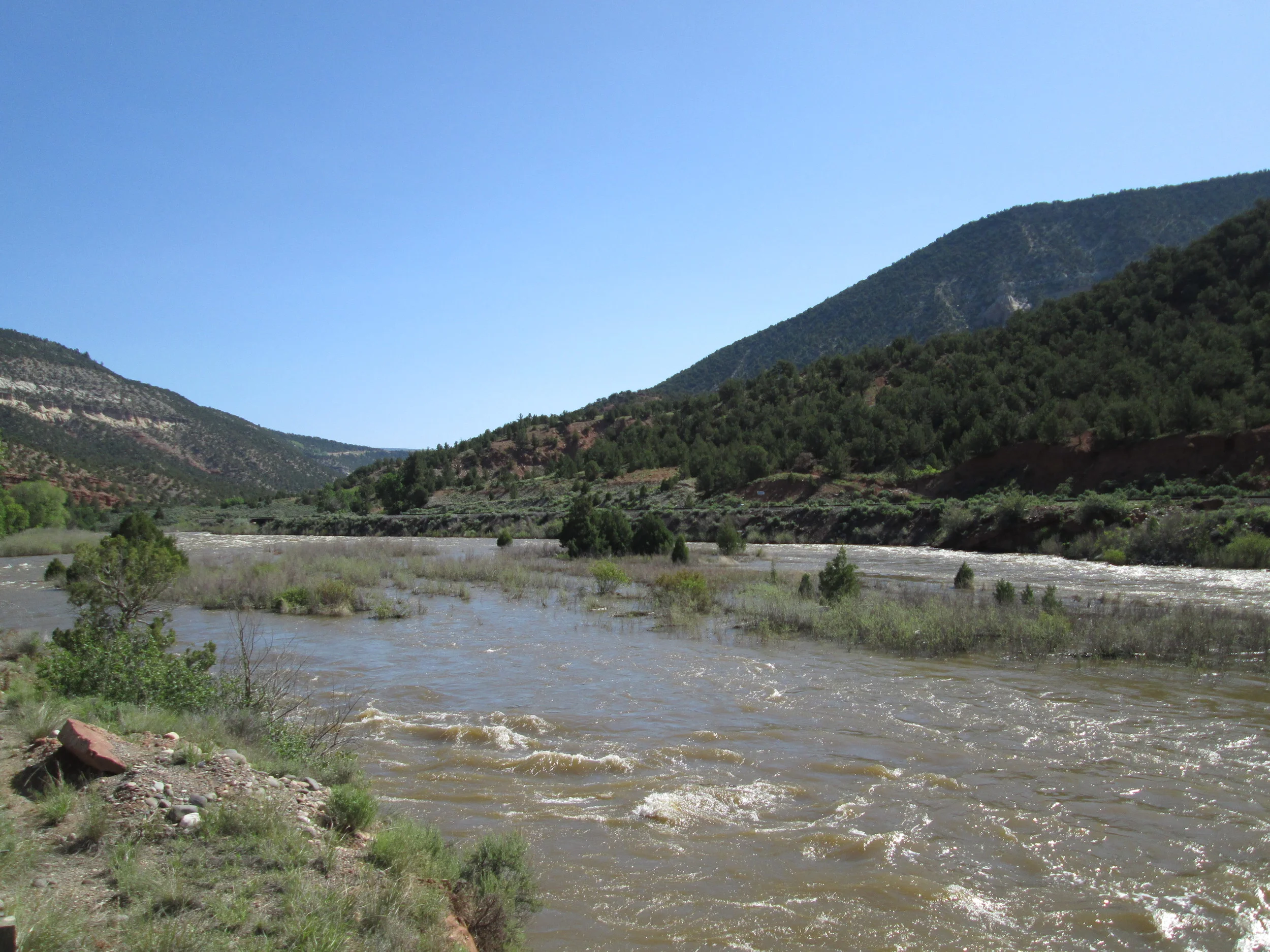
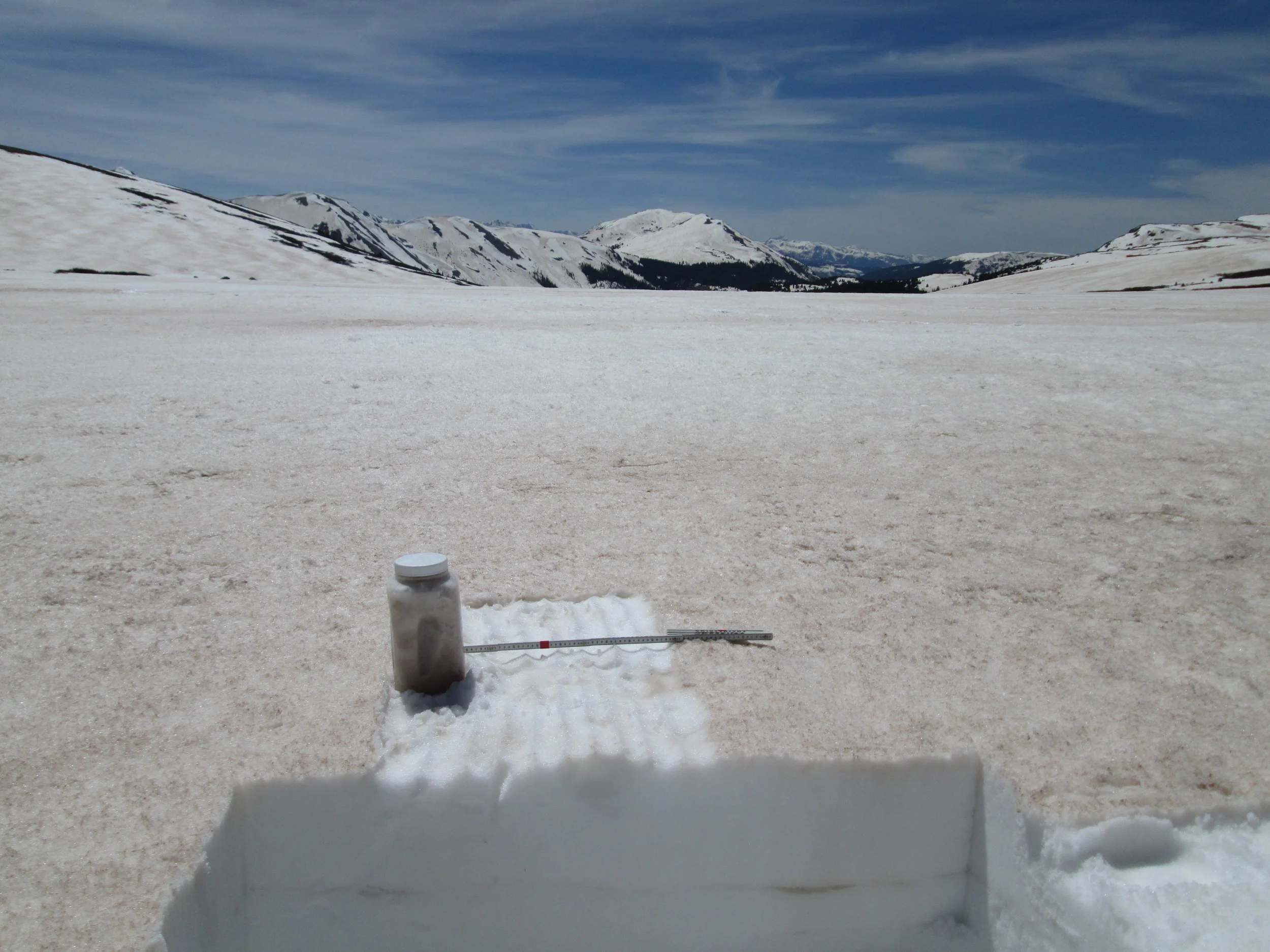
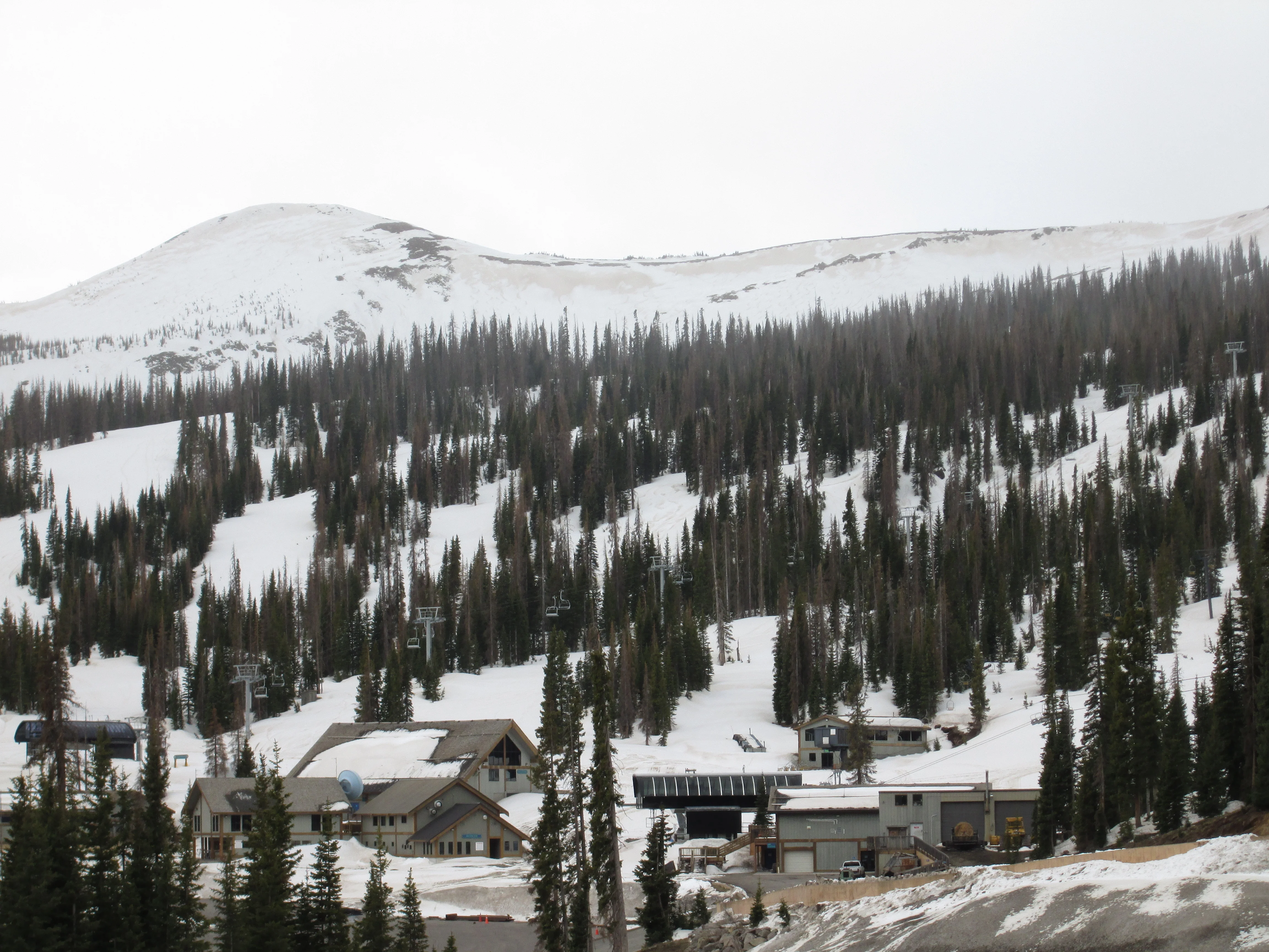
CODOS sites at McClure Pass, Rabbit Ears Pass, Willow Creek Pass, Berthoud Pass, Loveland Pass, Hoosier Pass, and the Park Cone site in Taylor Park were visited over April 20-22, 2015.  Dust layer D3 (April 14/15), merged with layer D2 (April 8), was clearly evident in the Central Mountain sites (McClure Pass and Park Cone) underneath the recent new layer of clean snow (CSAS Storm #12) and dust intensity in those locales could attain “AVG Dust” with just a few additional events.  D3 was weaker at Northern Mountain sites (Rabbit Ears Pass and Willow Creek Pass) and at Berthoud Pass, and very faint, even ambiguously present, in our other Front Range locales (Grizzly Peak and Hoosier Pass).   Dust intensity remains in the “MIN Dust” classification in those areas.  Dust was not apparent at the snowpack surface in any of these locales, during this circuit, and where dust was present it was well-buried under 4-15” of clean snow containing from 0.5” to 3.2” of water equivalent.  Snowpack temperatures were near 0 C in the lower snowcover and cooler near the surface, a typical temperature profile pattern for late April at these sites.  This Update presents text and photographs to complement the new snow profiles, snowpack SWE plots, and hydrographs posted to the specific webpages for these CODOS sites (all CODOS site webpage links are shown at the top of the CODOS Program home page , and on all site pages).

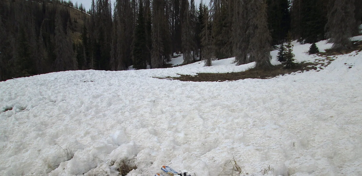
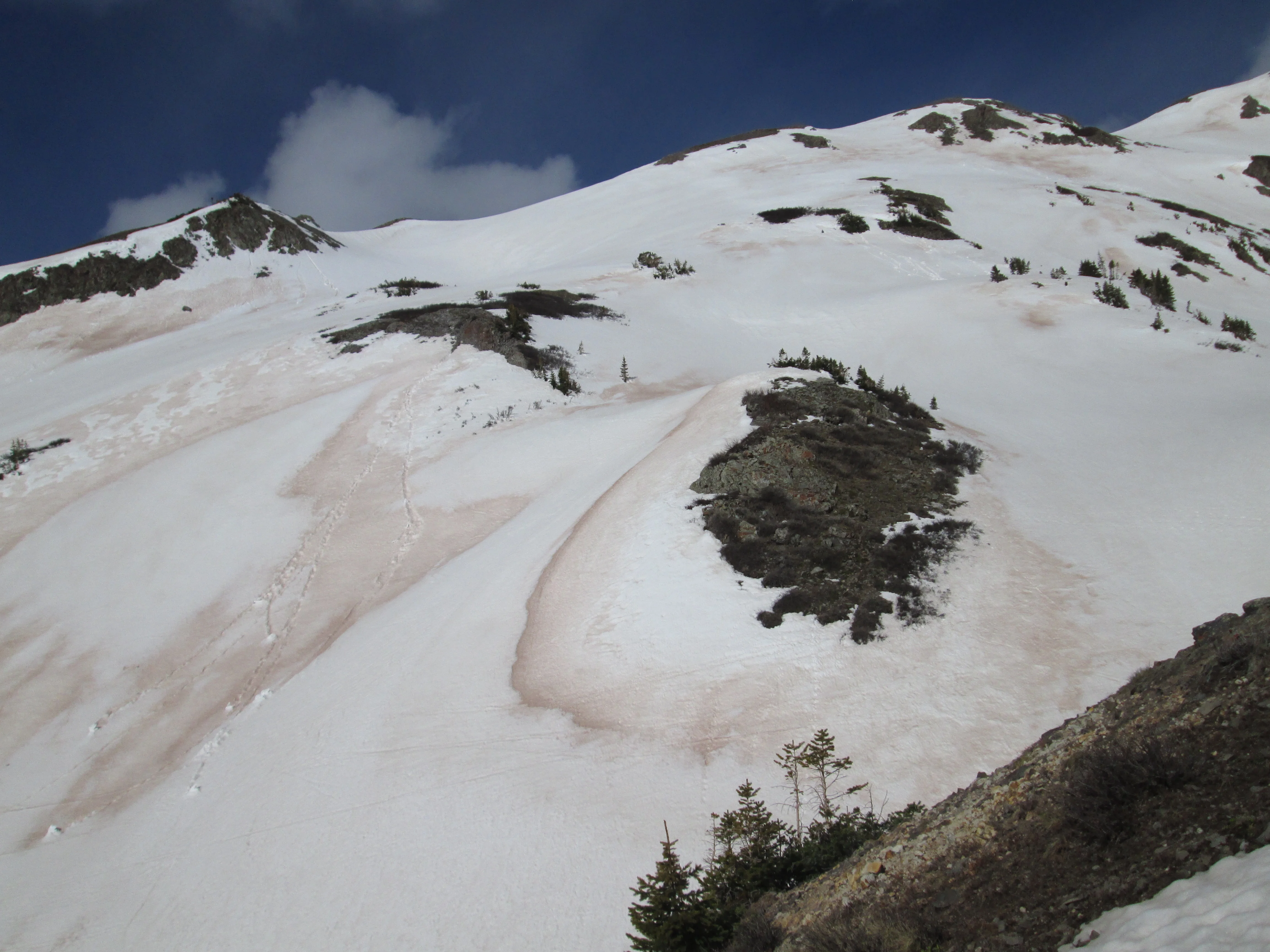
McCLURE PASS – APRIL 20

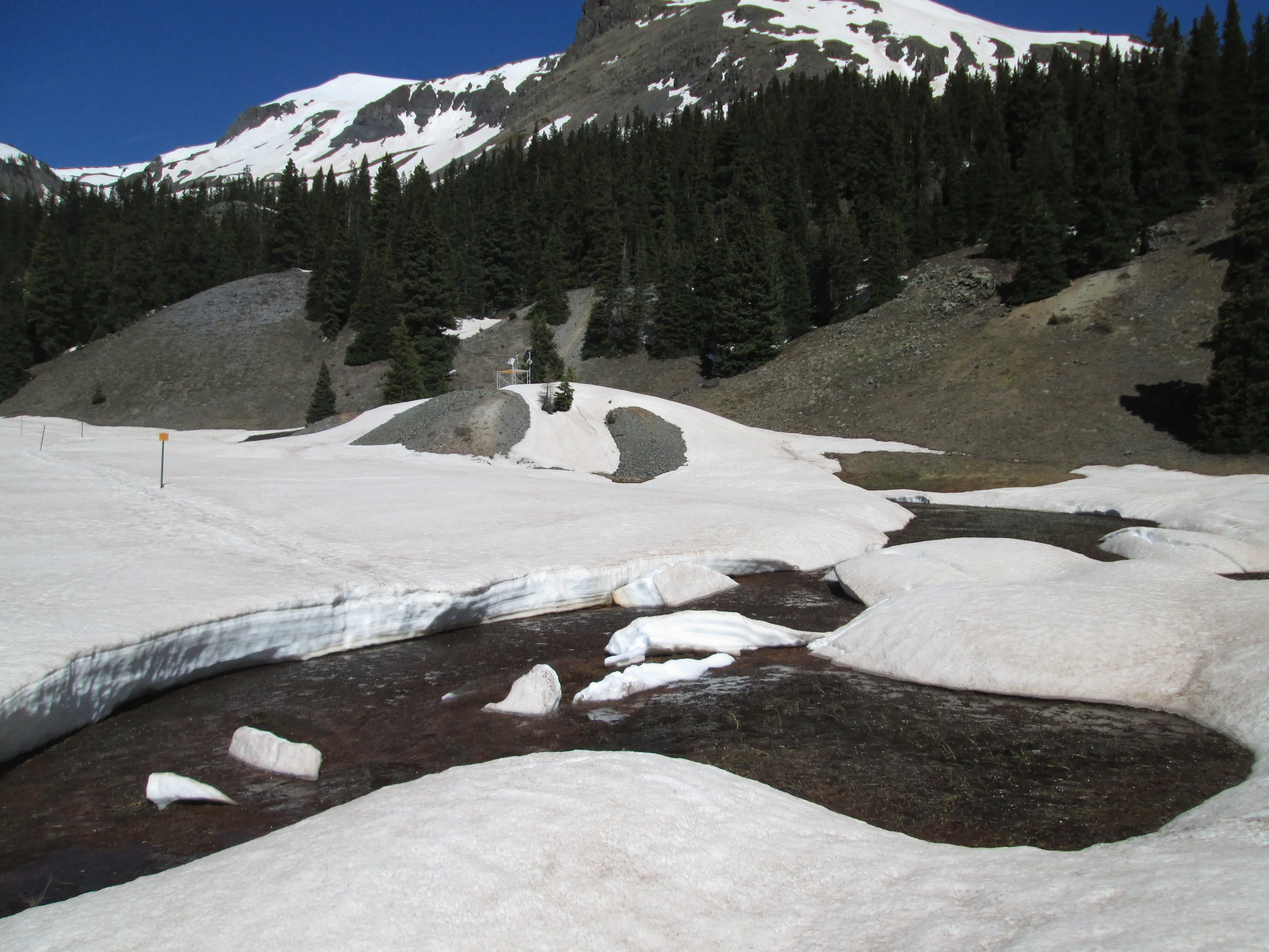
Spring was well underway at McClure Pass and snowcover at the CODOS site and at the adjacent McClure Pass Snotel had completely disappeared prior to the recent winter storm (CSAS Storm #12).  Only post-D3 new snow covered the ground at that site so an alternative snowpit site was selected on a nearby north-facing slope where old snow remained, enabling the verification of presence/absence of dust layers.

APRIL 20 UPDATE – SAN JUAN MOUNTAINS, GRAND MESA

APRIL 20 UPDATE – SAN JUAN MOUNTAINS, GRAND MESA

APRIL 20 UPDATE – SAN JUAN MOUNTAINS, GRAND MESA


SUMMARY

Dust-on-snow event D3-WY2015 was verified at our Swamp Angel Study Plot on April 15 (as reported in our Dust Alert that day) and during a just-completed circuit of the CODOS sites at Grand Mesa, Spring Creek Pass, and Wolf Creek Pass on April 16 and 17.  Dust layer D3 was observed at all of those sites in varying strengths, already merged with layers D2 and/or D1 where those layers had been deposited.   Although snowpack temperatures had cooled in near-surface layers, temporarily disrupting snowmelt discharge, those snowpacks also remained very warm overall.   As of the date of the site visits, anywhere from a trace to 4” of clean new snow overlay the D3/D2/D1 dust layer; subsequent snowfall may have resulted in deeper burial of the dust layer on Grand Mesa.   Dust layer D3 is substantial enough to eventually result in significant reductions in snow albedo, once re-exposed to direct solar radiation.  The merged D3/D2/D1 dust intensity currently remains within the “MIN Dust” domain of the Dust Enhanced Runoff Classification rankings at these sites although one or two additional dust-on-snow events could increase conditions to “AVG Dust”.  This Update presents text and photographs to complement the new snow profiles, snowpack SWE plots, and hydrographs posted to the specific webpages for these CODOS sites (all CODOS site webpage links are shown at the top of the CODOS Program home page , and on all site pages).

CODOS Dust Alert - Event D3 of WY 2015

CODOS Dust Alert - Event D3 of WY 2015

CODOS Dust Alert - Event D3 of WY 2015

Our third dust-on-snow event of WY 2015 did pan out, as was speculated upon yesterday, with the heaviest deposition of the season at Senator Beck Basin.  Timing of this event was a bit slower than anticipated.  Somewhat surprisingly, visibility from Silverton was still virtually undiminished at around 6 PM on Wednesday, April 14, even under strong SW’ly winds. 

CODOS Dust Alert – Potential High for Event D3 of WY 2015

CODOS Dust Alert – Potential High for Event D3 of WY 2015

CODOS Dust Alert – Potential High for Event D3 of WY 2015

As has been very well advertised by the National Weather Service, a potent, synoptic-scale weather system is approaching western Colorado this afternoon with a strong, pre-frontal wind field developing over the Colorado Plateau.  A High Wind Warning has been issued for strong SW’ly winds (SSW to WSW) and blowing dust is in the forecast this afternoon and this evening at several locales throughout the Plateau, from Leupp, AZ to Moab, UT.  As of 1:16 PM this afternoon airborne dust was beginning to obscure visibility from the USGS Abajo Peak

CODOS Dust Alert - Event D2 of WY 2015

CODOS Dust Alert - Event D2 of WY 2015

CODOS Dust Alert - Event D2 of WY 2015

Wednesday, April 8, produced another very weak dust-on-snow event here in Silverton, the second event (D2) of WY 2015.  Strong winds from the SSW and SW were underway at dawn on Wednesday but, as is often the case, dust only became apparent in the air, as reduced visibility, around mid-day.  Farther to the southwest, the USGS webcam at Abajo Peak, in Utah, showed substantial dust in the air by mid-morning, fully obscuring the view of Sleeping Ute Mountain, 55 miles to the southeast of Abajo Peak. 

APRIL 6 UPDATE – WY 2015 UNFOLDING

APRIL 6 UPDATE – WY 2015 UNFOLDING

SUMMARY

March 2015 began with a significant winter storm but continued and ended with very scant subsequent precipitation over most of the Colorado mountain system.  Consequently, during March, snowpacks saw either no net gain or declined, some quite substantially.  March also produced no dust-on-snow deposition events for Colorado, the result of either an absence of sufficient winds over the Colorado Plateau when soils were available in mid- and late-March, or the unavailability of loose soil during the strong winds associated with the major winter storm at the beginning of March.  Colorado entered April with the first dust-on-snow event of the season, warm and significantly sub-par snowpacks, snowmelt underway, and predictions of continued drought conditions for much of the mountain system and for the Colorado Plateau.  

CODOS Dust Alert - Event D1 - WY 2015

CODOS Dust Alert - Event D1 - WY 2015

CODOS Dust Alert - Event D1 - WY 2015

Greetings from Silverton -

Following an unusually dust-free March, an almost inevitable combination of strong SW'ly and W'ly winds and dry soil conditions finally occurred over the Colorado Plateau and generated our first dust-on-snow event of Water Year 2015 here in the western San Juan Mountains, and in Senator Beck Basin.  This event began lateWednesday afternoon and evening, April 1st, at low intensity and was perhaps more intense overnight before fading somewhat to a visible haze at dawn on Thursday morning, April 2nd, under still moderate SW'ly winds.  Winds then re-intensified during the day Thursday and began a swing to the WSW, W, and eventually NW by evening, as visibility was restored to 'crystal clear' sky conditions by sunset.  Strong winds and dust were observed in the Grand Valley, in Durango, in Gunnison, and elsewhere on the West Slope on both Wednesday and Thursday. 

CODOS Update: Dust-Free Snowmelt Underway

CODOS Update: Dust-Free Snowmelt Underway

March 23, 2015: CODOS Update – Dust-Free Snowmelt Underway

SUMMARY

During a complete circuit of all eleven Colorado Dust-on-Snow (CODOS) program monitoring sites, from March 17-20, 2015, we documented a complete absence of dust-on-snow in the Colorado mountains to-date, unusual spatial variation in snowpack conditions, and early isothermal snowpack temperatures generating snowmelt runoff at high streamflow levels for late March.  Current near-term weather forecast products suggest continued dry weather well into April and very low chances of achieving median Peak SWE conditions in most Colorado watersheds.  WY 2015 snowmelt season conditions began on March 1 within either the “Avg” or “Low” March 1 SWE condition domains of the DERC model and are trending, as of late March, toward “Min Dust” and “Avg” or “Dry” Spring precipitation conditions within that March 1 SWE domain.   

CODOS Update - March 1 SWE Conditions

CODOS Update - March 1 SWE Conditions

Colorado has begun March with a range of snowpack conditions across the mountain system, even as the southern mountains are experiencing a significant uptick in snowcover from a multi-day storm (CSAS Storm #10, in progress as of this writing).   This Update evaluates March 1st and 2nd SWE data from Snotel stations associated with our eleven CODOS sites and places them within the framework of the Dust Enhanced Runoff Classification scheme (DERC) developed by CODOS.  This Summary examines the state by Basin, and CODOS site-specific analyses are also presented for each CODOS site 

No-Dust Alert: Arizona weather squelching dust emissions

No-Dust Alert: Arizona weather squelching dust emissions

Greetings from Silverton on Thursday afternoon, February 26, 2015-

As of close examination of the snowpack at Swamp Angel Study Plot yesterday, I can confirm that Storm  #8 did not deliver any dust to Senator Beck Basin.  Thus, we have yet to observe any dust-on snow events so far this season.  

During Storm #8 the Winslow, Arizona airport measured at least 0.2" of precipitation (as rain and snow), indicating that at least some portions of the Little Colorado River basin saw some soil moistening/wetting.  Farther north, views from the USGS web cameras at Mesa Verde,Abajo Peak, and Island in the Sky showed significant snow on the ground after the storm cleared. 


Now, as hoped, Storm #8 is going to be followed by another significant winter storm starting tomorrow (Friday), for the San Juan Mountains and some Central Mountain locations at least.  NWS Grand Junction is warning of new snow amounts in the 2-4 foot range for the San Juan locations favored by southwest flow.  SW'ly winds may also be strong, at times, during this storm.  Normally, this predicted strong SWly wind field could be suspected to carry dust.

Fortunately, this approaching storm may also produce significant rain and snow amounts in northeastern Arizona that may preempt dust emissions.  (Southeastern Utah still retains substantial snowcover that will also preclude dust emission).  Here's the advisory for the approaching storm and a second, following storm, issued by the NWS Flagstaff office earlier today:

HAZARDOUS WEATHER OUTLOOK
NATIONAL WEATHER SERVICE FLAGSTAFF AZ
434 AM MST THU FEB 26 2015

.DAYS TWO THROUGH SEVEN...FRIDAY THROUGH WEDNESDAY

A FEW LIGHT RAIN AND SNOW SHOWERS ARE POSSIBLE ACROSS EASTERN
ARIZONA THURSDAY AFTERNOON.

FROM FRIDAY AFTERNOON THROUGH MONDAY...A TROUGH WILL MOVE INTO THE
SOUTHWEST UNITED STATES...BRINGING RAIN AND HIGHER ELEVATION
SNOW TO NORTHERN ARIZONA. SNOW LEVELS DURING THIS TIME ARE
EXPECTED TO RANGE FROM 5000-6000 FEET OVER THE KAIBAB
PLATEAU...6500-7500 FEET AROUND FLAGSTAFF...TO 7000-8000 FEET FOR
THE EASTERN MOGOLLON RIM AND WHITE MOUNTAINS. LOWER ELEVATION
RAINFALL AMOUNTS OF 1-3 INCHES POSSIBLE WITH THE HIGHER AMOUNTS
OVER THE MOGOLLON RIM...WHITE MOUNTAINS AND GILA COUNTY. SNOWFALL
OF 6-18 INCHES POSSIBLE FOR THE HIGHER ELEVATIONS. SIGNIFICANT
RISES COULD ALSO OCCUR ALONG STREAMS AND RIVERS...ESPECIALLY SOUTH
OF THE MOGOLLON RIM.

TUESDAY INTO WEDNESDAY...A COLDER SYSTEM COULD AFFECT THE
REGION...BRINGING ANOTHER ROUND OF HEAVY PRECIPITATION. SNOW
LEVELS COULD BE AS LOW AS 4-5 THOUSAND FEET. ADDITIONAL HEAVY
SNOW ACCUMULATIONS POSSIBLE FOR THE HIGHER ELEVATIONS...AND
SIGNIFICANT RAINFALL FOR LOWER ELEVATION AREAS.

THIS HAS THE POTENTIAL TO BE A LONG DURATION RAIN AND SNOW EVENT
FOR NORTHERN ARIZONA...WITH MAJOR TRAVEL IMPACTS. RESIDENTS AND
VISITORS ARE URGED TO PAY CLOSE ATTENTION TO THE LATEST
FORECASTS...AND BE PREPARED FOR SIGNIFICANT RAIN AND SNOW.

Given this heavy precipitation expected over much of the Colorado Plateau, there is at least some cause for hope that these storms will deliver only wanted snow and water, and no unwanted dust ... we will be watching and report.

More soon,

Chris

Dry spell, early snowpack warming

Dry spell, early snowpack warming

It has now been over a month since our last Winter Storm #6 here in the western San Juan Mountains, a minimal storm with only 1/2" (12 mm) of water content, and almost two months since Storm #5, our last 'decent' snowfall (see the CSAS Winter Storms webpage).  We have had weather in the meantime, of course, just very warm and dry weather.  Over the past ten days Silverton has been a quagmire of deep slush on our side streets on a daily basis.  The contrasts to the northeast part of the country are ... disappointing!  

No Dust-on-Snow So Far, Looking Ahead Using CODOS Experience

No Dust-on-Snow So Far, Looking Ahead Using CODOS Experience

This year we will refine our approach to describing patterns in dust enhanced snowmelt behaviors by focusing on three critical, interacting factors governing the impacts of dust. The first one-third of Winter 2014/2015 has, once again, begun to establish significant divergence in snowpack conditions across the state, favoring the northern mountains.  Overall, however, the state Snotel system has recently fallen below 1981-2010 mean and median snowpack values for mid-January. So far this winter we have observed no dust-on-snow deposition events at our Senator Beck Basin Study Area at Red Mountain Pass, the primary ‘sentry site’ for dust-on-snow in Colorado and for CODOS.

CODOS WY 2014 Summary

CODOS WY 2014 Summary

Water Year 2014 delivered a welcome return of substantial snowpacks to most of the state, aside from the persistently drier Southern mountains. The now-routine “dust season” of March, April, and May delivered ten dust-on-snow events. Although WY 2014 total dust deposition was not as heavy as in WY 2013, with its “maximum” intensity, a far-reaching and substantial event on May 11 (event D8) would play a major role in producing high or very high peak flows. Given the interplay of March 1 SWE conditions, dust intensity, and spring weather, spring 2014 snowmelt runoff was a prolonged process with early, dust-enhanced surges disrupted by several major winter storms in April and May frequently restoring high snowcover albedo.

CODOS Alert - long duration dust event D10

CODOS Alert - long duration dust event D10

Like much of western Colorado, Silverton was under siege from near-continuous SW'ly winds bearing near-continuous dust (and perhaps smoke) for several days starting last weekend, until yesterday afternoon.  The synoptic scale wind field driving this long-duration event has now broken down as the large weather system in the northern Rockies has finally moved eastward, opening the door for more moderate, westerly flow into Colorado.

CODOS Dust Alert - Event D9-WY2014

CODOS Dust Alert - Event D9-WY2014

Greetings from Silverton - On Friday afternoon and evening, June 13, we experienced event D9-WY2014, only our second logged June dust storm since beginning our observations back in 2003.  This was not a major dust storm but visibility was nonetheless substantially reduced here in Silverton on very strong SW'ly winds doing tree damage here in town.  Although we are in the final stages of snowmelt, and snow albedo was quite low already, this event did add an increment of dust-on-dust to the remaining alpine snowcover. 

Yesterday (Saturday) we also experienced 

CODOS Update – Dust Forcing High Snowmelt Rates Statewide

CODOS Update – Dust Forcing High Snowmelt Rates Statewide

Major reductions in snow albedo caused by merged dust layers were readily observed at the snowpack surface, at all elevations and on all aspects, during a recently completed circuit of CODOS sites at Grand Mesa, Hoosier Pass, Loveland Pass (Grizzly Peak), Berthoud Pass, Willow Creek Pass, Rabbit Ears Pass, and McClure Pass, and a special visit to Independence Pass.   

CODOS Alert for imminent, dust-enhanced surging in snowmelt runoff

CODOS Alert for imminent, dust-enhanced surging in snowmelt runoff

I'm writing to discuss an imminent increase in current snowmelt discharge rates driven by the re-emergence of buried dust and large-scale reductions in snow albedo throughout the northern, Front Range, and central mountains.  This dust-enhanced snowmelt surging is likely to exacerbate current flooding hazards.


The series of winter storms in April and May added significant SWE to the already large snowpacks in the northern, Front Range, and central mountains, and almost inevitably led to the strong snowmelt runoff now underway and requiring Flood Warnings and Flood Watches.  Those storms also had the effect of disrupting the impact of dust layers D3-8 contained in the Colorado snowpack by frequently adding enough clean snow to reduce or eliminate the absorption of solar energy by the dust, thereby intermittently restoring relatively high albedo to the snowpack.  That 'albedo reset' process is always more effective and long lasting in higher elevation, alpine snowcover, and much less effective or long-lasting at the lowest elevation snowcover.

CODOS Update – Upper Gunnison River and North Fork of the Gunnison

CODOS Update – Upper Gunnison River and North Fork of the Gunnison

CODOS sites at Park Cone and McClure Pass and their adjoining Snotel stations in Gunnison River headwaters have lost all snowcover even while the Schofield Pass Snotel retains most of its above-average Peak SWE.  Overall, subalpine snowcover throughout the Upper Gunnison Snotel network is largely consumed.  Where snowcover remains, dust event D8 is presumed to have enhanced ablation of recent snowfalls, re-exposing underlying dust layers D3-6/7, as present.  With new snow restoring higher snow albedo to that remaining snowcover, the most recent surge in the main stem Gunnison River, East River, and Lake Fork watersheds runoff was disrupted by Memorial Day weekend weather and leveled off at levels already well above or at median peak discharge values.  However, that generally thin layer of new snow will quickly melt as underlying dirty snow absorbs increasing solar energy this week and runoff surging will resume in those locales.  Alpine snowcover will sustain the remaining runoff in the Gunnison main stem but, given a prolonged period of dry and sunny weather, dust-enhanced snowmelt rates could result in early onset of the declining limb of the hydrograph.  In the North Fork of the Gunnison River watershed, prior episodes of high intensity, dust-enhanced snowmelt runoff have consumed the majority of snowcover and the center of runoff mass may have already passed the USGS gauge at Somerset.  North Fork flows may once again surge to a high level but this surge may be followed by a steep decline as the remaining snowcover is rapidly consumed.

CODOS Update - Senator Beck Basin and Western San Juan Mountains

CODOS Update - Senator Beck Basin and Western San Juan Mountains

Spring weather has effectively metered the impacts of eight dust-on-snow events in the western San Juan Mountains, parsing the ascending limbs of regional spring runoff hydrographs into a series of surges and retreats.  We're now seeing renewed surging throughout the region as dust re-emerges from beneath recent snowfalls. 

CODOS Update - Rio Grande Watershed Conditions

CODOS Update - Rio Grande Watershed Conditions

On Saturday, May 17, CODOS found snowmelt well advanced in the Rio Grande River watershed with snowcover significantly reduced at our Wolf Creek Pass CODOS site and “snow all gone”, effectively, at our Spring Creek Pass site.  Recent snowfall continued to shield the most recent dust layer D8, and the merged dust layers D6-D3 just below, from the full impact of solar radiation in most alpine terrain. Those dust layers were evident on solar aspects at and below tree line, where snowcover existed at all.  The Rio Grande River main stem was flowing near bank full and rising.