
SUMMARY
During a complete circuit of all eleven Colorado Dust-on-Snow (CODOS) program monitoring sites, from March 17-20, 2015, we documented a complete absence of dust-on-snow in the Colorado mountains to-date, unusual spatial variation in snowpack conditions, and early isothermal snowpack temperatures generating snowmelt runoff at high streamflow levels for late March. Current near-term weather forecast products suggest continued dry weather well into April and very low chances of achieving median Peak SWE conditions in most Colorado watersheds. WY 2015 snowmelt season conditions began on March 1 within either the “Avg” or “Low” March 1 SWE condition domains of the DERC model and are trending, as of late March, toward “Min Dust” and “Avg” or “Dry” Spring precipitation conditions within that March 1 SWE domain.
DUST CONDITIONS
Although we are now nearly a month into the March/April/May dust-on-snow season, no dust-on-snow events have been observed so far this season at the Senator Beck Basin sentry site at Red Mountain Pass, and no dust was observed in full-depth snow profiles at our other ten CODOS sites or their locales during the March 17-20, 2015 circuit. This season’s absence of dust-on-snow is now becoming unusual in the context of the past decade, as seen in the monthly chart (below) of event frequencies for Water Years 2005-2014 (see also the CODOS Dust Log). Wet, late-winter weather in the Colorado Plateau and, more recently, an absence of strong S, SW, or W’ly wind fields over the drying Plateau, may at least partially explain our dust-free spring, to-date. Of course, late March, April, and May could still produce the necessary soil, weather, and wind conditions to produce dust-on-snow events for Colorado.
SNOWPACK PROFILES
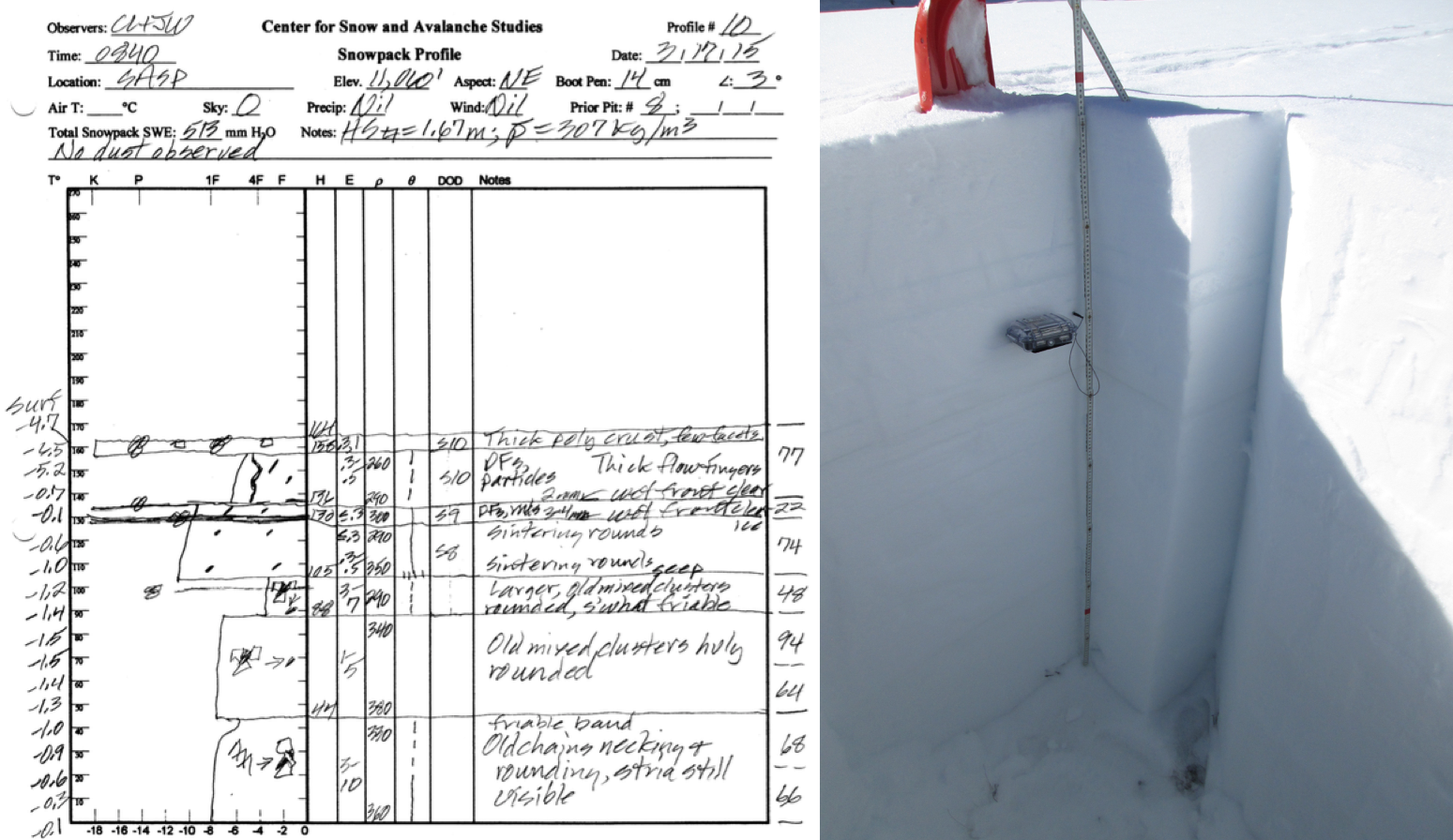
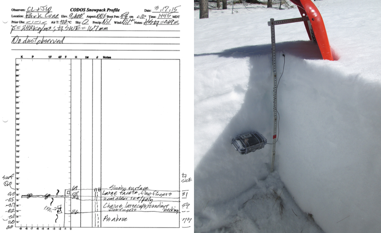
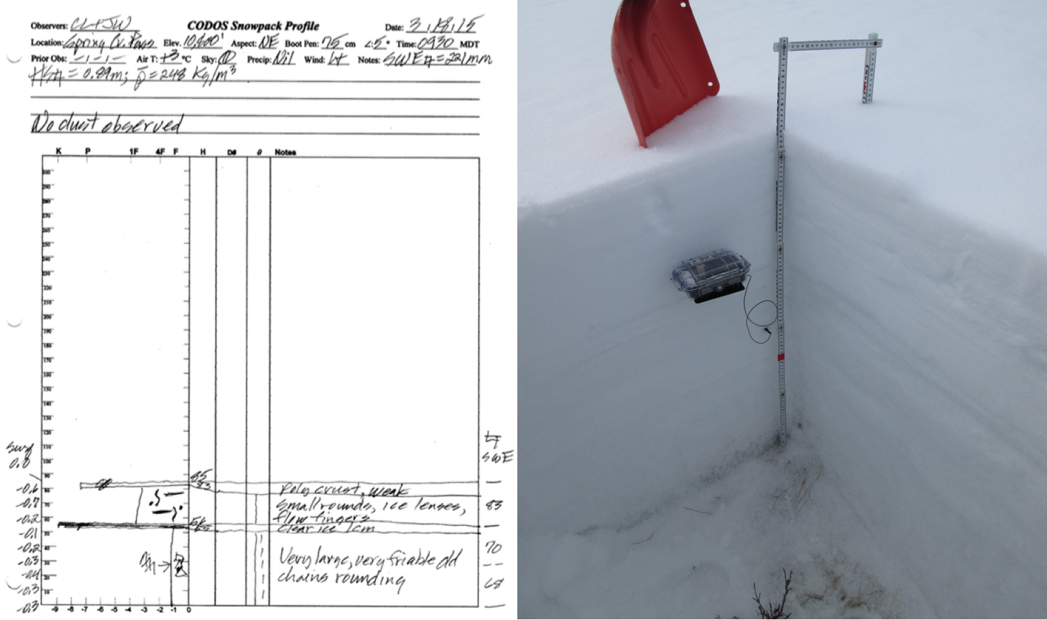
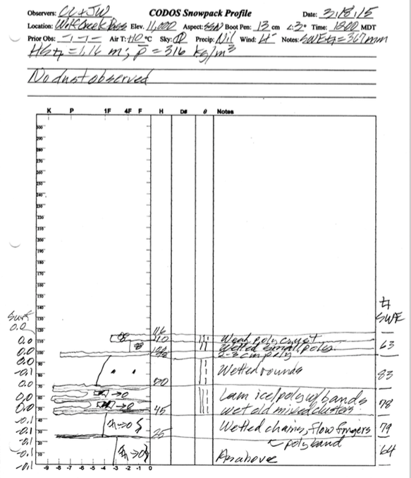

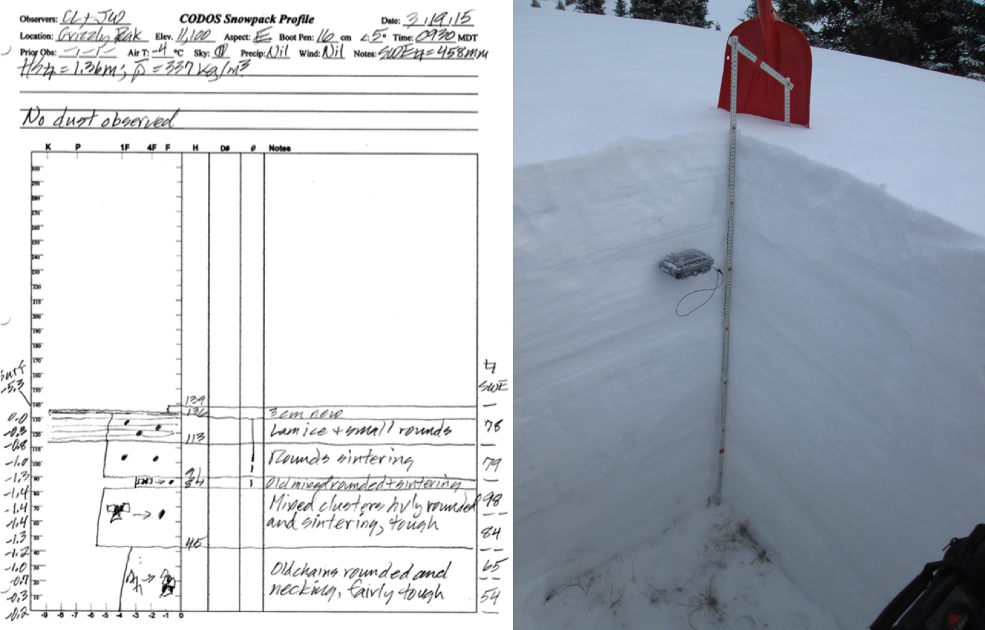
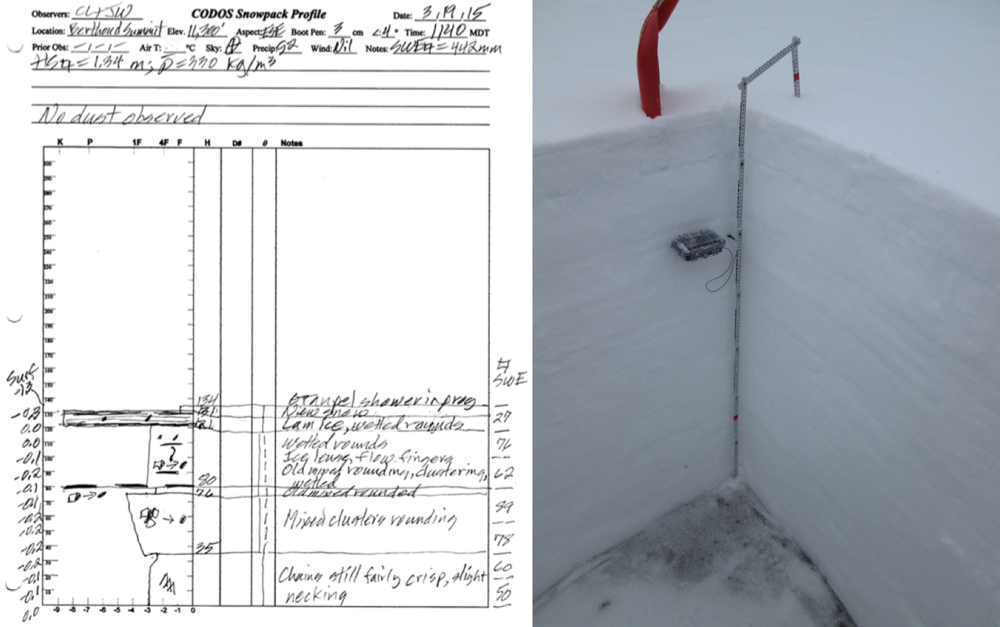
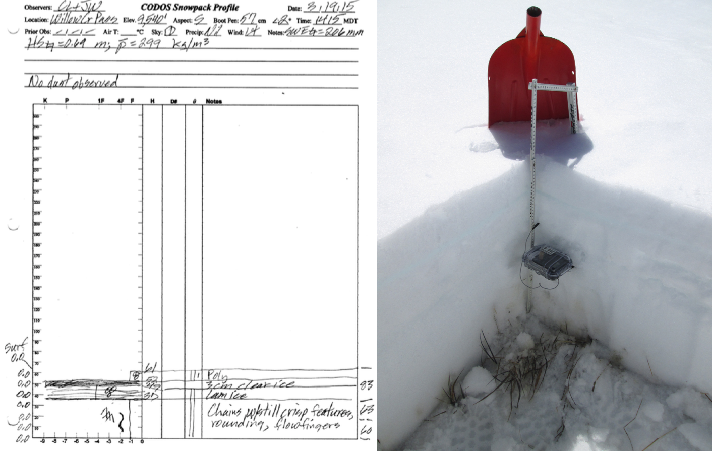
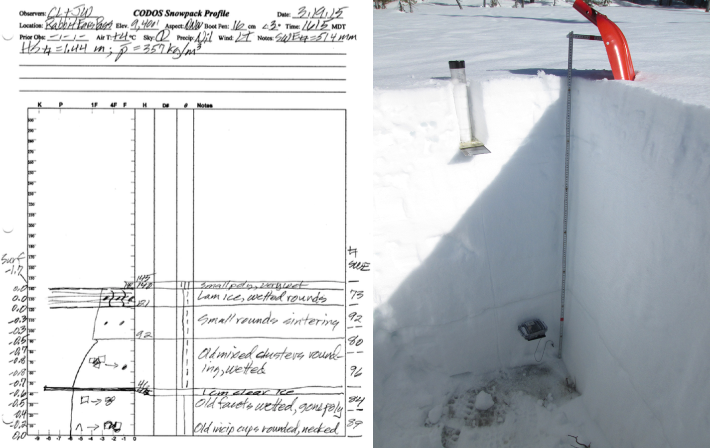

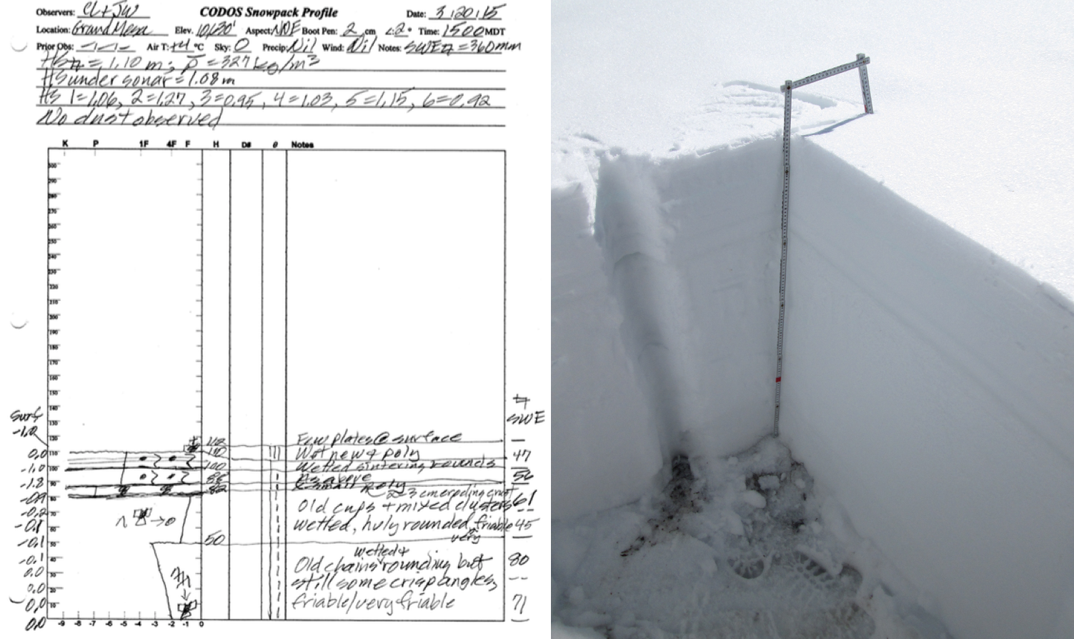
Full-depth snow profiles were performed at all eleven CODOS sites from March 17-20, verifying the absence of dust-on-snow discussed above. Measurements of snow water equivalent (SWE) content and mean (bulk) density of the snowpack at these CODOS sites also verified the generally sub-par conditions being reported by their nearby Snotel stations (Hoosier Pass being the notable exception). More importantly, these profiles documented the advanced warming of the snowcover anticipated in our February 16, 2015 Update (see table below). Several sites had fully isothermal snowcover, at 0.0° C throughout, and most others were very nearly isothermal. Only some high elevation sites (Swamp Angel, Hoosier Pass, and Loveland Pass (Grizzly Peak) retained minor cold content. Late March snow temperatures were substantially colder in March 2014 and colder still in March 2013, and it would be more weeks before most CODOS site snowpacks became isothermal in those years.
Snow that has become isothermal (or is close to it) is very unlikely to cool significantly, except diurnally, and then only in near-surface layers under overnight radiant cooling to clear skies. Sites exhibiting some cold content in our recent snow profiles will continue to warm quickly to 0.0° C, particularly in light of the near-term weather forecast (see below). New snow layers typically insulate the warm snow they land on from overnight cooling and are subsequently warmed quickly by both the heat content in the underlying snow and by normal surface energy inputs.
SWE CONDITIONS AND SPATIAL VARIATION IN SNOWCOVER
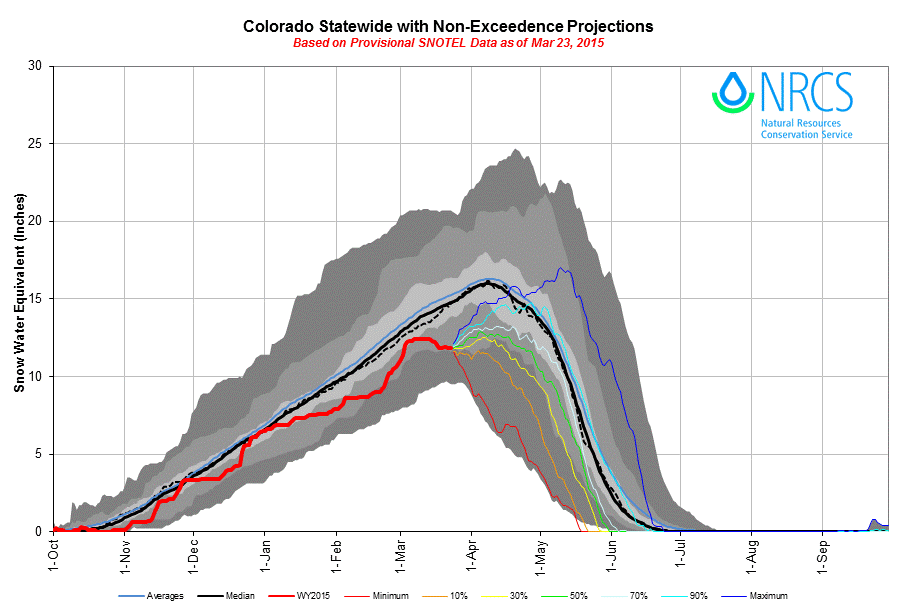
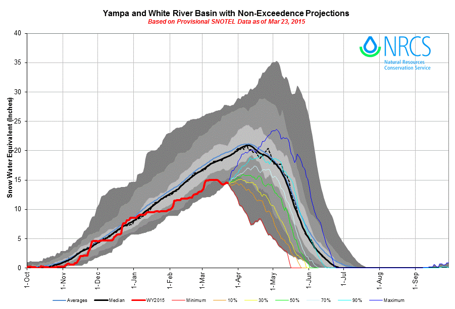
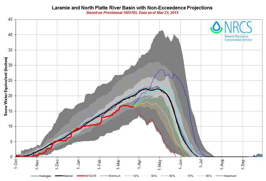
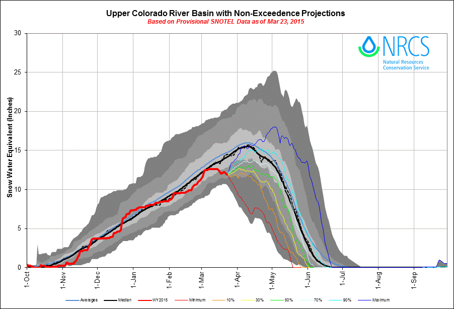
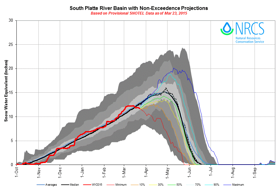
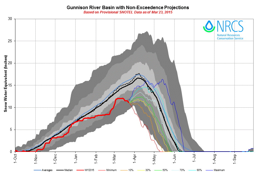
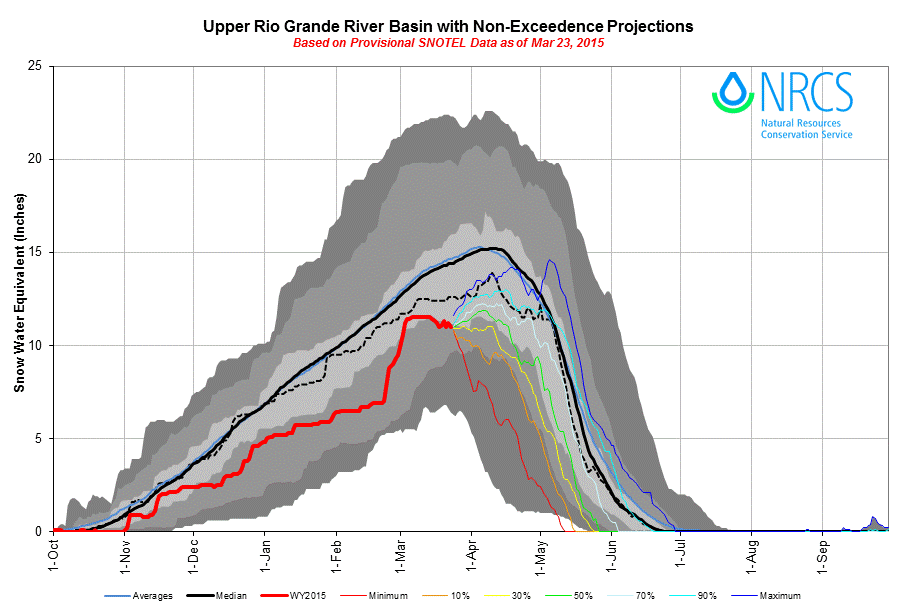
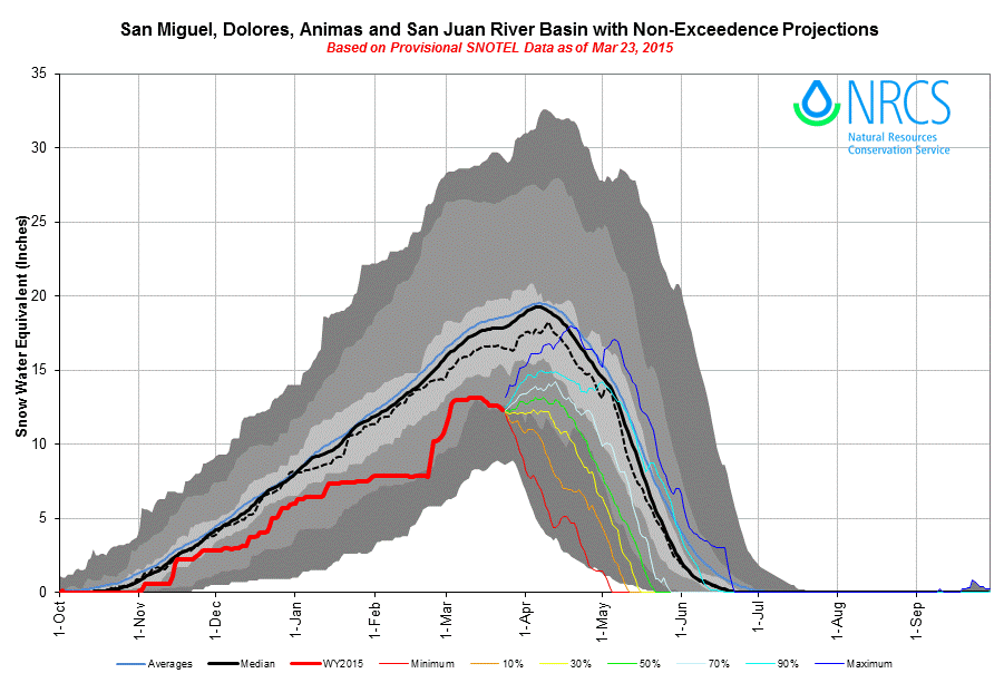
In recent weeks, and since the major storms of late February and early March, most Colorado Snotel sites ceased to gain significant snowpack and many actually have begun to lose snowcover and SWE. The basin-scale SWE plots shown above aggregate all Snotel sites within their respective watersheds and project the non-exceedence probabilities of future snowpack formation and ablation in those basins, based on historic data. Similar projection plots, captured the day of our recent visit, are presented on CODOS site webpages for the Snotel stations associated with those sites. In general, snowpack conditions at our CODOS sites and in their respective basins have deteriorated since March 1. As these CODOS Snotel sites approach their typical dates of Peak SWE, in April, it is possible that some sites will have already experienced Peak SWE, should the currently dry weather and early snowmelt ablation continue at current rates for the next two weeks (see forecast discussion below). Even if precipitation resumes, these projection plots suggest that is highly unlikely (at 90% non-exceedence probability or worse) that most basins will achieve median Peak SWE, with the South Platte Basin as the single exception.
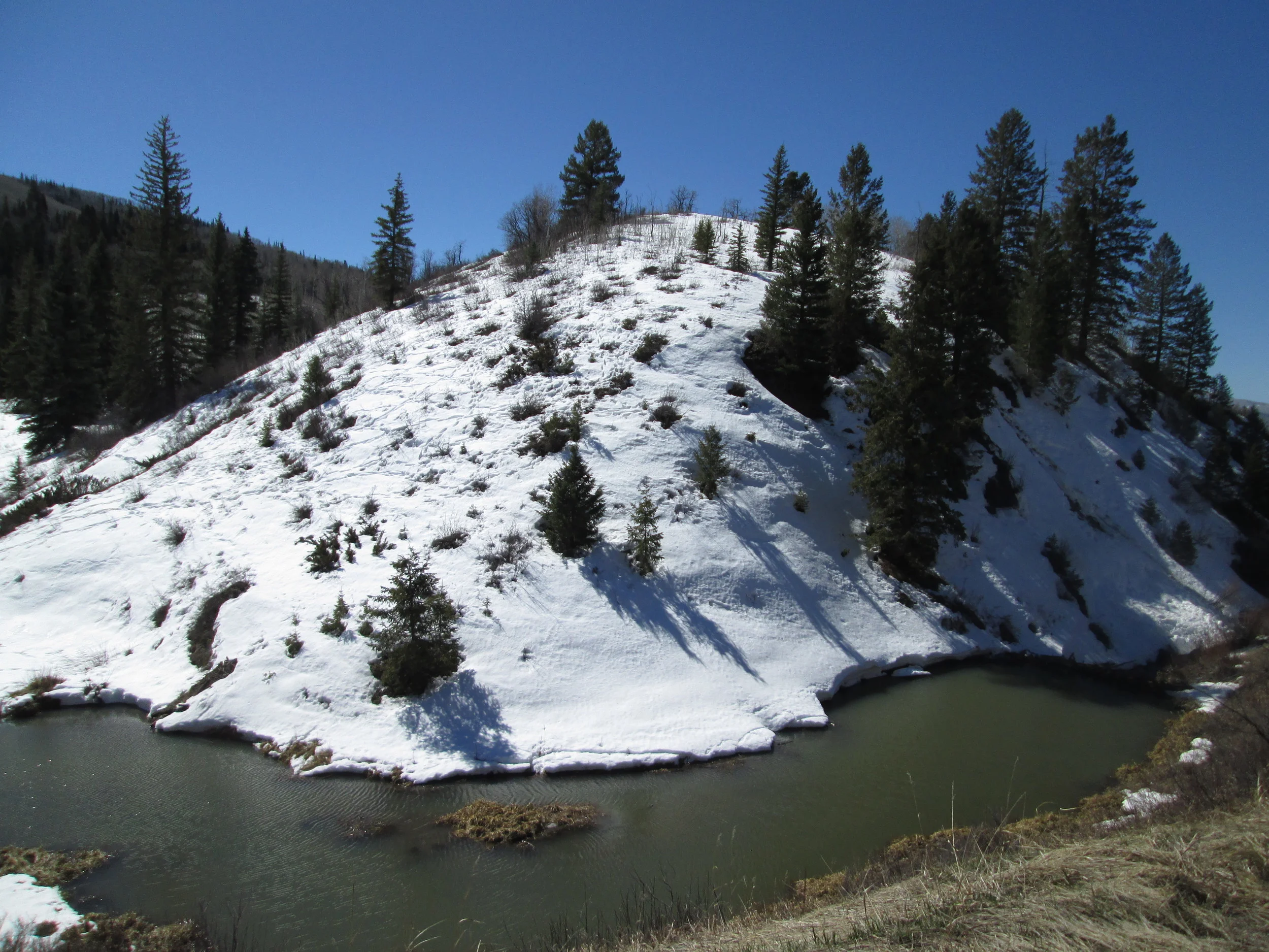
In addition, due to mid-winter conditions, it appears that current Snotel data could support over-estimations of basin-scale snowpack conditions in many/most locales. During the very dry and sunny period lasting from early January through mid-March here in the western San Juan Mountains, snowcover on sunny alpine and sub-alpine slopes (E, S, and W aspects) was very substantially eroded or, in some areas, completely ablated back to bare ground. Further, the lowest elevation snowcover in our locale experienced significant reduction or complete ablation on all aspects during this period. On the other hand, as you would expect, sub-alpine and alpine shady areas and slopes (i.e., forested terrain and NE, N, and NW aspects) retained a much higher fraction of their snowcover during that period, including ‘level’ (aspect neutral) sites such as our Swamp Angel Study Plot and the nearby Red Mountain Pass Snotel. Although aspect- and elevation-driven differences in snowpack formation are perfectly normal, this unusually long, dry, sunny, and unseasonably warm period resulted in extreme spatial variability in mid-winter snowcover that was atypical. Further, the extensive solar radiation inputs and warm temperatures during that period resulted in very unusual snowpack warming, as discussed above and in our February 16, 2015 Update.
This unusual spatial variation in snowcover was also frequently observed during the just-completed CODOS circuit. Our concern, therefore, is that current Colorado Snotel data may not fully capture the magnitude of variation in SWE that resulted from the long period of ablation from early January through mid-March since most Snotel sites are at least partially shaded and are ‘level’. Remote sensing of snowcover extent may currently show apparently normal conditions, thanks largely to the late February and early March storms. However, during our recent circuit we were left with the sense that snowcover was very thin (or gone) on a large fraction of terrain, despite comparatively good snowcover on northerly aspects.
STREAMFLOW
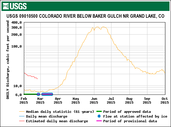
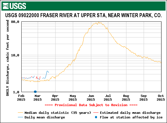
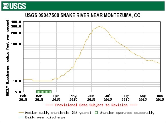
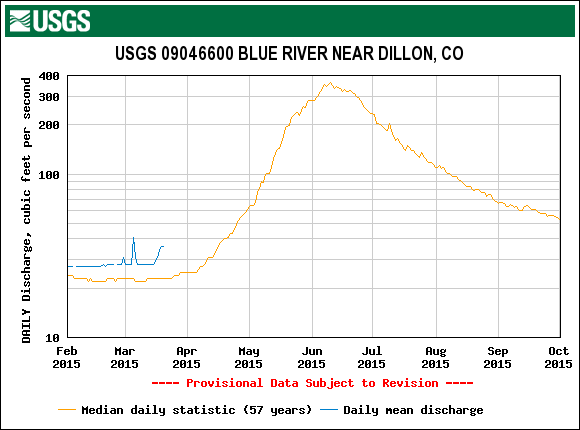
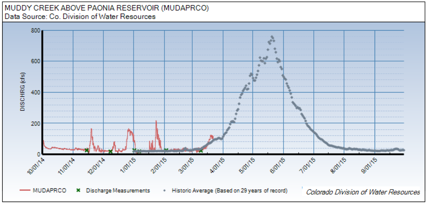
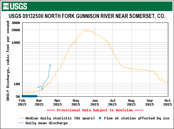
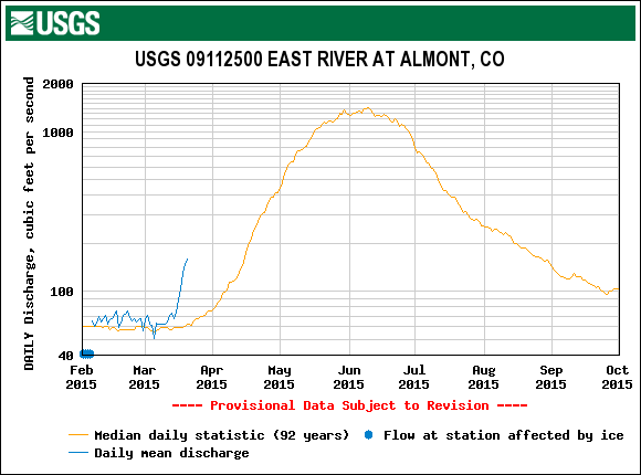
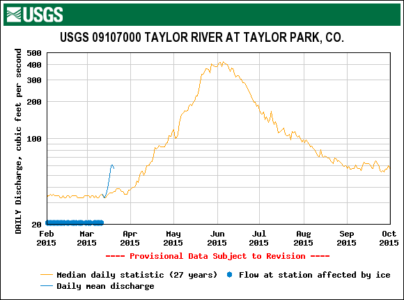
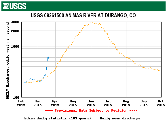
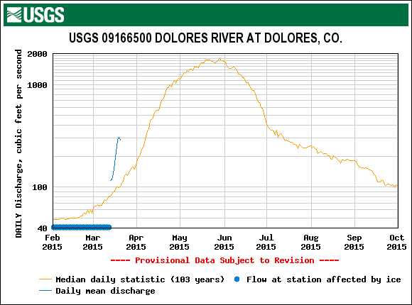
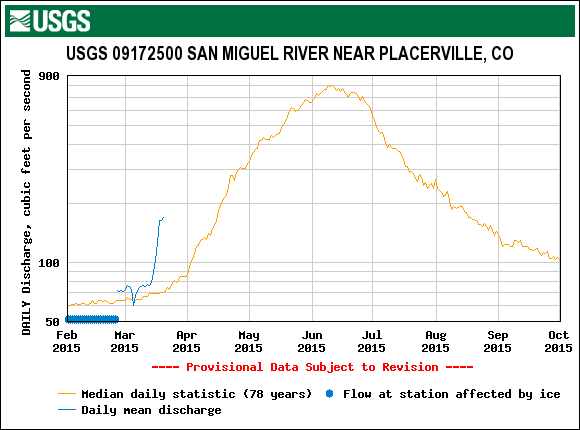
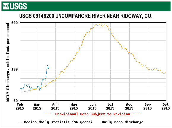
As discussed above, WY 2015 snowpack warming has occurred without the extra increment of radiative forcing produced by low snow albedo in exposed dust layers that has advanced the rate of snowpack warming in recent years. Rather, normal energy inputs to the currently clean, high albedo snowcover – from radiative sources, turbulent mixing with air, and thermal energy from the ground – have driven snowcover temperatures at all CODOS sites to isothermal temperatures, or very close to isothermal. Further, scant new snowfalls in recent weeks have not delivered significant amounts of cold snow to the snowpack surface. It has even recently rained on lower elevation snowcover in some locales, adding additional heat.
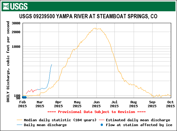
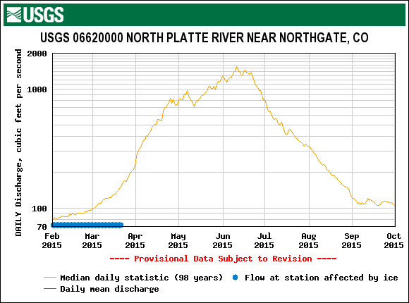
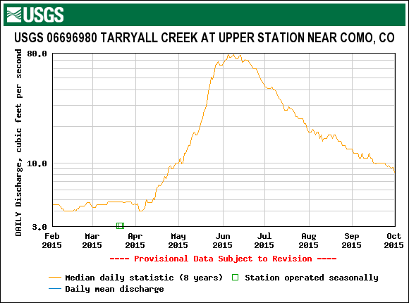
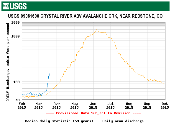
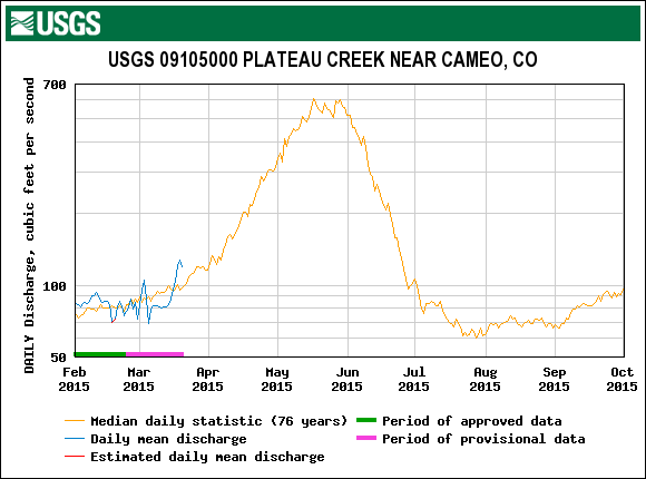
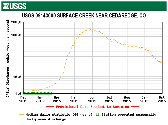
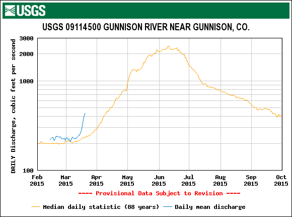
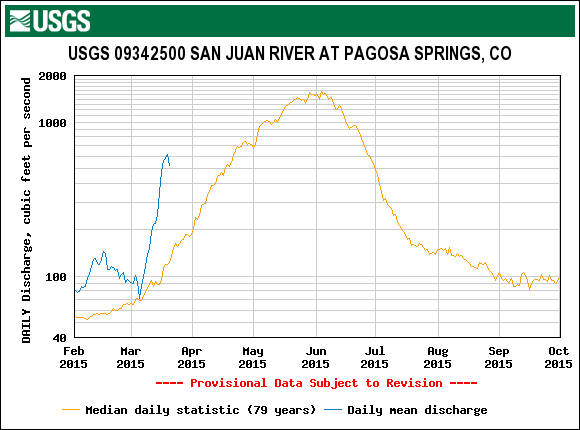
As a result, much of the Colorado snowcover is now “ripe” for snowmelt discharge and converting energy inputs from solar and thermal radiation, warm air, and even rain, directly into snowmelt and runoff, rather than consuming that energy in warming the snowcover to isothermal. Streamflow data (where gauges have de-iced) currently reflect this early onset of snowmelt with flows well above late March median levels (10x median on the San Juan at Pagosa Springs gauge). The very heavy rains from residual tropical storms last fall, and the consequent wet soils entering winter, may facilitate a more efficient WY 2015 snowmelt runoff, partially offsetting the poor snowpack conditions described above, just as occurred in spring 2014 following the very wet fall of 2013.
WEATHER AND CLIMATE FORECASTS
The NOAA Climate Prediction Center has issued, as of March 19, 2015, new three-month outlooks for April/May/June precipitation and temperature (above). Precipitation has a better than even chance of being above normal over that period. Temperatures have an equal chance of being either above or below normal for almost all of Colorado.
However, somewhat paradoxically, as of this writing the CPC’s 6-10 day and 8-14 day forecasts for the entire Western US, including Colorado, show enhanced probabilities of below normal precipitation and above normal temperatures. Further, CPC’s Seasonal Drought Outlook for March 19-June 30 indicates persisting or intensifying drought throughout western Colorado as well as the Colorado Plateau (and dust source areas). These latter precipitation products are hard to reconcile with the April/May/June precipitation outlook.
DUST ENHANCED RUNOFF CLASSIFICATION
In our March 1 SWE Conditions Update we narrowed the Dust Enhanced Runoff Classification (DERC) model “runoff space” for WY 2015 to either the “Low” or “Avg” March 1 SWE domains, by watershed. Since then, March has fallen short of producing “Average” spring weather, to-date, let alone initiated a “Wet” spring. The climate forecast presented above persists in forecasting above-normal precipitation for the remainder of the spring, but the near-term forecast and seasonal drought outlook products discussed above suggest that Colorado will ultimately experience a “Dry Spring”, under the DERC classification scheme.
In the absence of any dust-on-snow so far this season, dust conditions currently remain within the “Min Dust” classification and limit the cases of prior seasons with “Min Dust” to WY 2007, considered a Min+ season with a comparatively smaller amount of dust than observed in the other Water Years in our observation period (WY2006-2014). If this season remains “dust free” for the remainder of the snowmelt cycle, with no extra radiative forcing of snowmelt from dust-reduced snow albedo, it would be the first such season in our period of rigorous observation and, therefore, would have no precedent in WY2006-2014 hydrographs associated with CODOS dust-on-snow observations. Such a “baseline” season would have some value as a benchmark for “normal” snowmelt processes uninfluenced by dust- reduced snow albedo, even with sub-par snow conditions. (See the DERC section on individual CODOS site webpages for site-specific analyses of the entire WY 2006-2014 period).
If, on the other hand, soil conditions and weather in the Colorado Plateau do combine to eventually generate dust-on-snow events for the Colorado mountains later this spring (which could also bring additional snow), that dust would likely fall on already “ripe” snowcover where snowmelt is well underway. Then, with the consequent emergence of that dust and reduction in snow albedo, all the extra solar energy absorbed by dust exposed at the snowpack surface would result in near-instant acceleration of snowmelt rates and sharp and sustained surges in streamflows for as long as that dust remained exposed (and sufficient snowcover remains). Precedents for late spring dust impacts do exist within our WY 2006-2014 observation period hydrographs, and within the “Low” or “Avg” March 1 SWE domains within the DERC. CODOS will identify prior season hydrographs that best compare to current conditions as dust and spring precipitation conditions unfold.