
SUMMARY
Dust-on-snow event D3-WY2015 was verified at our Swamp Angel Study Plot on April 15 (as reported in our Dust Alert that day) and during a just-completed circuit of the CODOS sites at Grand Mesa, Spring Creek Pass, and Wolf Creek Pass on April 16 and 17. Dust layer D3 was observed at all of those sites in varying strengths, already merged with layers D2 and/or D1 where those layers had been deposited. Although snowpack temperatures had cooled in near-surface layers, temporarily disrupting snowmelt discharge, those snowpacks also remained very warm overall. As of the date of the site visits, anywhere from a trace to 4” of clean new snow overlay the D3/D2/D1 dust layer; subsequent snowfall may have resulted in deeper burial of the dust layer on Grand Mesa. Dust layer D3 is substantial enough to eventually result in significant reductions in snow albedo, once re-exposed to direct solar radiation. The merged D3/D2/D1 dust intensity currently remains within the “MIN Dust” domain of the Dust Enhanced Runoff Classification rankings at these sites although one or two additional dust-on-snow events could increase conditions to “AVG Dust”. This Update presents text and photographs to complement the new snow profiles, snowpack SWE plots, and hydrographs posted to the specific webpages for these CODOS sites (all CODOS site webpage links are shown at the top of the CODOS Program home page , and on all site pages).
SENATOR BECK BASIN – APRIL 14, 15
On the morning of April 14 we performed our weekly snow profile (Profile #16) at the Swamp Angel Study Plot in Senator Beck Basin, just hours before dust-on-snow event D3-WY2015. Dust layers D2 and D1 were merged and visible, albeit faintly, at the snowpack surface and the snow surface was slushy. Snowcover at Swamp Angel Study Plot had been declining steadily since the last very minor snowfall on March 25 (Storm #11), a dearth of precipitation that left our recent prior snow profile excavations still apparent. (We conduct each profile in a ‘new’ hole dug in rows across the plot, at sufficient distance from the prior profiles to avoid lateral snow temperature contamination from air temperatures in the older holes).
The April 14 Swamp Angel Study Plot snow profile #16 (in progress) is in the foreground, and the partially re-filled older snow profiles holes (there’s never enough snow to completely refill these holes) dating back several weeks are seen in the background, still unfilled and smoothed over by new snow.
Snowmelt discharge rates had remained unusually high, for early April, in our Senator Beck Stream Gauge and on the USGS Uncompahgre River near Ridgway gauge. The nearby Red Mountain Pass Snotel also recorded steady declines in SWE during that period. The Lizard Head Pass Snotel to the southwest, in the Dolores River headwaters, experienced very rapid loss of snowcover, perhaps under heavier D1 and D2 snowmelt rate enhancement than observed in the other watersheds. Lizard Head Pass is arguably the closest headwater (Dolores River) to northeastern Arizona and southeastern Utah dust source areas.
Later that evening of April 14 and overnight into April 15, dust-on-snow event D3 fell directly onto the merged dust layers D1/D2, followed by a trace of new snow. That trace of clean snow was thin and transparent enough to see through to the merged D3/D2/D1 dust which was already reducing snow albedo on the morning of April 15. Then, several inches of additional snow on April 16, 17, and 18 (Storm #12) have effectively shielded the dust from direct solar radiation at Swamp Angel Study Plot as of this writing. Winds may have scoured that new snow off of the snowpack surface at more exposed sites in alpine terrain, leaving the merged D1/D2/D3 exposed.
After collecting the 0.5m2 sample of D3, this clean white (square) surface showed clear contrast with the surrounding snowcover where the merged D1/2/3 dust layers was covered by less than a centimeter of new snow.
As observed on the morning of April 15, while sampling the D3 dust (shown above) , we still remain in the (comparatively) “Min(imal) Dust” domain of the Dust Enhanced Runoff Classification rankings of dust intensity at Senator Beck Basin, but perhaps only one or two additional events away from “Avg Dust” intensity. To-date, our only prior Water Year classified with “Min Dust” was WY2007. However, that year was also classified with “AVG March 1 SWE” and “AVG Spring” precipitation.
As it has unfolded, WY2015 has exhibited only “LOW March 1 SWE” throughout the San Juan Mountain System and has produced a dry spring since then, with only 12 winter storms this season at Senator Beck Basin, as of this writing, versus an average of 22.4 storms by the end of April, in our period of record. Given the early warming of the snowcover and onset of snowmelt, poor snowpack on March 1, drought conditions since March 1, and now increasingly intense dust-on-snow, WY2007 hydrographs in western San Juan Mountain watersheds would likely overstate runoff yields in WY2015, barring a major uptick in spring storms for the duration of April and May.
Instead, WY2012, with LOW March 1 SWE, a DRY Spring, and AVG Dust may prove to be the better analog to WY2015 runoff behavior for the Animas River, Dolores River, San Miguel River, and Uncompahgre River watersheds, should we have additional dust deposition. USGS gauge hydrographs from those four watersheds for the CODOS WY2006-2014 period of record, including WY2012, are collated and presented in the Dust Enhanced Runoff Classification discussion on the Senator Beck Basin webpage, at these links:
Uncompahgre near Ridgway (pdf)
San Miguel near Placerville (pdf)
Dolores River at Dolores (pdf)
Animas River at Durango (pdf)
GRAND MESA – APRIL 16
Much needed new snow challenged both the drive up to the Grand Mesa and our ski into the CODOS site at Skyway on April 16, 2015. Even with liberal application of “Glop Stop” on our ski climbing skins, traveling through alternately sunny and shady spots along the Skyway nordic ski trails resulted in the dreaded ‘glopping’ of thick clumps of the new snow to our skis, creating awkward stilts for the 2 km approach.
Even pre-treating our climbing skins with a heavy coat of “Glop Stop” was somehow not enough to prevent this mess … as CSAS field assistant Jay Welz contemplates.
Finally, in the early afternoon of April 16 we performed our second snow profile of the season at the Grand Mesa CODOS site. Although not apparent until digging, dust layer D3-WY2015, perhaps merged with layers merged layers D1/D2, was plainly visible underneath the 4” of new snow when seen in profile, in the snow pit wall. As of this writing, several inches of additional (clean) snow have fallen at this site since our visit. Snowcover at this site and the nearby Mesa Lakes Snotel had been declining slowly but steadily since peaking at a near-record low level in late March.
As seen in our April 16 snow profile, dust layer D3-WY2015, deposited directly onto already merged layers D1 and D2, was substantial at the Grand Mesa CODOS site, perhaps even a bit more intense than seen at the Swamp Angel Study Plot the day before.
As it has unfolded, WY2015 exhibited “LOW March 1 SWE” at the Mesa Lakes Snotel and has produced a dry spring since then. Given the early warming of the snowcover and onset of snowmelt, the extremely poor snowpack at Mesa Lakes on March 1, drought conditions since March 1, and marginally “MIN Dust” now approaching “AVG Dust” intensity, WY2012 hydrographs for Grand Mesa watersheds may be the best analogs to WY2015 behavior within our period of record, barring a major uptick in spring storms for the duration of April and May. Snowmelt rates will significantly accelerate on the Grand Mesa as the clean snow overlying the merged D3/D2/D1 layers settles and thins and the dust begins absorbing solar energy. Melt rates at the Mesa Lakes Snotel reached 1.0-1.5” per day under “AVG Dust” conditions in WY2014.
As of this writing, this year’s discharge on Plateau Creek resembles early WY2012 runoff. Surface Creek discharge data began at an unusually high level in early April 2015 but have declined since. USGS gauge hydrographs from those two watersheds for the CODOS WY2006-2014 period of record, including WY2012, are collated and presented in the Dust Enhanced Runoff Classification discussion on the Grand Mesa webpage, at these links:
Plateau Creek near Cameo (pdf)
Surface Creek near Cedaredge (pdf)
SPRING CREEK PASS – APRIL 17
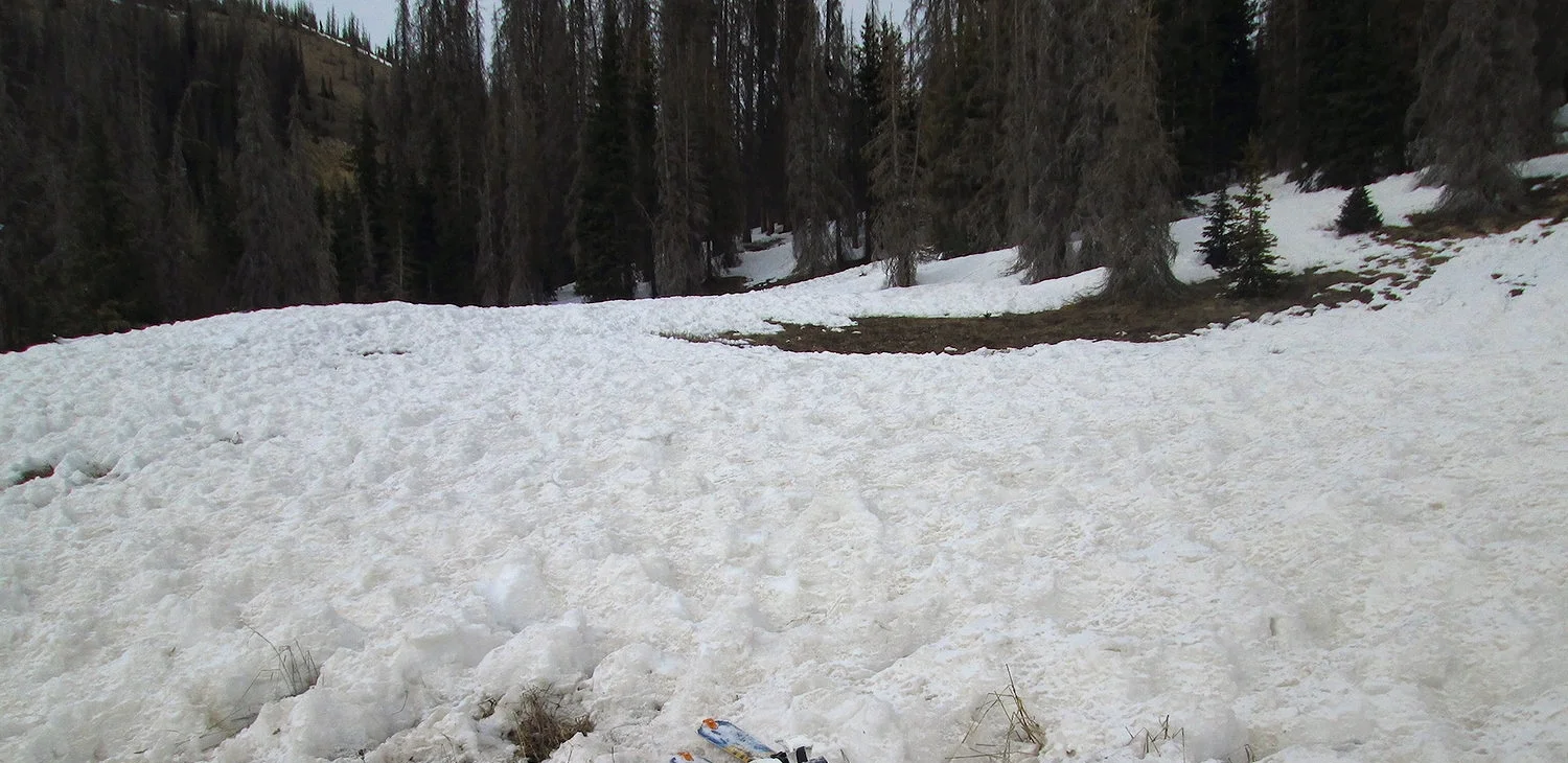
Showery weather greeted us at Spring Creek Pass in the early afternoon of April 17, 2015. Our NE-facing CODOS site clearly had only shallow snowcover remaining, with sagebrush visible on that slope. Snowcover at this site and the nearby Slumgullion Snotel had been declining rapidly in recent weeks.
Jay Welz gears up for the Spring Creek Pass snow profile to be performed on the open slope seen in the distance, to the left of the car.
Although not visible until digging our second snow profile of the season at this site, dust layer D3-WY2015, perhaps merged with layers merged layers D1/D2, was readily apparent when seen in profile underneath the 3.5” of new snow, in the snow pit wall. This shallow snowpack remained warm with evidence of snowpack wetting throughout its depth. Without significant additional new snow, the thin layer of clean snow overlying the D3/D2/D1 dust will be quickly consumed by melt, exposing the dust to direct solar radiation. Snowpack albedo will be substantially reduced throughout the Rio Grande watershed, where snowpack remains, and dust-enhanced snowmelt rates will surge well above rates previously observed this season.
Unfortunately, only scant snowpack does still remain in the Spring Creek Pass locale. Large sub-alpine areas that would normally be snow covered in mid-April were effectively snow-free on April 17, aside from the new snow falling at the time.
Looking north at North Clear Creek Park from Hwy 149 showing what had been snow-free ground, prior to the snowfall in progress.
The snowcover was thin or altogether gone in the lower elevation burned areas at the edge of the completely snow-free valley floor.
As it has unfolded, WY2015 exhibited “AVG March 1 SWE” at the Slumgullion Snotel but has produced a dry spring since then. Given the early warming of the snowcover and onset of snowmelt, the now very poor snowpack throughout the upper Rio Grande watershed, and still (marginally) “MIN Dust” approaching “AVG Dust” intensity, WY2012 hydrographs for the Rio Grande (and Lake Fork) may be the best analogs to WY2015 behavior within our CODOS period of record, barring a major uptick in spring storms for the duration of April and May.
As of this writing, WY2012 flows on the Rio Grande at Del Norte gauge resemble this year’s early onset of discharge, if at much higher levels in 2012. Colorado Division of Water Resources hydrographs for the CODOS WY2006-2014 period of record, including WY2012, are collated and presented in the Dust Enhanced Runoff Classification discussion on the Spring Creek and Wolf Creek webpage, at this link:
Rio Grande near Del Norte (pdf)
WOLF CREEK PASS – APRIL 17
In sharp contrast to the deep new snow we experienced in the Taylor River drainage earlier in the morning (thwarting our effort to visit the Park Cone site), intermittent sun and snow squalls greeted us in late afternoon at Wolf Creek Pass, with only a trace of new snow accumulation. Further, it was clear that almost no snow had fallen in this locale since our last visit, in mid-March. Avalanche fracture lines that we had observed on the ski area in March had not been refilled and obscured by new snow and were still clearly visible. Snowcover was also notably absent or thin on the ascent of the Pass, from the east. Further, dust-on-snow was clearly evident underneath the trace of new snow accumulation that day, where snowcover was present.
March avalanche fracture lines on the Wolf Creek Ski Area seen on our prior site visit were still in plain view on April 17, evidence of how dry and ‘storm-less’ the weather had been over that month period. The same effect was observed at Red Mountain Pass in early and mid-April.
We performed our second snow profile of the season at this site, finding dust layer D3-WY2015 on top of the snowpack, likely merged with previously merged layers D1/D2, all underneath a trace of new snow. This shallow snowpack remained very warm with evidence of snowpack wetting throughout its depth. Without significant additional new snow, the very thin layer of clean snow overlying the D3/D2/D1 dust was likely quickly consumed by melt, exposing the dust to direct solar radiation. Snowpack albedo will be substantially reduced throughout the Wolf Creek Pass locale, where snowpack remains, and dust-enhanced snowmelt rates will surge well above rates previously observed this season whenever this D3/D2/D1 layer is exposed. Additional significant dust events this spring could elevate dust intensity in this locale to “AVG Dust” conditions.
Unfortunately, only scant snowpack does still remain in the Wolf Creek Pass locale. Large sub-alpine areas that would normally be snow covered in mid-April were effectively snow-free on April 17, aside from the light new snow falling at the time.
Dust layer D3-WY2015 was plainly visible under a trace of new snow, likely merged with layers D2 and D1. Additional dark flecks of debris from nearby beetle killed spruce trees were also observed, contributing to the darkening of the snow surface.
As it has unfolded, WY2015 exhibited “LOW March 1 SWE” at both the Wolf Creek Summit and Upper San Juan Snotels and has produced a dry spring since then. Given the early warming of the snowcover and onset of snowmelt, the poor snowpack at those Snotel sites on March 1, very dry drought conditions since March 1, and “MIN Dust” now approaching “AVG Dust” intensity, WY2012 hydrographs for the adjacent Rio Grande and San Juan River watersheds may be the best analogs to WY2015 behavior within our period of record, barring a major uptick in spring storms for the duration of April and May. Snowmelt rates will significantly accelerate in Wolf Creek Pass headwaters as the merged D3/D2/D1 layers begin absorbing solar energy. Melt rates at the sunny Upper San Juan Snotel ranged from 1-2” per day under “AVG Dust” conditions in WY2014. Extreme snow surface roughness on the approach to the CODOS site was clear evidence of very high, dust-enhanced melt rates in the recent past, and those rates will increase with the addition of dust layer D3.
Very high melt rates enhanced by dust and other debris had recently produced extreme snow surface roughness along our approach to the Wolf Creek Summit CODOS site.
As of this writing, this year’s discharge, to-date, on the San Juan River resembled WY2012 flows with early onset of snowmelt to high levels for early April in both years (see the Hydrographs at the Wolf Creek Pass CODOS webpage). A similar pattern, albeit with lower amplitude so far this year, is seen on the Rio Grande hydrographs for this year, to-date, and during early runoff in WY2012. USGS gauge hydrographs from those two watersheds for the CODOS WY2006-2014 period of record, including WY2012, are collated and presented in the Dust Enhanced Runoff Classification discussion on the Wolf Creek Pass webpage, at these links:
Rio Grande near Del Norte (pdf)
San Juan River at Pagosa Springs (pdf)
WEATHER & CLIMATOLOGY
As of this writing, Sunday morning, April 19, 2015, the National Weather Service Grand Junction office is tracking a potentially significant snow event at the end of the coming week, on Friday and Saturday, April 24 and 25. This system could also have the synoptic characteristics of a dust-on-snow producer.
The NOAA Climate Prediction Center mid range forecasts, for April 24-28 and for April 26-May 2, respectively, also indicate a tendency for wet weather for the remainder of April.
CPC’s 6-10 day precipitation outlook as of April 18, 2015.
CPC’s 8-14 day precipitation outlook as of April 18, 2015.
Finally, CPC’s one-month Outlook for precipitation indicates increased probability of above normal precipitation for all of Colorado in May 2015.
ADDITIONAL CODOS SITE VISITS TO COMPLETE THE APRIL CIRCUIT
The CODOS team will visit the other seven CODOS sites not visited on this trip during the coming week (of April 20th). The McClure Pass CODOS site had lost all snowcover just prior to the recent storm and the Willow Creek Pass CODOS site may have also recently lost snowcover. Both sites will be observed first-hand on this circuit.