
SUMMARY
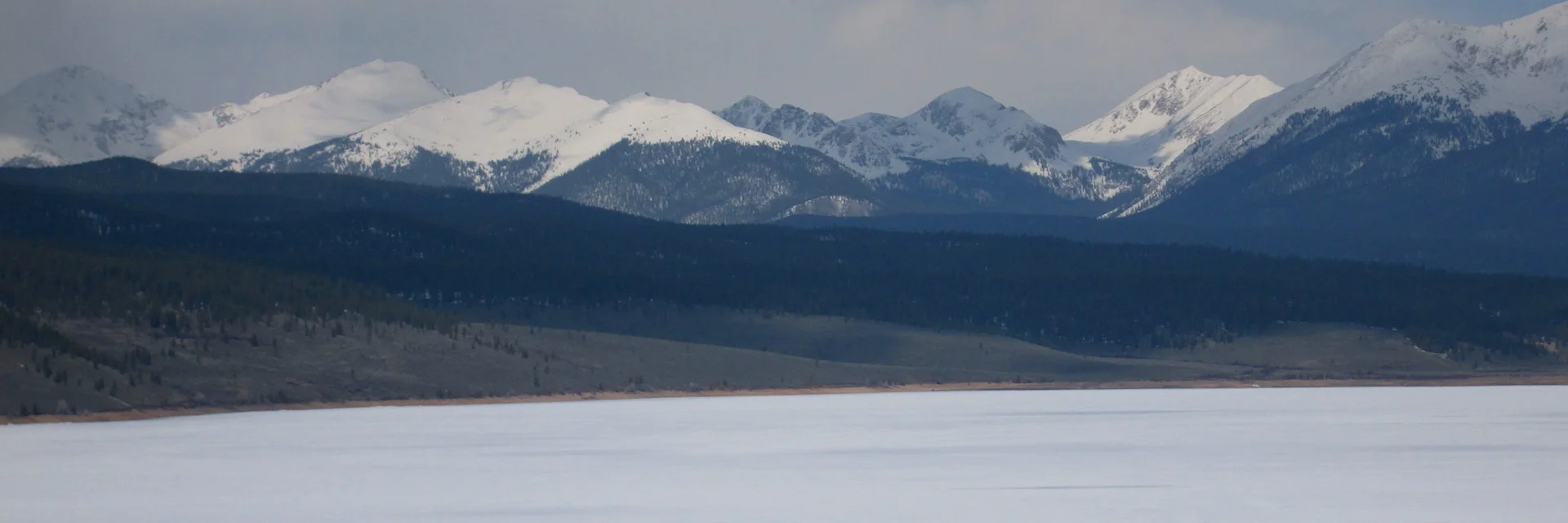
CODOS sites at McClure Pass, Rabbit Ears Pass, Willow Creek Pass, Berthoud Pass, Loveland Pass, Hoosier Pass, and the Park Cone site in Taylor Park were visited over April 20-22, 2015. Dust layer D3 (April 14/15), merged with layer D2 (April 8), was clearly evident in the Central Mountain sites (McClure Pass and Park Cone) underneath the recent new layer of clean snow (CSAS Storm #12) and dust intensity in those locales could attain “AVG Dust” with just a few additional events. D3 was weaker at Northern Mountain sites (Rabbit Ears Pass and Willow Creek Pass) and at Berthoud Pass, and very faint, even ambiguously present, in our other Front Range locales (Grizzly Peak and Hoosier Pass). Dust intensity remains in the “MIN Dust” classification in those areas. Dust was not apparent at the snowpack surface in any of these locales, during this circuit, and where dust was present it was well-buried under 4-15” of clean snow containing from 0.5” to 3.2” of water equivalent. Snowpack temperatures were near 0 C in the lower snowcover and cooler near the surface, a typical temperature profile pattern for late April at these sites. Patterns seen in runoff behavior during the Dust Enhanced Runoff Classification period of record are associated with current conditions in the watersheds represented by these CODOS sites. This Update follows the order of travel to these seven sites and presents text and photographs to complement the new snow profiles, snowpack SWE plots, and hydrographs posted to the specific webpages for these CODOS sites (all CODOS site webpage links are shown at the top of the CODOS Program home page , and on all site pages).
McCLURE PASS – APRIL 20
Spring was well underway at McClure Pass and snowcover at the CODOS site and at the adjacent McClure Pass Snotel had completely disappeared prior to the recent winter storm (CSAS Storm #12). Only post-D3 new snow covered the ground at that site so an alternative snowpit site was selected on a nearby north-facing slope where old snow remained, enabling the verification of presence/absence of dust layers.
The CODOS site at McClure Pass with some 6-8” of clean new snow (CSAS Storm #12) overlying bare ground; no ‘old’ snowcover remained at this site.
The McClure Pass Snotel in the foreground, with new snow only. On this trip a snow profile was performed at the base of the north-facing wooded slope in the distance, where old snow was still present.
Dust-on-snow event D3, which fell onto and merged with layer D2 was clearly present at the old snowpack surface at this ad-hoc site. (Dust layer D2 was confirmed by the Aspen Mountain Ski Patrol, prior to event D3). These merged D3/D2 events are the only dust layer present, as of this writing, in the snowpack in this locale. At the present, this single layer comprises “MIN Dust” intensity, but additional dust deposition could quickly elevate that to “AVG Dust” intensity. With over 20” of recent new snow following event D3, no dust was visible on the remaining snow covered terrain surrounding McClure Pass. The snowcover at this low elevation snow profile site (9,500’), even at the foot of this north-facing slope, was effectively isothermal and wet.
WY 2015 snowpack formation stalled at the McClure Pass Snotel site in January, then resumed during storms in late February and early March to a Peak SWE of 11.5” on March 10 (median Peak SWE is 16.3”). After peaking, snowcover began a steady decline during very dry weather at melt rates reaching 0.5-0.7” of SWE loss per day. The Snotel reached the first instance of “snow all gone” (SAG) on April 14, a record-early date for SAG. April 15 is the median date of Peak SWE at McClure Pass. New snow restored a layer of snowcover at the Snotel (as seen above) and, as of this writing, the Snotel reports 1” of SWE.
Thus, under the CODOS Dust Enhanced Runoff Classification (DERC) approach, Water Year 2015 at McClure Pass has unfolded with LOW March 1 SWE, MIN Dust intensity, to date, and overall DRY Spring weather that has not offset the poor snowpack as of March 1. In our March 1 Update we posted the following analyses of WY 2015 that narrowed the DERC domain for McClure Pass to prior Water Years with LOW March 1 SWE:
At McClure Pass, the only case of a prior Water Year with LOW March 1 SWE and a DRY Spring was WY2012, a year with AVG Dust intensity (WY2013 also had LOW SWE but an AVG Spring and MAX dust). Current hydrographs for Muddy Creek and the North Fork of the Gunnison, on the west side of McClure Pass, and for the Crystal River to the east, reflect the early onset of snowmelt previously described in our March 23 Update, since followed by a flattening of runoff rates with the rapid loss of scant snowcover at the lowest snow covered elevations. Dust-on-snow has played only a very minor role in the WY2015 snowmelt cycle, to date, with only the comparatively weak layer D2 having been exposed for periods of time since its deposition on April 8. Layer D3, now merged with D2, has not yet emerged extensively at or near the snowpack surface but will accelerate snowmelt rates well above rates previously observed this spring, once it becomes more widely exposed.
WY2012 hydrographs for the generally west-facing Muddy Creek and the North Fork of the Gunnison River watersheds also recorded early onset of snowmelt runoff followed by a general flattening in runoff rates while the median hydrograph ascending limb continues to climb. In the more north-sloping Crystal River watershed, WY2012 runoff reached higher relative levels but also eventually stalled well below and ahead of median peak levels and timing. Within the CODOS DERC period of record, WY2012 remains the closest analog in the DERC period of record to a likely pattern in WY2015 snowmelt runoff behavior in these three watersheds. In the meantime, spring 2015 is already producing green vegetation even at the McClure Pass elevations.
Aspen trees begin to leaf out at McClure Pass, on April 20, 2015.
RABBIT EARS PASS – APRIL 21
Snow and rain showers were underway while entering the notably snow-free Yampa Valley from the south.
The Flat Tops eastern rim, seen behind the town of Yampa, was well covered in snow, while the valley floor was snow free and beginning to green.
Snow and rain showers with thunder and lightning over the snow-free valley floor, just above Steamboat Springs, on the evening of April 20.
The second snow profile of the season was performed at our normal Rabbit Ears Pass CODOS site on April 21, located in an open wetland near the Rabbit Ears Pass Snotel. Dust layer D3-WY2015, perhaps merged with layer D2, was clearly evident some 6” below the snow surface, underneath recent (clean) new snow. D3 fell onto an old surface of melt/freeze snow and ice, perhaps containing layer D2, and melt water had thoroughly penetrated this snowpack, to the ground. These merged D3/D2 events are the only dust layer present, as of this writing, in the snowpack in this locale. At the present, this single layer still comprises comparatively “MIN Dust” intensity, but additional dust deposition could quickly elevate that to “AVG Dust” intensity. With over 14” of recent new snow following event D3, since settled to 5-6”, no dust was visible in the terrain on Rabbit Ears Pass. Snow temperatures were near-isothermal in this profile, with only the new snow layer retaining significant cold content.
Dust layer D3-WY2015 at the Rabbit Ears Pass CODOS site on April 21, 2015 perhaps merged with layer D2, some 6” below the snowpack surface, underneath recent new snow. Thick, very tough layers of melt/freeze snow laminated between several layers of clear ice comprised the next 16” of the snowpack.
WY2015 snowpack formation stalled and plateaued at the Rabbit Ears Pass Snotel site in March, reaching a Peak SWE of 19.4” on March 28 (median Peak SWE is 26.1”, on April 28), after which snowcover began oscillating during alternating dry and stormy weather, with melt rates ranging from 0.3-0.8” of SWE loss per day. The highest single-day loss of SWE was recorded the day after D3 was deposited, at a 1” drop in SWE.
Thus, under the CODOS Dust Enhanced Runoff Classification (DERC) approach, Water Year 2015 at Rabbit Ears Pass has unfolded with AVG March 1 SWE (see March 1 Update), MIN Dust intensity, to-date, and overall Dry Spring weather that has not sustained snowpack accumulation. In our March 1 Update we posted the following analysis of WY 2015 that narrowed the DERC domain for Rabbit Ears Pass to prior Water Years with AVG March 1 SWE:
Within the CODOS DERC period of record at Rabbit Ears Pass, WY2007 is the only case of a Water Year with AVG March 1 SWE, MIN Dust intensity, and a DRY Spring. So far, the early onset of WY2015 snowmelt and more recent early April stall closely mirrors the WY 2007 hydrograph for the Yampa River at Steamboat Springs gauge. Dust-on-snow has played only a very minor role in the WY2015 snowmelt cycle, to date, with only the comparatively weak layer D2 (if present at all) having been exposed for short periods of time since its deposition on April 8. Layer D3 (April 14/15) has not yet emerged extensively at or near the snowpack surface but will accelerate snowmelt rates well above rates previously observed this spring, once it becomes more widely exposed. In the absence of a major uptick in late April and May snowfalls, and/or significant additional dust-on-snow depositions, WY2007 may remain the closest analog in the DERC period of record to a likely pattern in WY2015 snowmelt runoff behavior in the Yampa watershed.
WILLOW CREEK PASS – APRIL 21
A complete circle of very white, very well snow-covered mountains surrounded North Park, itself almost snow free, while driving to Willow Creek Pass from the north. Once over the Pass, however, it was apparent that southerly aspects, at that elevation, had lost most or all snowcover, prior to the recent large storm, leaving only new snow from the recent storm on the ground.
The Willow Creek Pass CODOS site on April 21, 2015. The shovel marks the location of the March 19 snow profile, with the new profile immediately to the right (already ‘backfilled’). The Willow Creek Snow Course and Snotel site are located along the treeline in the distance, across the creek. Our site is virtually the only bush-free location in the meadow where a series of ‘clean’ snow profiles is feasible.
Our slightly south-sloping CODOS site was not immune to this loss of snowcover and only patches of old snowpack remained present at our site, underneath the new snow layer. Fortunately, old snow was still present adjacent to our March 19 snow profile, now marked by the small pile of ‘backfilled’ snow. Our second snow profile of the season was performed in that thin patch of old snowcover to enable verification of dust layers D2 or D3.
Dust layer D3-WY2015 was only weakly evident at the Willow Creek Pass CODOS site on April 21, 2015, perhaps merged with layer D2, some 4” below the snowpack surface, underneath recent new snow.
Dust layer D3-WY2015, perhaps merged with layer D2, was present but only weakly evident some 4” below the snow surface, underneath the recent (clean) new snow. D3 fell onto an old surface of melt/freeze snow and ice, perhaps containing layer D2, and melt water had thoroughly penetrated this snowpack, to the ground. Merged but very weak D3/D2 is the only dust layer present, as of this writing, in the snowpack in this locale. At the present, this single dust layer still comprises comparatively “MIN Dust” intensity, and it would require significant additional dust deposition to elevate that to “AVG Dust” intensity. With the recent new snow following event D3, no dust was visible in the terrain around Willow Creek Pass. Snow temperatures in this thin snowcover were cooled by the new snow and storm weather.
Parkview Mountain (12,296’) was resplendent in clean, white snow on April 21, 2015.
WY2015 snowpack formation stalled and plateaued at the Willow Creek Pass Snotel site in January, setting the table for a persisting shortfall in SWE for the duration of the winter, to-date. The snowcover then resumed building in February before stalling again in March, and then slowly gained SWE until the most recent storm produced a substantial uptick. The Willow Creek Pass Snotel may still gain additional SWE before peaking (median Peak SWE is 14.5”, on May 4).
Under the CODOS Dust Enhanced Runoff Classification (DERC) approach, Water Year 2015 at Willow Creek Pass has unfolded with LOW March 1 SWE (see March 1 Update), MIN Dust intensity, to-date, and perhaps almost AVG Spring precipitation that has sustained a near-normal but erratic rate of snowpack accumulation since March 1, from a sub-par starting point. In our March 1 Update we posted the following analysis of WY 2015 that narrowed the DERC domain for Willow Creek Pass to prior Water Years with LOW March 1 SWE:
Within the CODOS DERC period of record at Willow Creek Pass, WY2012 is the only case of a Water Year with LOW March 1 SWE and MIN Dust intensity, but with a DRY Spring. Although the USGS Colorado River below Baker Gulch stream gauge has only begun to record data, the early onset of WY2015 snowmelt, at unusually high levels, closely mirrors the WY 2012 hydrograph at that site. Dust-on-snow has played only a very minor role in the WY2015 snowmelt cycle, to date, with only the comparatively weak layer D2 (if present at all) having been exposed for short periods of time since its deposition on April 8. Layer D3 (April 14/15), itself rather weak, has not yet emerged extensively at or near the snowpack surface but will accelerate snowmelt rates somewhat, once it becomes more widely exposed. At present, and in the absence of a major uptick in late April and May snowfalls, and/or significant additional dust-on-snow depositions, WY2012 may remain the closest analog in the DERC period of record to a likely pattern in WY2015 snowmelt runoff behavior in the northern portion of the Upper Colorado River watershed. However, a near-AVG Spring 2015 to-date, and apparently high over-winter base flows, may result this spring in a somewhat higher amplitude and larger total runoff yield than was observed in WY2012.
BERTHOUD PASS – APRIL 21
Ski conditions at Winter Park looked great as we drove by, on the way to the Berthoud Summit Snotel site where we conducted our second Berthoud Pass snow profile of the season.
The upper portion of the 56” April 21, 2015 snowpack at the Berthoud Pass CODOS site, showing the impressive 15” layer of new snow containing 2.95” of SWE that had recently fallen onto a lightly dust-stained layer of melt-freeze ice.
Dust layer D3-WY2015 was present but only weakly evident some 15” below the snow surface, underneath the recent (clean) new snow. D3 fell onto an old surface of melt/freeze snow and ice, perhaps containing layer D2, and melt water had thoroughly penetrated this snowpack, to the ground. This potentially merged but weak D3/D2 dust is the only dust layer present, as of this writing, in the snowpack in this locale. At the present, this single dust layer still comprises comparatively “MIN Dust” intensity, and it would require significant additional dust deposition to elevate that to “AVG Dust” intensity. With the recent new snow burying D3/D2, no dust was visible in the terrain around the Berthoud Pass locale. Snow temperatures were typical of late April, effectively isothermal in the lower snowpack and colder in the top of the profile, cooled by the new snow and storm weather.
Early and mid-winter WY2015 snowpack formation at the Berthoud Summit Snotel site was on track for a good season, at 109% of median as of March 1 (see March 1 Update). Then, in March, accumulation stalled and plateaued, setting the table for a persisting shortfall in SWE for the duration of the winter, to-date. The recent storm produced a 20” gain in snowcover and produced the peak SWE value, to-date, at 16.6”, on April 21 (median Peak SWE is 21.8”, on April 30).
Under the CODOS Dust Enhanced Runoff Classification (DERC) approach, Water Year 2015 at Berthoud Pass has unfolded with AVG March 1 SWE, MIN Dust intensity, to-date, and overall DRY Spring precipitation, so far. In our March 1 Update we posted the following analysis of WY 2015 that narrowed the DERC domain for Berthoud Pass to prior Water Years with AVG March 1 SWE:
Within the CODOS DERC period of record at Berthoud Pass, WY2007 is the only case of a Water Year with AVG March 1 SWE and MIN Dust intensity, but WY2007 experienced an AVG Spring. WY2012 may provide an alternative case study, given that WY2007 was a DRY Spring, and the early onset and levels of WY2015 snowmelt at the USGS Fraser River at Upper Station gauge do more closely mirror the WY 2012 hydrograph at that site than the early 2007 hydrograph. Dust-on-snow has played a very minor role in the WY2015 snowmelt cycle in this locale, to date. Dust layer D2 (if present at all) may have been exposed for short periods of time since its deposition on April 8. Dust layer D3 (April 14/15) has not yet emerged extensively at or near the snowpack surface but will accelerate snowmelt rates somewhat, once it becomes more widely exposed. At present, and in the absence of a major uptick in late April and May snowfalls, WY2012 may remain the closest analog in the DERC period of record to a likely pattern in WY2015 snowmelt runoff behavior in this Fraser River tributary of the Upper Colorado River watershed.
LOVELAND PASS, GRIZZLY PEAK – APRIL 21
The recent major winter storm and ongoing snow showers had blanketed the Loveland Pass locale in mid-winter white but thin areas were still apparent in the snowcover on the west side of the Pass.
The west side of Loveland Pass on April 21, 2015, still showing areas of thin snowcover that developed earlier in the season despite the recent winter storm.
Arapahoe Basin on April 21, 2015.
Ski conditions at Arapahoe Basin looked great as we parked before heading to our CODOS site adjacent to the Grizzly Peak Snotel where we conducted our second Loveland Pass snow profile of the season. Some 10” of clean new snow overlay a thick, icy, and dirty crust that was the old snow surface.
In the April 21 snow profile at the CODOS Grizzly Peak site a 10” layer of recent new snow overlay the tough and dirty preceding surface containing as much as 2” of ice.
Although this old surface did have contaminants in it, which did match the D3 dust layer color, it was unclear whether this was evidence of a weak D3 deposition, or dust from the nearby Arapahoe Basin parking lots (located upwind during W’ly wind events), or both kinds of contaminants. Dust in the underside of cornices in the alpine terrain around Loveland Pass provided other evidence of a D3 event in this locale. Thus, D3 fell onto an old snowpack surface of melt/freeze snow and ice that perhaps also contained layer D2 and/or material from the nearby ski area parking lots.
As evidenced by the solid ice in the old surface, as much as 2” thick, snowmelt had been intense at our site and melt water had thoroughly penetrated this snowpack to the ground. Given that much of the material in this crust was parking lot dust, the potentially merged but comparatively weak D3/D2 dust is the only dust layer present, as of this writing, in the snowpack in this locale. At the present, this single dust layer still comprises comparatively “MIN Dust” intensity, and it would require significant additional dust deposition to elevate that to “AVG Dust” intensity. With the recent new snow burying D3/D2, no dust was visible in the terrain around the Loveland Pass locale. Snow temperatures were typical of late April, effectively isothermal in the lower snowpack and colder in the top of the profile, cooled by the new snow and storm weather.
Early and mid-winter WY2015 snowpack formation at the Grizzly Peak Snotel site was on track for a very good season, at 107% of median as of March 1 (see March 1 Update). Then, in March, accumulation slowed and then stalled and even declined in April, before the recent storm produced the peak SWE value, to-date, at 16.0”, on April 21 (median Peak SWE is 17.1”, on April 12).
Under the CODOS Dust Enhanced Runoff Classification (DERC) approach, Water Year 2015 at Loveland Pass (Grizzly Peak) has unfolded with AVG March 1 SWE, MIN Dust intensity, to-date, and overall DRY Spring precipitation, so far. In our March 1 Update we posted the following analysis of WY 2015 that sought to narrow the DERC domain for Loveland Pass to prior Water Years with AVG March 1 SWE:
Interestingly, within the CODOS DERC period of record at Grizzly Peak, there are no cases of prior Water Years that entered March with AVG March 1 SWE. Given that March quickly lost ground in snowpack formation, WY2012, with LOW March 1 SWE, may provide the most similar case study and, since data began on April 1, the onset and levels of WY2015 snowmelt at the USGS Snake River near Montezuma gauge do most closely mirror the WY 2012 hydrograph in the DERC period of record, to-date.
Dust-on-snow has played a very minor role in the WY2015 snowmelt cycle in this locale, to date. Dust layer D2 (if present at all) may have been exposed for short periods of time following its deposition on April 8. Further, the weak dust layer D3 (April 14/15), perhaps merged with D2, has not yet emerged extensively at or near the snowpack surface. However, once exposed, D3/D2 will accelerate snowmelt rates somewhat. At present, and in the absence of a major uptick in late April and May snowfalls, WY2012 may remain the closest analog in the DERC period of record to a likely pattern in WY2015 snowmelt runoff behavior in the Snake River watershed.
HOOSIER PASS – APRIL 22
Snowcover in the Hoosier Pass locale has sustained excellent conditions throughout the winter of 2014/2015 and the recent major winter storm left the landscape as white as can be recalled in the CODOS period of record. The second snow profile of the season was performed early on the morning of April 22 at our Hoosier Pass CODOS site, adjacent to (the now completely obscured) prior profile.
On arrival at the CODOS Hoosier Pass snow profile at 0820 MDT on April 22, 2015 to perform the second snow profile of the season. The prior March 18 profile had been dug to the left of the small tree top seen to the left of the gear and was now completely obscured by subsequent snowfall and blowing snow. The new profile would be dug in front and just right of the gear.
Among all CODOS sites visited in April, dust layer D3-WY2015 was most weakly (even ambiguously) present evident in the old snow almost 16” below the surface, underneath the recent (clean) new snow. If present at all, D3 fell onto an old surface of melt/freeze snow and ice and melt water had thoroughly penetrated this snowpack, to the ground. This extremely weak D3 dust is the only dust layer present, as of this writing, in the snowpack in this locale. As such, this single dust layer comprises, by definition, “MIN Dust” intensity, and it would require very significant additional dust deposition to elevate that to “AVG Dust” intensity. With the thick layer of recent new snow blanketing the Mosquito and Ten Mile ranges, no dust was visible in the terrain around the Hoosier Pass locale. Snow temperatures were typical of late April at this high elevation site (11,400’), approaching isothermal in the lower snowpack and colder in the top of the profile, cooled by the new snow and storm weather.
As at most CODOS sites during April, an often thick and very tough set of ice layers underlay the recent new snow layer. This 'snow' was much too strong to saw through or use a regular snow shovel to dig and required, instead use of a steel sod spade to excavate.
The old snow surface predating the recent new snowfall is seen in this photo. Because this layer was exposed for an extended period, accumulation of vegetation debris has darkened the ice and melt/freeze crust at the top of that older snowpack, but scant if any D3 dust could be detected.
Early and mid-winter WY2015 snowpack formation at the Hoosier Pass Snotel site was on track for a very good season, well above median as of March 1 (see March 1 Update). In March, accumulation slowed slightly until the recent major winter storm produced a large gain in snowcover and produced the peak SWE value, to-date, at 17.7”, on April 22 (median Peak SWE is 16.0”, on April 25).
Under the CODOS Dust Enhanced Runoff Classification (DERC) approach, Water Year 2015 at Hoosier Pass has unfolded with HIGH March 1 SWE, MIN Dust intensity, to-date, and overall near-AVG Spring precipitation, so far. In our March 1 Update we posted the following analysis of WY 2015 that narrowed the DERC domain for Hoosier Pass to prior Water Years with HIGH March 1 SWE:
Within the CODOS DERC period of record at Hoosier Pass, WY2007 is the only case of a Water Year with HIGH March 1 SWE and MIN(+) Dust intensity, and an AVG Spring. The early onset and levels of WY2015 snowmelt at the USGS Blue River near Dillon gauge do closely mirror the WY 2007 hydrograph. (No data are being reported at the USGS Tarryall Creek at Upper Station near Como gauge). Dust-on-snow has played a very minor role in the WY2015 snowmelt cycle in this locale, to date. Dust layer D2 may not be present at all in this locale and the very weak dust layer D3 (April 14/15) has not yet emerged extensively at or near the snowpack surface. D3 may accelerate snowmelt rates somewhat, once it becomes more widely exposed. At present, in the absence additional significant dust depositions, WY2007 represents the closest analog in the DERC period of record to likely patterns in WY2015 snowmelt runoff behavior in the Blue River and Tarryall Creek watersheds.
PARK CONE – APRIL 22
After a thwarted attempt on April 16 to reach the Park Cone CODOS site, bucking deep and intense new snowfall in progress, dry roads led to a different landscape on April 22, with only scant remnants of that 12” of new snow in the Taylor River canyon floor and on the shores of Taylor Reservoir.
Taylor Reservoir still iced over on April 22, with virtually snow-free shoreline and adjacent south- and east-facing slopes. The west slopes of the Sawatch Range, on the other hand, appeared heavily covered in the recent ‘clean’ new snow, down to and below treeline.
The Park Cone CODOS site is in an open, north-sloping meadow, uphill of the Park Cone snow course and adjacent to the Park Cone Snotel. This meadow had lost a good deal of its snow cover but our CODOS site did retain enough old snowpack (covered in new snow) to check for evidence of dust-on-snow layers.
Bare ground, bushes, and patches of only the most recent snow were found in the lower end of the CODOS Park Cone site meadow, but snowcover improved at the upper end of the meadow, where CODOS snow profiles are performed.
Our second snow profile of the season found dust layer D3-WY2015 present and moderately strong (for Park Cone), some 2.5” below the snow surface, underneath clean and slushy new snow. D3 fell onto an old surface of melt/freeze snow and ice, likely containing layer D2 (confirmed by the ski patrol in Aspen, prior to D3). Melt water had thoroughly penetrated this snowpack, to the ground. This merged D3/D2 dust is the only dust layer present in the snowpack in this locale and, as of this writing, may comprise either MIN+ Dust or AVG- Dust intensity. With the recent new snow burying D3/D2, no dust was visible in the terrain around the Park Cone and Taylor Park locale. Snow temperatures were typical of a shallow snowpack in late April, with full melt conditions in the top of the profile and some residual of the storm cooling still left just below the preceding snow surface.
This shallow snowpit at Park Cone on April 22 revealed merged D2/D3 in a significant layer just beneath the remainder of the recent 12" of new snow the week before
Early and mid-winter WY2015 snowpack formation at the Park Cone Snotel site was on track for an average season until stalling and plateauing in January and most of February, before further gains in snowpack and SWE in late February. Even at that, Park Cone entering the latter third of winter at only 81% of median on March 1 (see March 1 Update). Accumulation continued in early March before stalling again for the remainder of March and well into April when the recent storm produced a 12” gain in snowcover and produced the peak SWE value, to-date, of 7.9”, on April 19 (median Peak SWE is 10.1”, on April 5).
Under the CODOS Dust Enhanced Runoff Classification (DERC) approach, Water Year 2015 at Park Cone has unfolded with LOW March 1 SWE, MIN+/AVG- Dust intensity, to-date, and overall DRY Spring weather, so far. In our March 1 Update we posted the following analysis of WY 2015 that narrowed the DERC domain for the Park Cone locale to prior Water Years with LOW March 1 SWE:
Within the CODOS DERC period of record at Park Cone, WY2007 is the only case of a Water Year with LOW March 1 SWE, DRY Spring conditions, and MIN+ Dust intensity. WY2013 provided another case study with LOW March 1 SWE, but WY2013 experienced AVG Spring precipitation and MAX Dust. Reflecting those differences, the early onset and levels of WY2015 snowmelt at the USGS Taylor River at Taylor Park gauge do much more closely mirror the WY 2007 hydrograph, to-date, than the early 2013 hydrograph. However, the near-normal total yield of the WY 2007 Taylor River hydrograph is difficult to reconcile with the combined LOW March 1 SWE and DRY Spring reported at the Park Cone Snotel.
Dust-on-snow has played a minor role in the WY2015 snowmelt cycle in this locale, to date. Dust layer D2 may have been exposed for short periods of time since its deposition on April 8. Dust layer D3 (April 14/15) has not yet emerged extensively at or near the snowpack surface but will accelerate snowmelt rates, once it becomes more widely exposed. At present, in the absence of a major uptick in late April and May snowfalls, WY2007 is the closest analog in the DERC period of record to a likely pattern in WY2015 snowmelt runoff behavior in this Taylor River tributary of the Gunnison River watershed.
Nearby, WY 2015 in the Schofield Pass Snotel locale has also unfolded with LOW March 1 SWE, Min+ or perhaps AVG- Dust intensity (inferred from nearby CODOS sites), to-date, and overall DRY Spring precipitation, so far. Barring a major onslaught of precipitation, Peak SWE appears to have occurred at Schofield Pass on March 15 at only 22.9” (median Peak SWE is 33.7”, on April 16). In our March 1 Update we posted the following analysis of WY 2015 that narrowed the DERC domain for the Schofield Pass locale to prior Water Years with LOW March 1 SWE:
Within the CODOS DERC period of record at Schofield Pass, WY2012 is the only case of a prior Water Year with LOW March 1 SWE and DRY Spring conditions, but with AVG Dust intensity. As on the Taylor River, the early onset and levels of WY2015 snowmelt at the USGS East River at Almont gauge closely mirror the WY 2012 hydrograph, to-date. At present, in the absence of a major uptick in late April and May snowfalls, WY2012 is the closest analog in the DERC period of record to a likely pattern in WY2015 snowmelt runoff behavior in this East River tributary of the Gunnison River watershed.
WEATHER & CLIMATOLOGY
As of this writing, Friday morning, April 24, 2015, the National Weather Service Grand Junction office is expecting a modest snow event, primarily for western Colorado, over the coming weekend, on Saturday, April 25 and Sunday, April 26. This weather does not appear to have the synoptic characteristics to produce a dust-on-snow event. Drier weather is expected to return mid-week with mostly sunny skies and warming temperatures.
The NOAA Climate Prediction Center mid-range forecasts, for April 30-May 4 and for April 26-May 2, respectively, now indicate mixed tendencies for wet weather for the remainder of April, and somewhat elevated chances for wetter than normal weather in early May.
CPC’s 6-10 day precipitation outlook as of April 24, 2015.
CPC’s 8-14 day precipitation outlook as of April 24, 2015.
Finally, CPC’s one-month Outlook for May precipitation, made April 16, indicates increased probability of above normal precipitation for all of Colorado.