
Summary
On Saturday, May 17, CODOS found snowmelt well advanced in the Rio Grande River watershed with snowcover significantly reduced at our Wolf Creek Pass CODOS site and “snow all gone”, effectively, at our Spring Creek Pass site. Recent snowfall continued to shield the most recent dust layer D8, and the merged dust layers D6-D3 just below, from the full impact of solar radiation in most alpine terrain. Those dust layers were evident on solar aspects at and below tree line, where snowcover existed at all. The Rio Grande River main stem was flowing near bank full and rising.
Snow Profile and Snow Cover
Despite periods of high snowmelt rates in the Wolf Creek Pass locale in mid-April and early May, this site visit still found 42” of snowcover at the CODOS snow profile site, thanks to recent snowfalls. This snow profile retained 16.8” of SWE including substantial bodies of solid ice associated with the very thick layer of merged D3-6 dust layers. Snow temperatures were effectively isothermal and the snowpack was ‘very wet’ throughout. Thin layers of clean snow sat above and below the substantial May 11th D8 layer (possibly merged with a very weak D7 layer), but solar energy was still reaching the D8 dust and producing near-slush at 10:00 AM. Bands of faint dust at the middle of the snowpack could include layer D2 as well as one or more dust-on-snow events that were not observed at Senator Beck Basin.
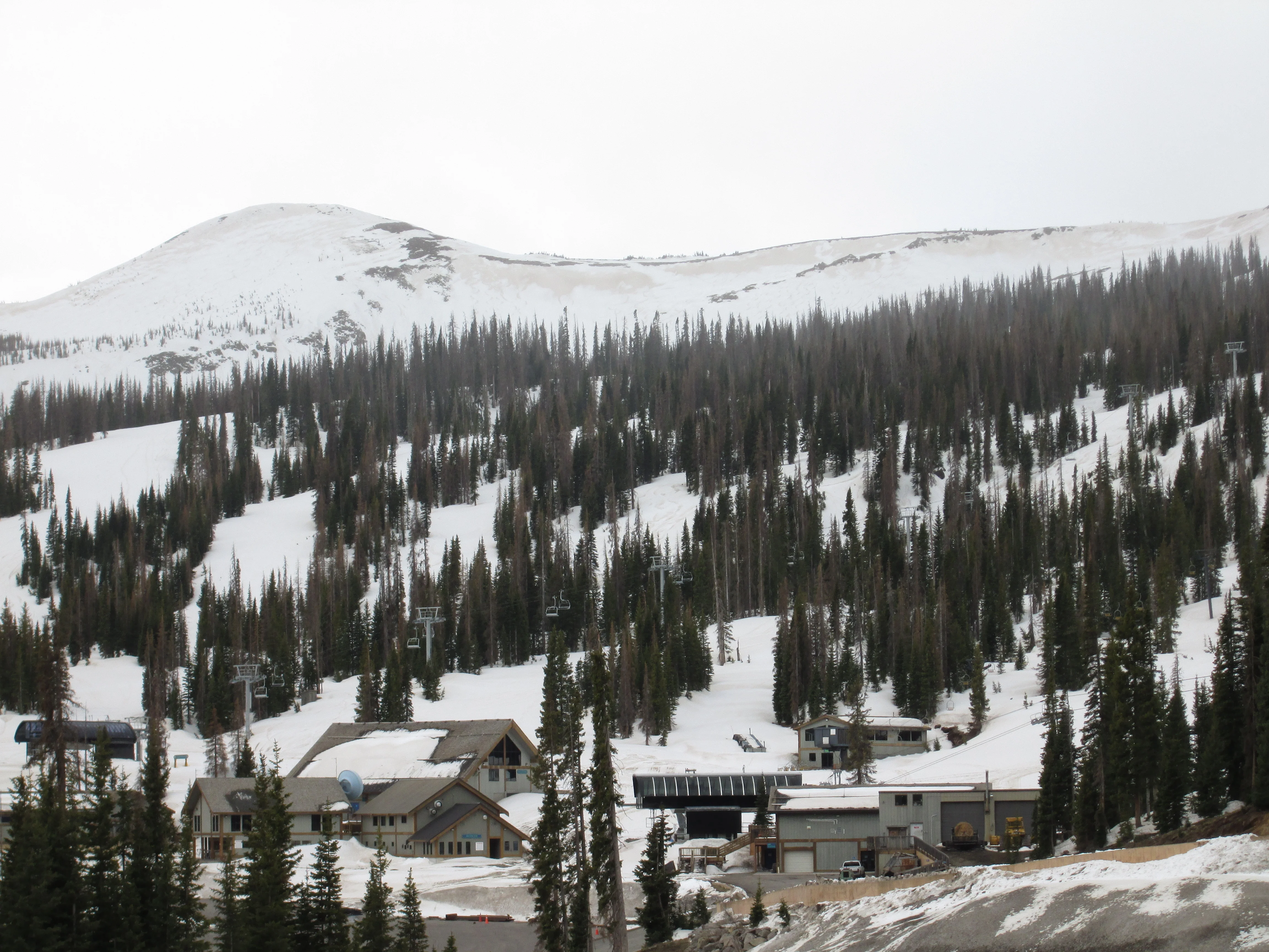
By the time of this writing, D8 has likely become fully exposed at the snowpack surface and merged with layers D3-D6. Dust was widely emerged on the alpine snowcover in avalanche terrain above the highway on the west side of Wolf Creek Pass (photo below, left). And, immediately across the highway from the CODOS site, D8 and D3-D6 dust was clearly visible on the (closed) Wolf Creek ski area (photo below, right).
South- and east-facing terrain above US Highway 160 showing dust widely exposed at the snowpack surface.
Wind stripping had removed recent snow and exposed dust layer D8 below the ridgeline at Wolf Creek Ski Area
Farther north, up-stream from Creede, distant snowcover in headwaters alpine terrain appeared clean and white from the valley floor (photo below, top left). Recently burned terrain was largely snow-free (photo below, top right) and the Brown and Hermit Lakes valley was also snow free (photo below, bottom left). The only snow found at our 10,800’, northeast-facing Spring Creek Pass CODOS site was rapidly melting Storm #24 snow, captured in and shaded by the sagebrush on that site (photo below, bottom right). Dust layer D8 was apparent in the larger patches of that recent snow. No snow profile was performed.
Looking southwest from State Hwy 149, west of Creede, at alpine headwaters terrain.
East-facing burned forest.
Hermit and Brown Lakes from a scenic overlook on State Hwy 149, with Simpson Mountain and Rio Grande Pyramid in the far distance.
The northeast-facing, 10,800’ Spring Creek Pass CODOS site, located in the sagebrush meadow seen behind the sign, in front of the trees.
Snotel Plots
As noted in prior WY 2014 Updates, winter 2014 favored the northern margin of the Rio Grande River watershed. A virtually ‘normal’ Peak SWE occurred on the median date at the Slumgullion Snotel site, and two significant April storms (Storms #23 and #24) resulted in substantial post-Peak SWE additions to the snowcover. The vast majority of SWE remains at that well-shaded, north facing Snotel site, located in the trees immediately behind roadside CDOT snow stakes.
CDOT snow stakes at Slumgullion Pass. The very shady Slumgullion Snotel is located in thick forest immediately behind these stakes.
However, in the main stem, the Beartown Snotel has roughly half of its near-average Peak SWE, despite also receiving Storms #23 and #24 snows. Farther south, the very exposed Upper San Juan Snotel site has lost more than half of its very poor Peak SWE. Because of the loss of tree cover at that site, the Upper San Juan Snotel experiences a comparatively high level of direct solar radiation compared to the well-shaded Wolf Creek Summit Snotel site. As a direct result, Upper San Juan Snotel snowmelt rates more accurately reflect the impact of dust-on-snow and reduced snow albedo.
The wide open Upper San Juan Snotel site. The solar panels face south. Patches of merged dust layers D3-8 are seen between rapidly melting patches of recent new snow (containing layer D8). US Hwy 160 is seen behind the Snotel. Looking upstream (left) and downstream (right) at near bank-full flows.
Most, but not all gravel bars are covered.
Hydrograph
Looking upstream (left) and downstream (right) at near bank-full flows. Most, but not all gravel bars are covered.
As of this writing, the Rio Grande River near Del Norte gauge is recording the fourth significant surge in snowmelt runoff of the season. Two prior surges resulted in flows reaching near-median peak levels at very early dates; it is also possible that the early May surge contained the center of the spring 2014 runoff mass. Given the remaining alpine snowcover, and the imminent emergence of dust layer D8 and its merger with merged layers D3-6, substantial reductions in snow albedo are going to influence the remainder of the snowmelt cycle. Since NWS Grand Junction expects sunny to partly sunny, windy, and generally warm weather for the coming week and weekend, the surge currently underway seems likely to be sustained and exceed median peak levels. Later in the month the May 18th NWS Climate Prediction Center 8-14 day precipitation outlook does foresee above average probability of precipitation for the San Juan Mountains and San Luis Valley for late May.
If that wetter weather does not materialize, and there is no significant reprieve from these sunny, dry, and warm conditions, the rapid, dust-enhanced ablation of the remaining snowpack could result in the current surge plateauing, reversing, and then entering the descending limb of the WY 2014 hydrograph well ahead of the normal peaking date, despite ongoing high snowmelt rates in the remaining snowcover. In that scenario, the WY 2014 hydrograph may exhibit an even earlier, more compressed and “flashy” runoff than observed in WY 2013, albeit with somewhat larger amplitude surges on the ascending limb. Late May snowfall could prolong the life of the remaining snowcover, delaying the onset of the descending limb and extending the runoff cycle.