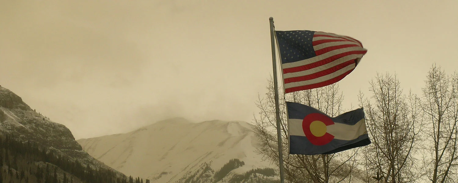
Greetings from Silverton,
Colorado Dust-on-Snow and Snowpack Conditions
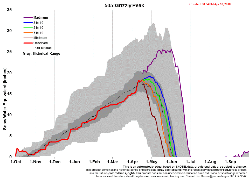
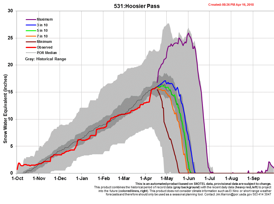
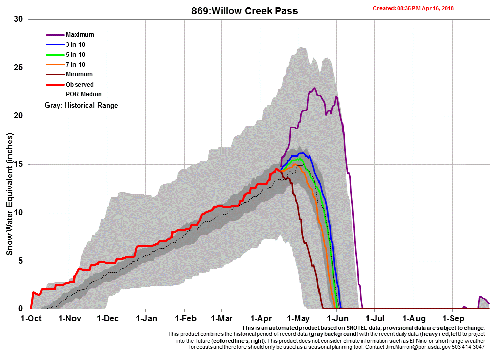
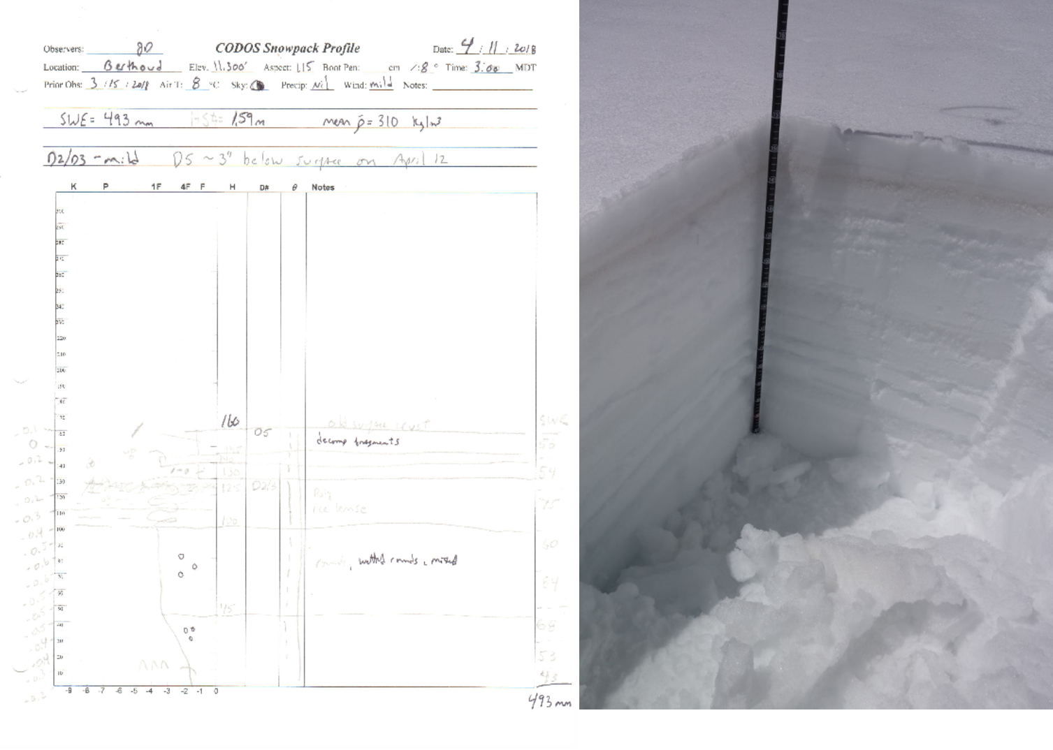
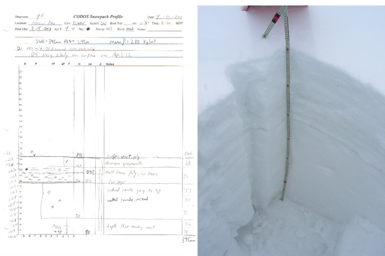
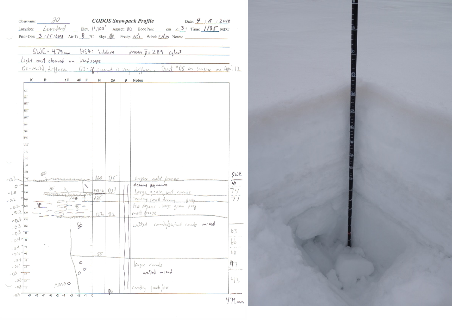
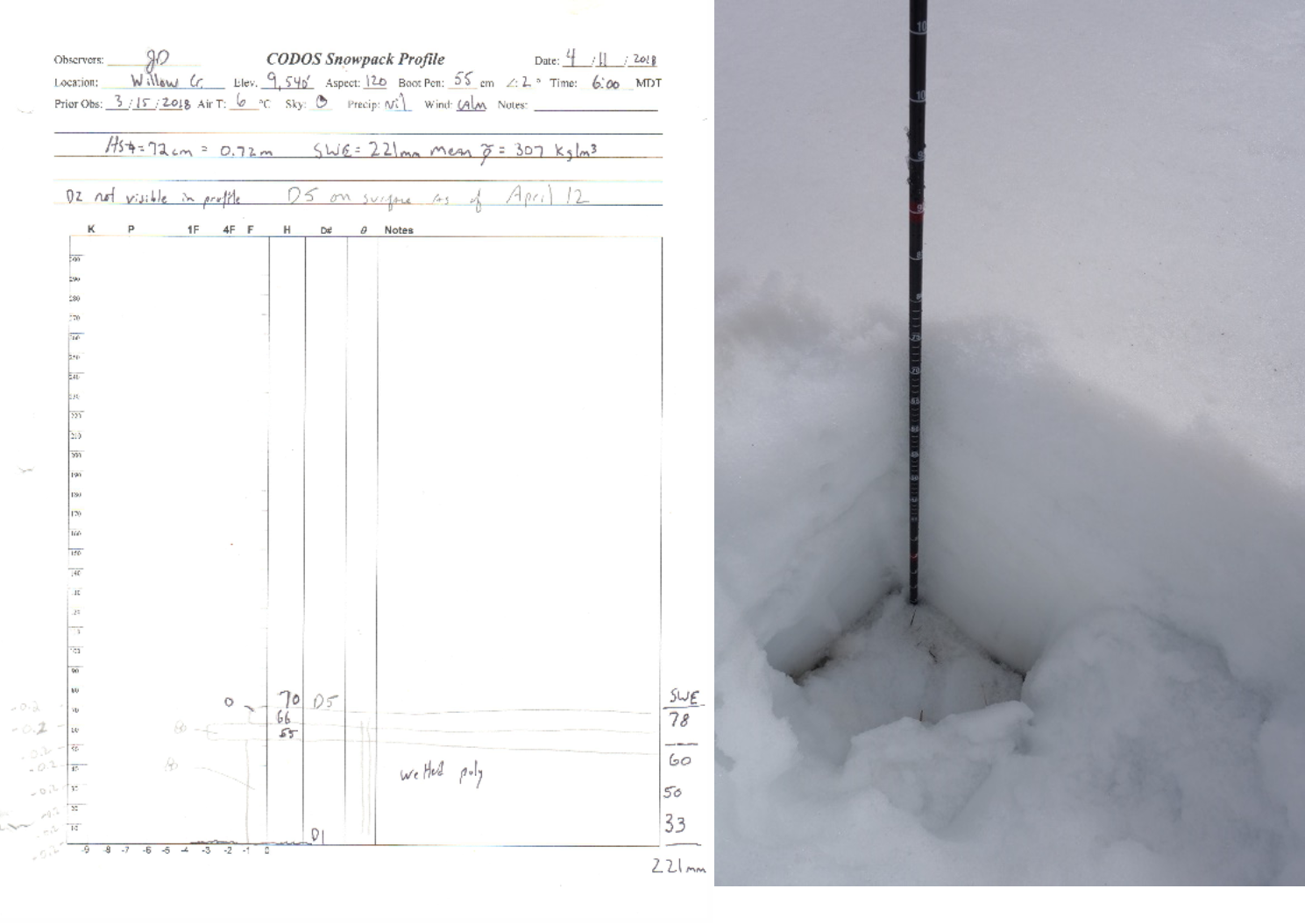
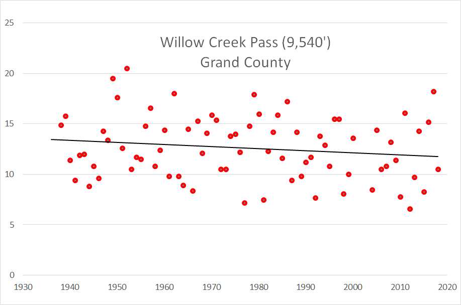
The CSAS team conducted a portion of the April CODOS tour on April 11. Sites visited were the Front Range locations, Hoosier, Grizzly (Loveland Pass), Berthoud, and Willow Creek Pass. With a significant winter storm in the forecast from April 12-14, along with accompanying dust storm warnings in the source region of the desert southwest, we opted to sample remaining sites after this system – very likely to deposit dust – had passed through Colorado. It is fortunate we postponed our trip, a severe dust storm (dust event D5) occurred late afternoon on April 12, immediately followed by snow accumulation of ~9” at Swamp Angel and various amounts throughout Colorado. Due to the spatial extent and severity of D5 the dust observations we collected on April 11 at Hoosier, Grizzly, Berthoud, and Willow Creek is now rendered obsolete; therefore, we are planning on resampling these sites on April 19. Immediately following revisiting these sites we will modify this April CODOS report to include those observations.
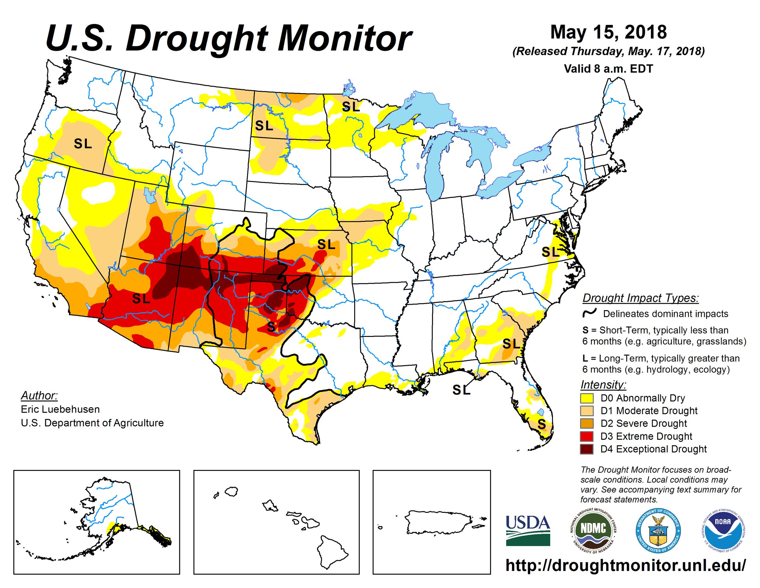
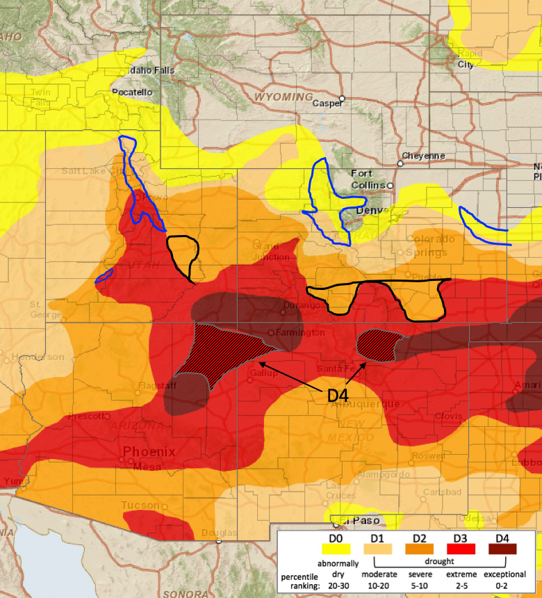
We have been holding our breath this season in expectation of major dust events unfolding, waiting for the other shoe to drop, in a sense, on a dismal snowpack in the southern half of the state. The conditions have been ripe for it all winter with the southwest digging deeper into severe drought, making it more likely we would see large quantities of dust mobilization in the source region. This dust event (D5) comes right as the southern part of Colorado has likely reached peak SWE and the northern part of Colorado is very near peak SWE, leaving the dust on (or very near the surface) of the snowpack. Except for when it may be temporarily buried by more snow accumulation this dust will advance snowpack warming, increase melt rates, and enhance sublimation for the duration of spring.
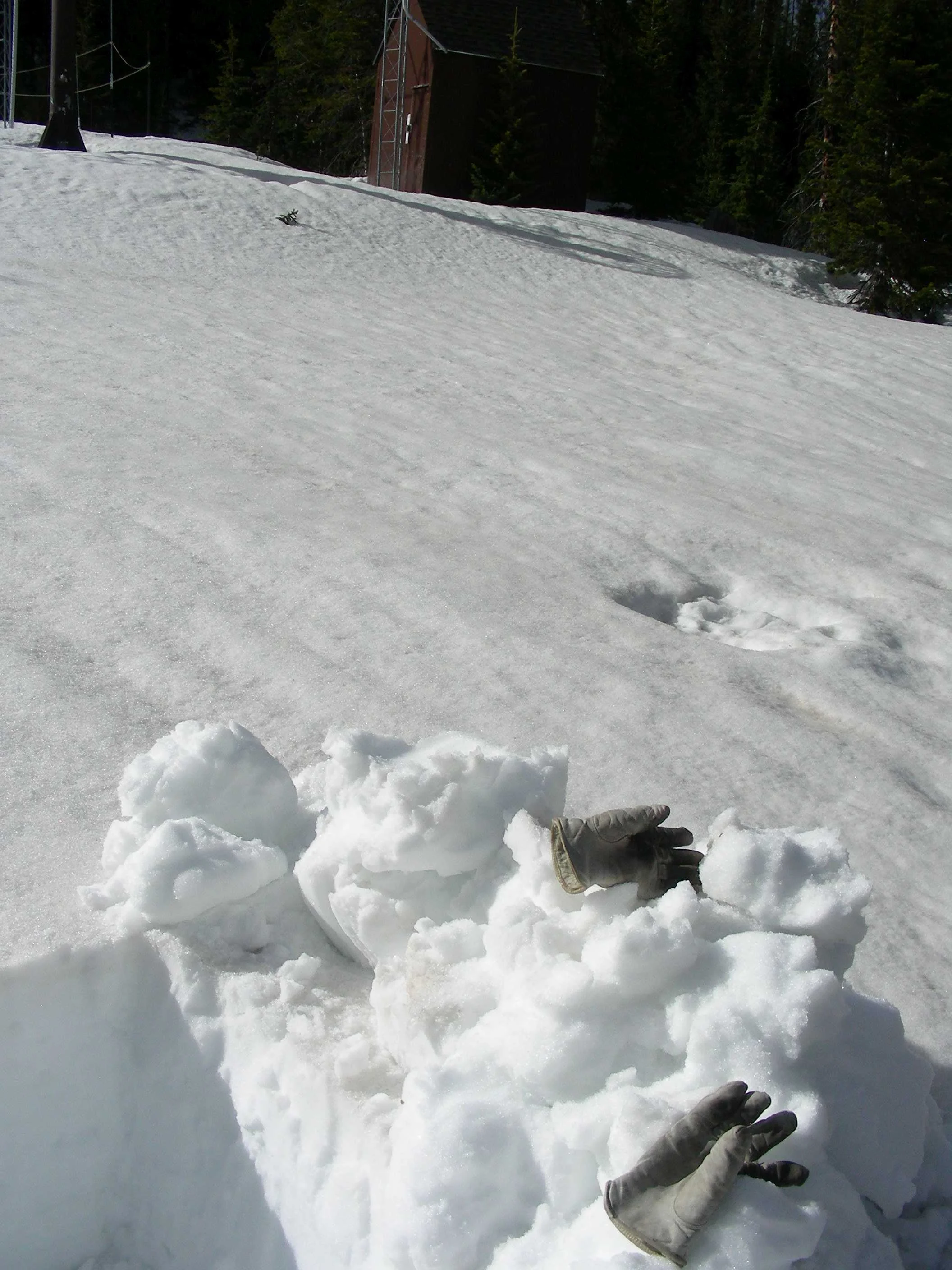
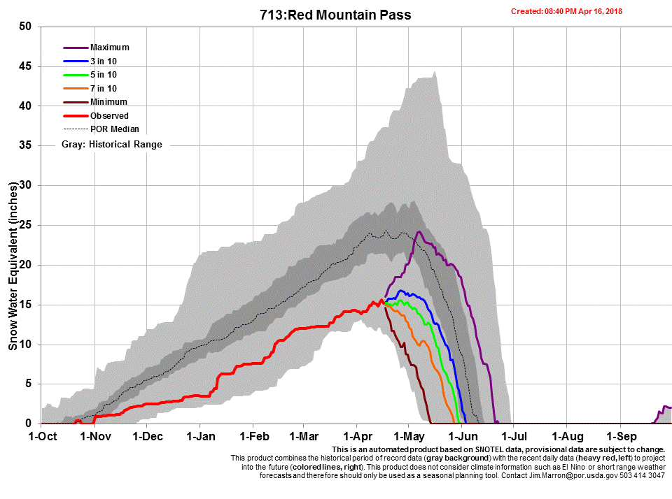
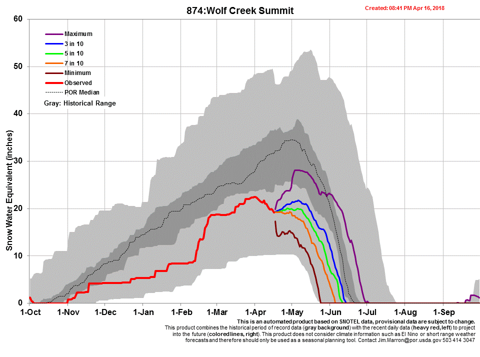
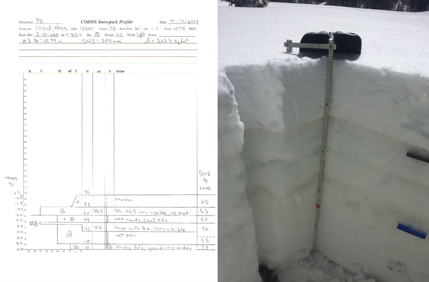
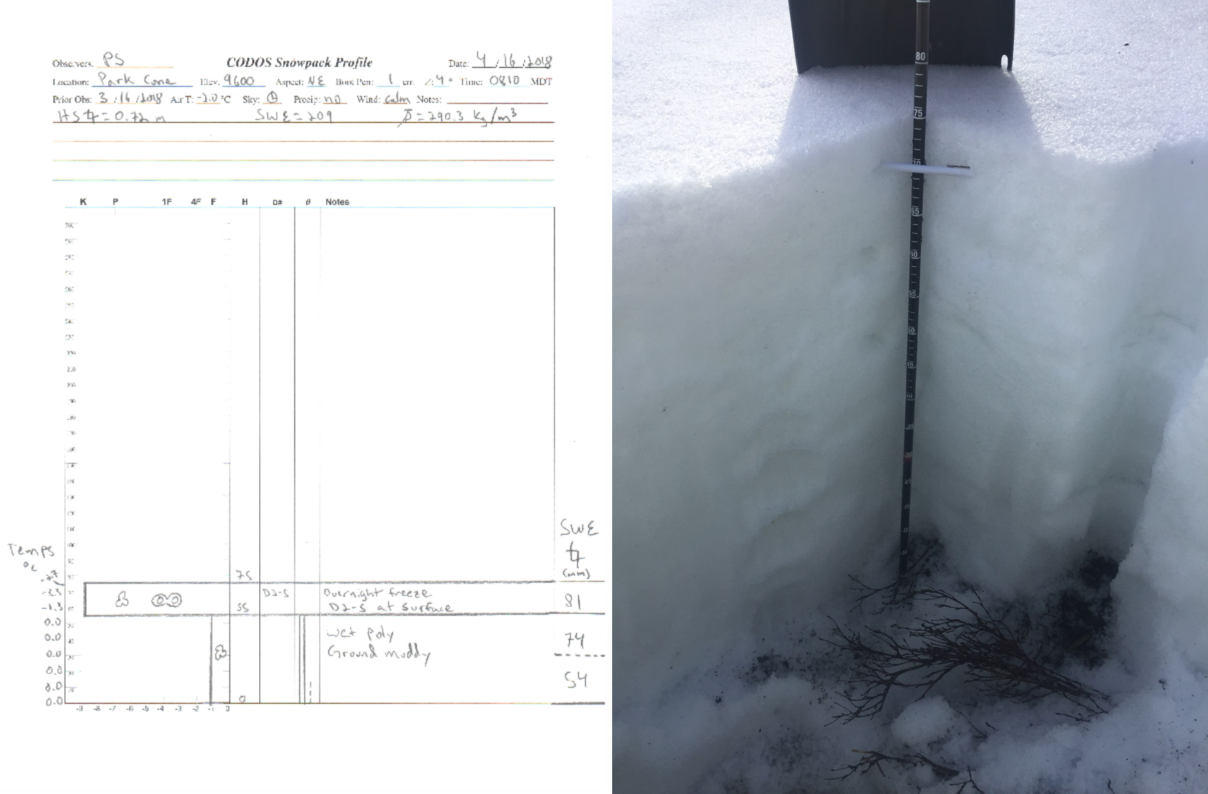
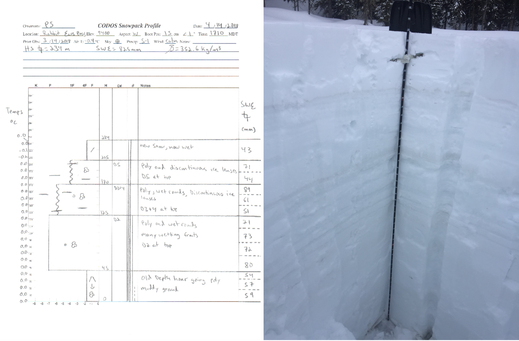
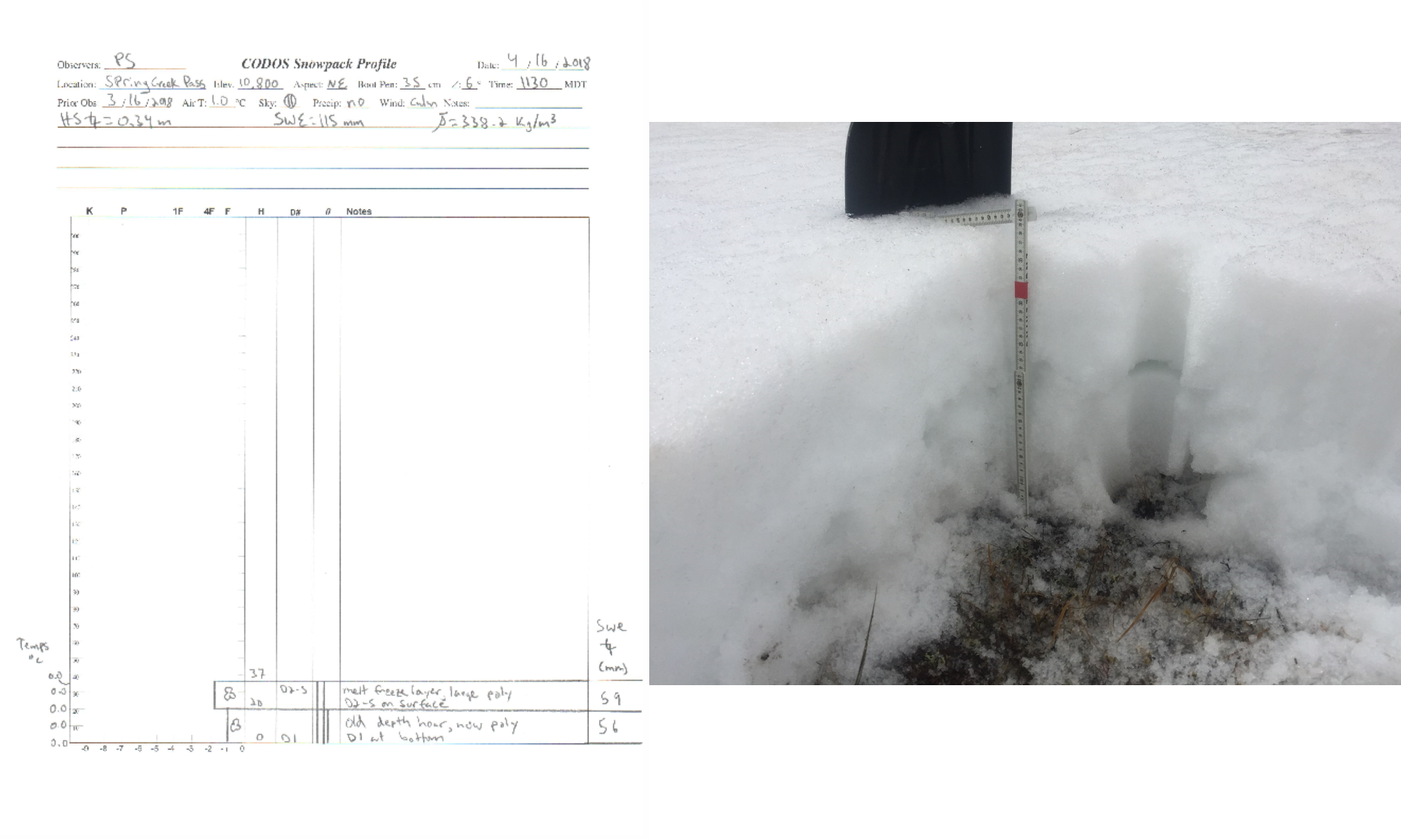
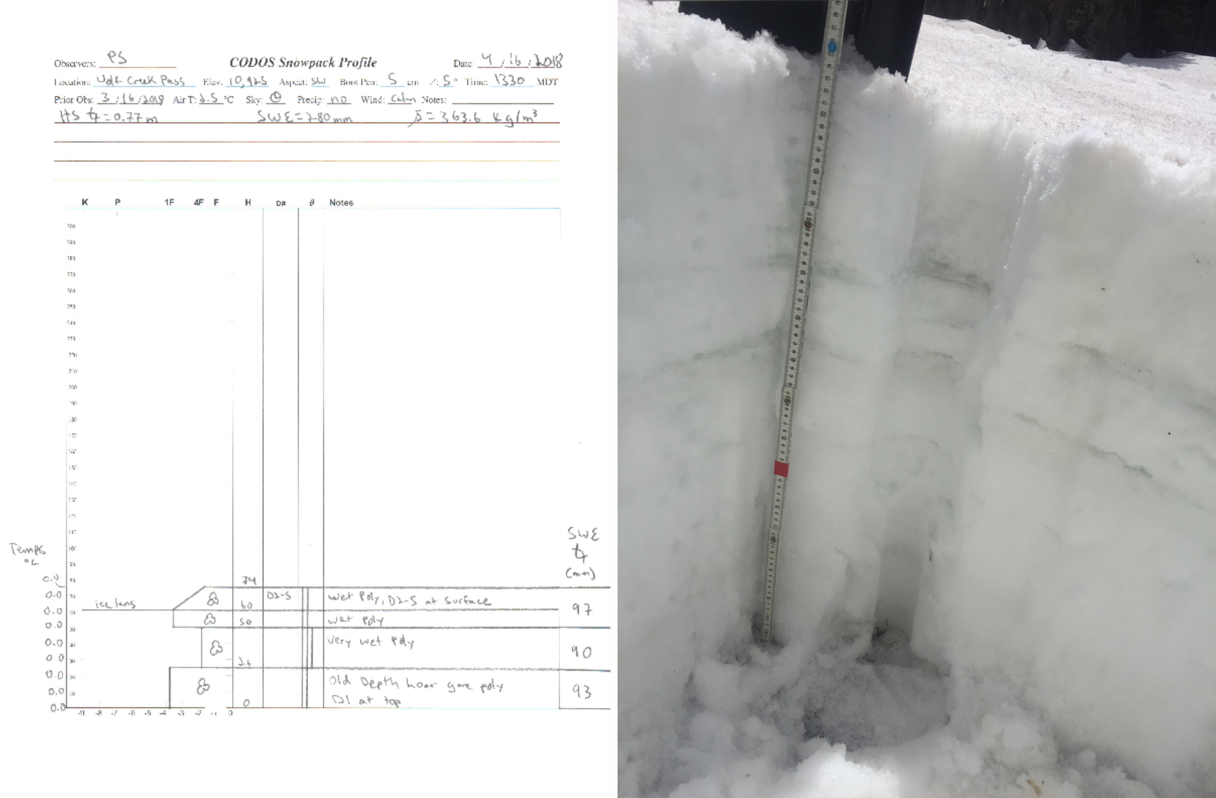
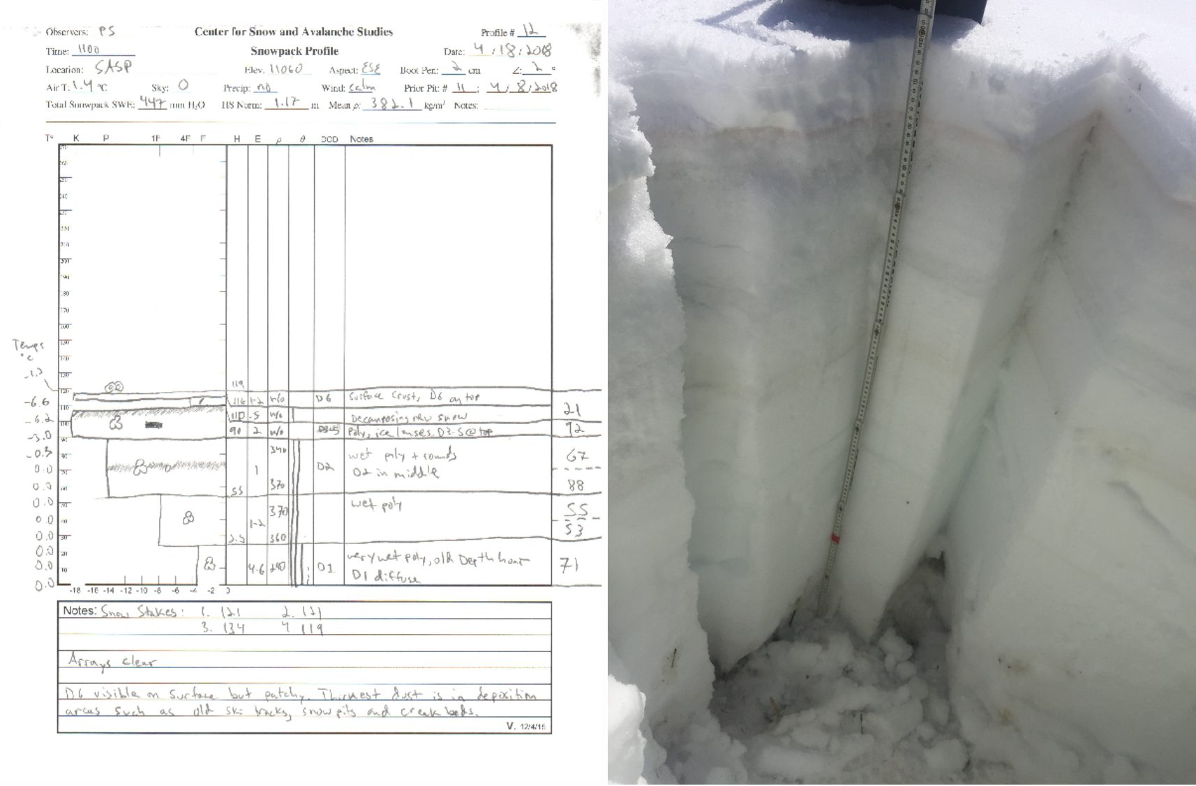
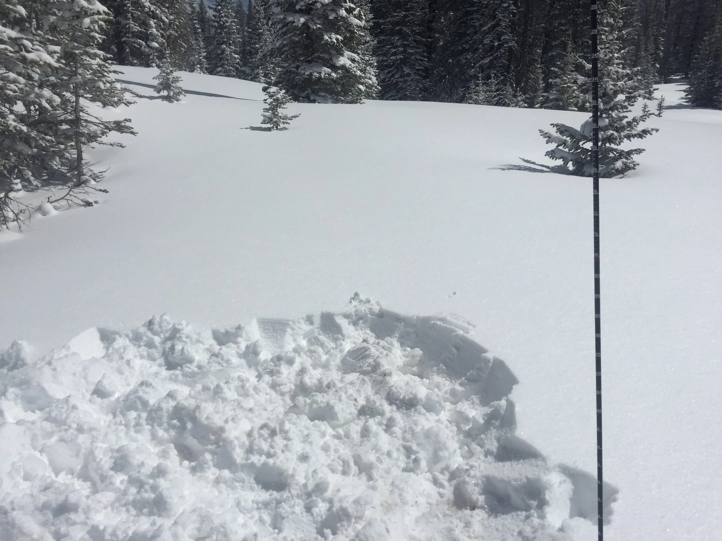
DUST CONDITIONS: At SASP, the dust-on-snow logs so far this season unfold like this, 1) Dust event D1 was deposited on the basal layer of snow likely with a precipitation event arriving on December 21. Located at the very base of the snowpack D1 will have no influence on snowmelt. 2) D2 was deposited February 18-19 and is of moderate intensity. It is still ~20” beneath the surface at SASP and will definitely increase the hydrologic consequences once merged with successive dust events near the surface of the snowpack. 3) D3 was light and deposited March 25 as a dry event, without precipitation, on the surface of the snow. 4) D4 was another dry event deposited directly onto D3 from April 1-3. It is slightly stronger than D3, and the two layers combined are very evident on/in the snowpack at SASP. 5) D5 was a major dry event, arriving with high winds on April 12 and followed by ~9” of snow accumulation at SASP. D5 fell on top of D3/D4 which were mostly on the surface of the snow, combining these three dust layers, which are now just under the snow surface at Swamp Angel (4”) and will be a major control on snowmelt once exposed. As of this writing, D5 is on the surface of the snow at Wolf Creek, Spring Creek, and Park Cone. D5 is ~12” beneath the surface at Grand Mesa and Rabbit Ears…….Now, let’s add D6. 6) D6 occurred yesterday (April 17, from early morning to late afternoon). As the Front Range was getting clobbered with high winds and dust originating out of the San Luis Valley, the Western Slope was also getting dust – not nearly the intensity as the Front Range – from our source region of the Desert Southwest. The morning of April 18, we found D6 is predominantly a light event near Red Mt. Pass. But D6 will increase snowmelt and advance the timing of when D3-D5 will be exposed to the surface. Once this happens D3-D6 will merge into one nasty dust layer that will intensify snowmelt and sublimation rates through the remainder of the season. And……There is currently a dust storm warning in effect until the evening of April 19 in the source region. But……a closed low is also currently making it’s way to Colorado and expected to deliver precipitation starting April 19-April 21, hopefully in the form of snow and not rain as we have seen at many areas the last couple of storms so far this April (please see weather section at bottom of report). Please see notes below of our observations from the CODOS sample sites throughout the state, describing if dust is present, it’s intensity, where it is located in the snowpack.
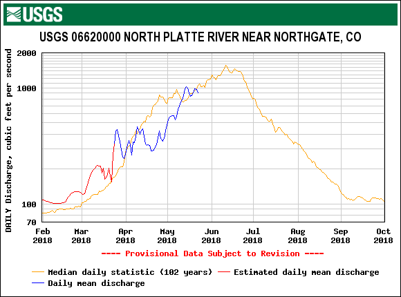
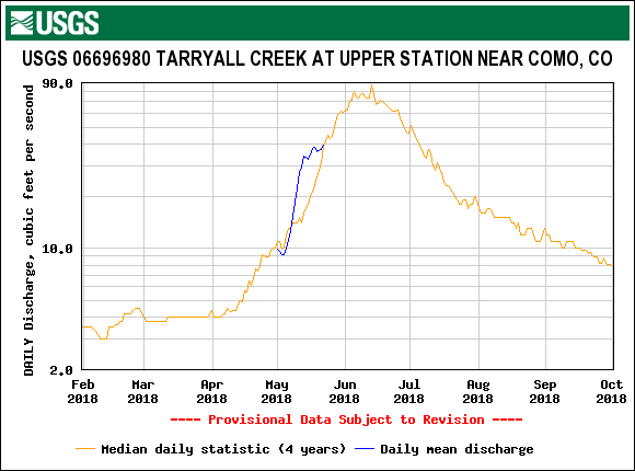
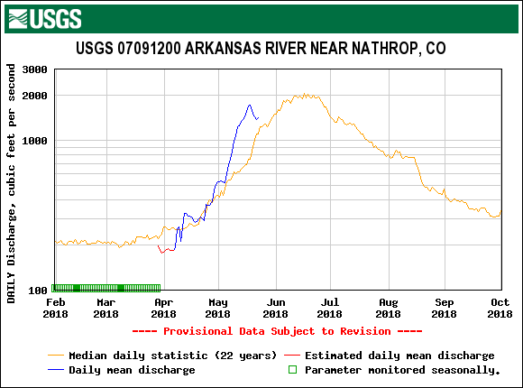
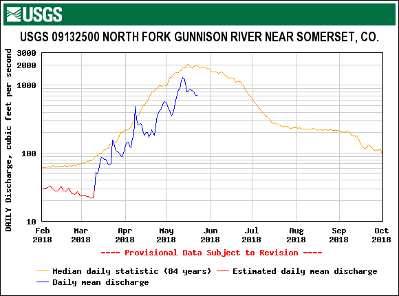
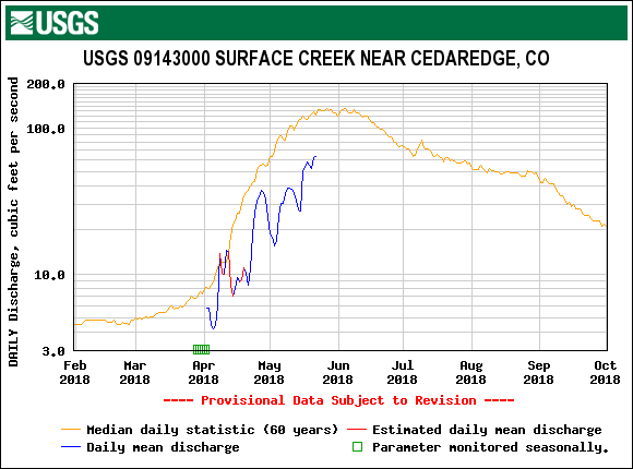
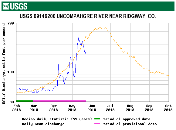
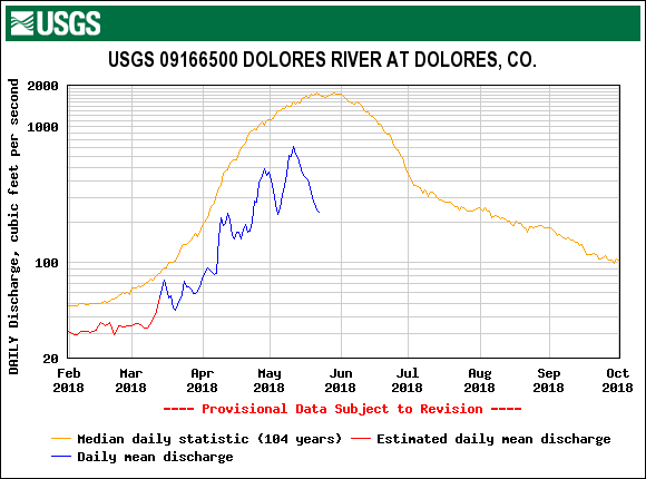
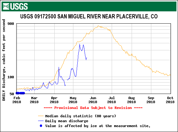
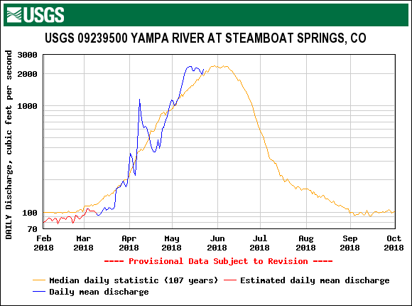
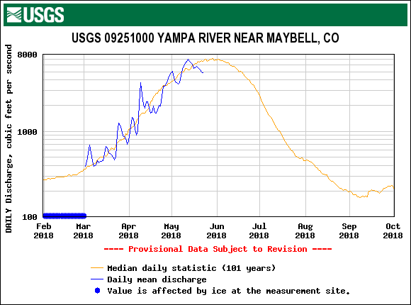
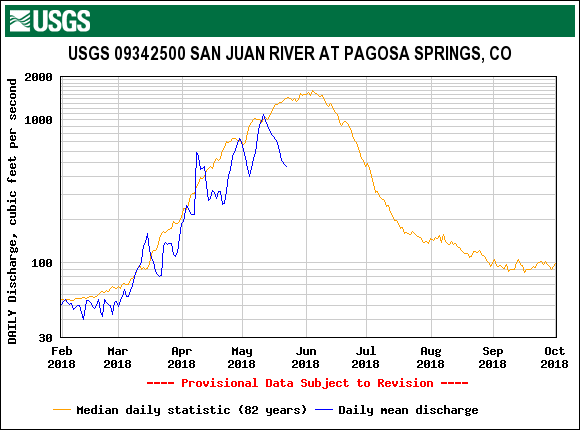
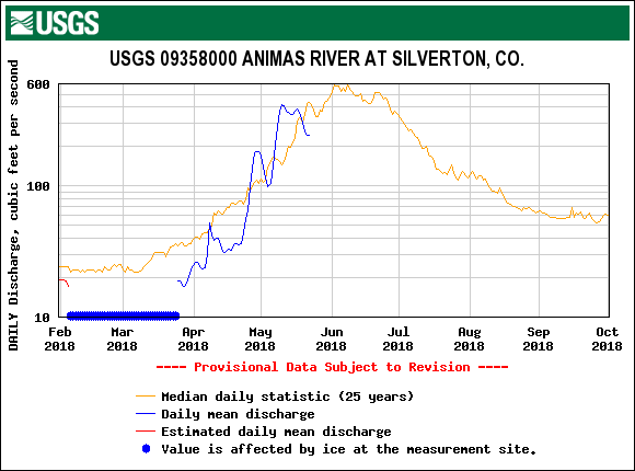
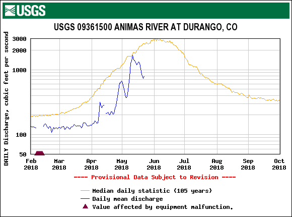
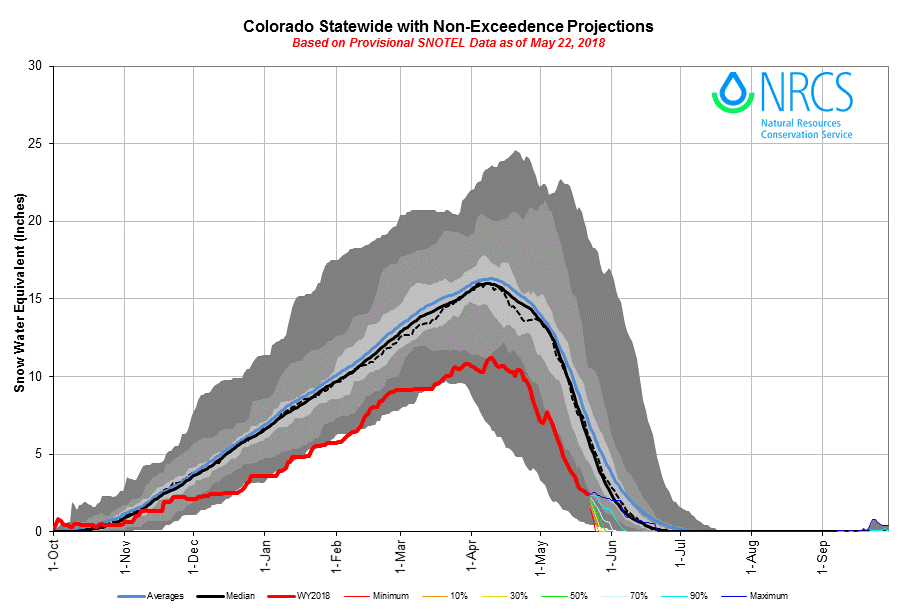
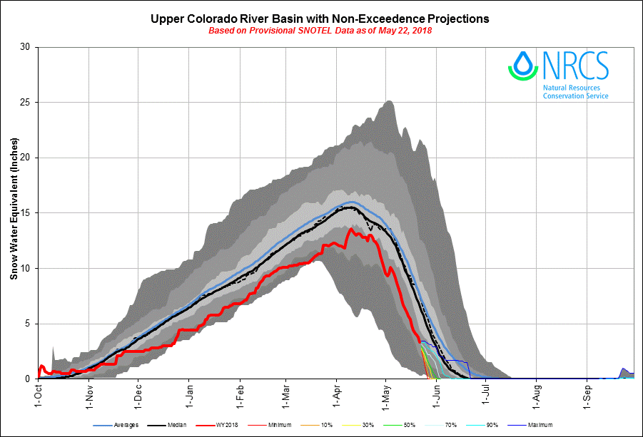
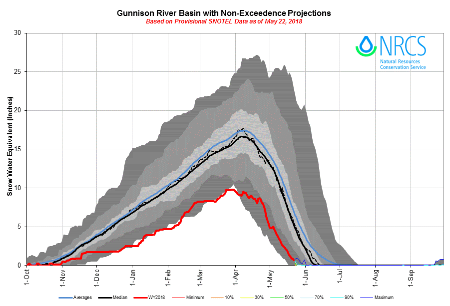
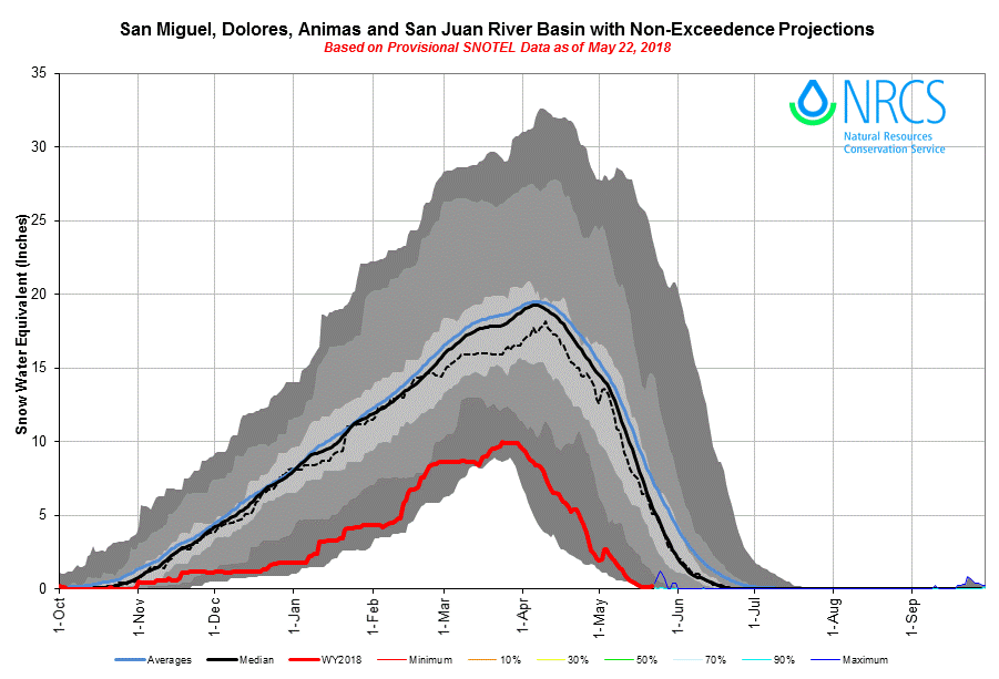
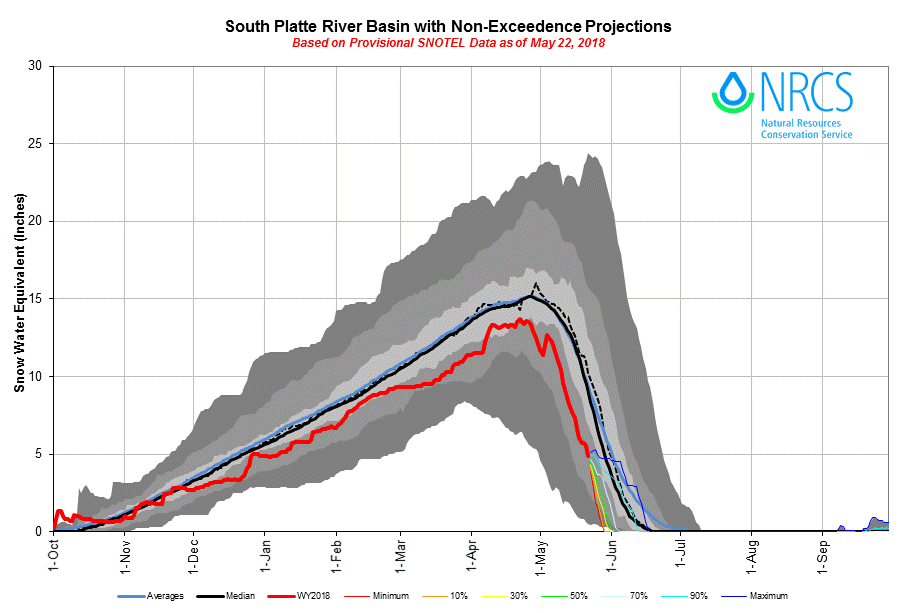
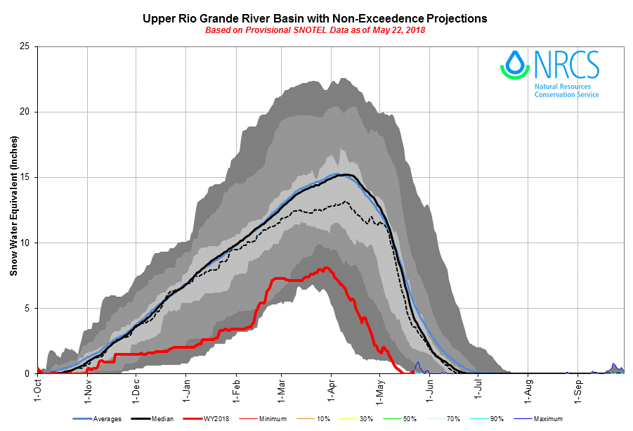
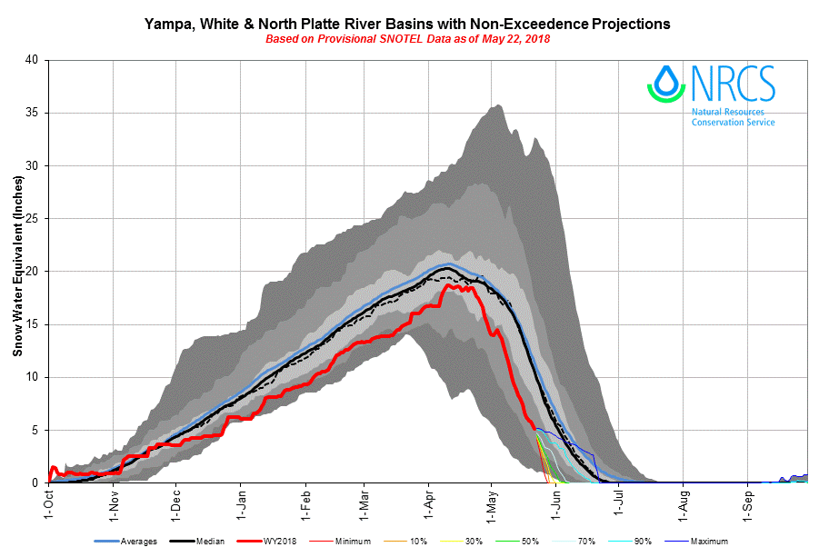
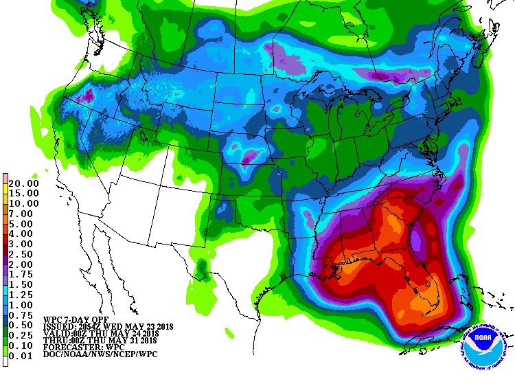
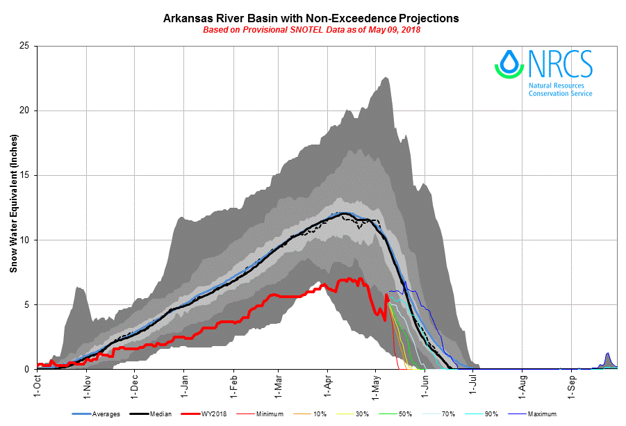
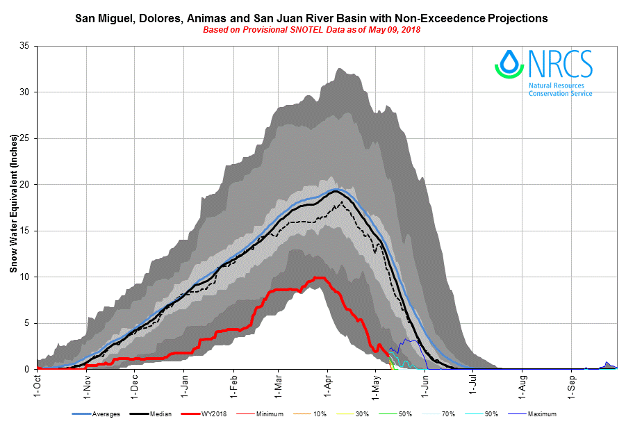
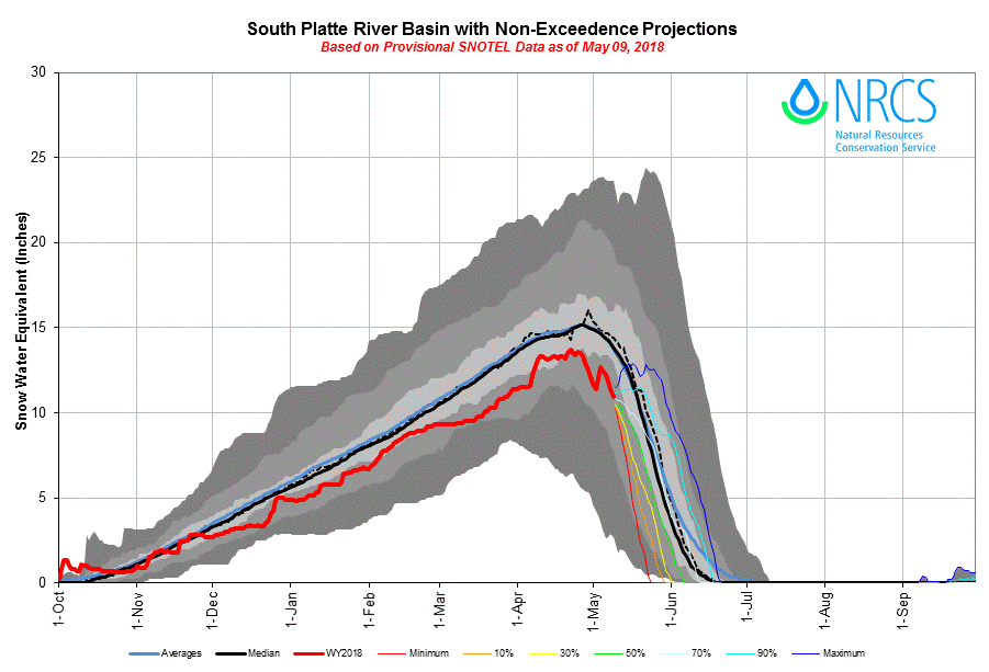
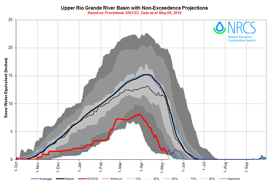
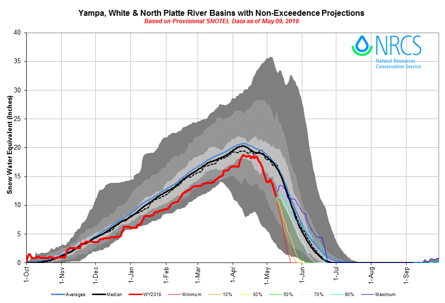
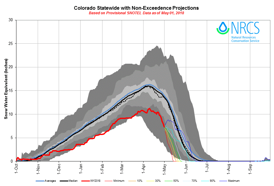
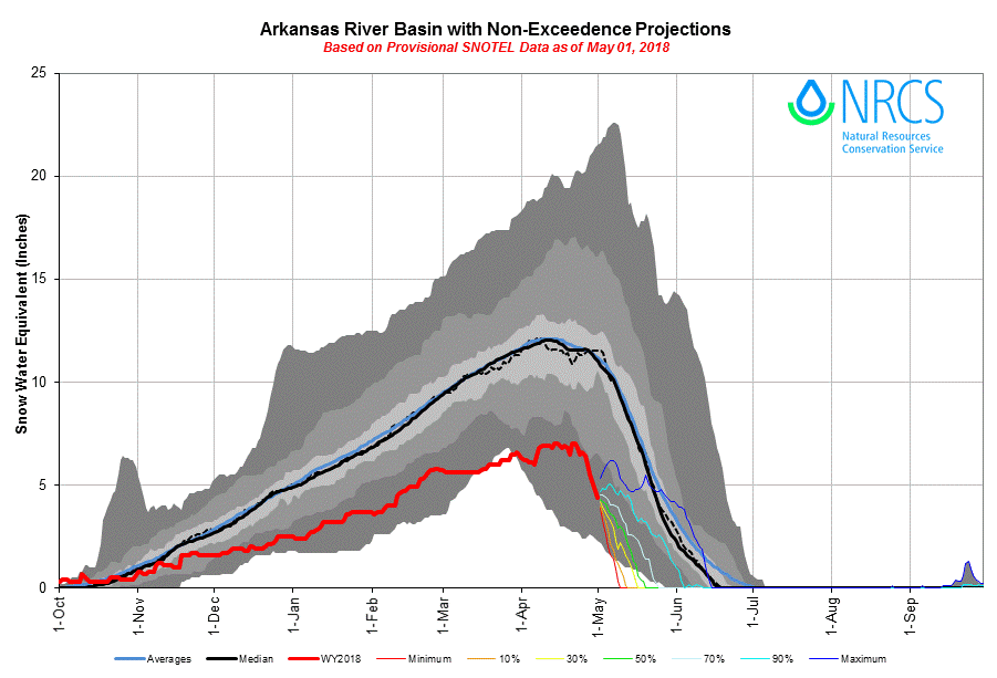
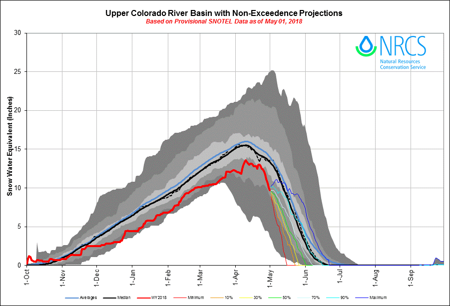
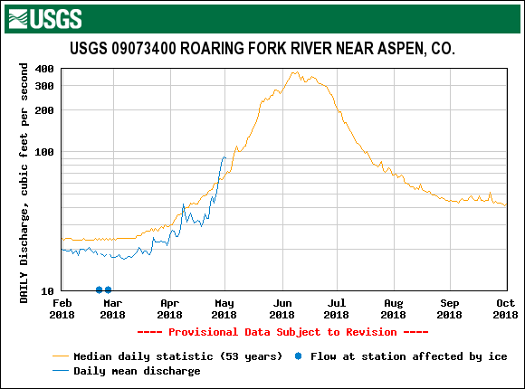
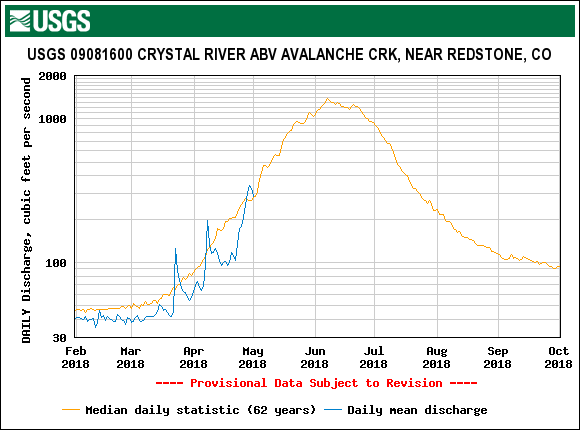
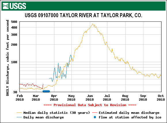
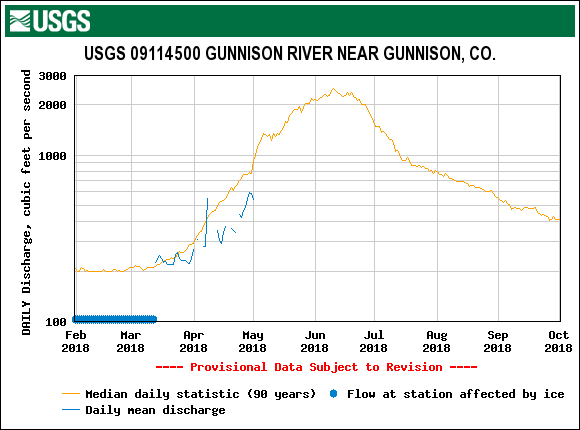
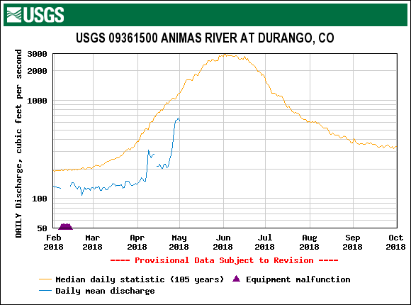
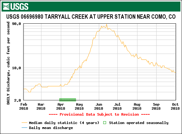
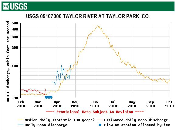
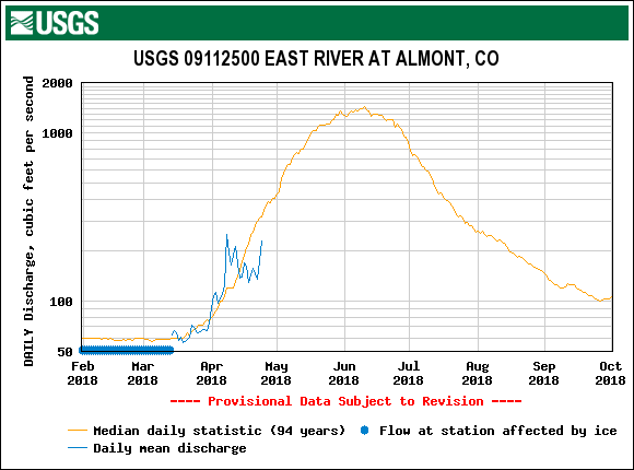
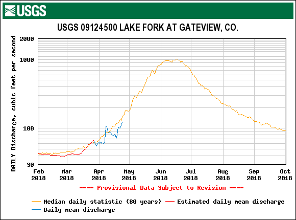
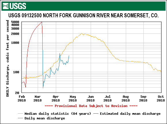
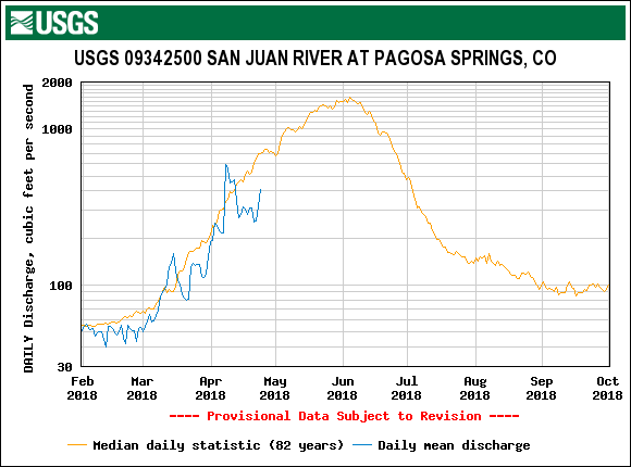
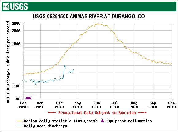
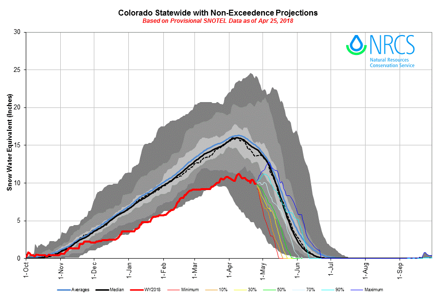
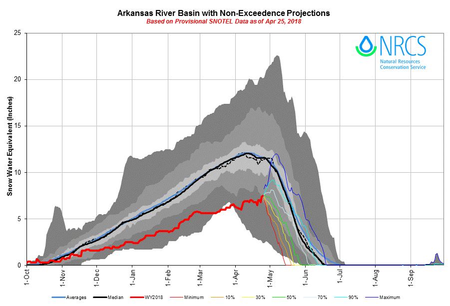
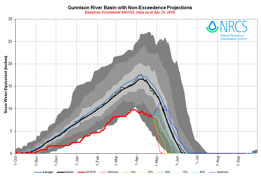
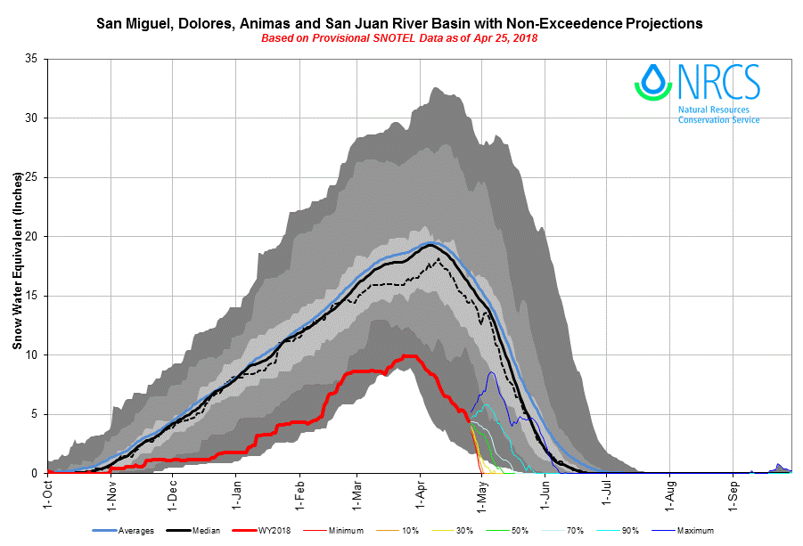
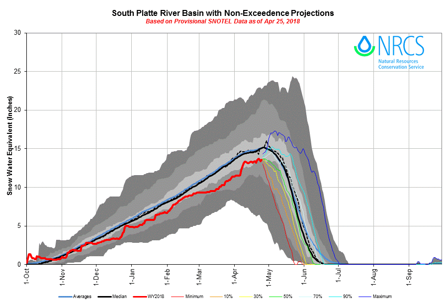
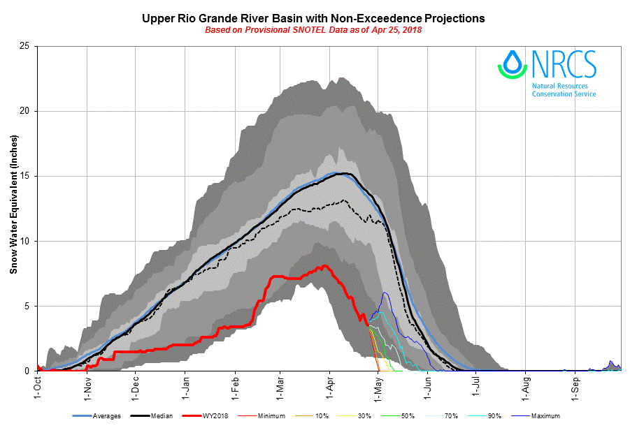
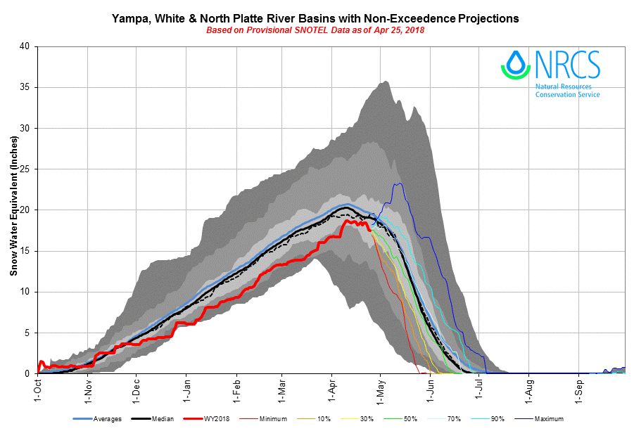
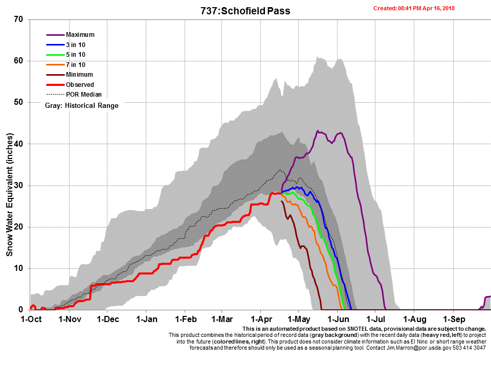
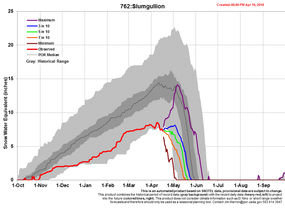
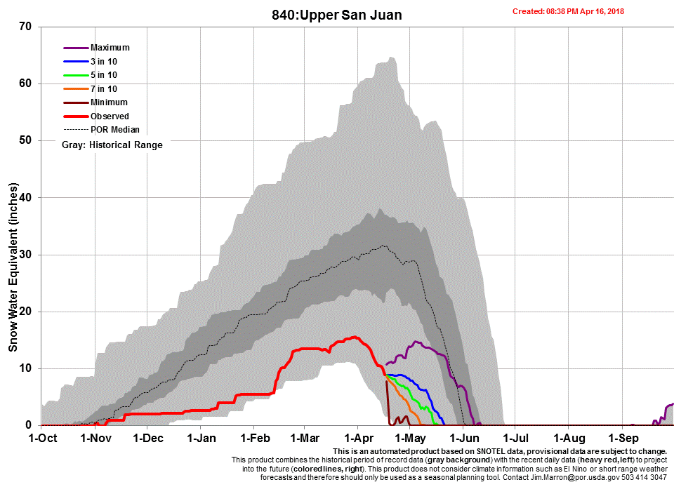
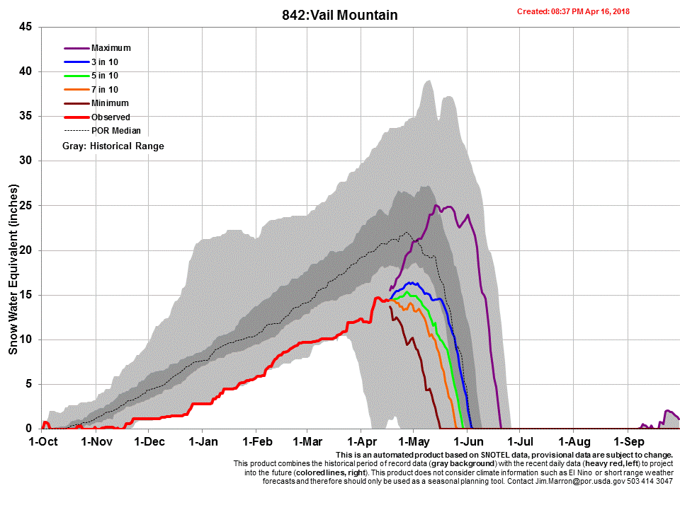
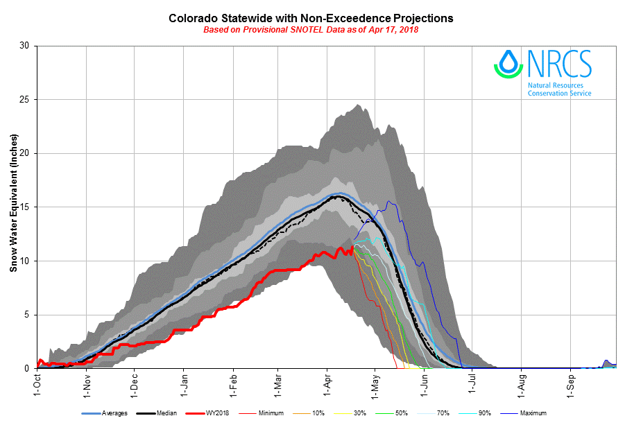
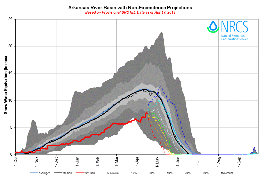
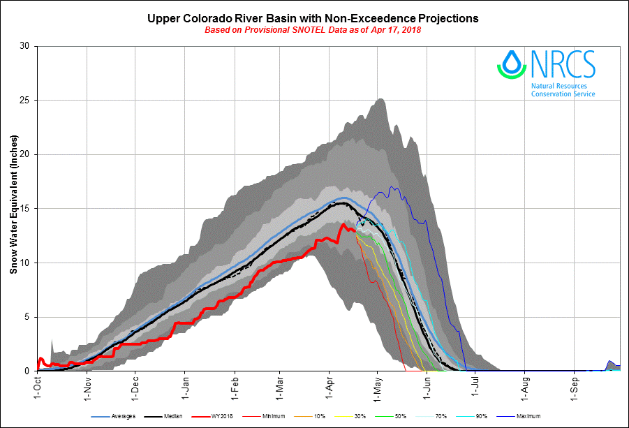
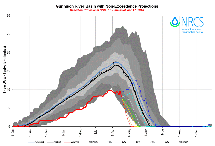
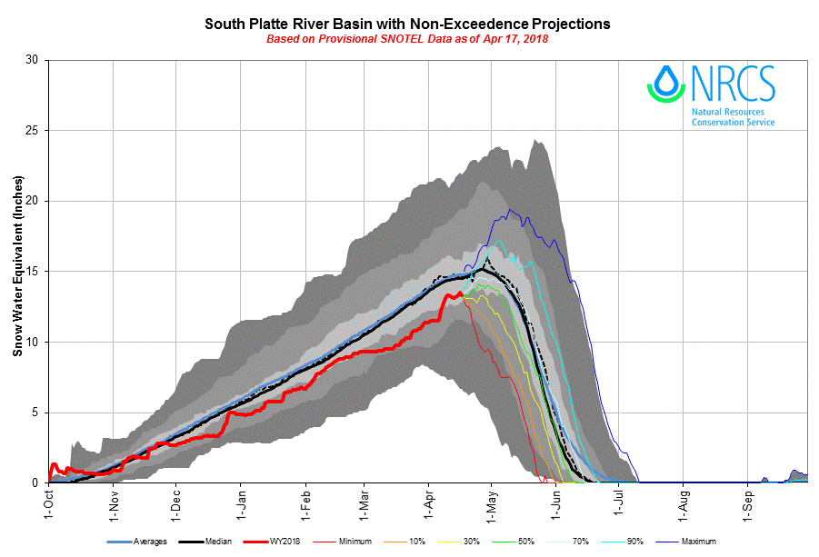
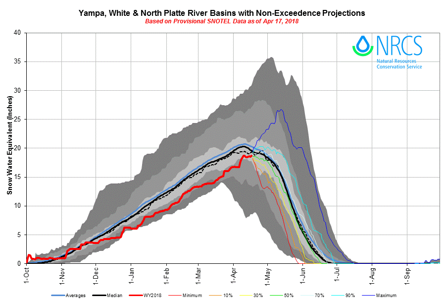
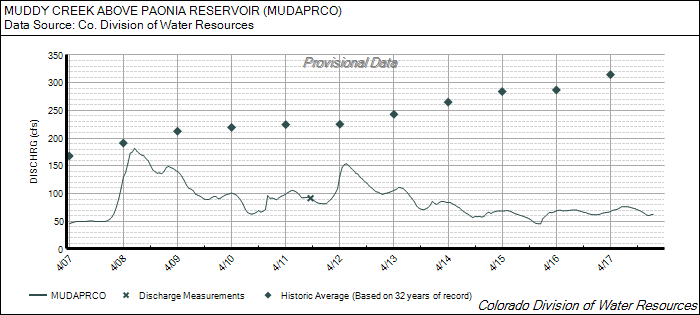
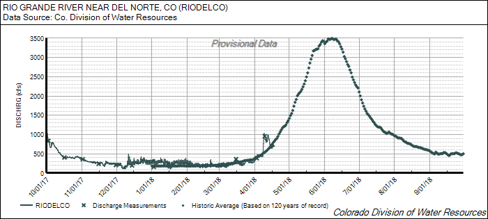
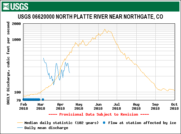
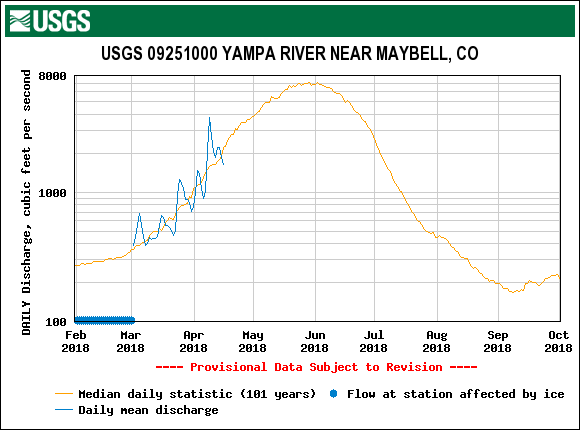
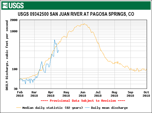
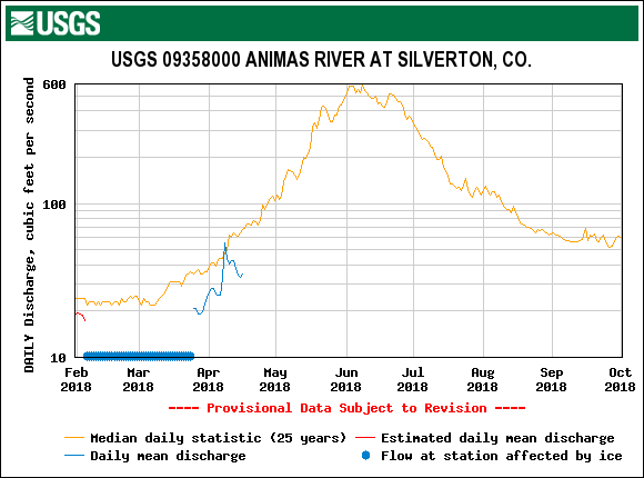
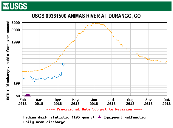
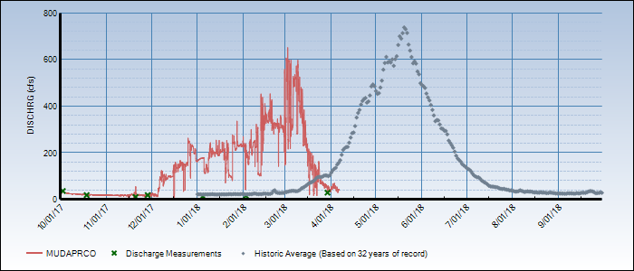
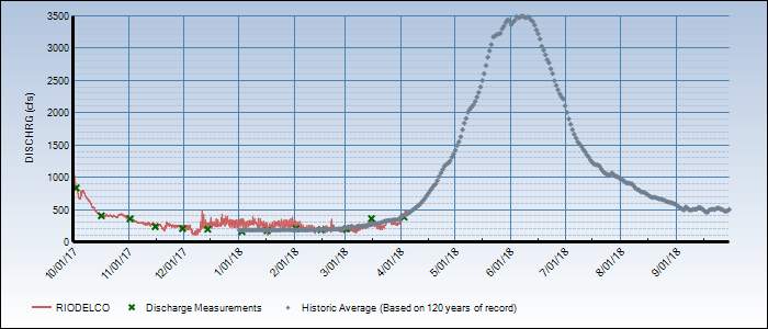
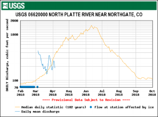
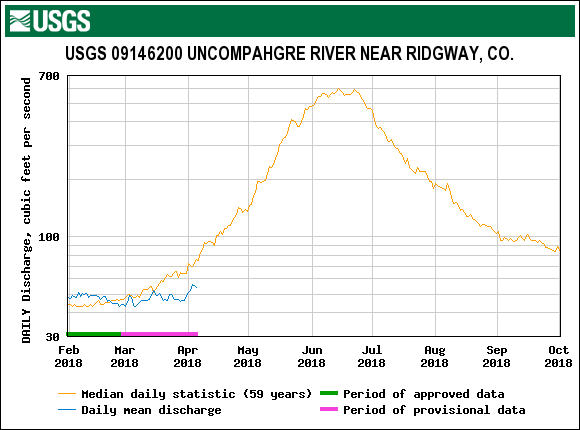
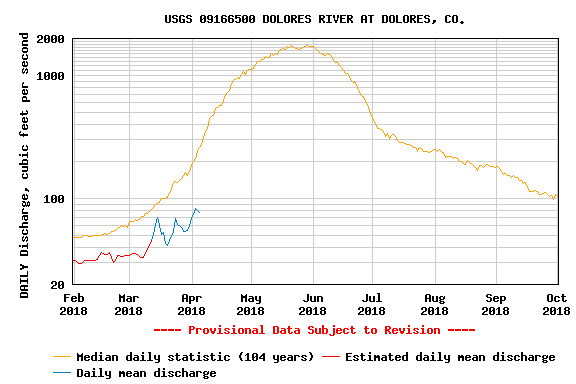
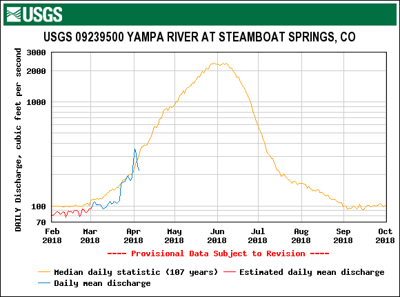
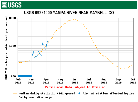
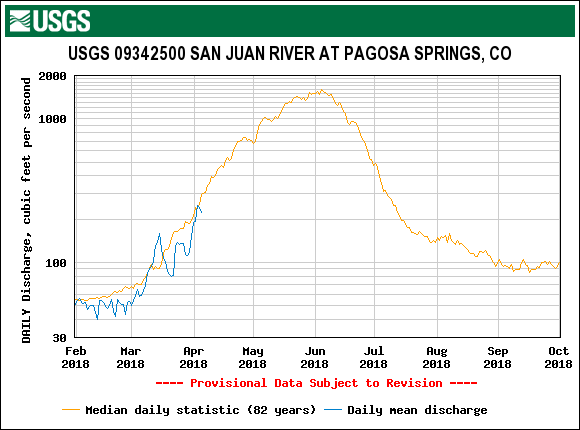
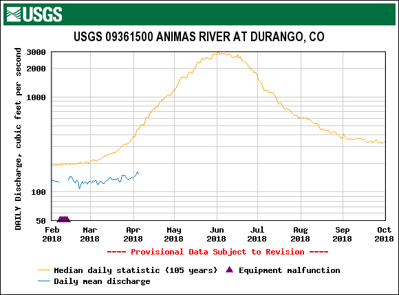
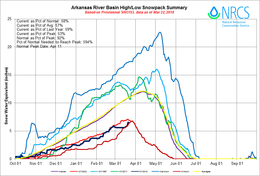
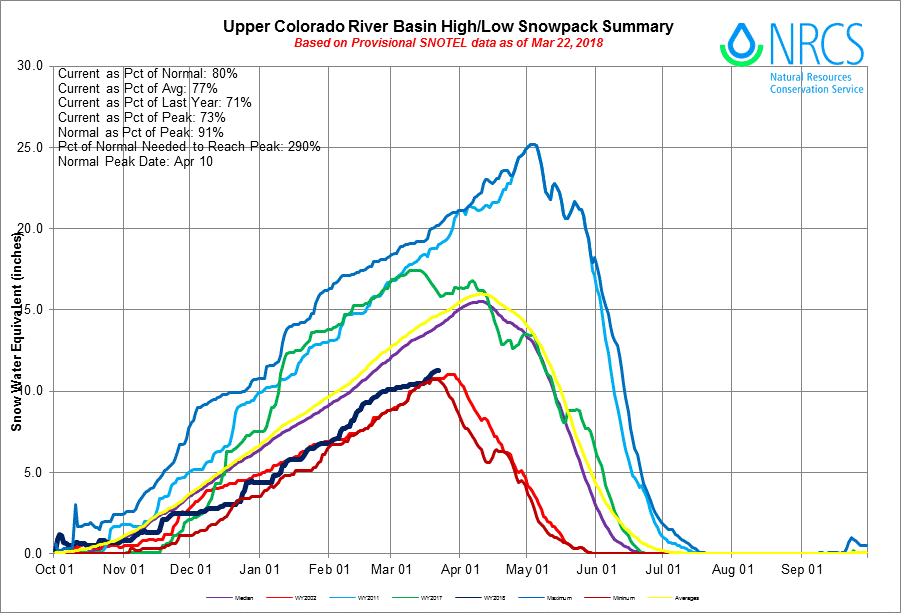
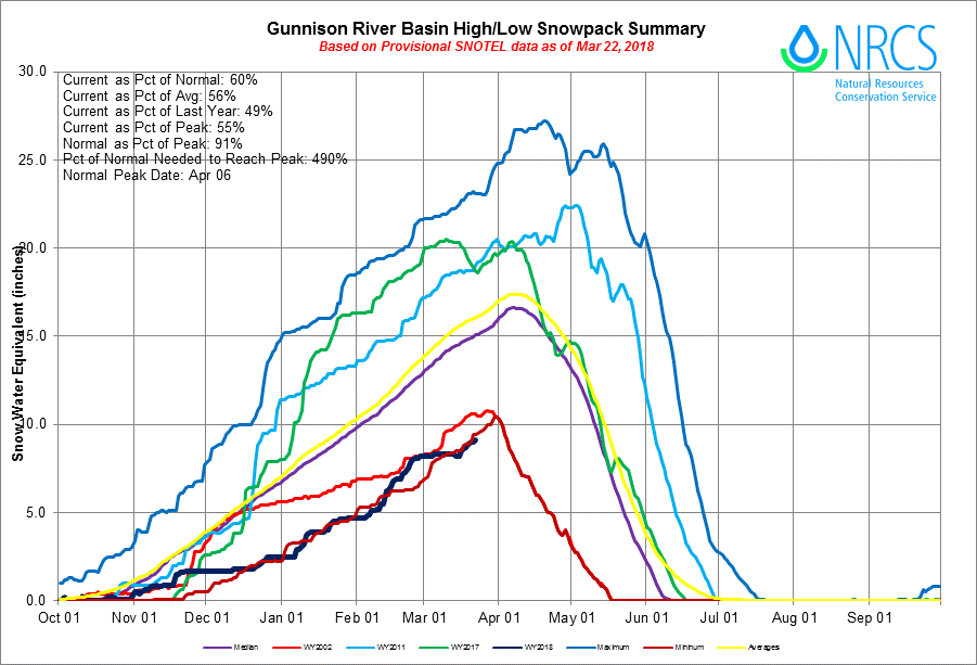
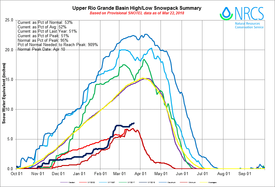
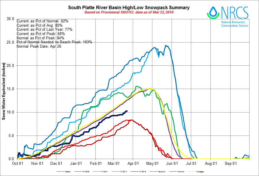
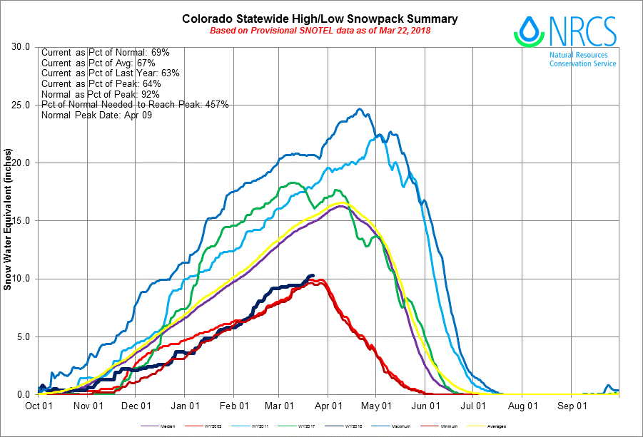
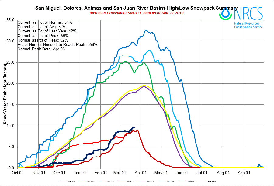
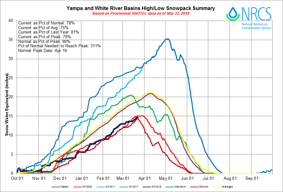
SNOWPACK AND STREAMFLOW: Hopefully, this year will be a good lesson on how much cumulative SWE matters; meaning, precipitation added to the snowpack after the date of peak SWE to significantly make a difference in cumulative streamflow. The classic example being the “miracle May” in WY2015 where we had a very poor winter season followed by a very wet month of May that turned our water supply outlook around. So far this spring we have had a couple good storms, April 6-8 and April 12-14, that have been the cause of sharp increases in many SNOTEL projection plots throughout most of Central/Northern Colorado, and to a much lesser (if at all) degree in the Southern part of the state. As of this writing, the North Plate and Laramie basins are of average median SWE, the South Platte, Colorado and Yampa basins are of slightly below average median SWE, and the Arkansas, Gunnison, Dolores/San Miguel/Animas/San Juan and Rio Grande are well below average median SWE. As mentioned we have a couple of storms in the forecast that will deliver more snow……….and possibly dust.
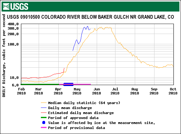
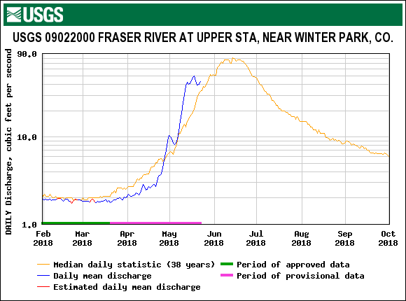
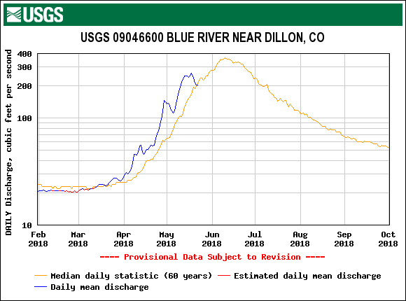
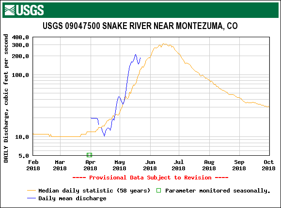
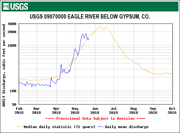
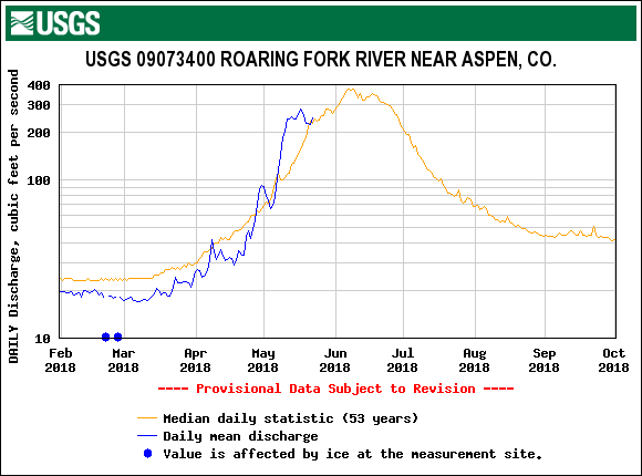
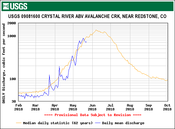
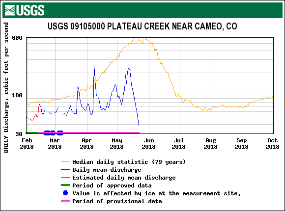
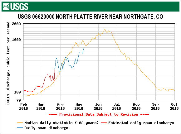
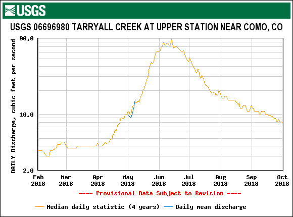
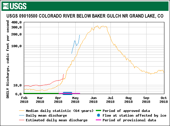
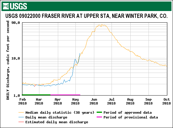
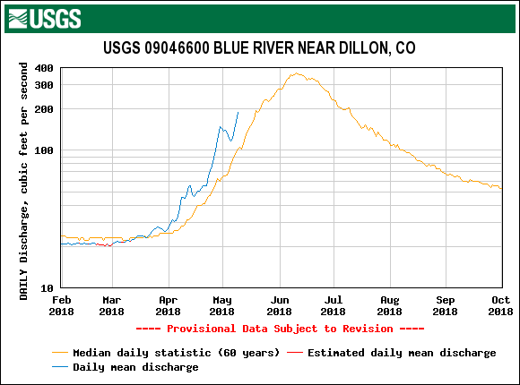
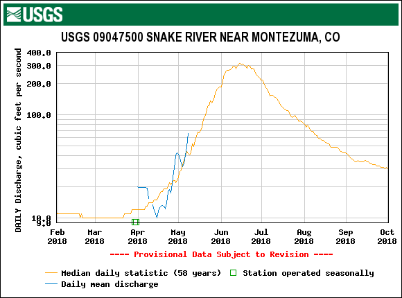
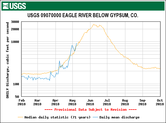
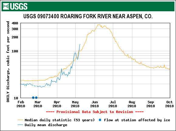
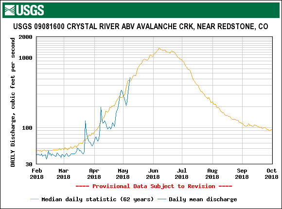
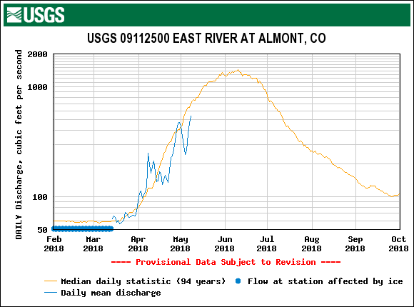
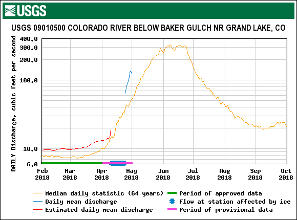
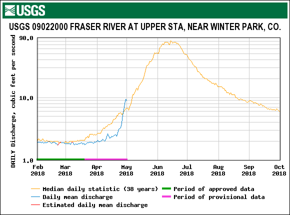
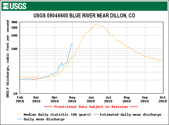
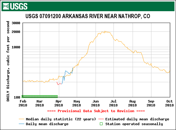
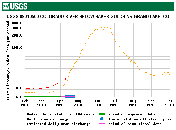
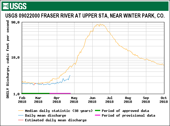
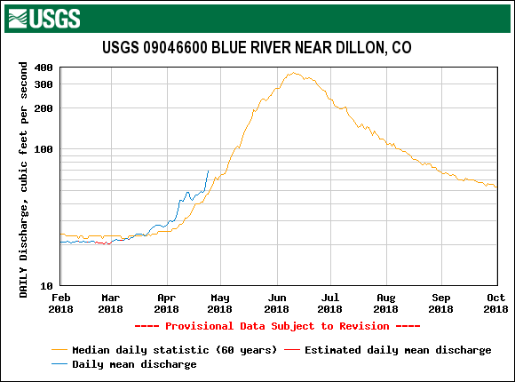
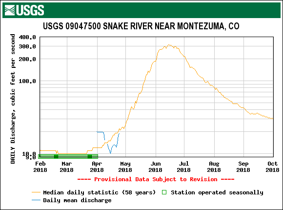
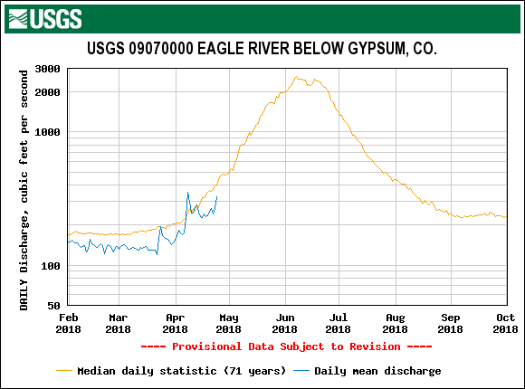
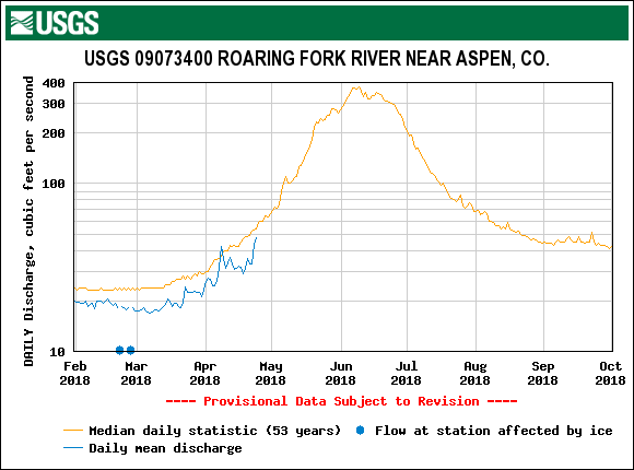
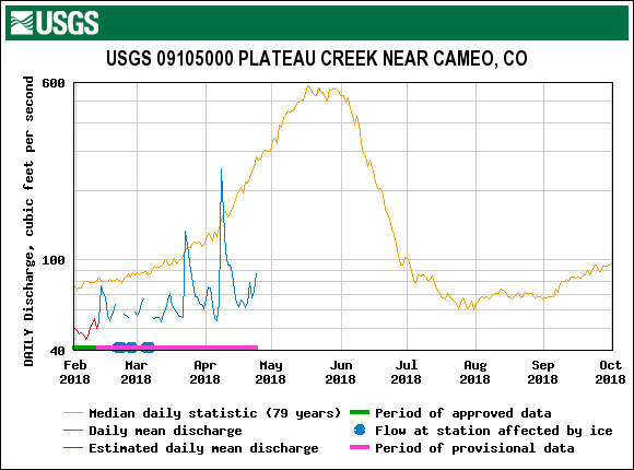
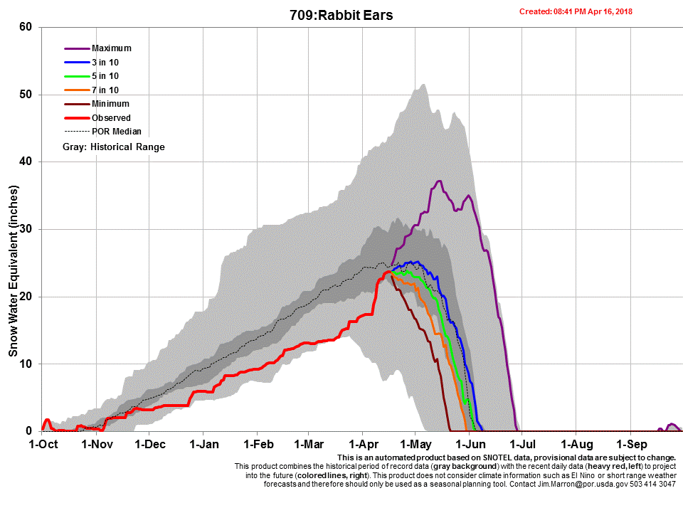
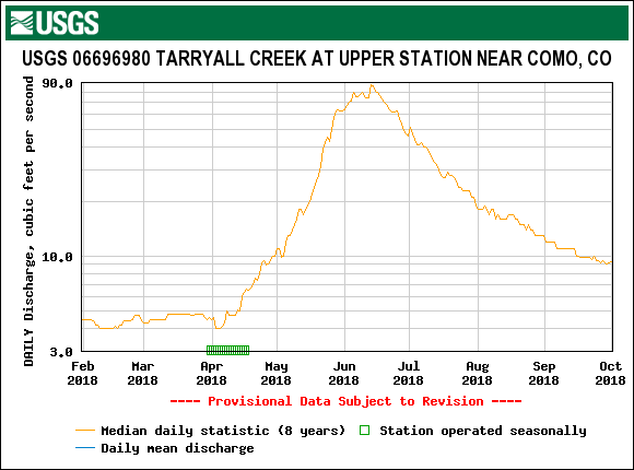
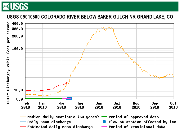
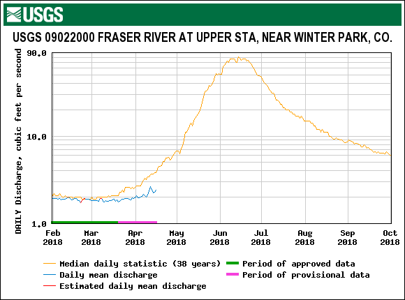
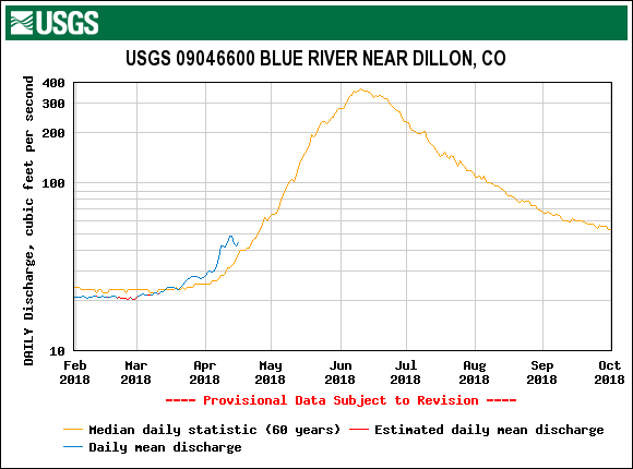
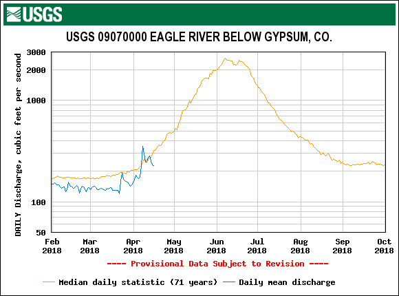
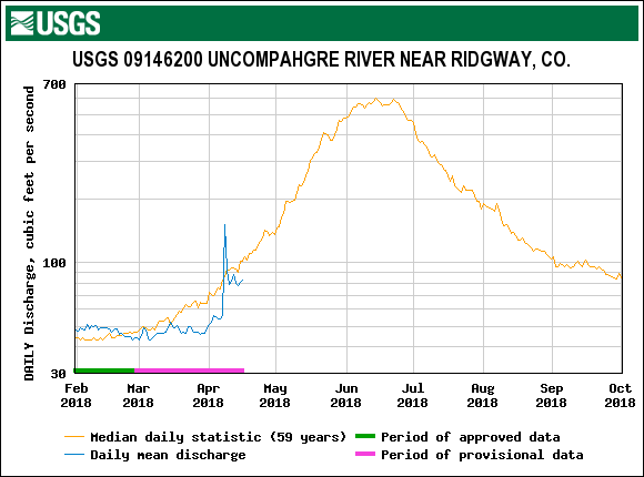
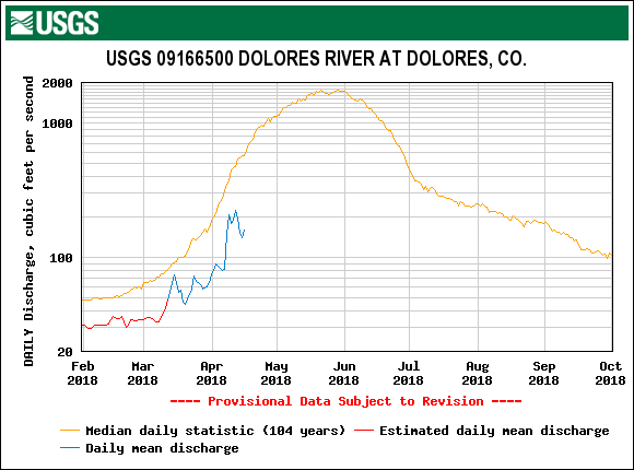
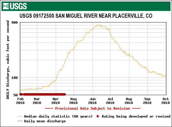
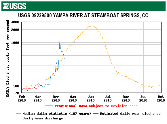
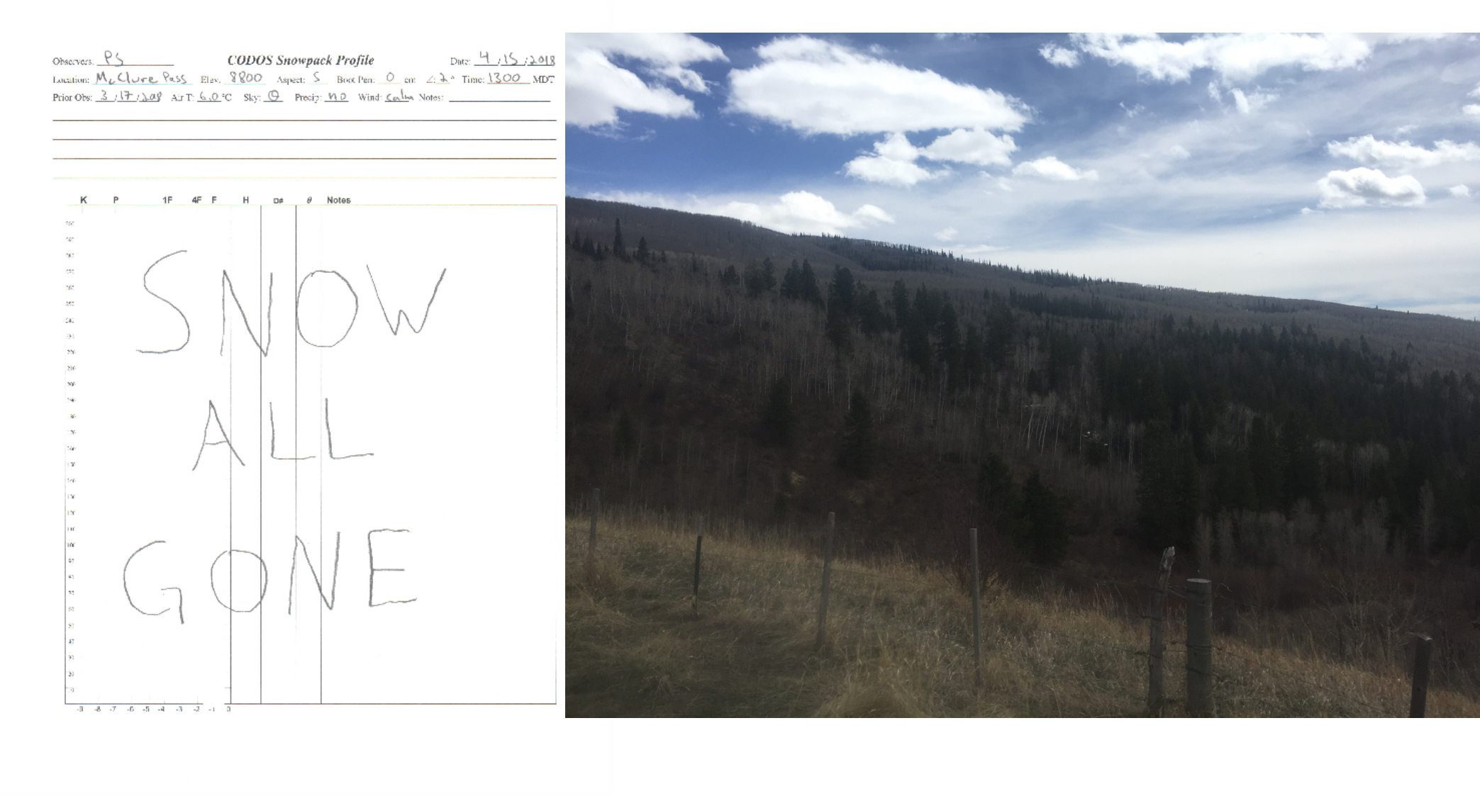
As we noted in the March CODOS tour update, and as USGS gauges are attesting to, snowcover across Colorado (besides Rabbit Ears and nearby mountains) below 10,000’ is lacking. This is likely contributing to the lower stream flow we are seeing statewide. And what snowmelt runoff was present at lower elevations may have been absorbed by the dry soils.
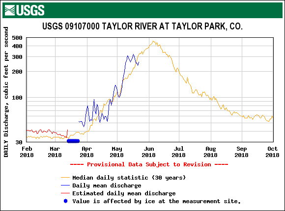
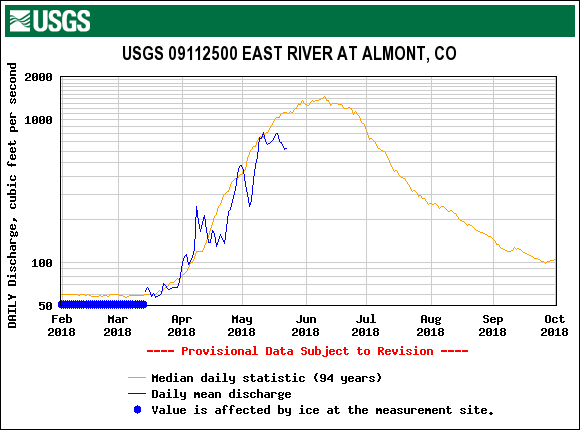
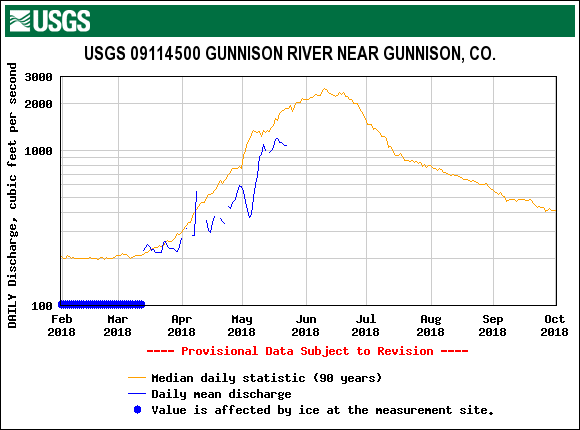
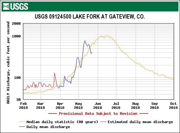
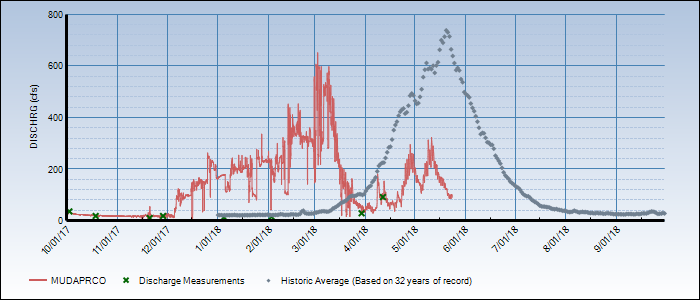
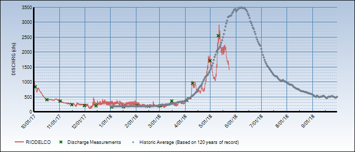
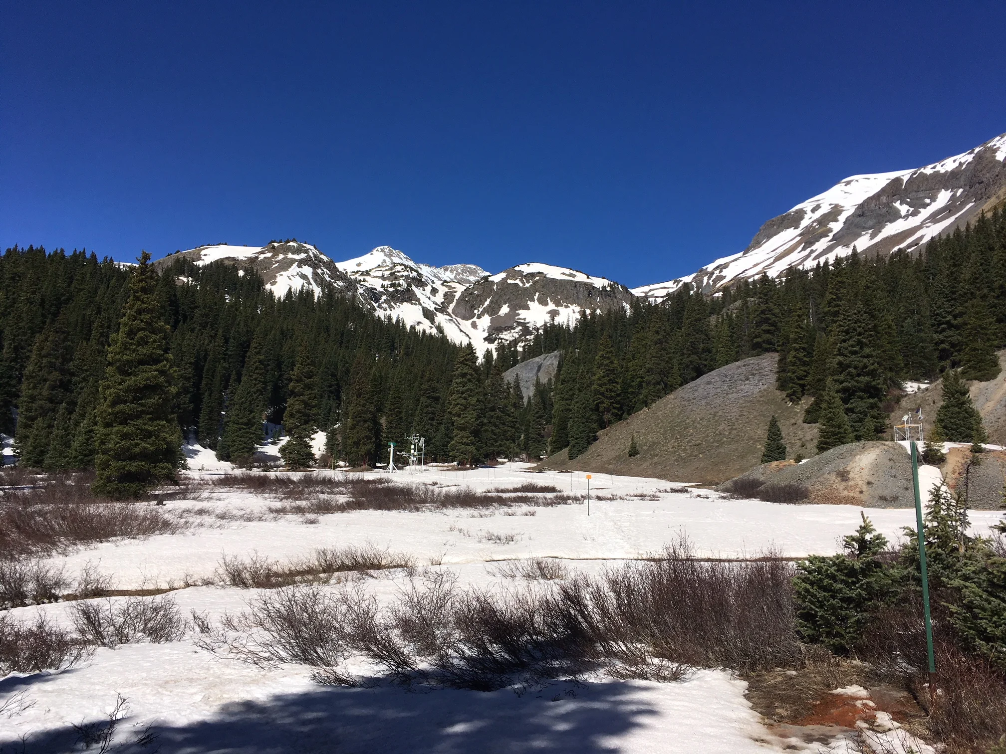
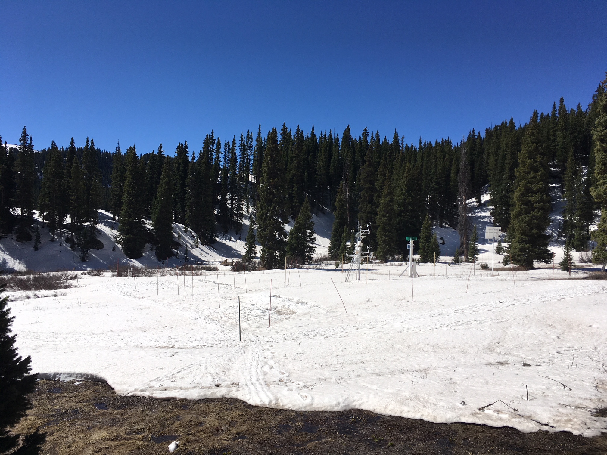
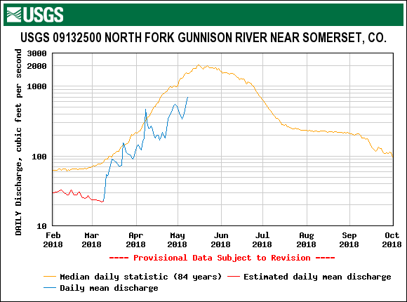
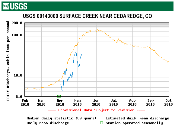
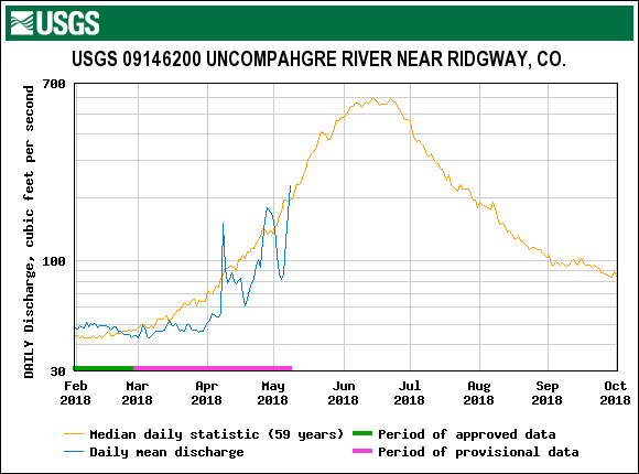
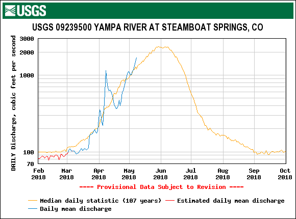
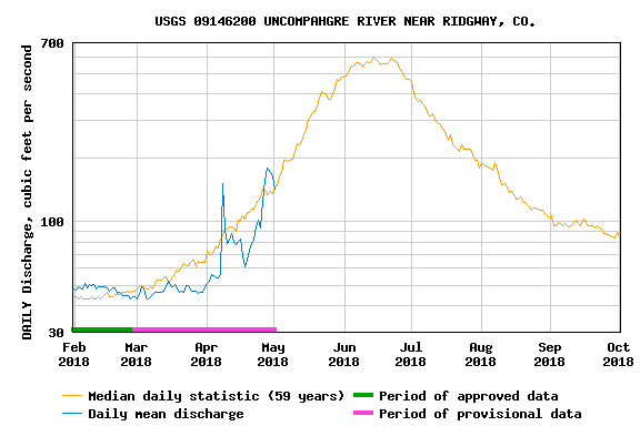
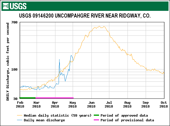
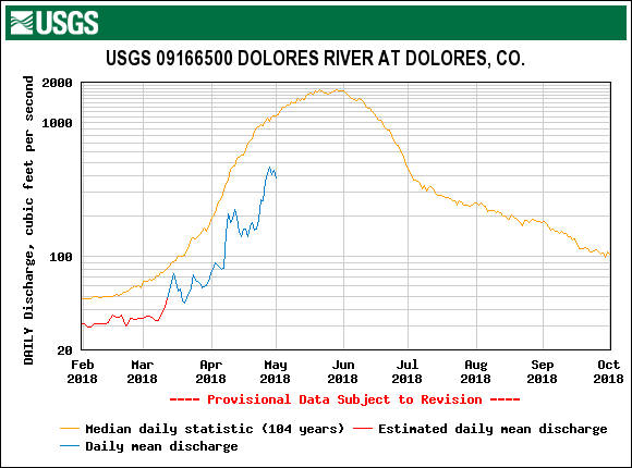
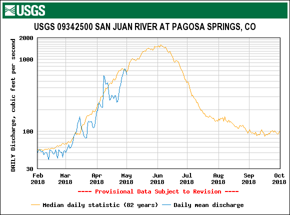
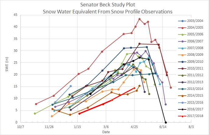
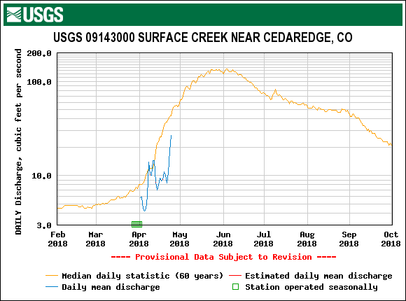
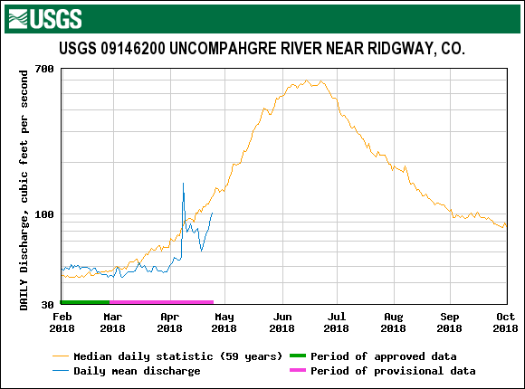
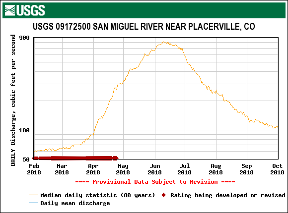
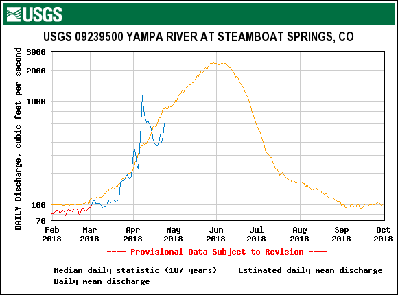
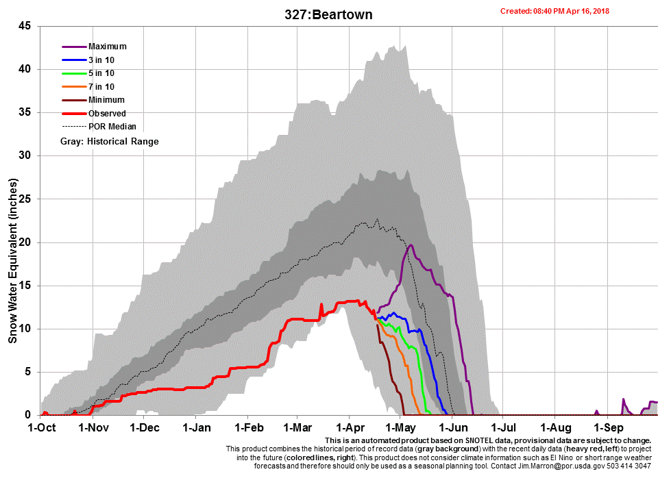
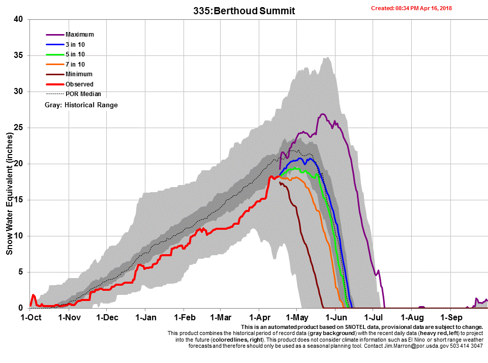
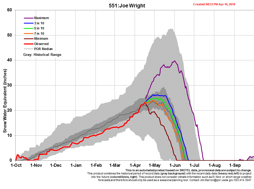
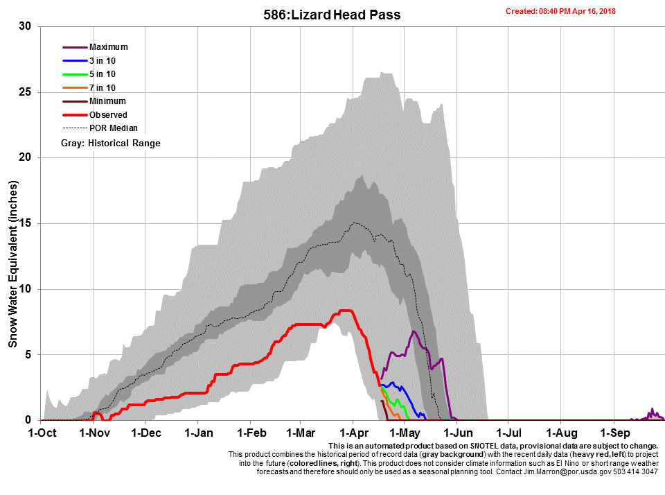
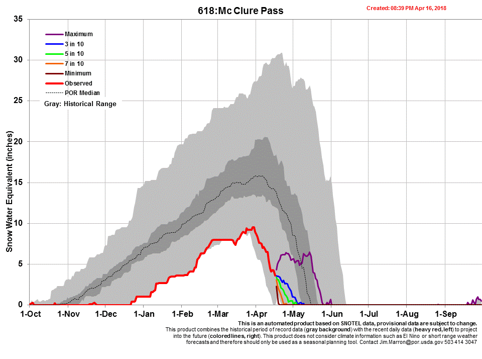
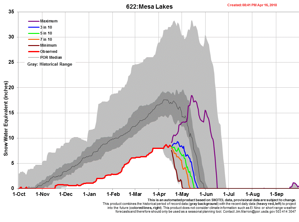
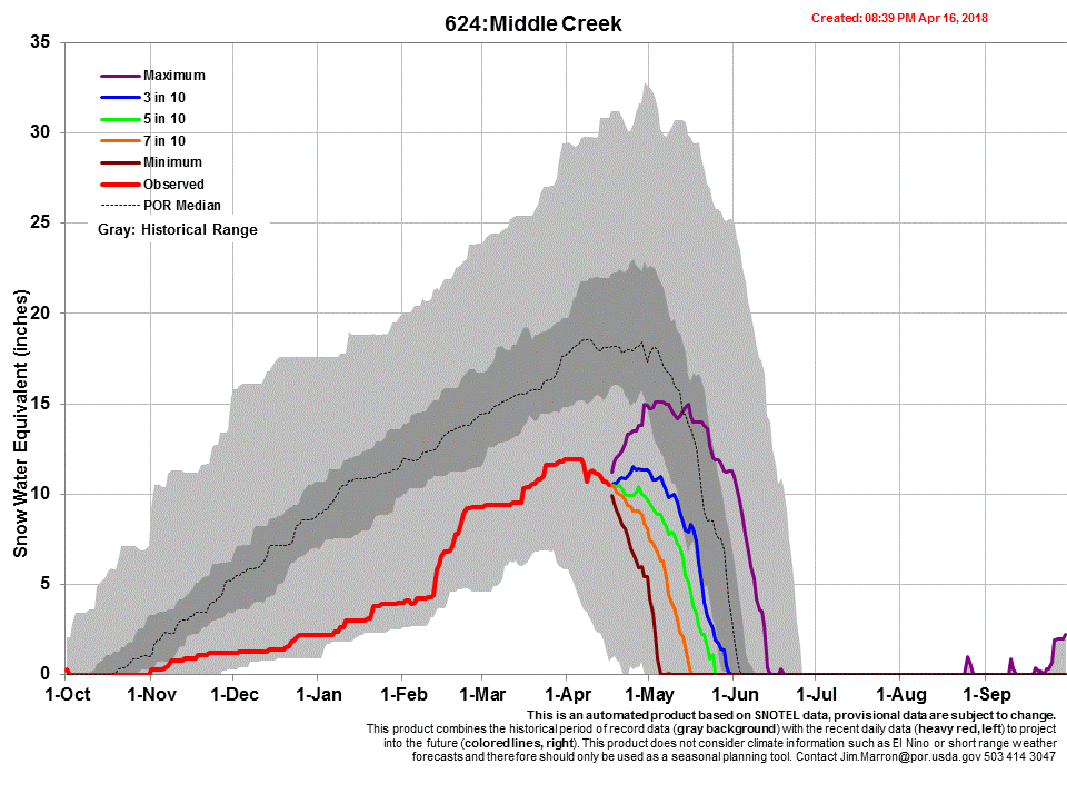
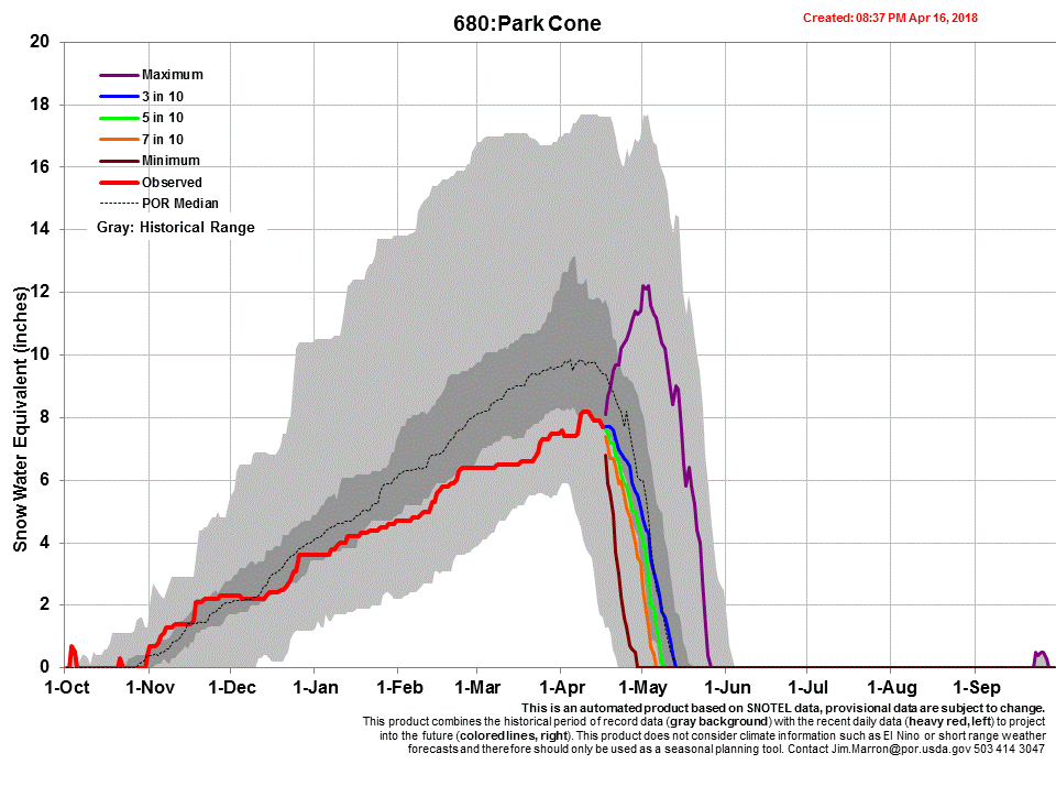
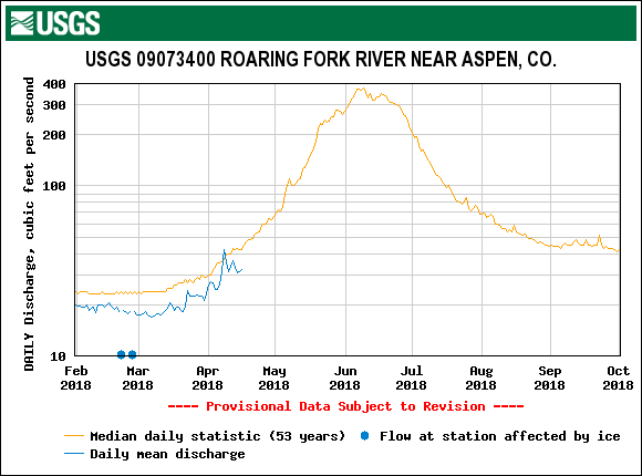
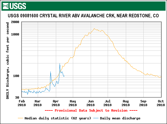
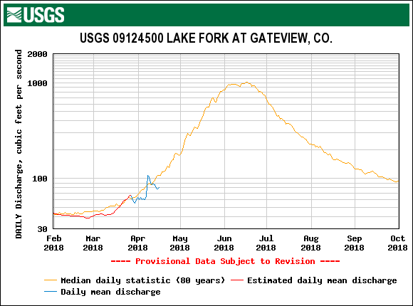
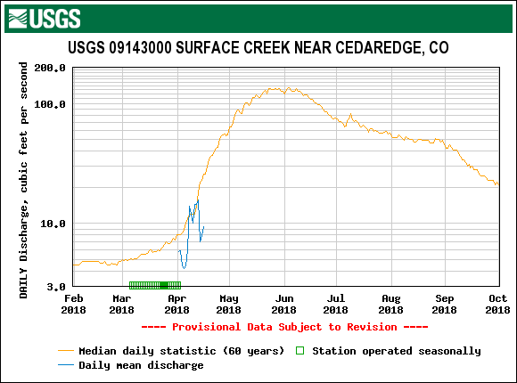
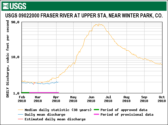
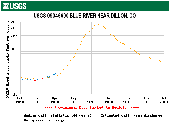
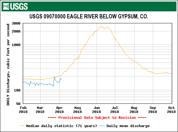
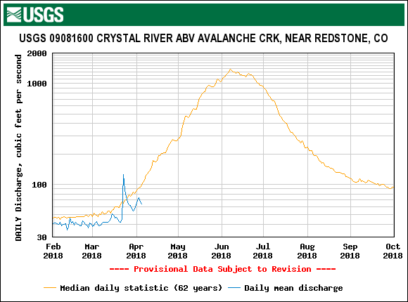
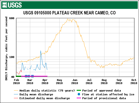
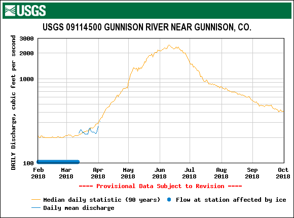
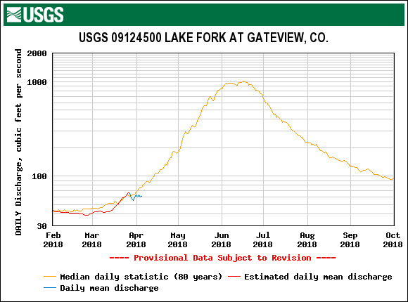
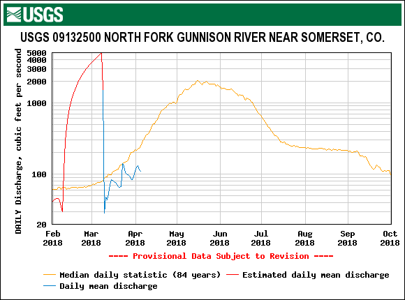
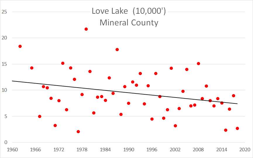
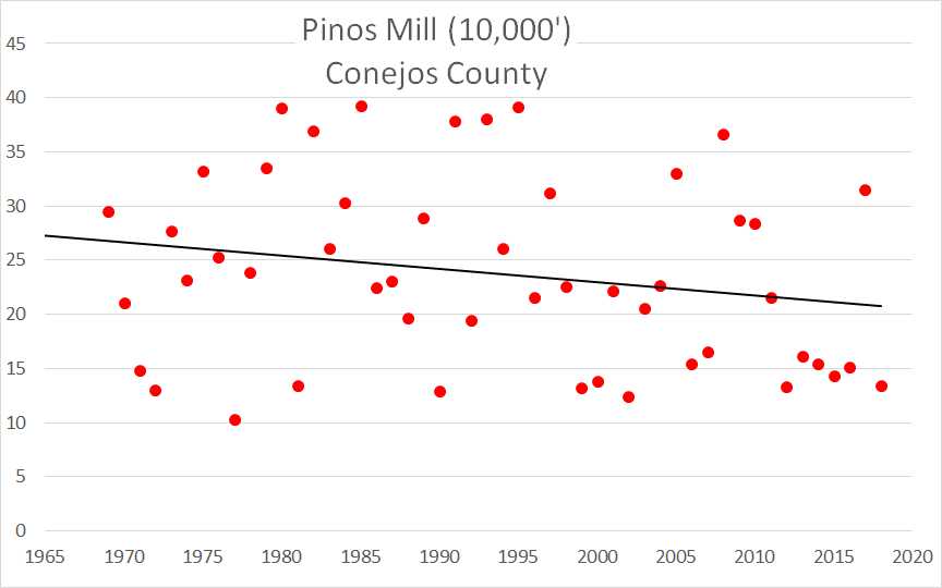
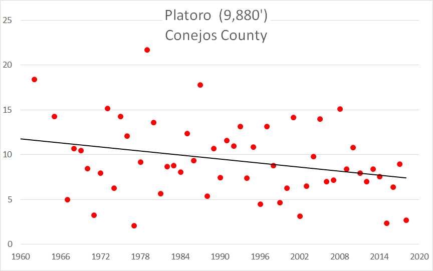
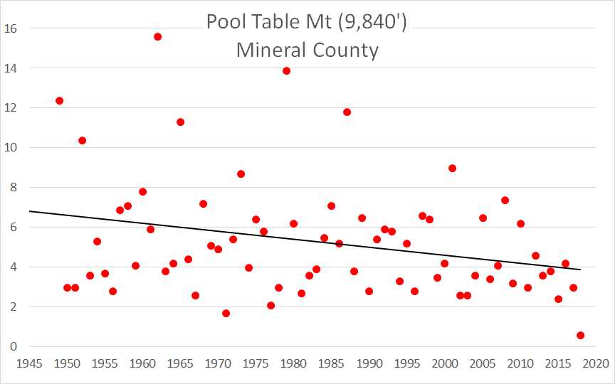
We are posting the snow profiles collected and new photos on each CODOS site’s webpage, as well as hydrographs and SWE graphs. Below you will also find a summary table and brief discussion for each CODOS location. Using the Dust Enhanced Runoff Classification (DERC) approach, links to hydrographs of the CODOS sites from WY2006-2017 are collated and presented to help with ascertaining what this spring runoff scenario might look like. We anticipate at least one additional full circuit of our ten CODOS sites this season as well as intensive monitoring at Senator Beck Basin (SBB).
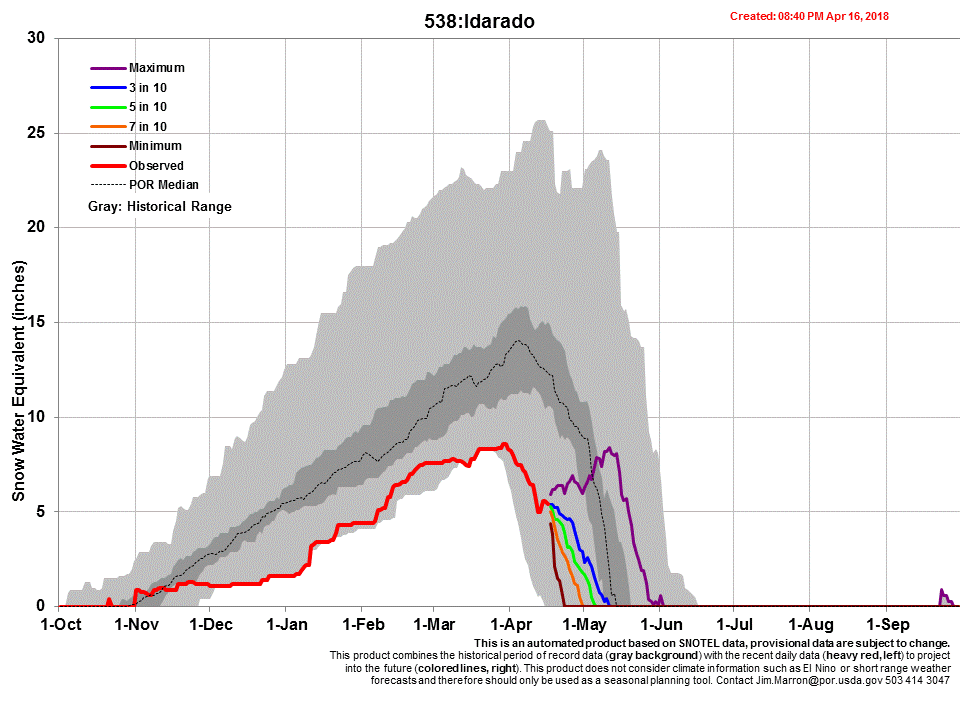
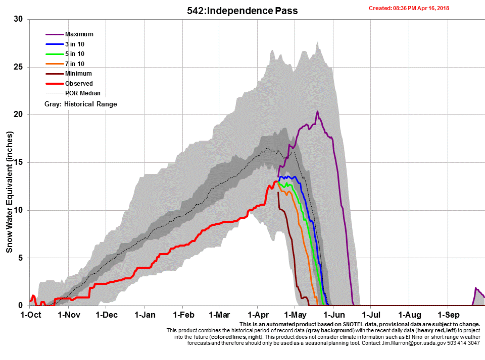
Table 1. Dust and snowpack conditions as of April 16, and updated on April 20 for Front Range sites, with current DERC categorization. This is the time of year when we try to categorize dust severity throughout Colorado into either “Minimum”, “Average”, or “Maximum”. All locations are now classified as "Average" dust severity, but within that classification there is a bit of variance. Wolf Creek, Swamp Angel, and possibly Grand Mesa are on the upper end of average, while Central and Northern Colorado are more in the middle range of average. Within that categorization, along with pictures, we try to elaborate as to the local characteristics of the dust. The intent is to assess the effects of the dust on snowmelt. The table below summarizes dust events observed during the recent CODOS tour as well as the classification of total severity of dust-on-snow at each location. Considering this information along with March 1 SWE conditions and a current estimation of spring weather conditions, previous water year hydrographs are suggested as possibly meeting similar conditions as WY2018, and what the ensuing spring runoff might look like. “Current DERC Spring Conditions” are characterizations of spring weather to date (March-April 16). If there are no previous water years in the DERC matrix to directly compare with WY2018, then these sites are noted in bold, and alternate water years are presented that may offer an idea of possible runoff scenarios that are close to current conditions. Years in parenthesis are nearest neighbor dust conditions that also may shed light on runoff scenarios. In the pdf links under each CODOS sample site are the hydrographs for viewing.