

Greetings from Silverton,
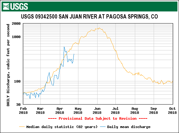
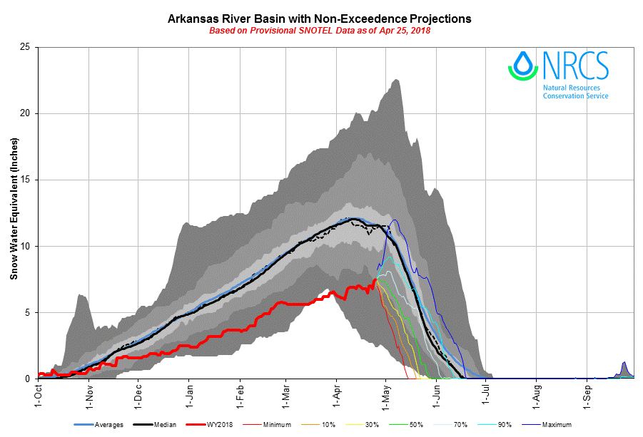
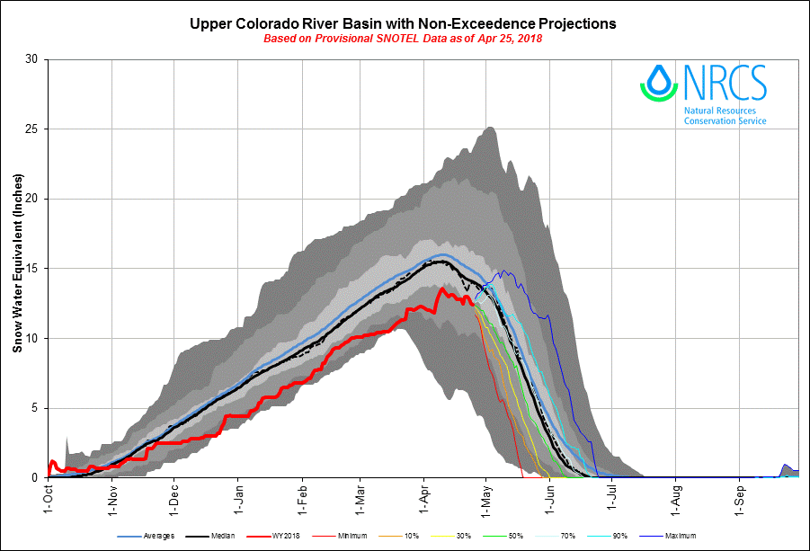
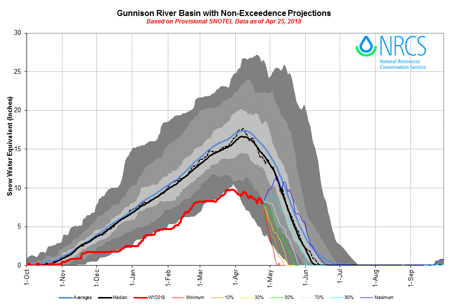
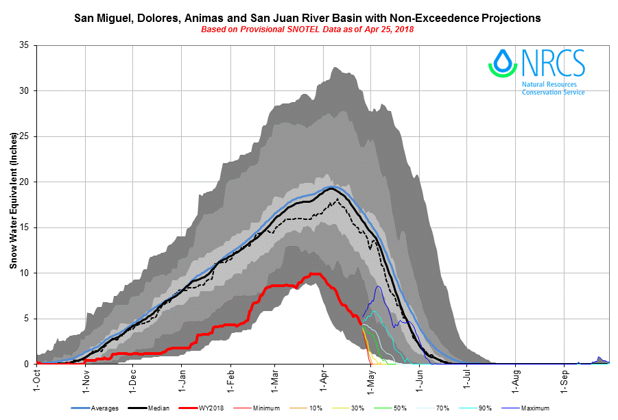
Red Mt. Pass: The snow accumulation received April 20-21, after dust event #7 was deposited on April 19, is nearly melted down to dust layers D3/D4/D5/D6/D7 at Swamp Angel Study Plot. These combined dust events make for a very dirty layer that will enhance snowmelt for the foreseeable future, likely until the snowpack has completely ablated. Currently, D3-D7 is 2" below a pretty clean snow surface at SASP but emerging rapidly. It is surprising the dust has not emerged sooner based on how very wet the snow is near the surface in the afternoons these last few days. But temperatures in the evenings have been well below freezing, and along with radiative cooling, refreezing the top ~ 9" of the snowpack at night, hence the following mornings melt energy goes toward warming up the snow before energy goes toward melting the snow. Still, the dust is already increasing snowmelt, as solar radiation can penetrate up to 1' into the snow depending on various factors, and with this dust just under the surface it is helping the snow absorb more radiation than otherwise. Snowmelt will really be ramped up when the dust is fully exposed and the faucet turned on when nighttime temperatures stay above freezing. In the San Juans in general dust is already enhancing snowmelt where exposed on the snow surface in areas such as steep slopes, southerly and exposed aspects, and shallow areas. Where the dust is exposed it makes for a very orange/brown color on the snow. Currently, dust is exposed on roughly 60%-70% of the existing snowcover. Also where there is bare ground, and there is a lot of it, it is warming and melting the adjacent snow faster than if there was complete snow cover. Over the last few days we have seen an uptick in streamflow. This will continue possibly until our next chance of precipitation and fresh snow accumulation, where we might see a temporary albedo reset. Please see albedo, air temperature, and streamflow plots below.

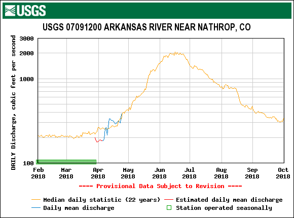
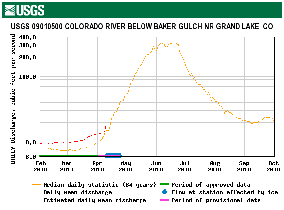
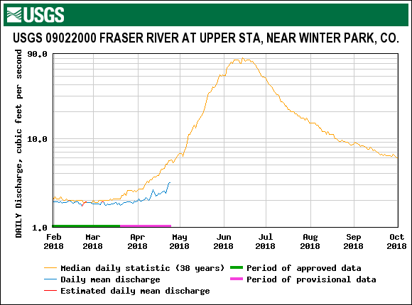
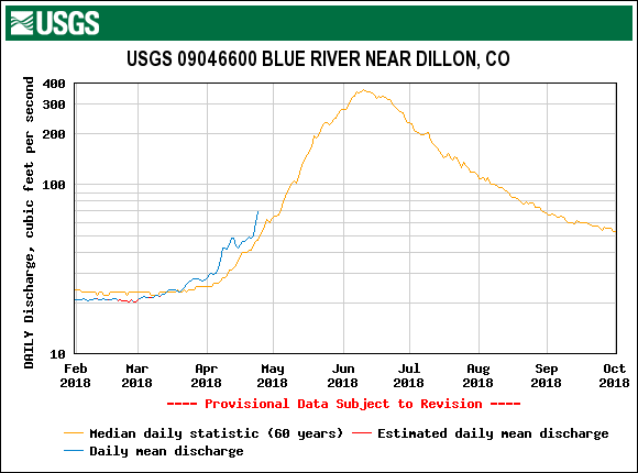
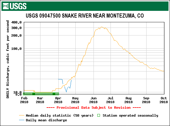
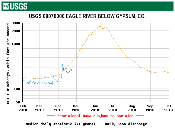
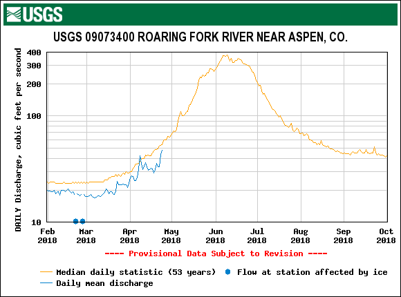
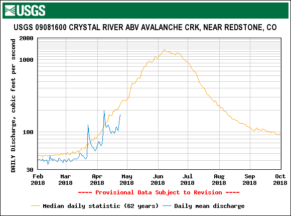
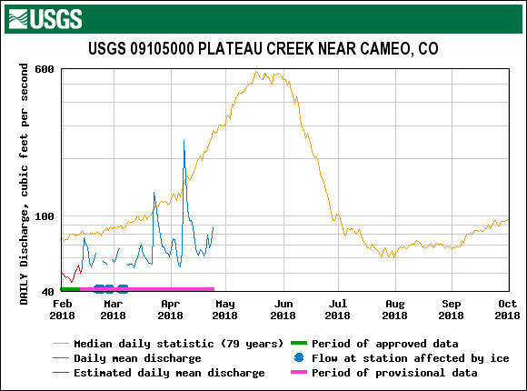
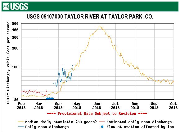
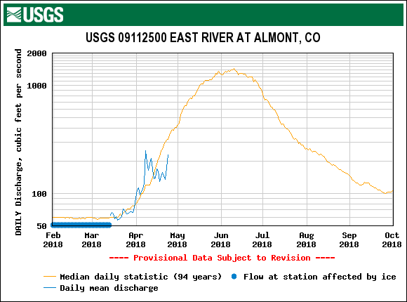
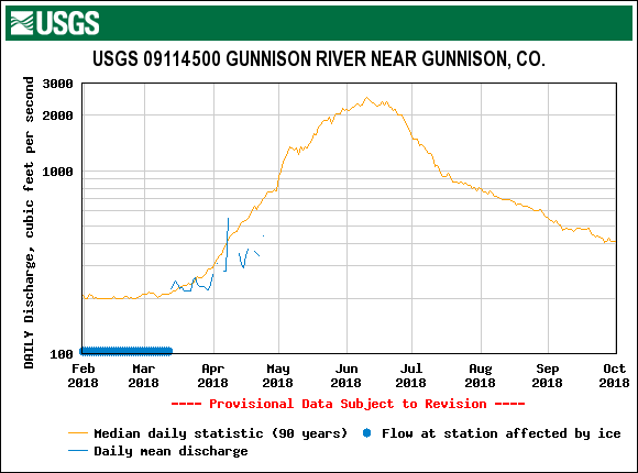
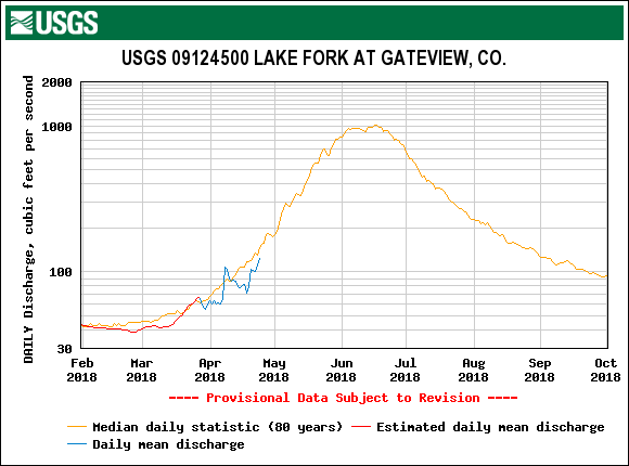
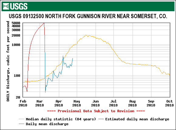
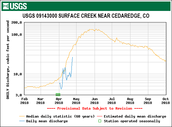
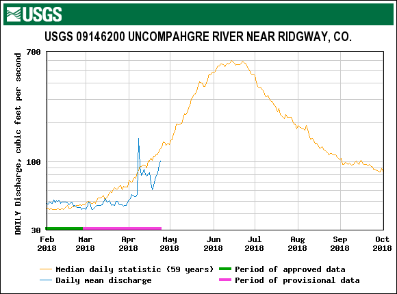
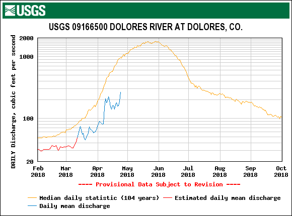
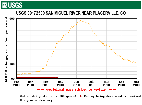
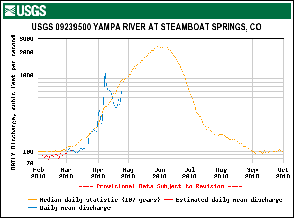
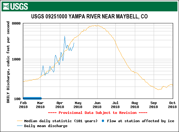
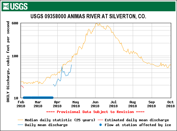
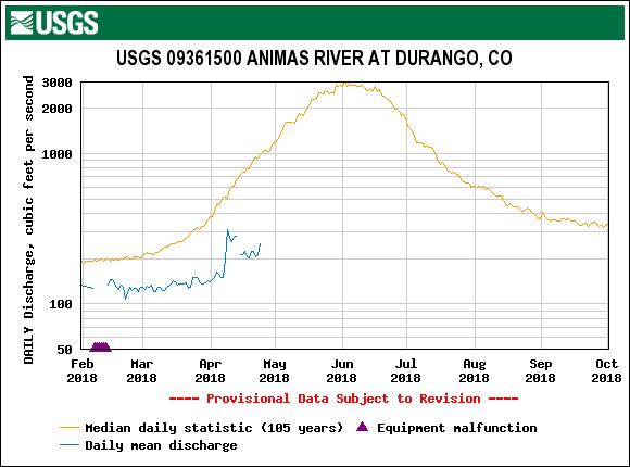
This is the time of year where we show streamflow as it relates to albedo of the snow surface. Most streams in Colorado saw an uptick in flows during a mostly rain event, with some wet snow, on April 8-9. Albedo is currently declining rapidly with the emerging dust and streamflows have increased over the last couple days. Minimum nighttime air temperatures have been cold, freezing the top ~ 9" of the snowpack. Expect albedo to continue to degrade until we receive snow. Overcast conditions over the weekend and maybe next week could slow daily melt rates.

The ablation season is underway at SASP. Elevation 11,060'.

SASP on the morning of April 25. D6-D7 is 2" under the surface with D3-D5 slightly beneath. D2 is about 1' beneath D3-D5.
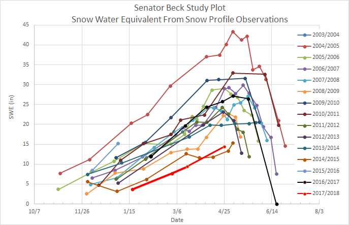
SWE at SBSP on April 25, elevation 12,200'.
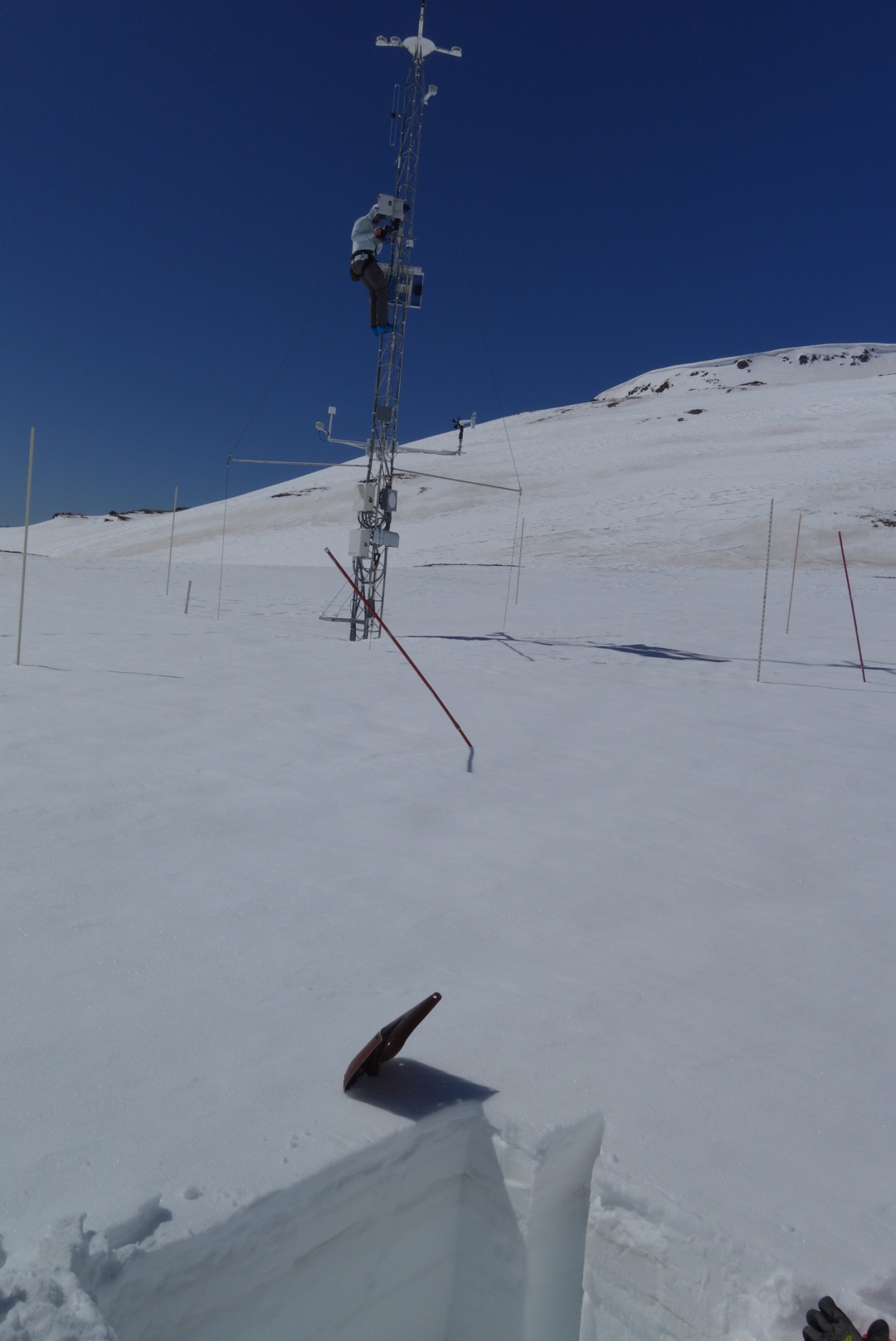
At Senator Beck Study Plot on April 25 dust is approximately 4" below the surface but exposed in the surrounding terrain.
Rio Grande: Dust layers were merged at the surface in the Rio Grande during our CODOS tour on April 16. It was of greater severity than Swamp Angel. Judging by the amount of precipitation received over the April 19-21 storm event (Wolf Creek and Upper San Juan SNOTEL showed around 0.7" precipitation, 2" snow depth gain, and ~1" reported SWE, basically no precipitation at Lilly Pond which is now showing snow-all-gone, and 0.2" precip, 3" snow depth gain and 0.5" gain in SWE at Upper Rio Grande which is now showing snow-all-gone) any snow covering the dust was superficial, and did not slow down snow ablation any real degree. With the forecast being sunny until the minor storm system this weekend, we can expect continued snowmelt to continue likely even more so with any possible coverage of dust assuredly now exposed at the surface.
Central Colorado: Generally, more precipitation was reported from the April 19-21 storm as you move north. Observations from other snow scientists driving around Colorado yesterday (April 24) reported that dust was not exposed in the Crested Butte area. But near Park Cone SNOTEL, where dust was on the surface on April 16, station data reported 0.5" precip, 0" snow depth gain, 0" added SWE from the April 19-21 storm, so dust is very likely still exposed in that locale. Monarch Pass is showing a good blanket of pink dust. New snow accumulation of ~10" on Grand Mesa was observed from the April 19-21 storm. Mesa Lakes SNOTEL reported 1.4" of precipitation, 6" of snow depth gain and 0.8" of added SWE from the storm. Dust at Grand Mesa area is likely a few inches under the surface but emerging rapidly due to the warm weather at the CODOS sample site. Once D6/D7 is exposed it will encourage melt down to D3-D5 which was 9" below surface on April 14. Like all locations throughout the state, dust is likely already exposed on certain aspects and lower elevations. As a reminder, D5 (and possible D6 and D7) was at the surface on April 19 at Hoosier, Loveland, Berthoud, and Willow sample locations. Observers reported that dust was still covered at Berthoud Pass yesterday.
Weather Forecast: This weekend a minor storm system will take a glancing blow at the San Juans, but no significant precipitation is expected. With low energy, low moisture and an unfavorable storm track we are anticipating overcast conditions, moderate winds and minor flurries at the most.
Looking forward we are seeing another weak system move into the area early and middle of next week. This system has more favorable southwest flow, but only moderate energy and dry air. At present, this incoming system looks more like a dust event than a winter storm, but being several days out an accurate prediction is difficult. This system will likely deliver some snow to isolated parts of the state, but no one location will break any records. The long-term outlook remains hot and dry, just as it has for the majority of the winter and spring so far.
In the News: On Sunday NPR ran an article that was posted on the front page of their national website, along with that the radio portion has been getting airplay. The article discussed the problem of dust on our Colorado snowpack and highlighted the work of CSAS' Colorado Dust-on-Snow Program. You can read the article here. The radio program Here and Now ran the radio version. Rarely does any news piece mention the fact that we are a small non-profit, let alone mention who supports CSAS. So I would just like to send out a big thank you to our funders. Your long-term stable support allows the Director (me), the only full-time employee, and our two seasonal-part-time employees, to stay focused on collecting and reporting the data, because that is what really matters. Most people are surprised to hear that we are a non-profit, because these folks who understand the problem know that it is of such great importance that we must be under the wing of some sort of state or federal government. Not so. Again, a big thank you to the below entities for making what we do possible (list is not exhaustive):
Colorado Water Conservation Board
Colorado River Water Conservation District
Upper Gunnison River Water Conservancy District
Southwestern Water Conservation District
Rio Grande Water Conservation District
Tri-County Water Conservancy District
Dolores Water Conservancy District
City of Grand Junction
Denver Water (raw water)
Denver Water (climate change program)
Bureau of Reclamation
Forest Service
Rio Grande/Colorado/Gunnison/Southwestern Roundtables
Researchers in Senator Beck Study Basin
Individual Donors
And also, our thoughts go out to Steve Fearn who passed away this week. I always enjoyed watching Steve and his colleagues piece apart and work through a problem at the Southwestern Water Conservation District meetings. I was marked by his intelligence and fairness.
More soon.


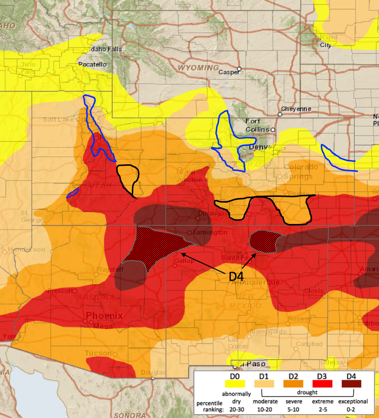
U.S. Drought Monitor map for UCRB. Proposed changes for this week. From NIDIS Intermountain Drought Early Warning System.