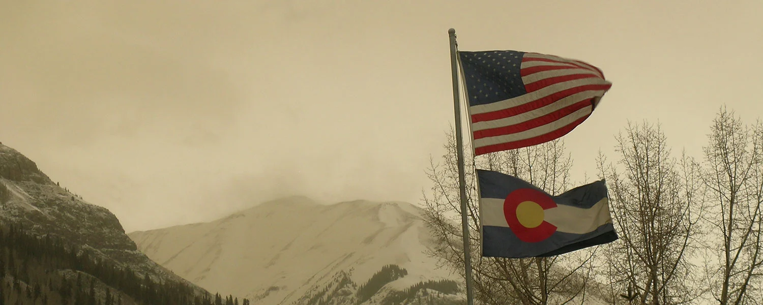
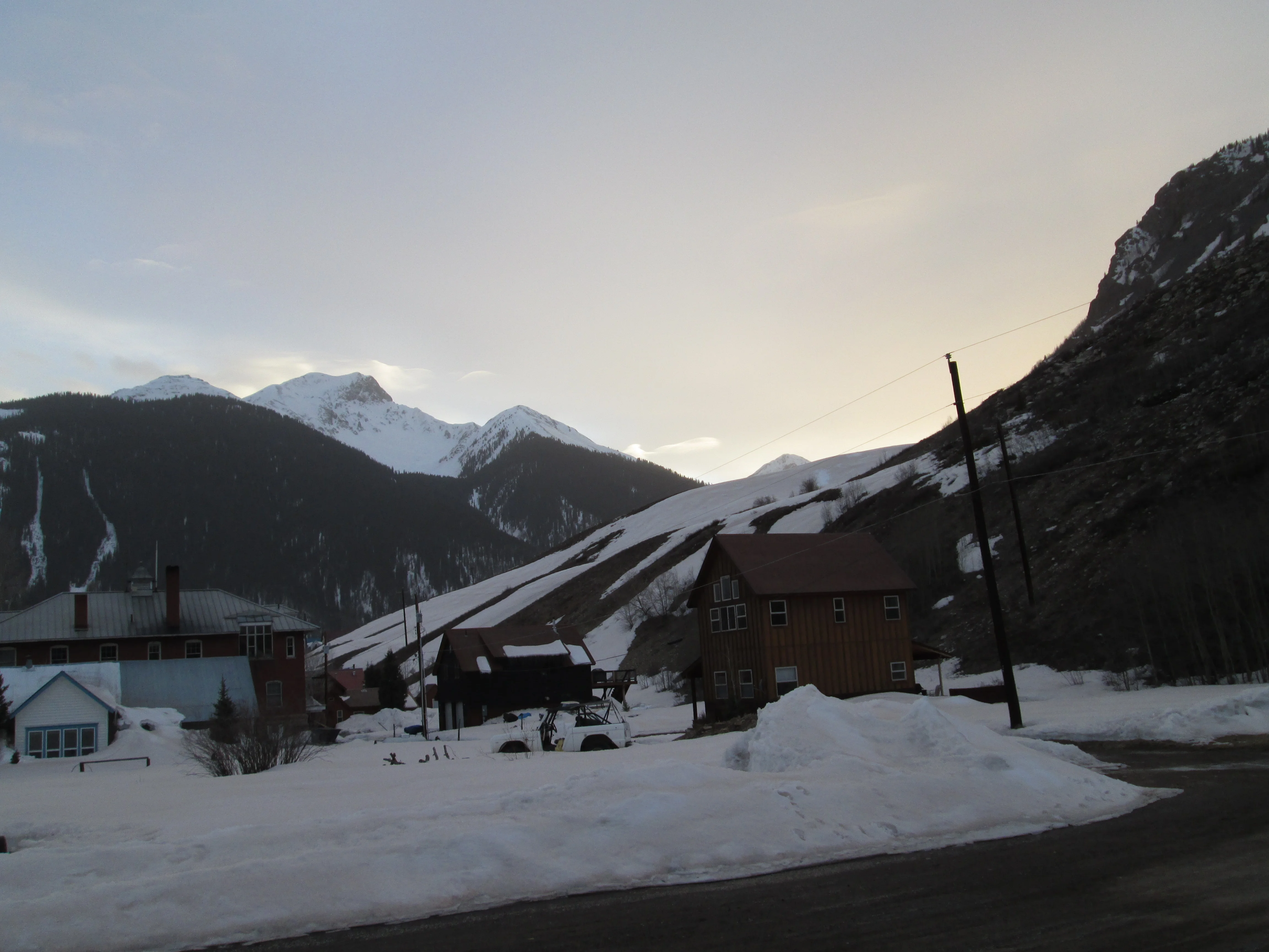
Like much of western Colorado, Silverton was under siege from near-continuous SW'ly winds bearing near-continuous dust (and perhaps smoke) for several days starting last weekend, until yesterday afternoon. The synoptic scale wind field driving this long-duration event has now broken down as the large weather system in the northern Rockies has finally moved eastward, opening the door for more moderate, westerly flow into Colorado.
Greetings from Silverton - On Friday afternoon and evening, June 13, we experienced event D9-WY2014, only our second logged June dust storm since beginning our observations back in 2003. This was not a major dust storm but visibility was nonetheless substantially reduced here in Silverton on very strong SW'ly winds doing tree damage here in town. Although we are in the final stages of snowmelt, and snow albedo was quite low already, this event did add an increment of dust-on-dust to the remaining alpine snowcover.
Yesterday (Saturday) we also experienced
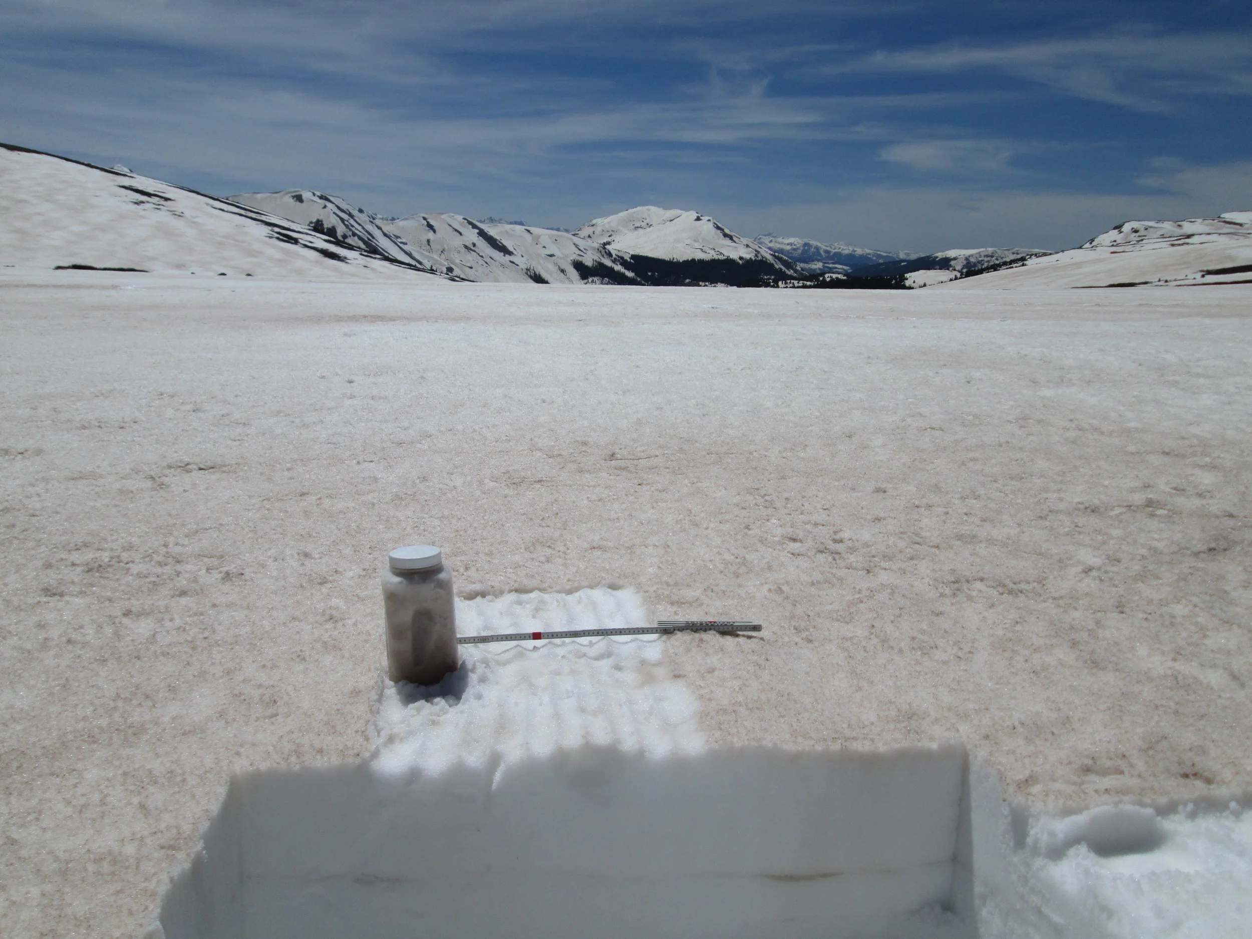
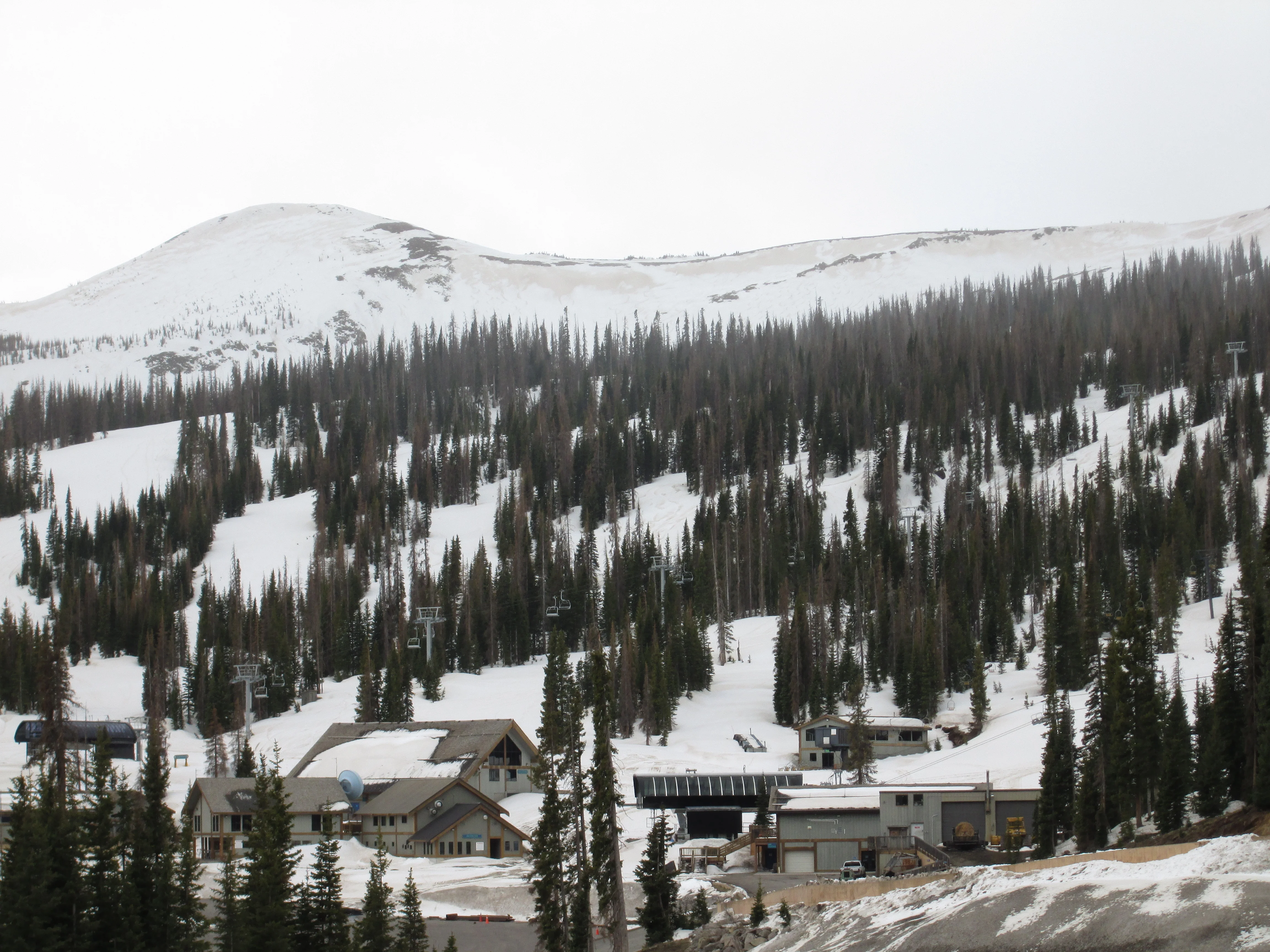
Major reductions in snow albedo caused by merged dust layers were readily observed at the snowpack surface, at all elevations and on all aspects, during a recently completed circuit of CODOS sites at Grand Mesa, Hoosier Pass, Loveland Pass (Grizzly Peak), Berthoud Pass, Willow Creek Pass, Rabbit Ears Pass, and McClure Pass, and a special visit to Independence Pass.
I'm writing to discuss an imminent increase in current snowmelt discharge rates driven by the re-emergence of buried dust and large-scale reductions in snow albedo throughout the northern, Front Range, and central mountains. This dust-enhanced snowmelt surging is likely to exacerbate current flooding hazards.
The series of winter storms in April and May added significant SWE to the already large snowpacks in the northern, Front Range, and central mountains, and almost inevitably led to the strong snowmelt runoff now underway and requiring Flood Warnings and Flood Watches. Those storms also had the effect of disrupting the impact of dust layers D3-8 contained in the Colorado snowpack by frequently adding enough clean snow to reduce or eliminate the absorption of solar energy by the dust, thereby intermittently restoring relatively high albedo to the snowpack. That 'albedo reset' process is always more effective and long lasting in higher elevation, alpine snowcover, and much less effective or long-lasting at the lowest elevation snowcover.
CODOS sites at Park Cone and McClure Pass and their adjoining Snotel stations in Gunnison River headwaters have lost all snowcover even while the Schofield Pass Snotel retains most of its above-average Peak SWE. Overall, subalpine snowcover throughout the Upper Gunnison Snotel network is largely consumed. Where snowcover remains, dust event D8 is presumed to have enhanced ablation of recent snowfalls, re-exposing underlying dust layers D3-6/7, as present. With new snow restoring higher snow albedo to that remaining snowcover, the most recent surge in the main stem Gunnison River, East River, and Lake Fork watersheds runoff was disrupted by Memorial Day weekend weather and leveled off at levels already well above or at median peak discharge values. However, that generally thin layer of new snow will quickly melt as underlying dirty snow absorbs increasing solar energy this week and runoff surging will resume in those locales. Alpine snowcover will sustain the remaining runoff in the Gunnison main stem but, given a prolonged period of dry and sunny weather, dust-enhanced snowmelt rates could result in early onset of the declining limb of the hydrograph. In the North Fork of the Gunnison River watershed, prior episodes of high intensity, dust-enhanced snowmelt runoff have consumed the majority of snowcover and the center of runoff mass may have already passed the USGS gauge at Somerset. North Fork flows may once again surge to a high level but this surge may be followed by a steep decline as the remaining snowcover is rapidly consumed.
Spring weather has effectively metered the impacts of eight dust-on-snow events in the western San Juan Mountains, parsing the ascending limbs of regional spring runoff hydrographs into a series of surges and retreats. We're now seeing renewed surging throughout the region as dust re-emerges from beneath recent snowfalls.
On Saturday, May 17, CODOS found snowmelt well advanced in the Rio Grande River watershed with snowcover significantly reduced at our Wolf Creek Pass CODOS site and “snow all gone”, effectively, at our Spring Creek Pass site. Recent snowfall continued to shield the most recent dust layer D8, and the merged dust layers D6-D3 just below, from the full impact of solar radiation in most alpine terrain. Those dust layers were evident on solar aspects at and below tree line, where snowcover existed at all. The Rio Grande River main stem was flowing near bank full and rising.
As reported earlier today, we just logged Winter Storm #24 of the season over the Mother's Day weekend, adding another 12" to our total snow depth and 1.3" of water content. Storm #24 fell directly onto merged D3-7 dust in our locale, over most terrain except northerly aspects where Storm #23 snow was still obscuring D3-7. Storm #24 weather event blunted another statewide surge in snowmelt runoff last week.
Spring 2014 weather and dust-on-snow events have proven challenging to stay abreast of, with two new dust events and a major winter storm in just the last week. Timing our CODOS fieldwork to observe dust at the Colorado snowpack surface has been tricky but our just-completed visit to all eleven CODOS sites did verify that event D4 was very extensive, spanning the mountains from north to south and west to east. We also found that D4 (usually merged with D3) was widely exposed on the lowest elevation snowcover in all watersheds, and only thinly covered by cleaner snow in the adjoining alpine terrain. Although the impacts on snow albedo from this exposed D4/D3 dust were greatest in the Red Mountain Pass, Crested Butte, and Grand Mesa locales, and comparatively weaker at Willow Creek Pass, all locales exhibited significantly reduced snow albedo from merged D4/D3.
We're catching up with recent events before, during, and after our Wednesday-Saturday CODOS circuit last week. This Alert will revise our previous "D6 Averted" email and update you on our subsequent seventh event of the season - D7-WY2014, deposited on Saturday, April 26.
As of this writing at 7 AM, we have not received a significant new dust-on-snow deposition here in Silverton, despite some fairly strong SW'ly winds yesterday afternoon and overnight. Blustery weather continues this morning but skies appear quite clear as the sun rises and blue sky is revealed between fast-moving clouds. Neither did we receive any meaningful fresh snow, so dust layer D4 remains just as exposed as it was yesterday.
However, even without additional fresh dust, the surging being logged on streams throughout the Colorado mountains is likely to be sustained until at least next weekend. Several watersheds experienced flows yesterday that approached their median peak flow levels. The current surging is being enhanced by dust layer D4, perhaps merged with D3 in some locales, and the next several partly sunny to sunny days will reveal additional D4 at the snowpack surface, absorbing even more solar energy. This coming weekend a potentially significant and energetic winter storm may deposit fresh snow and restore high albedo to the snowcover for some period, OR, may deposit snow and dust, only briefly restoring higher albedo.
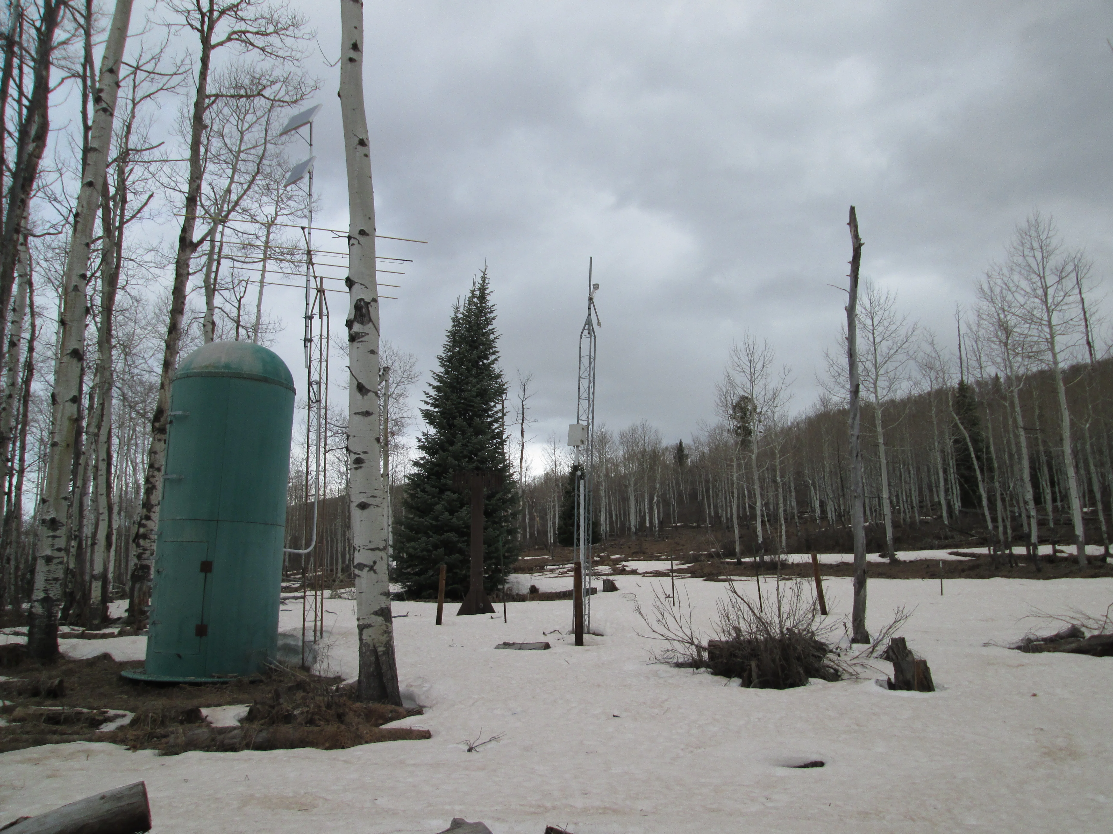
The CSAS crew is heading out for a full CODOS site circuit this morning, first to Swamp Angel Study Plot and then to Park Cone this afternoon, then onward in the usual progression over the next several days, returning to Silverton Saturday evening. We will then issue our eleven site-specific Updates over the following several days.
Furthering the thoughts in our Wednesday, April 16 Update, a D6-WY2014 dust-on-snow event now appears even more likely, and this event may be 'dry' for some areas, without accompanying snowfall. If the next dust event is dry in your watershed, and falls on an extensively re-emerged D4 layer, the additional reduction in snow albedo would only accelerate any streamflow surging already in progress. If D4 had not yet re-emerged, a dry D6 event would initiate a surge that could soon accelerate as D6 merged with D4.
Streamflow surging late last week at virtually all of the gauges that CODOS monitors was clearly related to the series of sunny days, the widespread emergence of dust layer D4 at the snowpack surface (possibly merging with D3), and very warm temperatures.
Then, last weekend's winter storm produced snowfalls of varying depths around the state but were generally sufficient to bury layer D4 and restore high snow albedo to most snowcovered terrain (the exception being the very lowest snowcover, where the storm may have produced mixed rain/snow precipitation). Streamflow surges have reversed over the weekend and early this week, statewide, to varying degrees.
Late Sunday afternoon (March 30) brought dramatic dust-laden southwesterly winds to southwest Colorado and beyond. Here in Silverton the dust arrived "dry," with perhaps a trace of new snow at higher elevations. Winds died down after dark, and skies cleared by 0100 hrs Monday morning.
The predicted dust storms mentioned in yesterday's email did materialize in the Colorado Plateau by mid-day. A 'live report' from a Silverton friend visiting Bluff described blinding dust and zero visibility by noon. Mid-afternoon photos from the USGS's Abajo Peak and Mesa Verde webcams showed building dust-in-air entrained in squally weather. Another report had dust in Cortez shortly thereafter. We also heard reports of 'raining mud' from Pagosa Springs and Montrose.
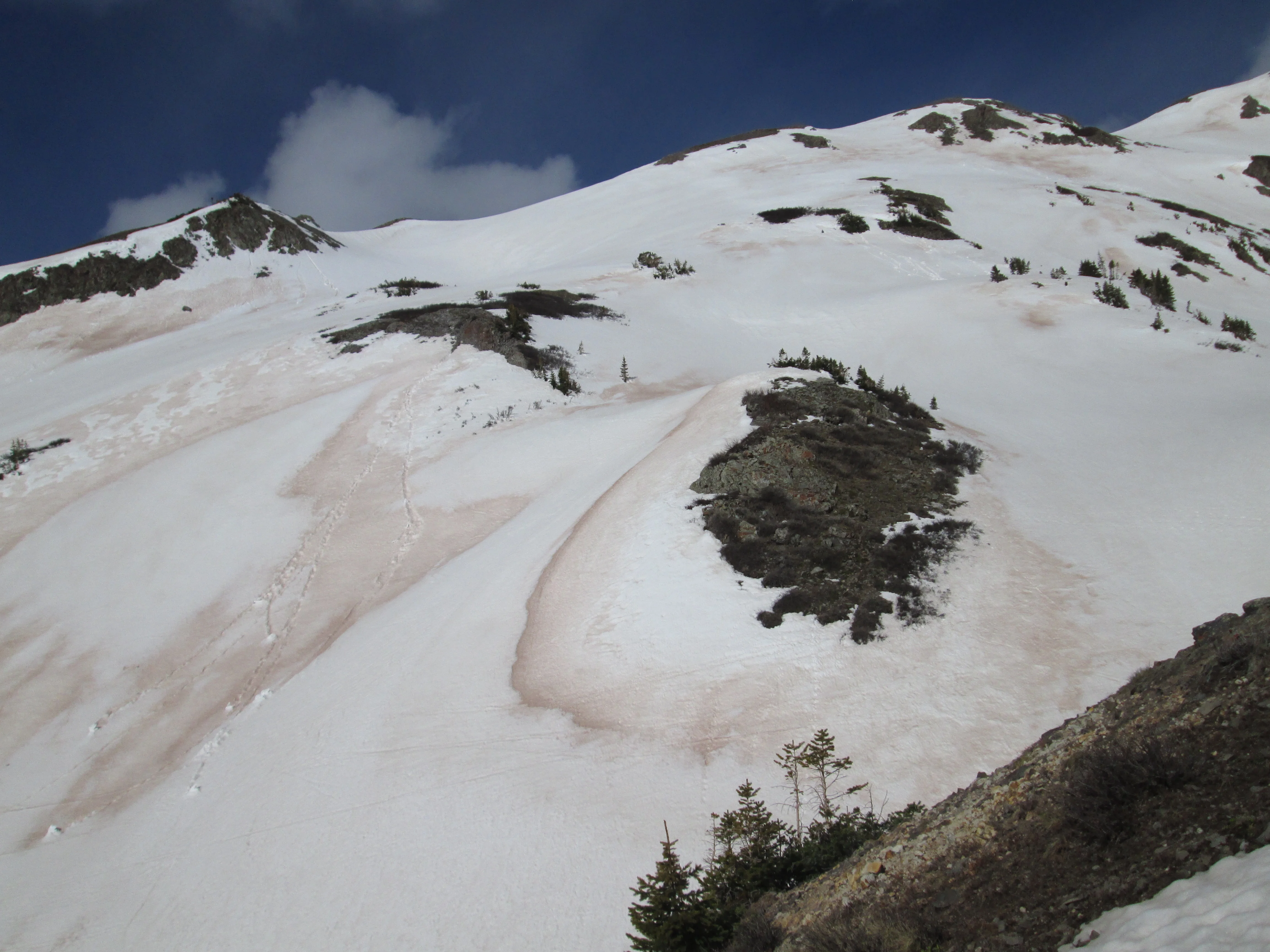
We began to observe dust in the air and within snow squall clouds at around 5 PM. We'd had several inches of clean appearing snow by then but within an hour the town appeared to have been spray painted pink. Unfortunately, the light was rather poor so our photos around town do not do this transformation justice. However, CSAS field assistant Andrew Temple did capture the same effect at nearby Molas Pass, showing the vivid coral pink dust color at the snow surface.
We will be collecting samples of this D3 dust, and photos of the dust layer in-situ, at Swamp Angel Study Plot either later today (after avalanche control on Red Mountain Pass) or tomorrow. We've advanced our tour of all CODOS sites to begin tomorrow, returning to Silverton by Monday or Tuesday and then issuing a complete set of site-specific Updates later that week. This D3 event is very likely to be spatially extensive and we will verify whether it, and events D2 and D1, are present or absent at all ten sites.
As of this morning, the National Weather Service in Flagstaff has issued a "Dust Storm Warning" for Kayenta and NE Arizona, on strong SW'ly winds developing today. (See attached screen shot). Kayenta has a 40% chance of rain showers and thunderstorms today, but little if any precipitation will fall farther south in the Little Colorado River valley near Leupp and Winslow. As of 0800 this morning, winds were already averaging SW 26 mph and gusting 37 mph in Flagstaff. Moab, UT also will see SW'ly winds today averaging 20-30 mph and gusting to 45, with 30% chance of scattered rain showers (high of 66 F).
The NWS Grand Junction office is also forecasting strong SW-to-W winds throughout the Colorado mountains today through Thursday, in conjunction with a Winter Storm Warning. So, this is a large, synoptic scale weather system and wind field that could sustain high average wind speeds through Thursday at most Colorado mountain passes.
Dust season has resumed at Senator Beck Basin. As of observation and collection at Swamp Angel Study Plot this Tuesday morning, we must report that a modest new dust layer D2-WY 2014 was deposited ‘wet’, overnight last night, within a trace of precipitation. Based on our Putney wind data, and imagery from USGS webcams at Abajo Peak and Island in the Sky showing building dust in the air in late afternoon, we estimate that this dust was deposited on WNW’ly winds between dusk and midnight Monday, March 17.
Given the north and northwesterly bias of this winter’s active storm track and winds, and corresponding lack of southwesterly flow, most of Colorado’s mountain watersheds have already developed well-above-average snowpacks. The San Juan Mountains and most associated watersheds are the exception to that trend in snowcover. The southern San Juan Mountains may also have the only snowpack containing significant dust, as of event D1, February 16. If, in fact, the remainder of the state’s snowpack remains dust-free, then snowpack ‘ripening’, toward snow temperatures of 0° C throughout, is proceeding without the extra energy provided when desert dust contained in or near the snowpack surface absorbs solar radiation. However, the majority of dust-on-snow events (and dust mass) logged by CODOS for Water Years 2005-2013 occurred after mid-March. Given current snowpack conditions, and the likelihood that many Snotel sites have not yet recorded Peak SWE, even in the absence of dust-on-snow Spring 2014 snowmelt runoff is going to release large amounts of water and flooding hazards are emerging in some watersheds. Should dust be deposited in the Colorado snowcover over the next several weeks, that dust will be positioned high within the snowcover and, in conjunction with April and May weather, influence the timing and rate of the high-volume snowmelt runoff. That potential interaction of very high SWE, potential dust forcing, and spring weather conditions is captured within a 3x3x3 dust-enhanced snowmelt runoff behaviors “space”.
Based on observations over the past week, I can now report that dust season has arrived, albeit just barely, at Senator Beck Basin, with an extremely weak D1-WY2014 dust layer deposited early on the morning of February 16. Ambiguous evidence was present on the snow surface near Swamp Angel Study Plot (SASP) later that morning, confounded by heavy vegetation debris, and I could not actually see a dust layer in my snow profile at SASP. However, over the past week, clear cut evidence of the layer was exposed farther south, at Molas and Coal Bank passes.