CODOS Update May 7, 2021: General Observations II
Greetings from Silverton,
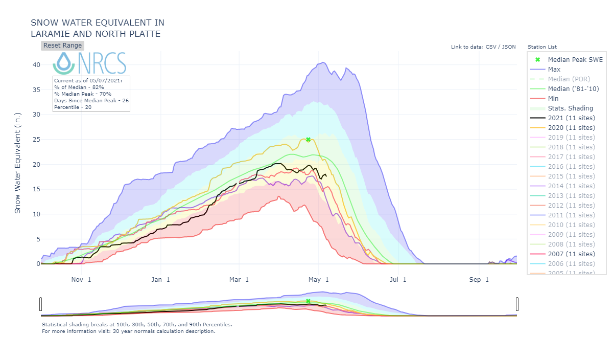
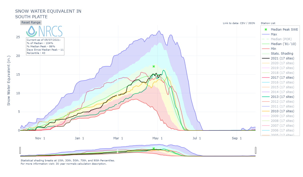
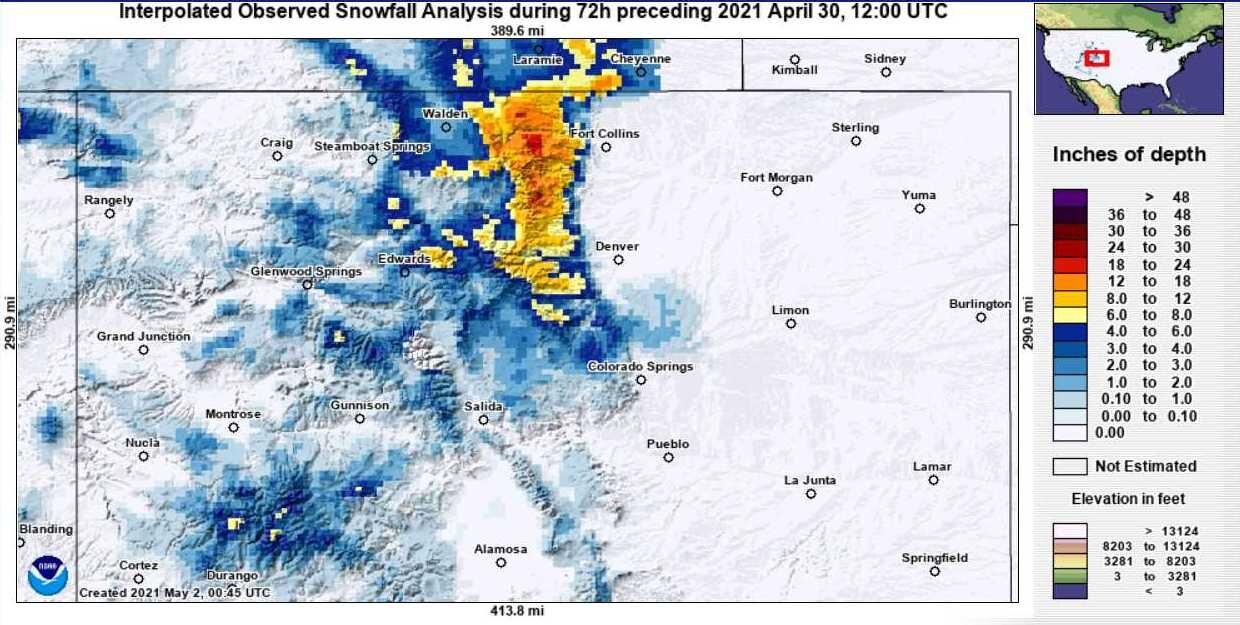
We are well into ablation season, even in the S Platte where a nice storm delivered well over a foot in the northeastern mountains the end of April. Judging by SNOTEL data in this area even the higher elevations are likely seeing mostly full dust exposure by now (see CODOS reports from April for details). The productive storms in the Front Range mountains and the forecast this week indicating more snow to again favor this area, have and will put another pause on rapid snowmelt and hopefully adding an inch or two precip to the snowpack.
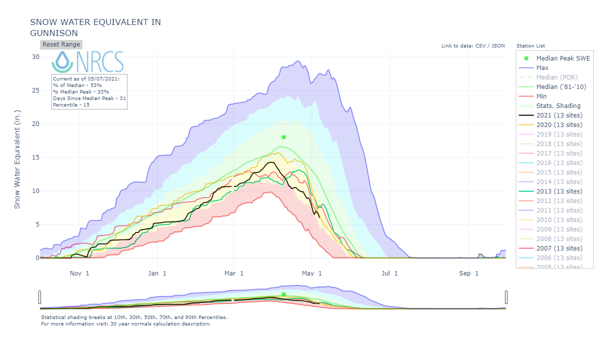
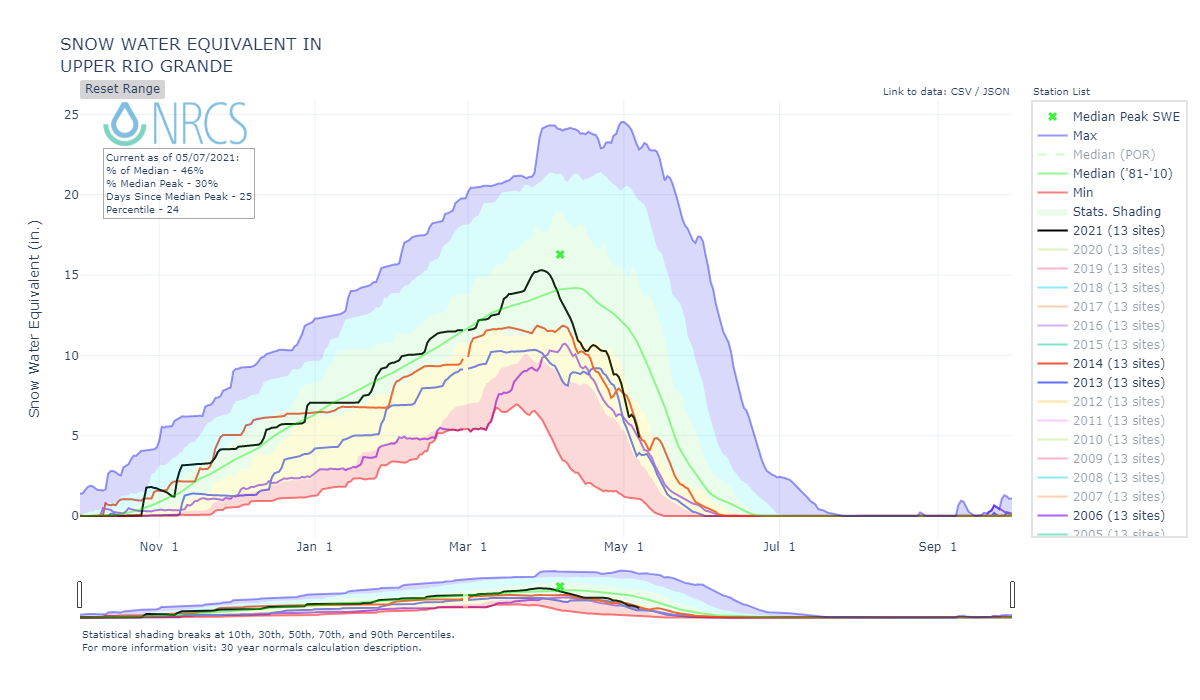
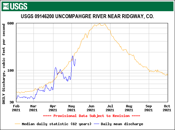
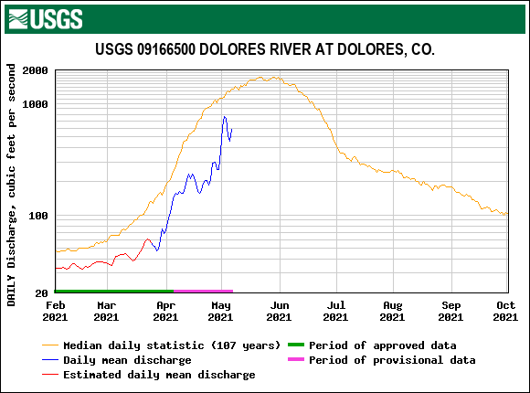
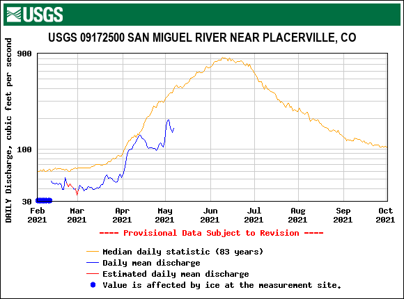
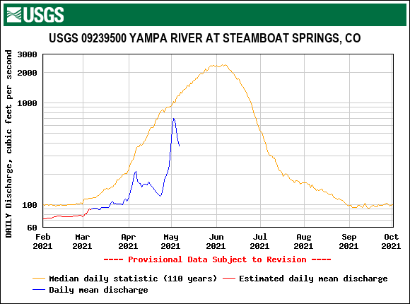
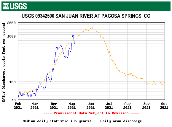
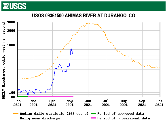
Elsewhere, other areas of Colorado that were not so lucky in seeing more snow have seen prolonged exposed dust and rapid snowmelt. In Central and Southern Colorado the snowmelt ablation curve, of a much below normal snowpack, has been in steep decline. At Senator Beck, our last storm was a week ago, before then it was mid-April. What precipitation we have been getting is scant. It feels a lot like last year, very hot and dry post-April 1st conditions, very significant dust on surface, very few cloudy days to slow ablation. Today however has been cooler and mostly cloudy, the forecast is for chances of precip over the weekend and then better chances on Monday. The CBRFC held their water supply update today, you can grab the slide show here if you want to see how another hot and dry year translates to supply estimates.
Next week will be busy as we plan to do snow profiles at SBSP and SASP to coincide with Airborne Snow Observatory flights in SW Colorado and then we hit the road for the final CODOS tour of the season.
More Soon
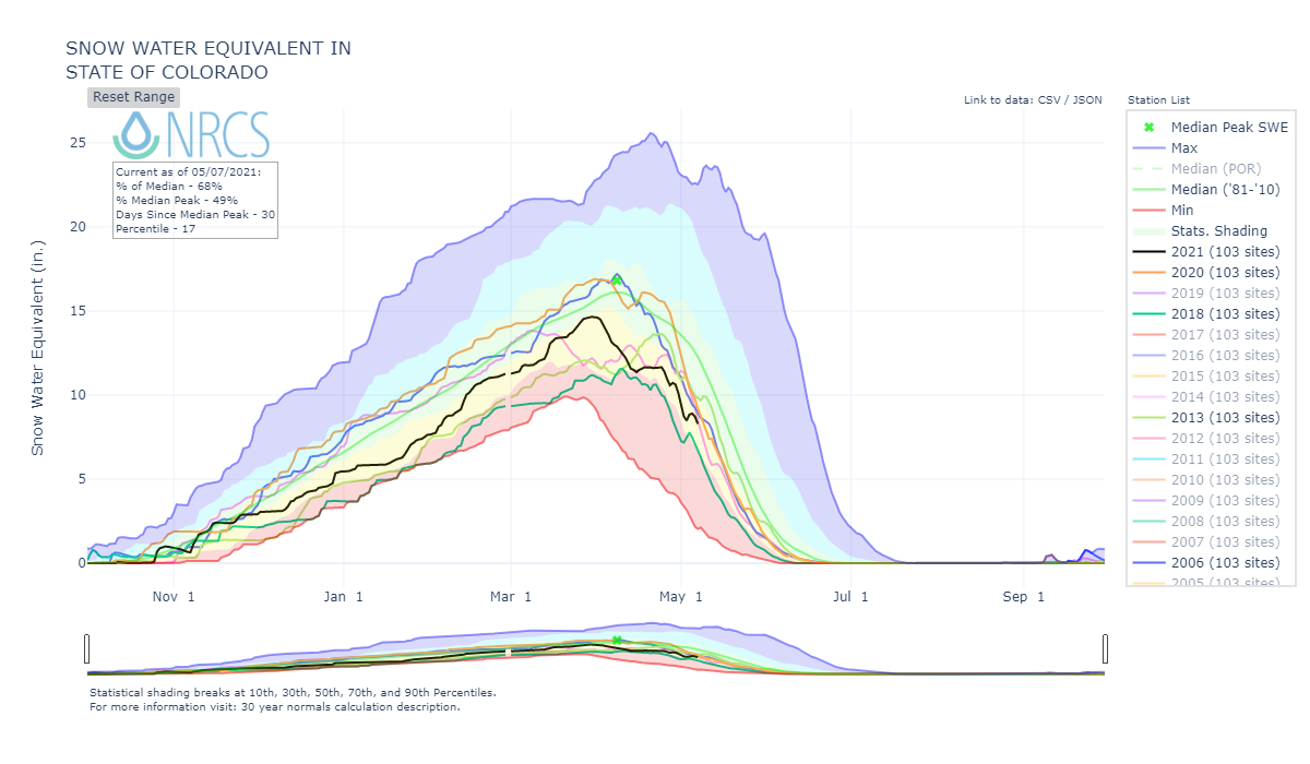
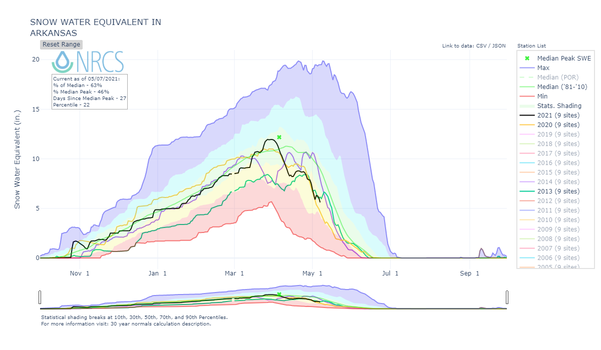
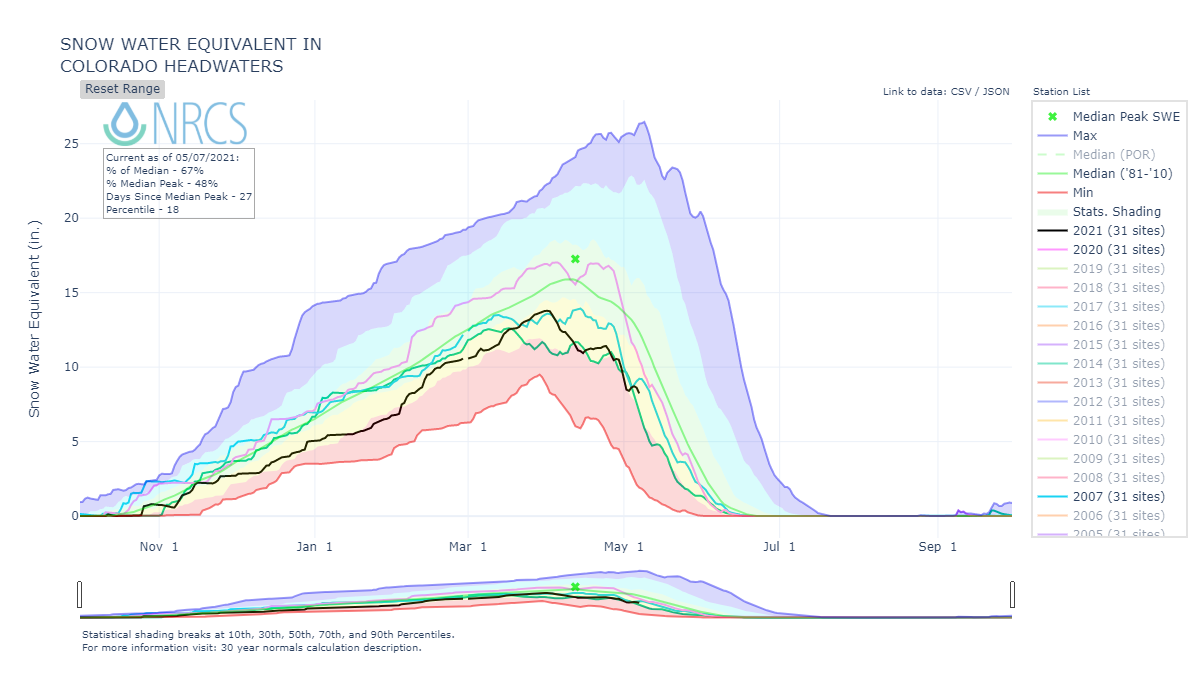
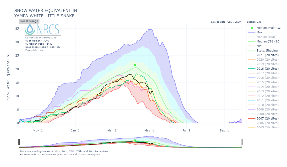
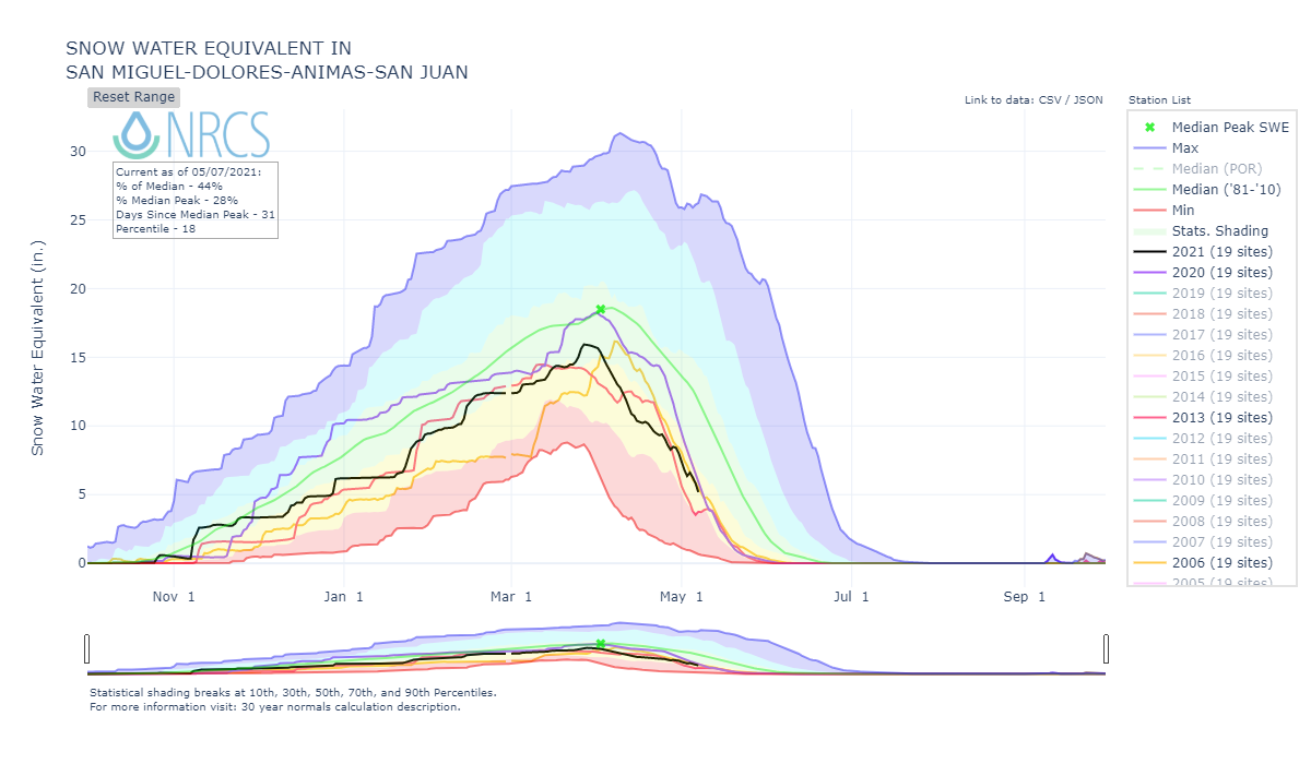
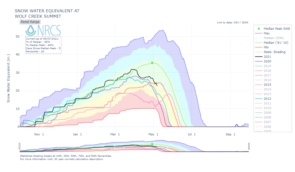
Below: Basin SWE conditions with a few other similar years thrown in largely based on our dust enhanced runoff classification model.
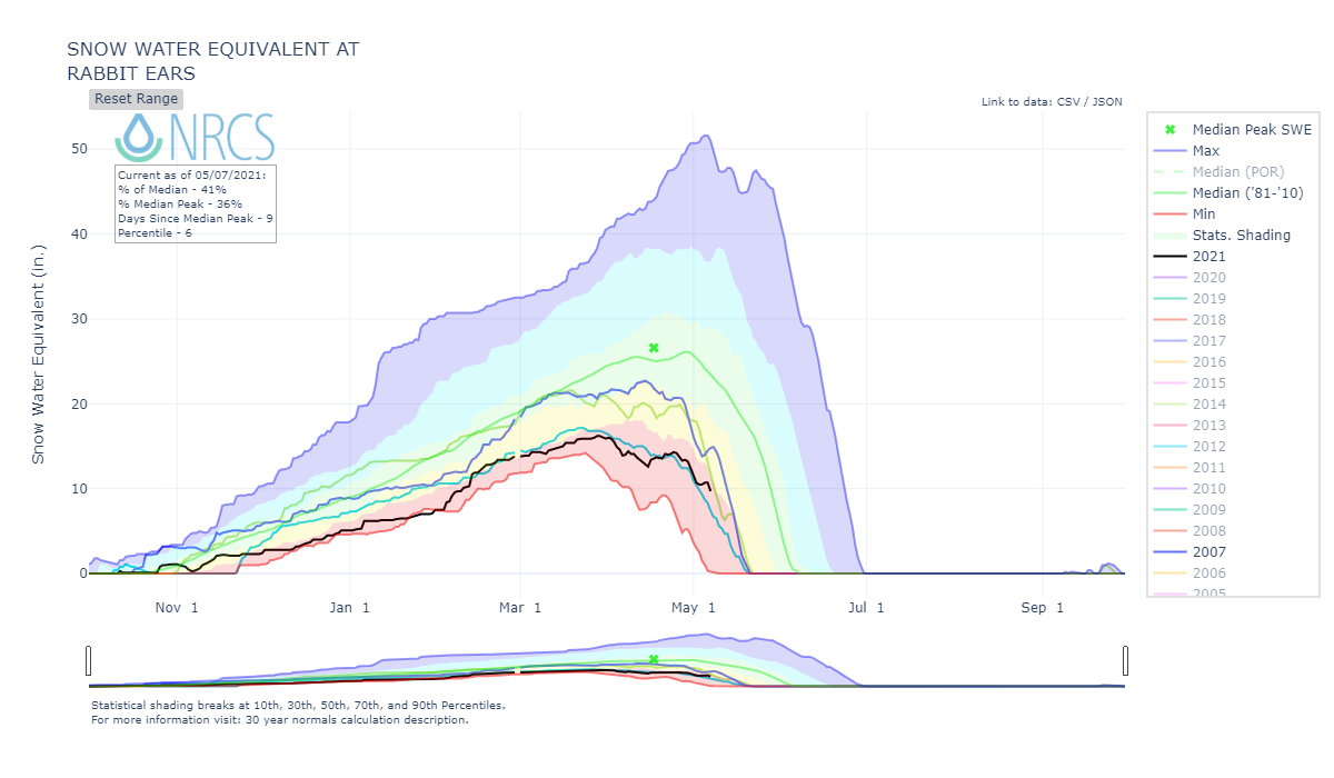
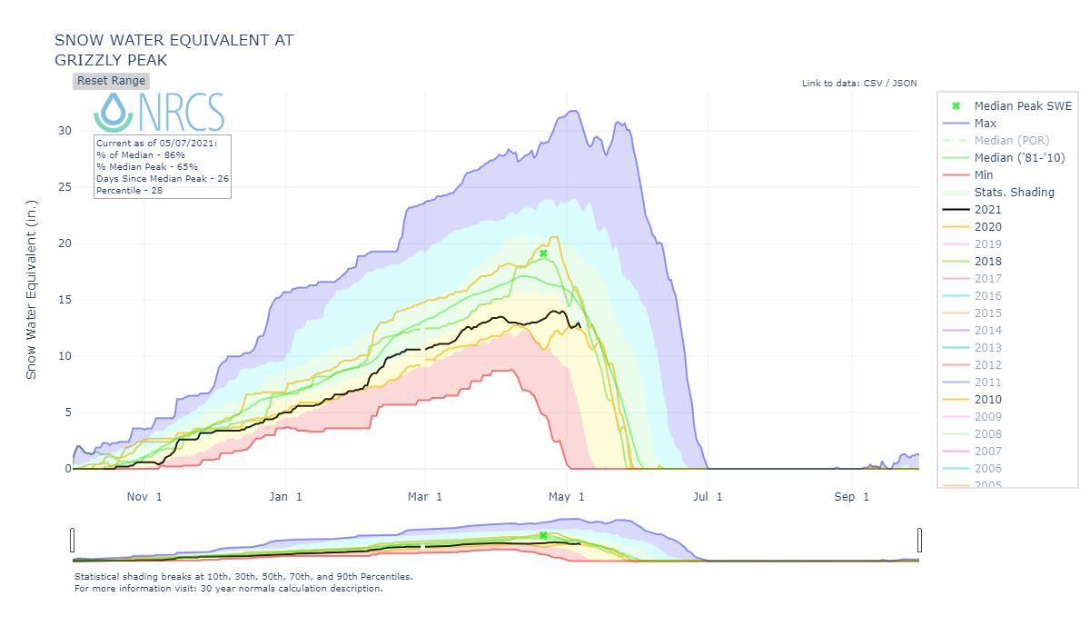
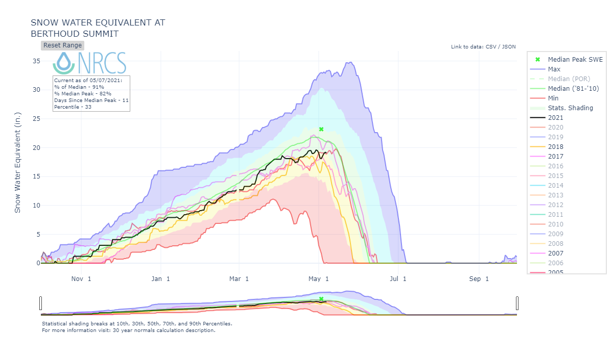
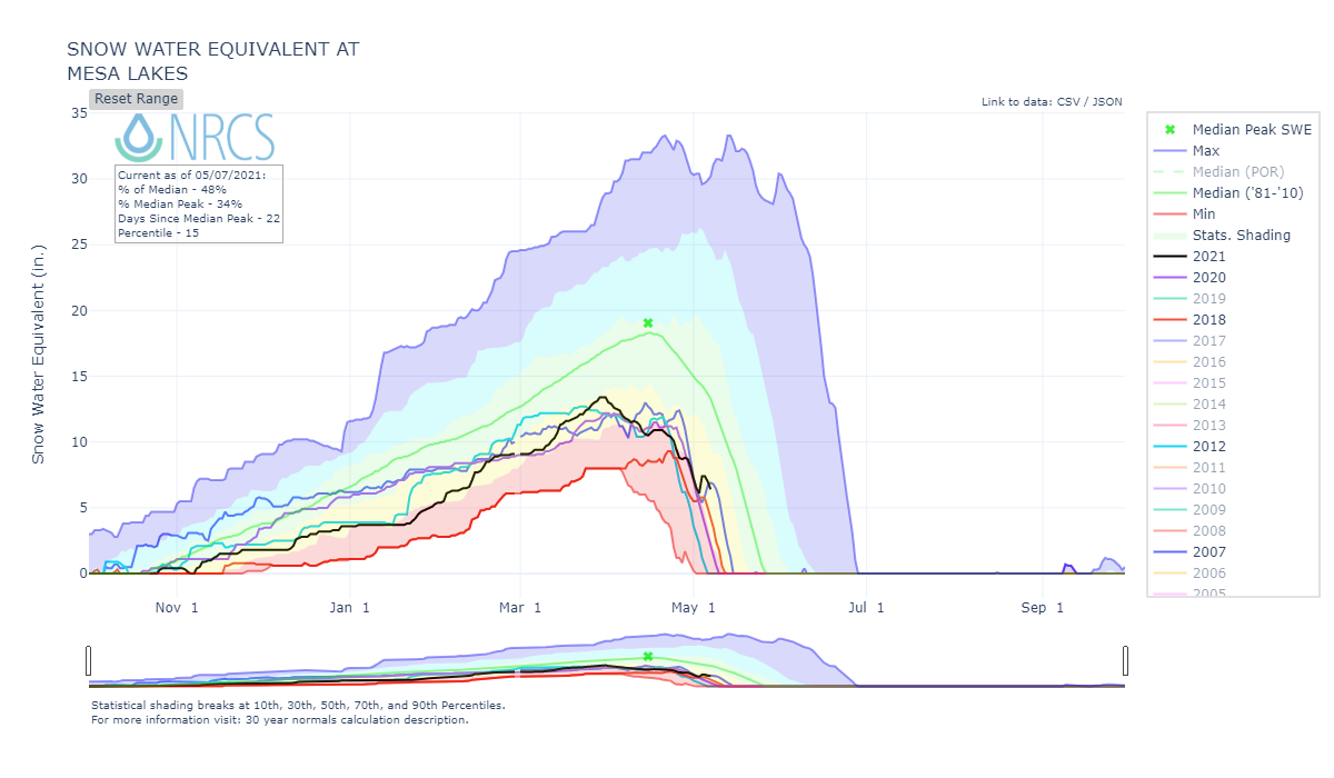
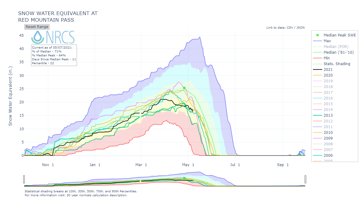
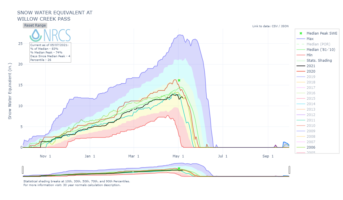
Below: A few select higher elevation SNOTEL stations with a few similar years shown as well.
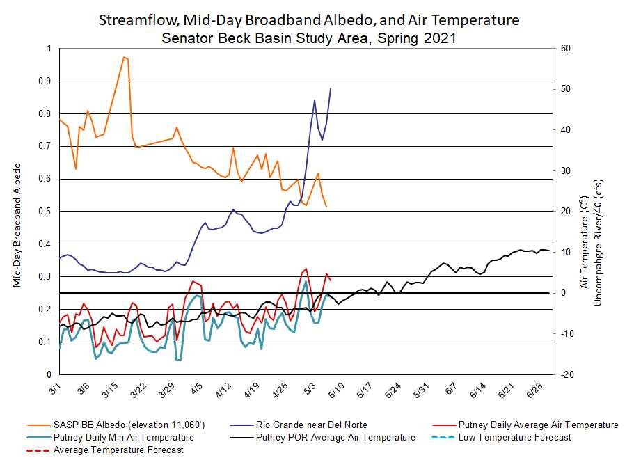
Below: There have been a few very hot episodes this spring. The lack of new snow and very sizable dust load on the snow surface has kept albedo lower than usual. The albedo forecast is for albedo to stay low or decline further, hence snowmelt/streamflow increasing. With the trough making its way into Colorado we will see a pause on rapid snowmelt starting this weekend into early next week. Any snow accumulation will have minimum staying power it appears in keeping the snowpack cool (unless you are in the S Platte possibly, according to the forecast).
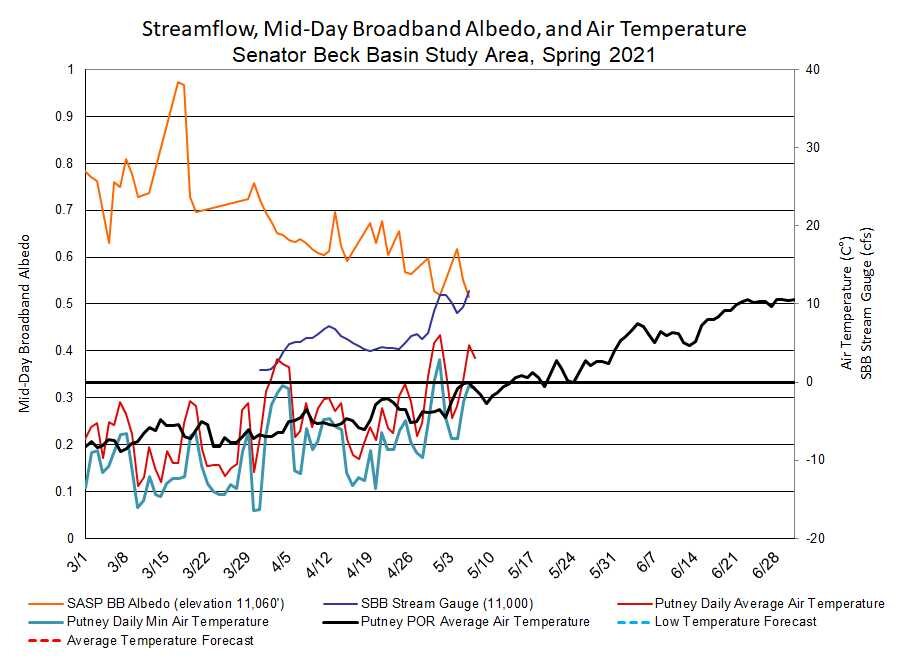
Below: Similar to last year, a dry and hot April. When we have seen precipitation it has been minimal.

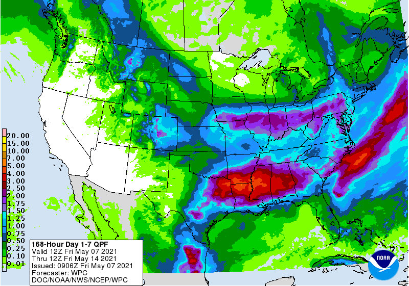
Below: Northeast mountains really benefitted from the storm the end of April. In the San Juans the precipitation constituted a storm, but barely. The forecast (see next slide below) favors the NE quadrant of CO as well.
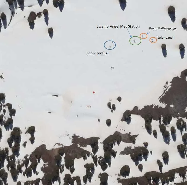
Below: Aerial image of Swamp Angel Study Plot on April 29, 2021 as part of an airborne hyperspectral remote-sensing project. You can see the orange colored dust on surface, this imagery was taken a day after 2 days of precipitation that delivered 0.7”, this gives an idea how strong the dust is this year and how tough it is to cover dust with warm spring storms.