CODOS Update May 27, 2021: Last Couple Weeks of Snowmelt
Greetings from Silverton,
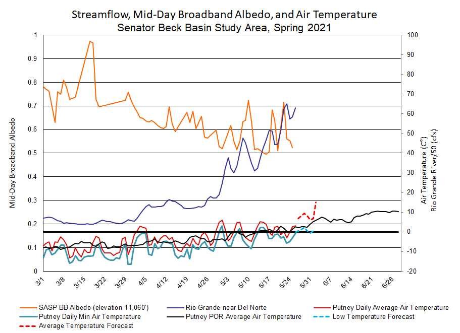
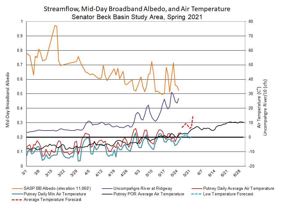
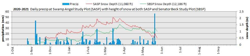
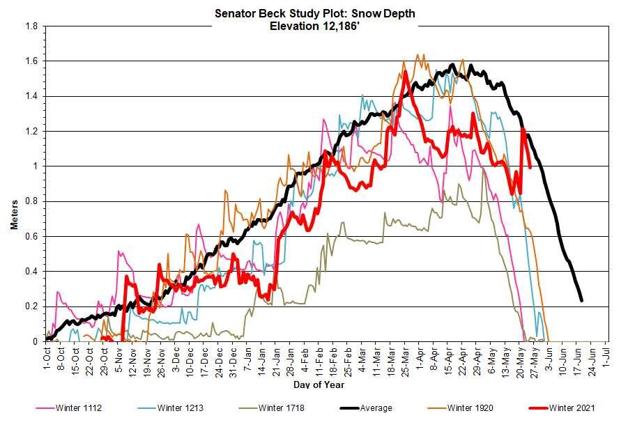
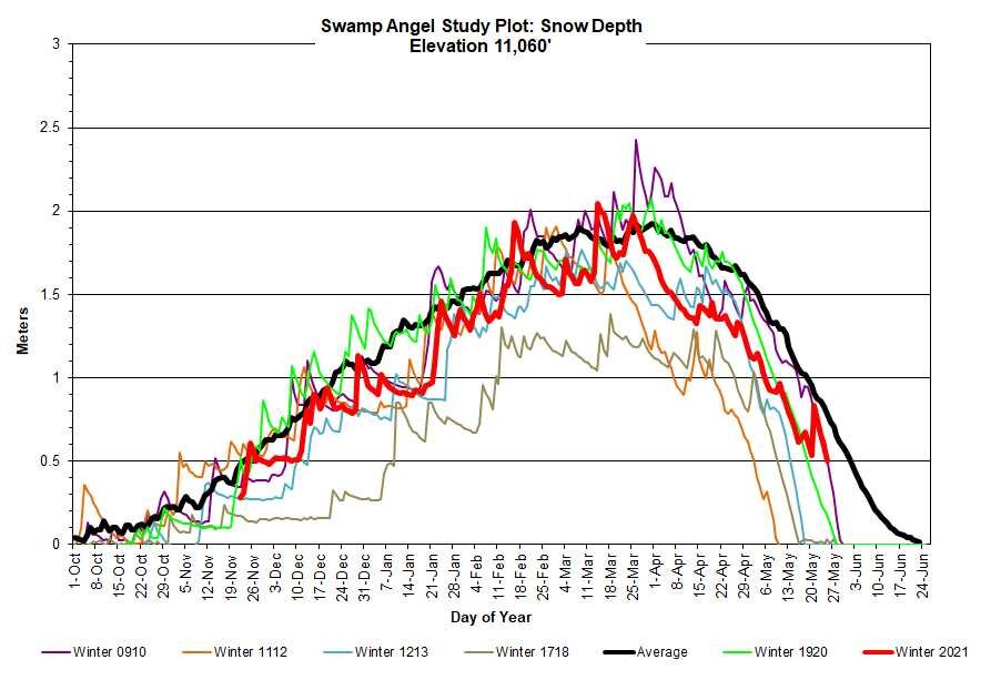
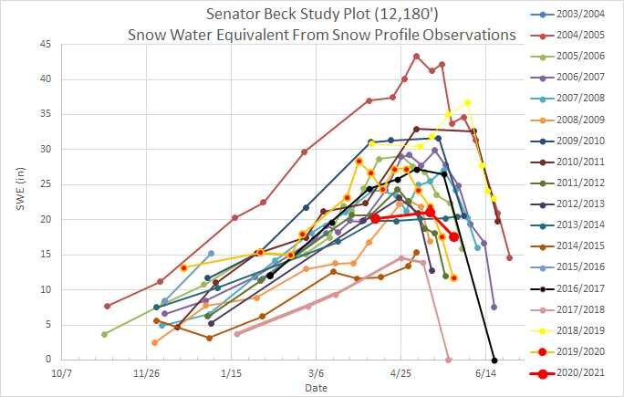
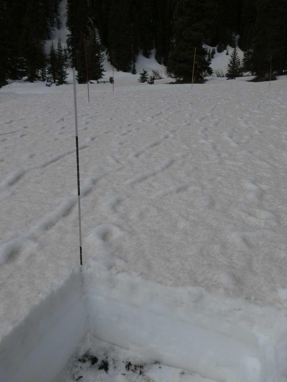
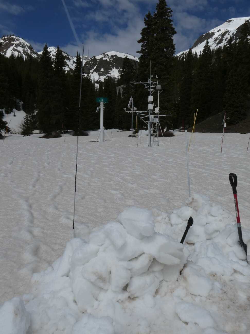
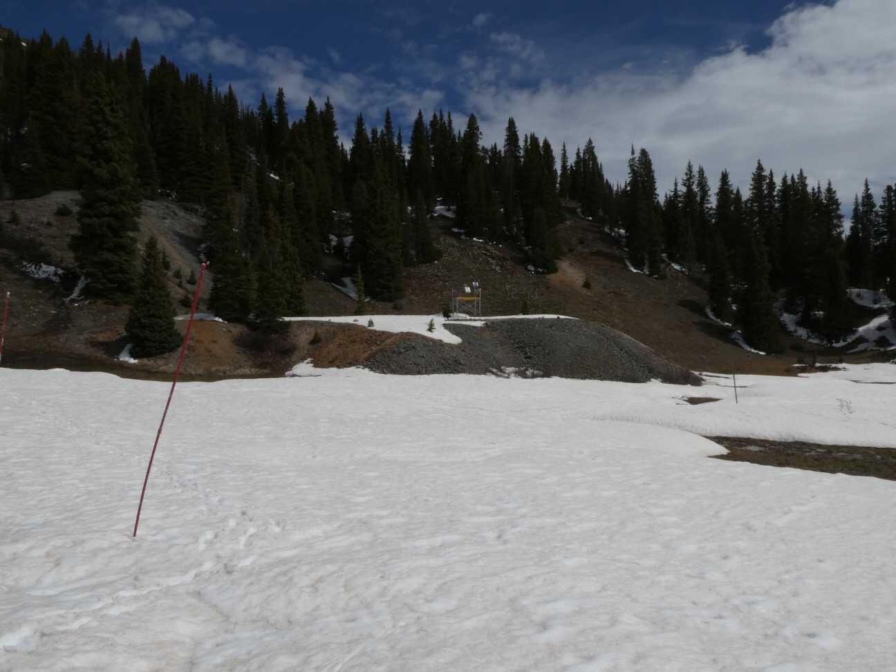
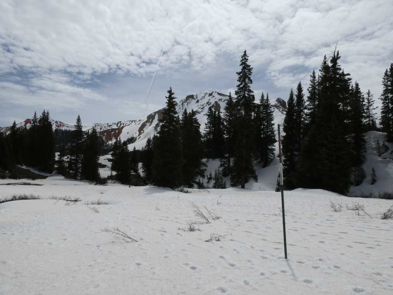
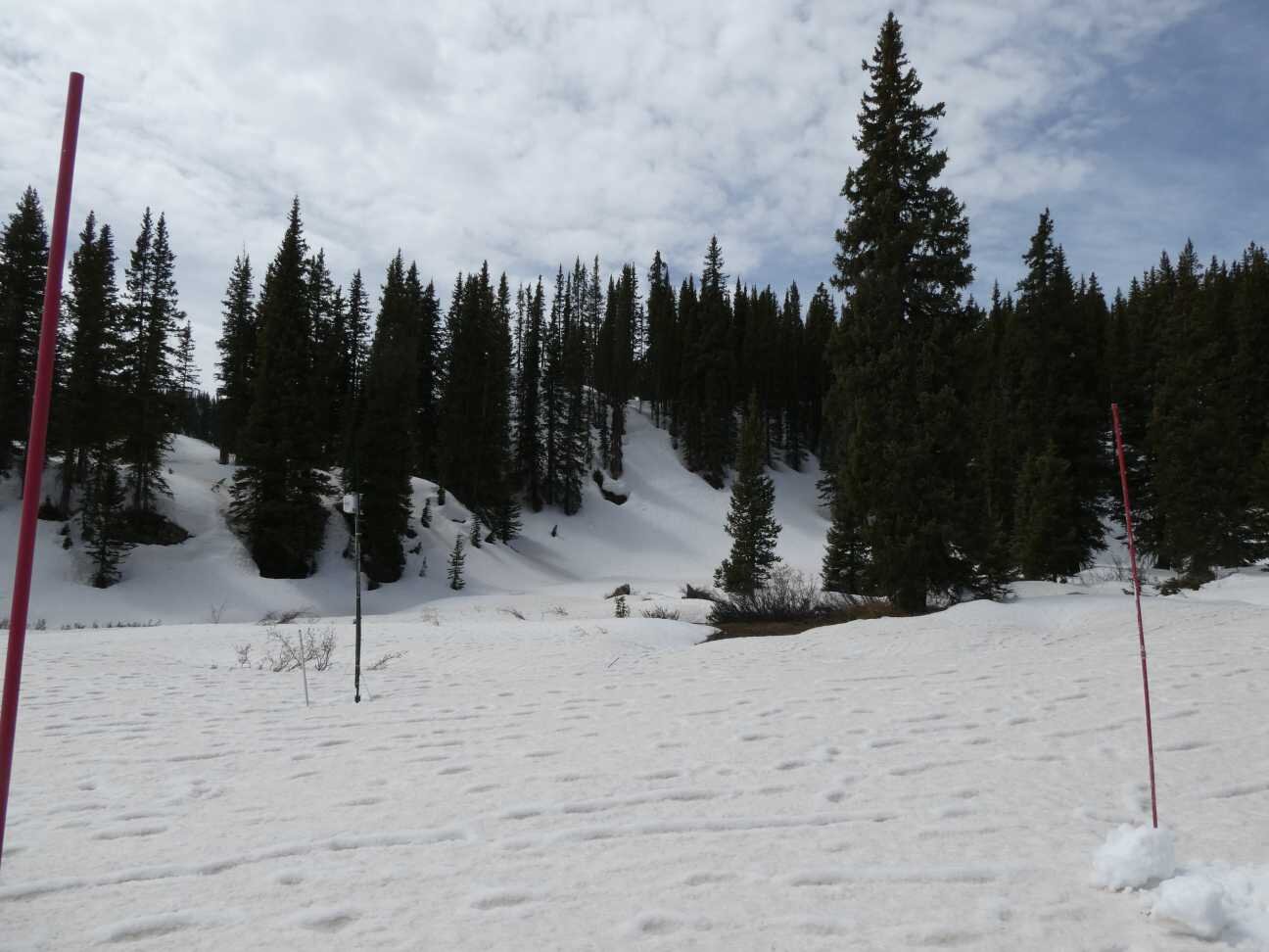
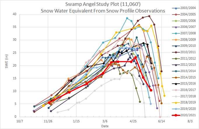
Observations at Swamp Angel (11,060’) on May 26 showed a remaining 1.9’ of snow as 10” SWE while nearby Red Mt SNOTEL also reported 10” SWE. At the Senator Beck site (12,200’) snow depth is 3.2’ with ~17.6” SWE. The dust storm that came through Southern Colorado May 22 was a dry event, no accompanying precipitation, with high sustaining winds throughout the day and evening which resulted in the plentiful dust to accumulate in natural eddies of the landscape. In the high country where snow exists, some areas may be nearly black with dust while other areas are just considerably dusty.
We are going into the last couple weeks of the bulk of snowmelt and peak streamflow timeframe (some streams have already peaked). With the pretty heavy dust in central/southern Colorado all at the snow surface and it being late May we can expect to see melt rates in the 1” - 1.5”/day realm if afternoon storms do not put the kibosh on it. Some higher elevations (headwaters near SBB and S Platte come to mind) have held onto snow a little longer than expected this spring (even though it still is below normal), mainly due to a few timely storms in latter May. The weather yesterday at Red Mt Pass was cool and largely high overcast – not a heavy snowmelt kind of day. Today looks to be sunny with a chance of precip. The forecast is bringing back better chances of precipitation in the mountains this coming week. If the result is not significant precip then maybe it will translate to periodic cooler conditions, the forecast is for mostly above normal temperatures.
Take Care
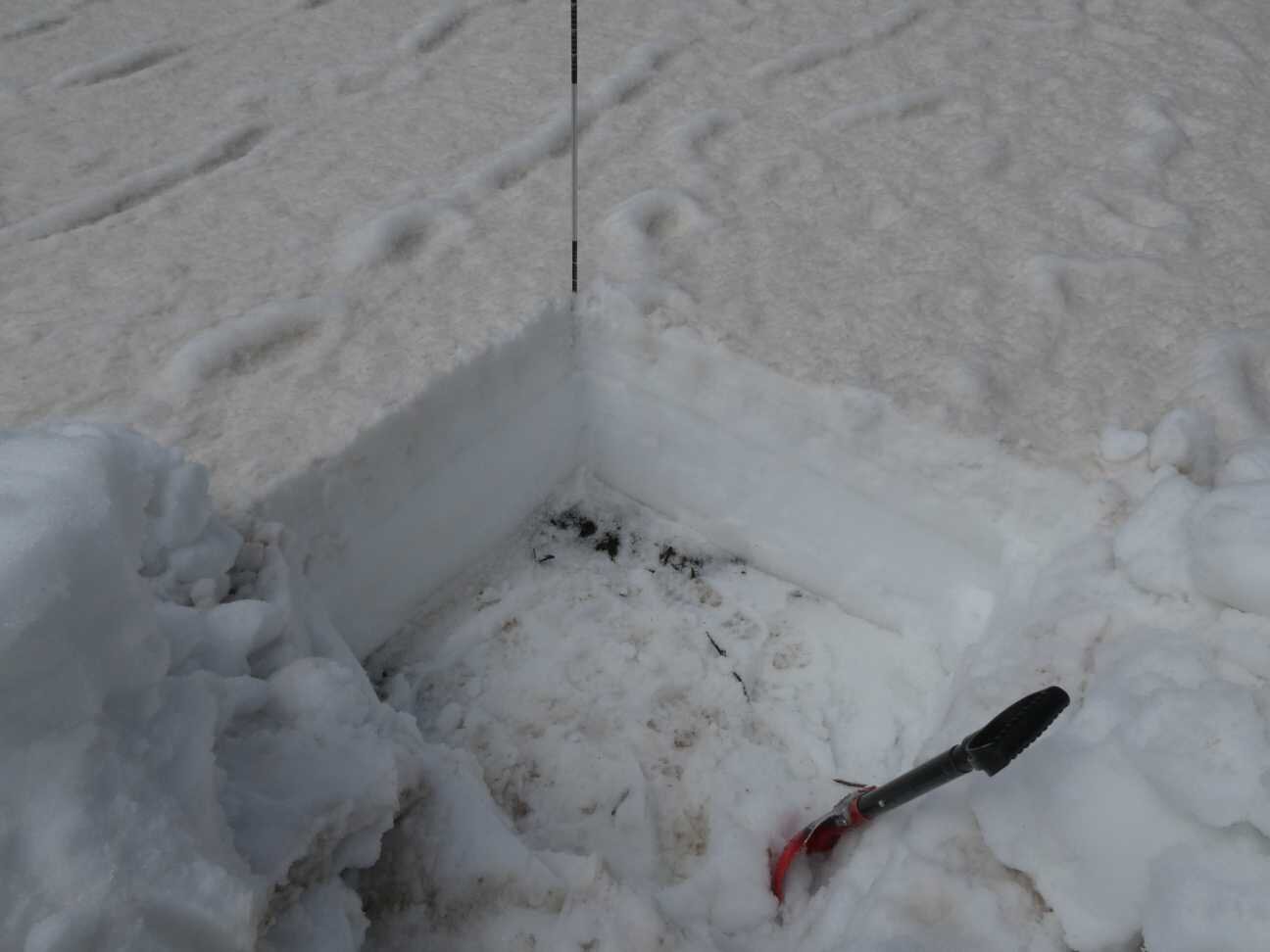
Below: Dust event #7 was a pretty heavy dry event that got blown around the landscape and collected predominantly in eddies, although its addition to the already existing merged surface dust everywhere is apparent.
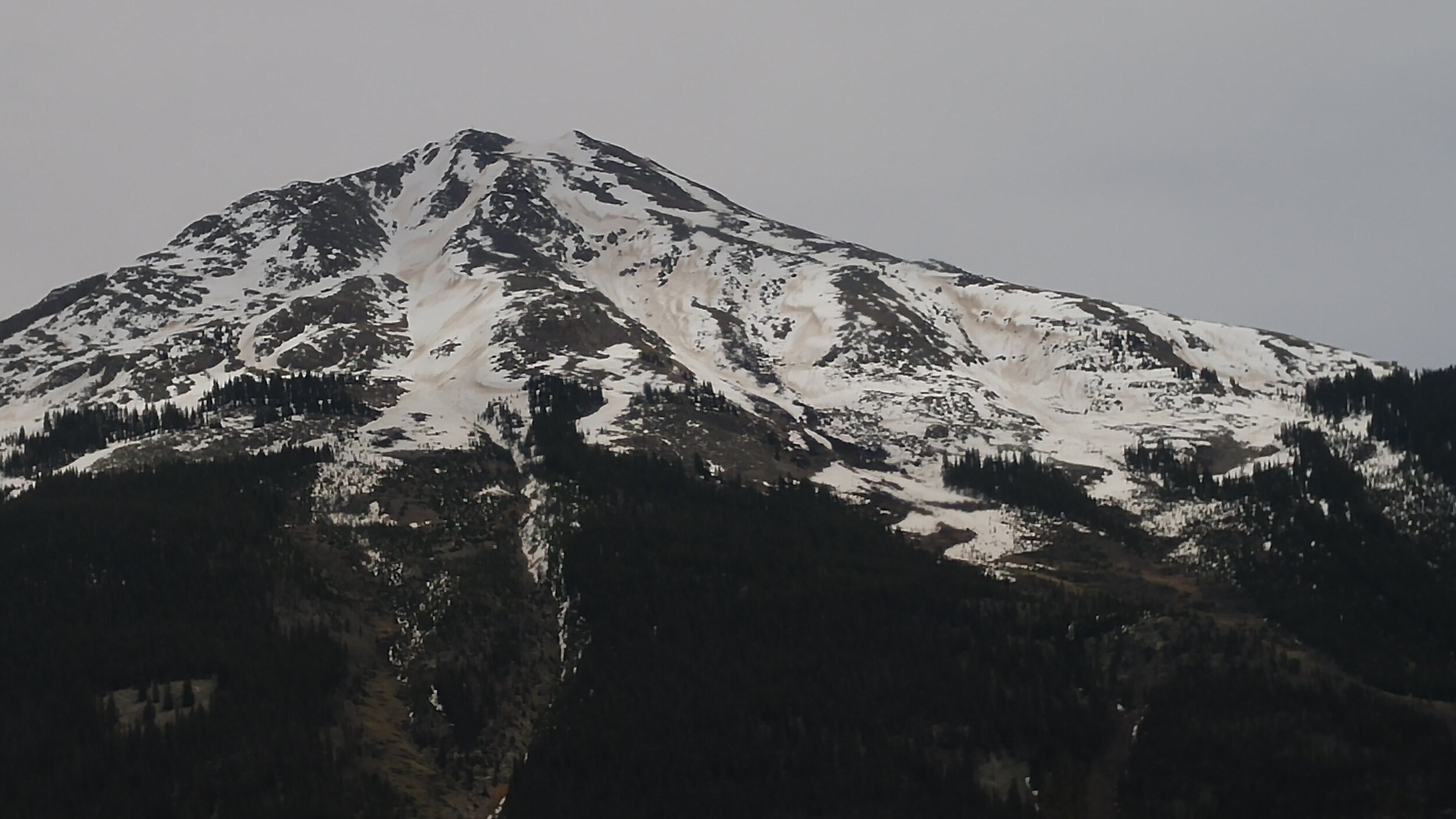
Below: A nice picture taken by Robert Stump at Yankee Boy Basin on May 22 during extremely high winds that later that day brought widespread dust. The wind stripped the top 2-4” of snow from Fridays storm to reveal the season’s merged dust underneath. This photo was taken before the dust event on the same day.


Below: A big day Friday delivered 2.5” precipitation provided a boost of water and a temporary albedo reset. Albedo from the ensuing new dust and existing dust quickly plummeted over the last couple days. The forecast lends me to think albedo will likely mostly stay low and snowmelt to increase overall, maybe with some blustery timeout days later next week.