CODOS Update June 3, 2021: Snow Near Gone at SASP, High Elevation Melt to Follow
Greetings from Silverton,
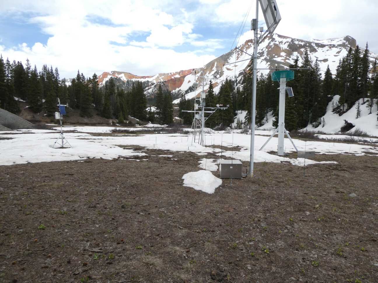
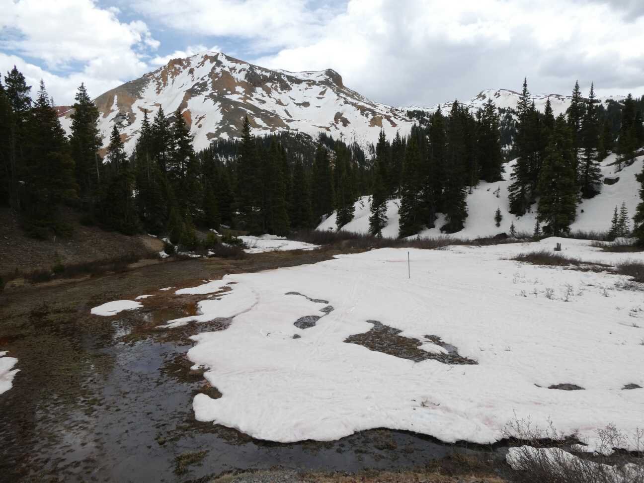
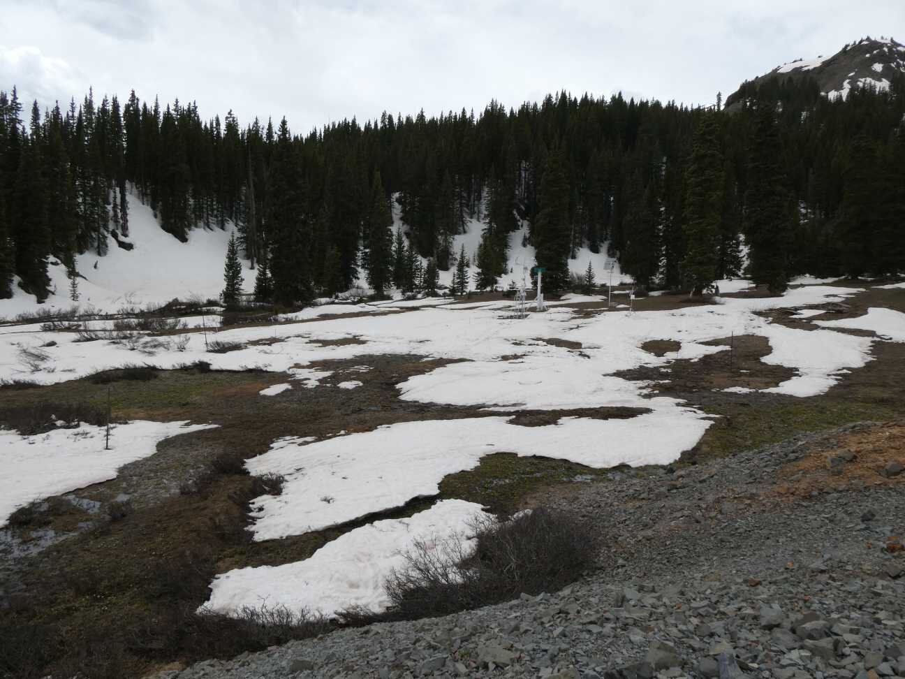
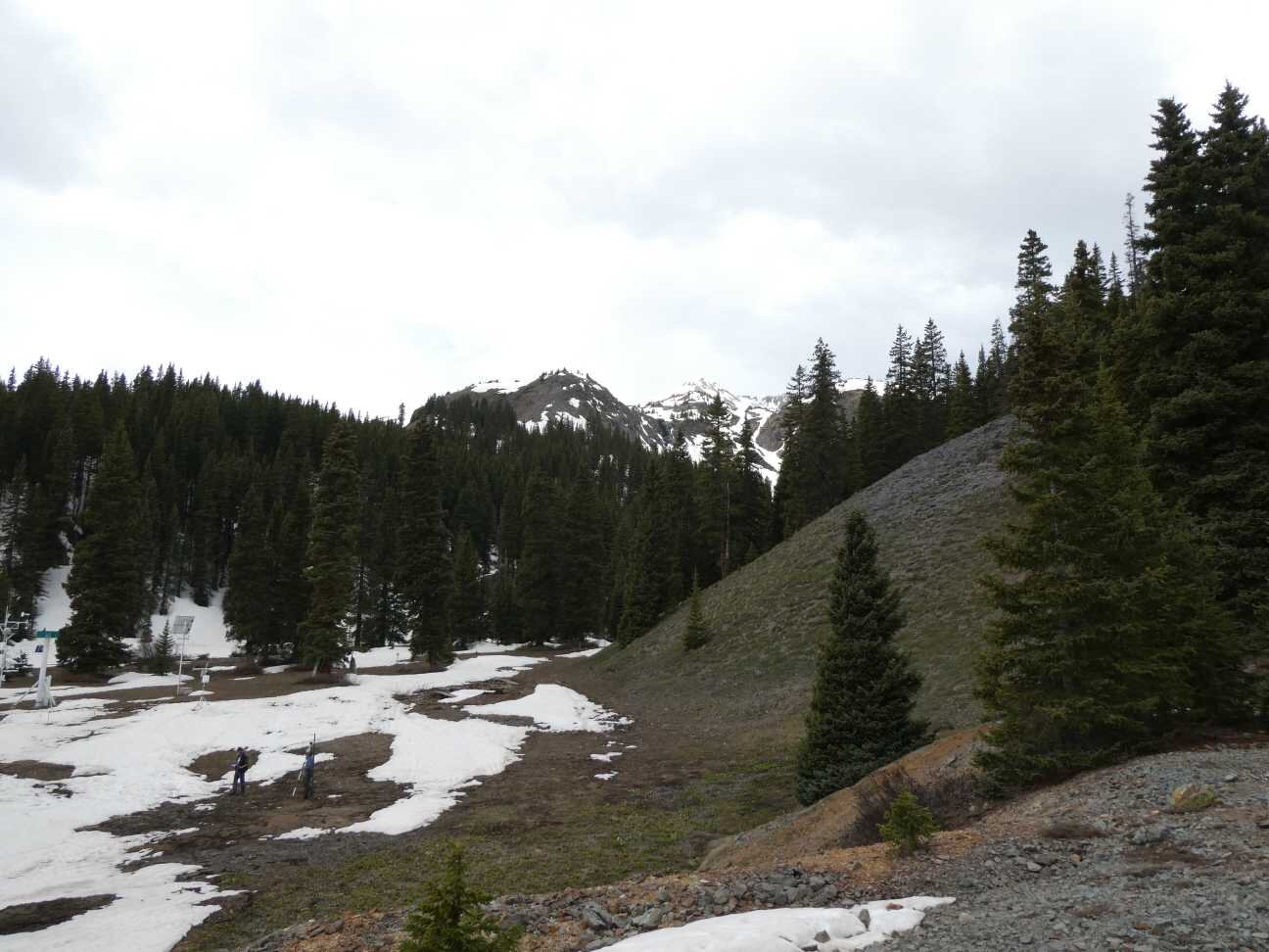
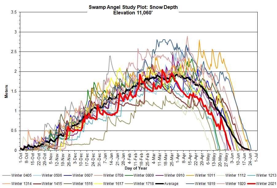
Snow is nearly gone at Swamp Angel (11,060’) but this elevation band is not entirely out of the snowmelt ball game. There is still snow mainly on northerly, treed covered aspects (see pictures below). Since the last update the weather has been pretty consistent, namely there has been a period each day that is cloudy/overcast/coolish. That, and a couple storms about 12 days ago pushed snowmelt, and peak flows, back a bit, later than I would have guessed a few weeks ago. One mile away, Red Mt SNOTEL over the last week shows the daily melt rate at only 0.66”/day. But when the full sunny days are there – with the help of pretty heavy surface dust – snowmelt has been over 1”/day.
Many streams near the Senator Beck headwaters (Rio Grande, Animas, Uncompahgre) had a peak discharge on May 30/31 from the melt, albeit slow, of the majority of this general ~11,000’ band of snow and have since subsided a bit.
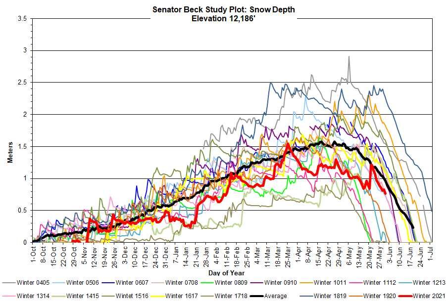
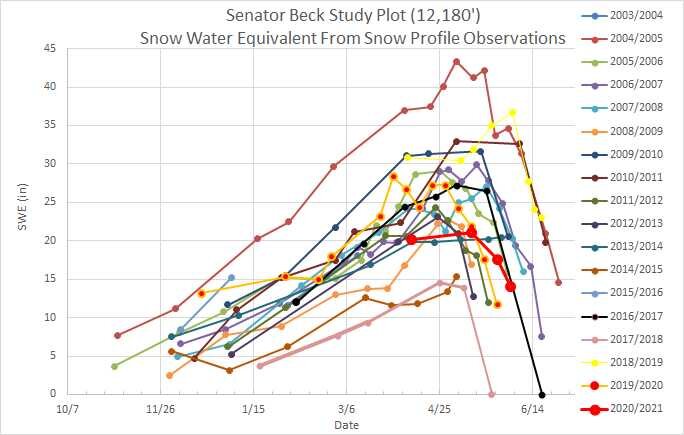
Airborne Snow Observatory flew the Animas, Dolores, and Conejos around the April 19-21 and May 16 timeframes. That effort showed the bulk of SWE in the Animas Basin, for instance, around an elevation band of 12,500’, plus or minus 600’ (see graphs below). Senator Beck Study Plot (12,200’) has held onto snow pretty well this week. Currently there is ~2.5’ snow depth and ~14” SWE. In the last 7 days it lost ~3.6” SWE. Given that Senator Beck Study Plot is in the sweet spot of this ASO measured elevation band it should be a good indicator how the bulk of meltout unfolds.
As mentioned in numerous updates these headwaters typically see peak discharges from the ~11,000’ and high alpine melt out, which one provides the actual peak of the snowmelt hydrograph depends on a number of factors (snowpack conditions, spring weather, etc). The conditions this year point to the the high elevations constituting the being highest.
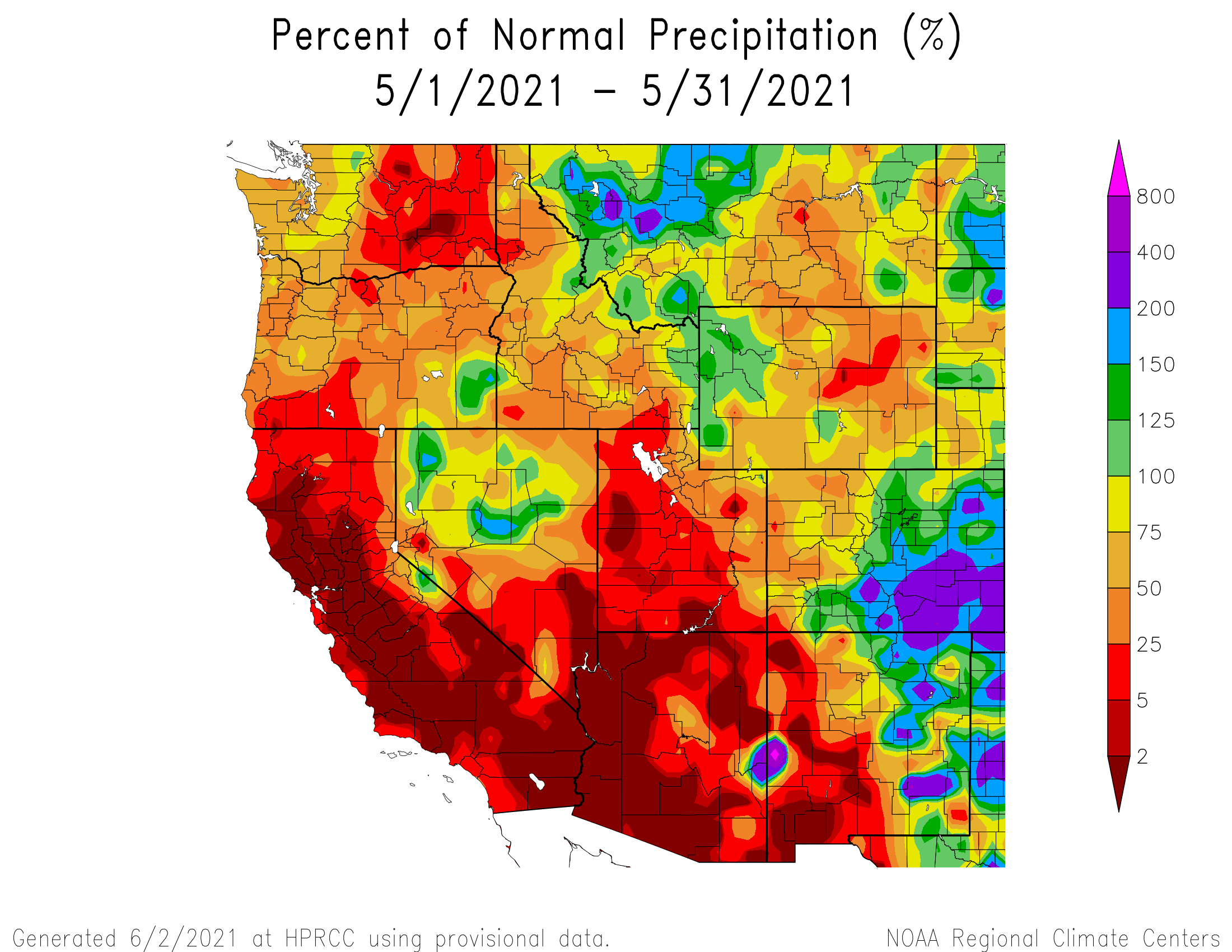
Generally, Senator Beck is pretty indicative of conditions in the region, but this season conditions seem pretty variable when looking at the SNOTEL data, such as presently Wolf Cr SNOTEL is 18% of normal and Red Mt SNOTEL is 130% (while the Rio Grande Basin as a whole fared better than the Uncompahgre/Animas Basins). SWE volumes at both SBSP and SASP are in the 25 percentile this year. Runoff volume is another discussion that comes down to sub-basin conditions such as a horrible April, not so great May for much of Western Colorado, dry soils, dust enhanced sublimation of the snowpack, etc.
Then there is the weather. The forecast calls for chances of precipitation the next four days. Temperatures are expected to be hot at lower elevations and higher than the season norms overall. Now that we are in the month of June with heavy dust-on-snow and not the best chances for precipitation there is not much keeping remaining snowpack from rapid melt. This morning the SBB stream gauge is showing a jump.
Always interesting, every year there is something to learn, or unlearn.
Take Care
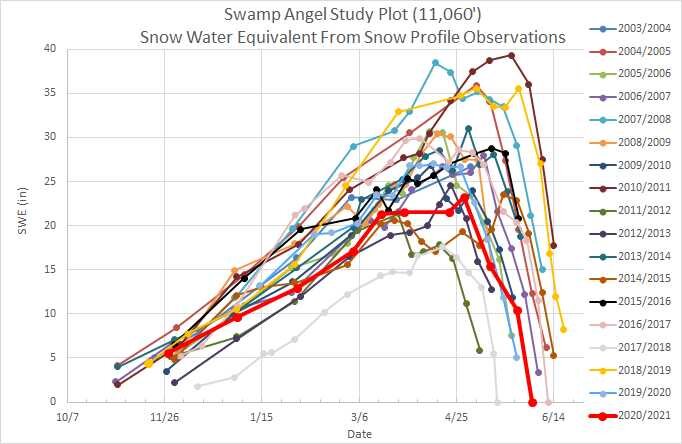
Below: Plots of snow depth and SWE at Senator Beck station and Swamp Angel. The May 20 storm delayed further depletion by around 7 days. SWE for both sites in the basin are in the 25 percentile range.
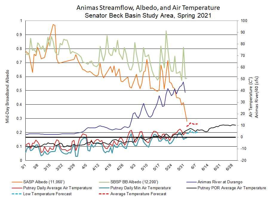
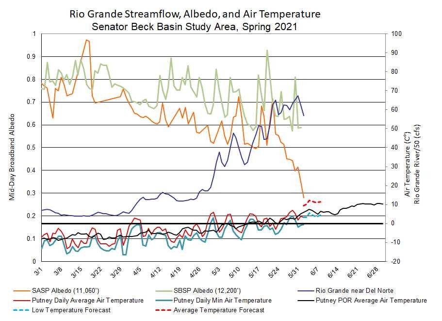
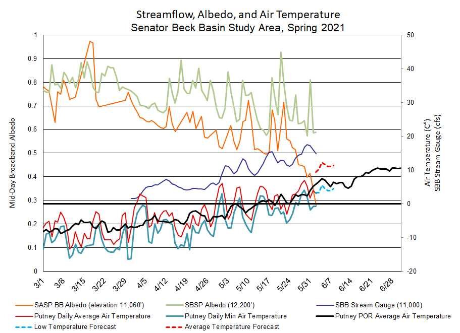
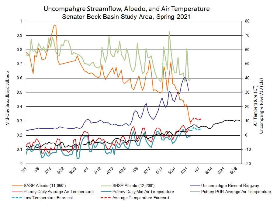
Below: Albedo at Senator Beck stations streamflow on the Animas, Uncompahgre, Senator Beck and Rio Grande. At the 11,060’ SASP station with snow gone albedo is 20-30%, the albedo of bare ground. At the higher 12,200’ SBSP site, with 2.5’ of snow still on the ground, we are seeing the albedo of dust on snow. The last albedo reset was on May 30 from a skimming of fresh snow and before that on May 20 from the big storm where it went to above 90%.

ASO measured SWE in the Animas Basin

ASO measured SWE in the Conejos.
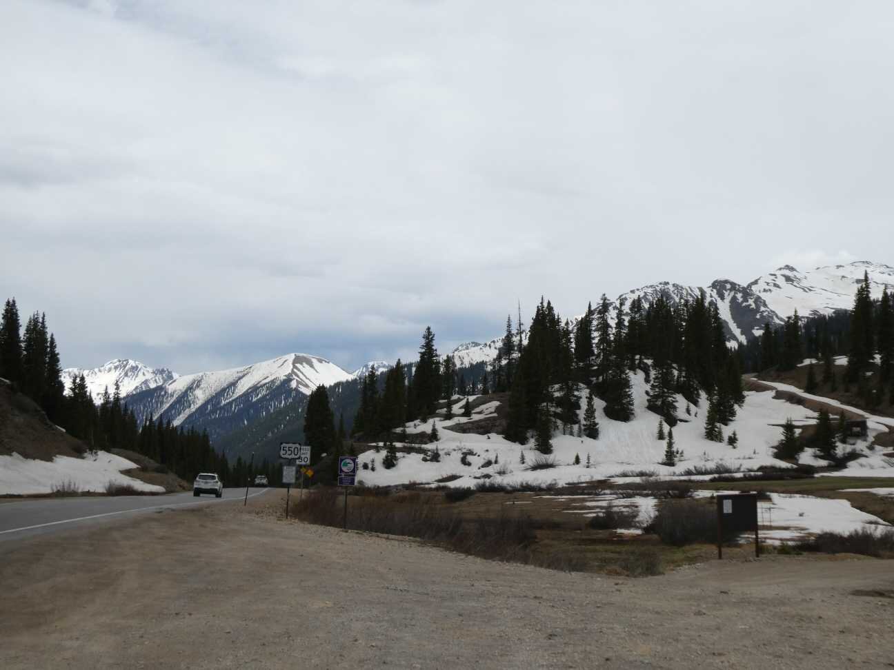
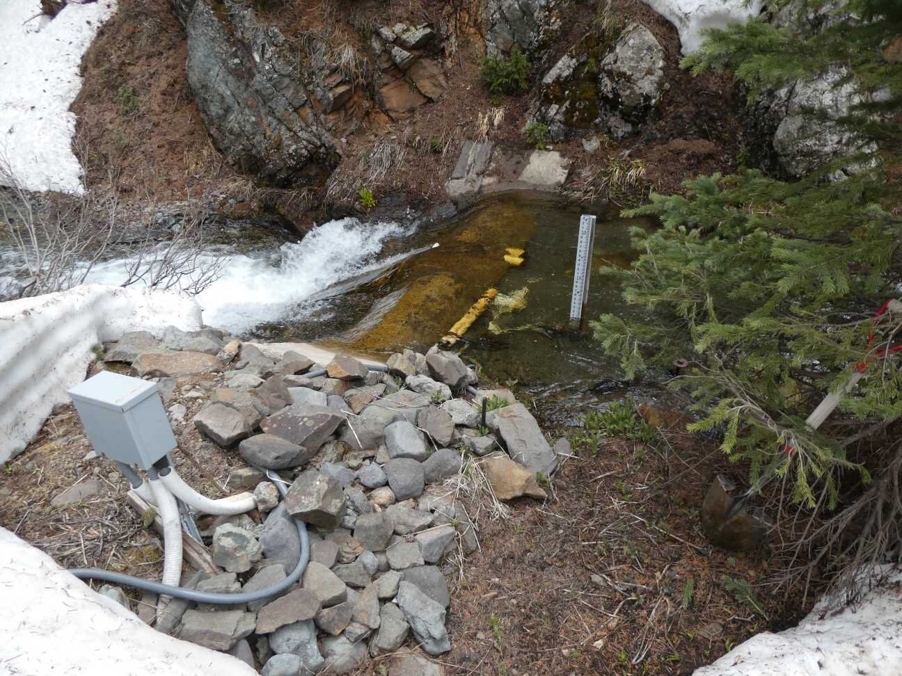
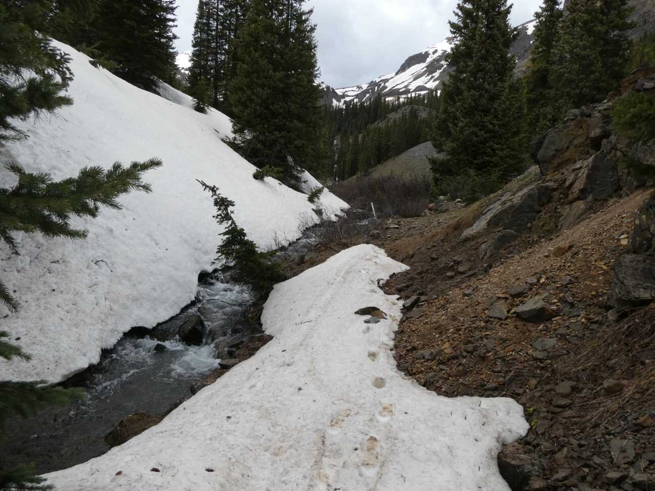
Below: Pictures from Swamp Angel on June 2.