CODOS Update MAY 25, 2026: Winter wrap-up
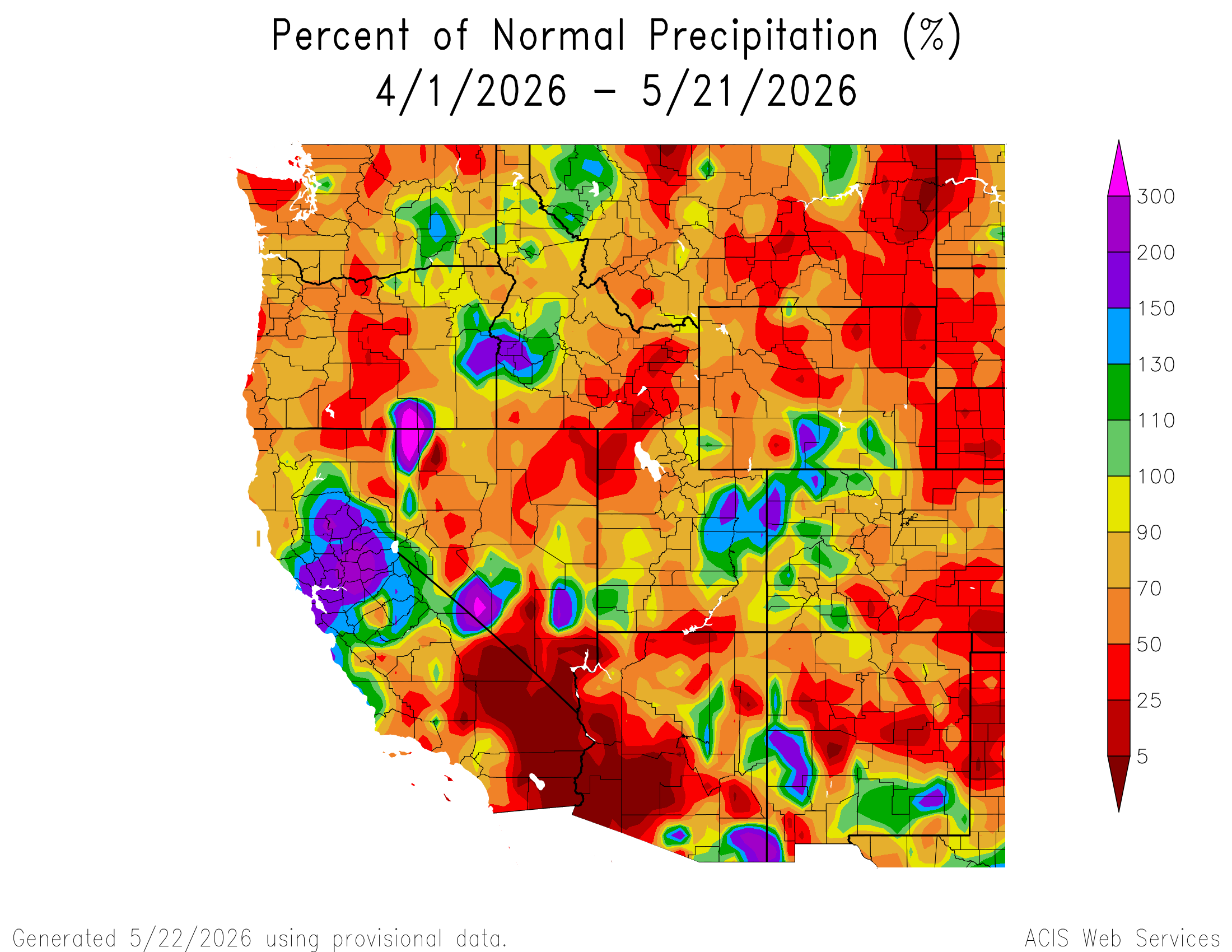
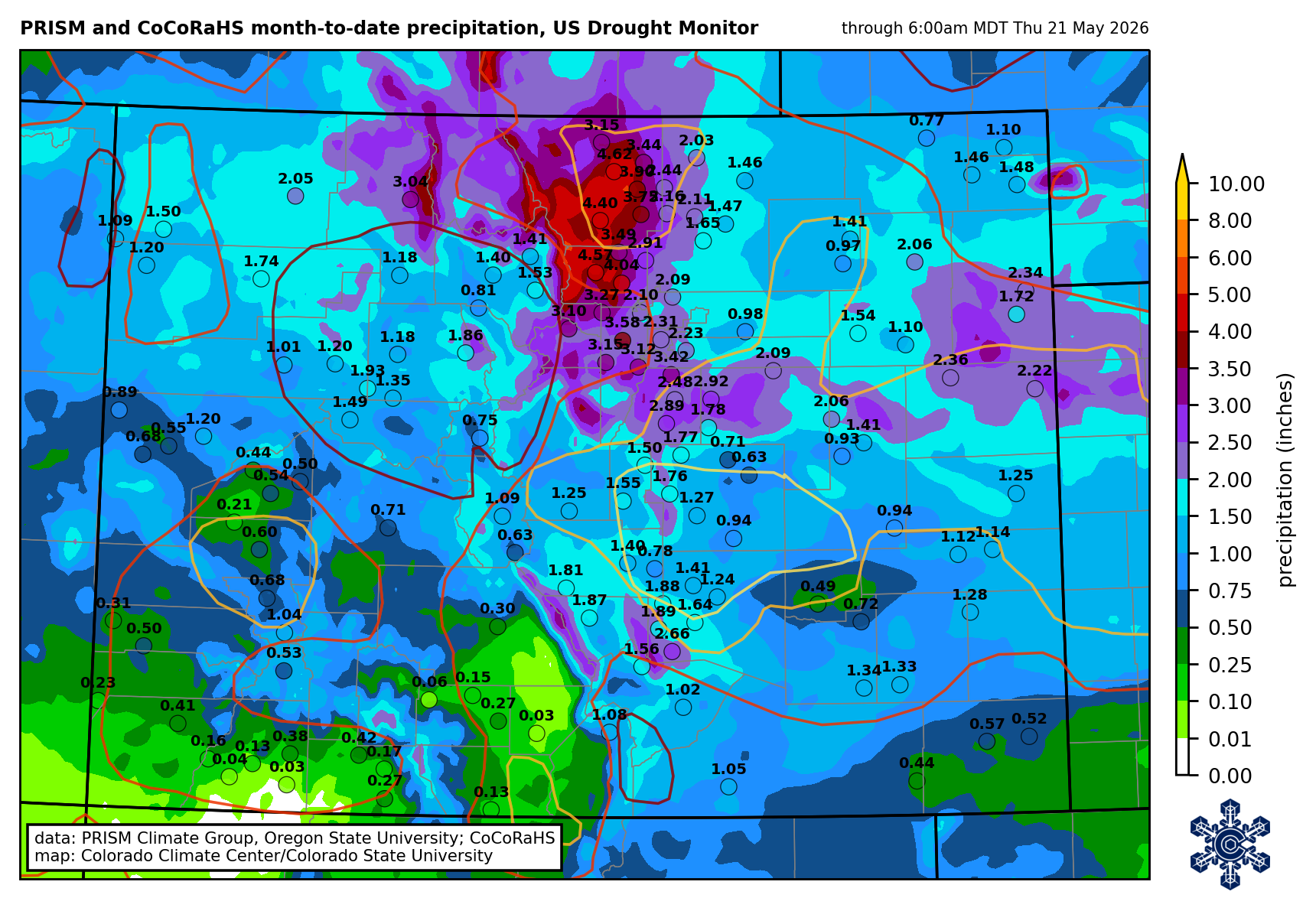
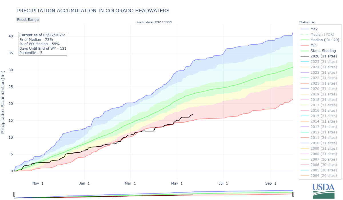
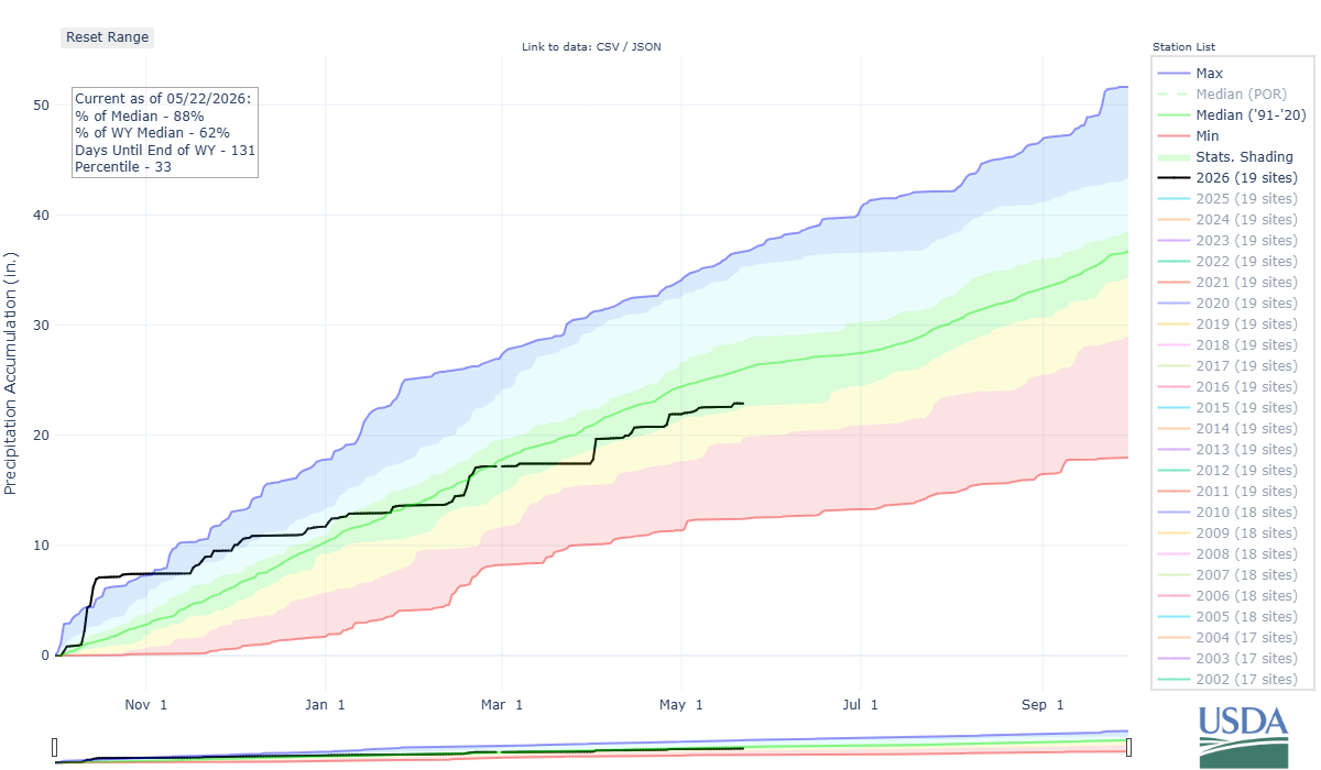
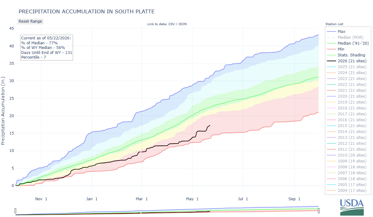
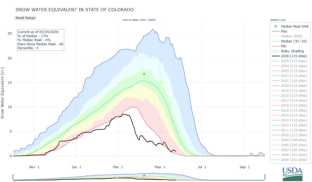
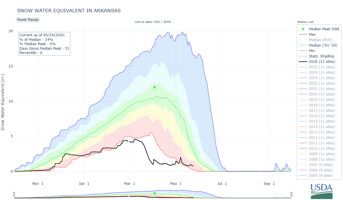
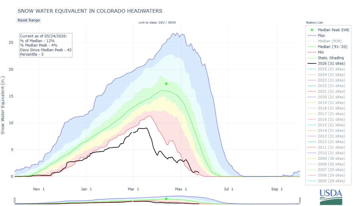
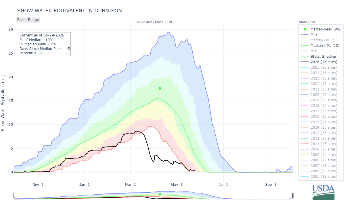
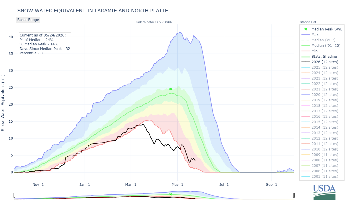
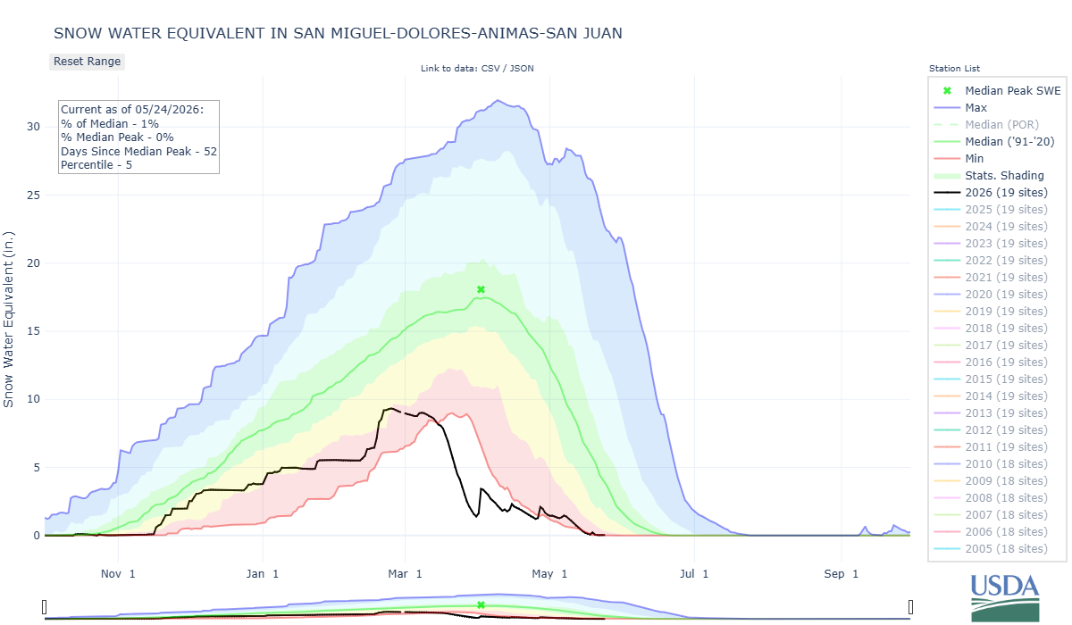
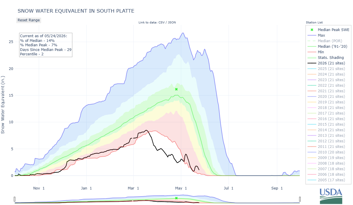
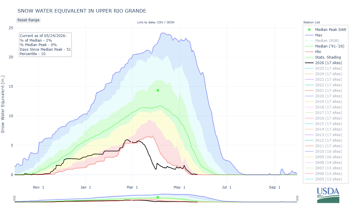
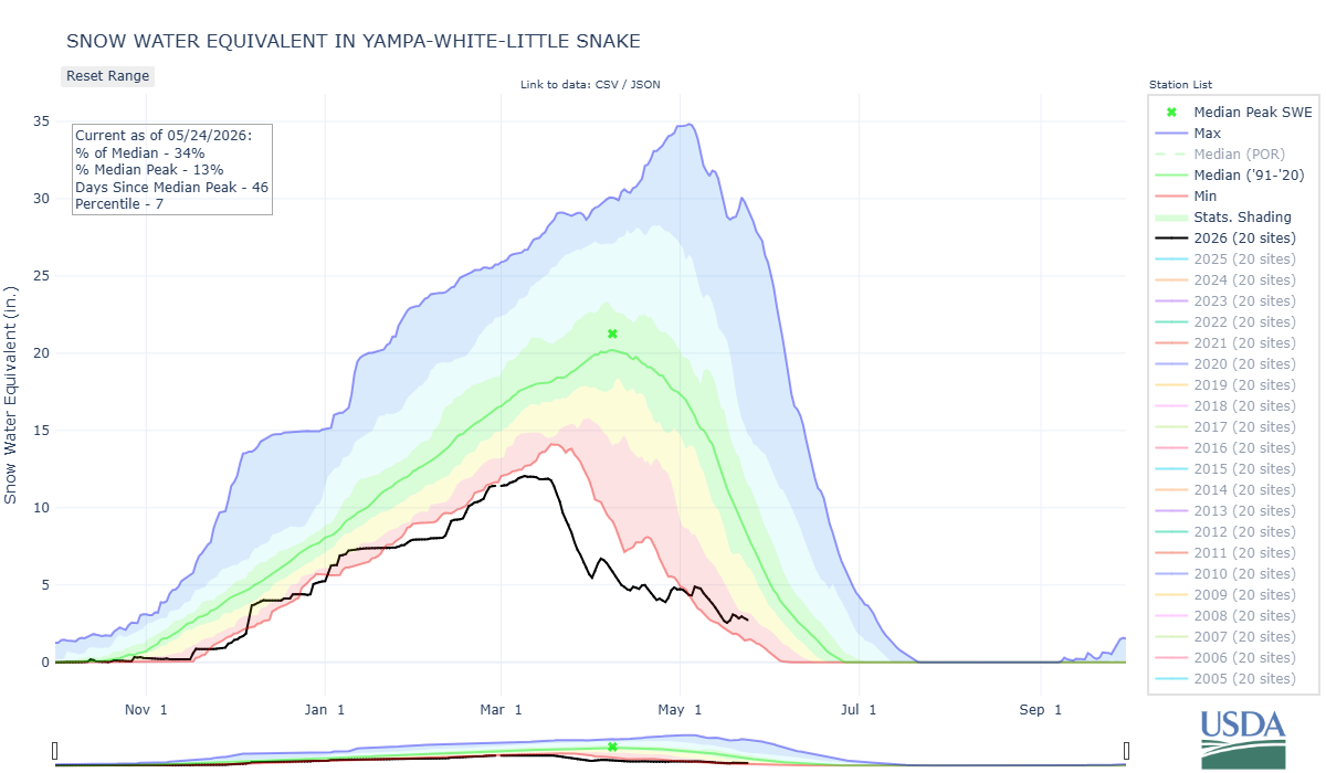
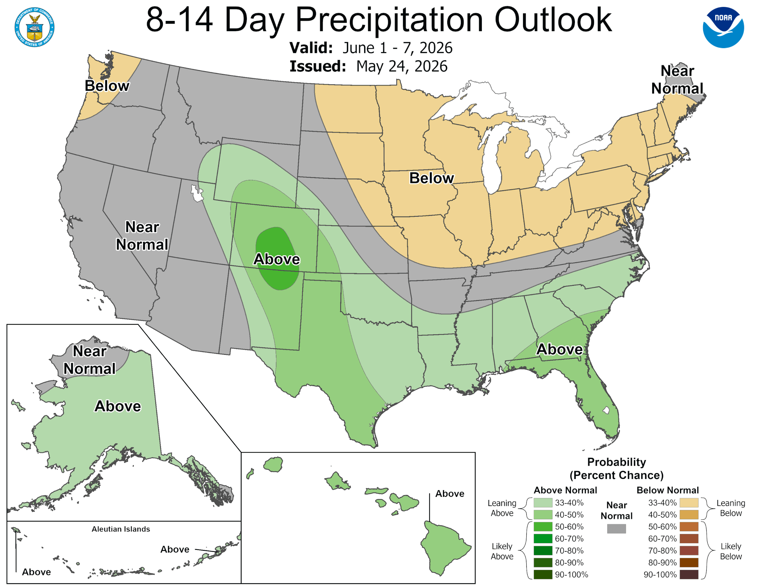
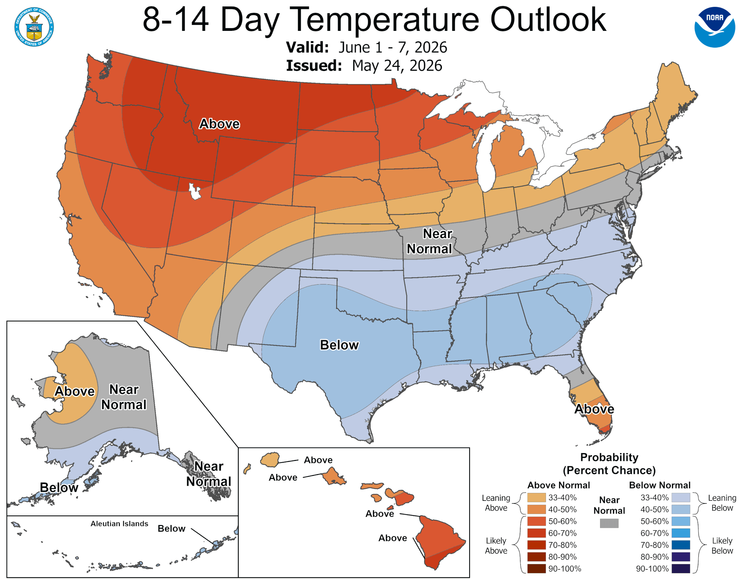
The closer to normal precipitation since April has been very welcome. The way things were going the end of March it seemed winter was just ready to call it quits. The periodic precipitation added a bit to the remaining snowpack, soil moisture (many locations the wet snow fell on the ground having already lost the season’s snowpack), and slowed melt. Please see plots below.
Dust-on-Snow Recap: It was the lightest dust-on-snow winter in our record books. We did not have a real discernible dust event or dust layer in the snowpack at Swamp Angel and very lite dusting at Senator Beck station. A storm carrying dust on March 21 swung around, missing the San Juan’s, and hit Grand Mesa and the Roaring Fork region making for a distinct dust layer in the snowpack. Very mild dust was also observed at the Front Range sites. The Rio Grande Basin was similar to Senator Beck but with a noticeable dustier surface the end of March, likely from more local sources. Given that we typically receive around seven dust events on average and dust layers are a common sight in and on the Colorado snowpack is another reason this season is so very unique. We will drill down on this subject in our end of season summary which will available this summer.
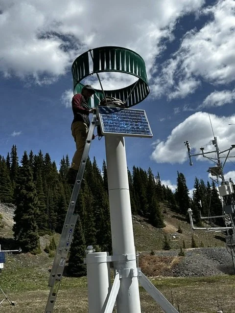
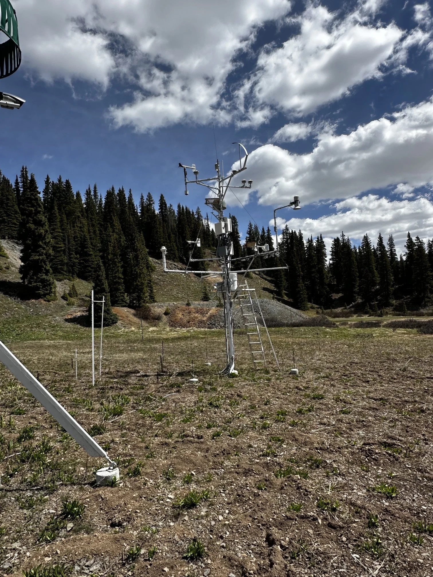
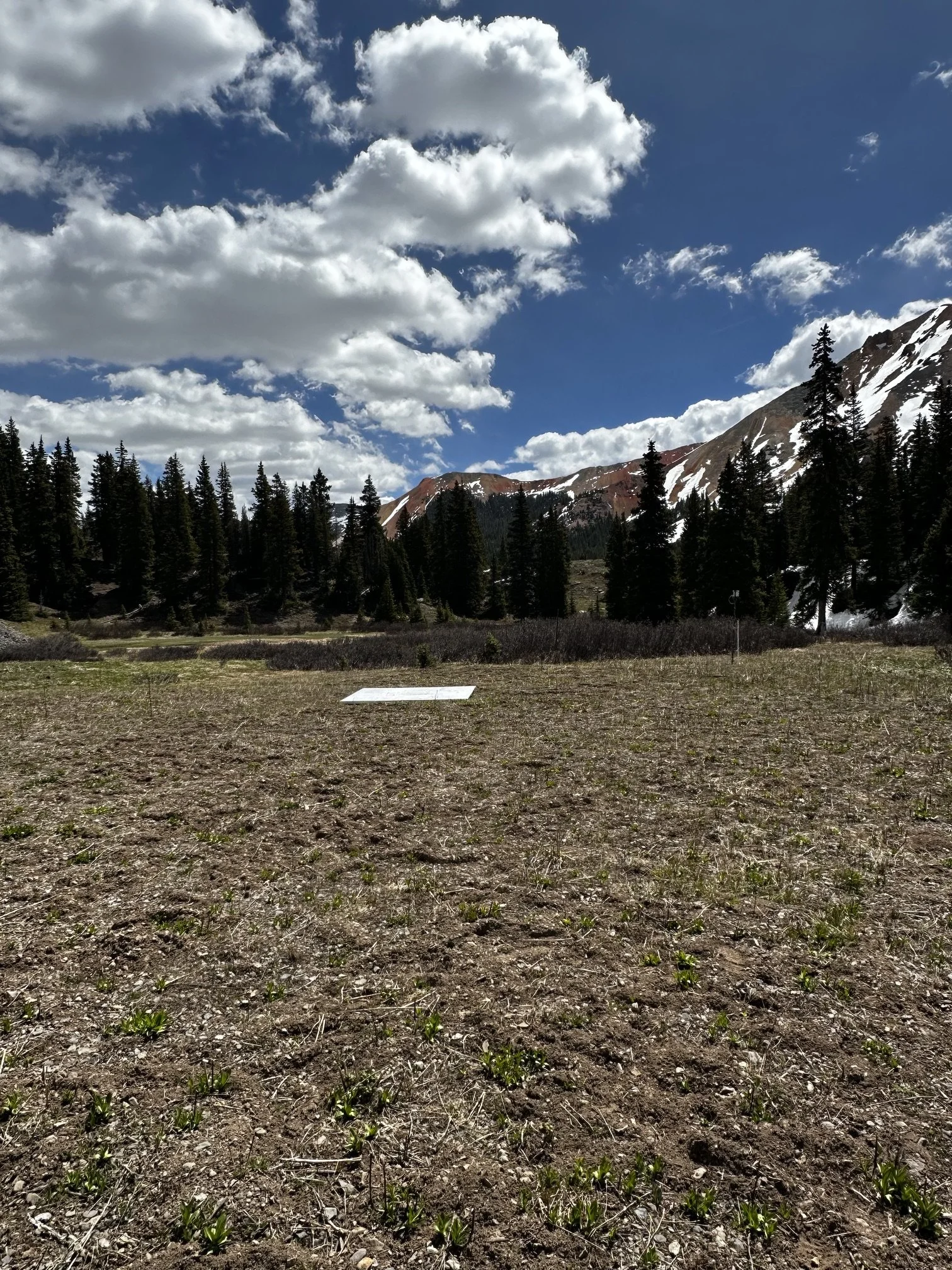
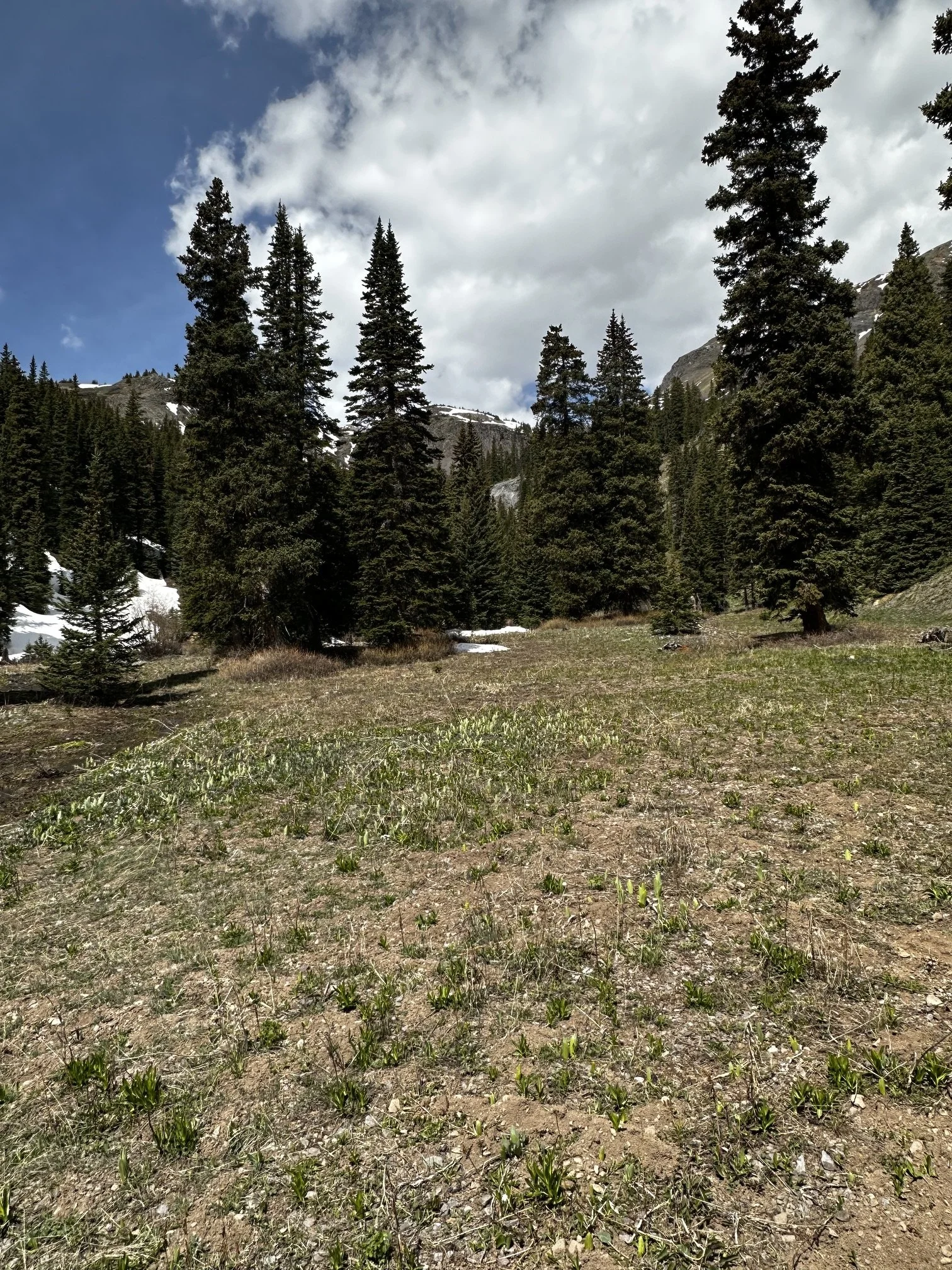
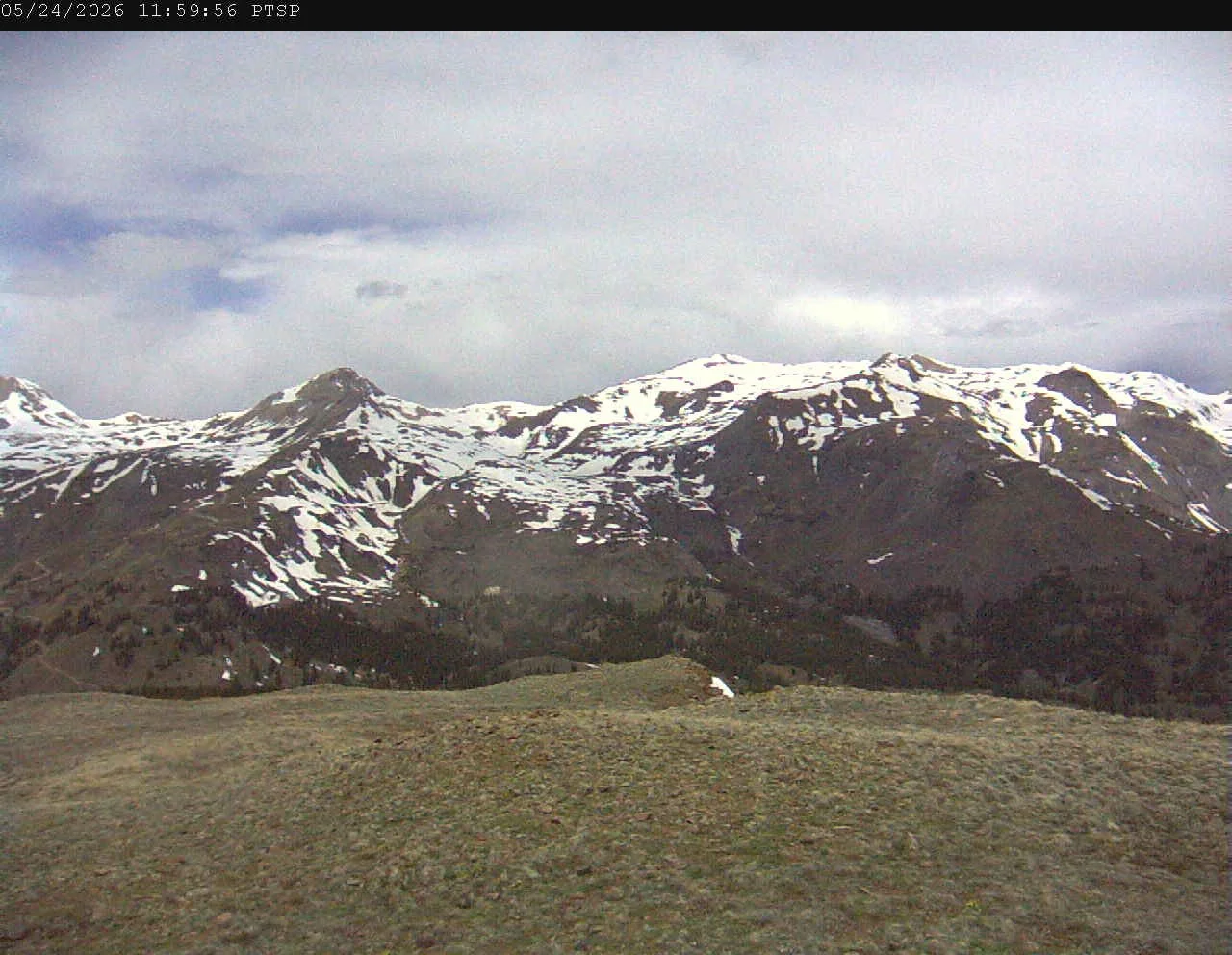
Below: We were at Swamp Angel Thursday, May 21, 2026 to do station maintenance, about a month ahead of normal. Around the 11,000’ and higher there is a little snow remaining on treed north facing aspects. Our stream gauge isn’t seeing the action it typically does this time of year either.
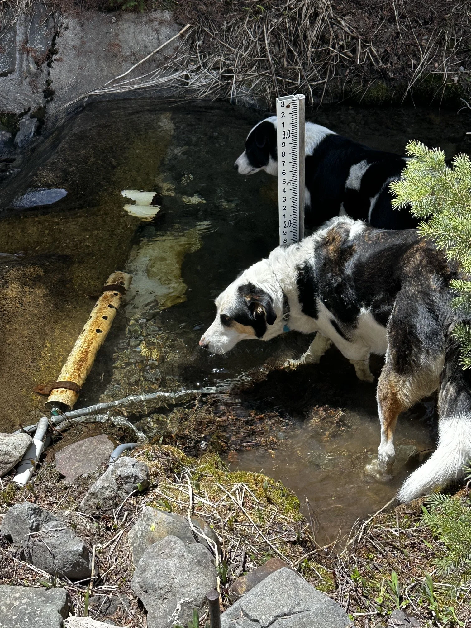

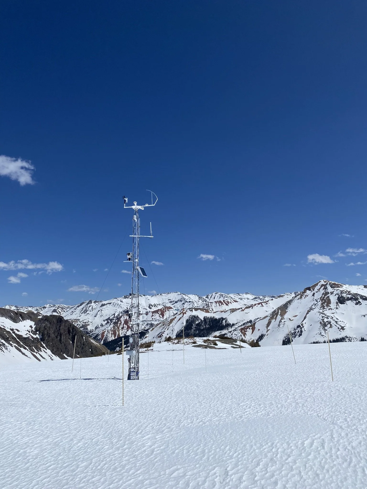
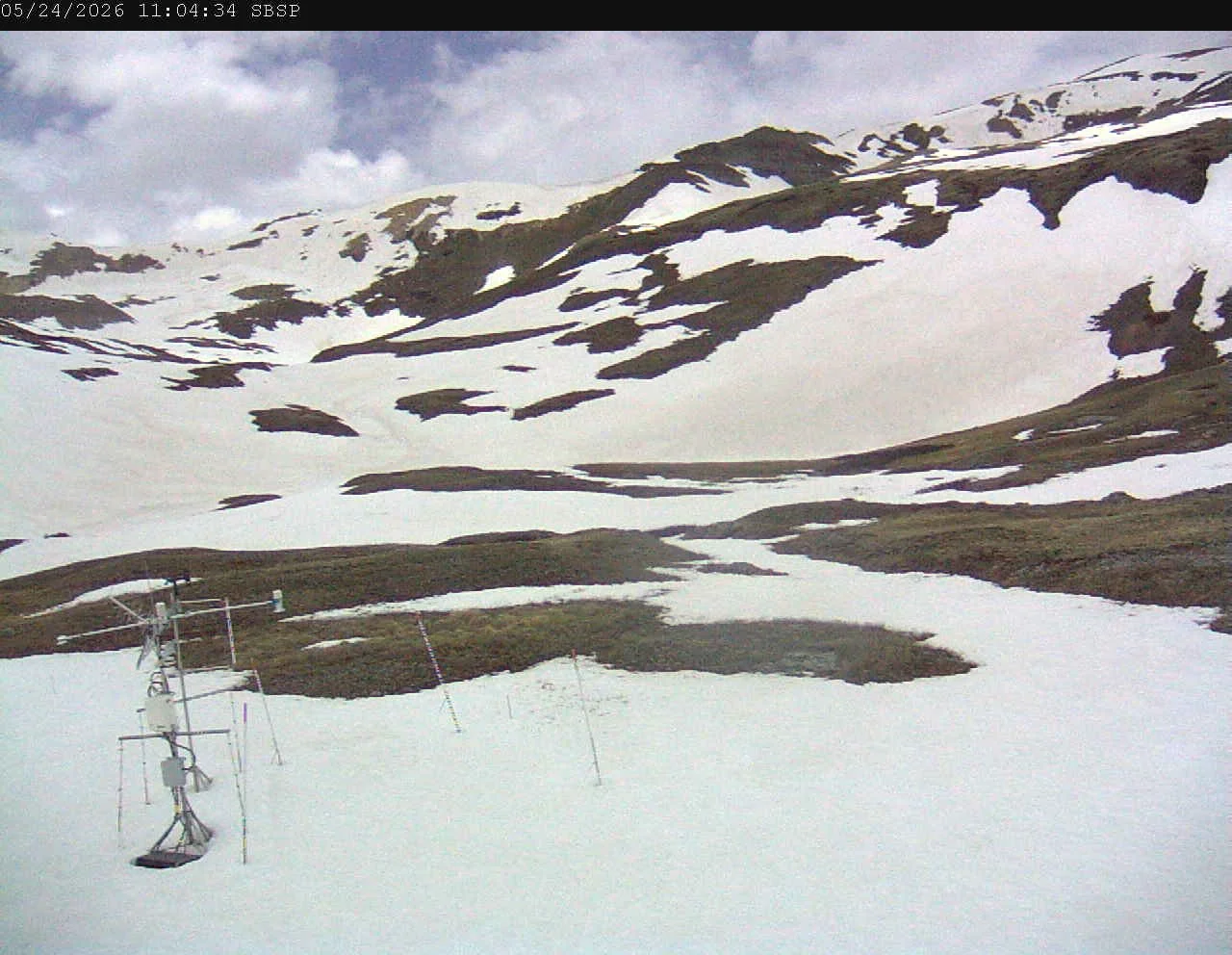
Below: Senator Beck station has ~10 cm under the snow depth sensor. There is 20 cm more snow on the USGS snow scale (left picture). Our stream gauge is showing a very slight increase due to the higher elevations increasing melt.
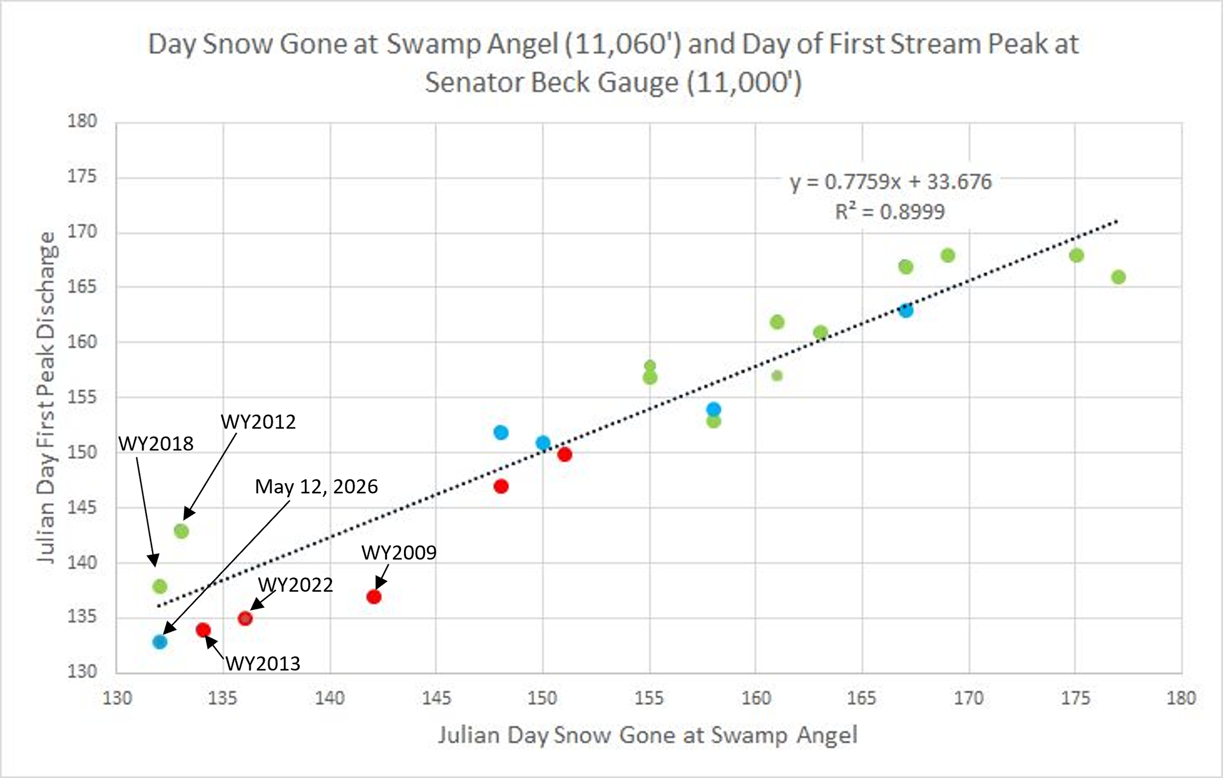
Below: For a few southern basins we discuss often the relationship of melt-out at certain elevation bands and spikes in streamflow. In extreme years almost anything can happen, you have to expect any reliable process or relationship that you would see during a normal year to breakdown. It was a little surprising to see the relationship this spring hold to within a day between melt-out at Swamp Angel (11,000’) and streamflow peak. We saw one of the earliest melt-out dates at Swamp Angel in our record and earliest peak, occurring May 12/13.
This is a unique year for our dust-on-snow record books. The red dots are “high” severity dust years, green dots are “average”, and blue are “low”. WY2026 we saw very minimal dust deposition (lowest in our POR) but extreme dry/warm conditions lead to the streamflow surge late March, and after a few spring storms extended winter a few weeks, the snowmelt peak occurred May 12/13 (most streams in Colorado show this late March surge and peak May 12/13ish). WY2018 was also extremely dry and dust conditions were “upper-end-of-average”. WY2009 was a notorious severe dust year. WY2022 was a dry spring and dusty. WY2013 was a dry all season and dusty. Seeing a blue dot in the lower left corner is alarming.
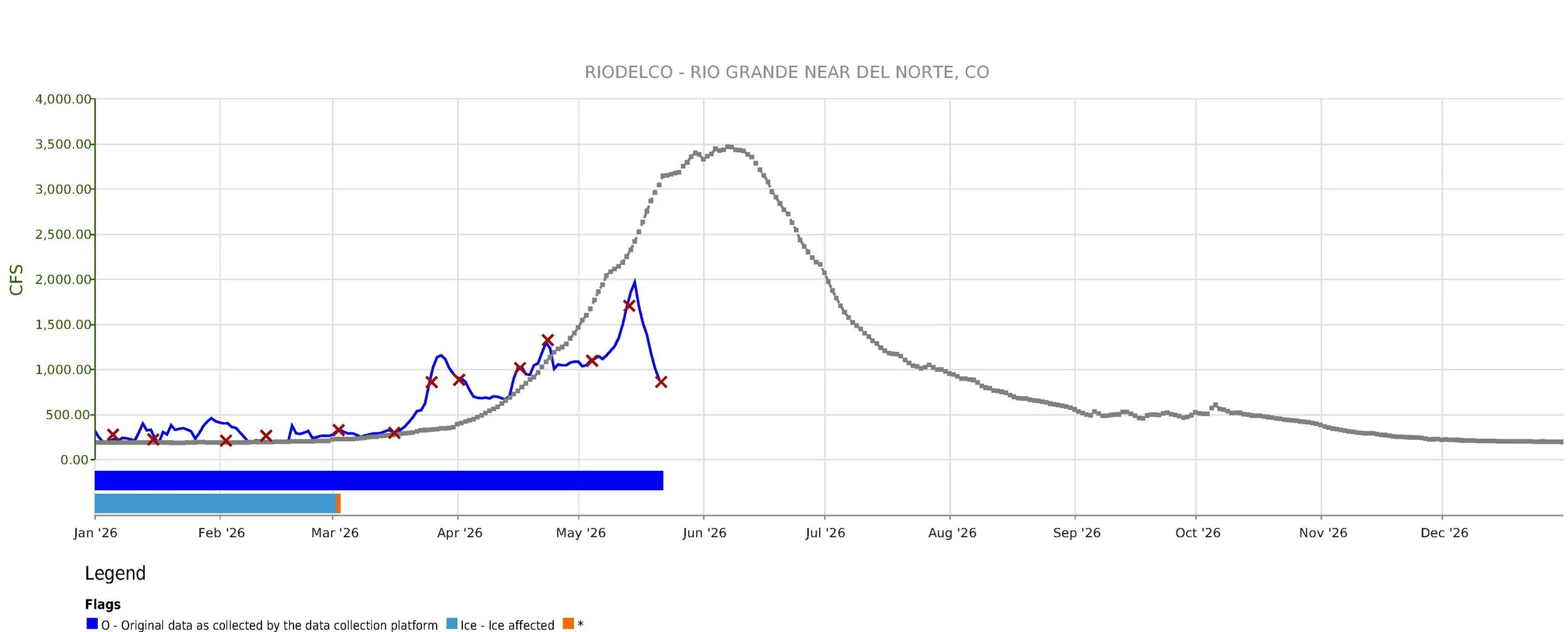

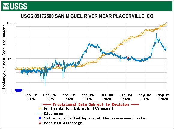
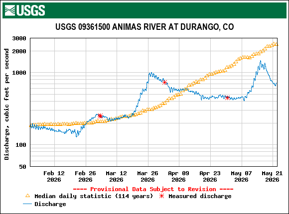
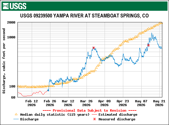
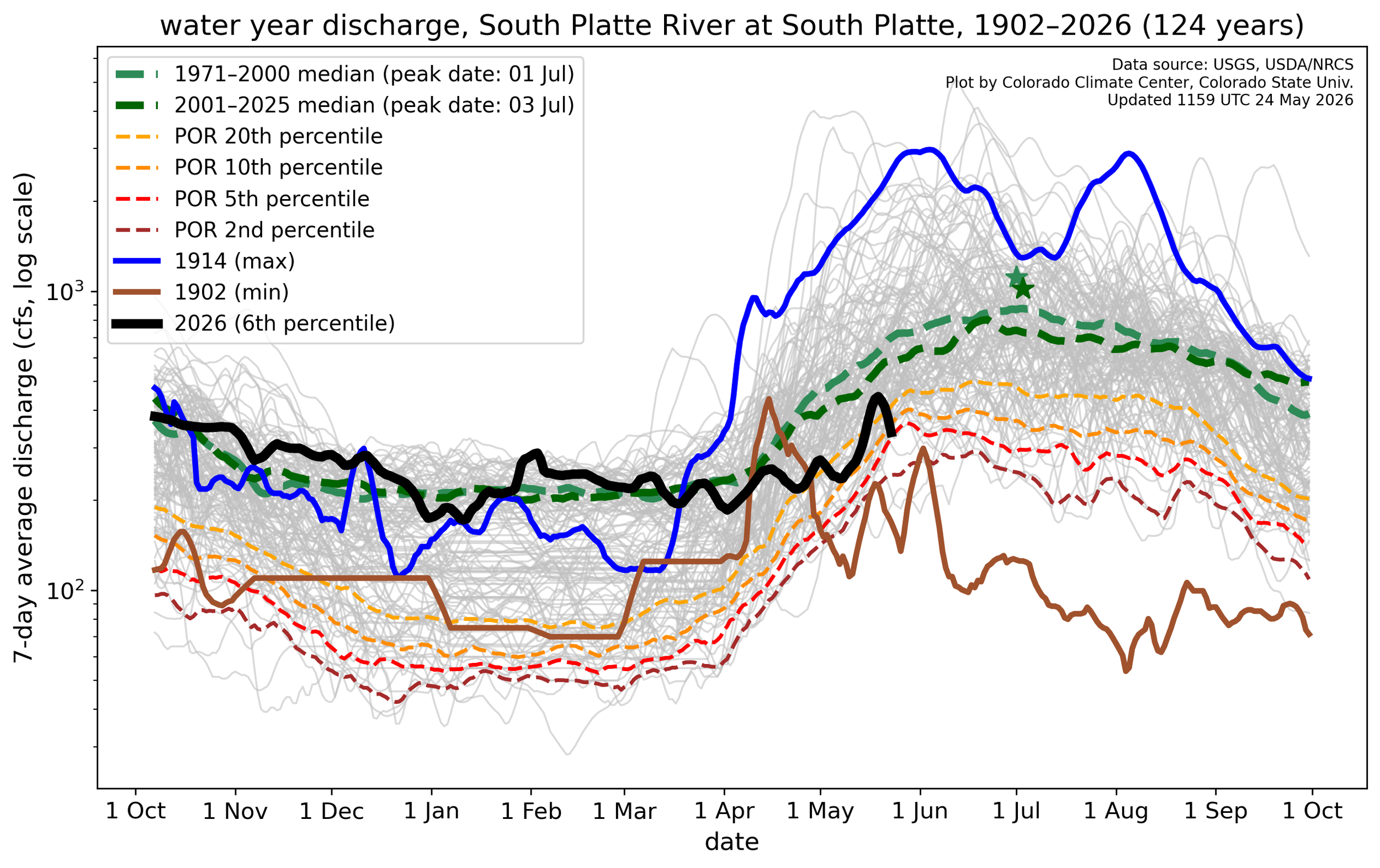
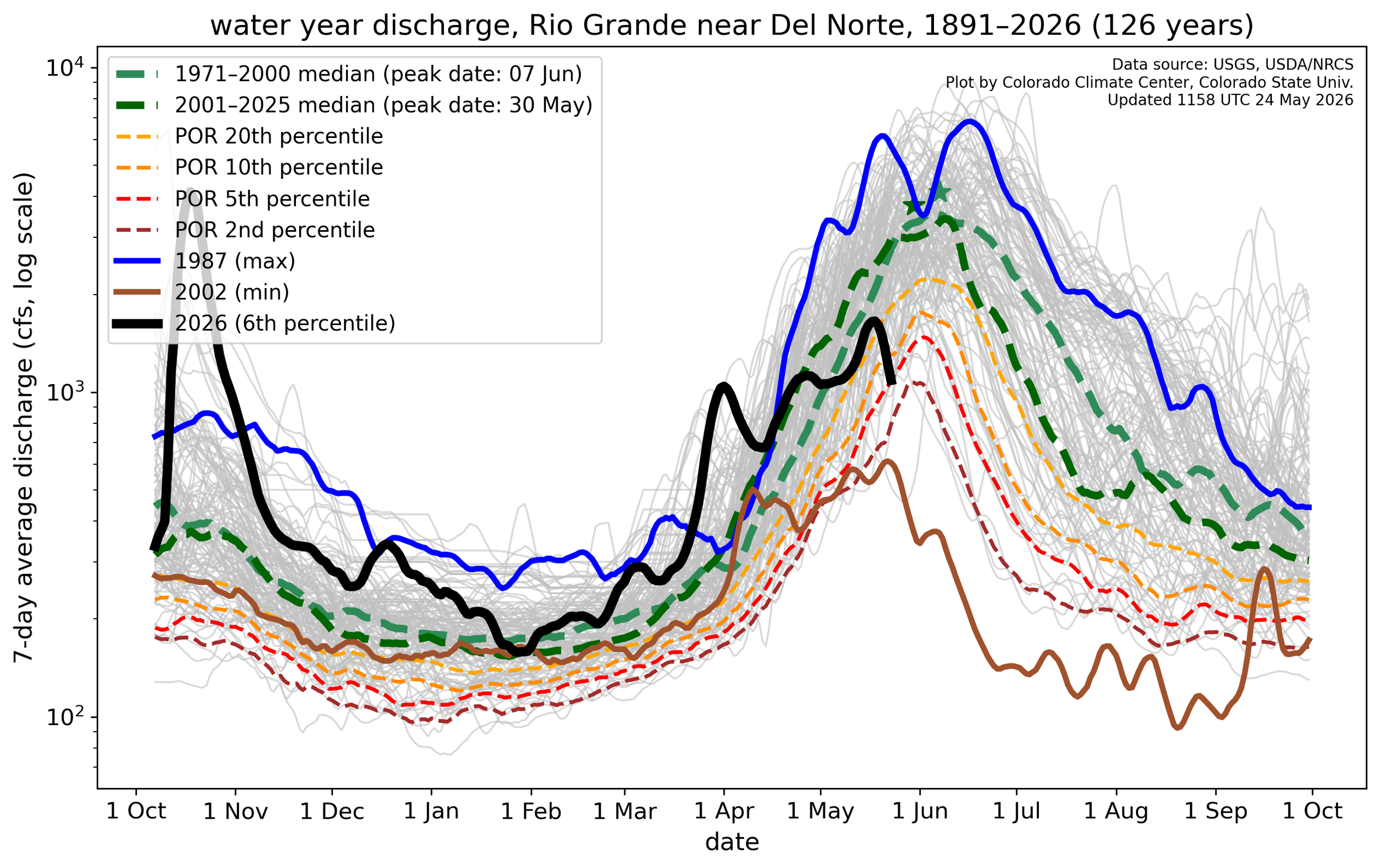
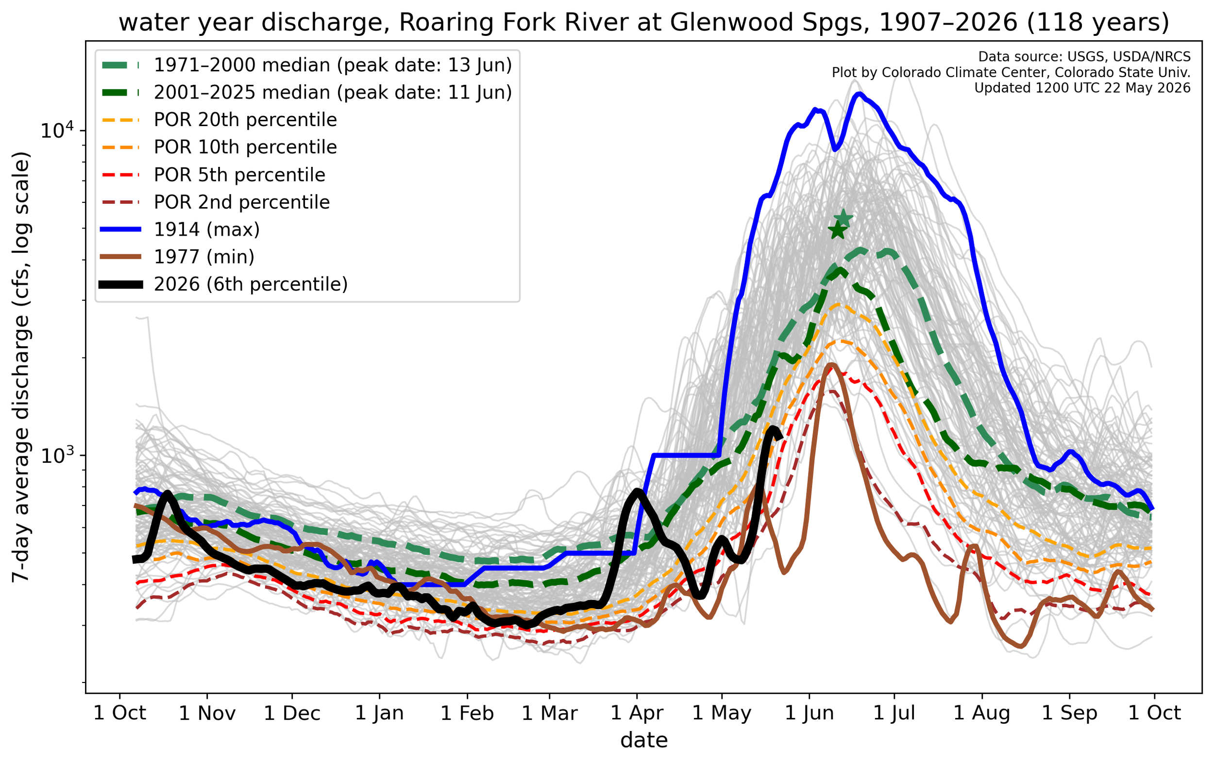
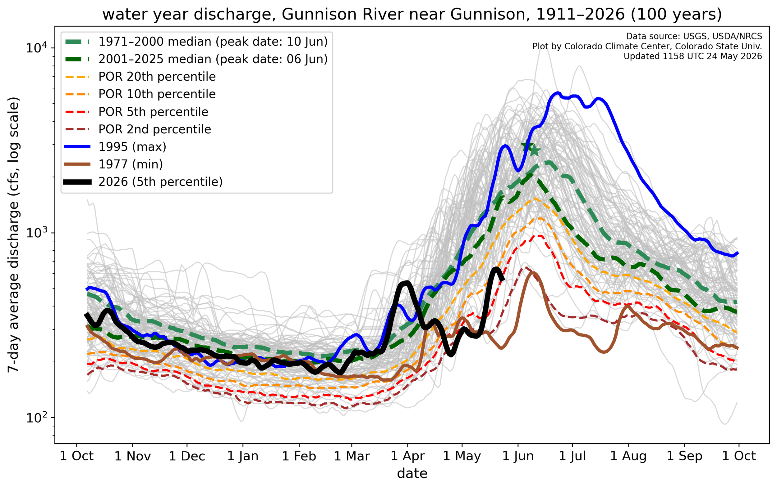
Below: Spring tried it’s best after a dismal winter. Following the March melt some regions saw acceptable and even close to wet conditions. Comparing the 6.5 month cumulative precipitation from November 1 - April 1 (5 months), and April 1 - May 22 (7 weeks), the Southwest Basins roughly received 25% of it’s winter precipitation in the last 7 weeks. The Upper Colorado region received 36%, and the South Platte 45%.