CODOS Update May 7, 2026: in the red
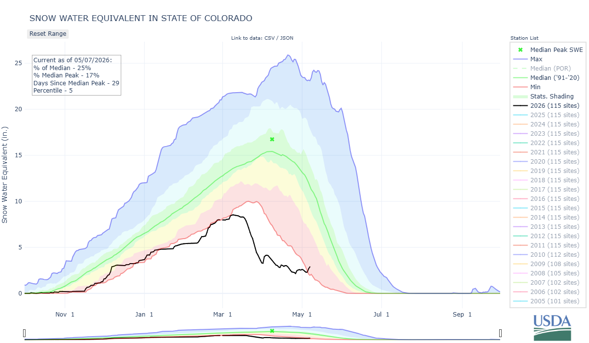
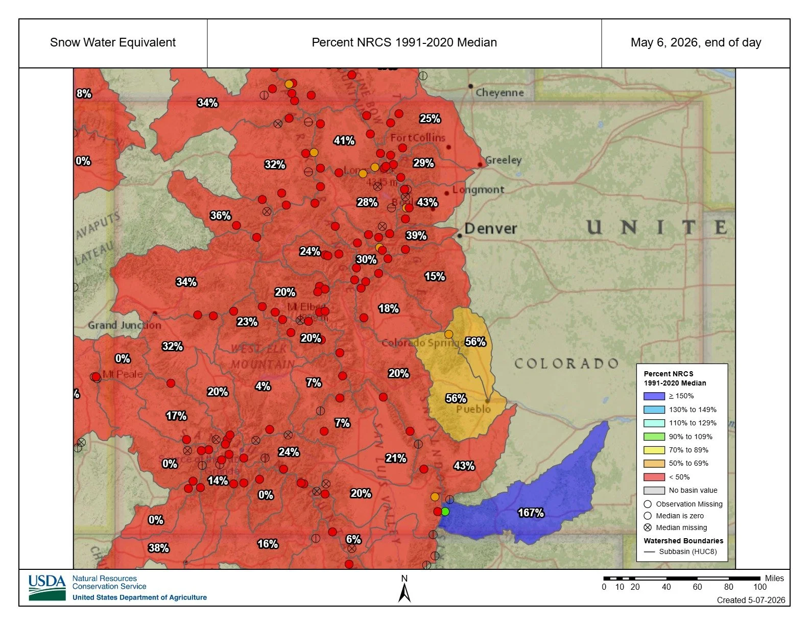
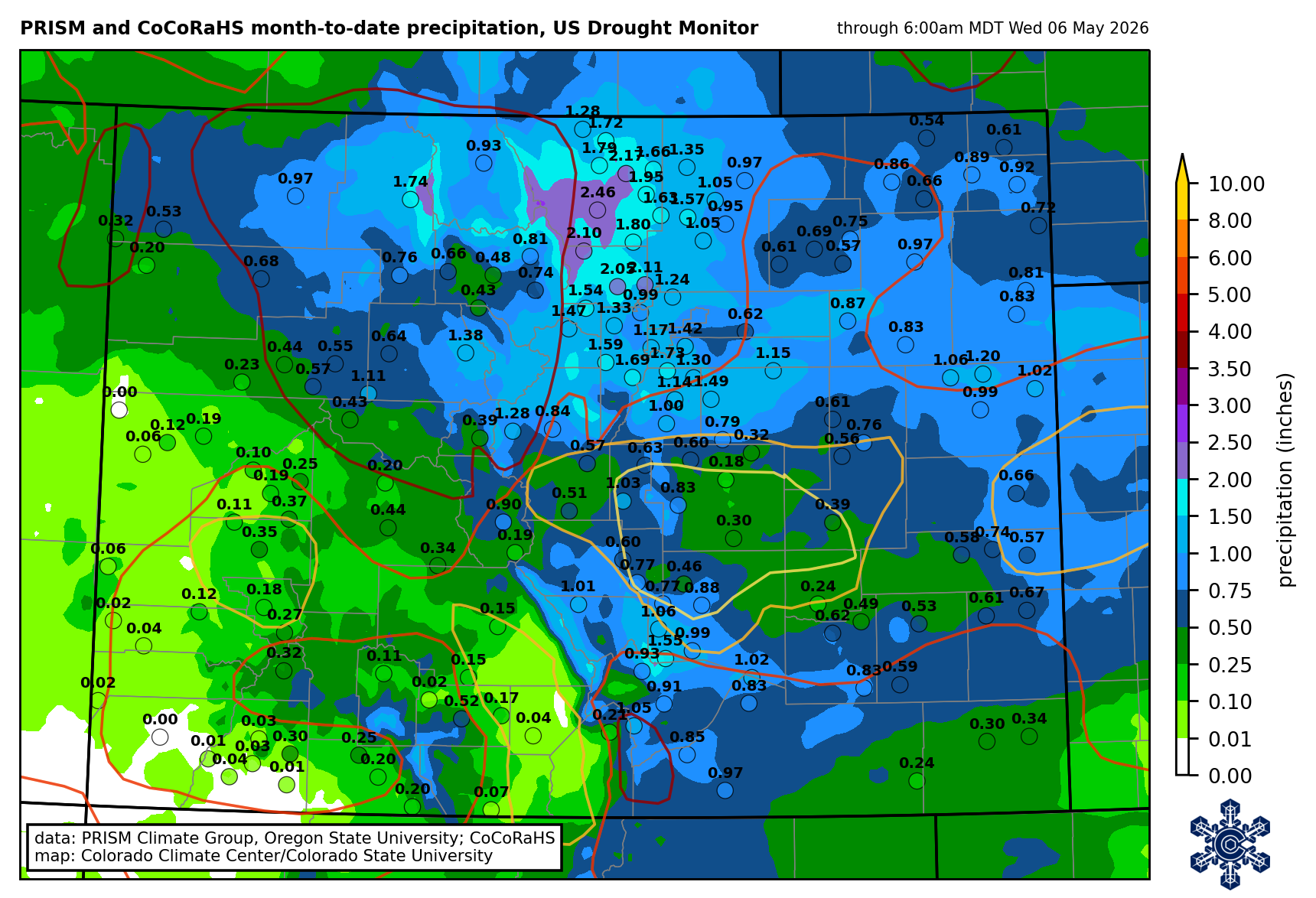
We’re in the red for State of Colorado snow water equivalent (SWE). Generally, ‘in the red’ implies ‘bad’. In this case, it is indeed bad, but also notable as it means we’re back in known territory instead of the black void of historic lows we’ve been riding through this winter – an improvement of sorts. SWE for the State of Colorado reached 2.3” on May 5th, matching water year 2012’s record low (see plot below).
In the past couple weeks since our last update, the bouts of overcast, cool weather and precipitation have continued.. This has continued the general flatlining effect on our SWE plots – ‘flatlining’, though again would generally imply ‘bad’, in this case means the mountains have been holding onto their little remaining snowpack instead of rapidly melting out. Most streamflows have not spiked again since the record-warm March temperatures abated (again, plots below).
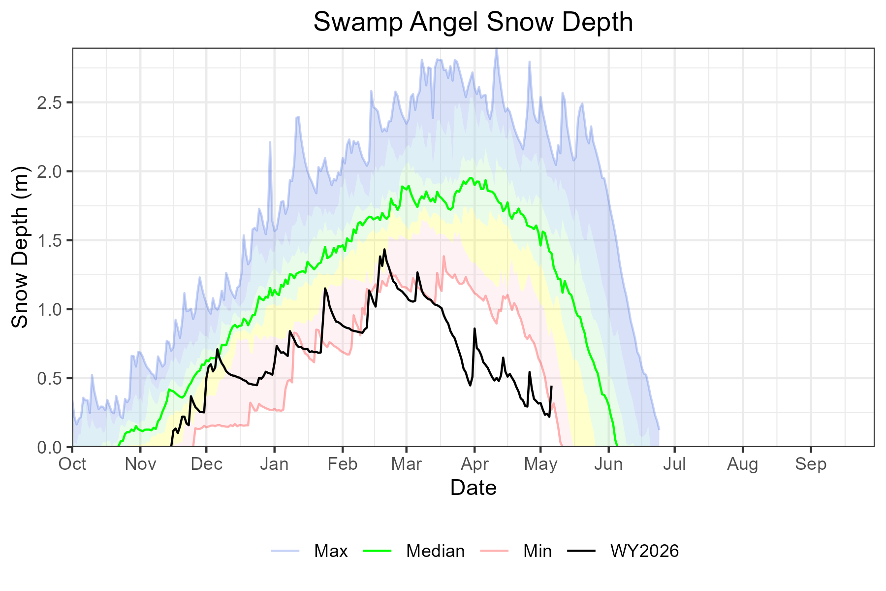
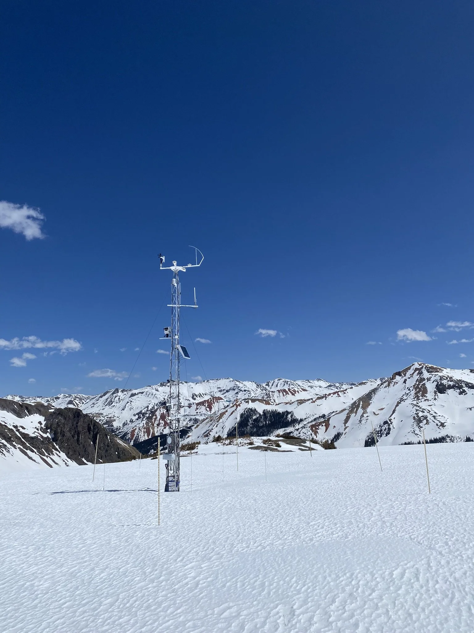
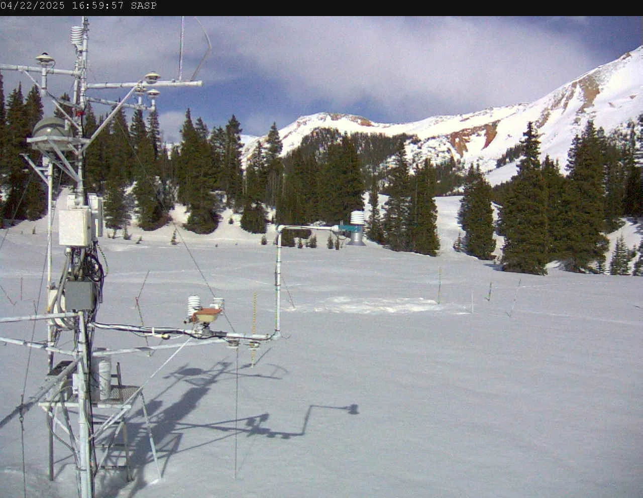
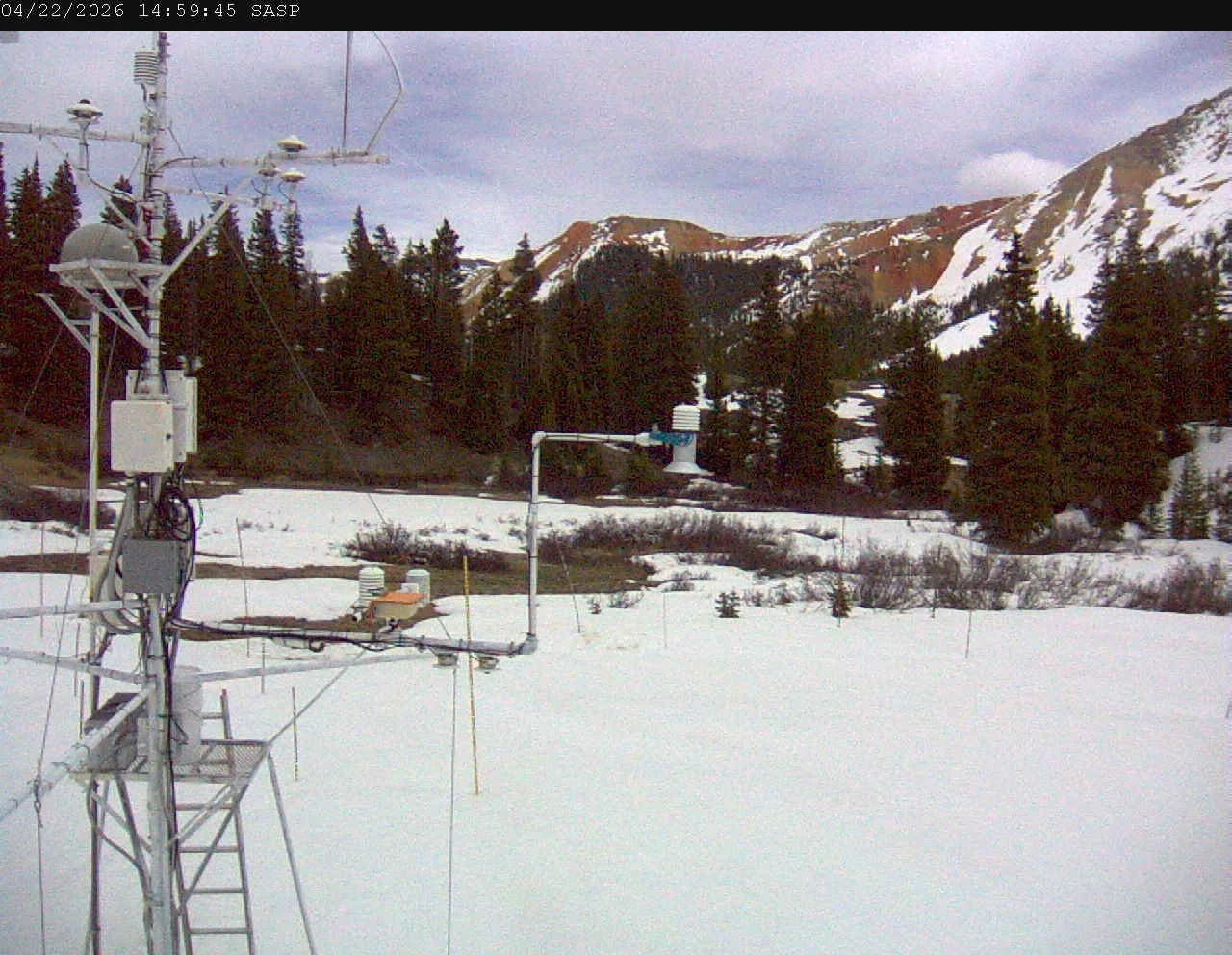
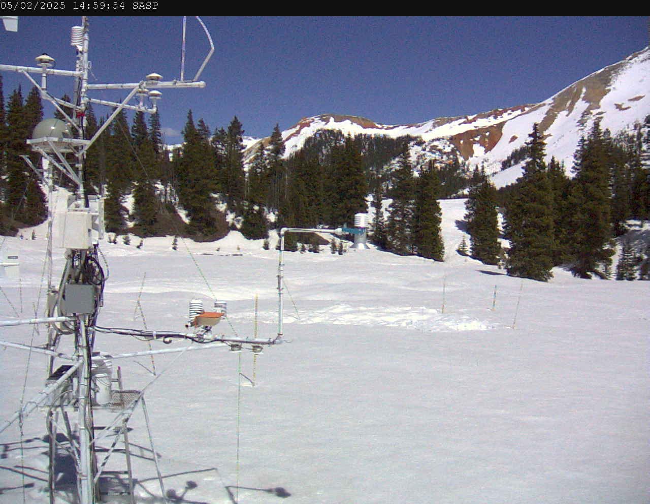
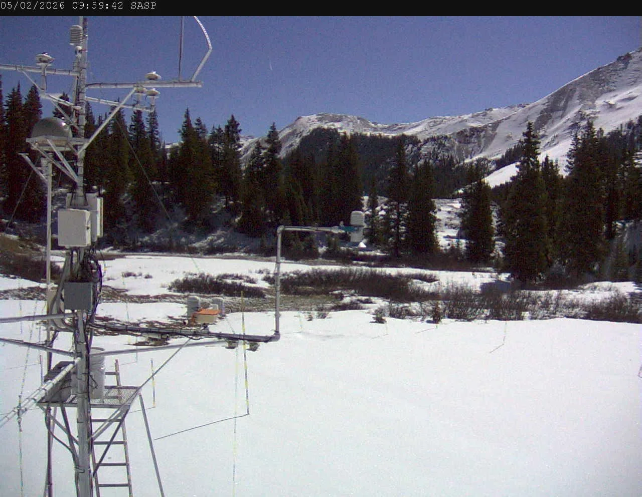
CSAS’s Swamp Angel station has flirted with melt-out over the last couple weeks. Much of the willows and wetlands are showing, and it is accessible hiking, highlighting just how much this year differs from previous ones (see photos below of last year at this time). Depth under the snow sensor on May 5th last year was approximately 40” and this year is just about 8”.
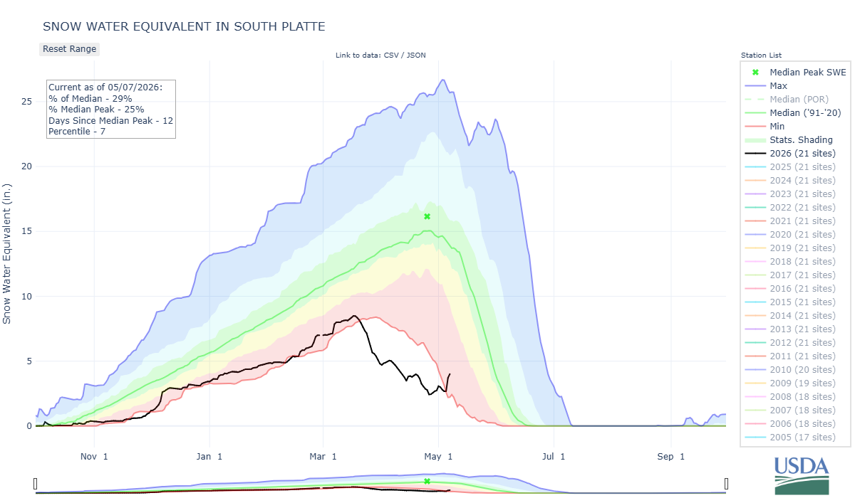
Winter storms are not quite done with Colorado yet. Though they will likely have limited impact on the grim, total water yield of the winter, fresh snow adds more water to a thirsty system, and freshens the albedo – however brief – and helps preserve the remaining snowpack. The central mountains and Front Range mountains have been sitting at the highest percent of median SWE in the state, and over the last couple days they got another big boost. Wet snow fell across the state, the biggest winners were the Front Range mountains and just west of Fort Collins, gaining 1” - 2.5” precipitation. Swamp Angel gained 1” precip.
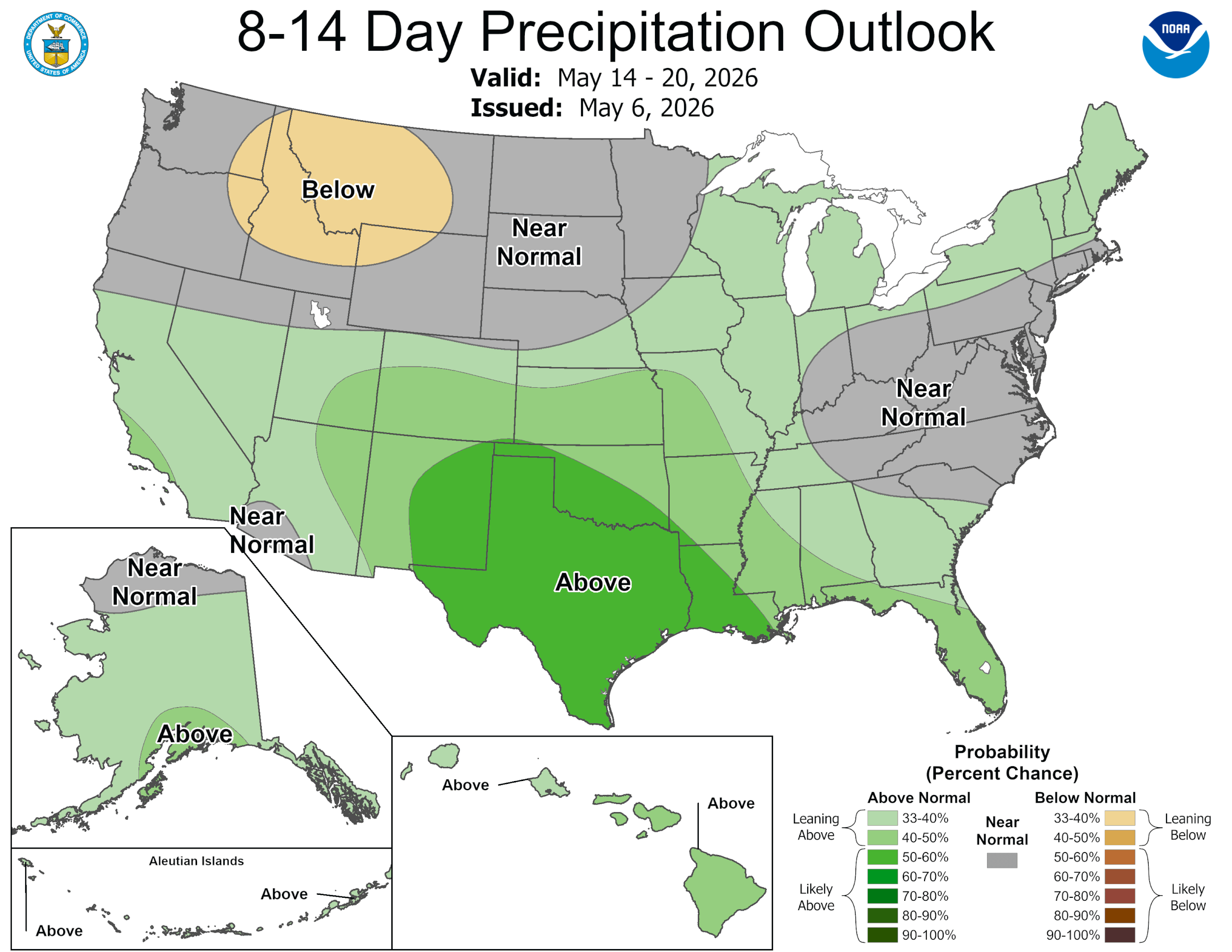
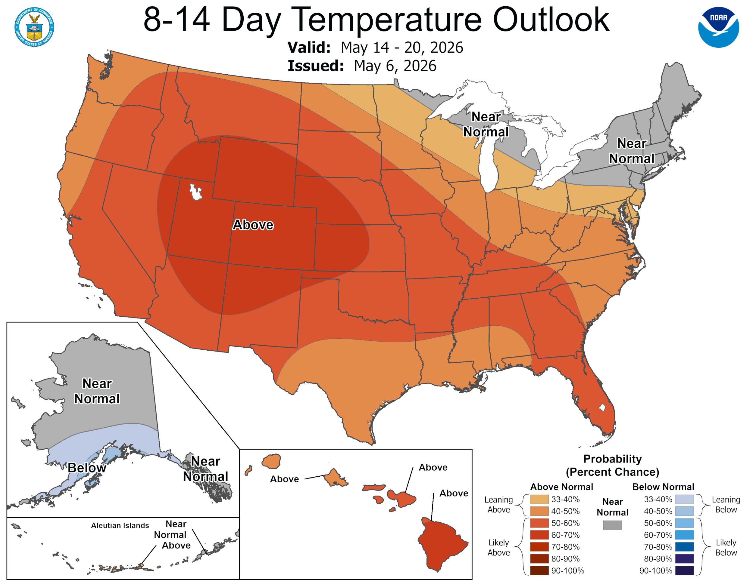
Looking ahead to the next couple weeks, it is probable this cool and stormy period will shift back into warmer weather though continuing above average chances for precipitation for the short-term. The precipitation outlook gives hope of wetter conditions, though early summer looks to be a toss up. The recent precipitation and warmer period approaching will likely bring up streamflows and chip away at our high elevation snowpack.
Below: Photos of Swamp Angel Station and Red Mountain No. 3 from April 22, 2025 and 2026, and May 2, 2025 and 2026.
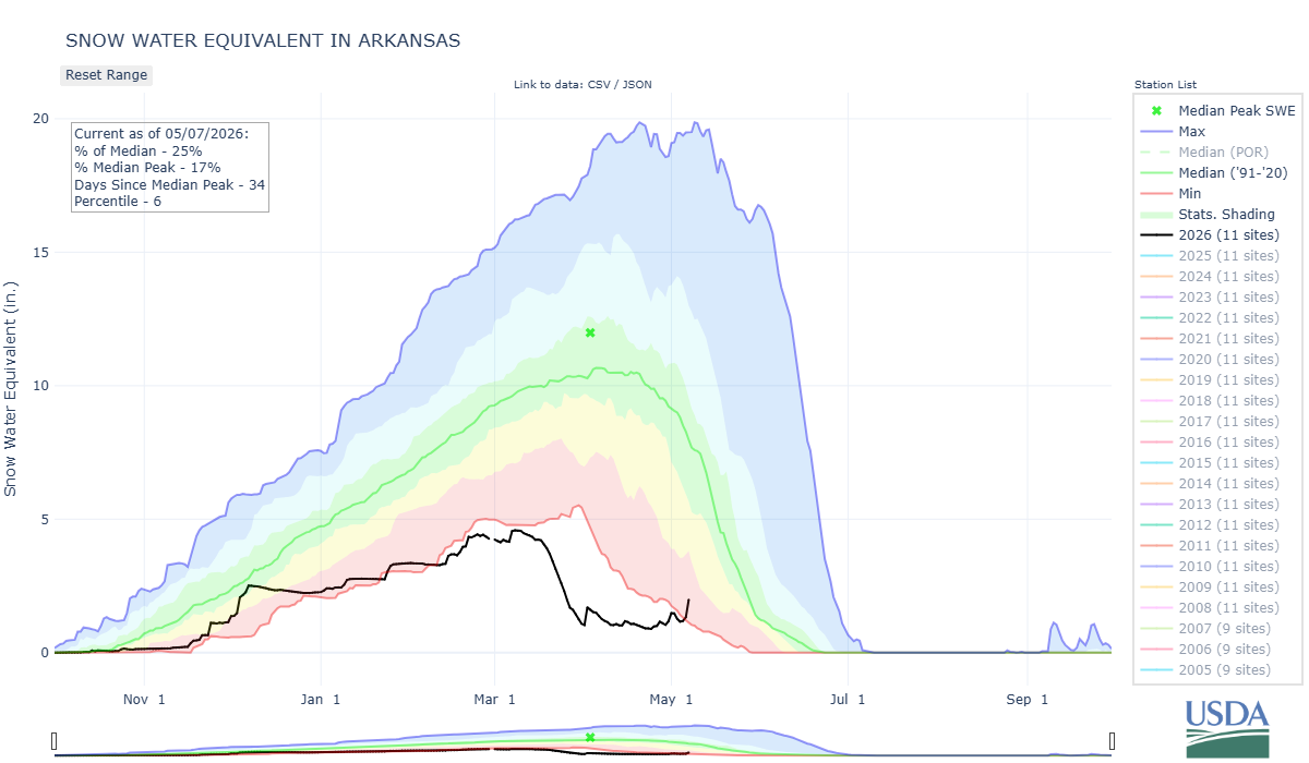
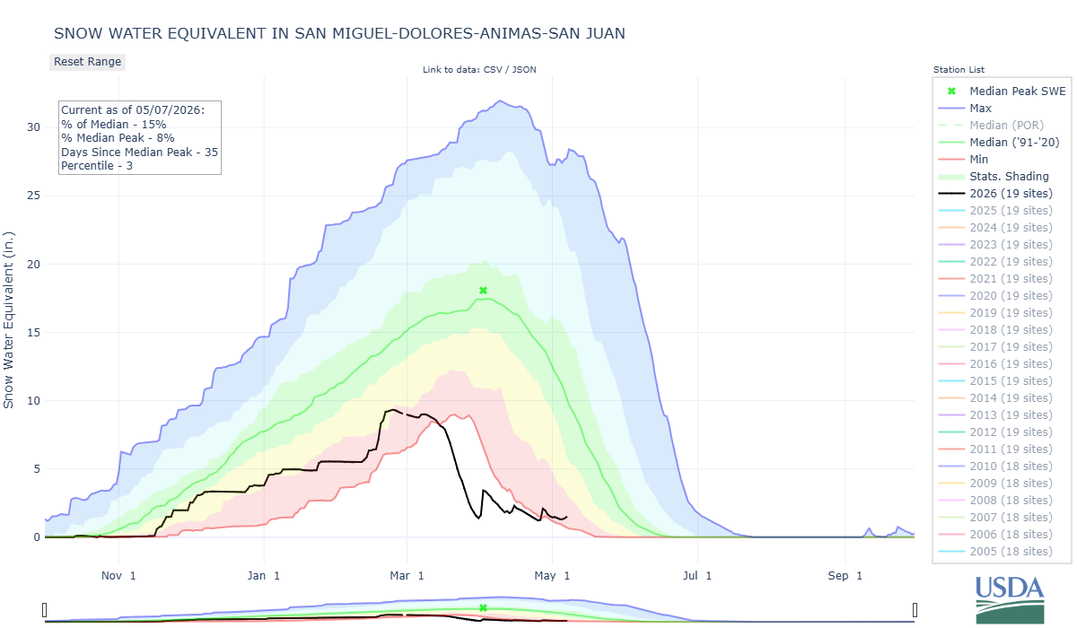
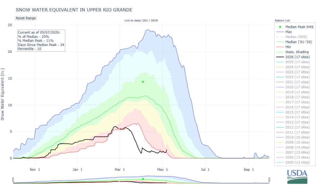
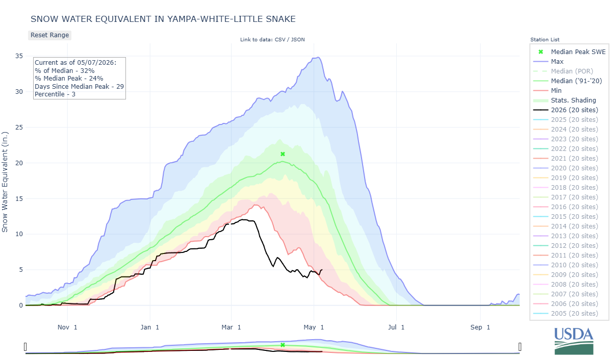
Below: State of Colorado snow water equivalent and major basins, some recovering slightly with a stormy April.

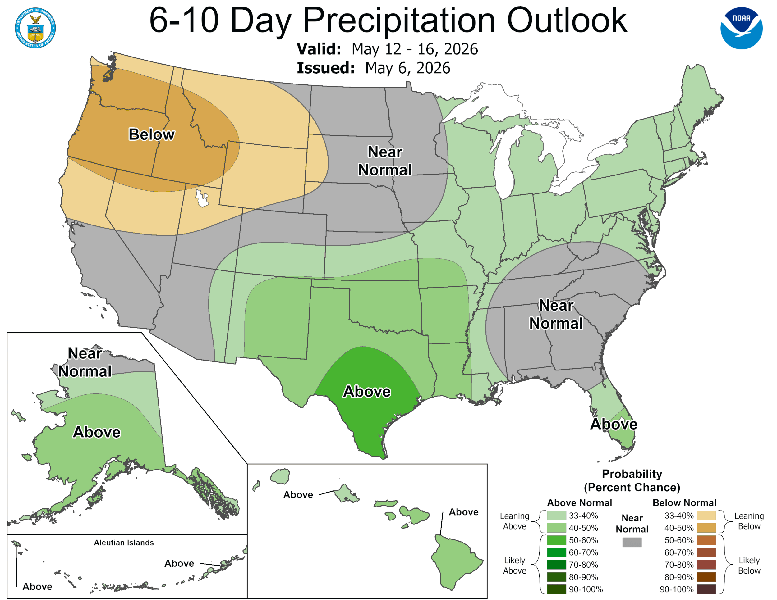
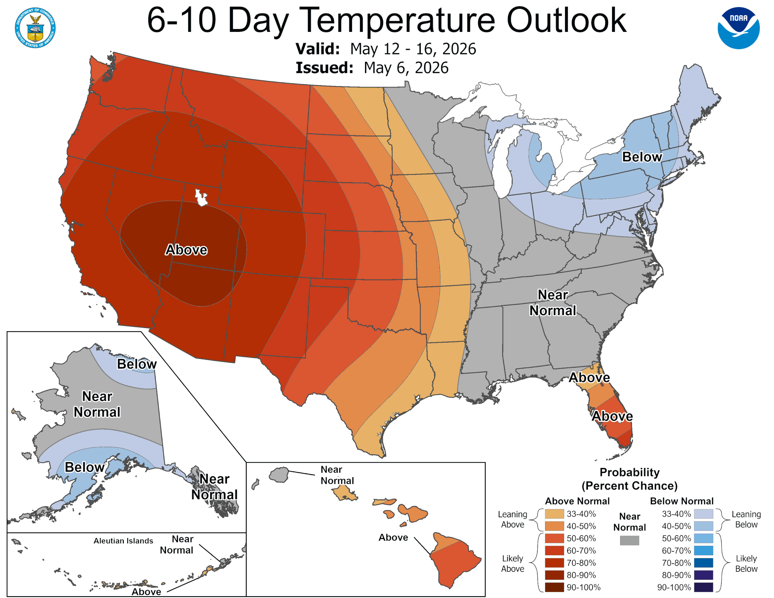
Below: The CPC foretells a brief spell of warm and dry, and then warm and above average chance of precipitation in the near future.
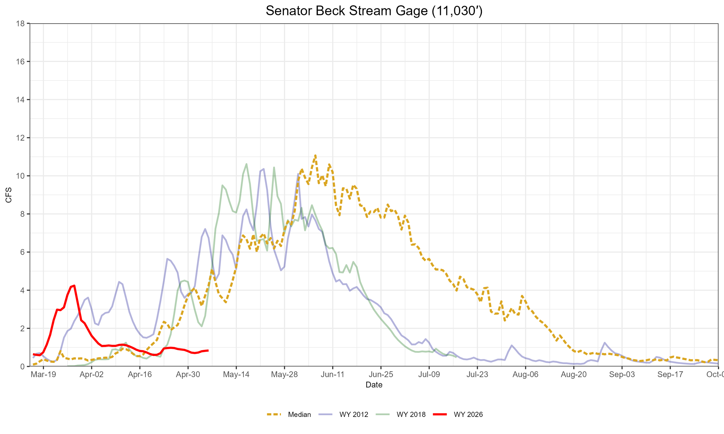
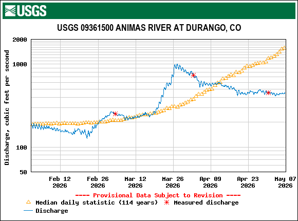
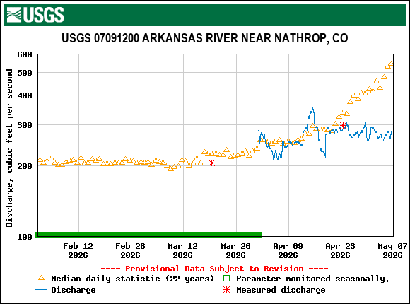
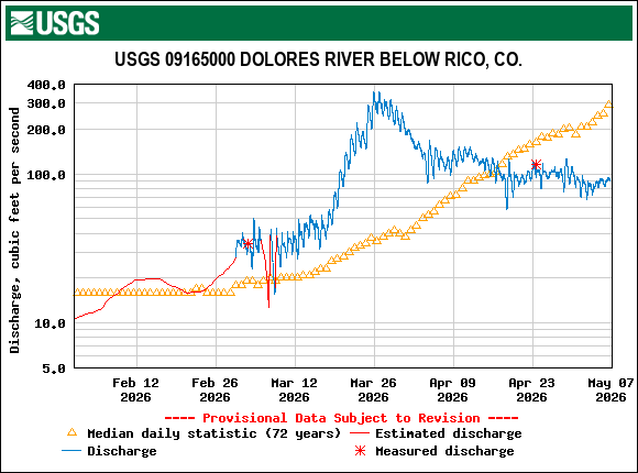
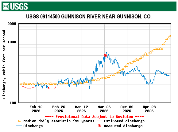
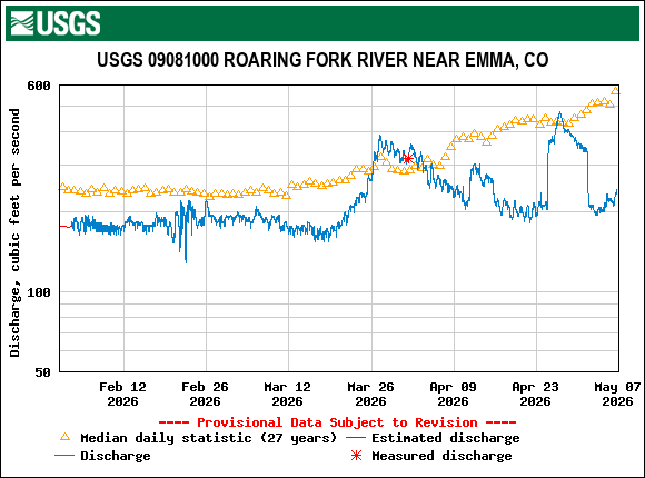
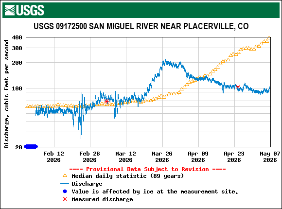
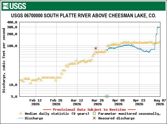
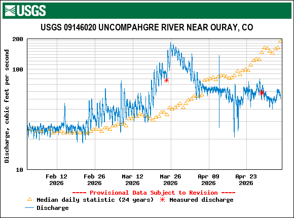
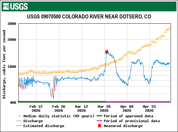
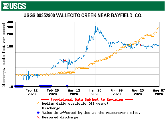
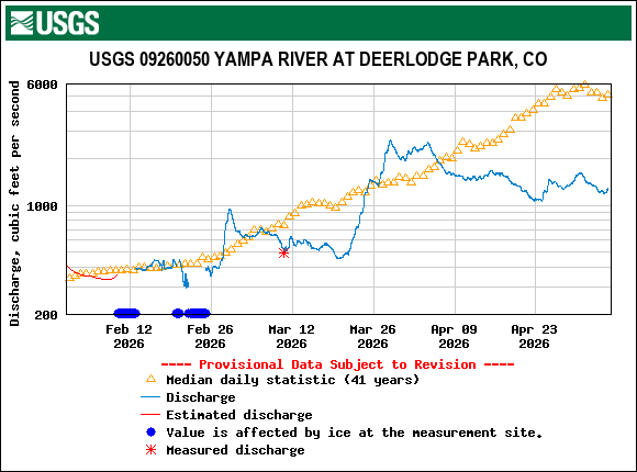
Below: Many rivers around the state peaked at the end of March. Will we see another peak?

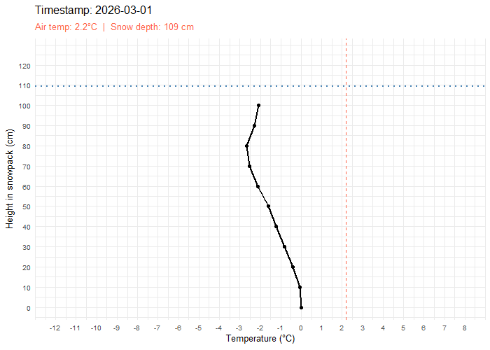
Below: Looking back at the month of March, we wanted to see the evolution of snowpack temperature. This vertical snow temperature animation from our Swamp Angel Study Plot shows how an isothermal snowpack can rapidly ablate. Snow depth is the dotted, horizontal blue line, and air temperature is the vertical, dashed red line.
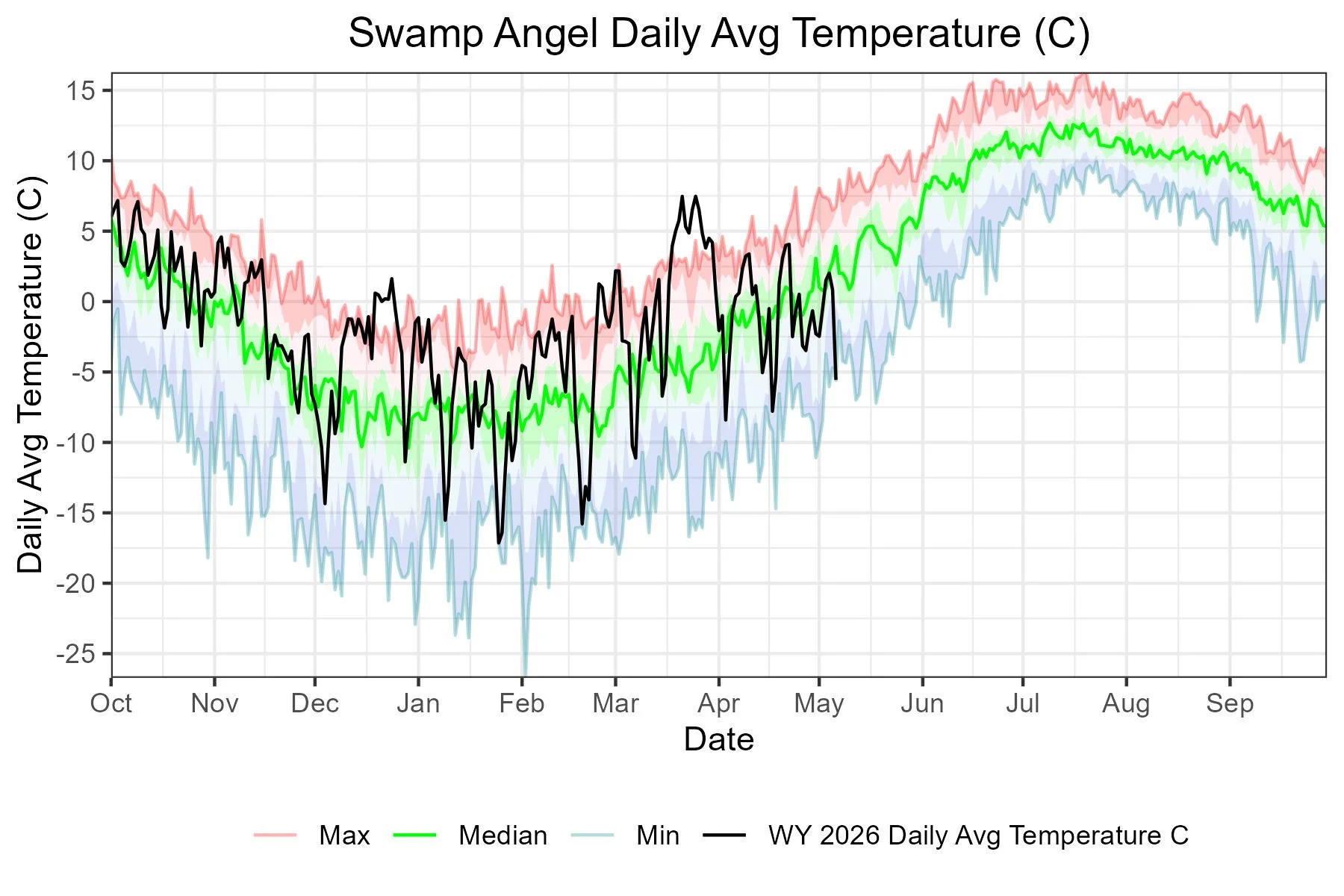
Below: Streamflows at our stream gage are well below normal for this time of year. Temperatures at Swamp Angel dropped yesterday as we picked up snow. Swamp Angel snow depth also dipped into the red for the first time since mid-March.