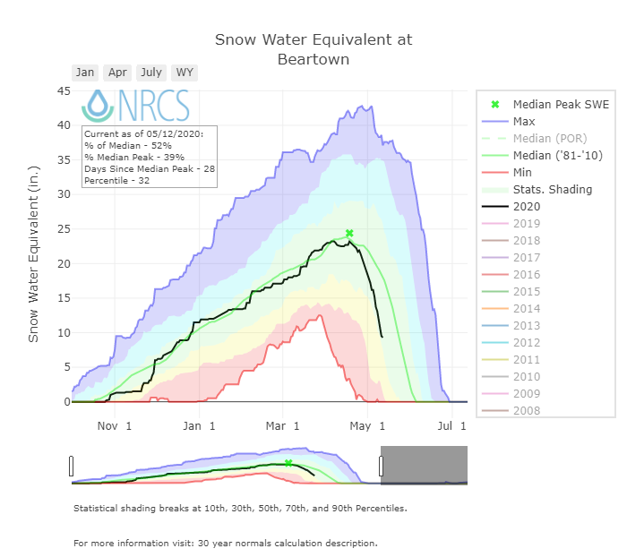
CODOS Update May 12, 2020: Dust Event #1 Emerging Soon, Three Weeks of Rapid Snowmelt
Greetings from Silverton,
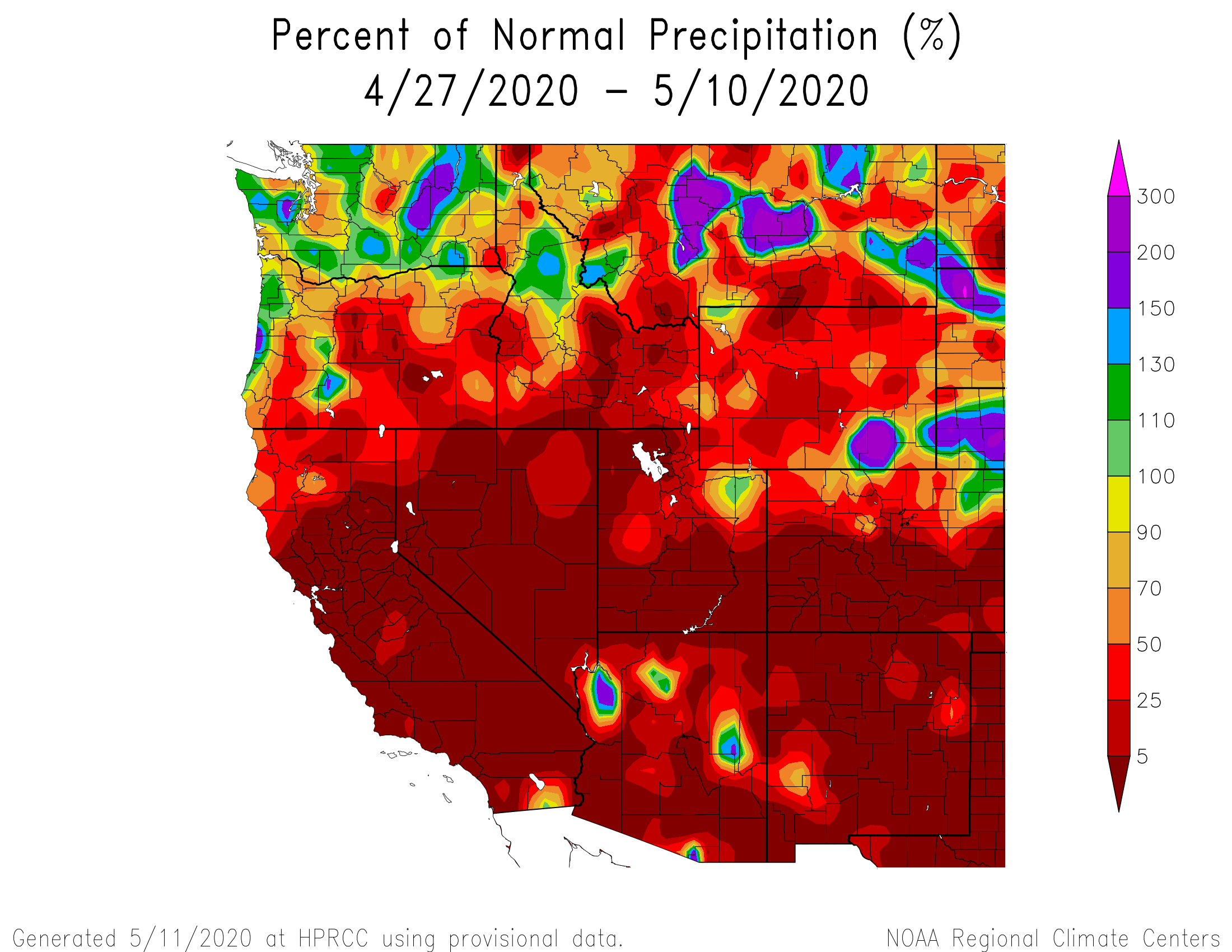
Snowmelt has continued unabated this past week. Finally yesterday (May 11) we received measurable precipitation at Swamp Angel and parts of the surrounding Southwest. This is the first bit of moisture since April 25 and has provided a temporary slowdown in snowmelt due to the cooler temperatures, thick clouds, and fresh snow covering existing dust (a few inches as of this morning.
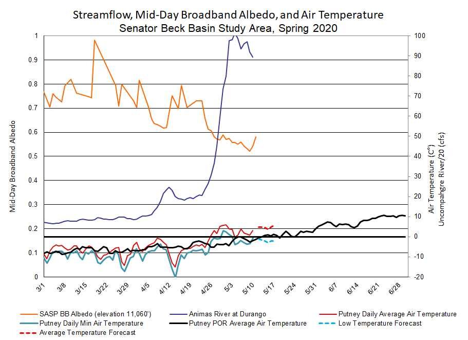
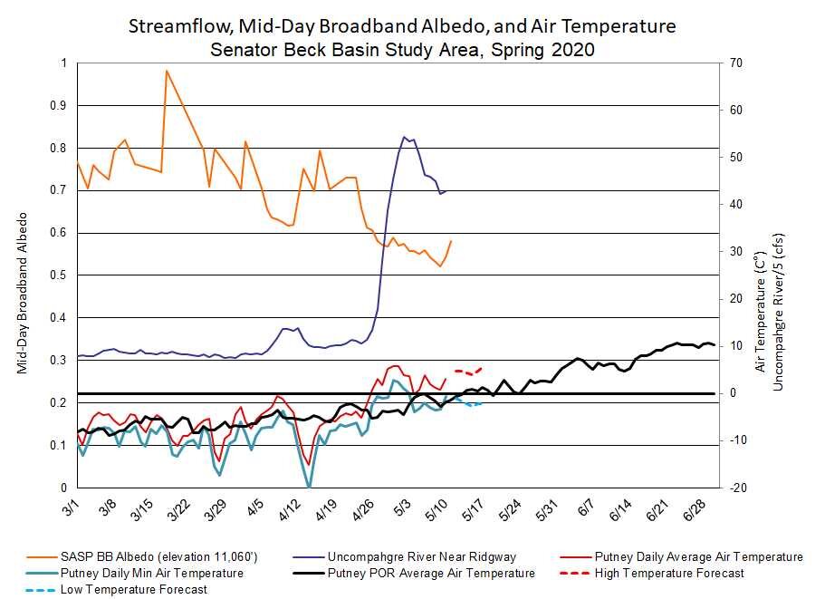
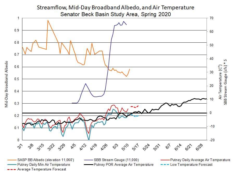
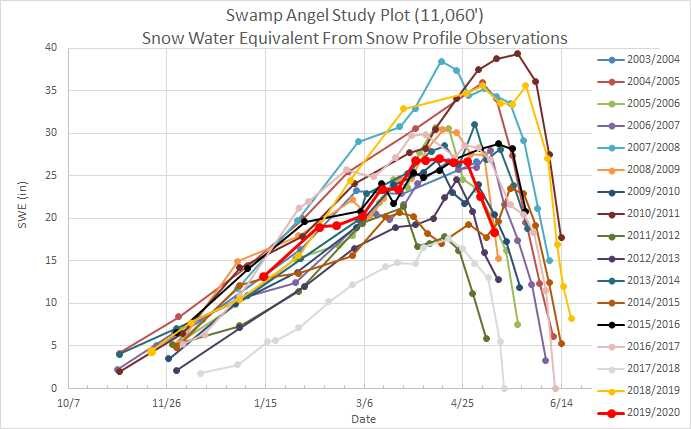
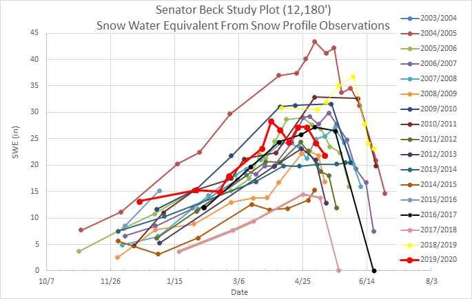
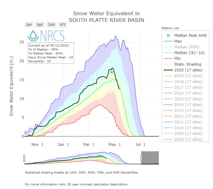
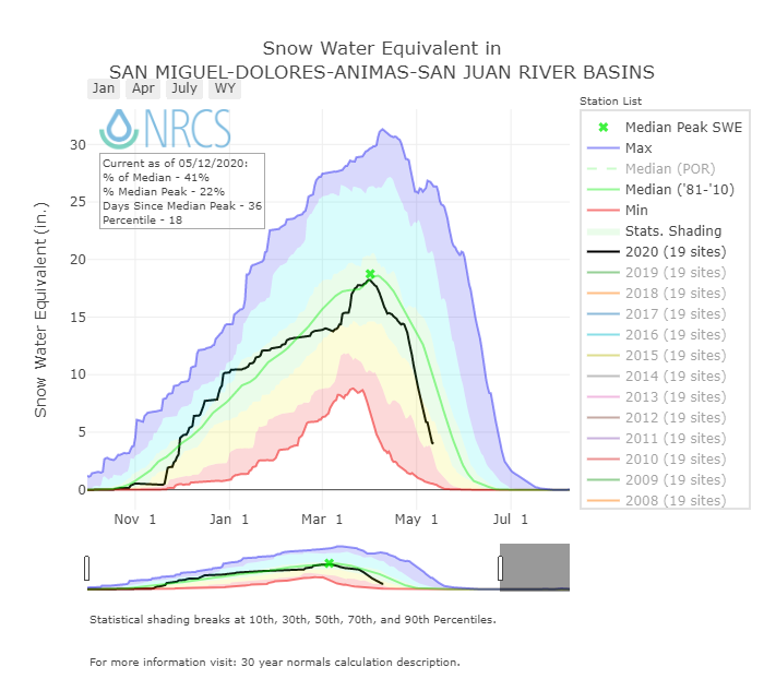
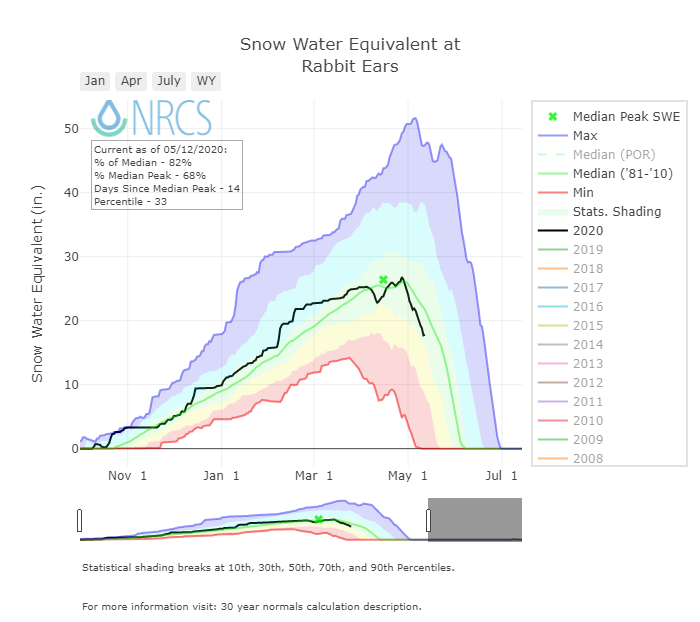
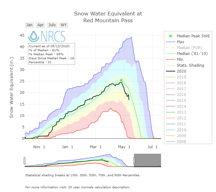
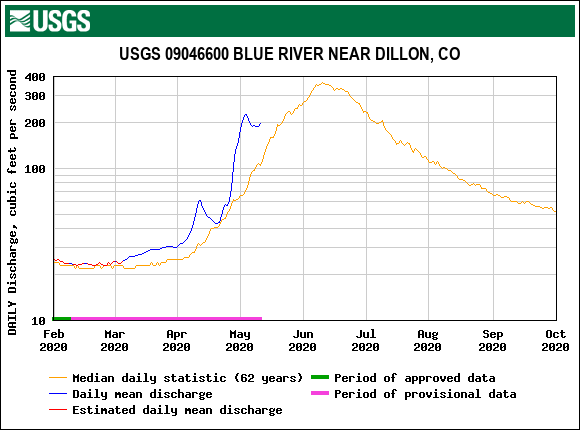
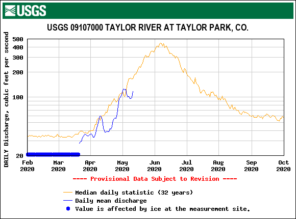
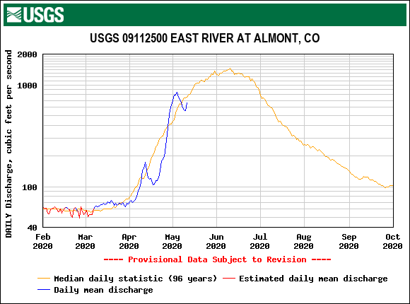
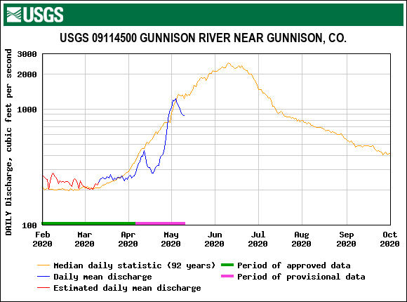
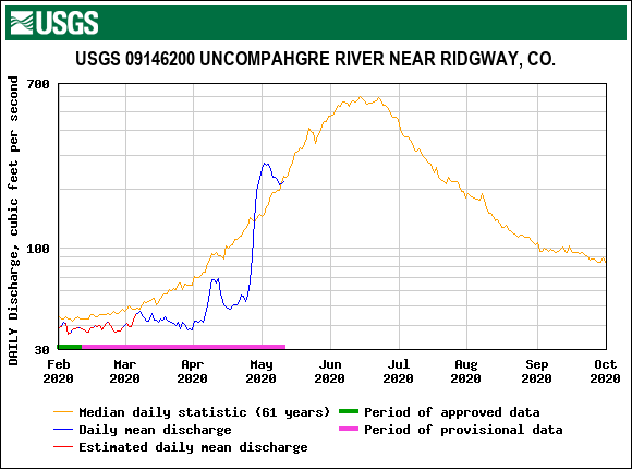
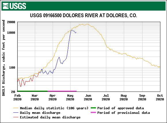
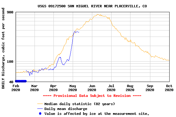
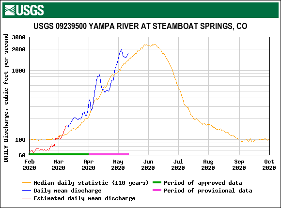
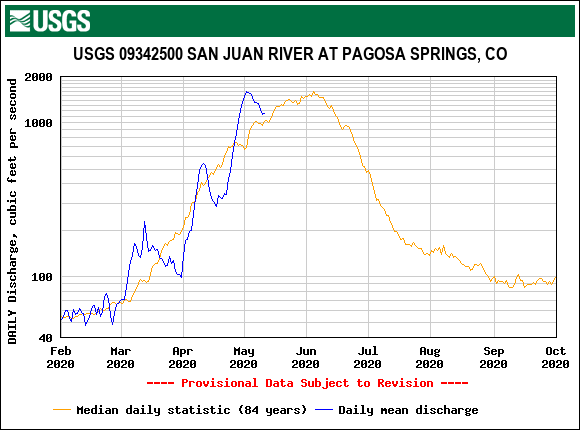
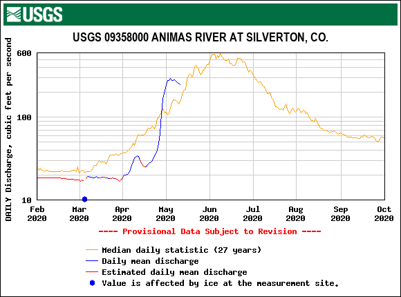
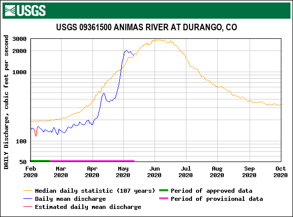
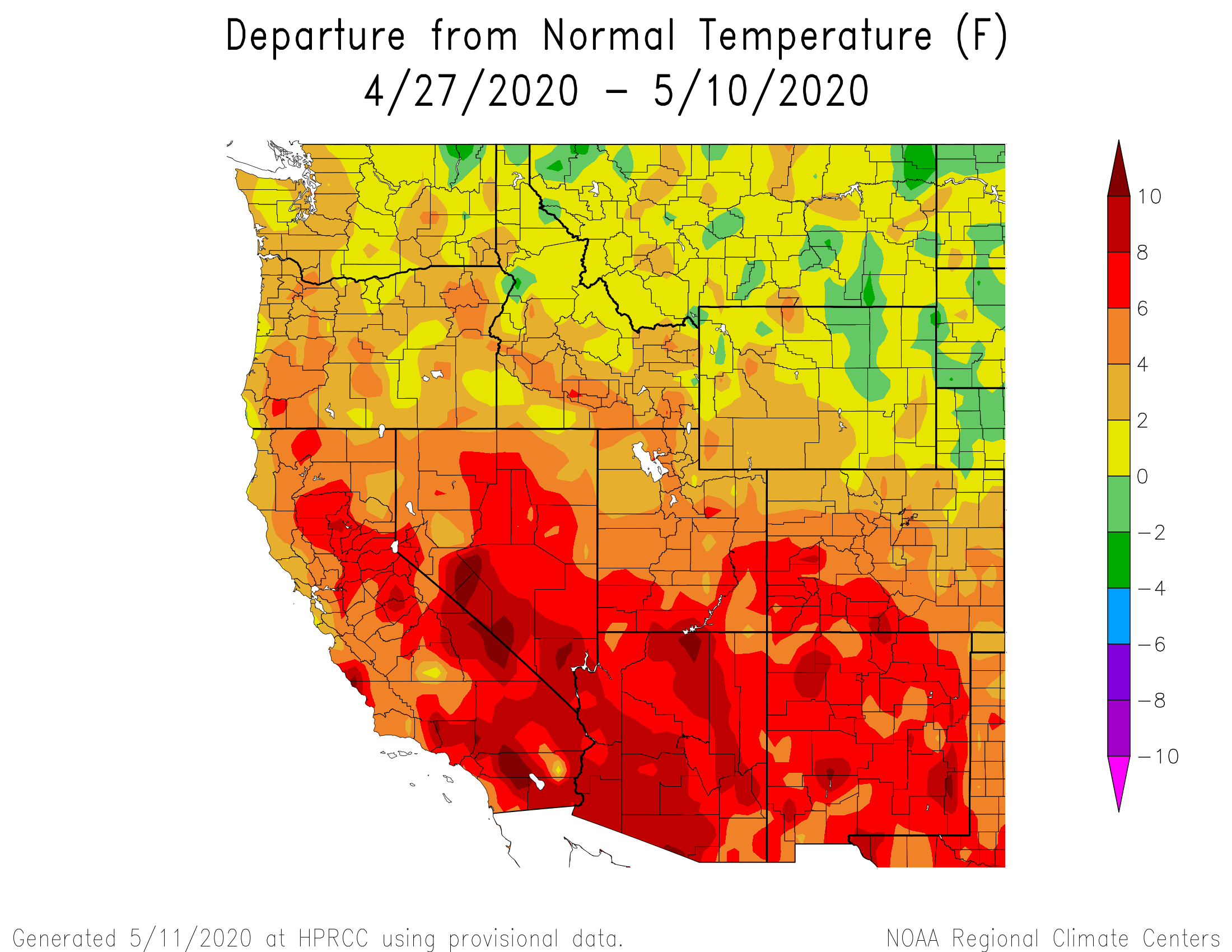
At Swamp Angel over the last 3 weeks from April 21-May 11, we saw an average daily melt rate of 0.42”/day. At Red Mt SNOTEL it was 0.40”/day. In the San Miguel/Dolores/Animas/San Juan Basin as a whole daily SWE lose has been 0.49”/day. Over the last 14 years the average has been 0.25”/day for this time period. Since peak SWE (April 1) the basin-wide melt rate has been 0.23”/day (average 0.17”/day).
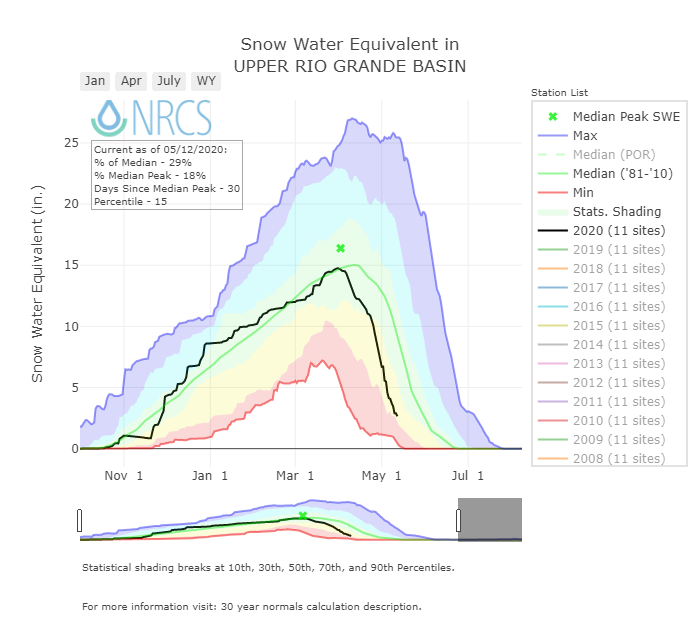
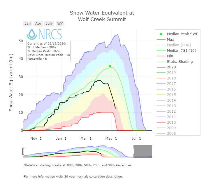
In the Rio Grande since April 1, near the date of WY2020 peak SWE, Wolf Creek SNOTEL saw SWE decline at a rate of 0.39”/day. The past 14 year average is 0.17”/day. These rates would be closer to normal if it was June but this rapid decline is about a month early.
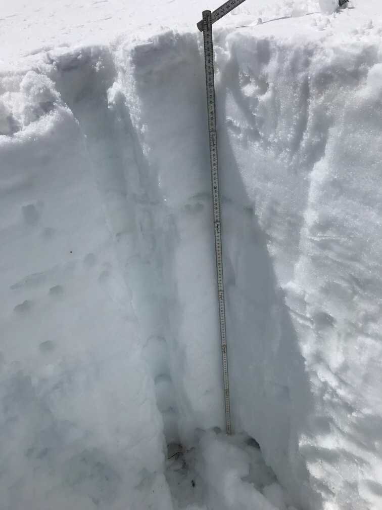
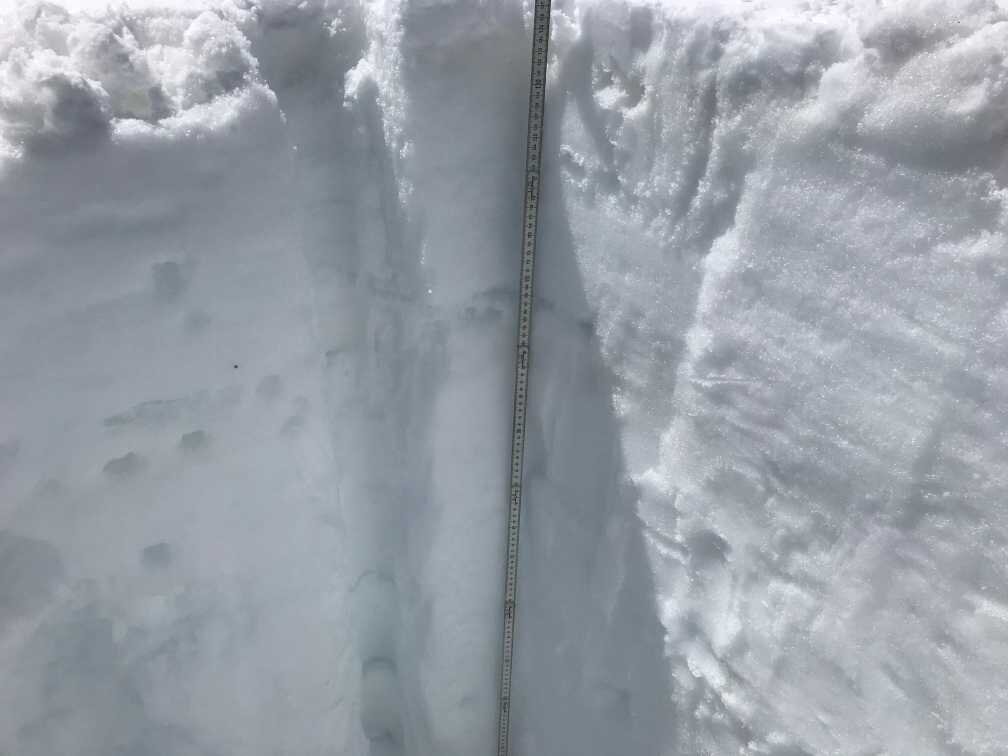
Moderate dust event #1 is just under the snow surface at Swamp Angel and about 12” under at Senator Beck. The May 11 storm was short lived and we have already returned to sunny conditions. After a few days of the sun doing its thing D1 will be emerged along with D2/D3 at the surface, notably further darkening the surface of the snowpack. The effect being greater absorption of solar radiation and faster snowmelt. D1 has already been exposed in some areas around the landscape (shallow areas, south facing slopes, etc) in the San Juans for some time, but now it is close to being dominate at this elevation band and below. It will take a week or so for D1 to be widespread at high elevations.
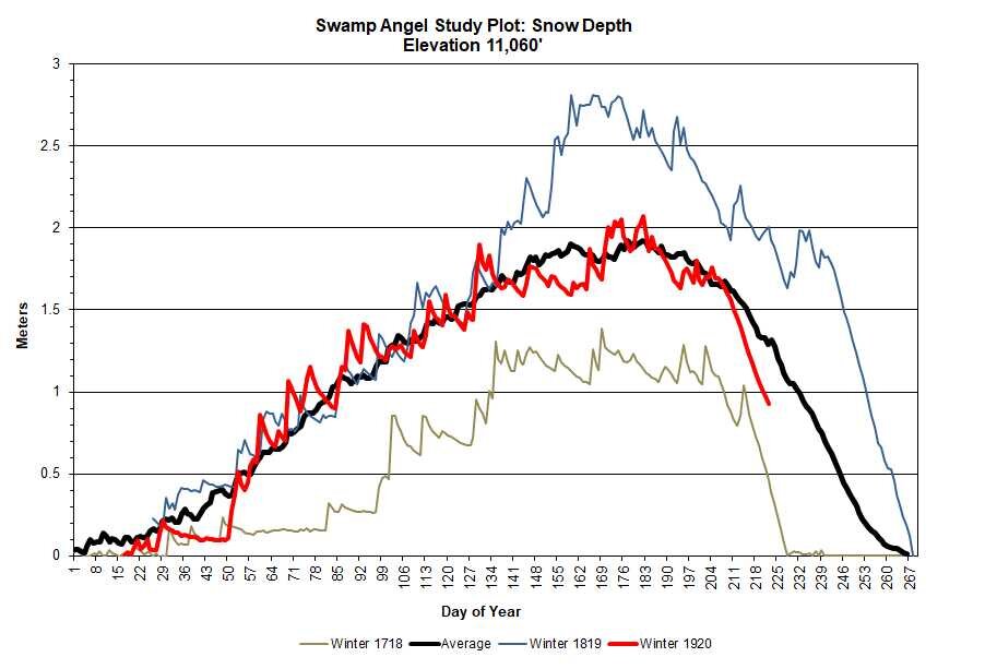
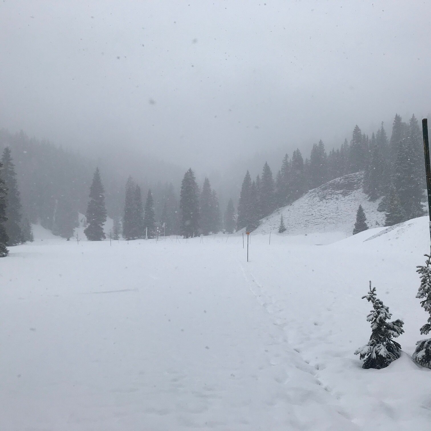
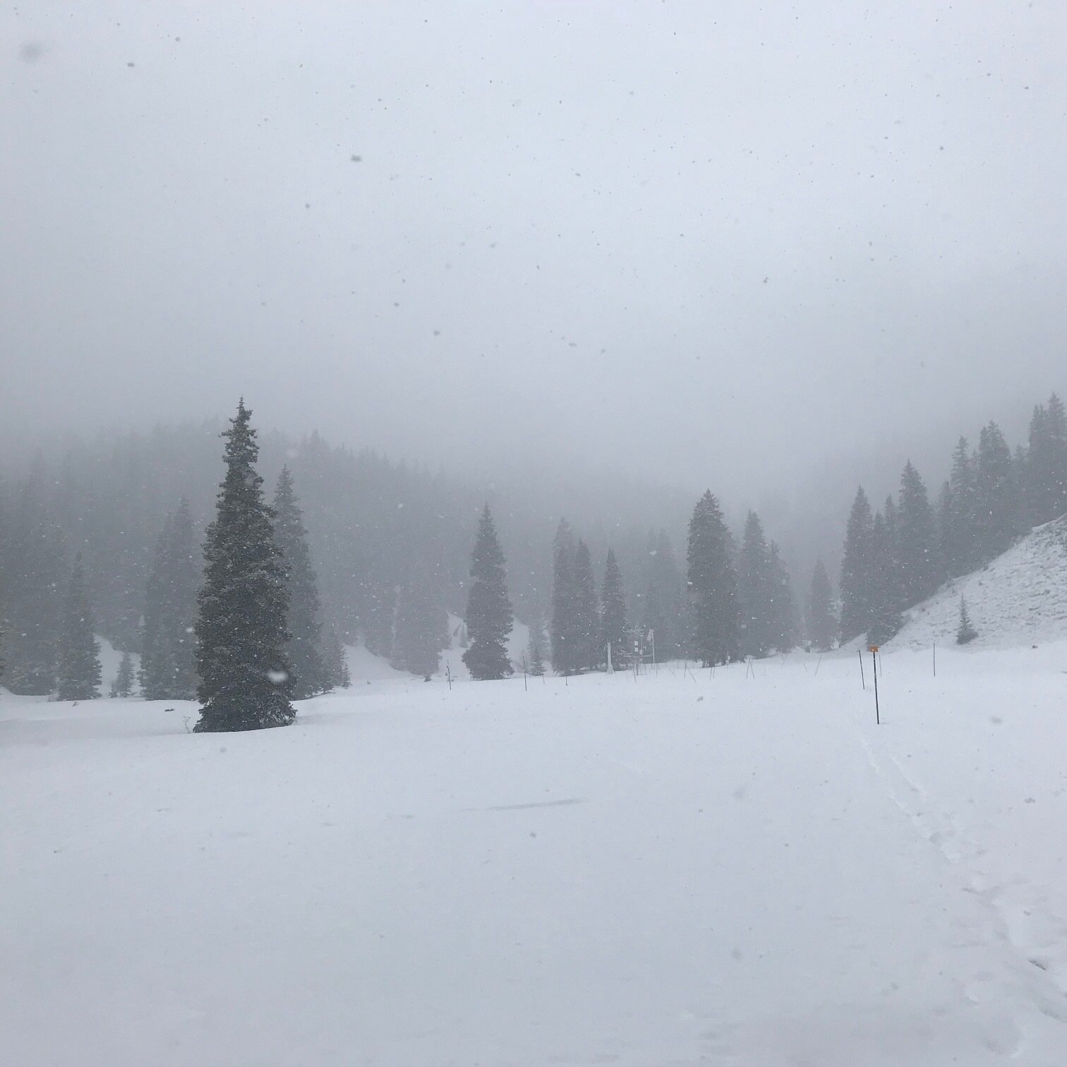
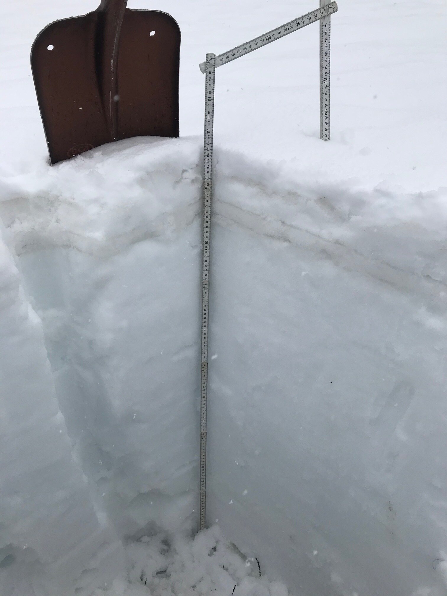
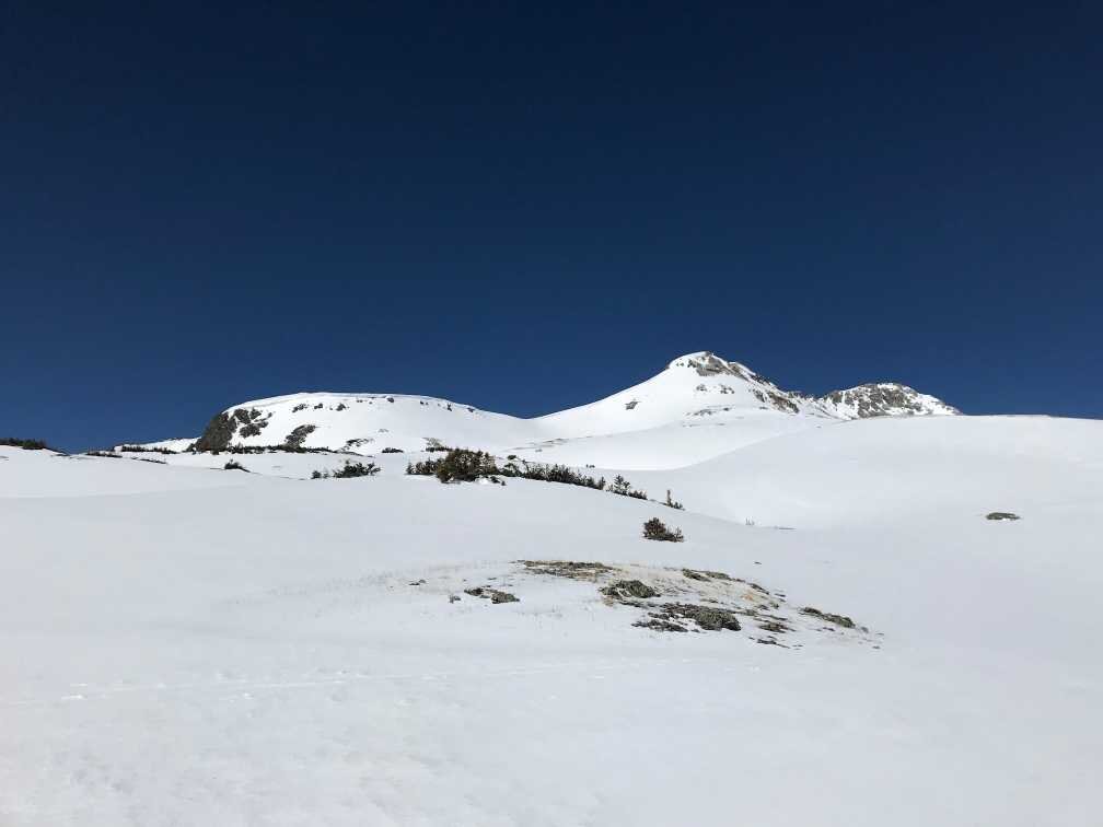
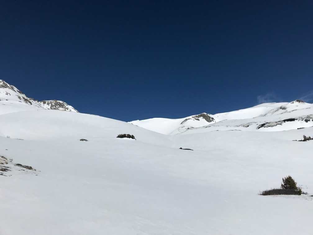
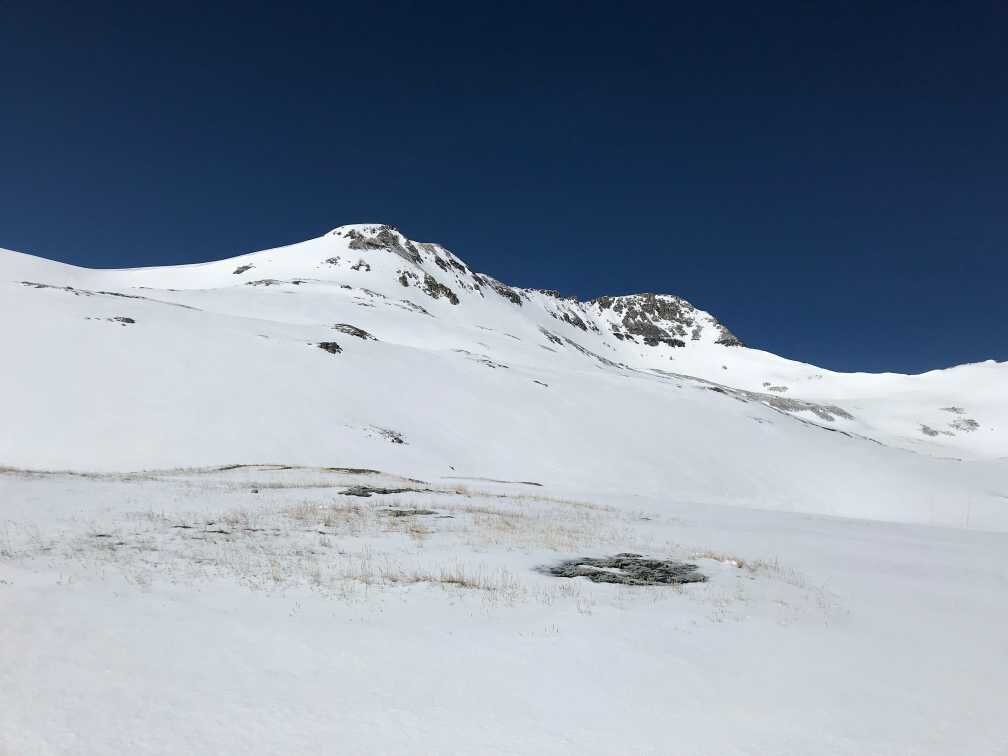
Below: Pictures of Swamp Angel on May 11, 2020. SWE at Swamp Angel in now 18.4” with D1 just a few inches below surface. Clear and sunny weather has returned after a one day reprieve. Expect the snow surface to darken further with the merging of D1 with D2/D3 which are already on surface, hence rapid snowmelt to continue, particularly as the forecast calls for mostly sunny and warm conditions.
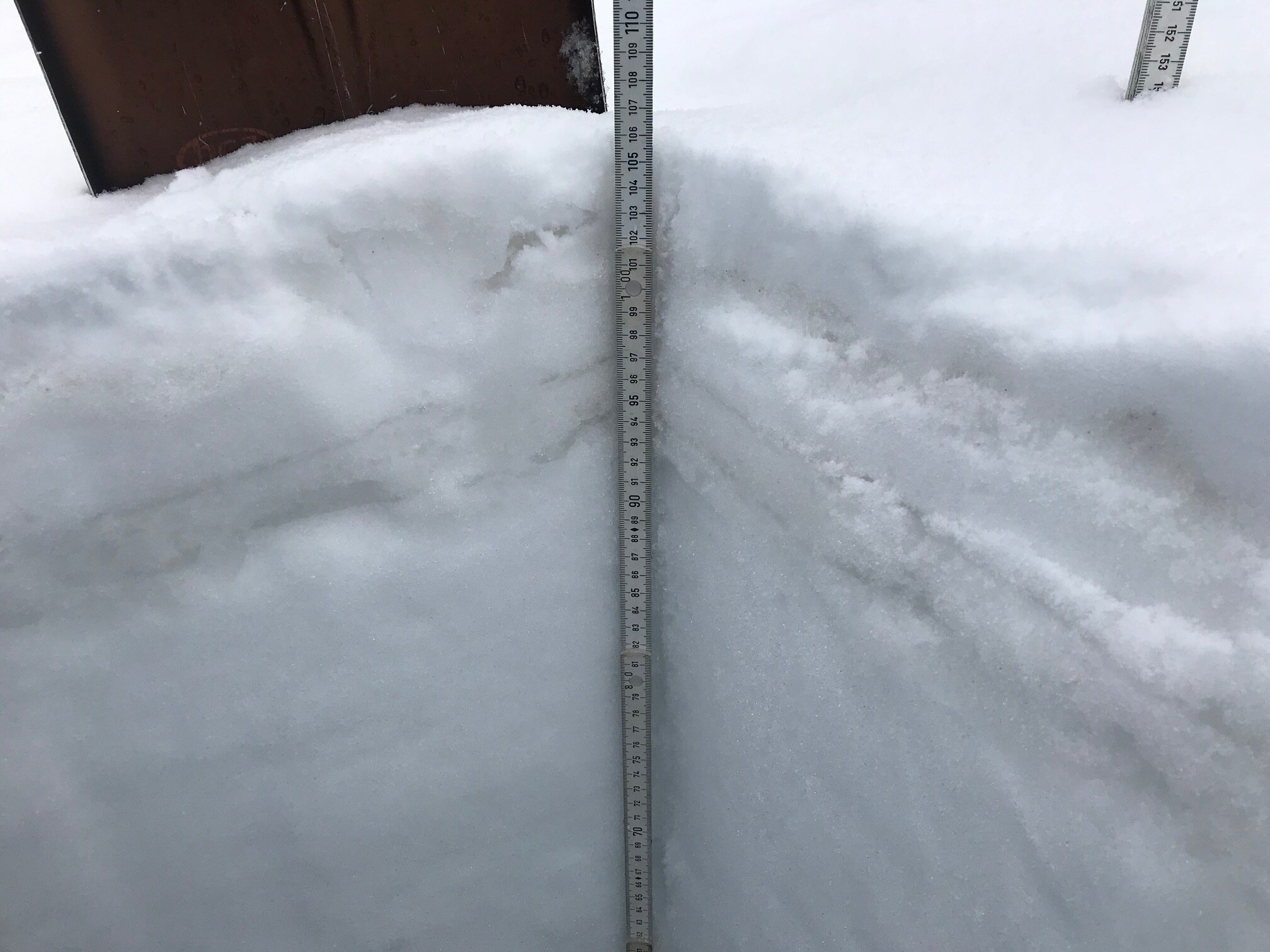
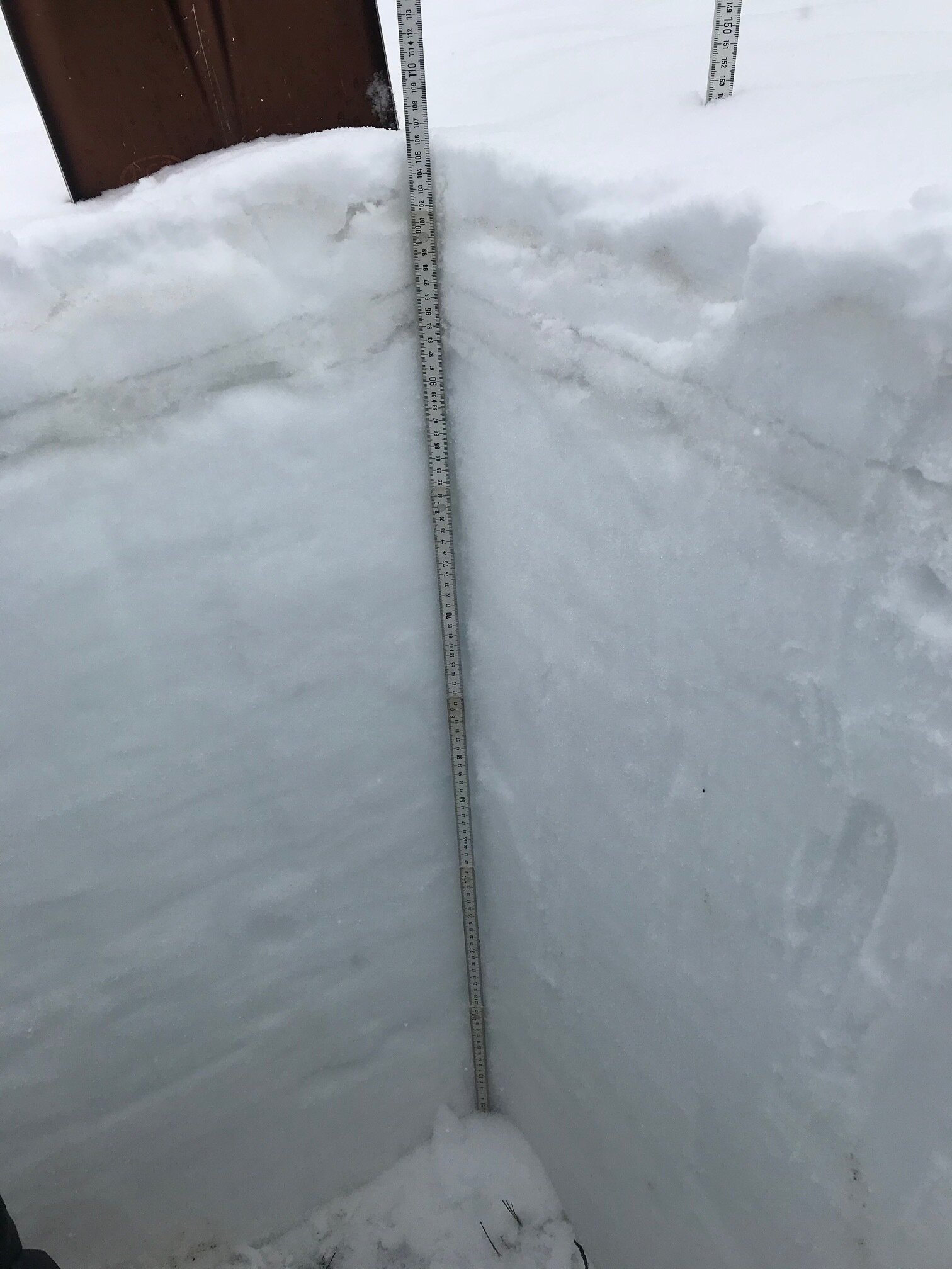
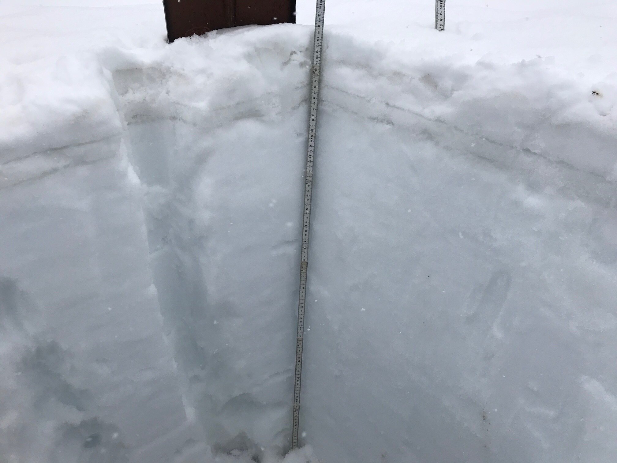
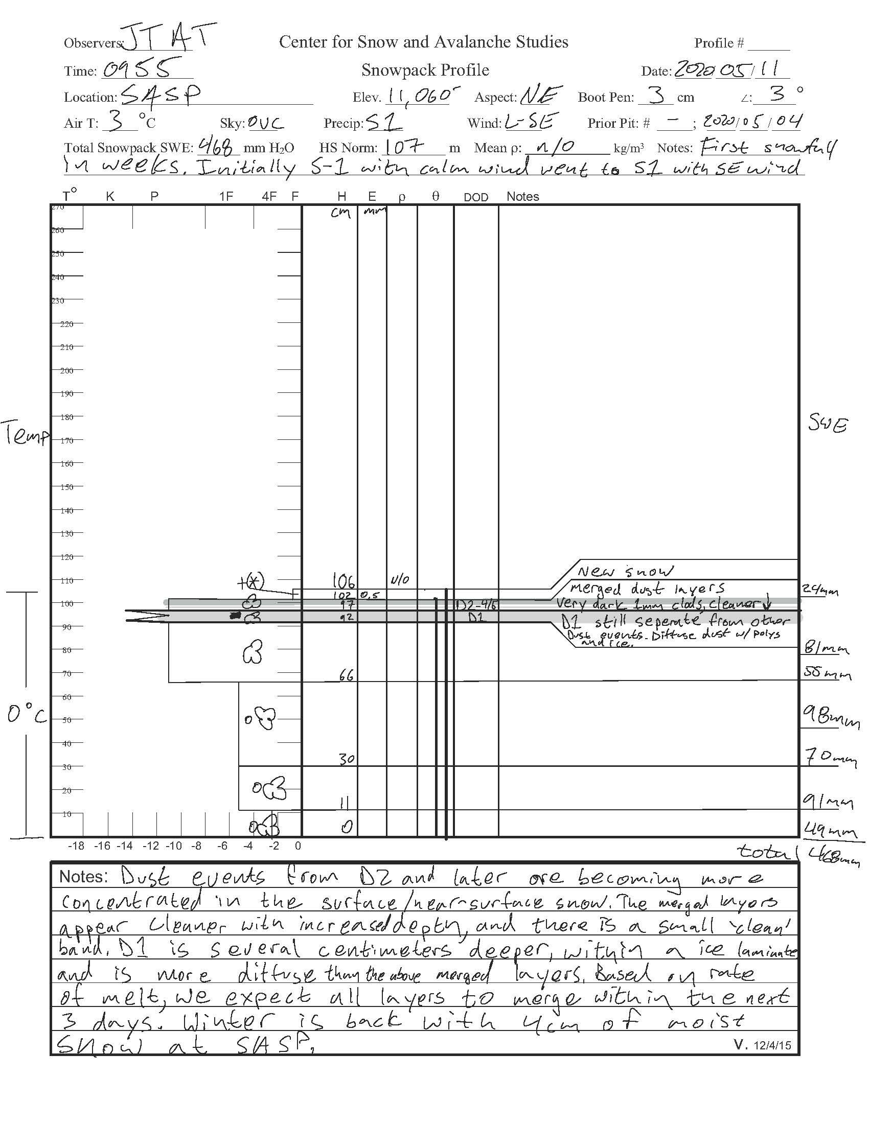
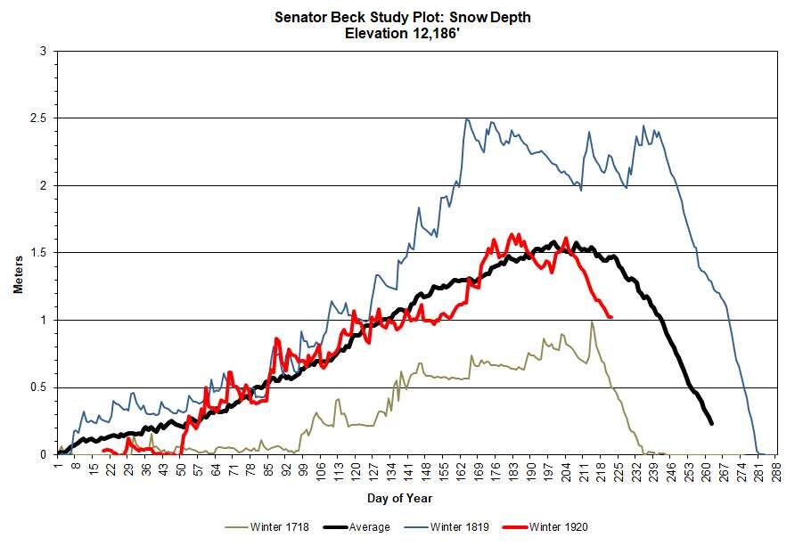
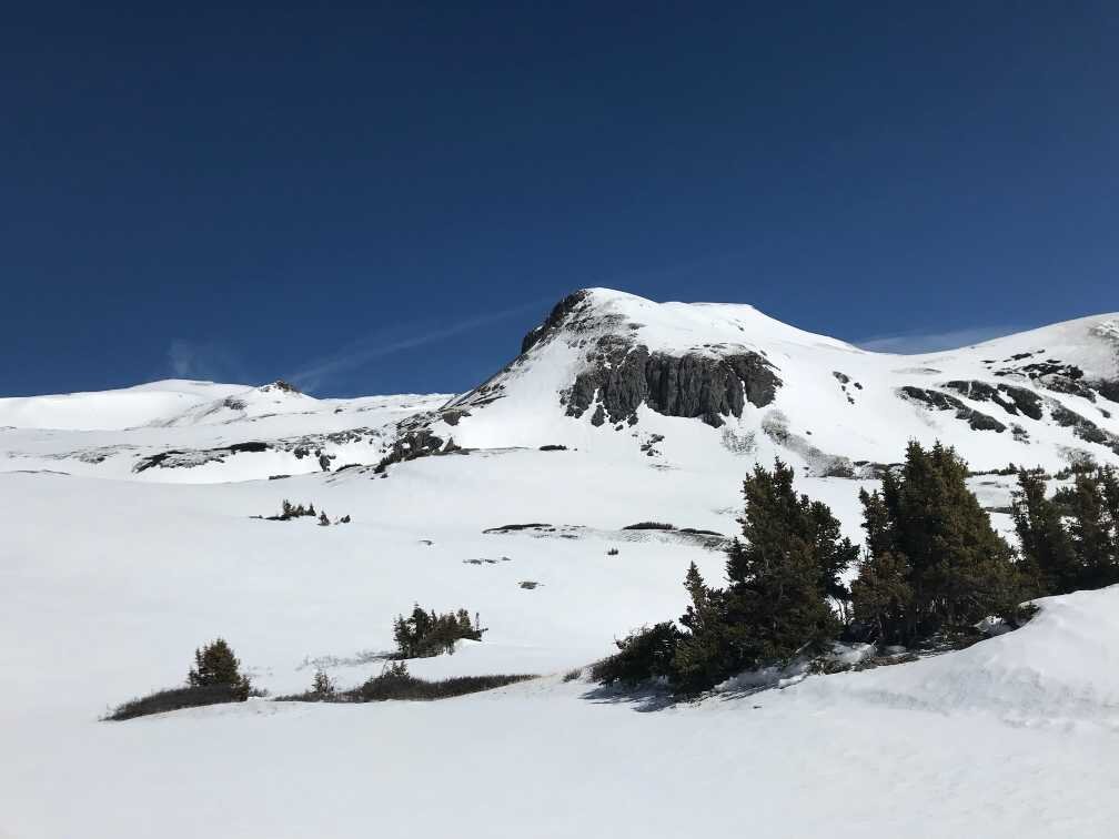
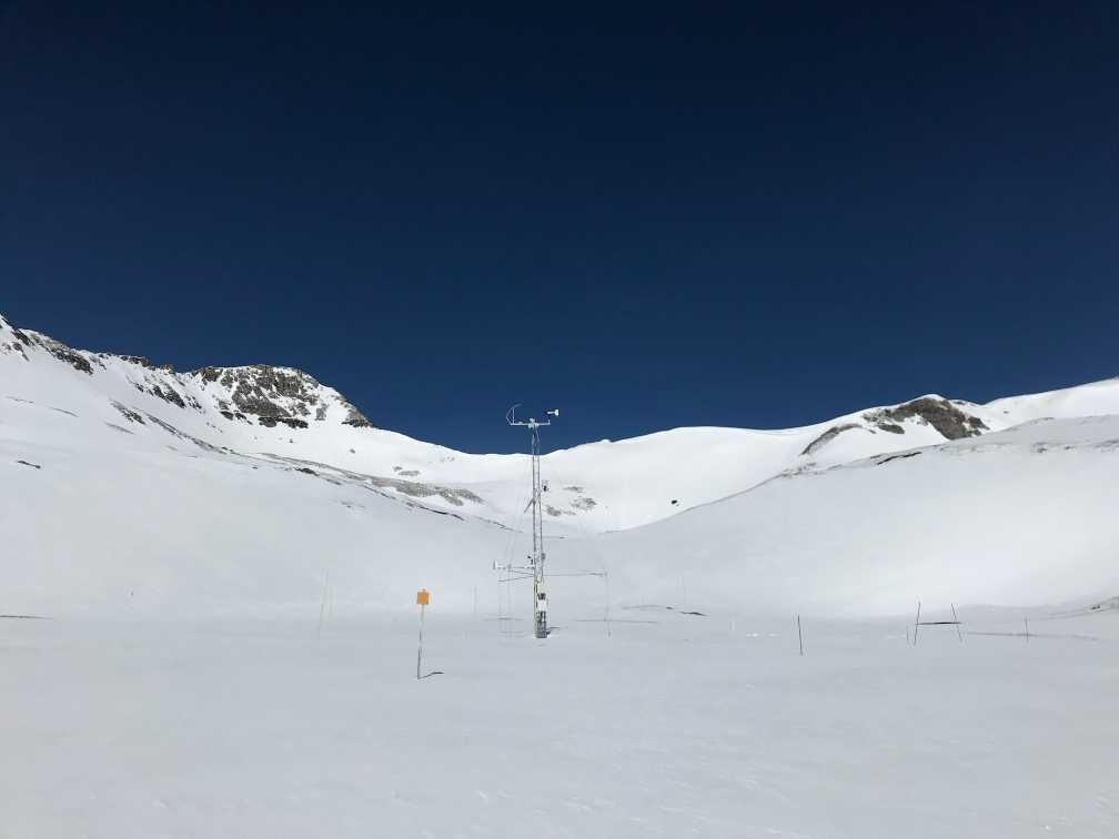
Below: At Senator Beck Study Plot today (May 12), SWE is currently 21.9” and D1 is currently about 12” below the surface. Even at 12,200’ snowmelt has been accelerated these past ~3 weeks. Please see plots below.
Below: For a few days cooler nighttime temperatures slowed snowpack melting and yesterday snow accumulation provided a temporary albedo reset, slowing snowmelt still further. This will be short lived given the forecast of mostly warmer than normal conditions and lack of precipitation.