CODOS Update May 19, 2020: All Dust Layers Merged, SBSP (12,200’) Melting Fast, Peak Discharge Timeframe, Another Dust Event?
Greetings from Silverton,
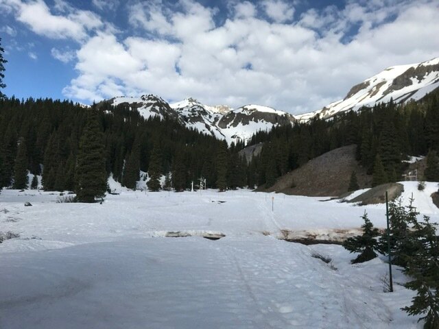
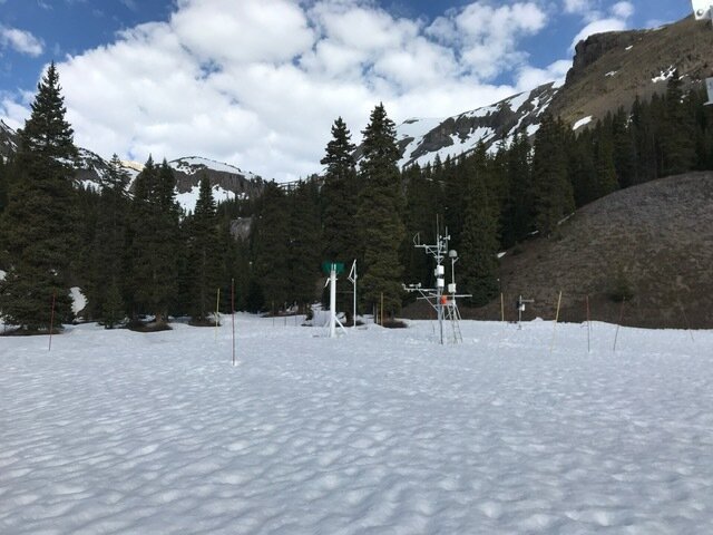
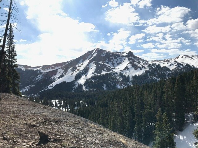
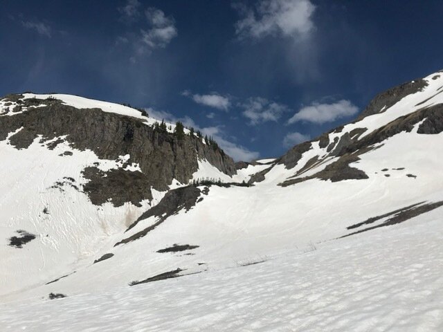
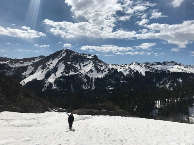
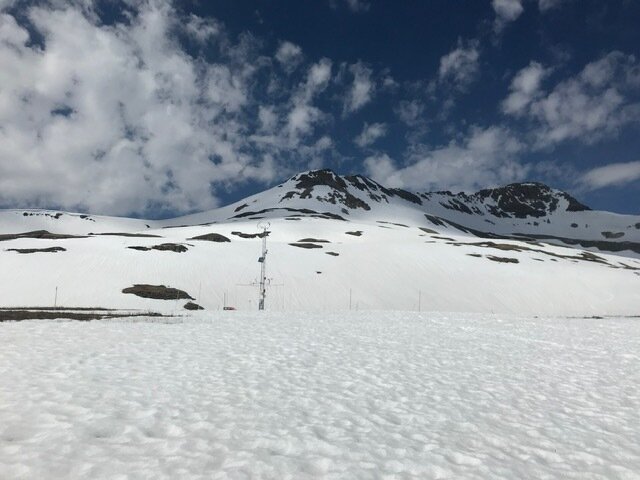
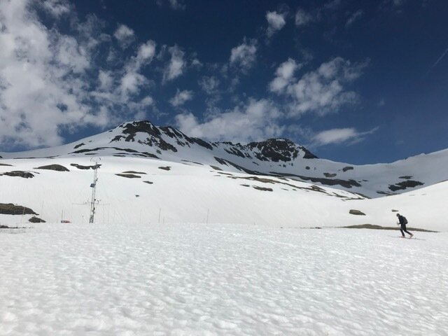
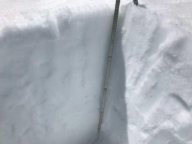
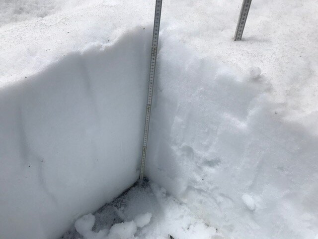
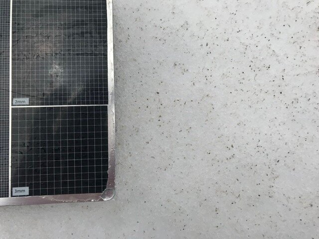
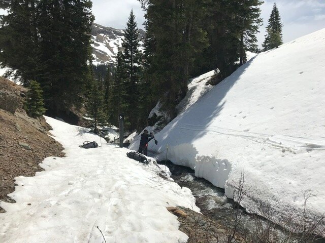
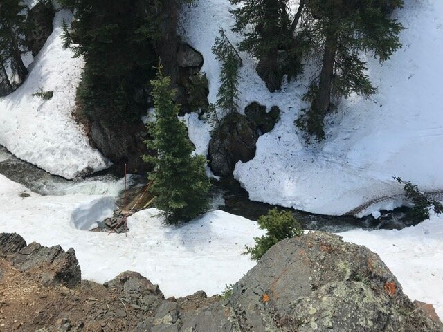
We visited Senator Beck Study Plot (12.200’) and Swamp Angel Study Plot (11,060’) yesterday (May 19). Dust was near fully emerged last week, and now this week all dust layers are fully emerged on surface at the study plots and surrounding landscape. At SASP albedo has nearly bottomed out, meaning the next big dip we will see in albedo will be when the ground is exposed. Around SBSP sun cups have formed which play into reducing albedo further and increasing surface area, possibly increasing sublimation.
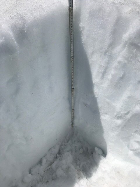
On May 19 at SASP we observed 11.9" of SWE, down from 18.4" on May 11. That’s a melt rate of about 0.92"/day over the last 7 days. At SBSP we observed 17.6" of SWE, down 4.3” from 21.9" from our last visit 6 days ago. That is a melt rate around 0.72"/day. The week prior at SBSP SWE depleted 2.3” and the week prior to that 3”. So the highest of elevations are now contributing full on to streamflow.
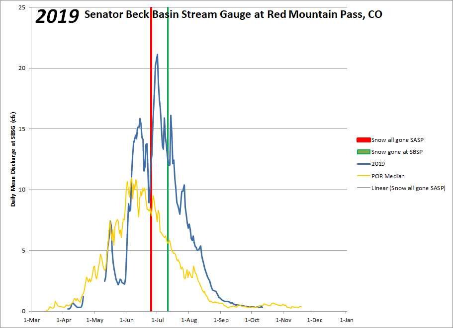
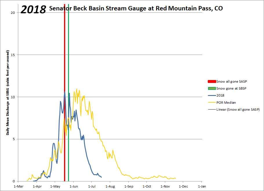
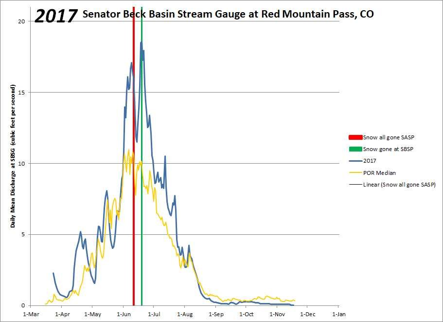
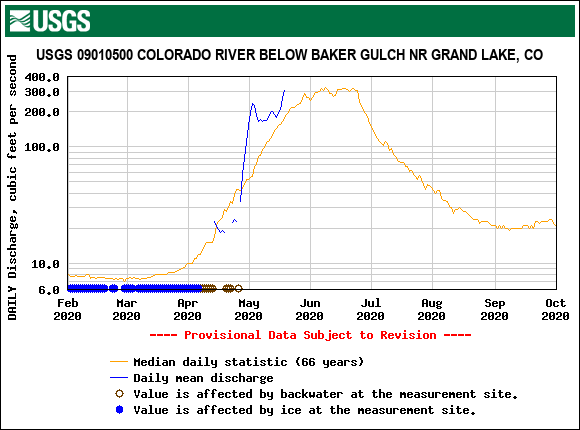
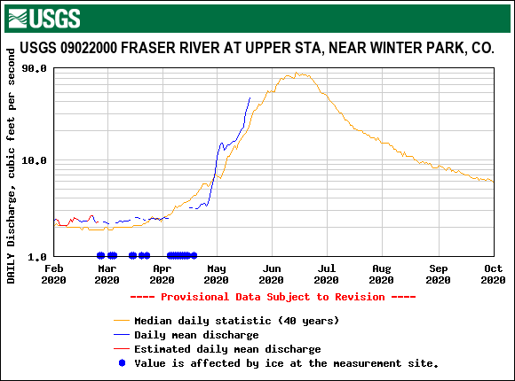
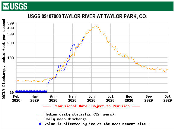
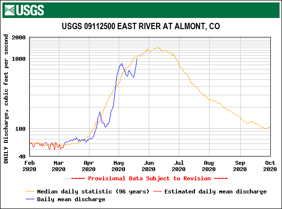
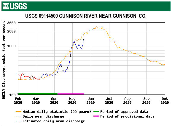
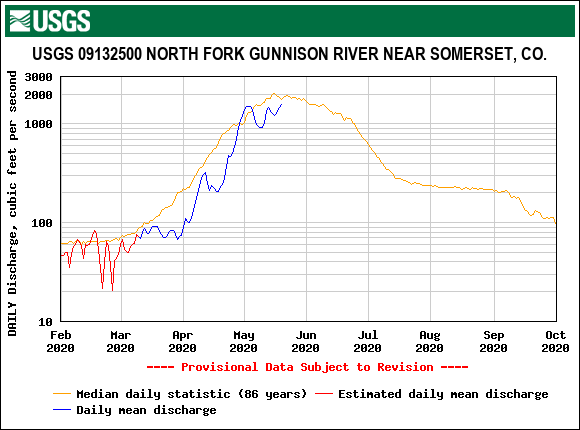
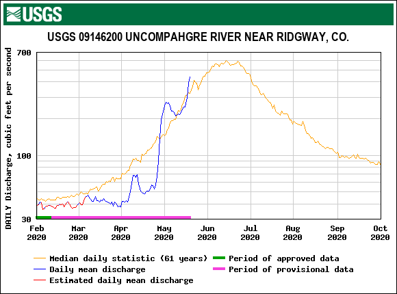
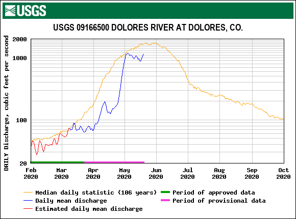
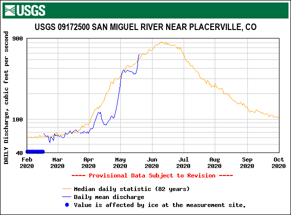
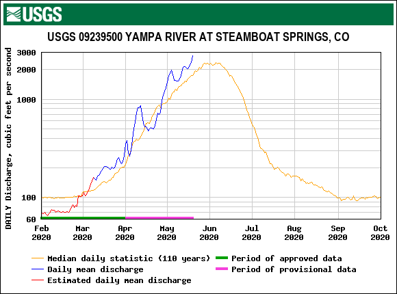
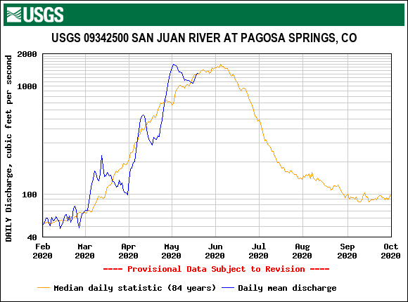
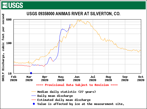
At this rate of melt we are looking at snow being gone at SASP in about 11 days. If history holds the SBB streamgauge will peak in the same amount of time. Typically the day snow is all gone at SASP our gauge peaks (on average within 1-2 days) and when snow is all gone at SBSP we see a second peak. It varies as to which peak is the highest snowmelt peak of the season, last year for example the second peak was the highest since there was still a lot of lower elevation water making its way to the streams when SBSP was well into melt. But in 2016 the biggest peak was by far the first peak likely since the higher elevations started contributing earlier in the season and lower elevations had a compressed melt period following spring storms. In 2018, a very dry year, the two peaks were near identical. I would guess for SBB this first peak will be the highest peak since higher elevations as indicated by observations at SBSP are melting at a good click already and in another ~10 days will lose close to a third of its remaining snowpack. And by extension, since the SBB, Uncompahgre, Animas, and other local gauges mirror each other pretty closely, we should see some sort of peak in these rivers as well.
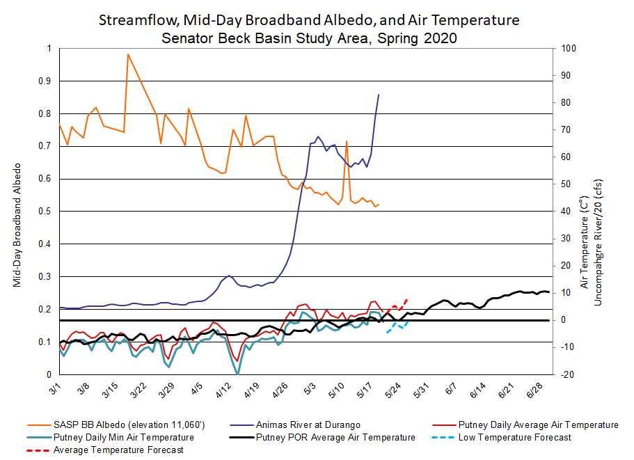
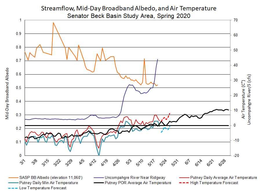
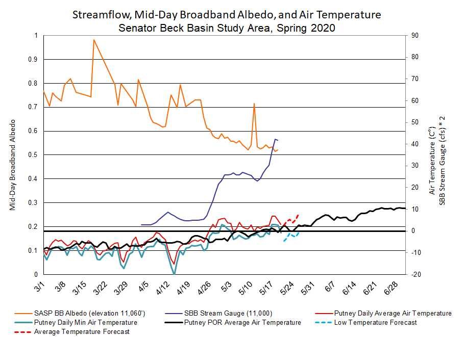
A slight cool down is expected over the next few days with nighttime temperatures slightly dipping below freezing. There are no stormy conditions expected in the Southern Mountains so we will see what happens in terms of cloud cover reducing radiative forcing and cooler temperatures slowing snow melt Going into next week the forecast calls for continued warming. Streamflow at SBB dropped slightly yesterday in response to this minor cool down, and expected to rebound once the cooler period passes.
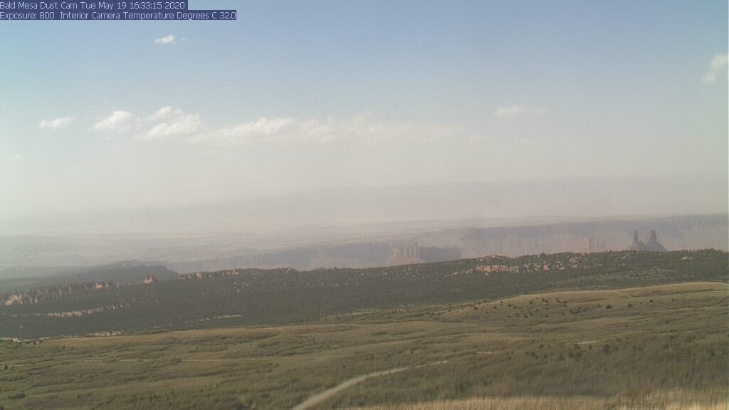
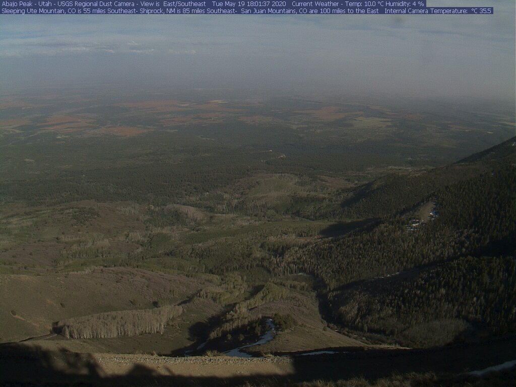
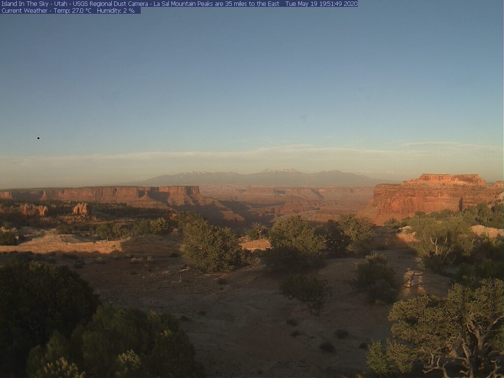
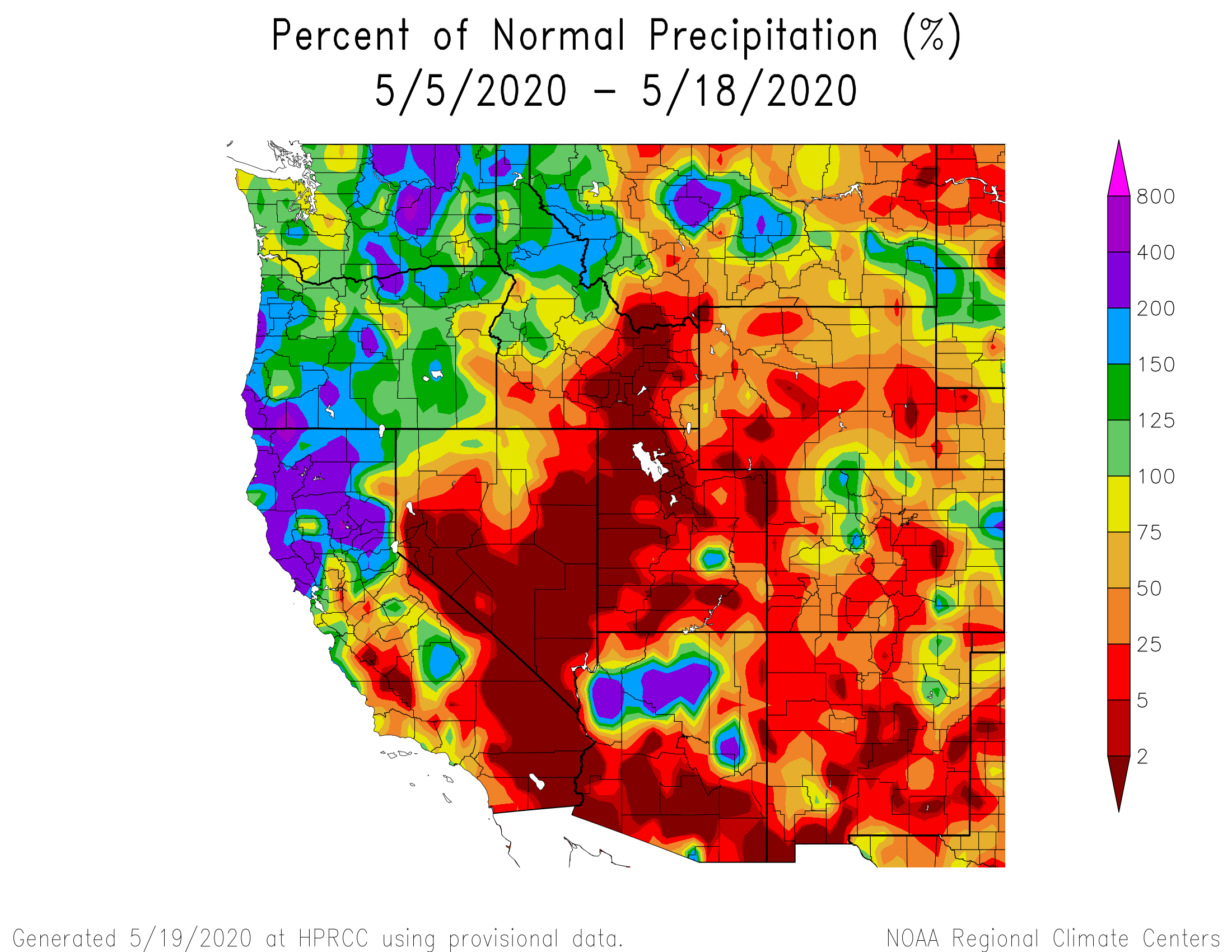
A new dust event? The forecast yesterday in the Desert Southwest was for windy and dusty conditions and the USGS dust cameras show a bit of dust late yesterday (see below). So it is likely the Southern Colorado Mountains at least received some amount of dust. With all the season’s dust layers now at the surface of the remaining snow it may be difficult to determine if and/or how much new dust was received. We plan to make more observations soon, but unless a major event happened the effects on the remainder of the snow season will be negligible.
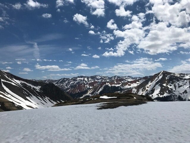
Below: Pictures of Swamp Angel and Senator Beck on May 19, 2020.
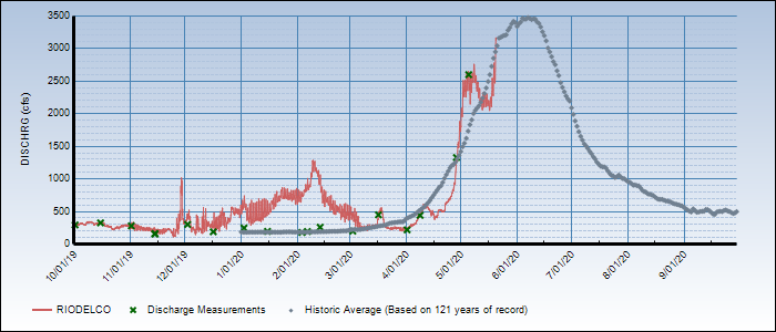
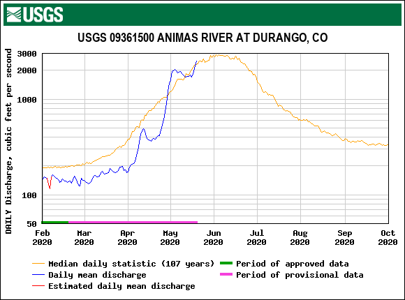
Below: Streamflows took a small breather ~14 days ago for a number of days in response to a cool period followed by a minor albedo reset from a quick moving storm May 11. Since then the quick upward blip in albedo returned to descending and streamflows continued their upward spike. The forecast calls for a little cooler conditions the next few days then a return to the heat that will push snowmelt to predominate completion at and below around 11,300’.
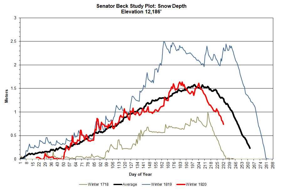
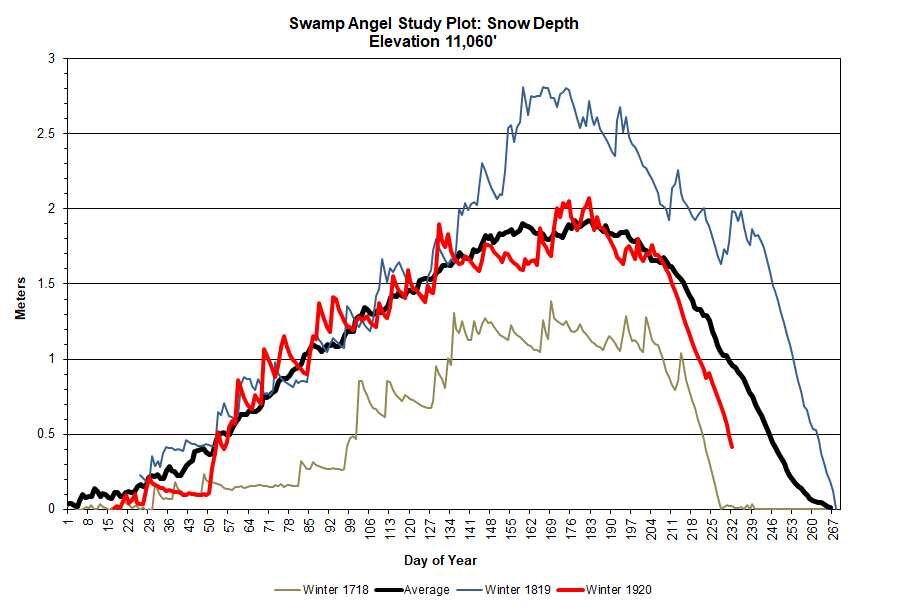
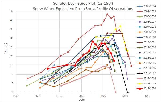
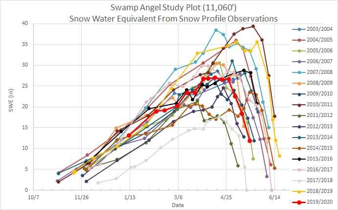
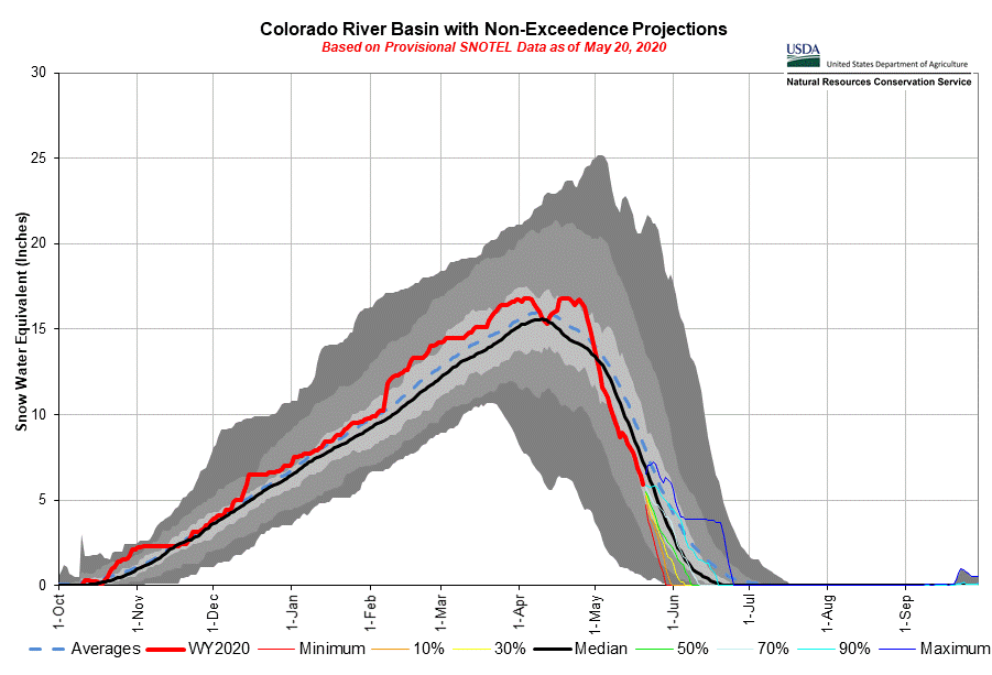
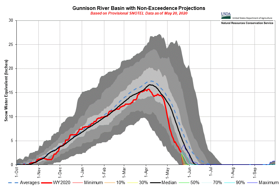
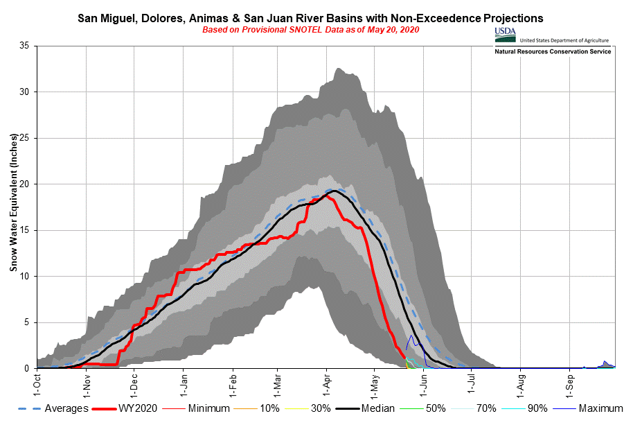
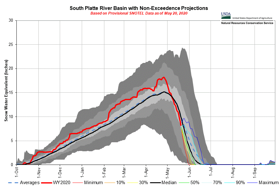
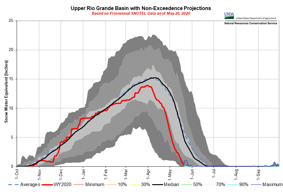
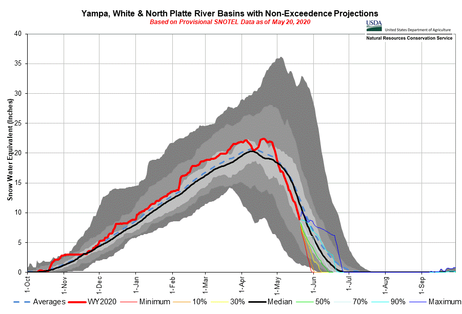
Below: A steep fall of the snow hydrograph as seen in snow depth and SWE plots below. We were looking pretty good with near normal peak SWE at SBB, then a very dry and hot spring ensued, undoing an otherwise adequate snow season.
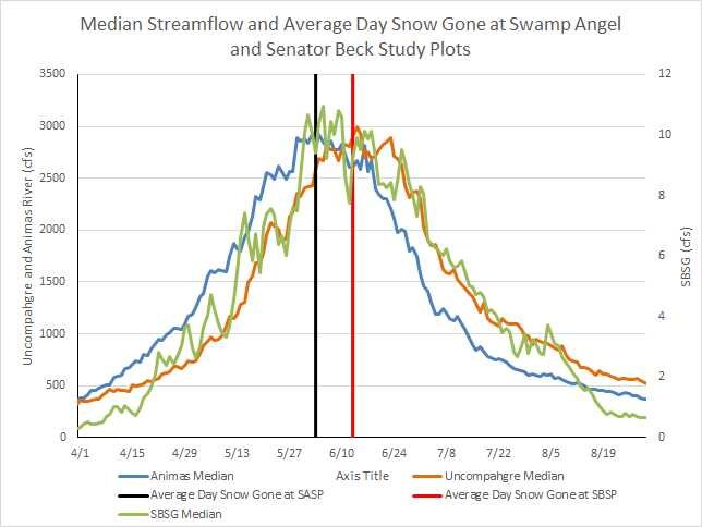
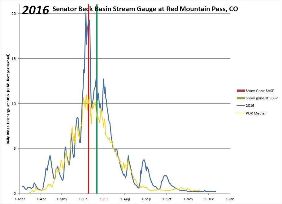
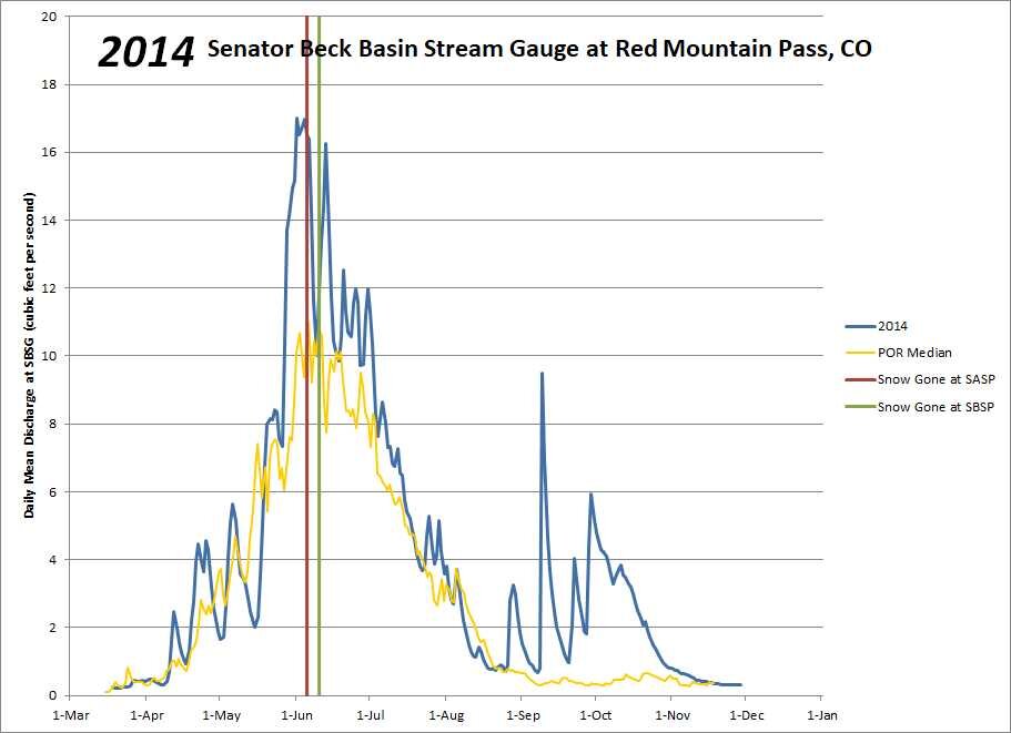
Below: The first slide shows median streamflow with the average day snow is all gone at SASP and SBSP. The lower elevation melt out of SASP corresponds to a typical first peak and the higher elevation melt out of SBSP contributes to the second peak. A few example plots from recent years are also shown.

Below: USGS dust camera images of dust mobilized in the Desert Southwest in the late afternoon on May 19.