CODOS UPDATE MAy 10: Warm up, Cool Down, Repeat
Greetings from Silverton,
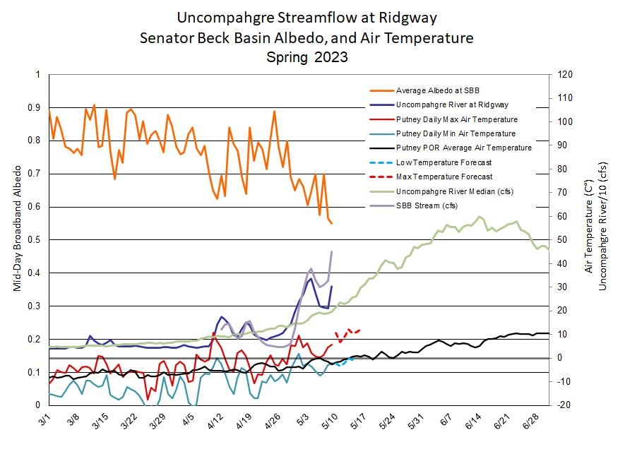
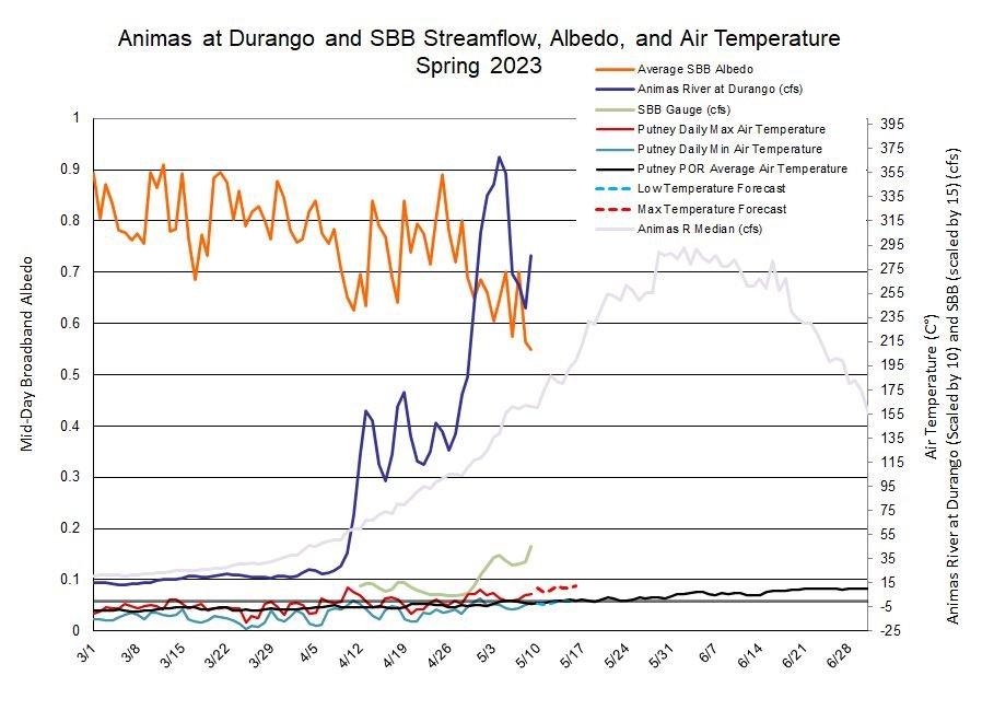
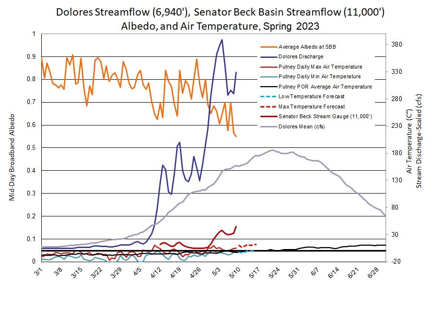
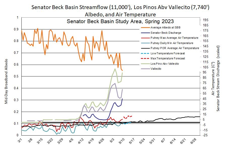
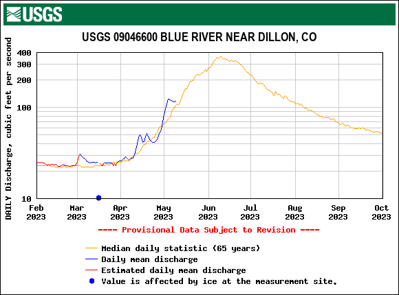
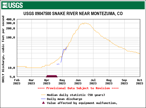
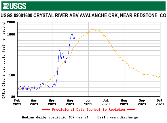
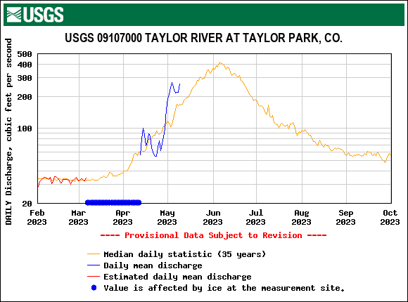
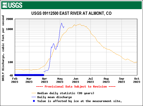
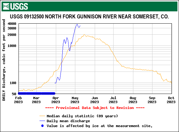
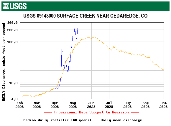
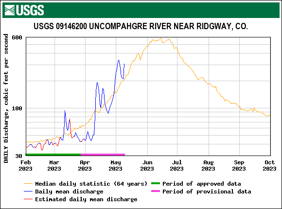
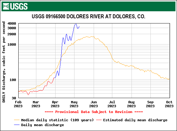
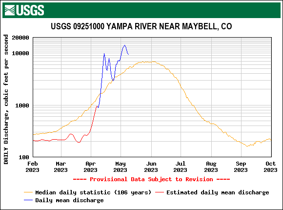
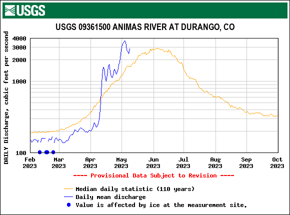
Since our last update we saw sunny/warm conditions with exposed dust ramp up snowmelt. Going into this past weekend there were a few days of high overcast and blustery conditions that slowed snowmelt for a few days. Monday and Tuesday were back to warm/sunny, resulting in an upward spike in streamflows. The Senator Beck streamgauge (11,000’) is starting to ramp up. The snowpack at the adjacent Swamp Angel Study Plot has been wet for well over a week. It is poised to go.
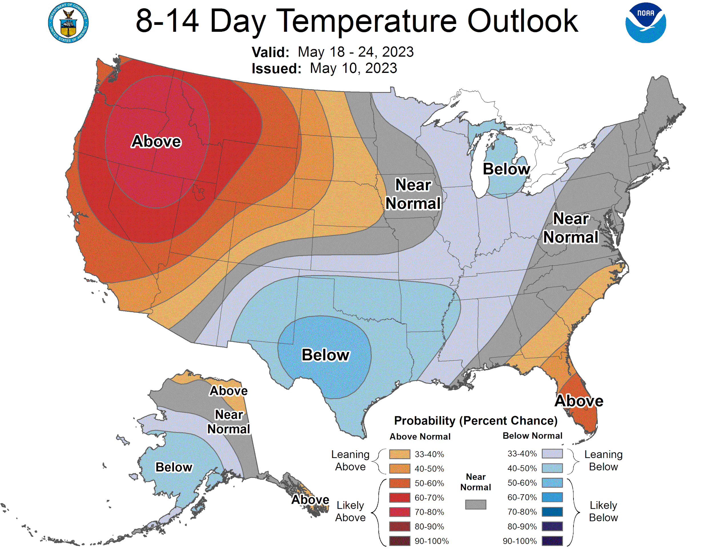
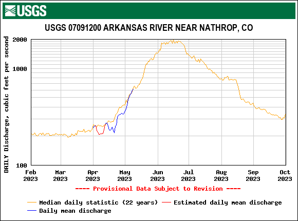
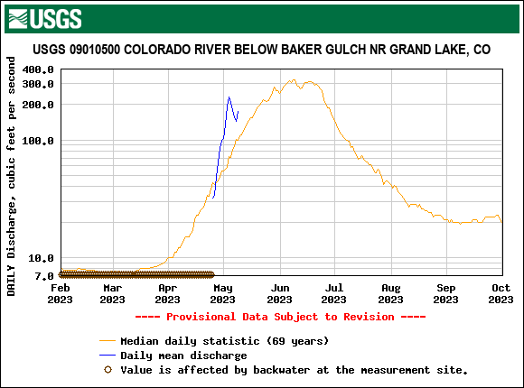
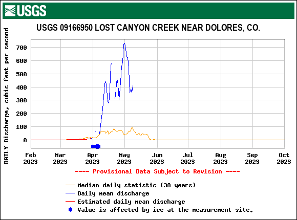
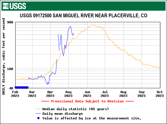
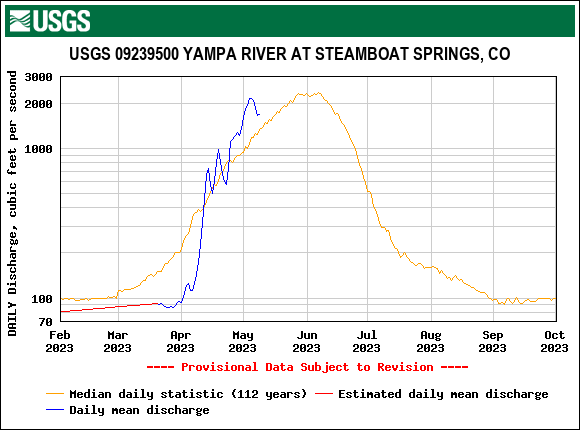
I’m not even going to try to boil down the weather forecast. I have heard and read the longer term forecast is “odd” and “weird and getting weirder”. But as we head into mid-May I think it is safe to say streamflows will jump given half a chance. Western basins are 100%-185% of median. The Arkansas and are South Platte are 65% and 81%. We got some snow to melt. And it’s my job to remind readers we have severe dust conditions on the surface in parts of the Upper Gunnison, Roaring Fork, Grand Mesa, Lower Rio Grande and Dolores. In the Upper Rio Grande and San Juan’s near Red Mt Pass we have solid average conditions, which was a bit of a head scratcher the first part of April when the dust events hit, because typically the San Juan’s are hit the hardest and dust severity lessens as you head northeast into Colorado. The big event in early April skirted the Upper San Juan’s and/or blew the dust further into Colorado due to the intense winds. Please see images below.
More Soon,
Jeff Derry
Below: Albedo is heading into it’s lowest territory of so far this season. Dust will remain stubbornly at the surface. Any spring storms that come with snow will likely provide an albedo reset of no more than a few days. There are chances of snow in the high elevations this week.

Below: MODIS image from yesterday, May 9. A speckling of cloud cover in this image, but shows the hard hit areas from dust.