CODOS UPDATE April 29: Time-OUT IS OVER
Greetings from Silverton,
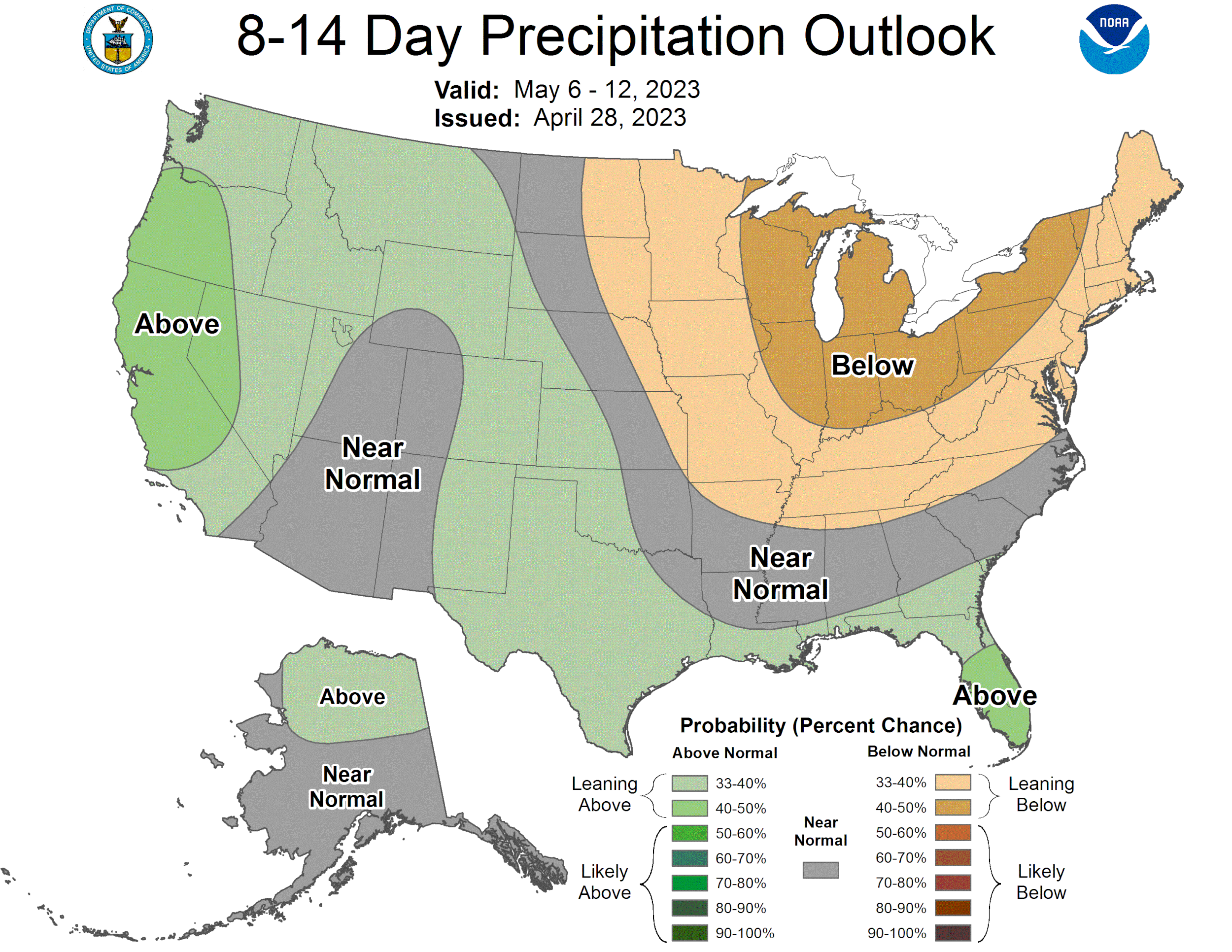
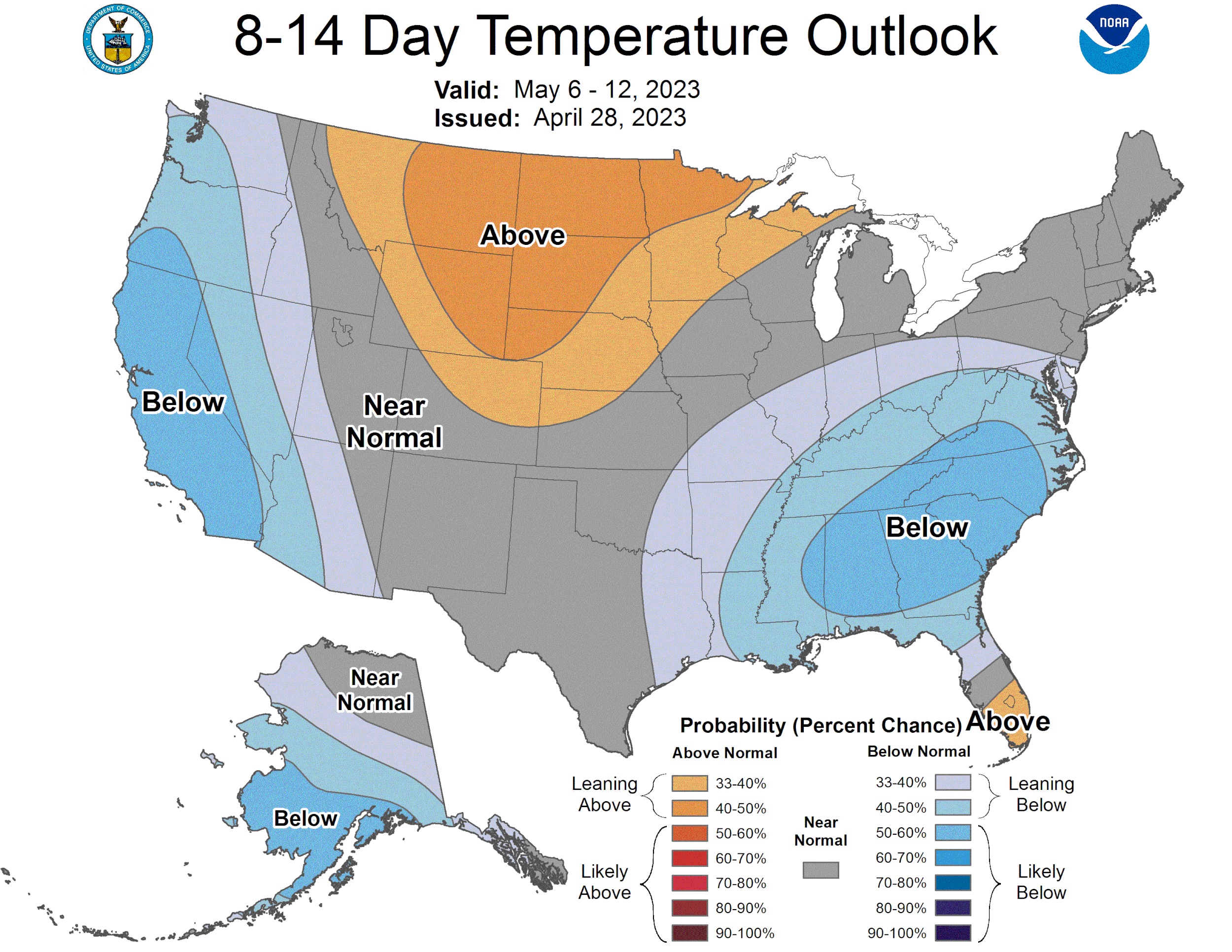
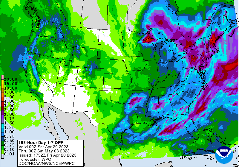
Over the last couple of weeks we have seen most hydrographs move sideways in response to a number of storms coming through Colorado. During this timeframe the Swamp Angel precipitation gauge gained over 2.5" of precip, with 10 days of recorded precip. This has done well to add more SWE to the snowpack, cover the surface dust that was on the snow, and slow snowmelt rates. That time-out looks to be over. The weather forecast is calling for a warm-up this weekend and the week ahead with not much precip but for a little starting Thursday. It was nice having that temporary albedo reset to slow things down, but these spring storms are typically wetter and combined with the spring warmth, do not keep the dust covered for very long. We can expect to see the dust that was covered to show itself soon - dependent on how much snow your locale received. Lower elevations - particularly the more heavily dust impacted areas like the Dolores, Grand Mesa, Rio Grande, Roaring Fork, parts of the Gunnison - will kick into gear rather quickly. The CBRFC forecast is expecting some rapidly rising rivers. As reported in our last update, all the codos sample sites (which are at mountain passes) are isothermal. The warm-up ahead will push the snowpack ahead into the ripening phase. It’s the first of May, it’ll be a roller coaster snowmelt ride from here on out.
More Soon,
Jeff Derry
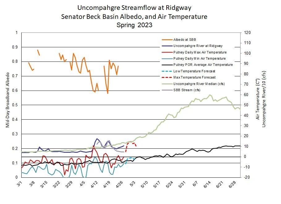
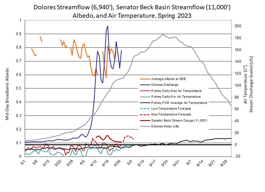
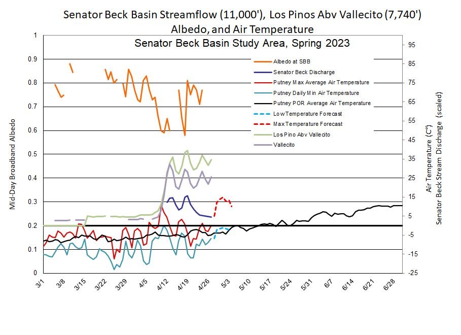
Below: We are well into the time of year that I like to show my favorite plots. The orange line is albedo in Senator Beck, where there are gaps in the line is a good thing because that is when we received snowfall that covered the uplooking solar radiation sensors, making the reflected/incoming solar radiation ratio greater than one. When albedo goes up, streamflow goes down, and vis-versa. Referencing our stream gauge at 11,000’ can be helpful to see what is happening higher up and what is making it’s way down the hill. I like to show low/max air temperature. If the snowpack does not get a good freeze overnight then when it wakes up it is poised to continue melting, whereas a good freeze will require additional heat before melt continues. The NWS weather forecast not only gives an idea of temps, but also used somewhat as a proxy for solar input and influence on albedo. The big question is what is the albedo forecast? Knowing this will indicate what streamflows will do. Given the forecast, the albedo will gradually degrade as the snow ages and the dust becomes exposed. So the forecast is for a dropping albedo and rising streamflows.

Below: MODIS image from yesterday, April 27. A good bit of cloud cover in this image, but the take home point is the high elevations are fairly bright from recent snowfall. The lower elevations and areas harder hit with dust are significantly darker.