CODOS UPDATE March 4: Major dust wallop, Dust event #2
Greetings from Silverton,
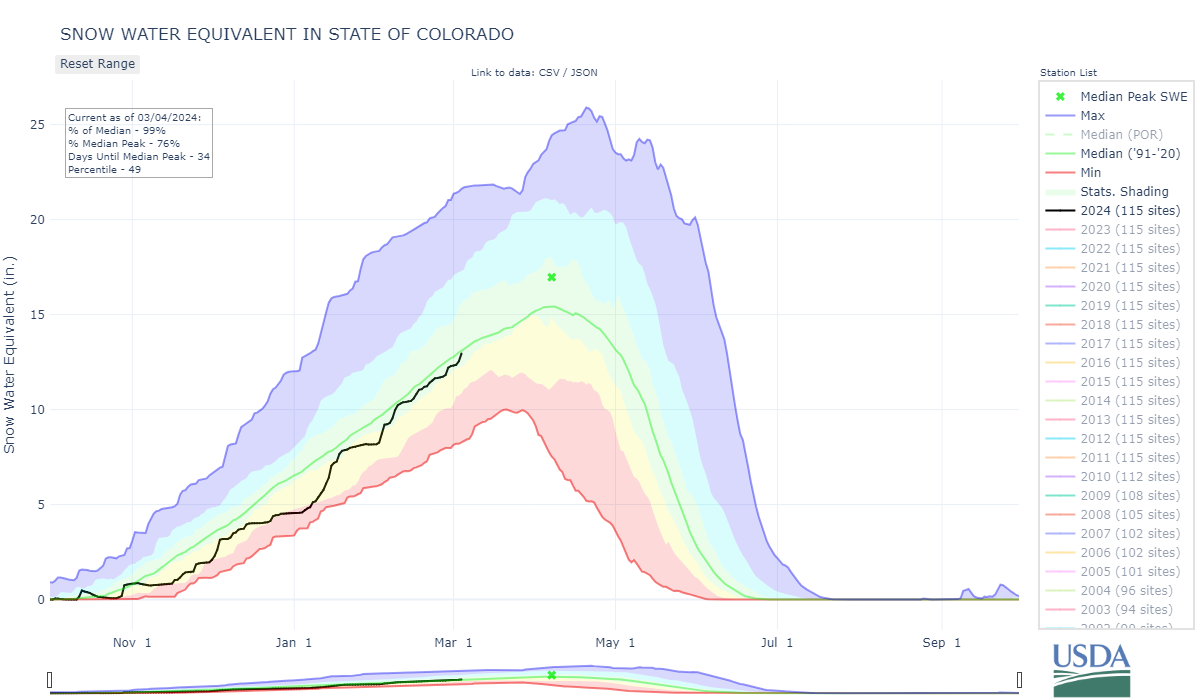
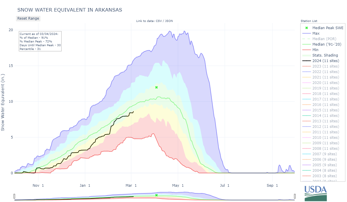
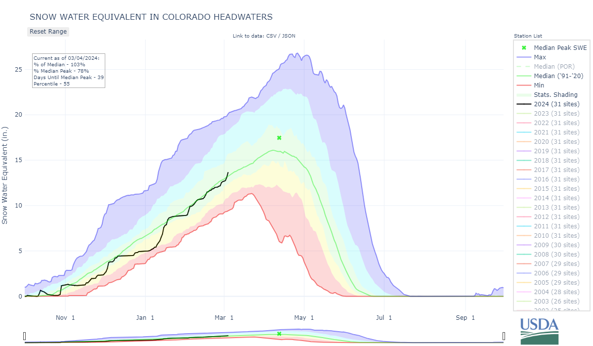
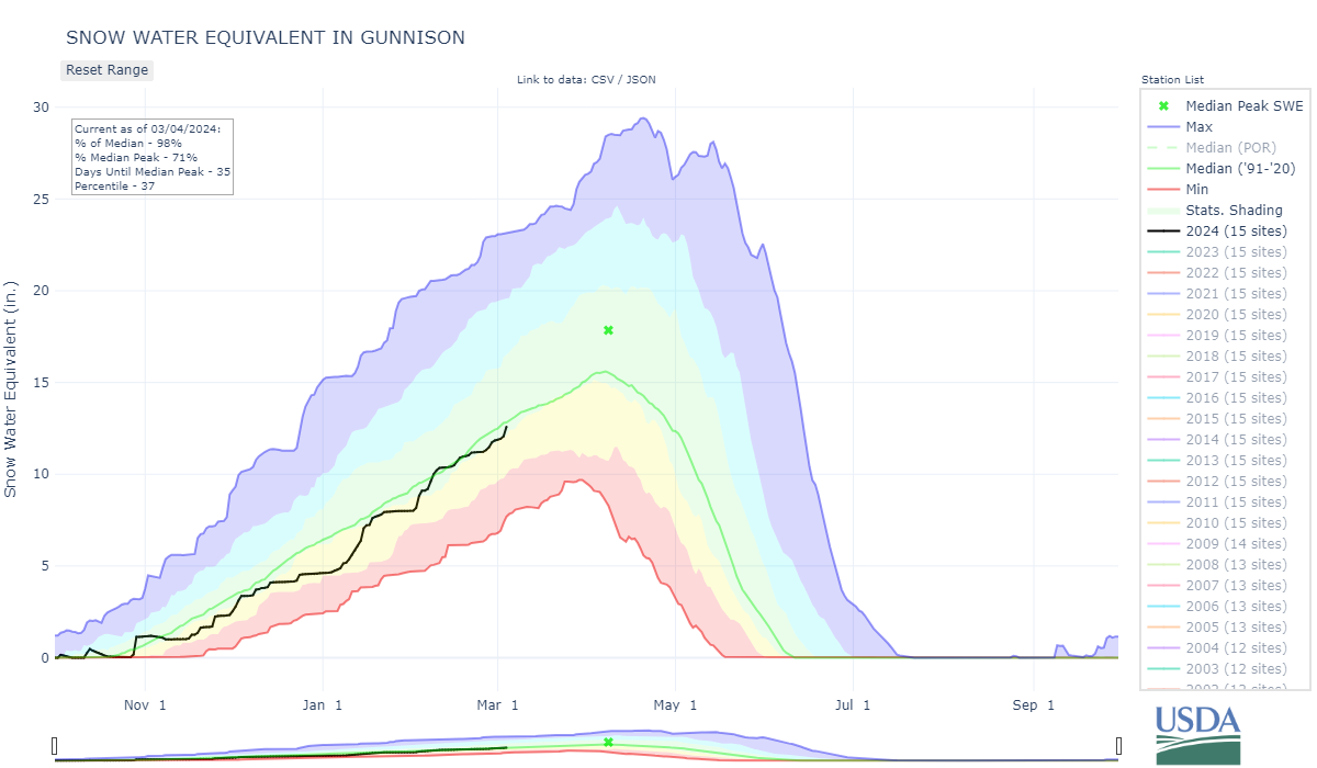
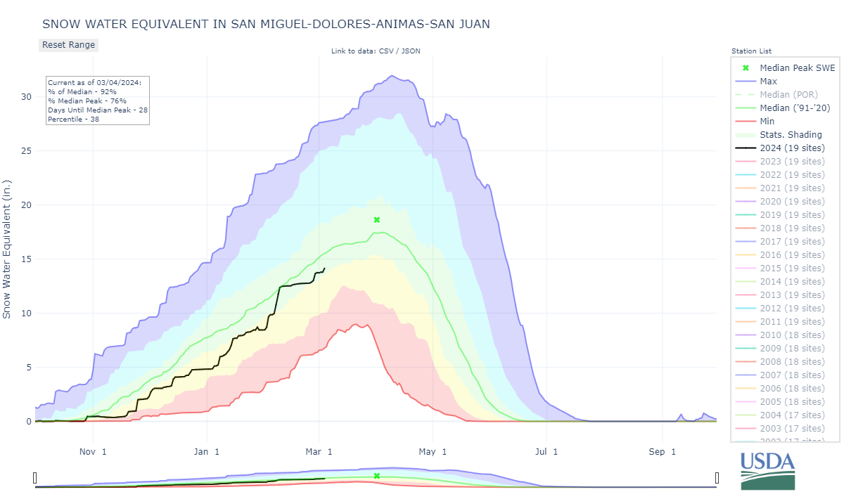
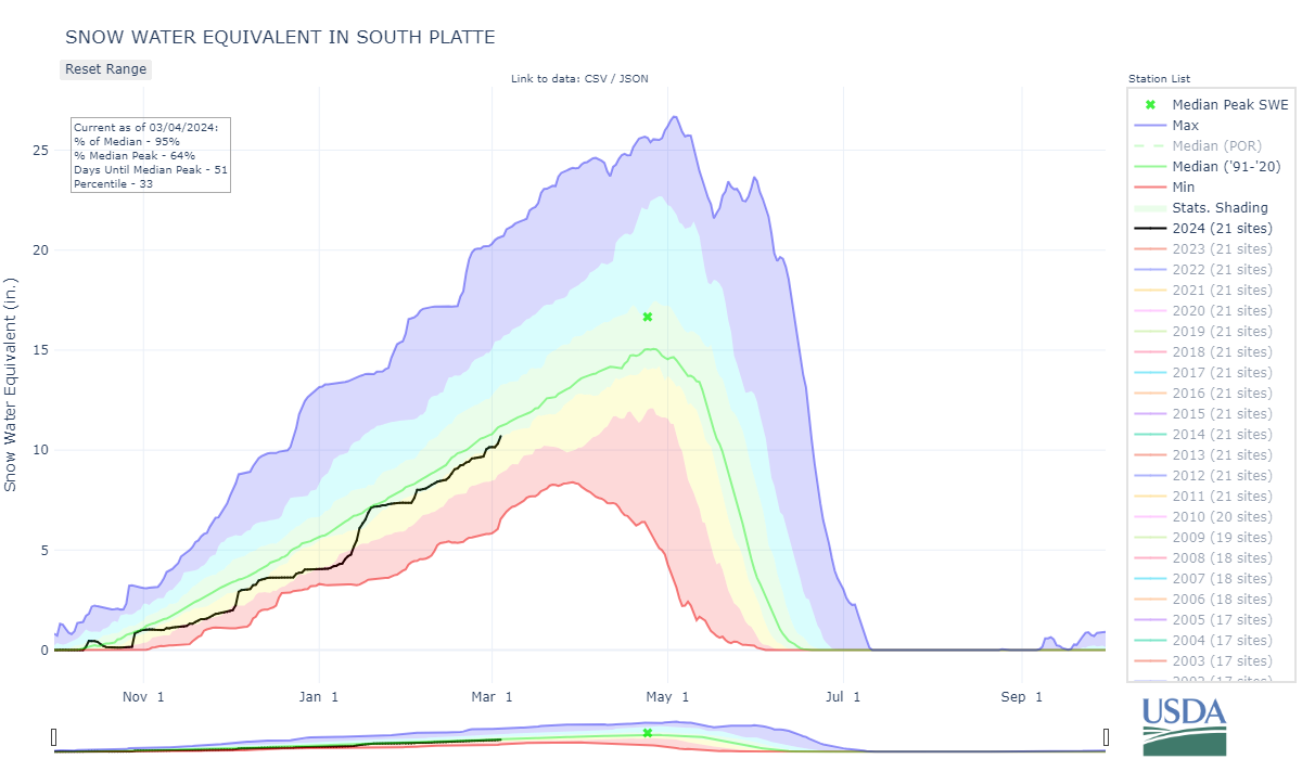
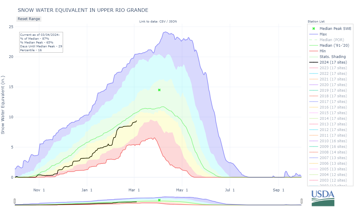
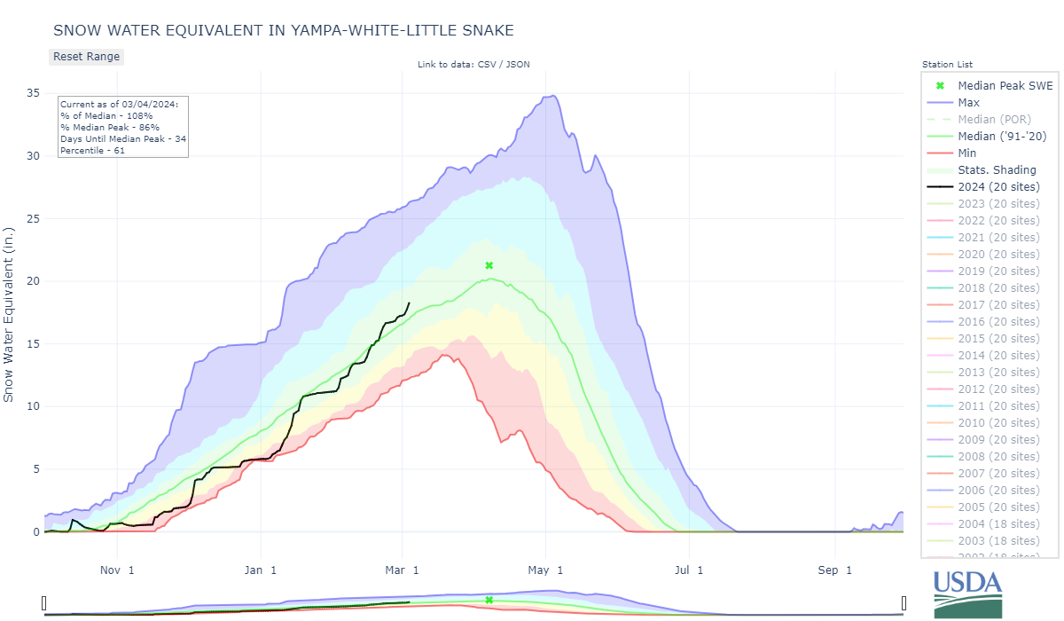
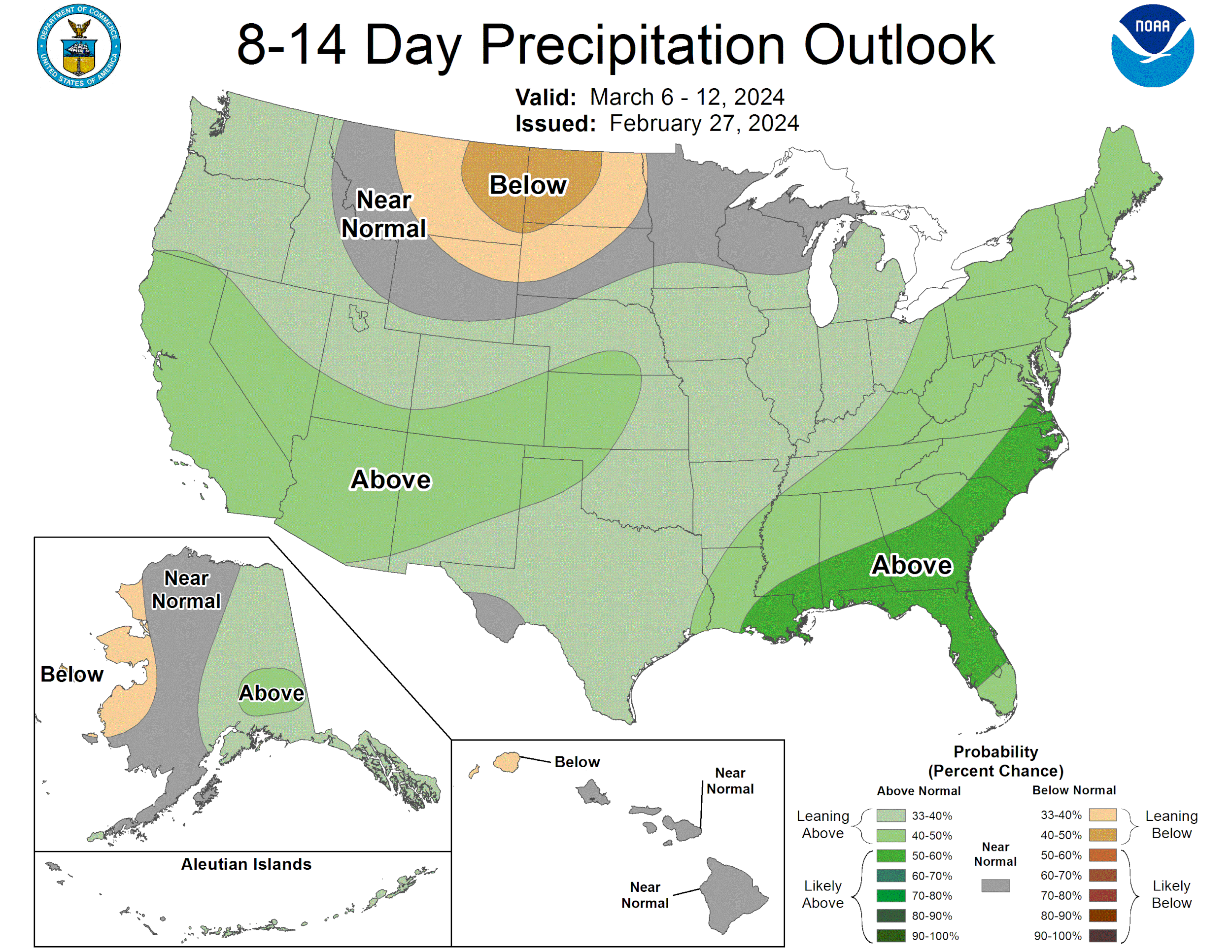
The high winds that came through Colorado Feb 26-27 and brought the first dust-on-snow event of winter didn’t abate, or at least not for very long, because even bigger winds roared through over the weekend (March 2/3) bringing all kinds of dust over a widespread region. The satellite image below gives an idea of where the dust got kicked up and it’s trajectory through Colorado. This event is very significant in how it could influence ablation of the snowpack. Windy spring conditions didn’t hesitate to ramp up with the arrival of the month of March. We went from average winds and no dust to high winds and two dust events in just a couple days. The wind/dust ushered in a snow storm that helped maintain a somewhat near normal snowpack (see snow accumulation map below). Next week the codos team will assess dust-on-snow conditions statewide and report our findings soon after.
Take Care,
Jeff Derry
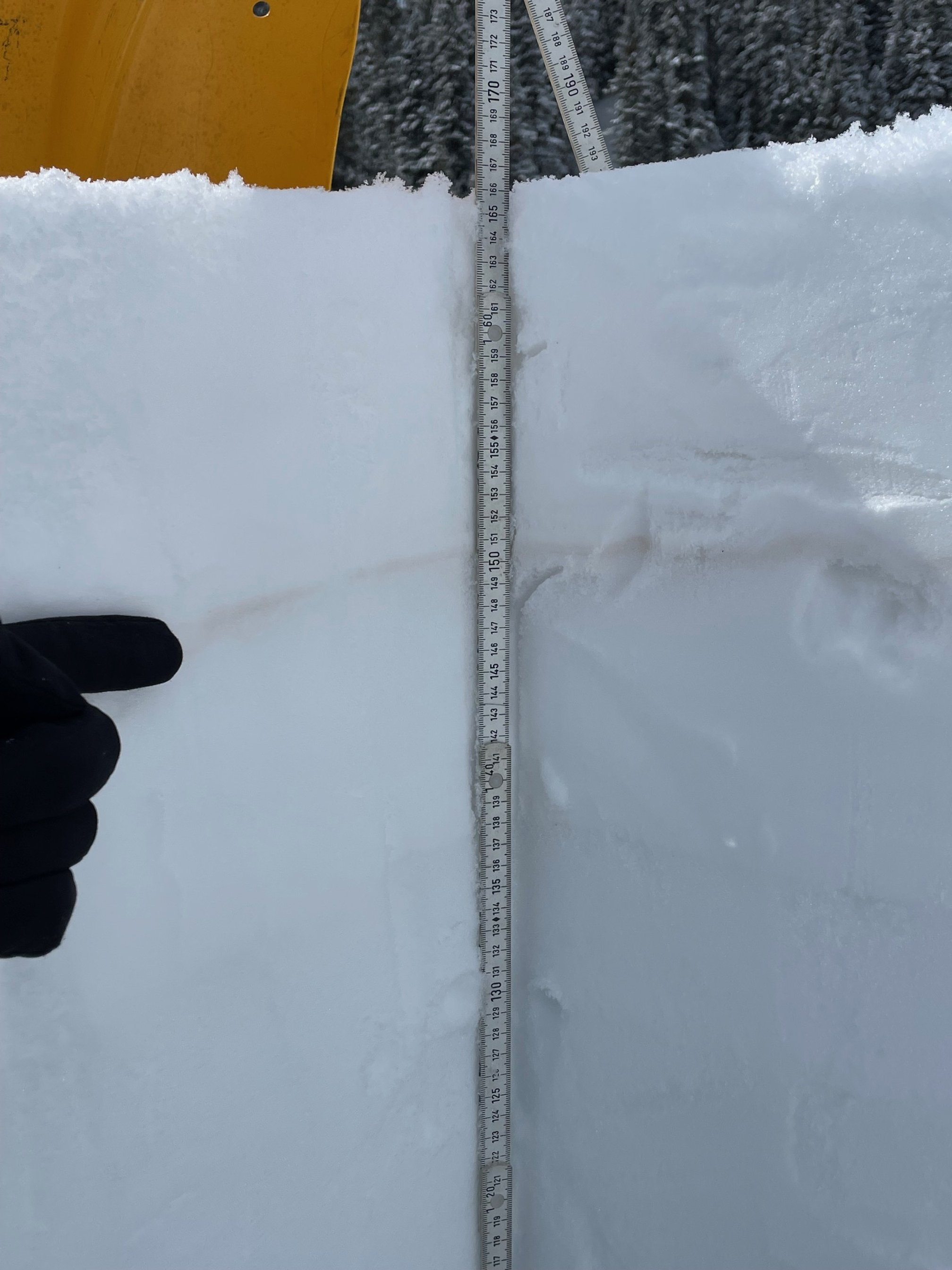
Below: Swamp Angel near Red Mt Pass

Below: Dust RGB image of the dust event on Saturday, March 2.