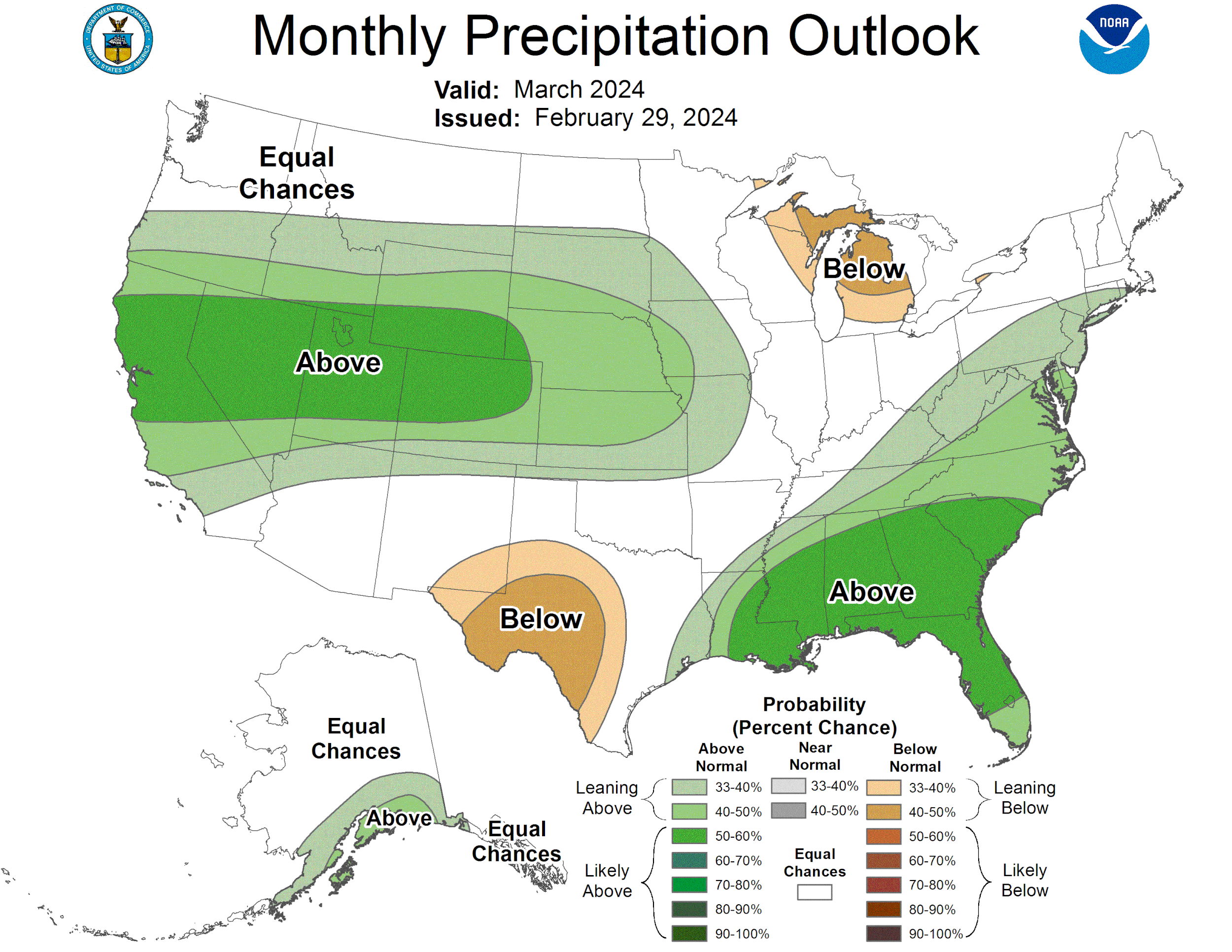
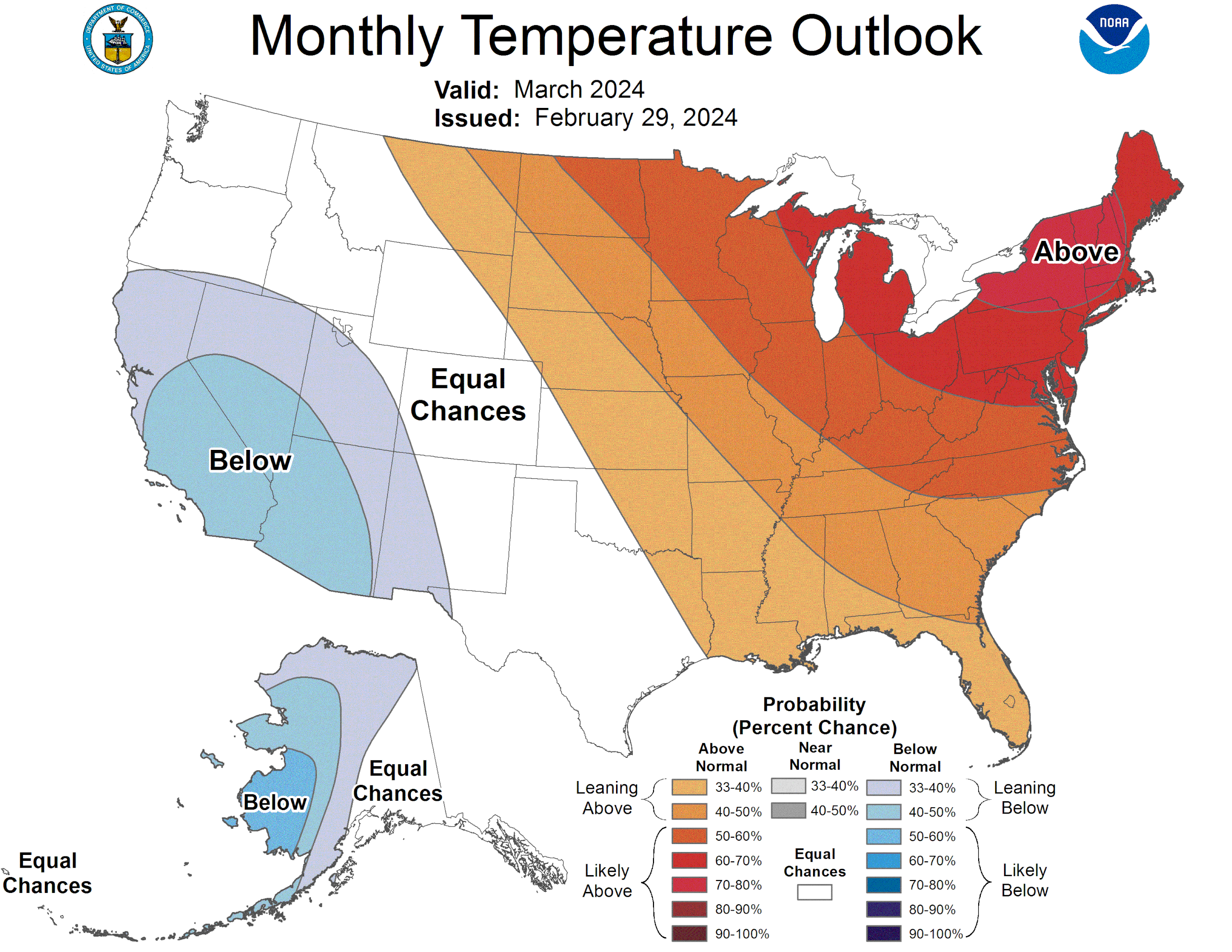
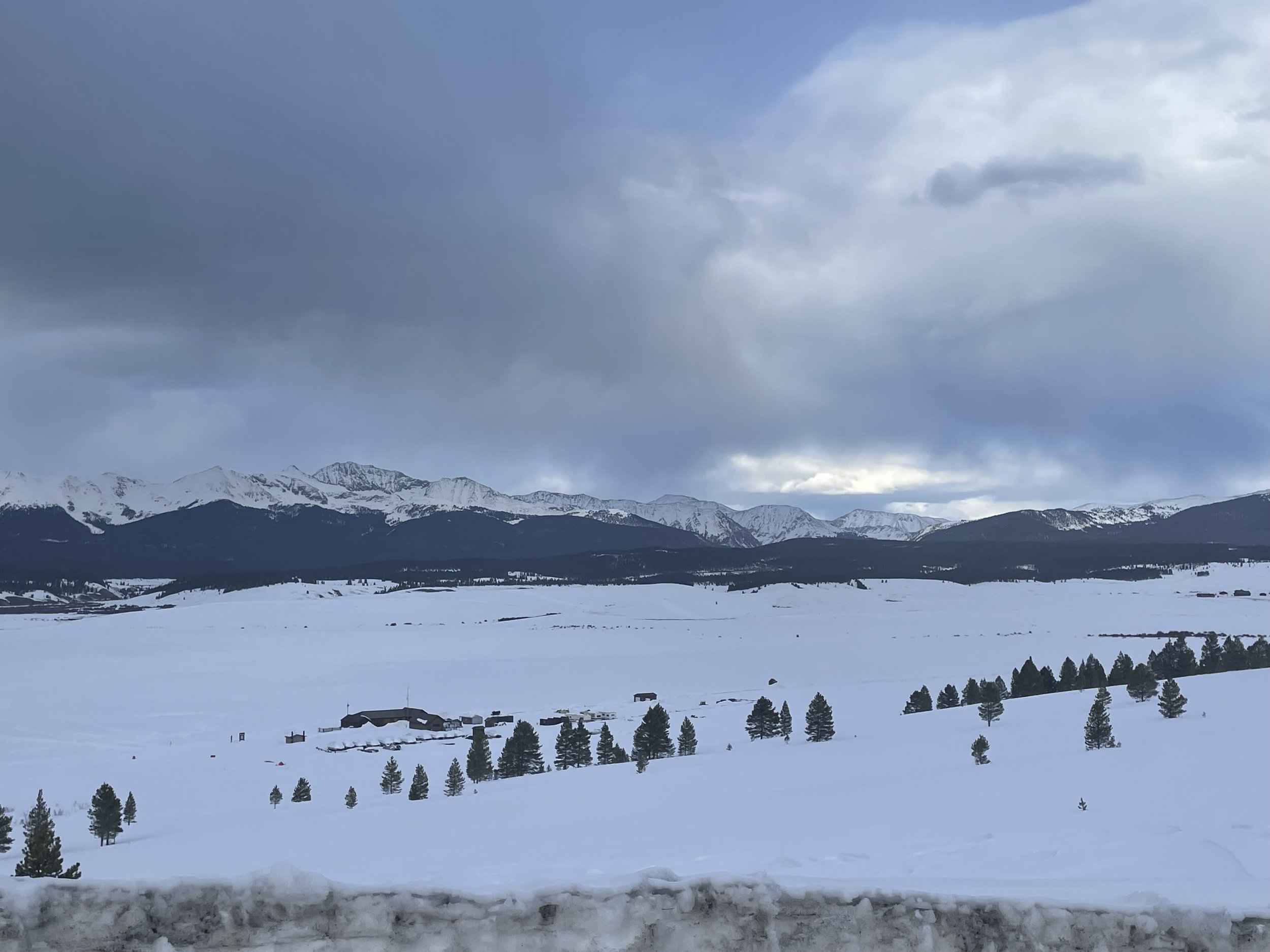
CODOS Tour Update March 15, 2024: Statewide dust-on-snow observations for march
Greetings from Silverton,
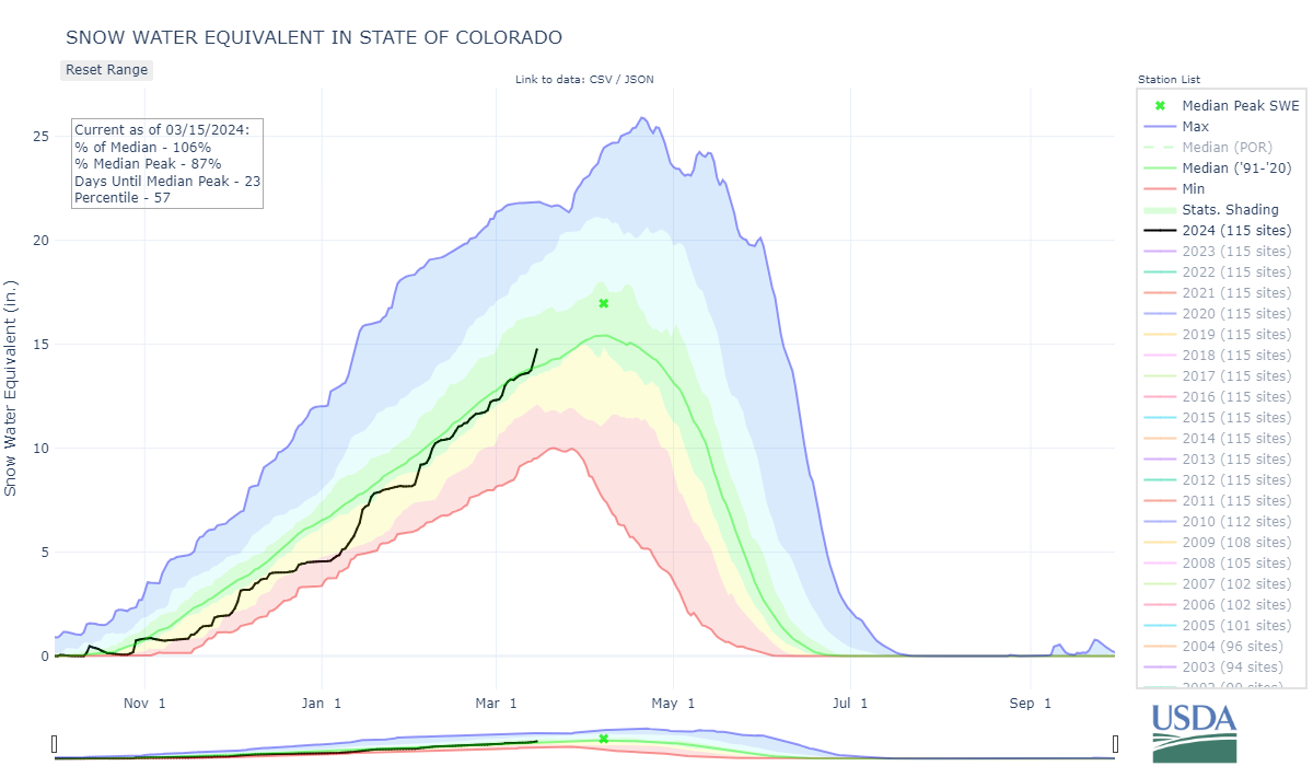
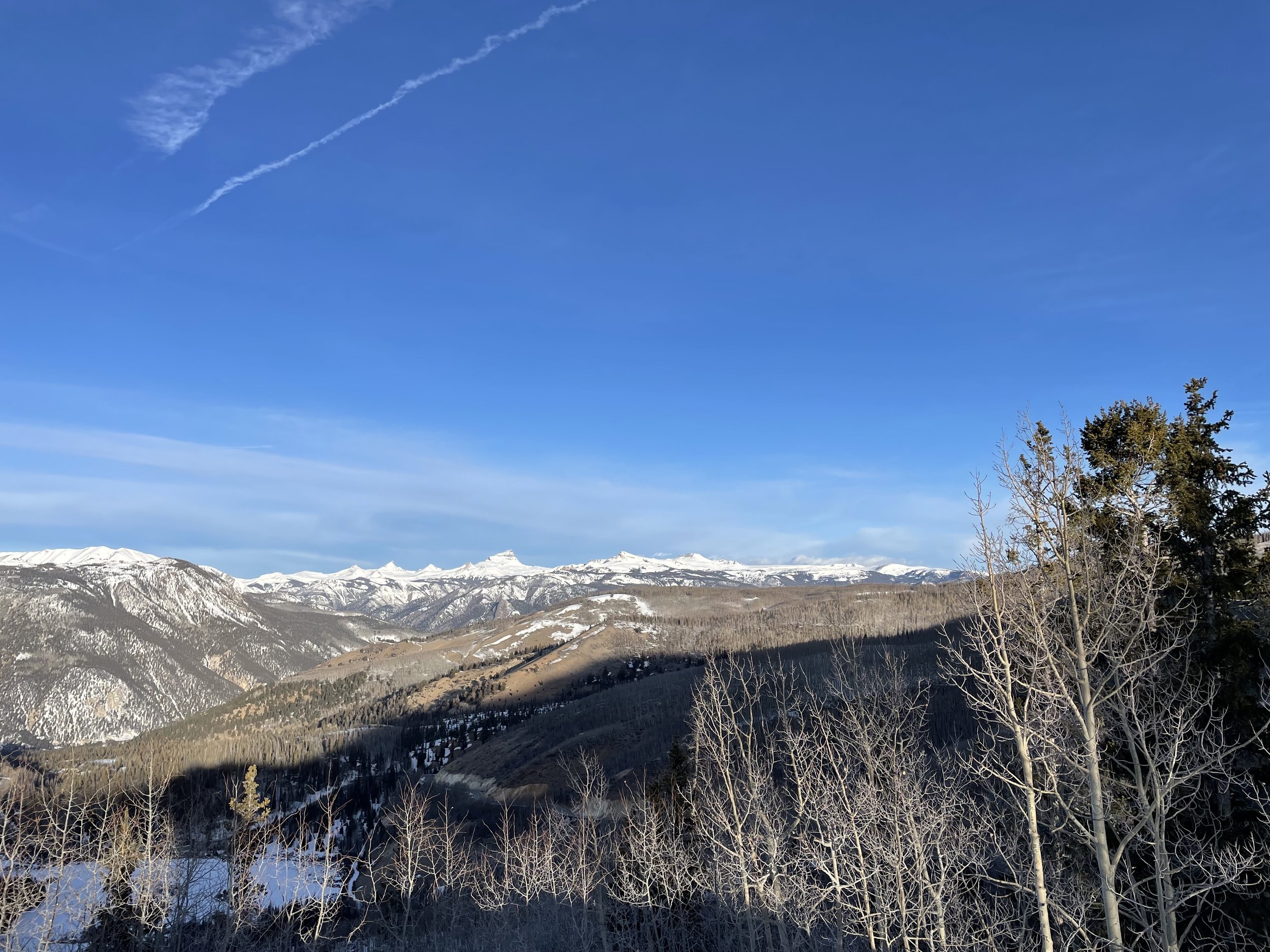
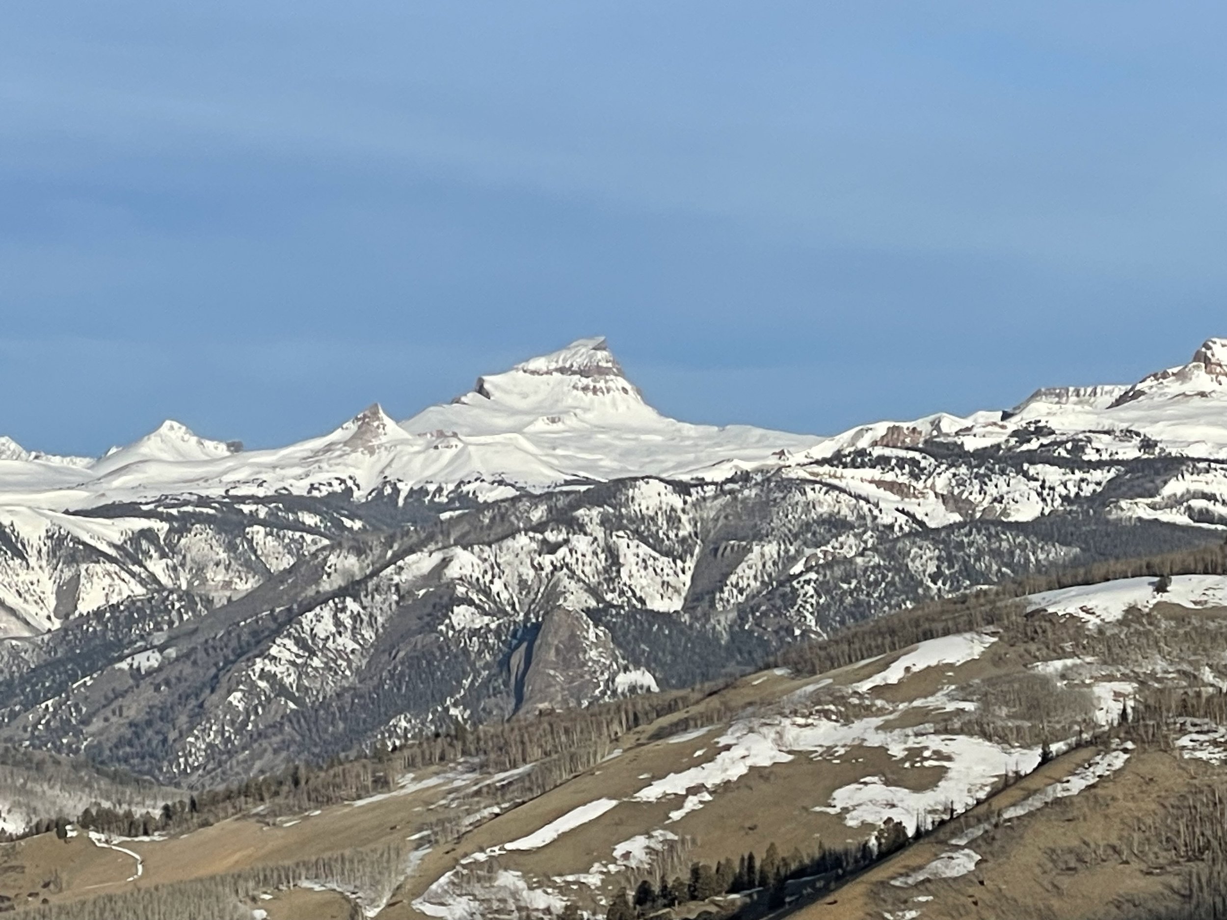
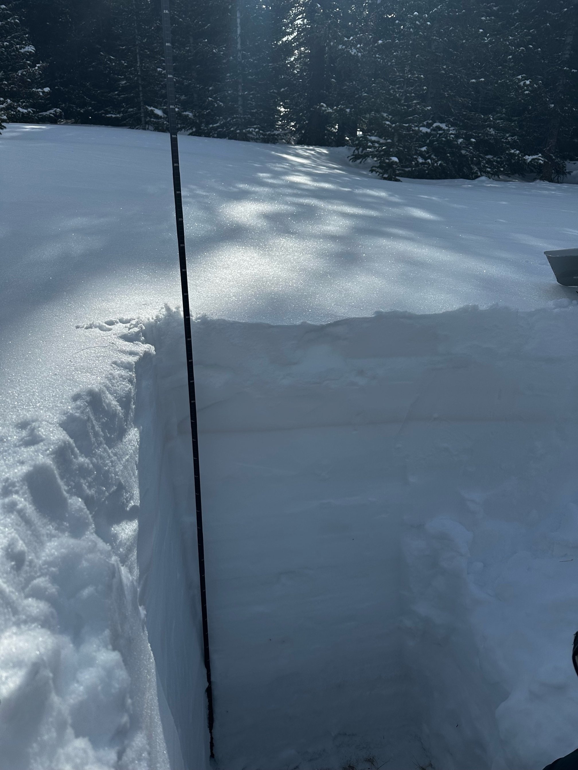
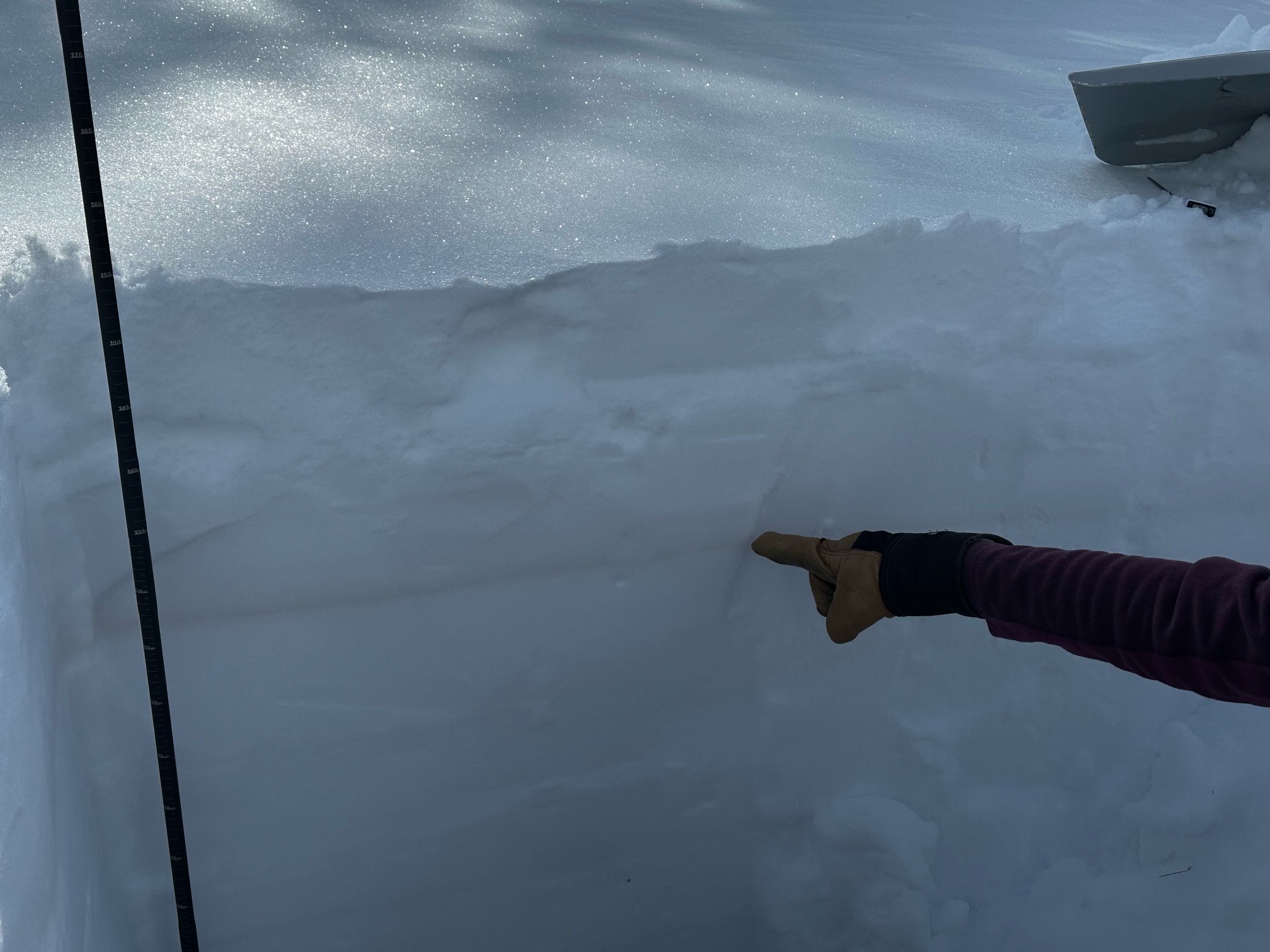
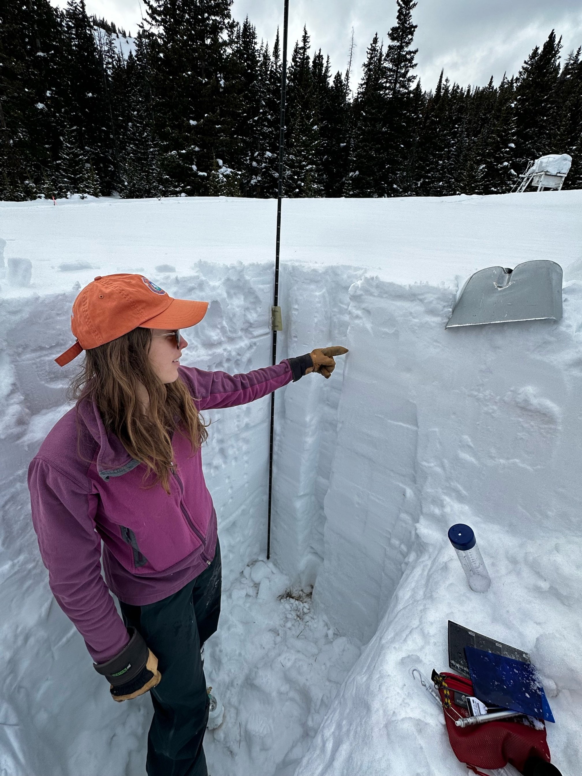
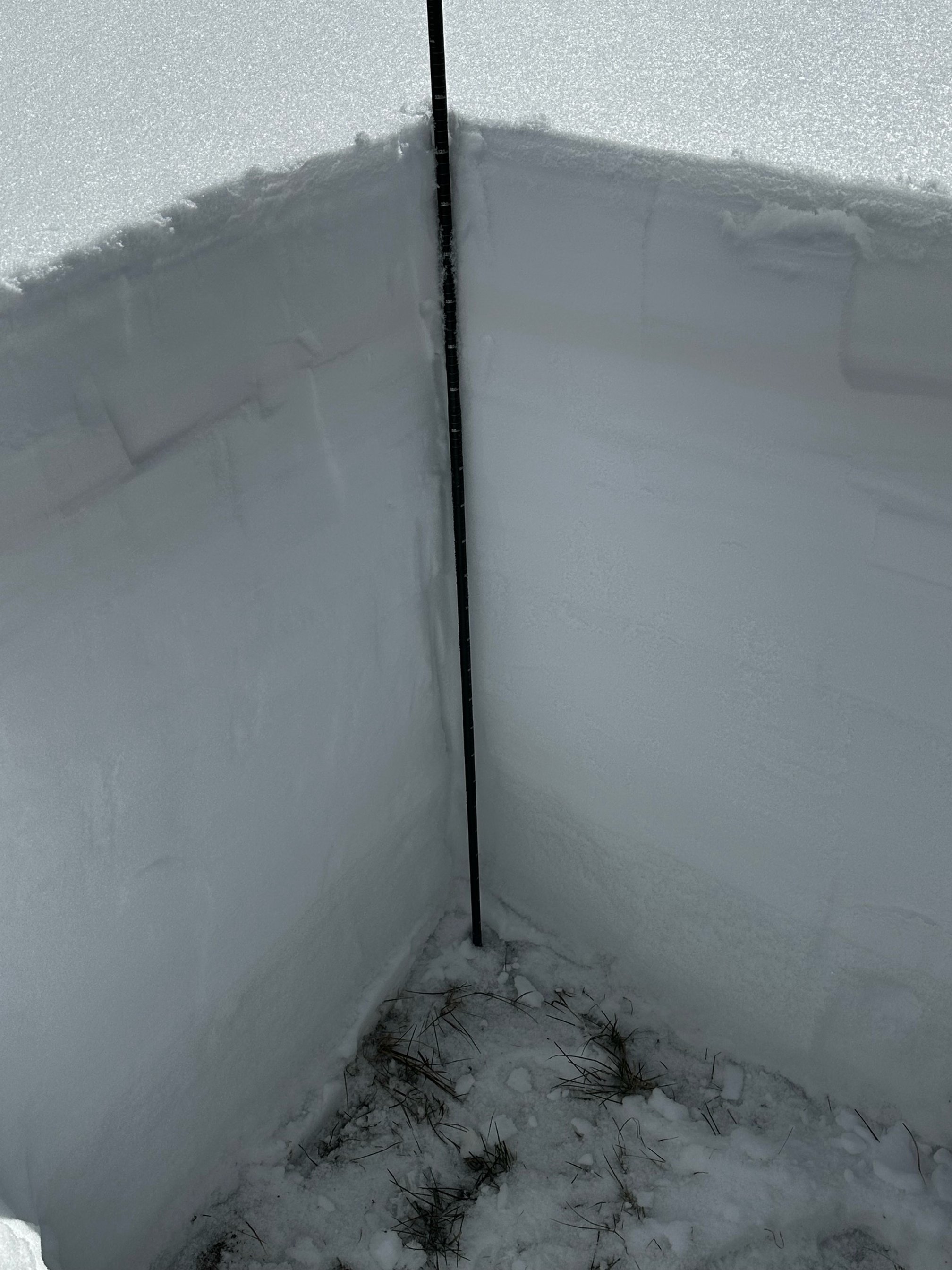
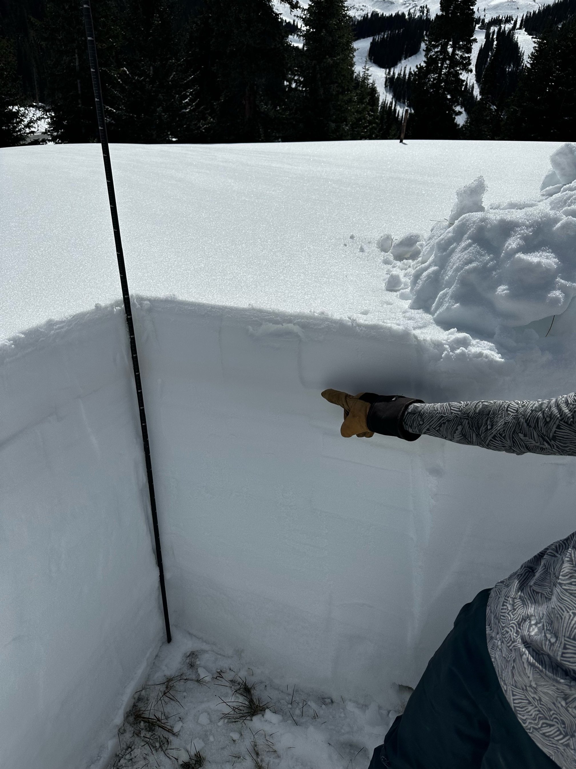
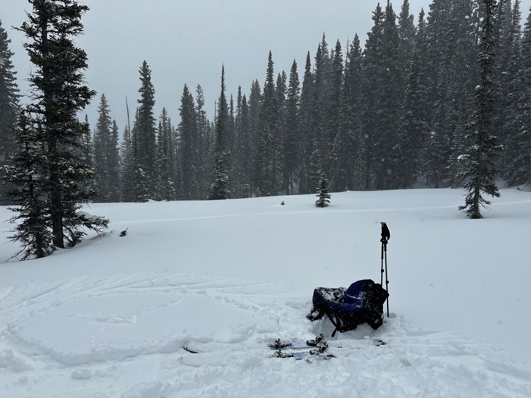
This past week the Colorado dust-on-snow team traveled to mountain passes across the state digging snow profiles searching for dust-in-snow, and finding plenty of it. It pretty much all came from the storm event March 2-3 that dug into the Desert Southwest before whipping the airborne dust far into Colorado. This second dust event (D2) of the season is widespread and consists of a definitive dust layer in the snowpack, but it is very interesting the wide range of variability we observed in terms of its severity. Some of it is typical; the San Juan’s got hit pretty hard from the Dolores over to the Rio Grande, and we observed decreasing severity from Hoosier Pass going north to Loveland Pass, and onward to Berthoud Pass. What was unexpected is just how mild the dust layer is at Grand Mesa and Park Cone, but also how severe it is at McClure Pass and the Roaring Fork region. McClure Pass has the most severe dust layer in the snowpack than any of the other sites. This is sort of a repeat of last year where McClure was one of the hardest hit regions after a severe dust event on April 3.
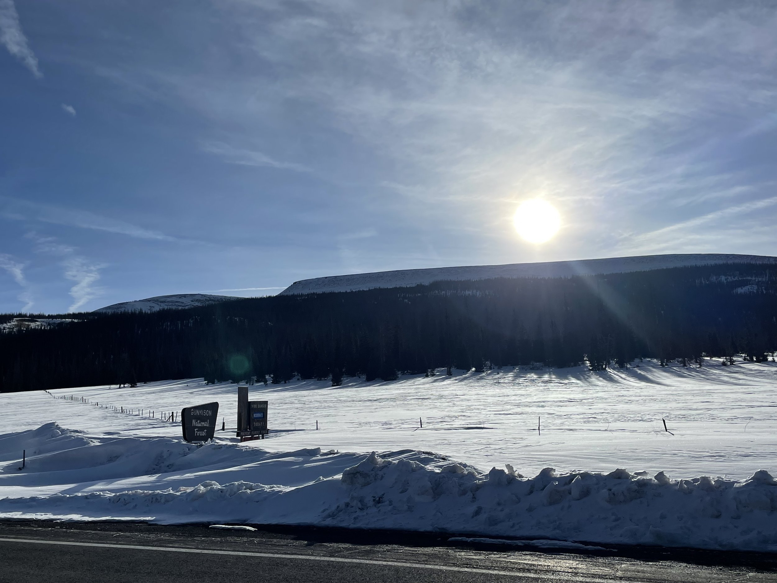
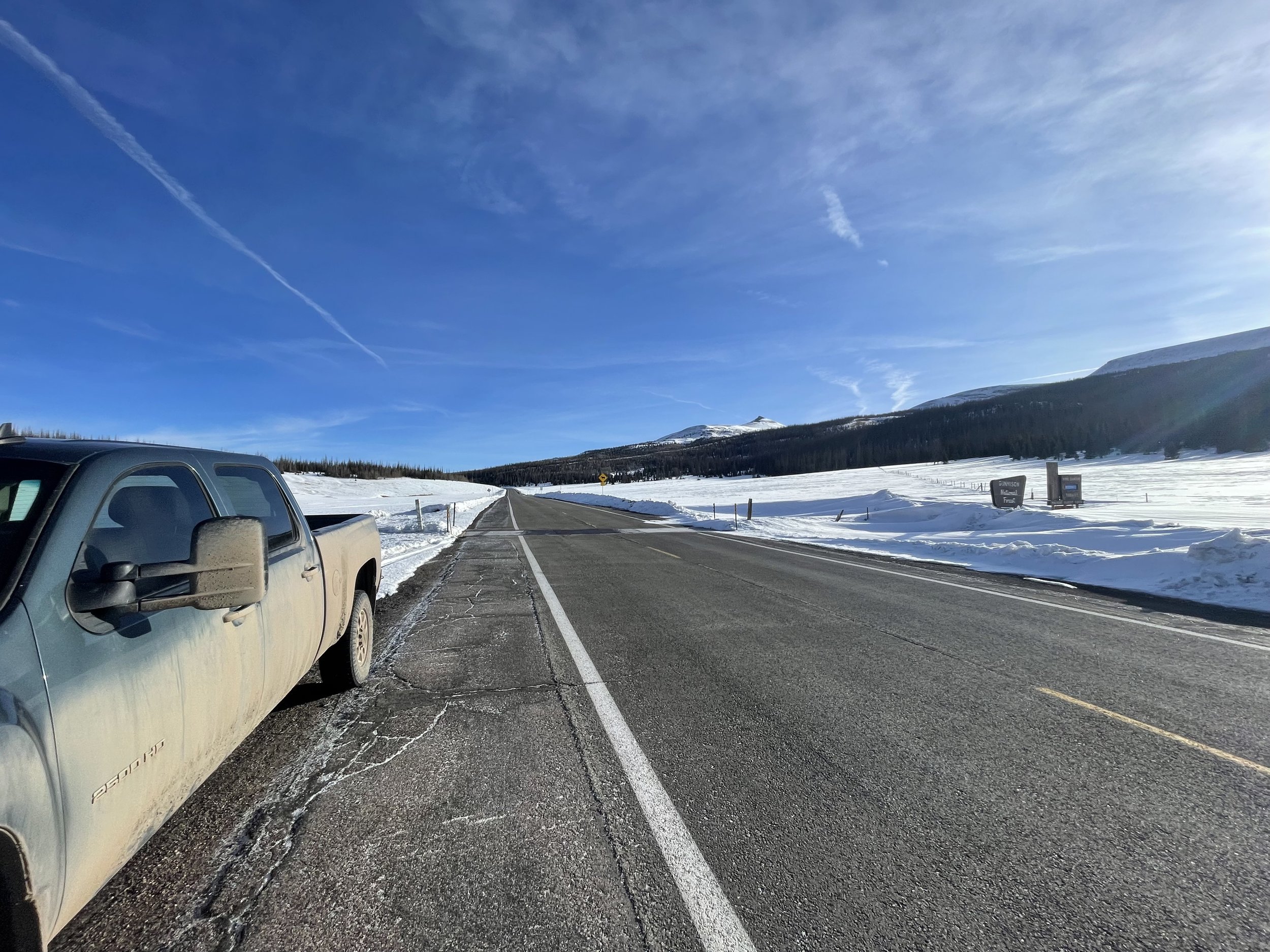
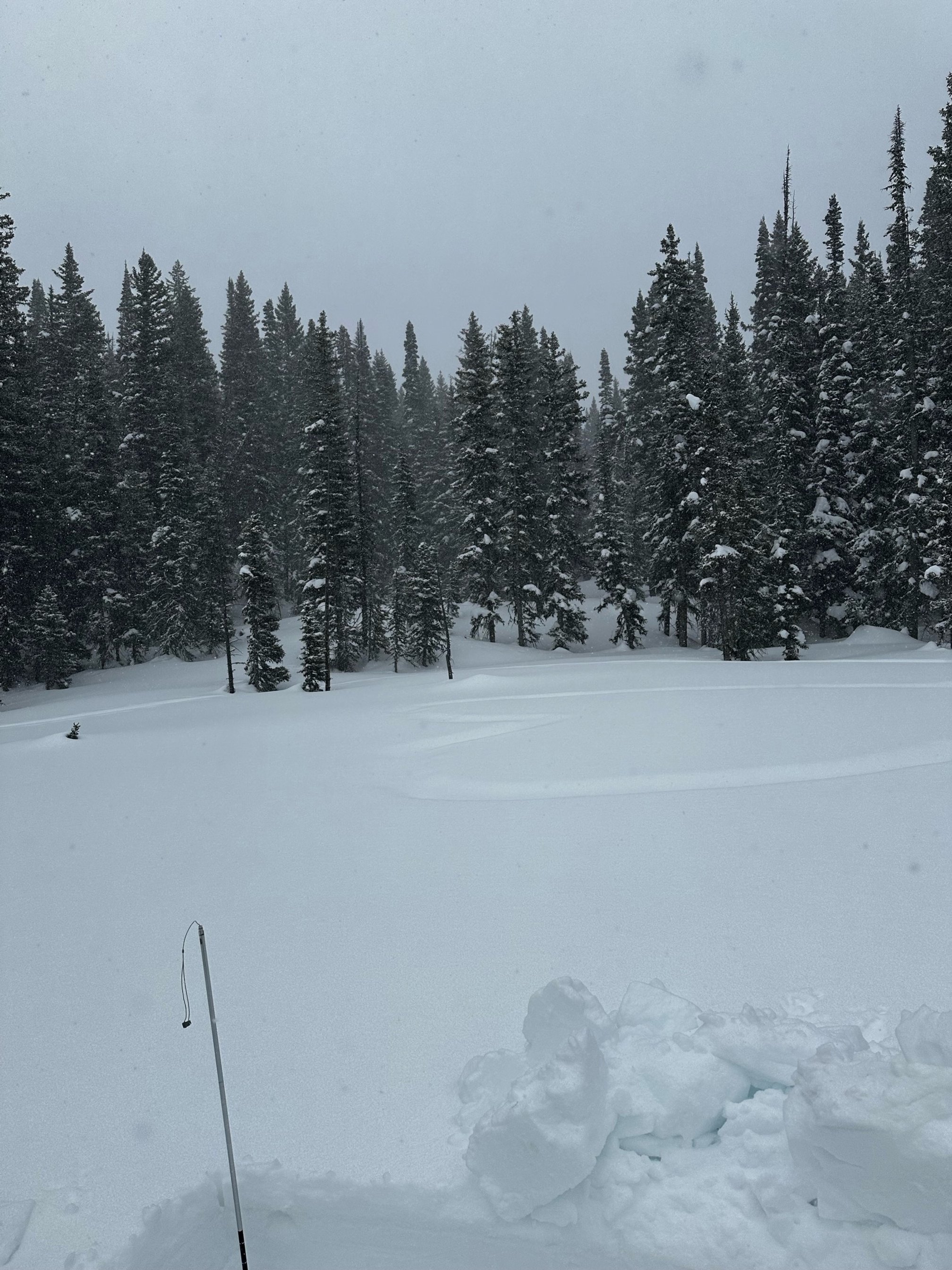
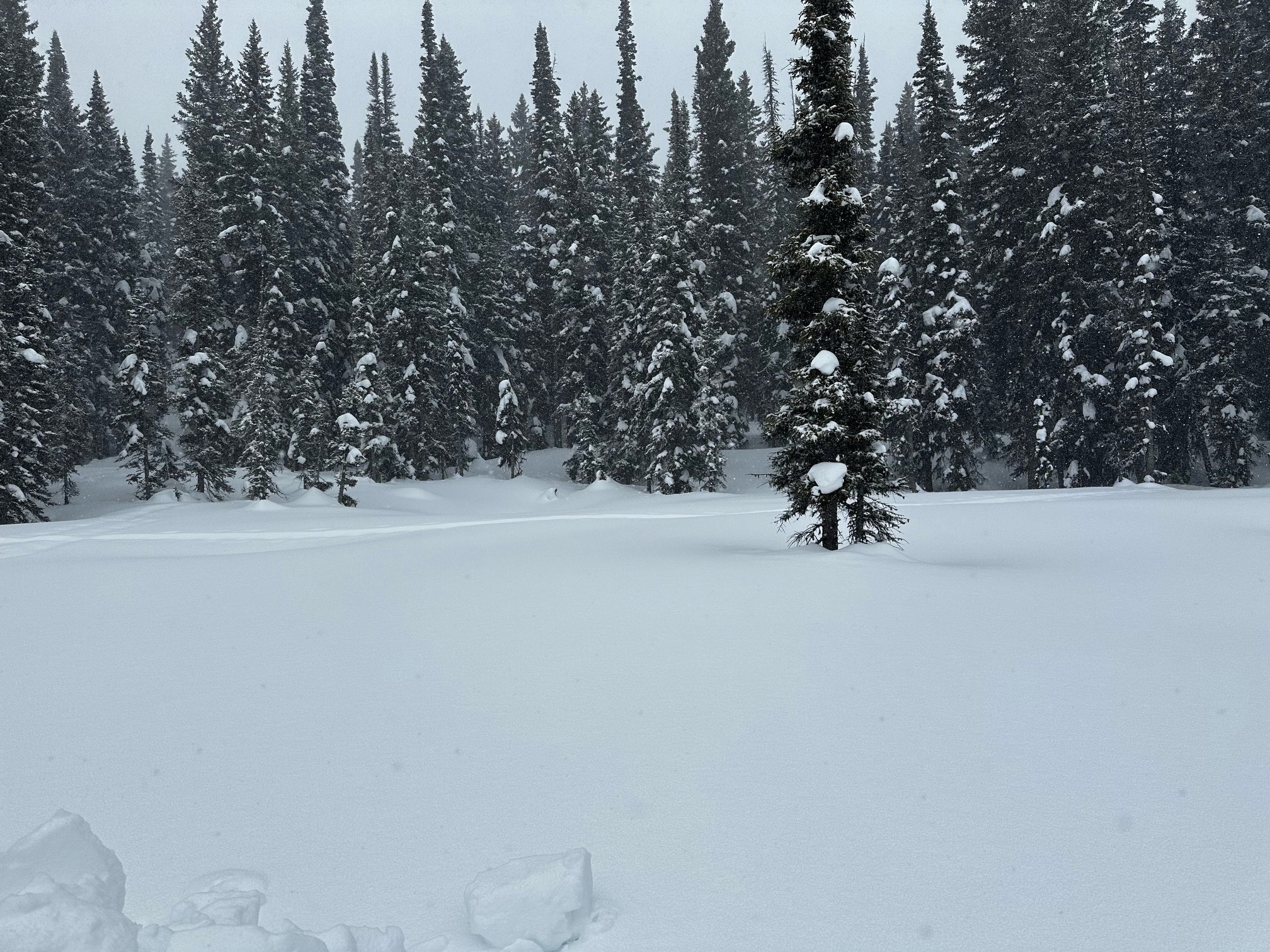
Fortunately, starting March 13 widespread snowfall hit Colorado. The accumulation map is shown below. As of this writing the forecast is for it to continue primarily for Southern Colorado. The snow we already received and what is to come over the next few days will bury the D2 dust layer further than what we observed this past week. So when reading our observations below concerning how deep the dust is buried consider the recent accumulated snow we recently received. We will continue to monitor this D2 dust layer and any new dust events. More soon.
A summary for each CODOS site is below. And feel free to email or call the CSAS office with questions.
Take Care,
Jeff Derry
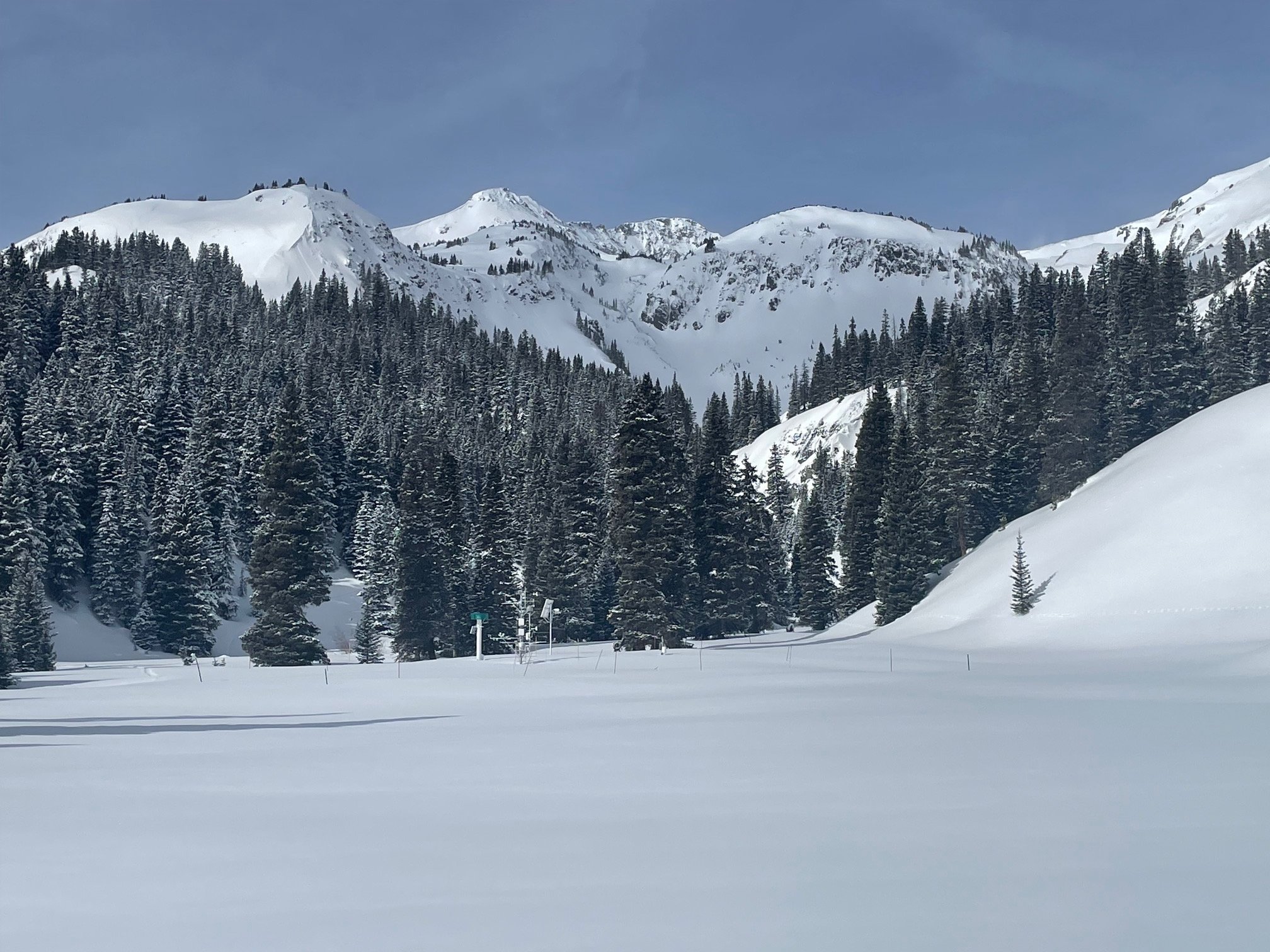
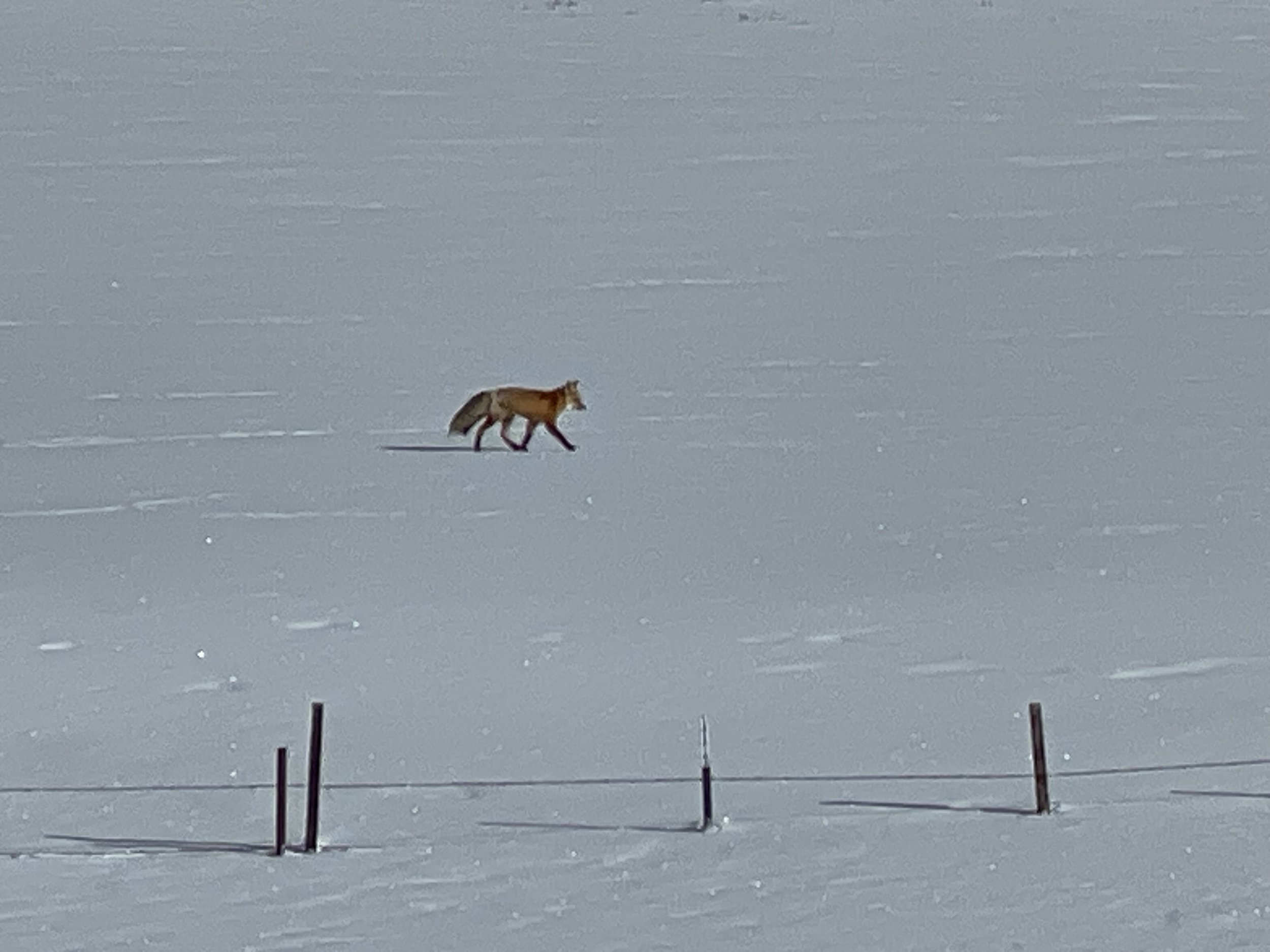
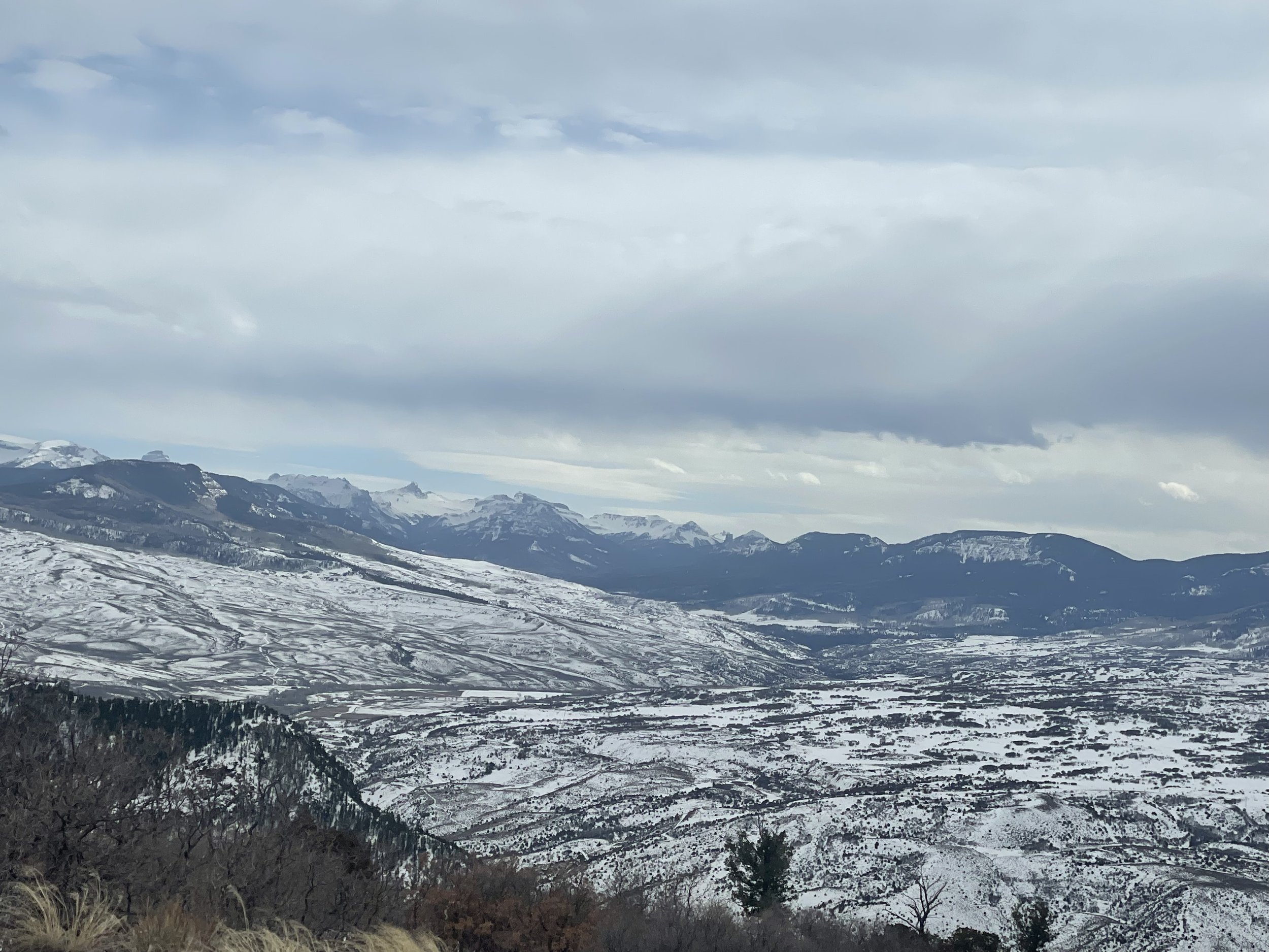
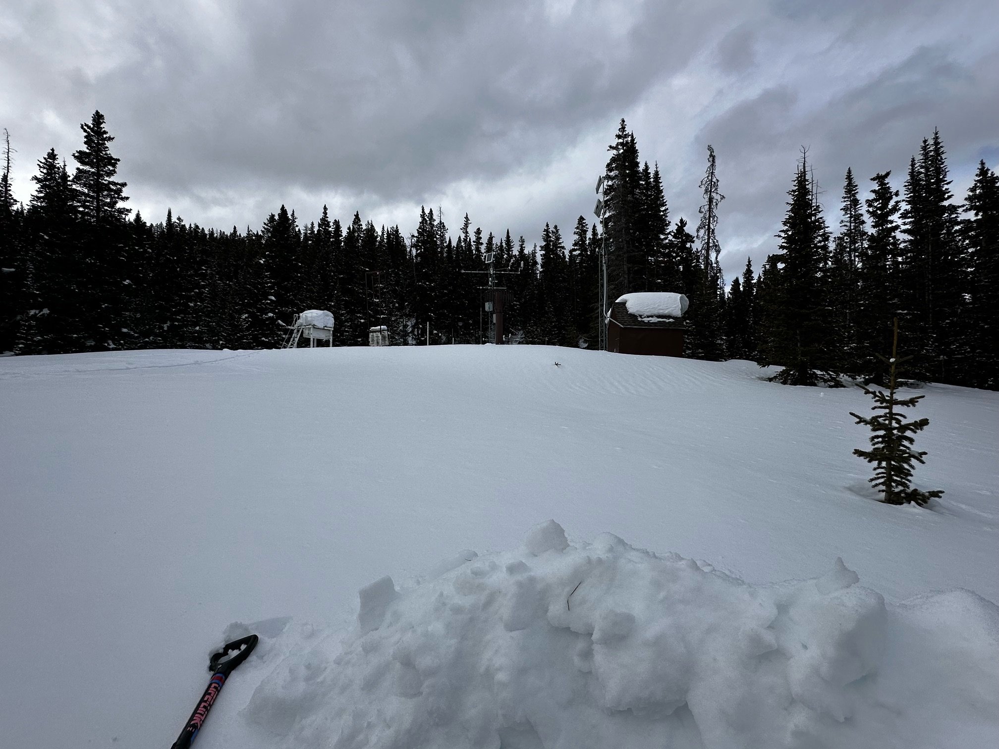
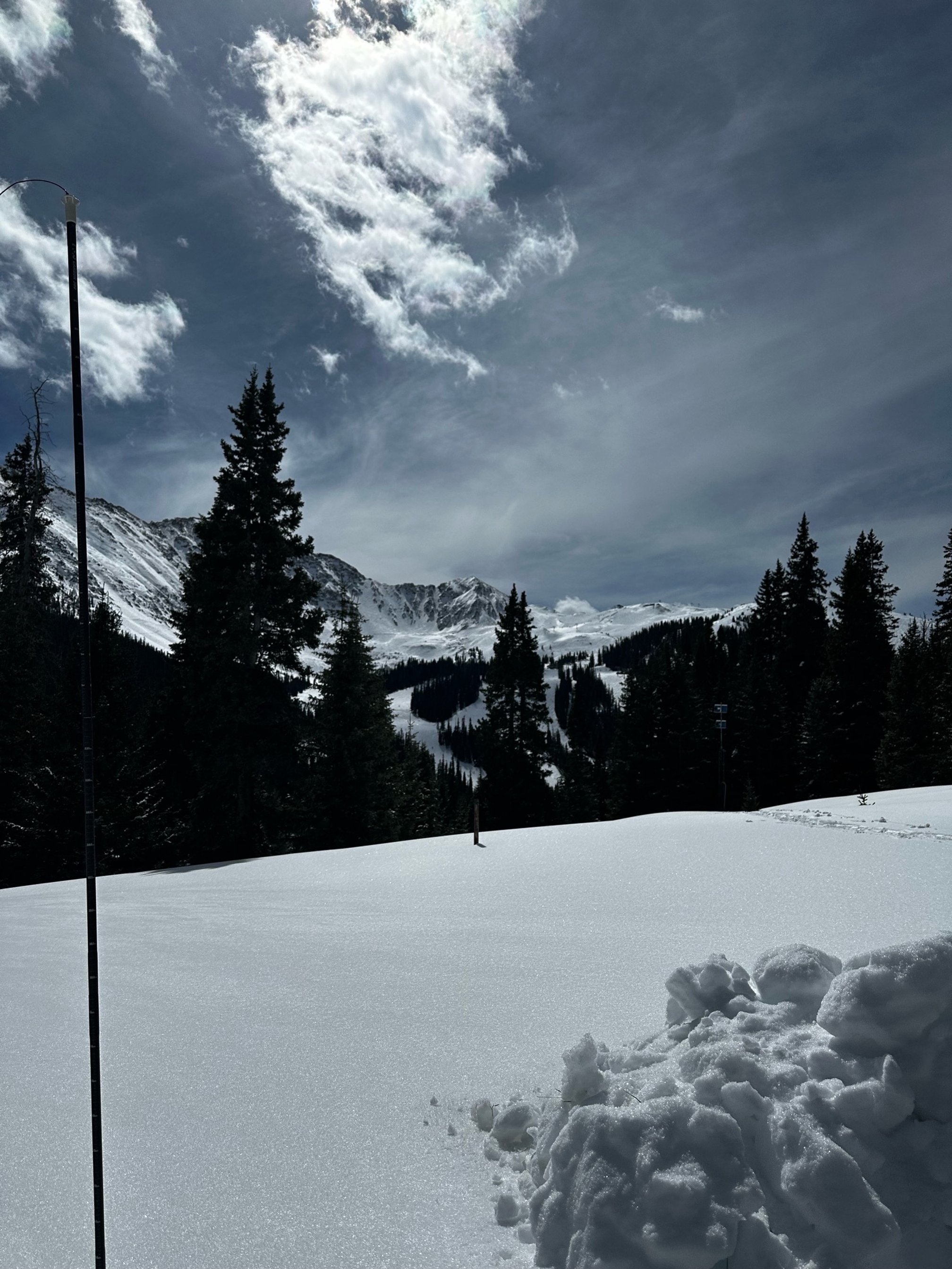
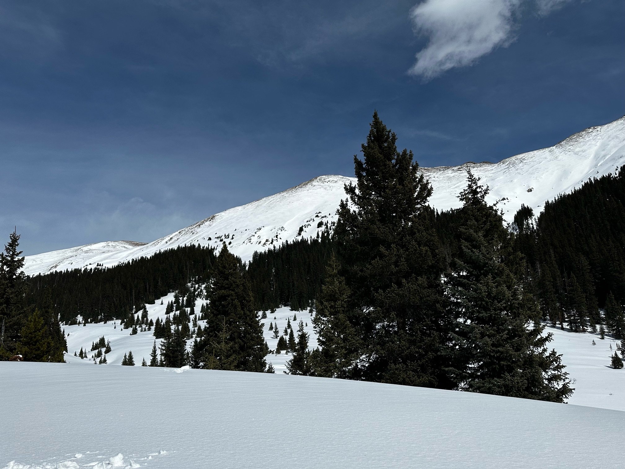
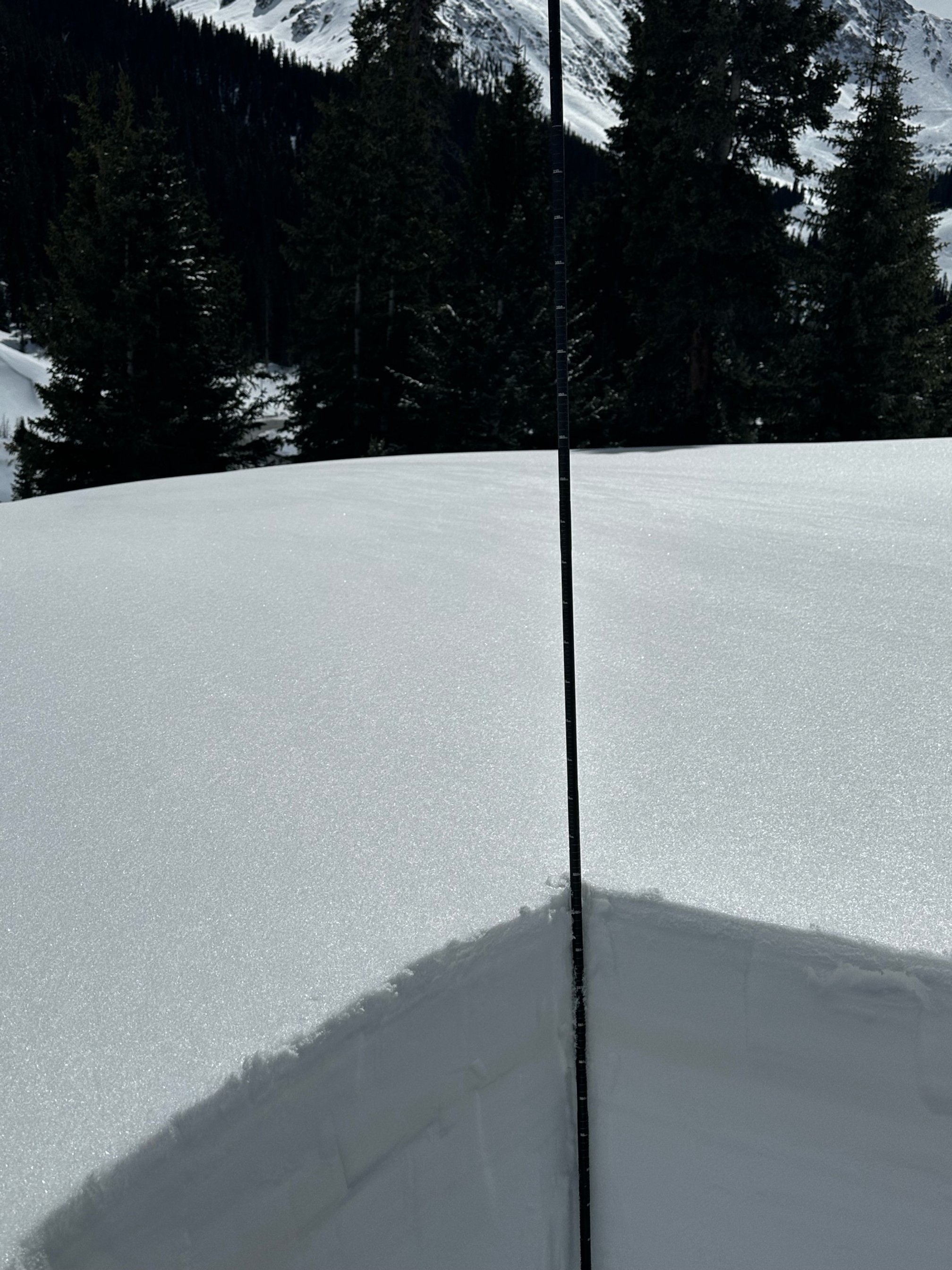
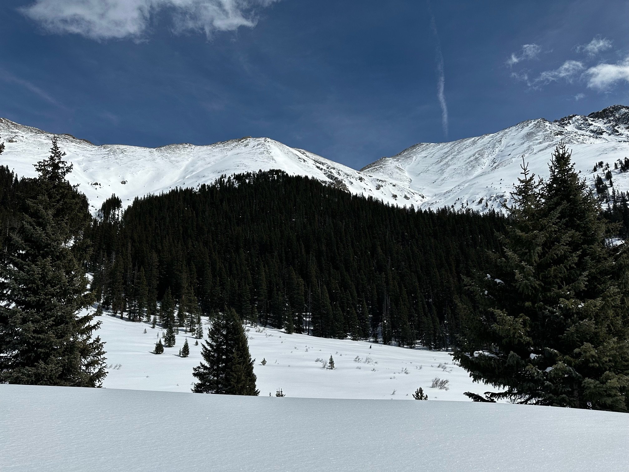
Below: CODOS monitoring locations.

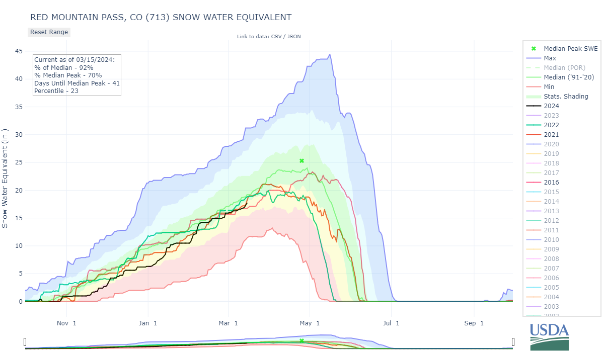
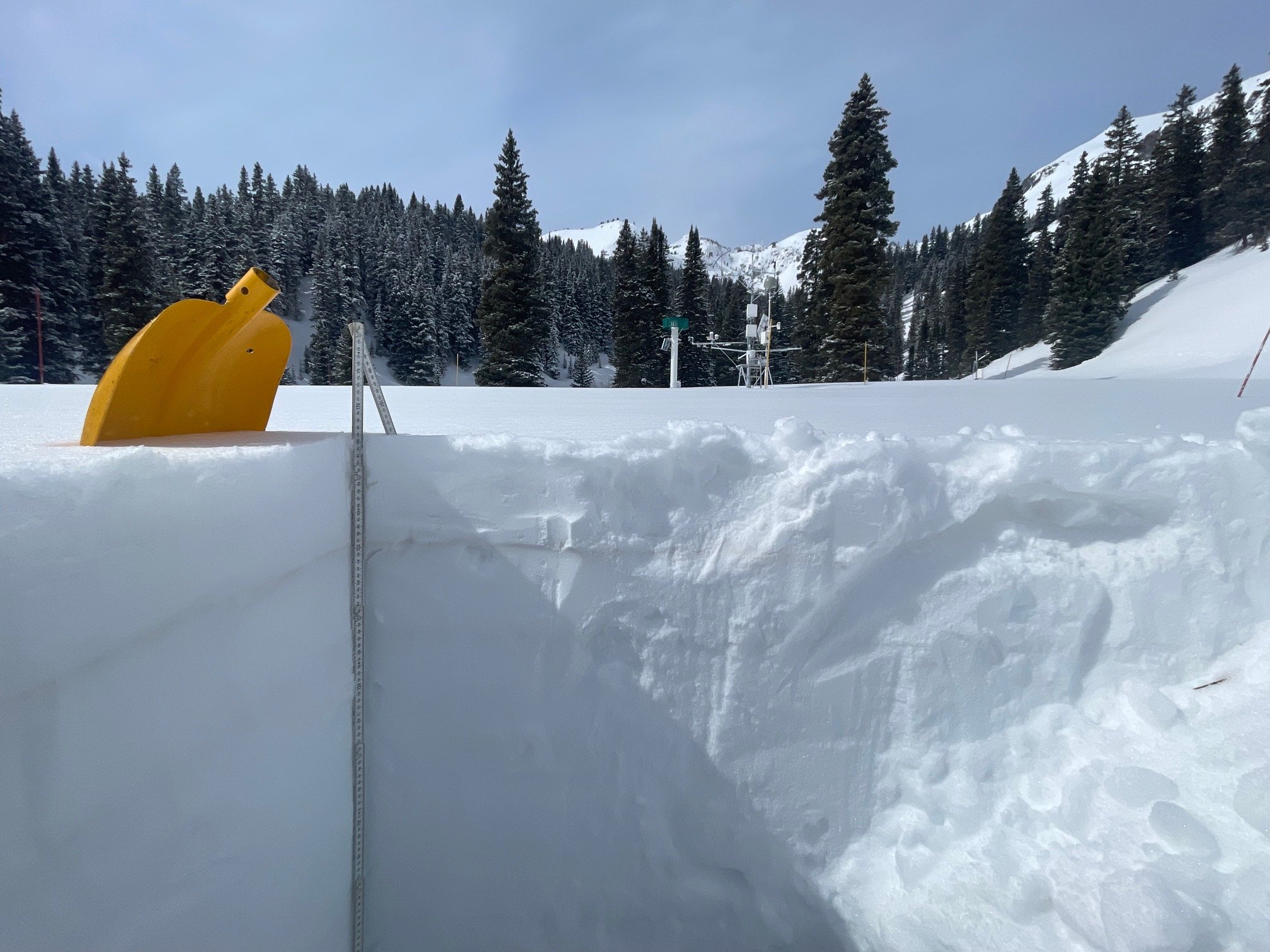
SWAMP ANGEL (Red Mt Pass): March 4
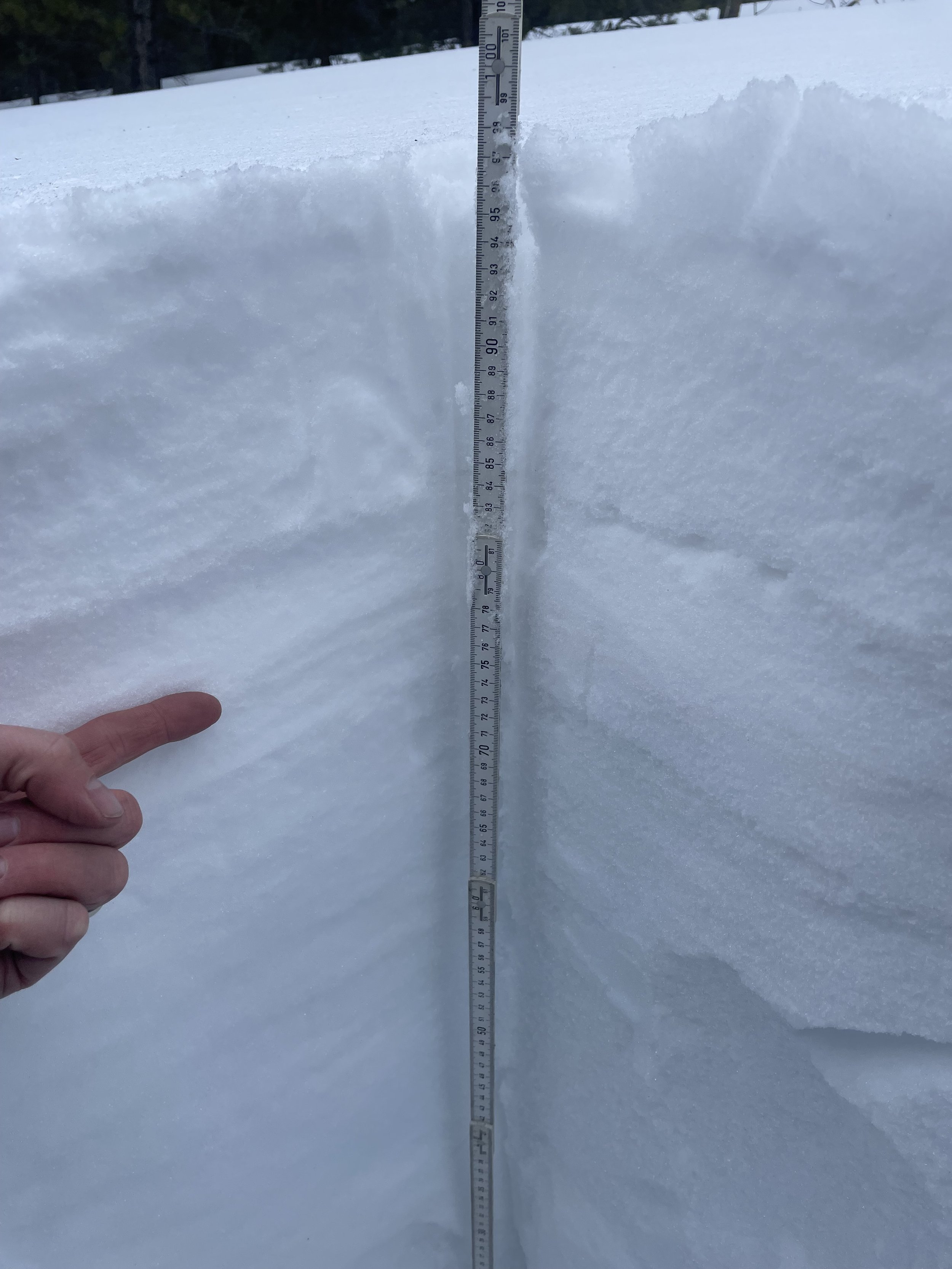
Our last pit at Swamp Angel at Red Mt Pass was on March 4 following the dust event (D2) that rolled through March 2. At that time the D2 event was under 15 cm of snow, since then we have received another 15 cm, so currently that nasty dust layer is approximately under 1’ of snow. On March 4 we measured 19.5” SWE as 5.5’ snow depth at Swamp Angel. Nearby Red Mt SNOTEL was reporting 16.2” SWE. Since then Red Mt SNOTEL shows a 1” gain in SWE. The much milder D1 lies just underneath the D2 layer. At the beginning of the week of March 11 D2 was becoming exposed where the snowpack is shallower and southern facing slopes. Recent snowfall should provide a temporary cover on D2.
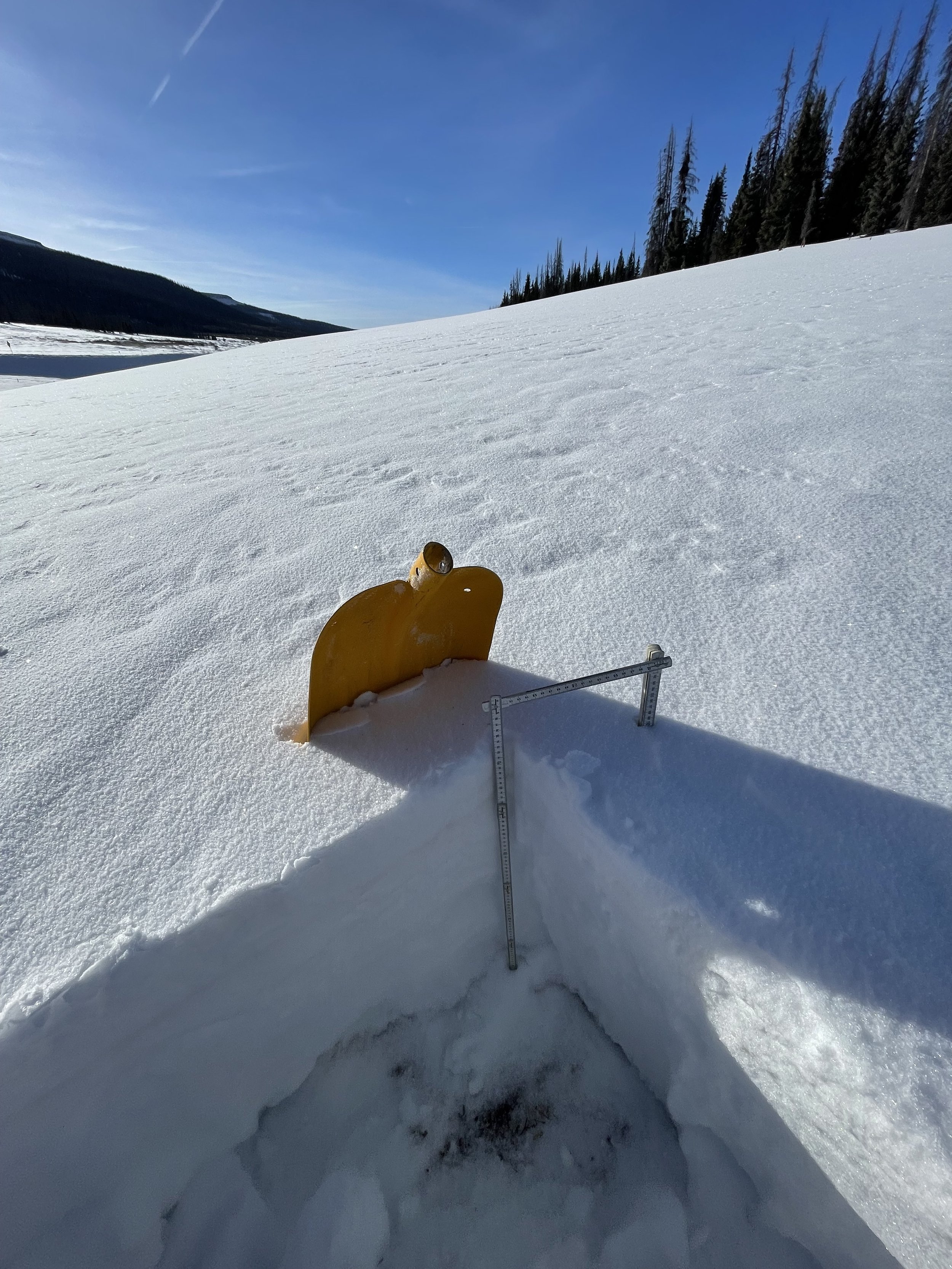
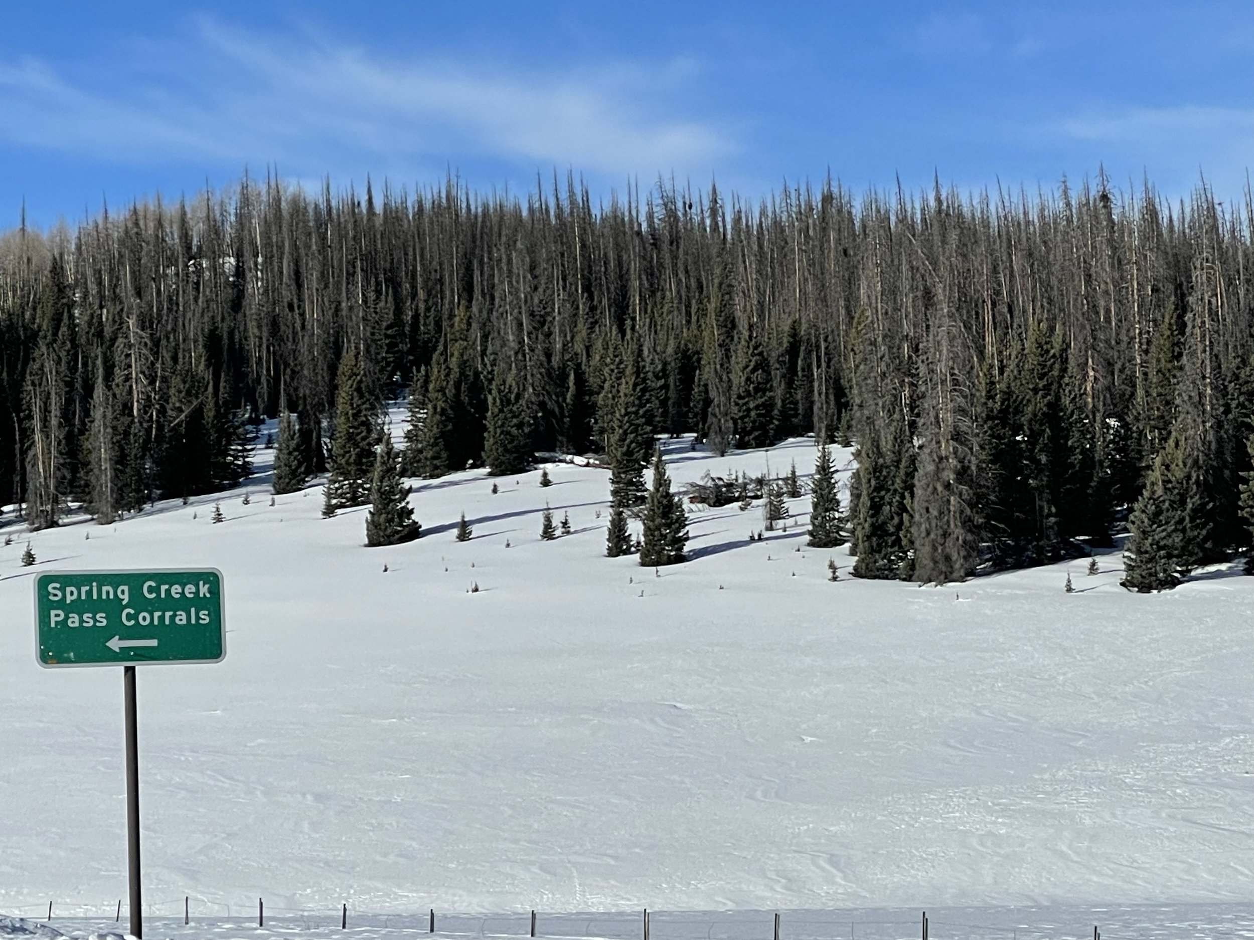
SPRING CREEK PASS: March 12
Spring Creek has 2.3’ snow depth with 6.9” of SWE. A pretty shallow snowpack. At our sample site, this is the third lowest SWE observation going back to WY2017. The March 2 dust layer is very noticeable, at about medium severity, under about 4” snow accumulation. Some areas had dust at the surface. With the current storm expectations are for this dust layer to be buried further, and hopefully boost the snowpack closer to median levels.
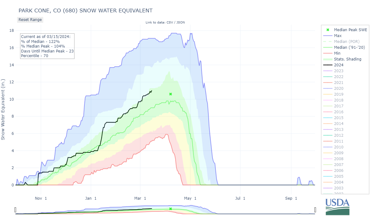
PARK CONE: March 11
For Park Cone, snow depth was at 3.4’, SWE was 10.7”. Snow depth was 3.25’ and 10.6” SWE at Park Cone SNOTEL. Dust is present but barely distinguishable.
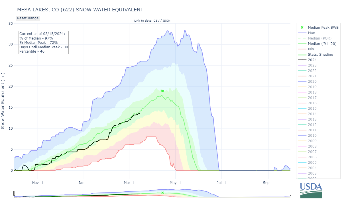
GRAND MESA: March 11
Grand Mesa has a 5.3’ deep snowpack as 17.5” SWE. Mesa Lakes SNOTEL was showing 4.2’ snow depth and 13.3” SWE. Dust was observed in the snowpack as well as on the surface. Dust severity was surprisingly mild especially compared to more severe conditions at McClure Pass and the San Juan Mountains.
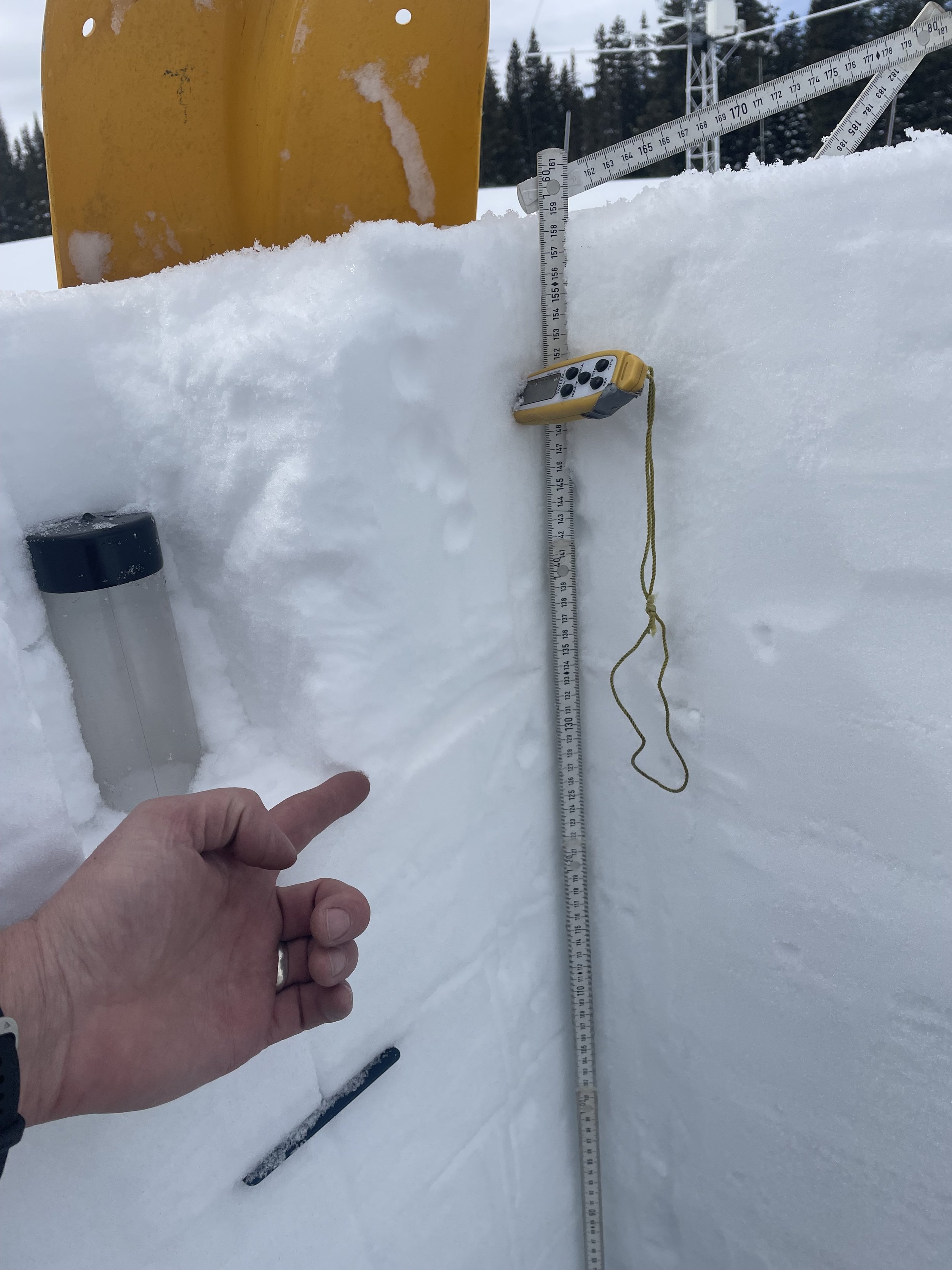

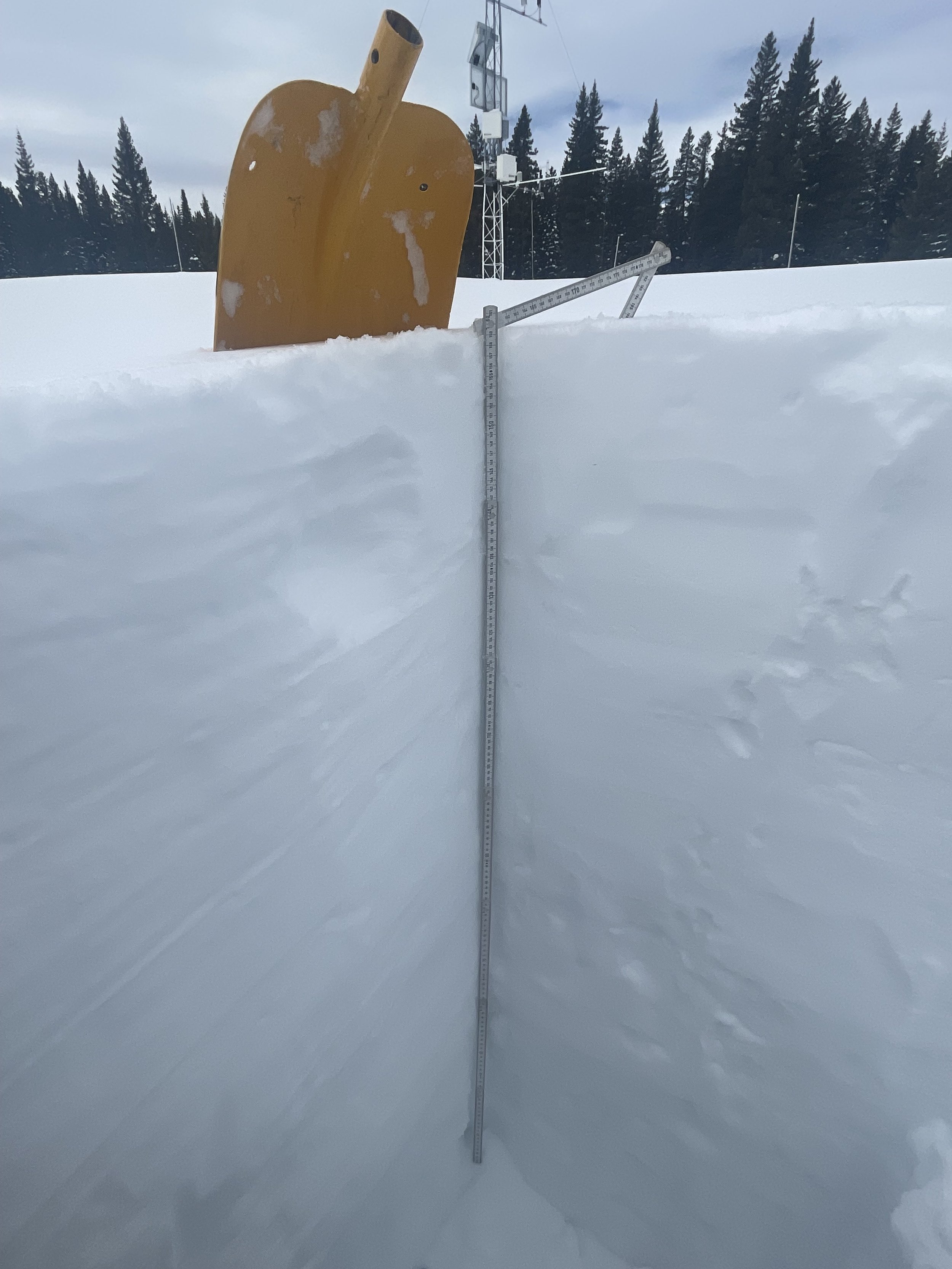
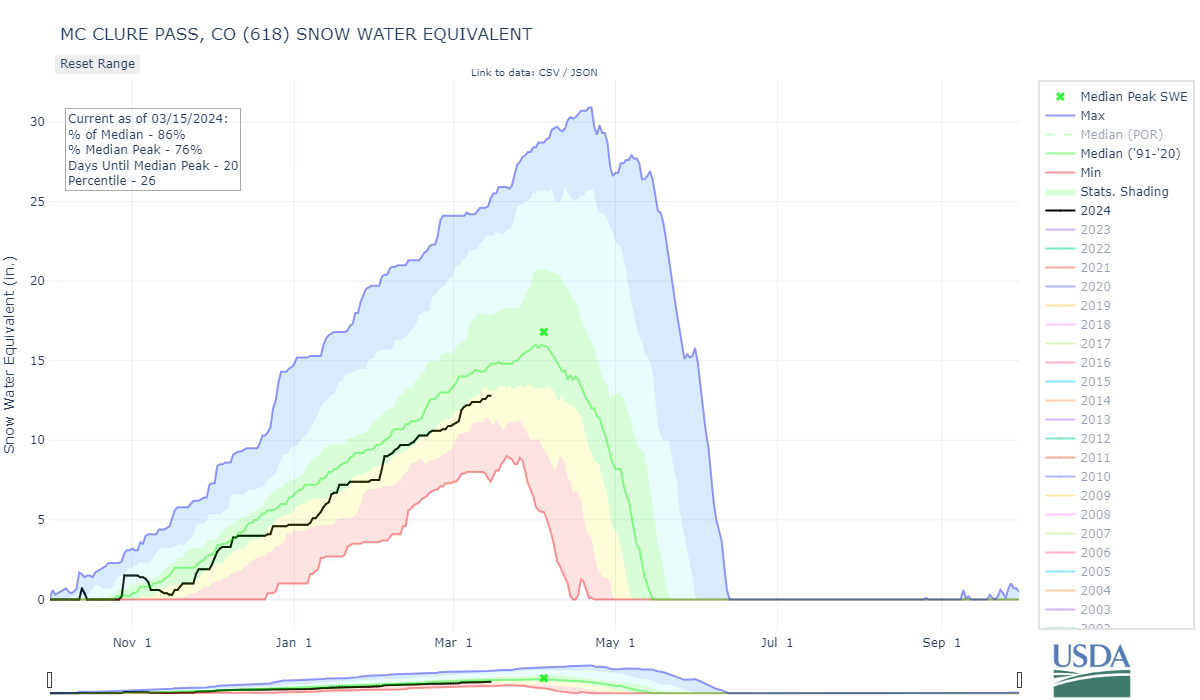
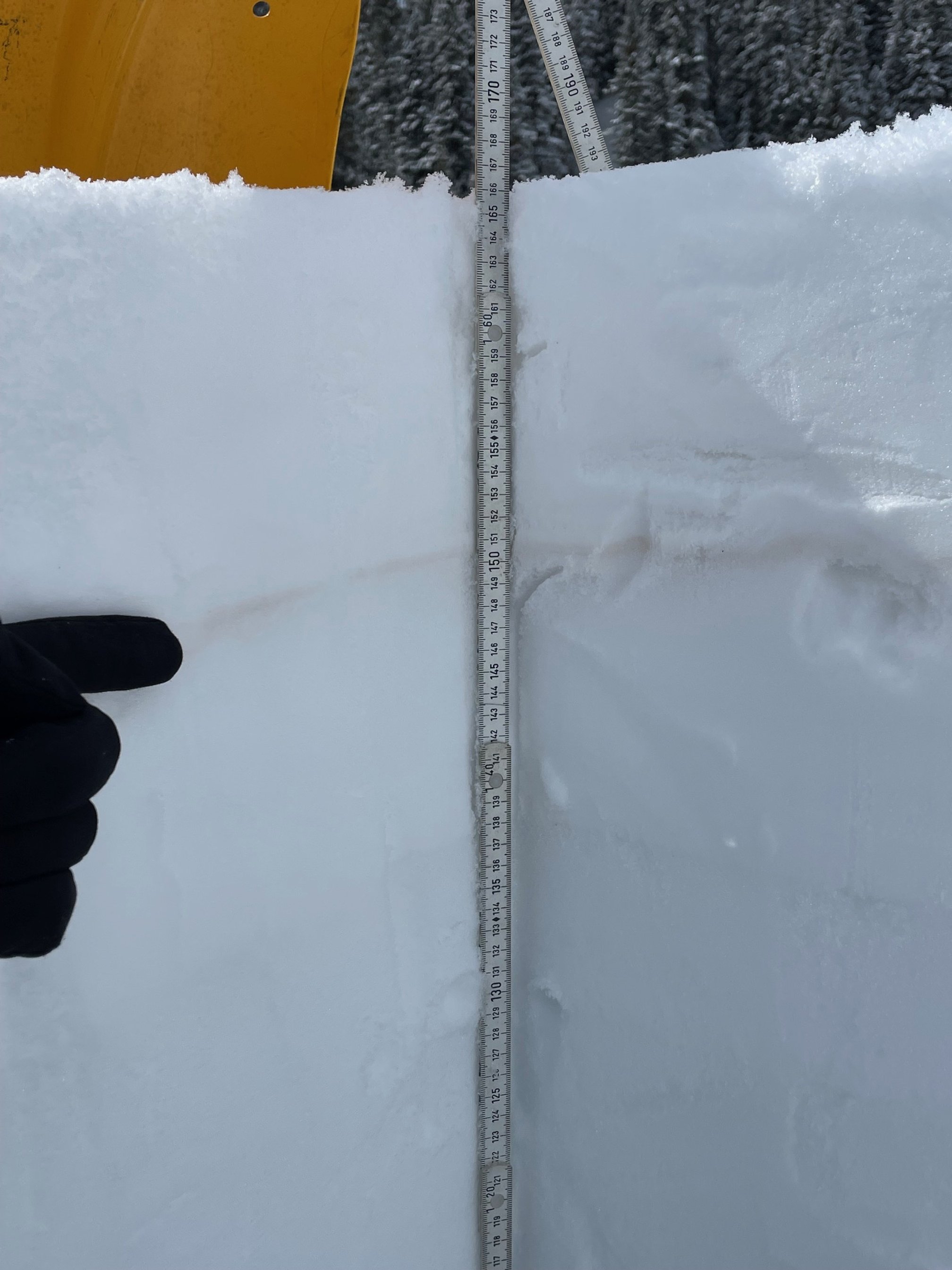
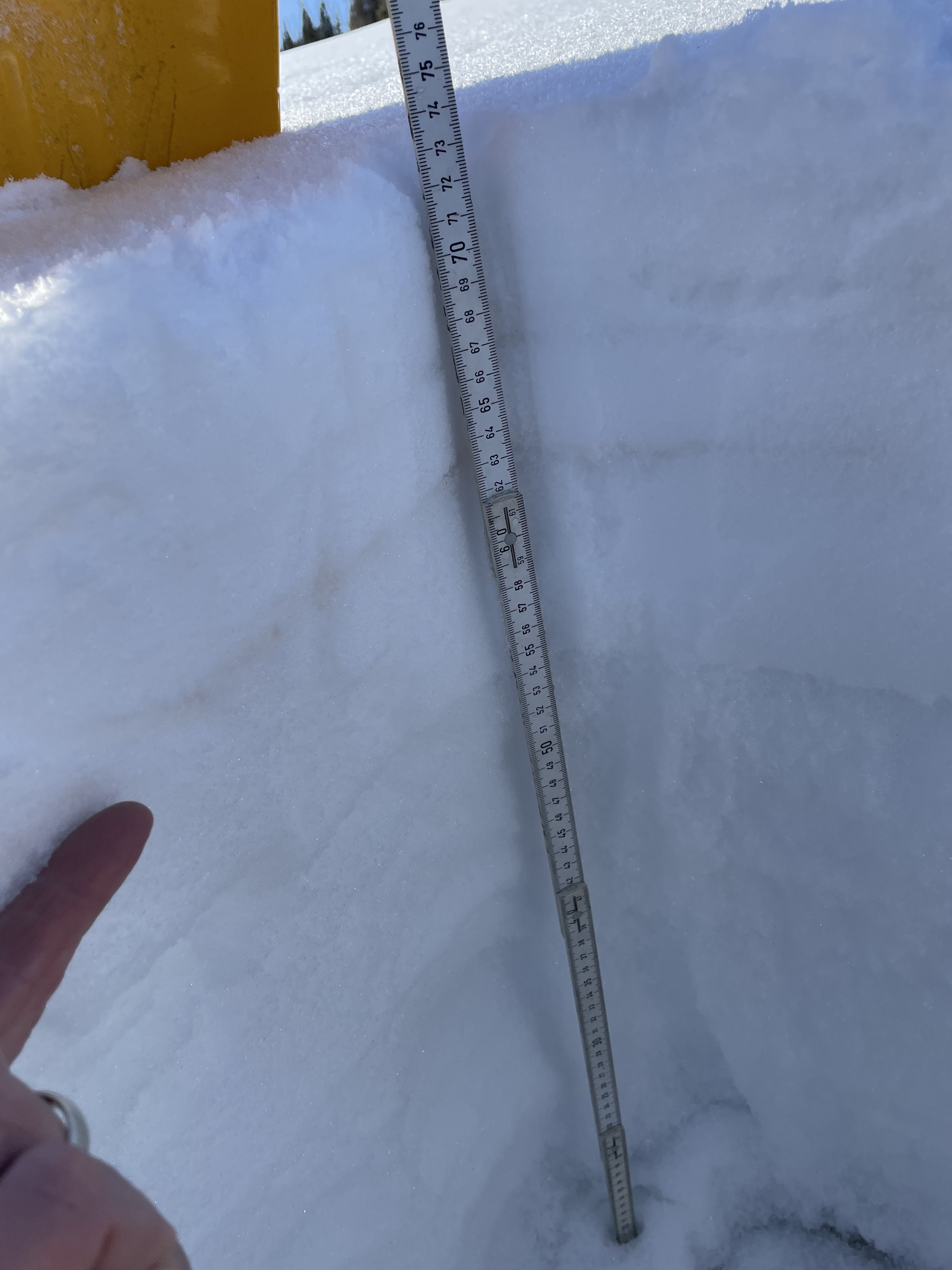
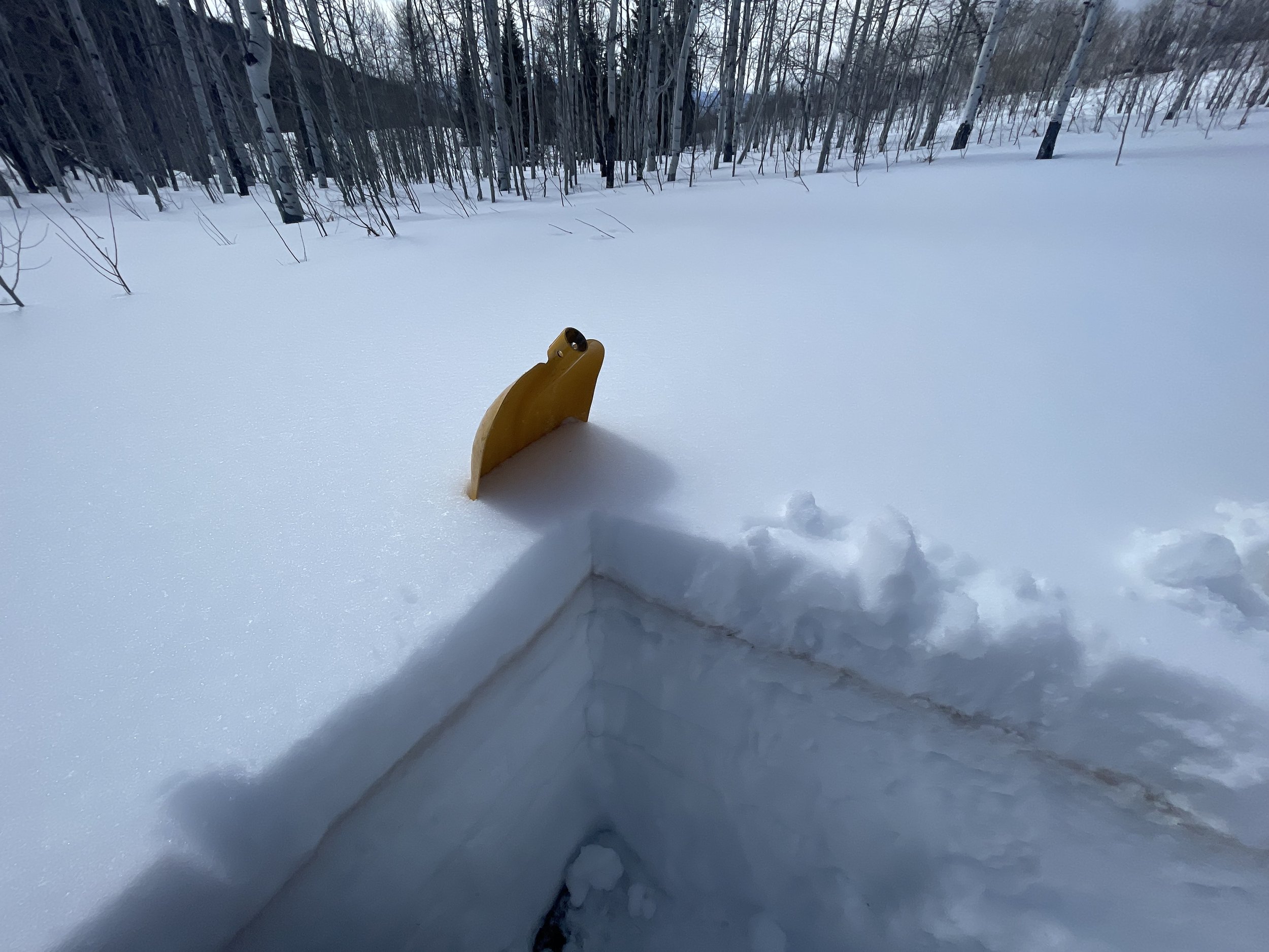
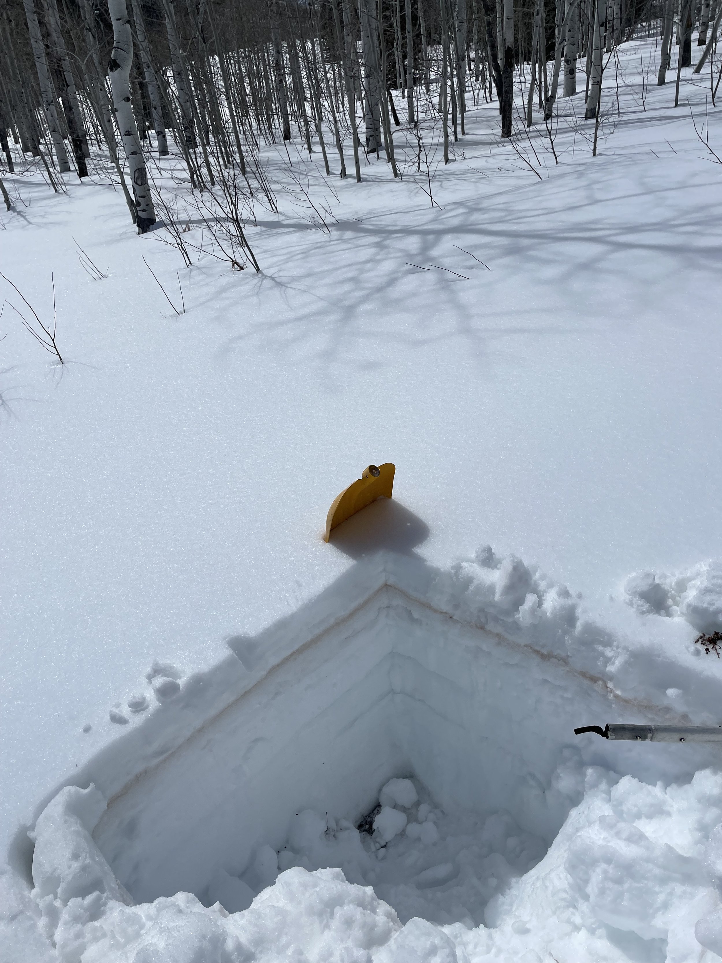
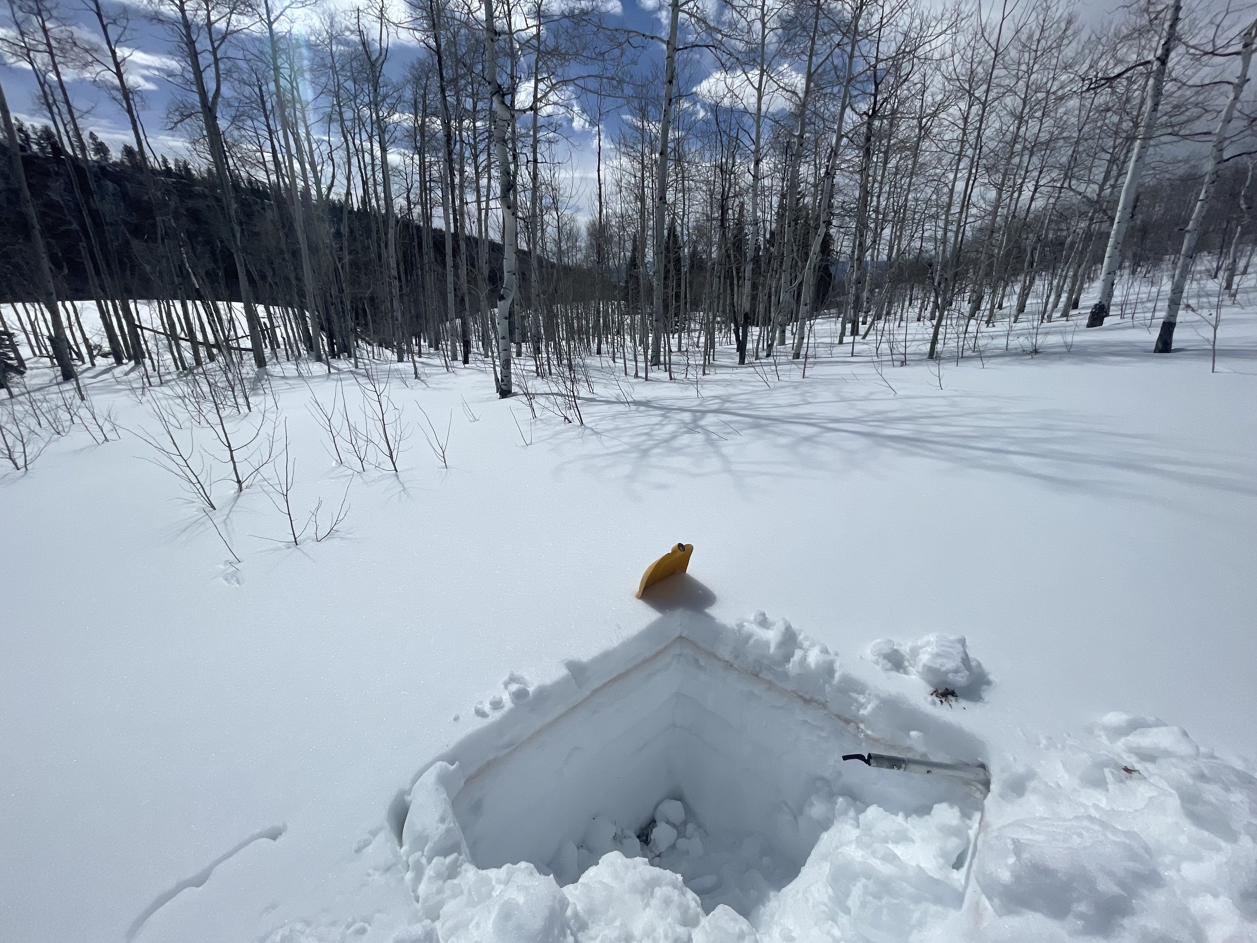
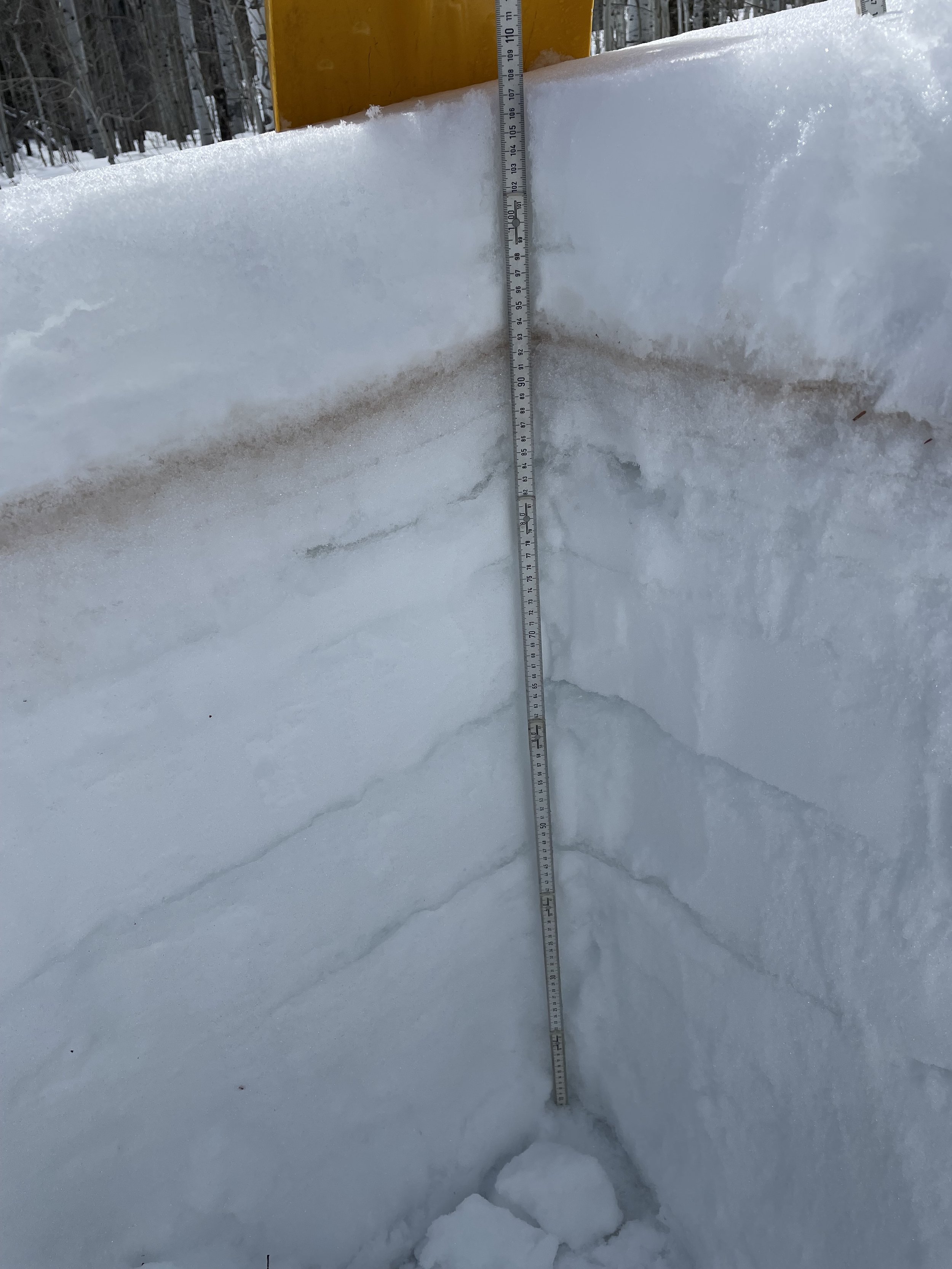
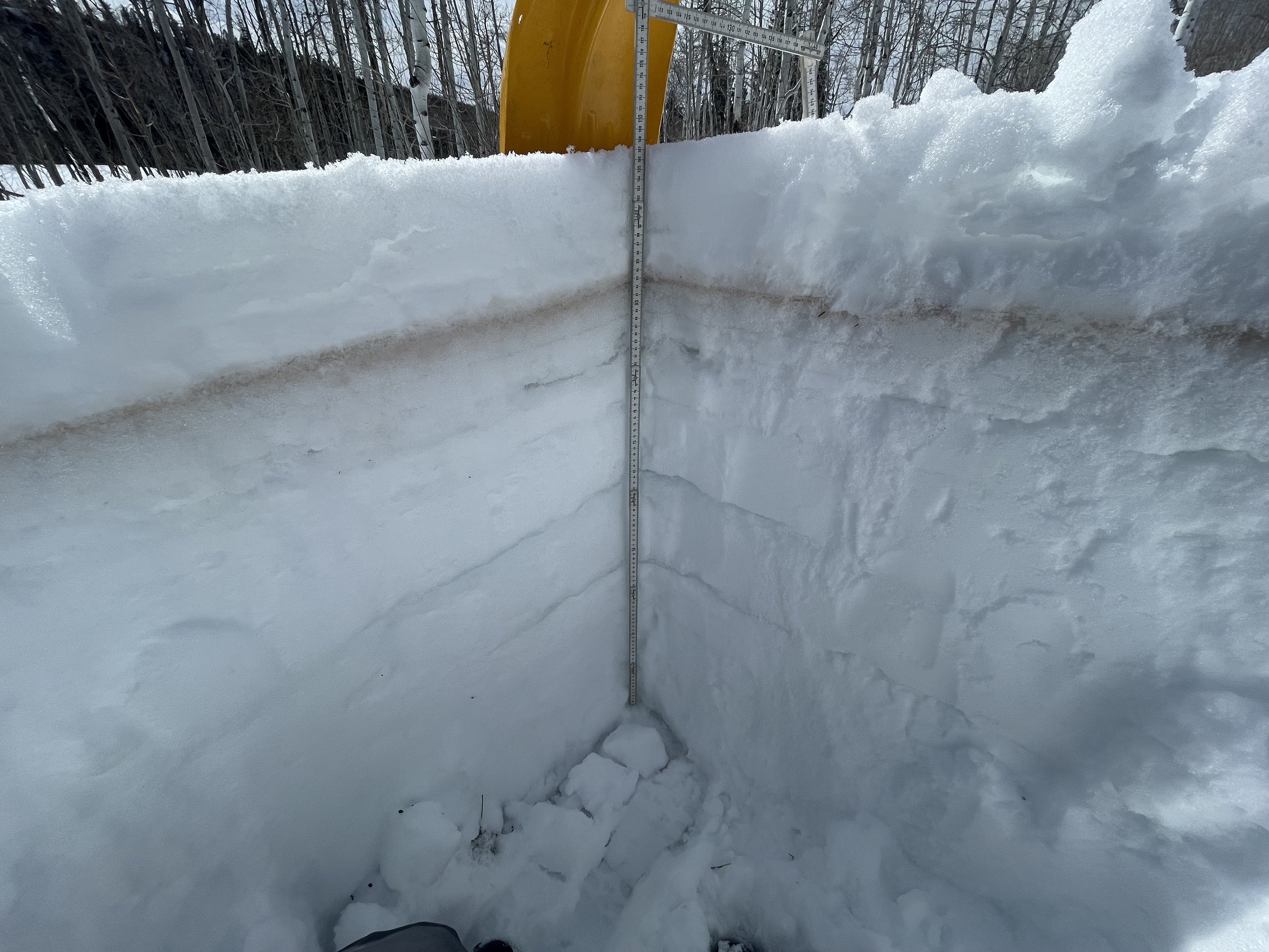
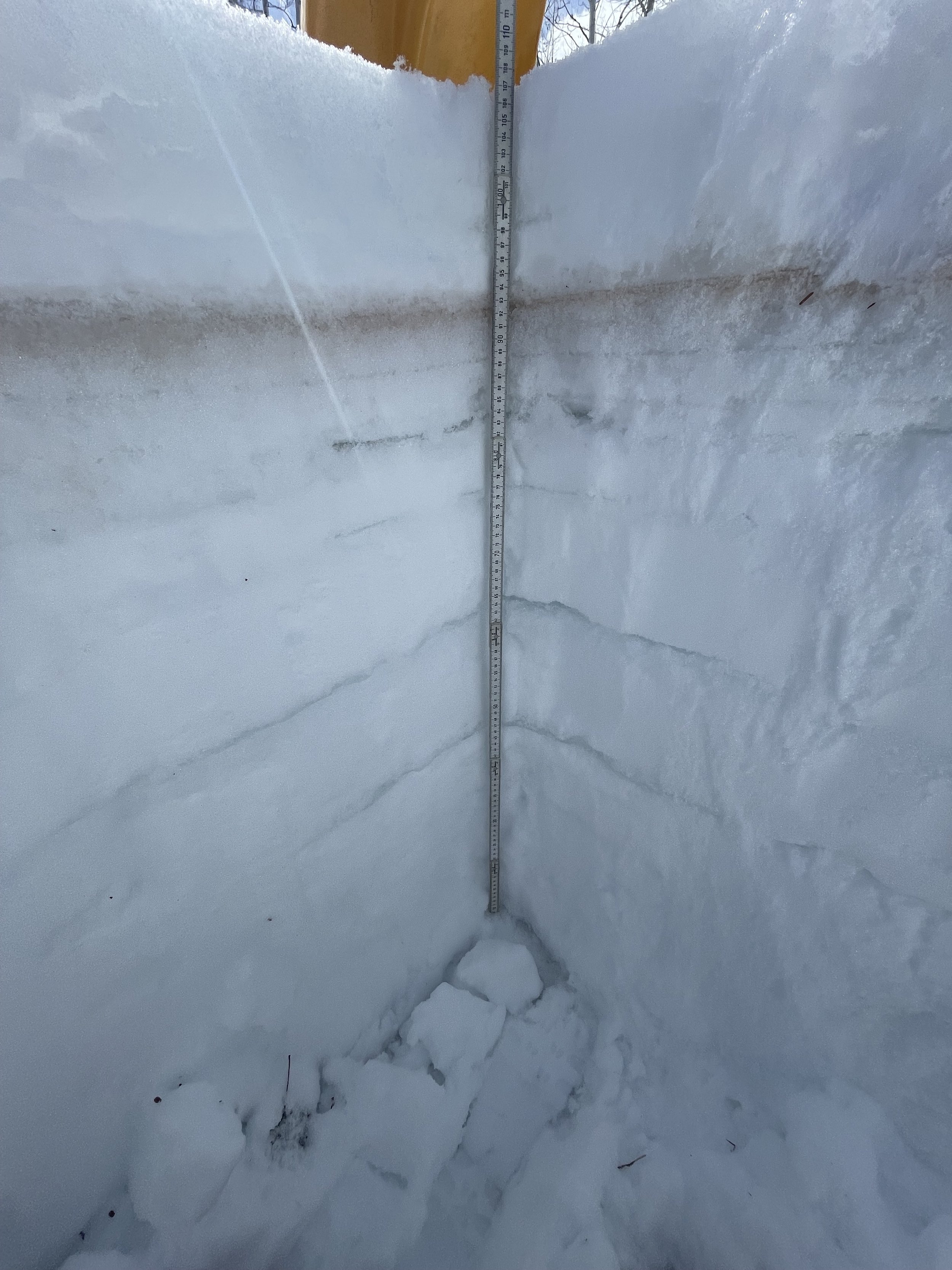
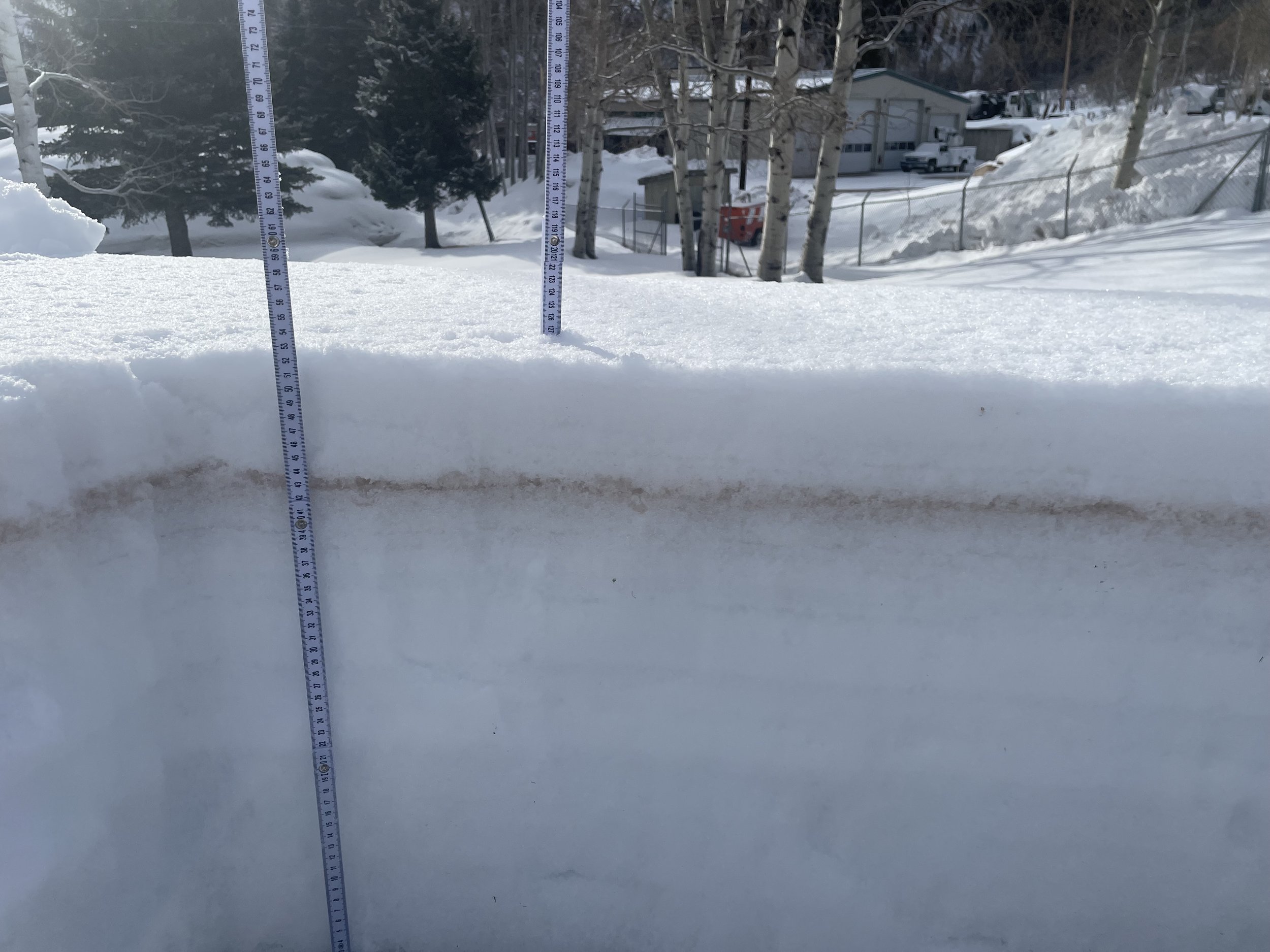
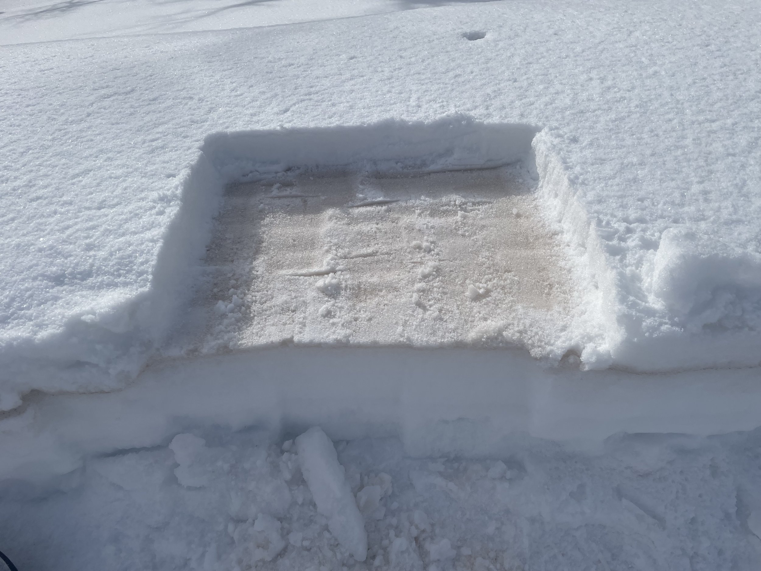
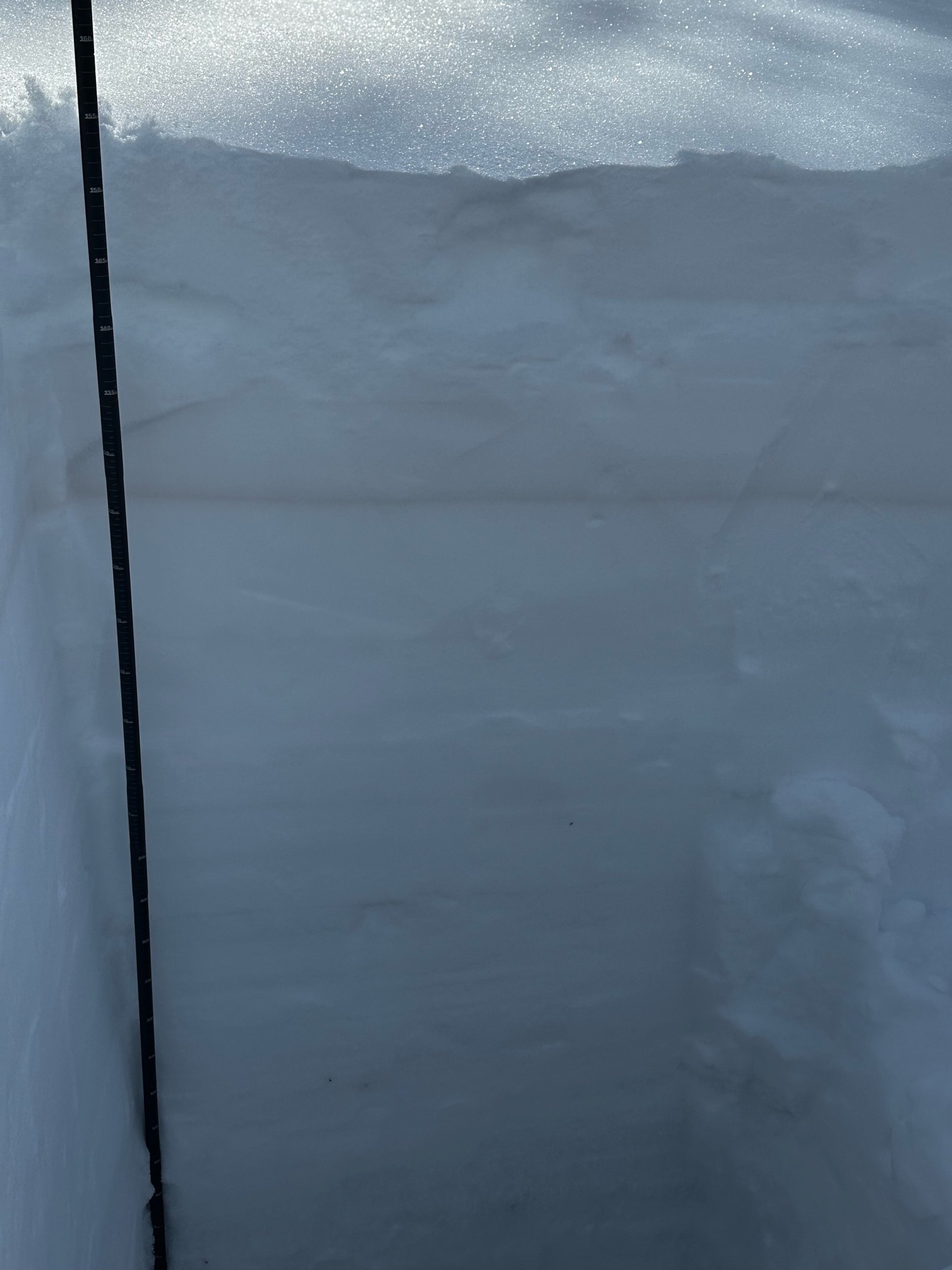
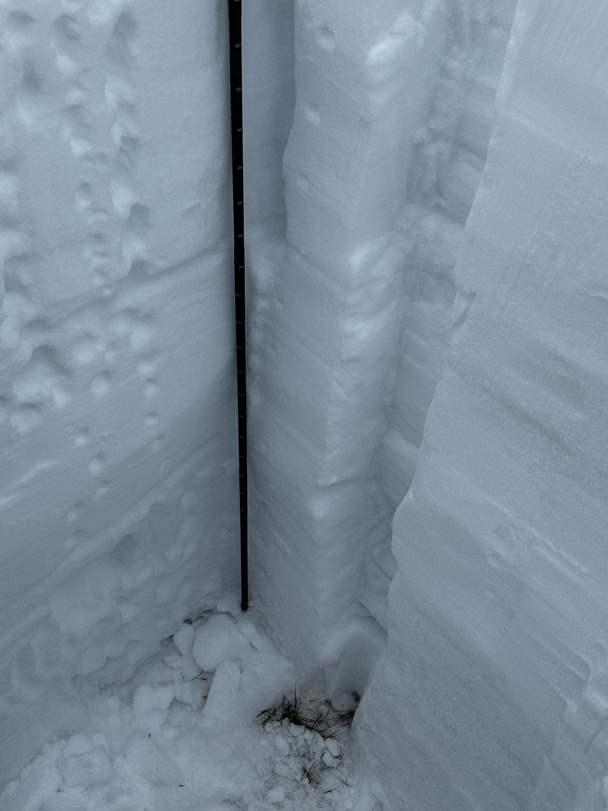
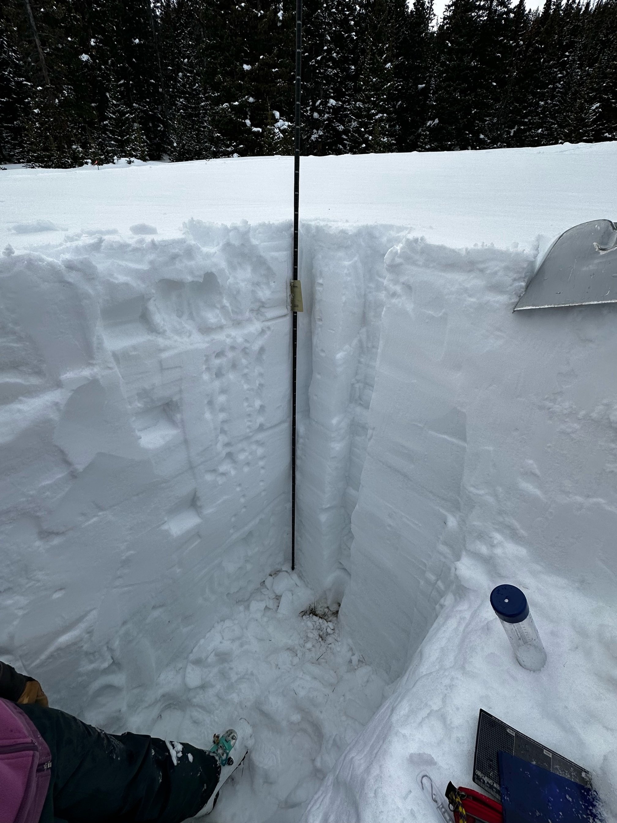
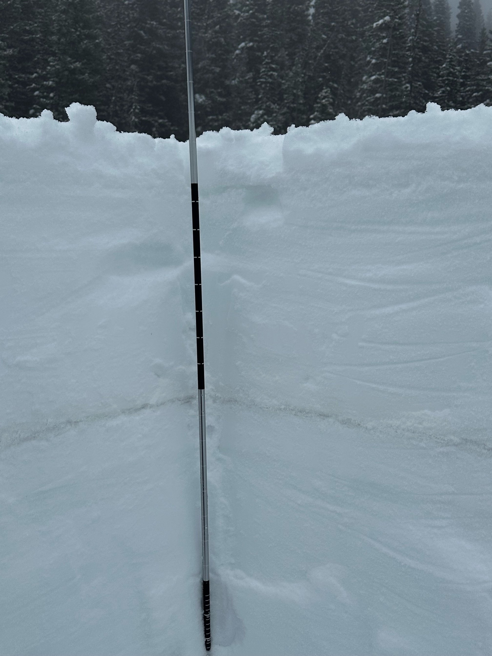
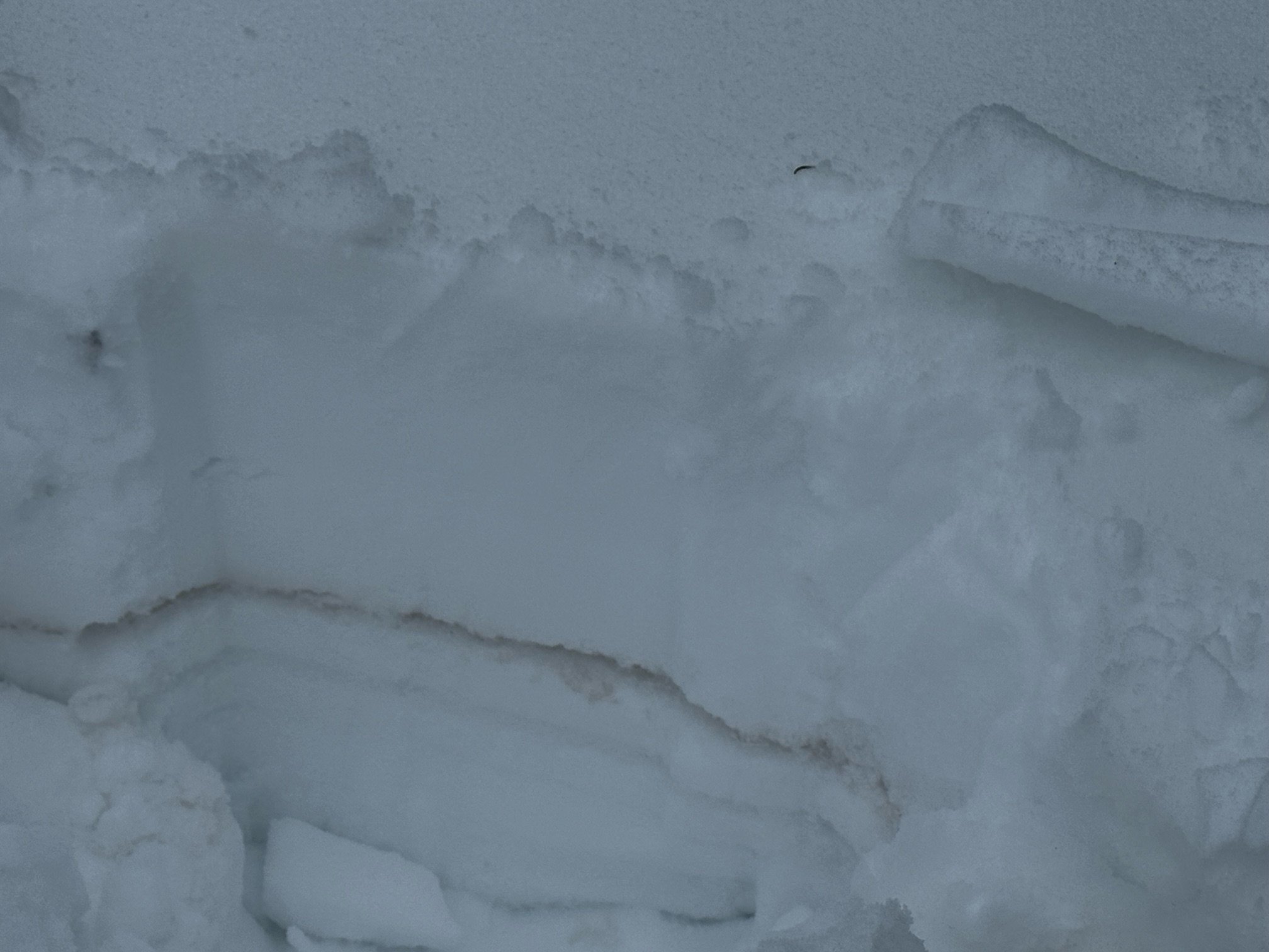
McCLURE PASS: March 14
For McClure Pass, snow depth was at 5.9’, SWE was 13.7”. Snow depth was 3.6’ and 12.4.” SWE at McClure SNOTEL. Dust at McClure was exceptionally dirty! And this gels with observations in the Roaring Fork and city of Aspen. The dust front of the D2 storm track must have been funneled right into McClure. This is the second year in a row that McClure/Roaring Fork received the brunt of a nasty dust-on-snow event. All we can do is hope for a snowy spring to keep this dust covered (and hopefully we do not receive any more like this - but we likely will), because when this dust is exposed it gonna be ugly. See photos below provided Steve Hunter with city of Aspen and the CODOS team.
Below: photos from Steve Hunter with the city of Aspen of dust in and surrounding Aspen.

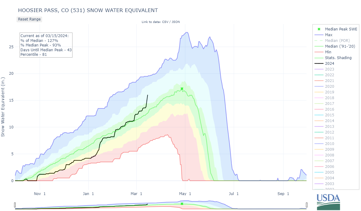
HOOSIER PASS: March 12
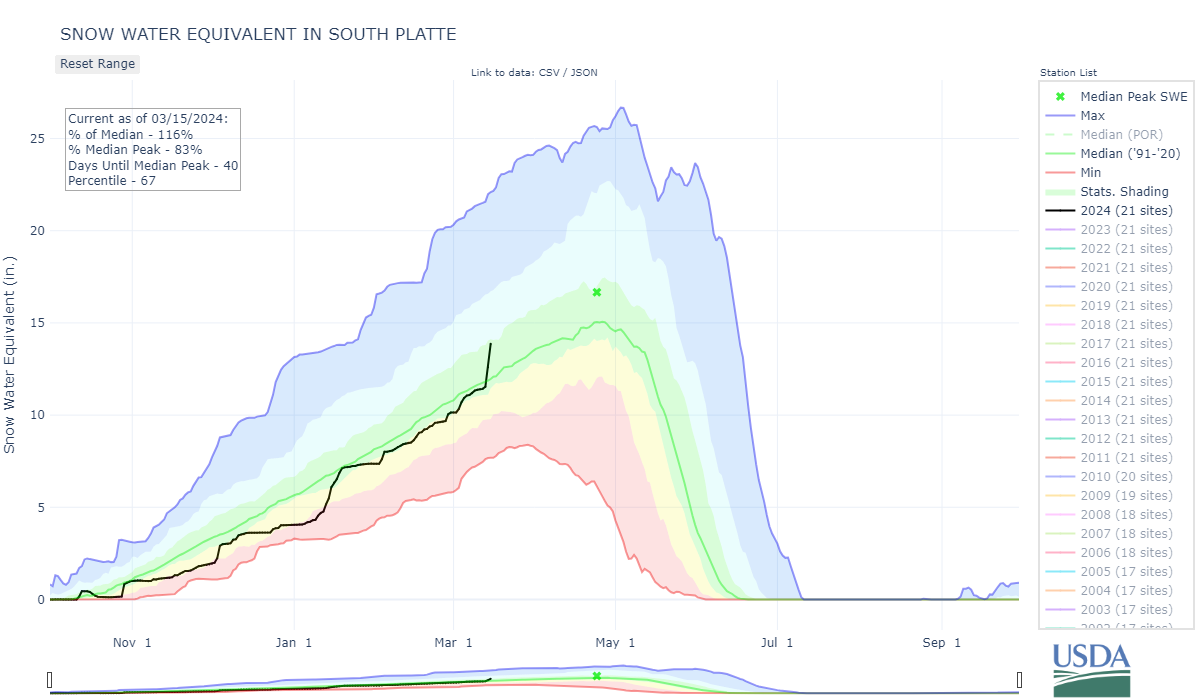
Snow depth was 5.0’, SWE was measured at 16.26”. Nearby Hoosier SNOTEL reported 13.6” SWE. Hoosier SNOTEL saw a good bump from the storm beginning March 13 and is now 120% of normal. The obvious and significant D2 dust layer was 1’ under the surface on March 12, now with the storm it is under at least 6” more snow. Considering the trajectory of the storm that brought D2, Hoosier was the next sample site downwind of McClure that got hit so hard. So it is understandable how dust severity at Hoosier is the worst of the Front Range (Hoosier/Loveland/Berthoud) sites.
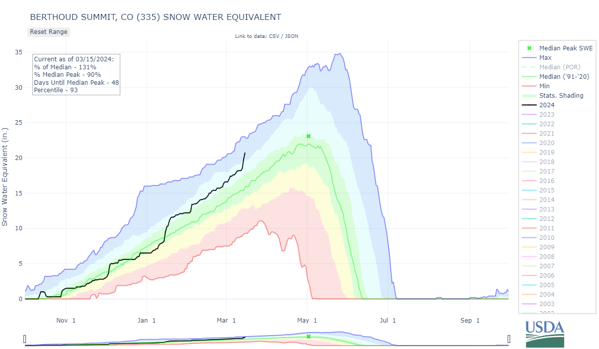
Berthoud PASS: March 12
Berthoud had 5.5’ snow depth and 19.7” SWE. A few feet away the SNOTEL was reporting 5.25’ depth and 18.2” SWE. The D2 dust layer was almost 1’ under the surface. At least 10” of new accumulation occurred a over a couple days following our visit.

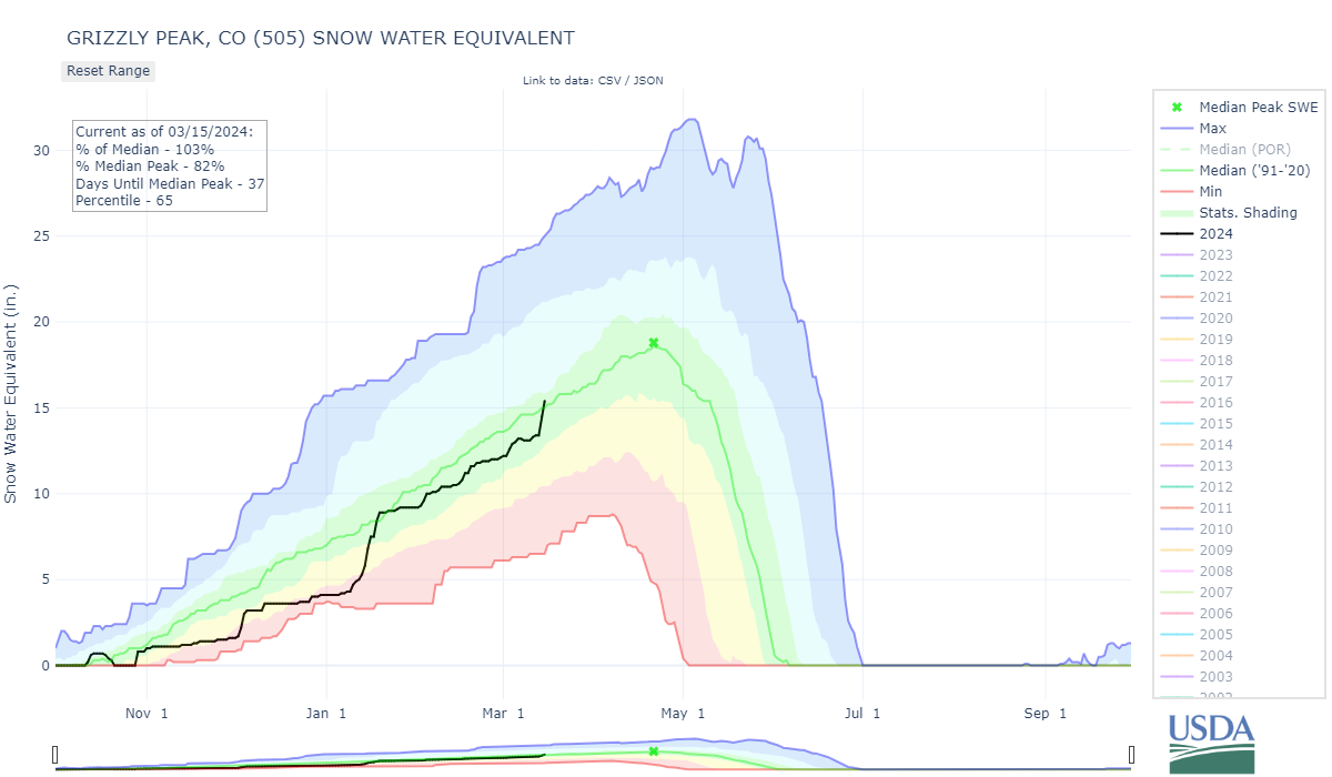
Loveland PASS: March 12
We measured 4.2’ snow depth as 14.7” SWE at the Loveland site. Nearby Grizzly SNOTEL was reporting 3.7’ depth and 13.4” of SWE. Dust layer D2 was 7.0” beneath the surface on that day. Again, the Big Storm looks to bury it further.
RABBIT EARS PASS: March 13
At our Rabbit Ears Pass sample location the D2 event is of medium severity and mixed in with an old surface crust. About 5.5” SWE sat on the dust as 22” snow depth, at least 6” of snow accumulated while we were there and soon after we left.
WILLOW Creek PASS: March 12
We visited Willow Creek late on March 12. With minimal daylight we collected only minimal data. Significant dust made it’s way to Willow Creek Pass. It sat under ~10” snow and now more than that with the stormy days that followed.
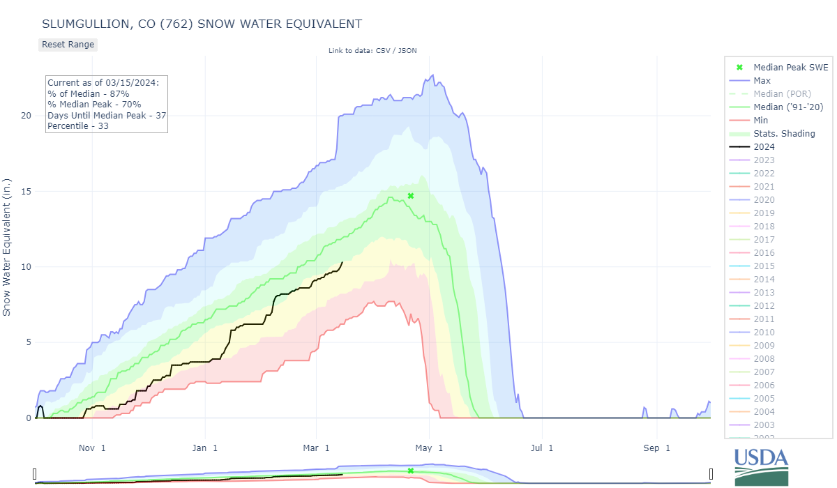
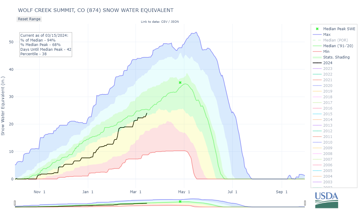
WOLF CREEK PASS: March 13
The big storm that began March 13 threw a wrench in our CODOS circuit itinerary and we had to cancel visiting Wolf Creek Summit until conditions allow. Hopefully we will get observations the week of March 18. But, by all supporting evidence it is estimated there is a significant D2 layer in the snowpack in this region as well. Hopefully much more snow falls and gives us more water and dust cover.