CODOS UPDATE March 1: Got Dust
Greetings from Silverton,
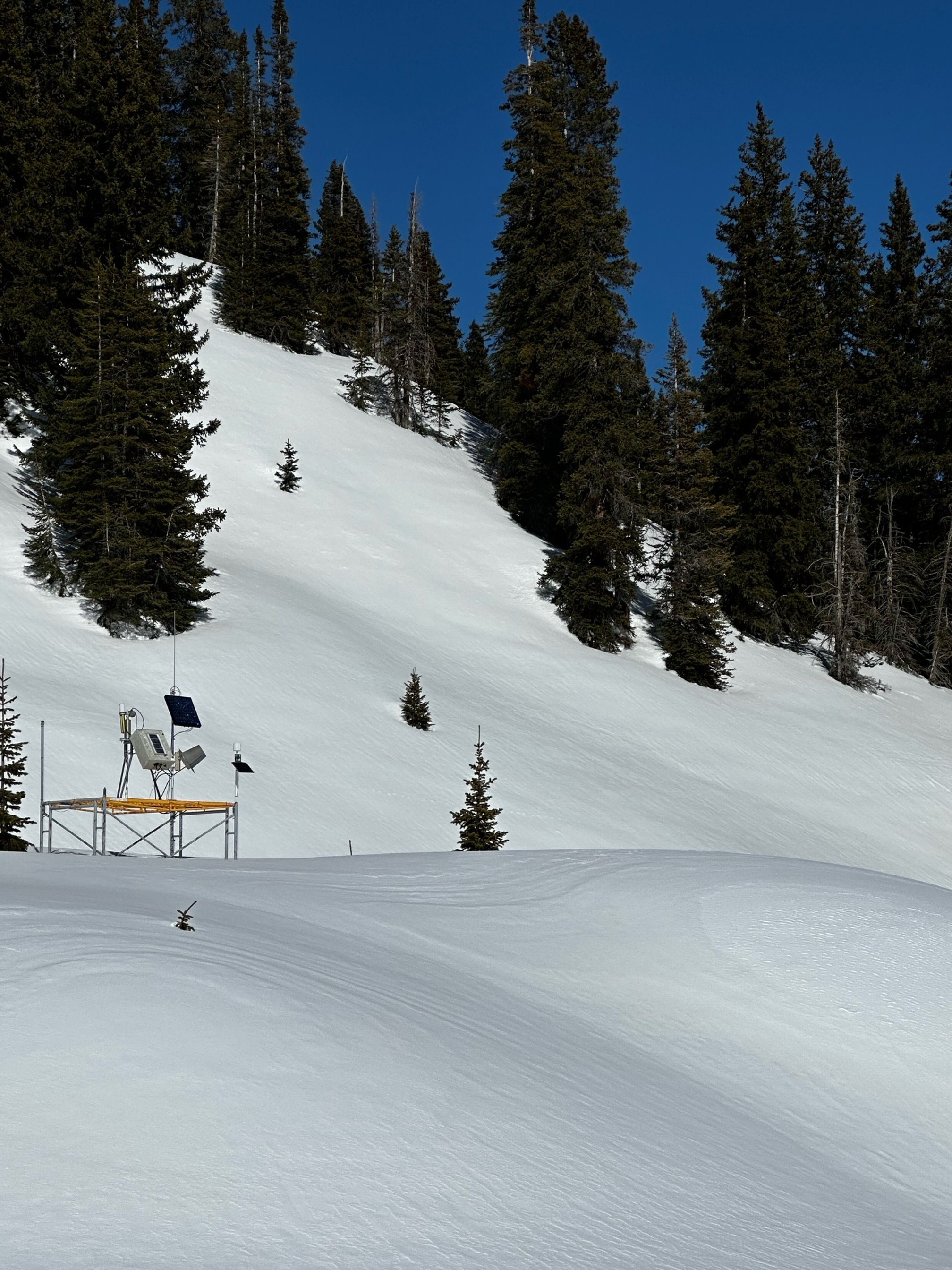
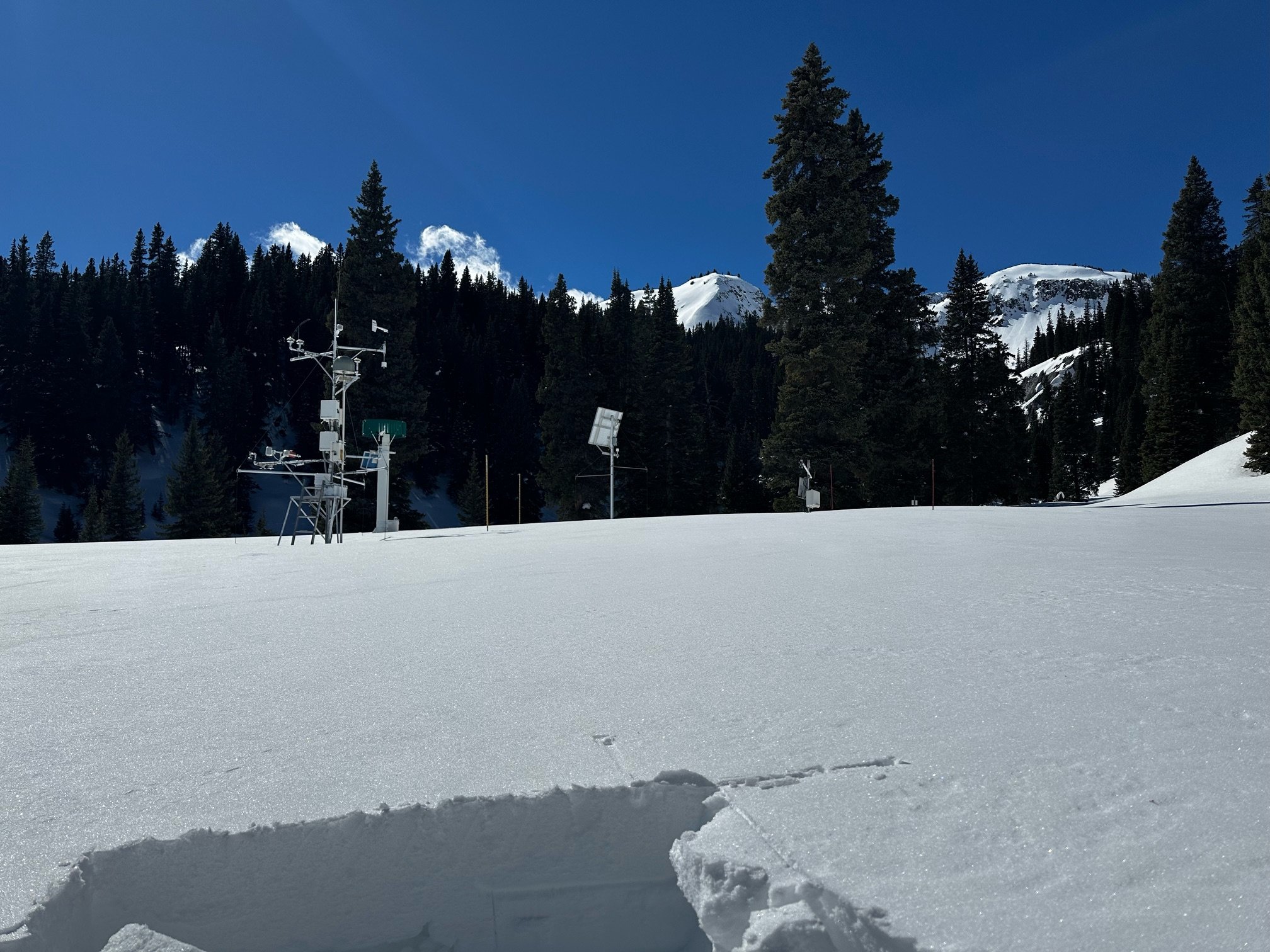
The winds kicked up well before any significant precipitation fell here in the San Juan Mountains. The winds in fact were a pesky presence through most of the storm that rolled through Monday and Tuesday (Feb 26-27). Some friends drove from Silverton to Flagstaff on Monday and reported widespread dust mobilization and a dusty hazy sky throughout the Four Corners region. The highway hosted fast moving “sand snakes” and at a few spots sand dunes on the road were ~6” deep. So the dust that settled on the snowpack was expected. This is the first dust-on-snow event of the winter season. At Swamp Angel it was pretty light in terms of severity and since it came in with stiff winds it was more concentrated in natural eddies of the landscape. Gotta take the bad with the good, the storm also deposited 1” precipitation as about 8.5” snow accumulation. Nearby Red Mt SNOTEL reports about the the same accumulation in SWE.
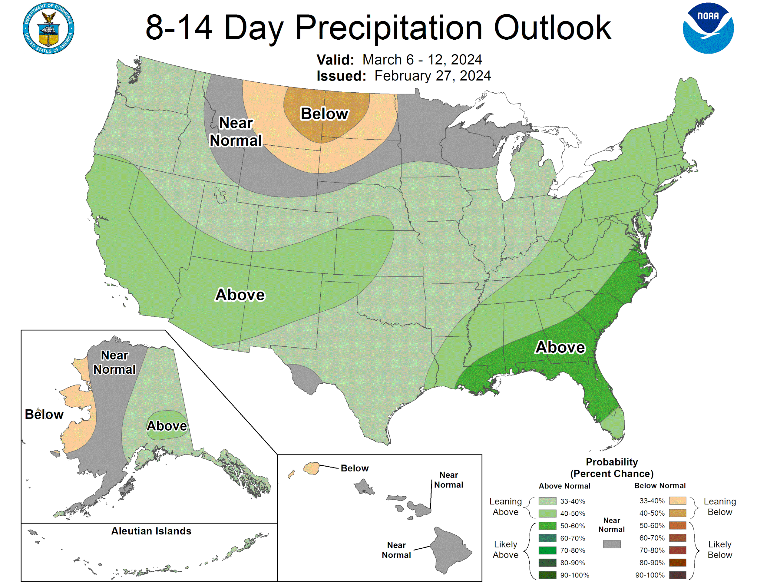
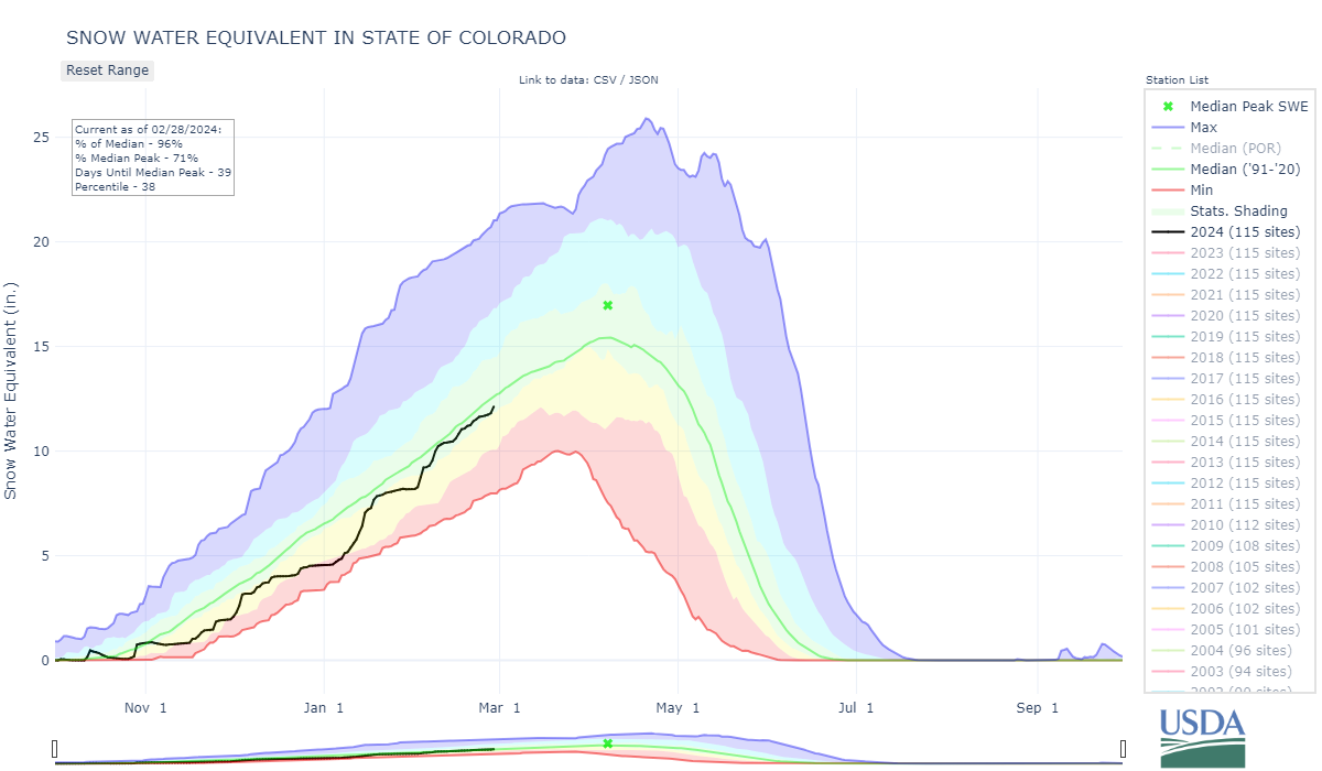
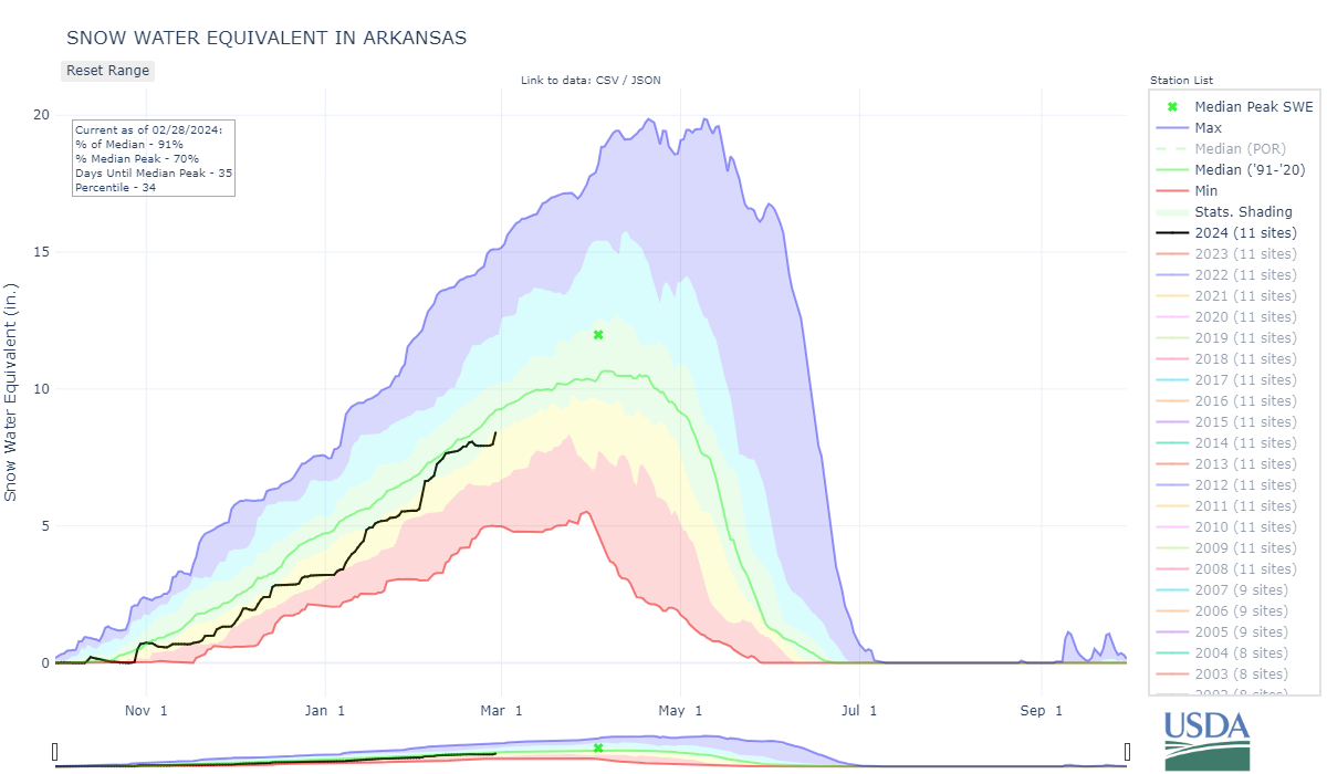
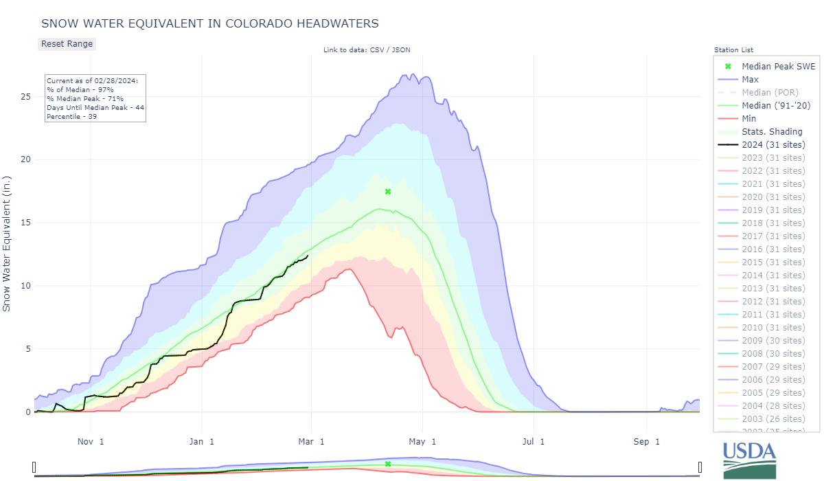
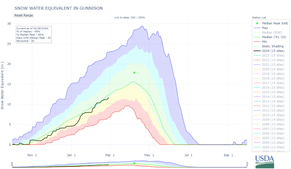
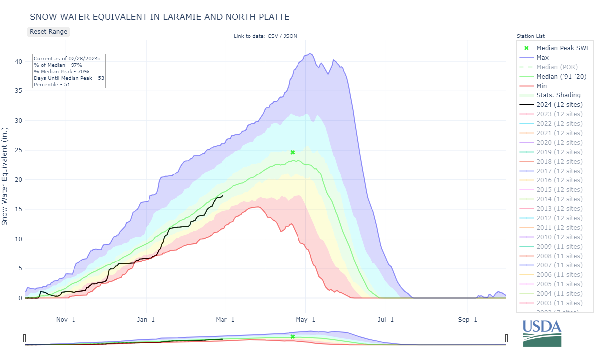
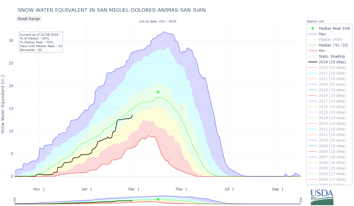
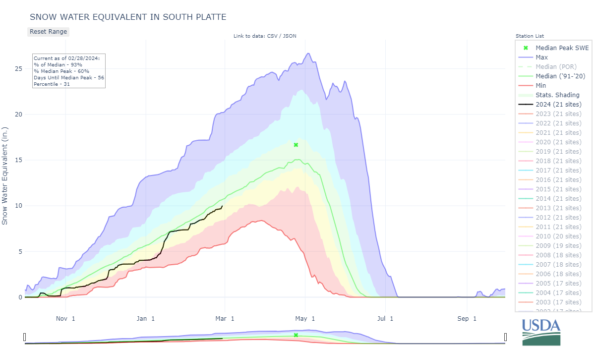
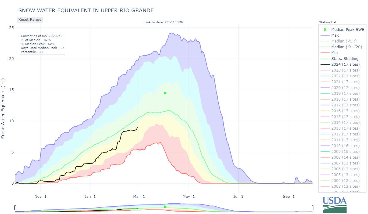
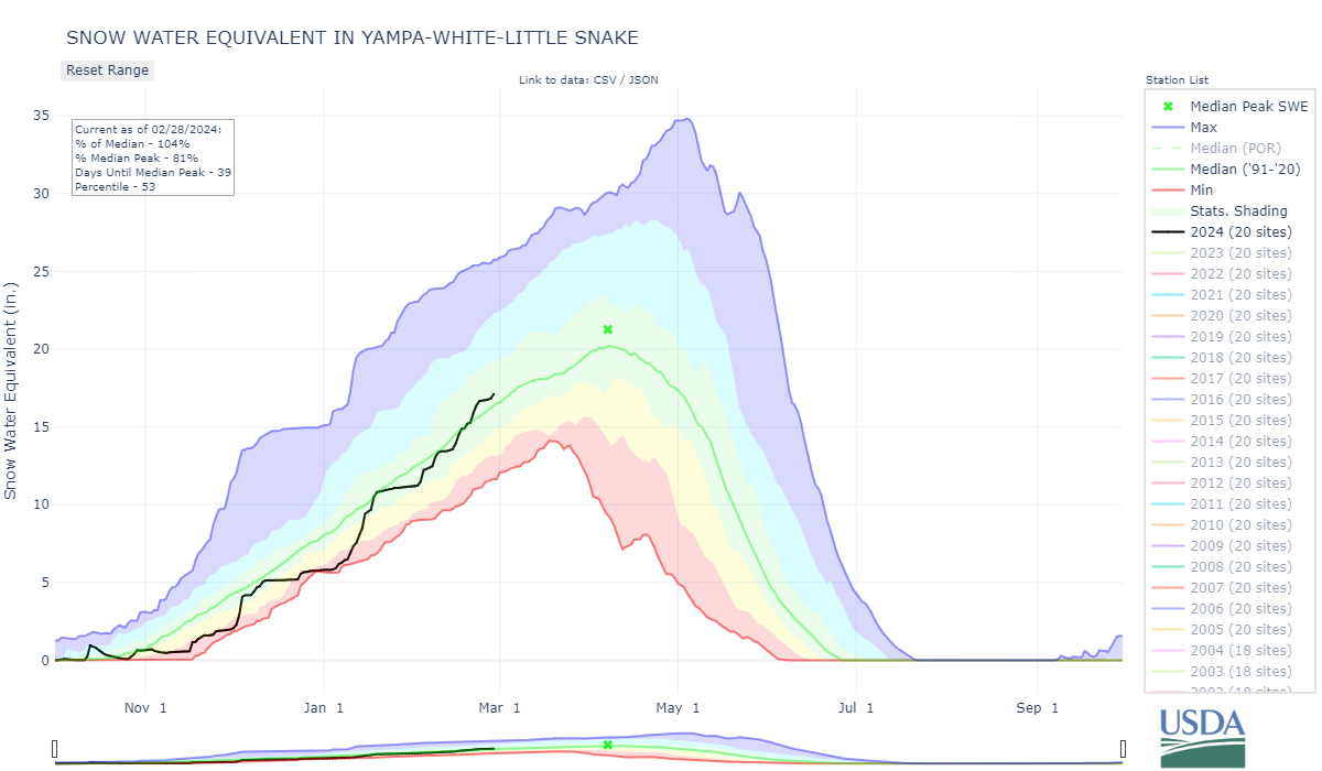
The snowpack has been repeatedly falling behind and then surging to catch up with wet AR storms. Statewide the snowpack is 96% of median. Major basins range from 85% (Rio Grande) to 105% (Yampa). The El Nino hasn’t exactly over impressed so far this winter, you don’t want to assume the snow will be there until it is on the ground. But the good news is there are chances of more storms this weekend and the 1-month forecast is calling for increased chances for above normal precipitation. See image below of precipitation percentiles by season during the top 10 strongest El Nino’s.
Take Care,
Jeff Derry
Below: Snow accumulation for 72 hour period ending Wednesday (Feb 28) in the morning.

Below: During the big El Nino period in WY2016, Klaus Wolter, a CU researcher who I think has since retired, distributed this handout showing seasonal precipitation during the 10 strongest fall El Nino conditions since 1915. There is a tendency for above-normal spring precipitation throughout majority of Colorado.