

March 12, 2020: dust event #1 showing itself, snowpack conditions, atmospheric river to the rescue?
Greetings from Silverton,
The dust layer that we suspected was in the snowpack since mid-January at Senator Beck Study Basin made itself evident this past week. On January 16-17 we issued Storm Report #10 that described a 26 hour storm that was accompanied by wind gusts as high as 73 mph. The dust was deposited as a diffuse layer with 6.7” snow accumulation. At Swamp Angel, through the process of compaction and metamorphism, the dust now appears as a 2” thick band located 20” below the surface. Late last week this mild dust layer was emerging on solar aspects and in some isolated locations on leeward slopes in the Northern San Juan Mountains. There is a unusual disconnect between observations at Swampy (20" below surface) and other locations, being discontinuous and at variable depths across the landscape, a much larger disconnect than normal. Even though this dust came with snowfall, which sometimes can help promote even distribution, the wind really had its way with this event.
The good news is March 8-9 Swamp Angel received 0.4” precipitation and 2” snow accumulation. This new accumulation served to cover the dust where it was exposing itself, primarily near and above treeline. Another mild system is coming through Colorado today through Thursday morning. Favored snowfall shifts to the Park Range and northern Continental Divide with up to 2 to 6 inches of snow.
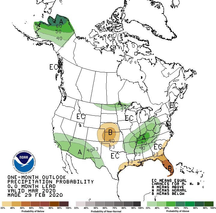
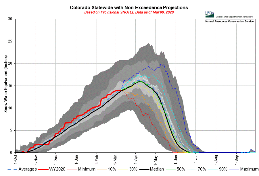
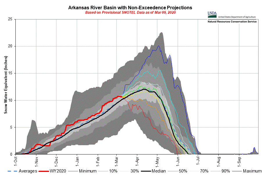
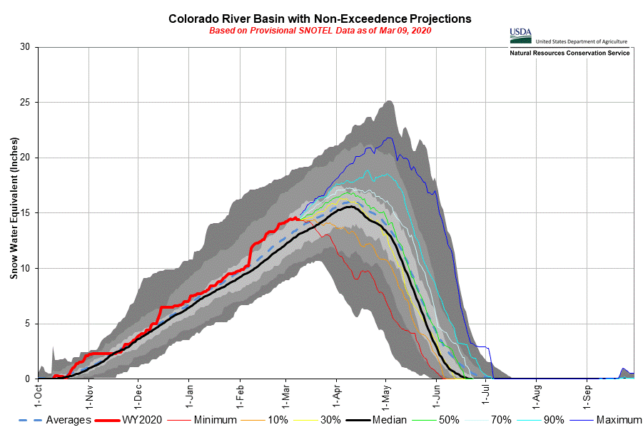
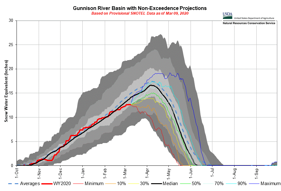
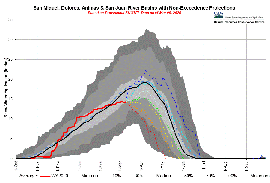
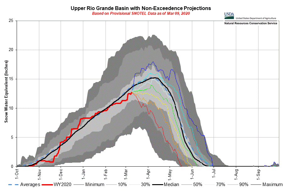
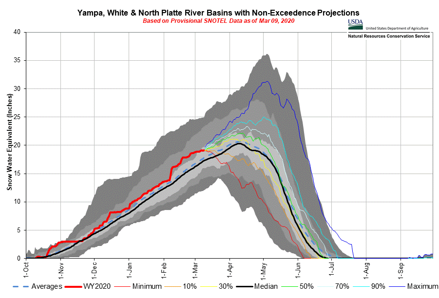
The real hope comes on Friday when ample moisture associated with an atmospheric river over the Pacific becomes entrained in flow ahead of a low that is expected to hit San Juan Mountains. The NWS calls for potentially heavy snow in the San Juans, portions of Central Colorado and lesser amounts farther north. With the San Miguel/Dolores/Animas/San Juan River Basins currently at 84% of normal, Upper Rio Grande at 93%, and Gunnison at 90%, this system could go a long way in boosting the snowpack as we approach the typical timeframe of peak SWE (around April 1). For instance, the Southwest Basins as a whole are about 4” short of median SWE and the current forecast map (below) calls for upwards of ~3” precipitation at higher elevations over the next week. For the Gunnison and Rio Grande this storm(s) could possibly return the snowpack to near median.
We have entered the dust-on-snow season where we receive the vast majority of dust-on-snow events. We receive the most dust in April, March, and May, in that order. Starting next week we will begin our CODOS tour of Colorado digging snow profiles and looking for dust presence and severity throughout the state.
More Soon, and until then, wash your hands.

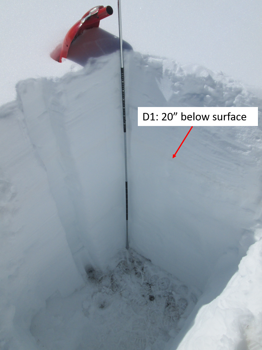
Above: Snow profile at Swamp Angel with the mild dust event #1 (D1) visible ~20” beneath surface.

Wind rose plot of the storm #10, January 16-17, that brought wind gusts as high as 73 mph and dust-on-snow event #1 (D1)