CODOS Update March 10, 2023: A Tad Bit More Dust, Storms Coming In
Greetings from Silverton,
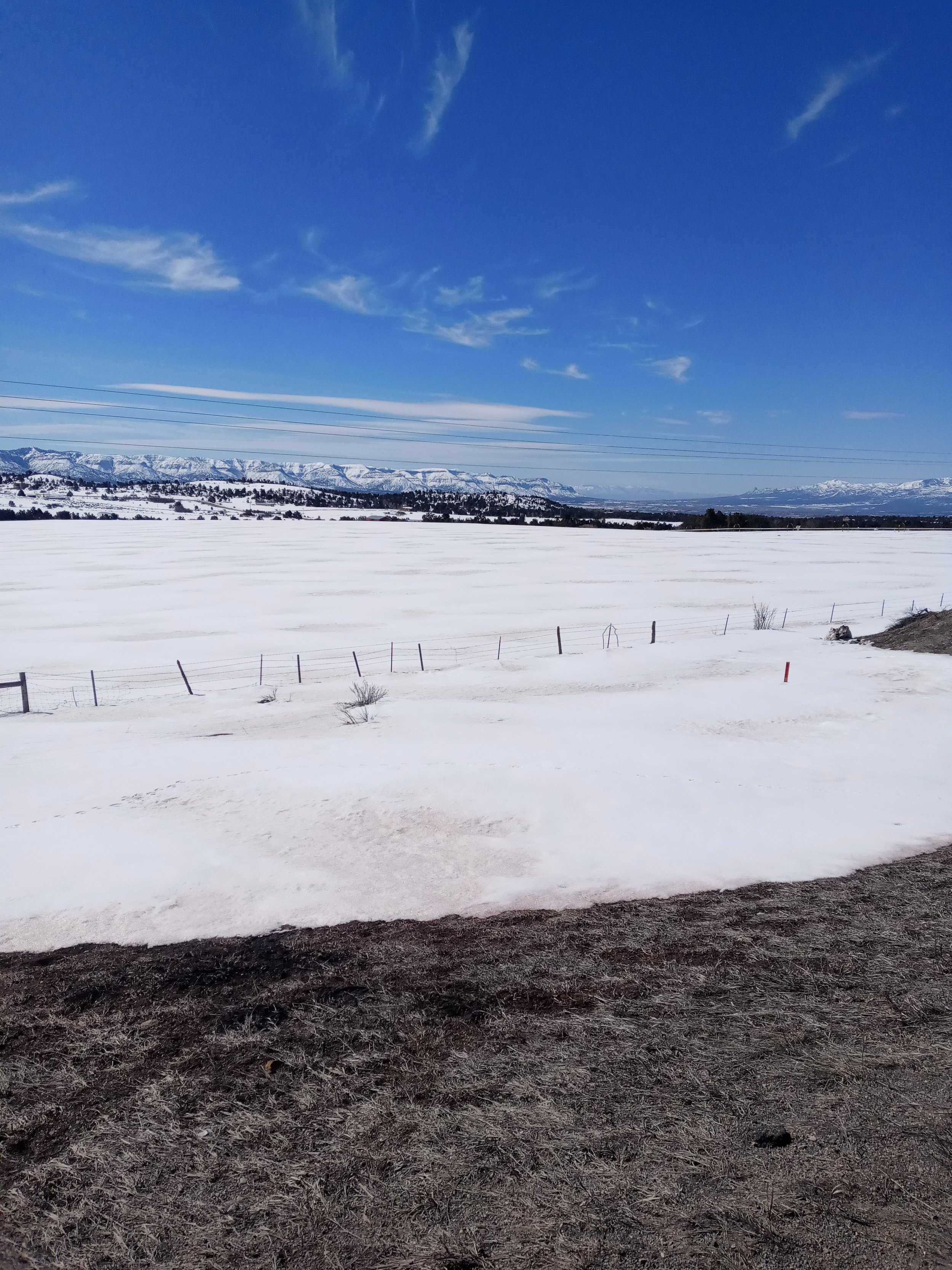
On Sunday, March 5, consistent high winds brought in a mild dust-on-snow event that was dispersed across the surface according to the will of the blustery wind. With no snow this past week it stayed on the surface collecting in ski tracks, lee sides of hills, and other accumulation areas. On undisturbed snow the dust is hardly, if at all, noticeable. With the high winds this week the crusty snow surface is largely littered with pine cones and needles.
Satellite imagery did not capture the airborne dust coming into Colorado on March 5 very well because of cloud cover, but it did capture an intense localized dust event in the San Luis Valley.
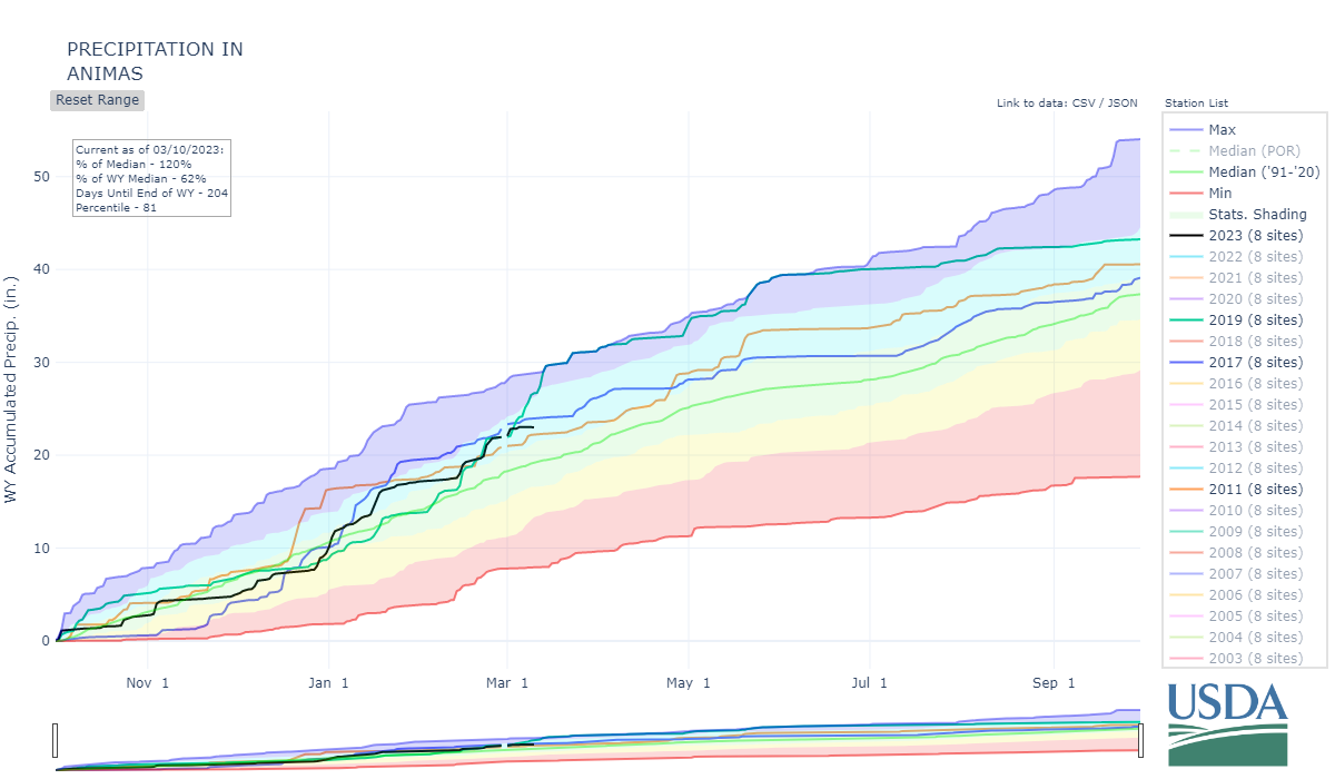
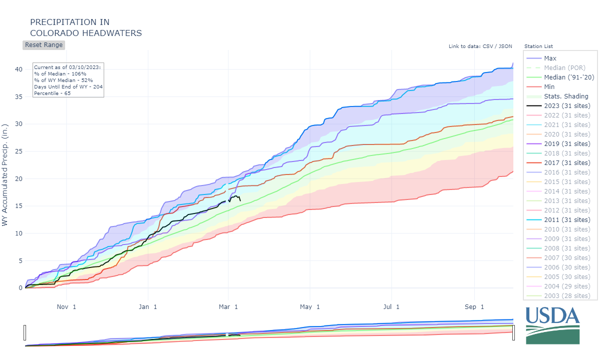
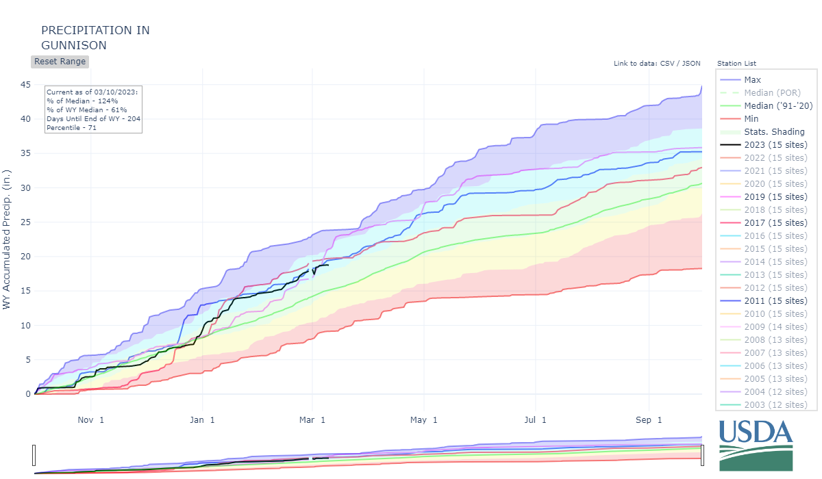
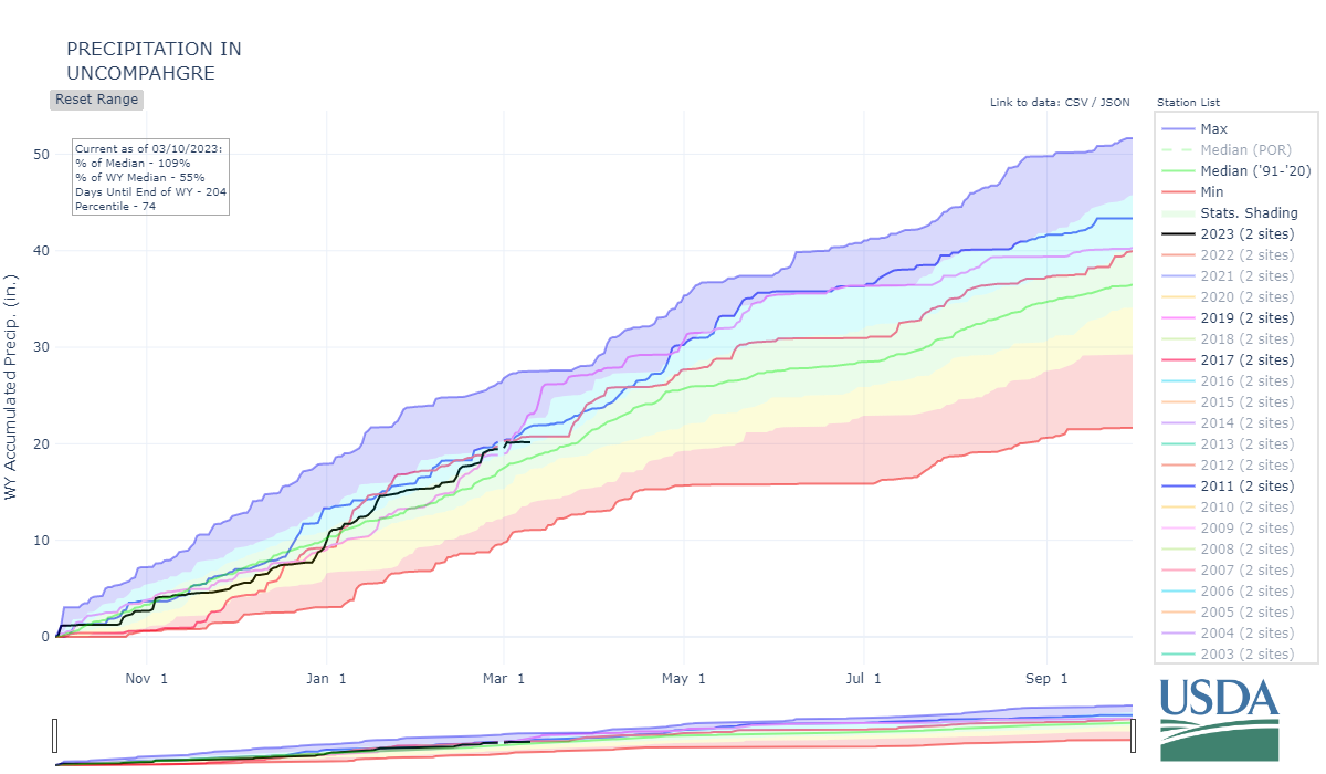
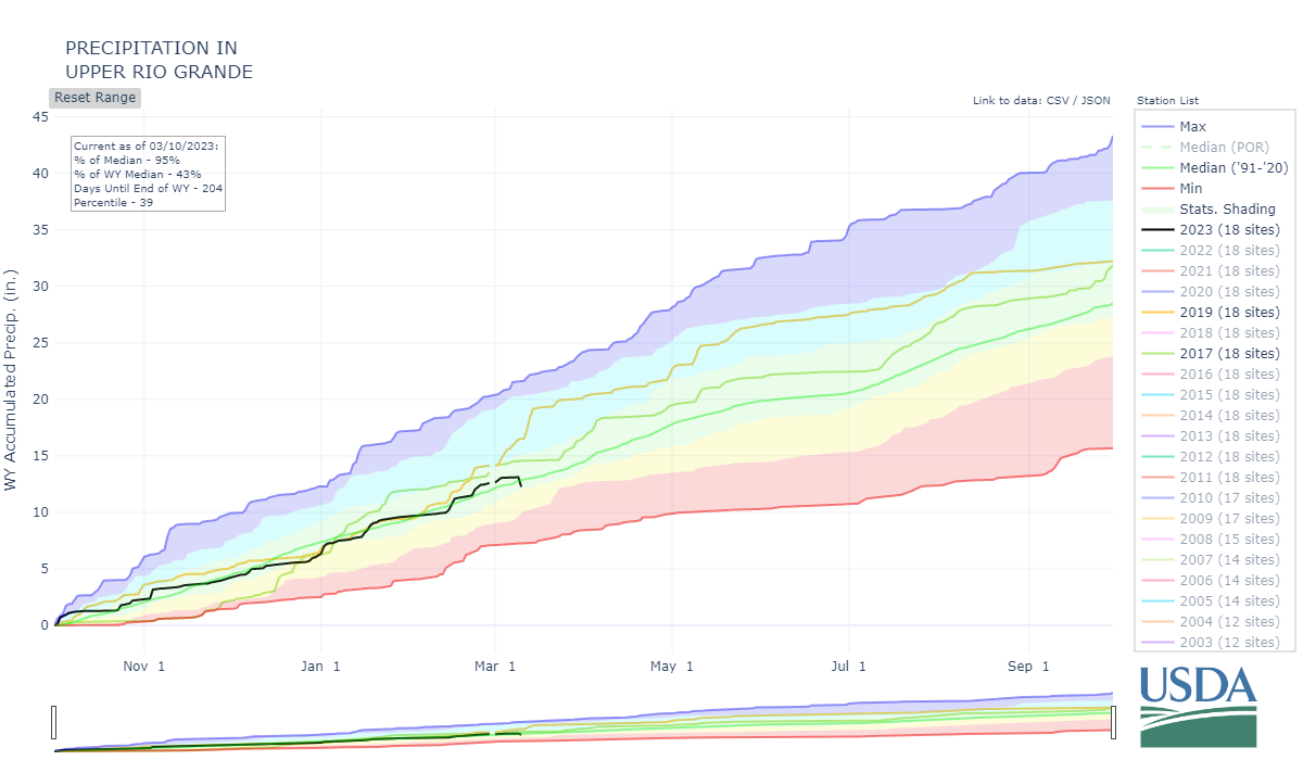
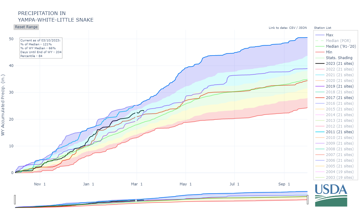
As we noted in the March 1 Update, this season resembles WY2017 in terms of dust event timing and severity. Snow covered area at the lower elevations and precipitation in the desert southwest is greater than it has been for the last several years. This helps keep dust from becoming airborne or at least minimized. In terms of the snowpack, WY2017 offers a good comparison as well for a number of basins, as of now! If we get the forecasted ~5” precipitation this week dare I suggest we start comparing better with WY2019?
It’s currently snowing hard here in Silverton, we will see. Next week we hope to find a window to visit the 11 codos sample sites around the state and assess snowpack and dust conditions. I don’t expect to find much dust but I do expect to do a lot of shoveling. We will report what we saw the end of next week.
Take Care - Jeff Derry
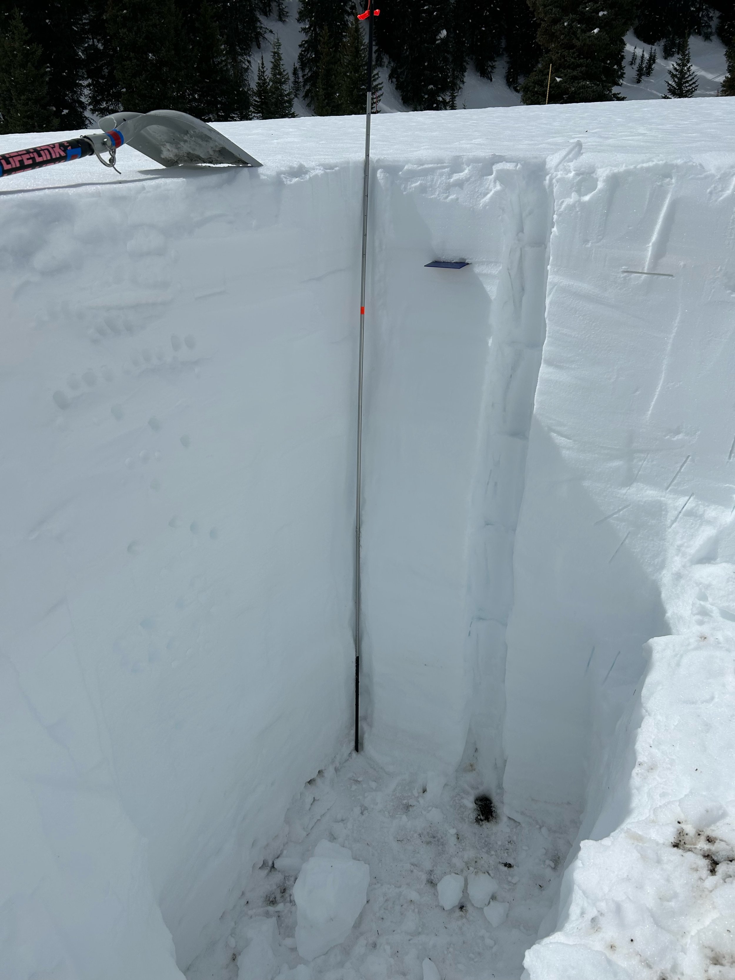
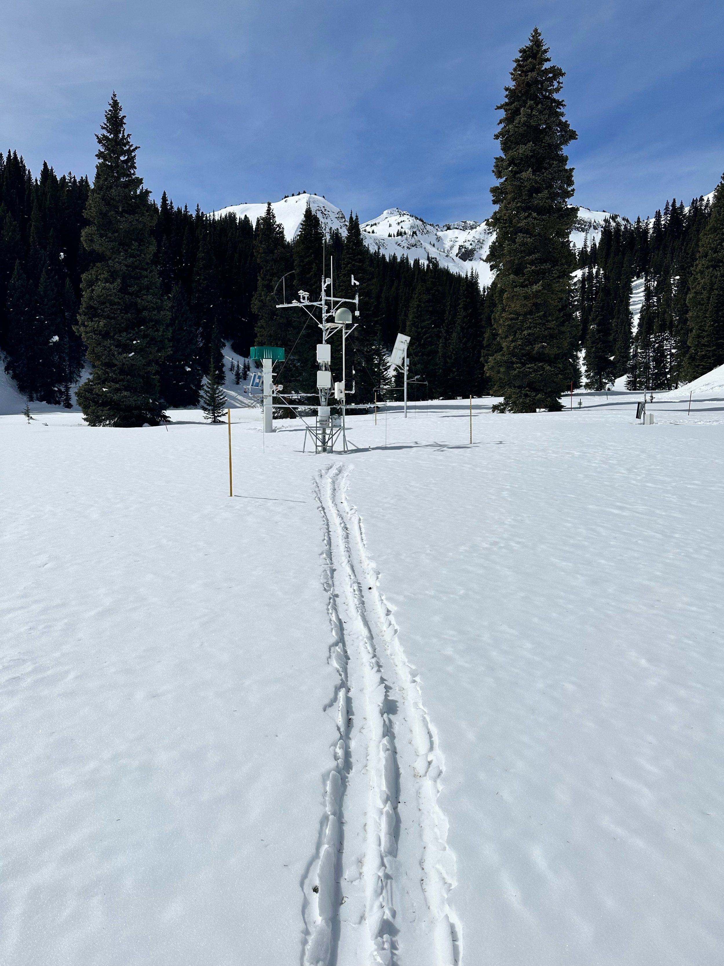
Below: Snow profile at Swamp Angel is looking pretty clean for this time of year. Mild dust layer #2 is located where you see the crystal card and D3 is located on the surface, but only obvious at accumulation points of the landscape. D3 appears to be a bit more severe towards the Dolores/San Miquel side of the hill (thanks to Skippie for the middle photo). High winds this past week were a nuisance, note the pine needles and cones in the ski tracks.
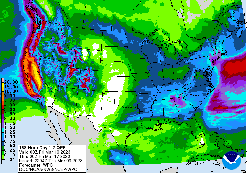
Below: Impressive snow totals forecasted from the storms this week, check out AR activity in California!