CODOS Update January 7, 2022: Real-Time SWE From 12,200’, Anyone?
Greetings from Silverton,
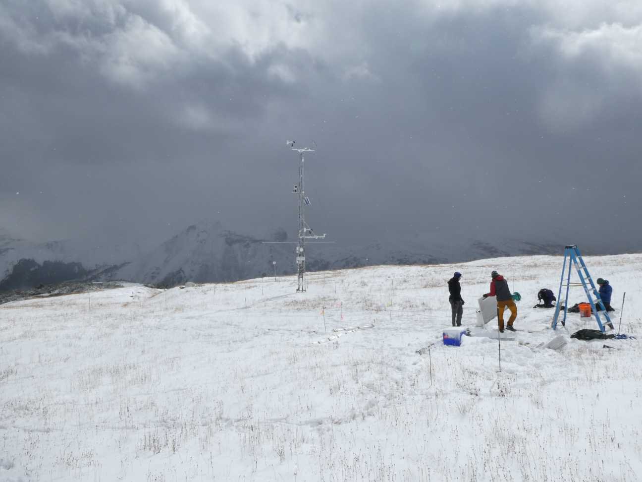
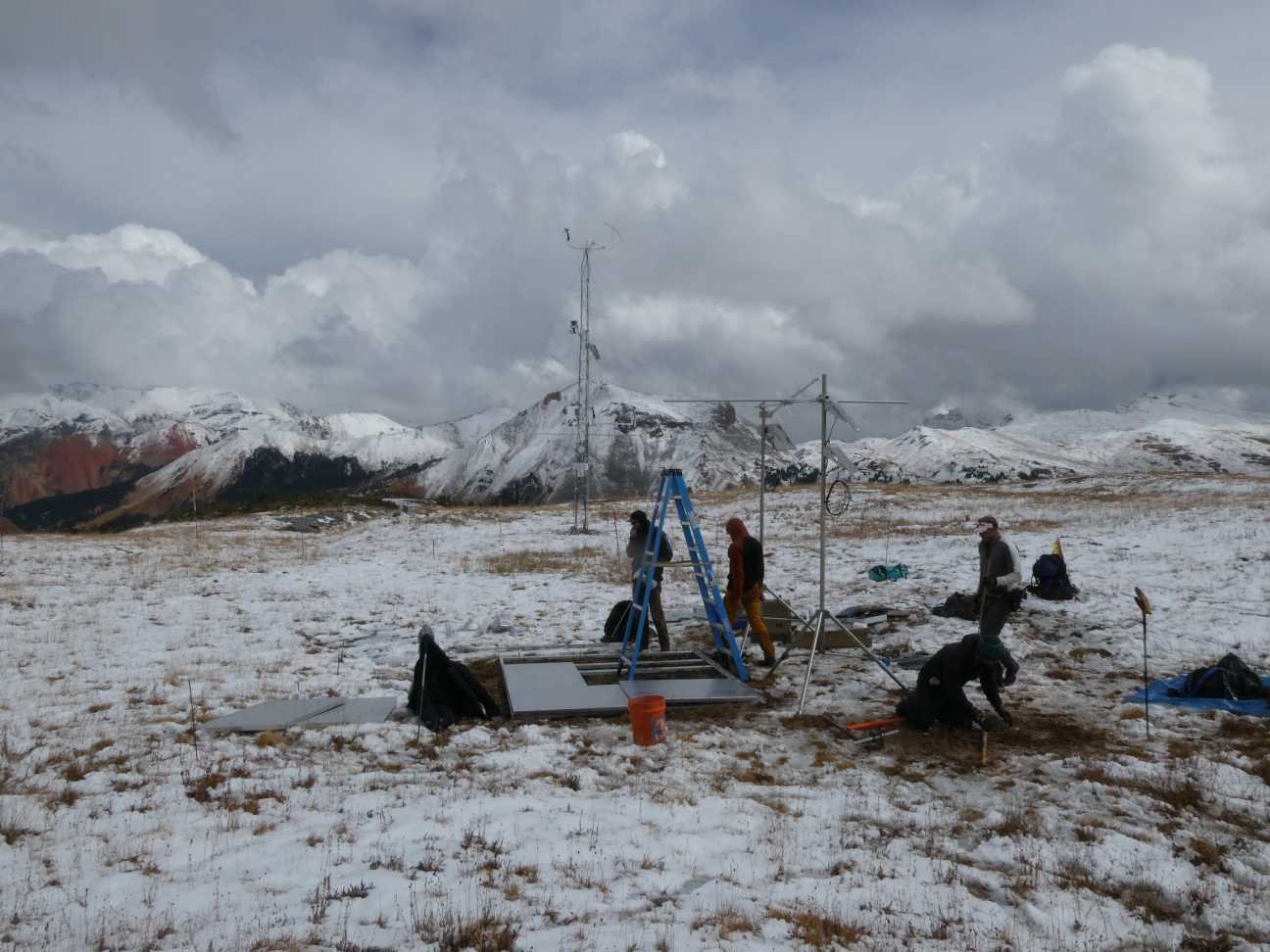
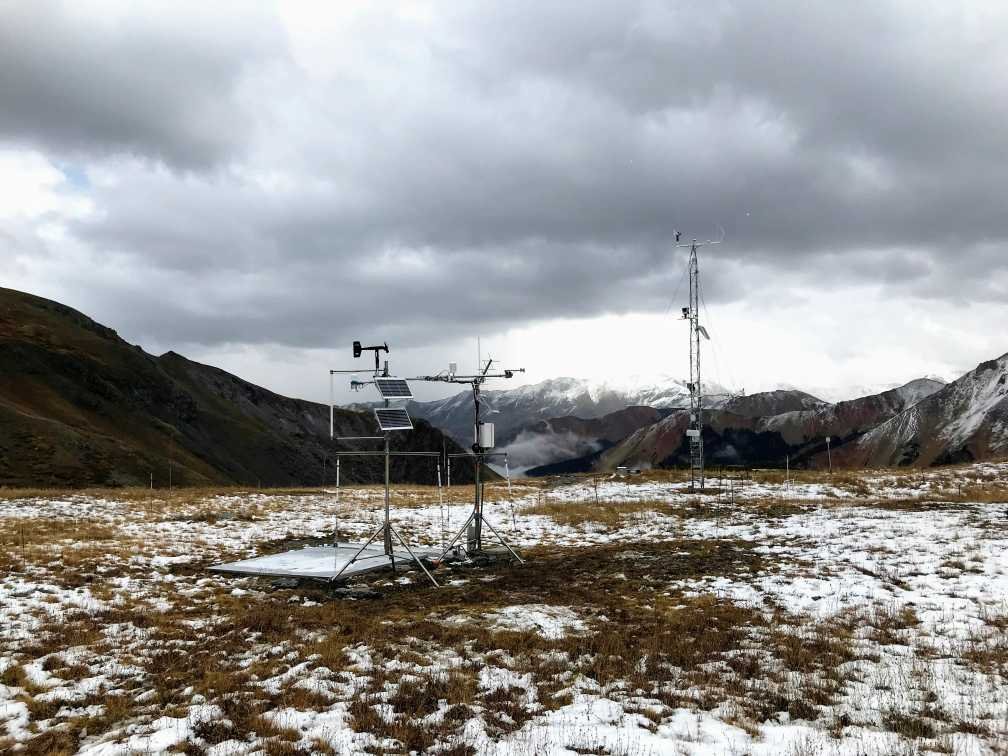
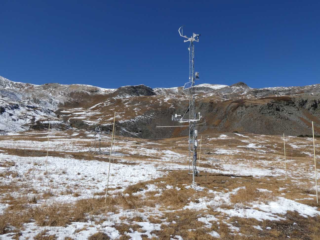
USGS-NGWOS Station: The USGS as part of their Next Generation Water Observing System deployed six snow monitoring stations this past summer/fall across the high country of the Upper Colorado River Basin. Center for Snow & Avalanche Studies is hosting one of these stations in our Senator Beck Study Basin (SBB) and it is collocated next to our alpine climate station located at 12,200’.
What makes this USGS installation unique is the data may be of greater use sooner because the USGS data can be compared to our climate station data which has a 20-year data record. Meaning, some of the data on newly deployed stations need to be taken with a grain of salt until a sizable period of record is established (10-20 years). Such as snow accumulation, is the value high, low, average? And it takes time to establish correlations to the overall watershed. However, snow accumulation varies over space and time, and the difference in snow accumulation can vary greatly at close proximities especially in the high alpine. So one must be careful about making correlations even with a stations a few feet away (such as these two stations). We have already begun the work to understand the relationship between these two stations and establish a range of known variability at and around the stations we should come to expect.
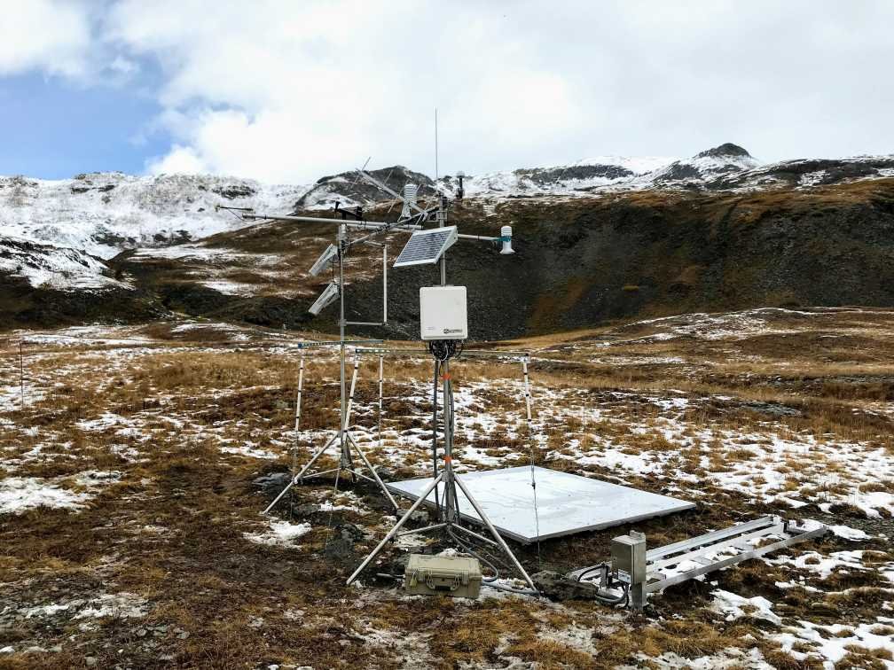
CSAS’s stations are highly instrumented with research grade sensors. This allows assessment of the functionality of USGS’ newer (and some more cost effective) sensors in a challenging environment, hopefully validating their accuracy and reliability to expand their use in the future at more stations throughout a particular watershed.
One of the new sensors deployed is a snow scale that measures snowpack mass, or SWE. It is similar to a SNOTEL pillow but without the fluid. This real-time data will be compared to SWE information from snow profiles we have been collecting since 2003. There are a few other unique sensors on the USGS station; such as a density and liquid water sensor at 10cm to assess wetness (ripeness) of snowpack come springtime, and a snow drift sensor to assess how much and when snow is being redistributed.
Variables collected at the USGS Snow Monitoring Station:
- Air temperature
- Wind speed/direction
- Relative humidity
- Longwave radiation uplooking/downlooking
- Shortwave uplooking/downlooking
- Snow depth
- Soil temperature/moisture (5 cm, 10, 20, 30, 40, 50)
- SWE
- Snow density (10 cm above soil surface)
- Liquid water content (10 cm above soil surface)
- Snow drift mass flux
- Snow surface temperature
Data can be found here on the USGS website and just recently CAIC started posting some data to their weather station webpage. We will also be using this new data in conjunction with our data and observations in future CODOS updates.
Links to the other USGS-NGWOS snow station data (a map of station locations will be forthcoming):
https://waterdata.usgs.gov/nwis/uv?site_no=394759105464101
https://waterdata.usgs.gov/nwis/uv?site_no=375429107433201
https://waterdata.usgs.gov/nwis/uv?site_no=385315107063001
https://waterdata.usgs.gov/nwis/uv?site_no=395709105582701
https://waterdata.usgs.gov/nwis/uv?site_no=395811105480401
https://waterdata.usgs.gov/nwis/uv?site_no=395448105453601
Below: Setup of USGS station during the early season wet snow storm that occurred the end of September. The tower is CSAS’s climate station.
Snow School: Snow School for Water Professionals is combination classroom and field course we typically offer every year around the month of February based out of Silverton. This 2 ½ day class is perfect for anyone wanting to learn more about the role of snow and our mountain systems as it pertains to water resources. Unfortunately with the spike in covid we decided to cancel the class again this winter. I believe we could stay at safe distances while doing the field class portion, but the lectures in our small office maybe not so much. And I fear many folk’s employers may not sign off on it as well. So, for next year, if you are interested in attending Snow School for Water Professionals please let me know and the beginning of next winter I will contact you about your preferred dates to attend the class. Please do not hesitate to contact me with questions.
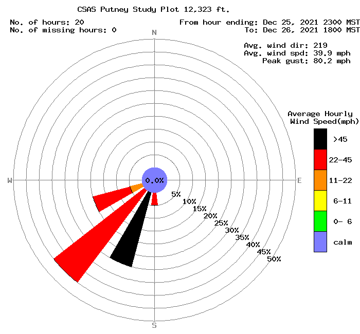
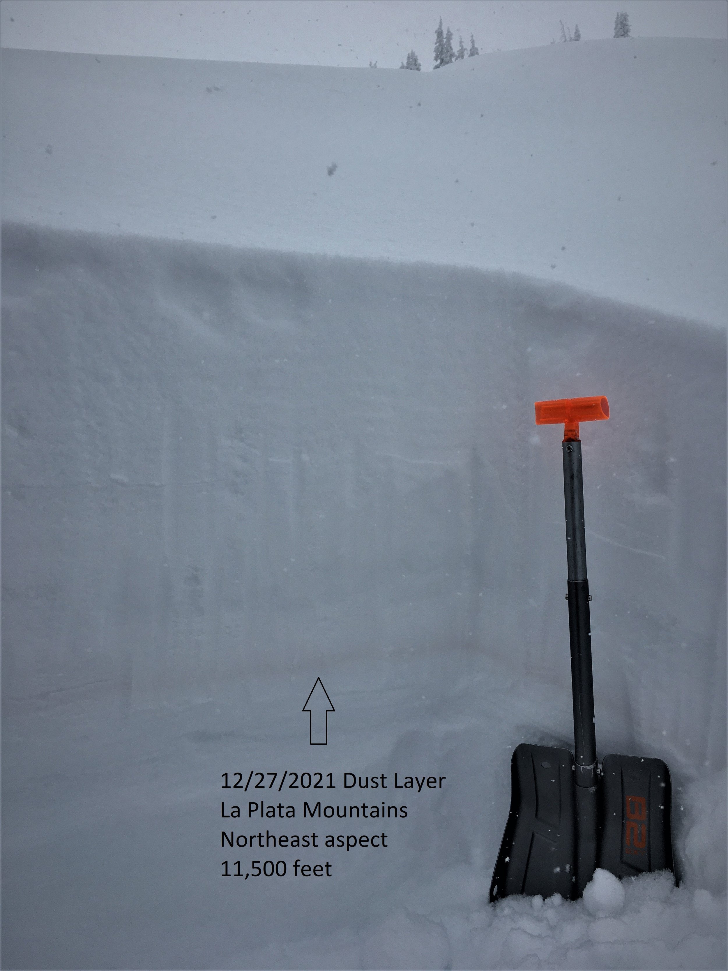
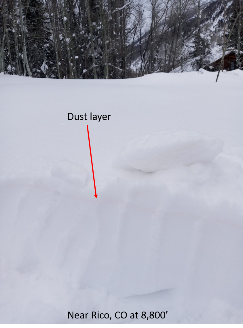
Dust Event #1 for WY2022: With the very high winds all of Colorado was experiencing over the last number of weeks it perhaps no surprise that a bit of dust would be in the mix. Dust came late December 26 and/or early December 27 as a follow up to the storm that preceded it. The dust is pronounced in the La Plata’s, Rico, Telluride area. Dust was not apparent in a snow profile done yesterday at Swamp Angel but some fraction must be there. We will keep you updated.
Below: Wind Rose for dust event #1 of the season and a few pictures.
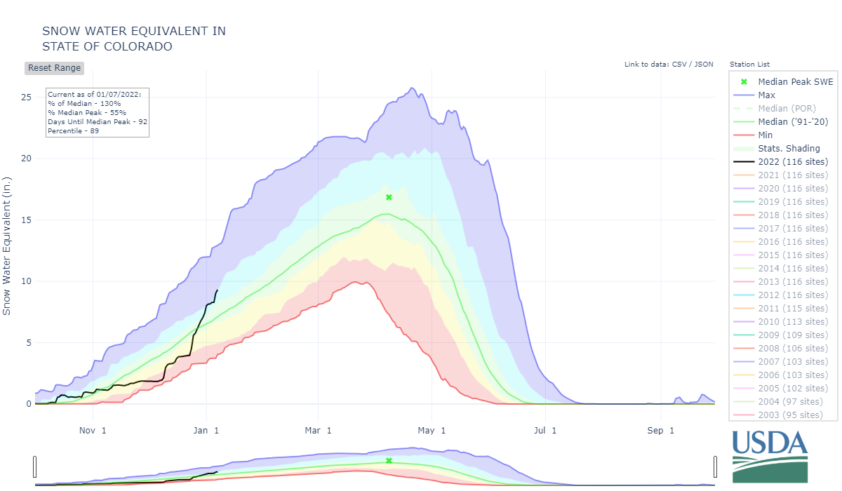
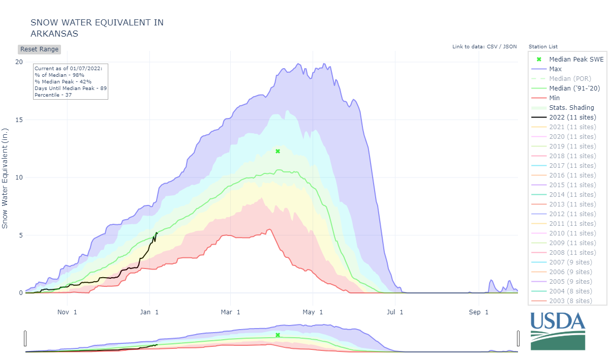
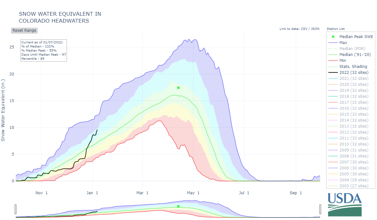
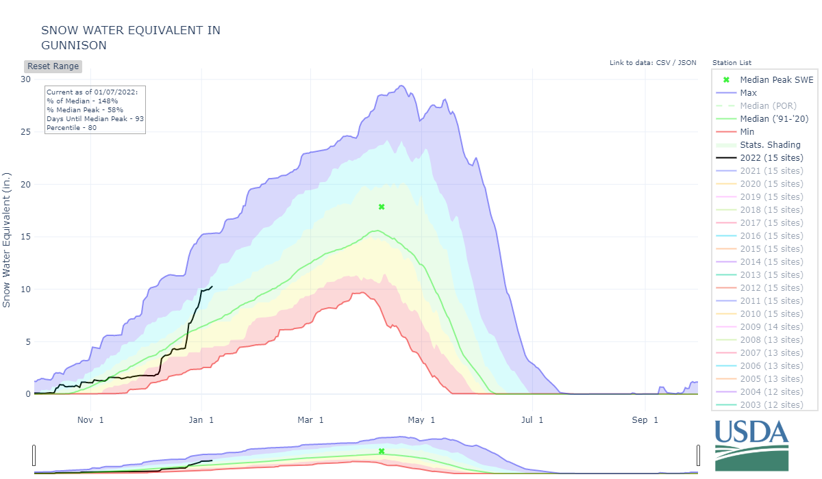
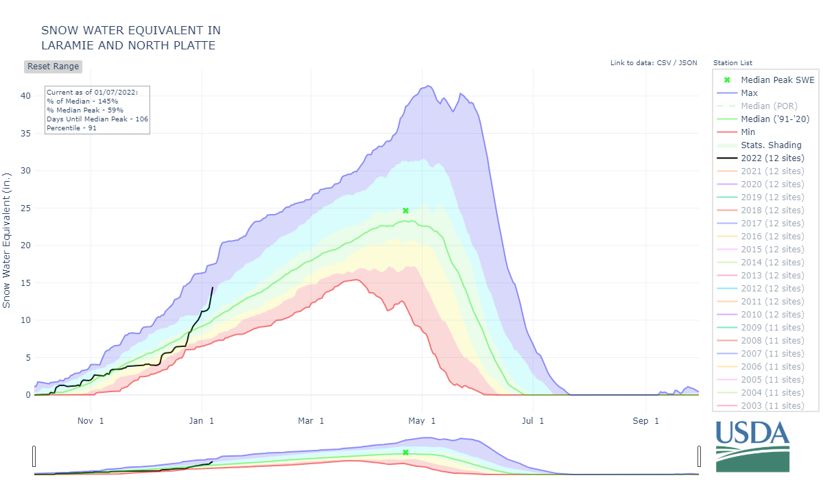
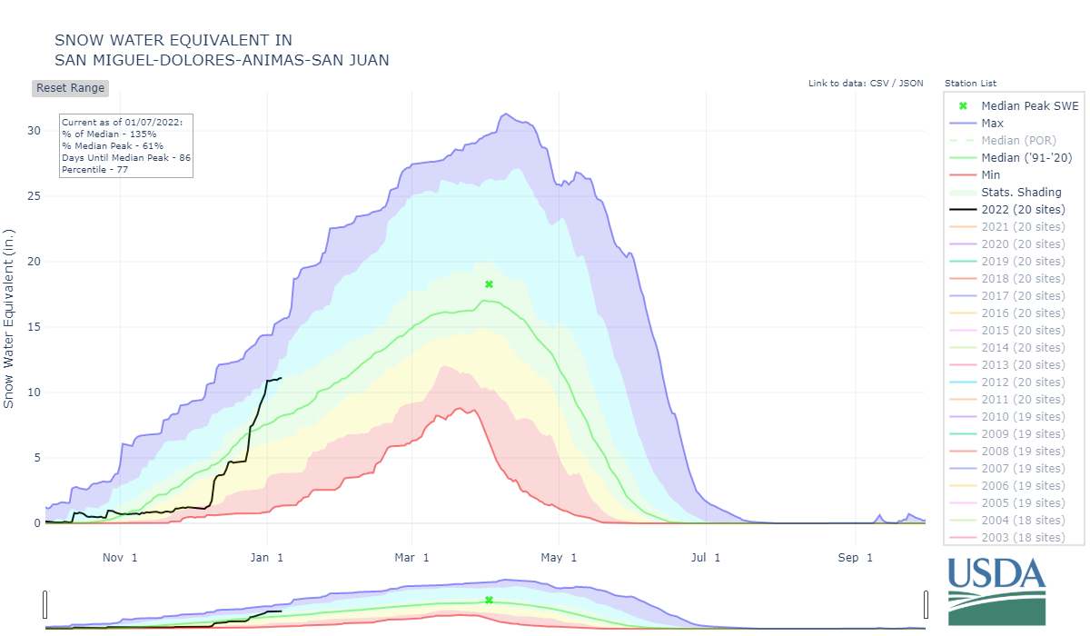
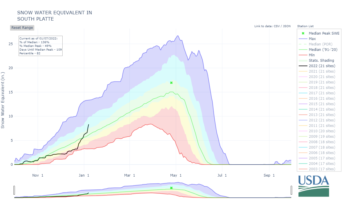
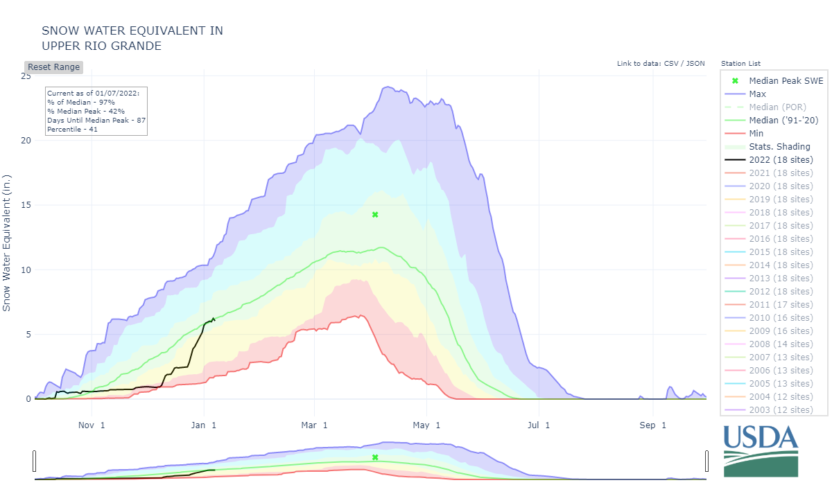
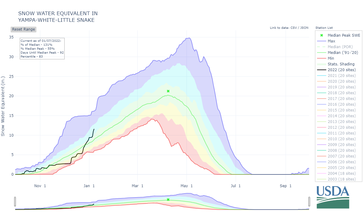
State of the Snowpack: Last week’s storm ended the very productive storm cycle for Southern Colorado that initiated the second week of December. At that time the Colorado snowpack was in the danger zone, very close or at all time minimums. The back-to-back storms delivered the goods in the mountain zones, springing the snowpack to median levels or much better (150%) according to SNOTEL data networks (see plots below). And the storm that hit Central and Northern Colorado over these last couple days provided another sizable boost to those regions. Great to see, but there is a lot of winter left, hopefully it keeps coming.