CODOS Update January 21, 2022: Importance of AR’s in Colorado, Workshop Reminder
Greetings from Silverton,
Importance of Atmospheric Rivers for Colorado Snowpack: For a number of years I have often wondered how much of Colorado winter season precipitation is from atmospheric rivers. Most people are aware how important AR’s, or the pineapple express, are to California; providing 30-50% of California’s precipitation, 40% of Sierra snowpack, yet account for ~17% of West Coast storms (some AR’s can hold 7 times the Mississippi River in water content). But some remnants of AR’s that hit the West Coast make their way to Colorado. The AR that kicked off the storm cycle in early December in Colorado show a recent example how productive these events can be. Nearly every winter the snow hydrograph in Colorado shows sharp jumps that most often are attributed to AR’s. There have been many seasons that were saved, or not, by just a couple storms that were AR events. Finally a paper was published and posted on NIDIS that approaches this question. The researchers found that almost one-third of the snowpack in the Upper Colorado River basin is attributed to AR induced snowfall. And the primary origin of these AR’s are from the southwest. Read the paper here.
Exploring the Ability to Fix a Broken Water Cycle Workshop: On December 3, 2021 we held the first of its kind Workshop titled Dust, Snow, and Flow in the Rio Grande and Colorado Headwaters. The workshop was intended to be a continuing effort, building on stakeholder participation to foster change in land and soil health. If any change is going to come about towards improving/repairing ecosystems, soil, water, and minimizing dust-on-snow events in the Colorado headwaters, it will only come about through stakeholder exchange of experiences and understanding the realities we are faced with. From this a cohesive force can forge actual change. The workshop comprises a very diverse group including Hopi and Navajo representatives, land owners in the southwest, water managers, state/fed agencies, scientists, etc. Join us, the second workshop will take place on Feb 4 from 8:30-12:00 via Zoom.
Dust-in-Snow Conditions: As reported a couple weeks ago dust came late December 26 and/or early December 27 as a follow up to a storm that preceded it. That dust layer is obvious in the snowpack in the La Plata’s, Rico, and Telluride area. Going east in the San Juan’s dust is not apparent in snow profiles but likely there to a degree. Last week the CODOS team dug profiles at Hoosier Pass and on the west side of Rocky Mt National Park, near the Colorado River headwaters. No dust was observed in these snow profiles.
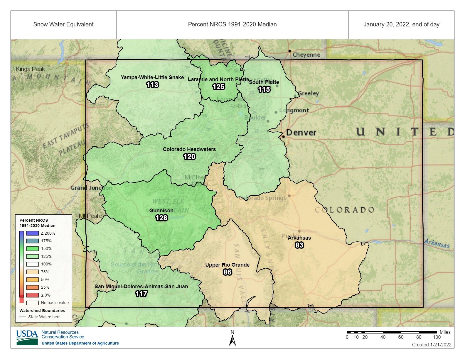
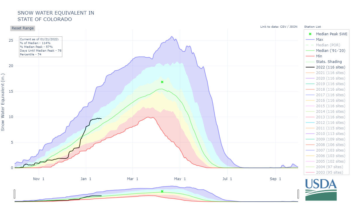
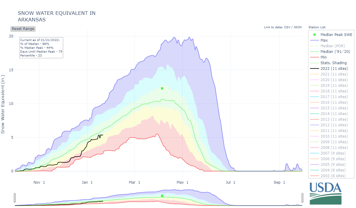
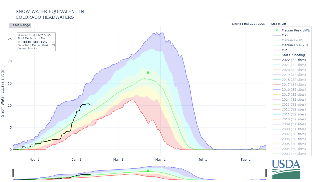
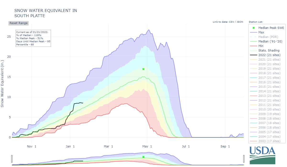
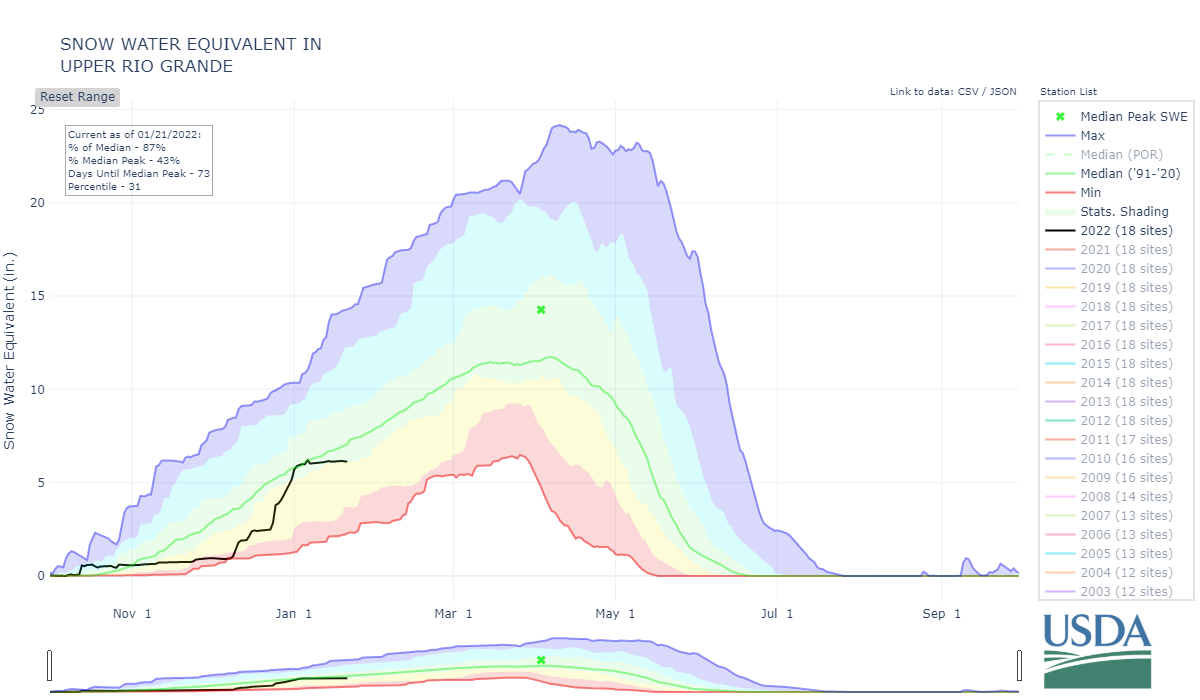
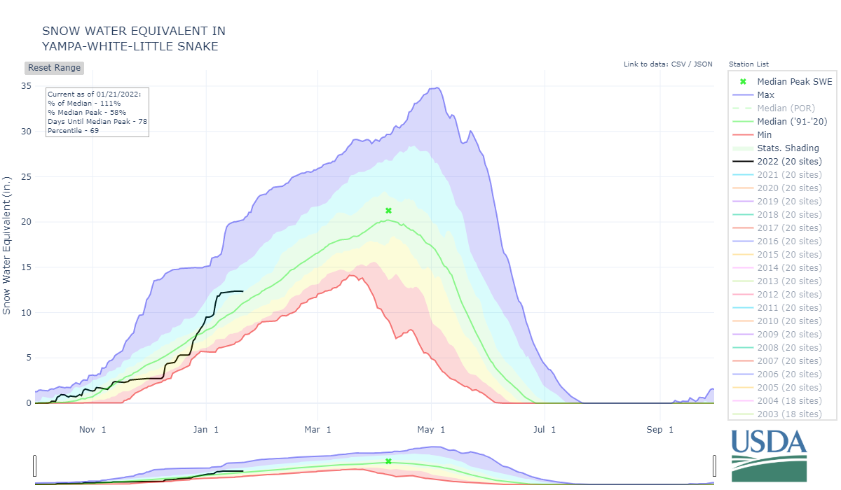
Looking Ahead: The storm cycle that kicked off the second week of December and lasted thru the first week of January really saved us from being in dismal snowpack conditions in the short-term (very short-term). The storms have dropped off these last couple weeks and it appears the rest of the month will be pretty dry. If it hasn’t happened already (Rio Grande, Arkansas), basins that were well above average will start falling below average roughly in a week or so if we don’t see more precipitation.