CODOS Update February 9, 2022: Snowpack in Stasis, Wx Shift Coming?
Greetings from Silverton,
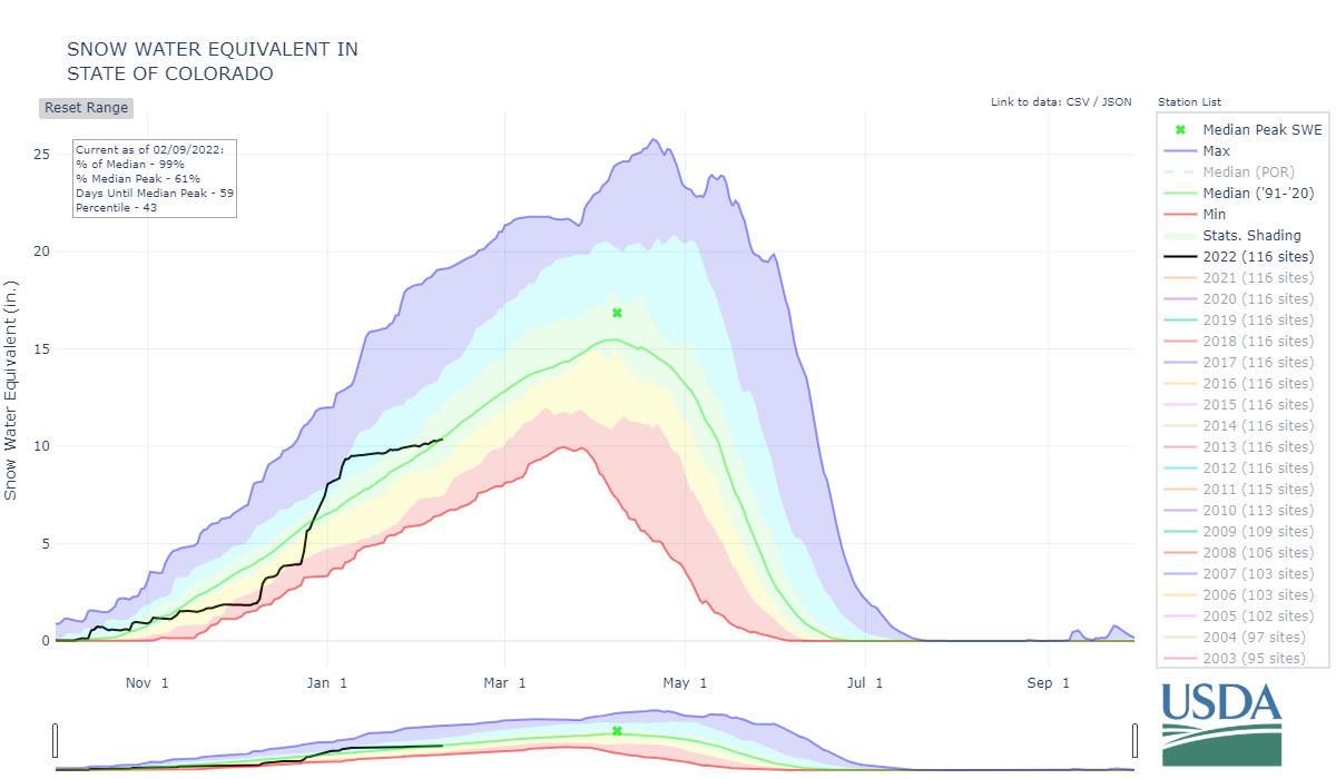
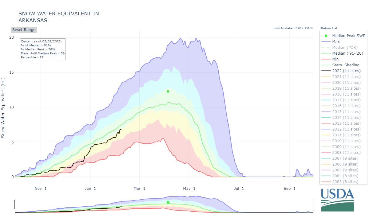
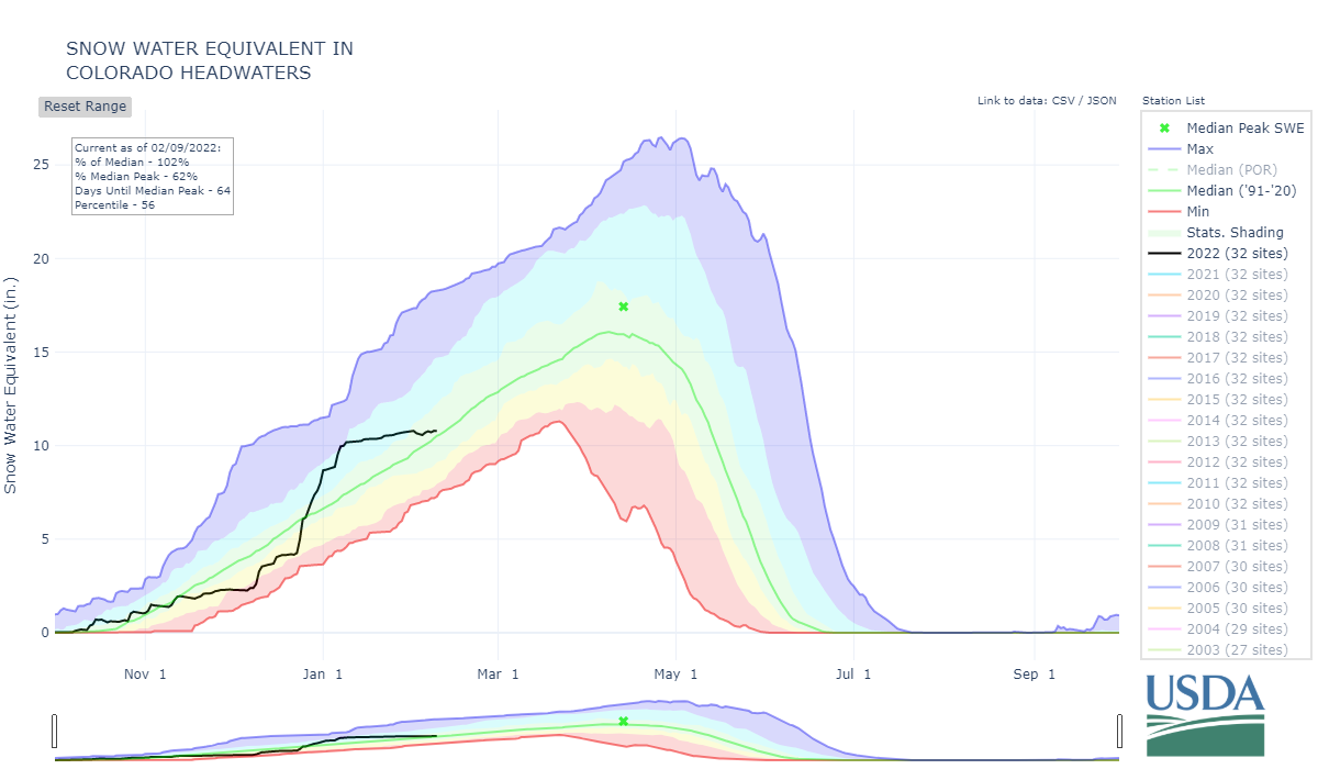
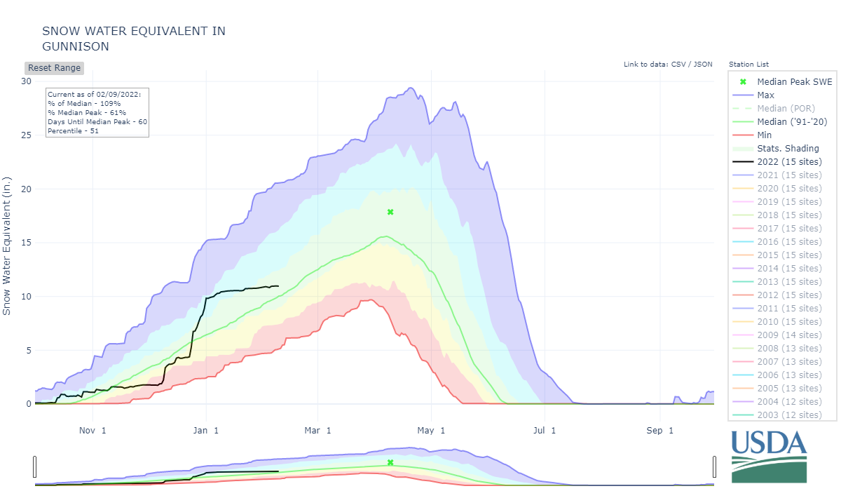
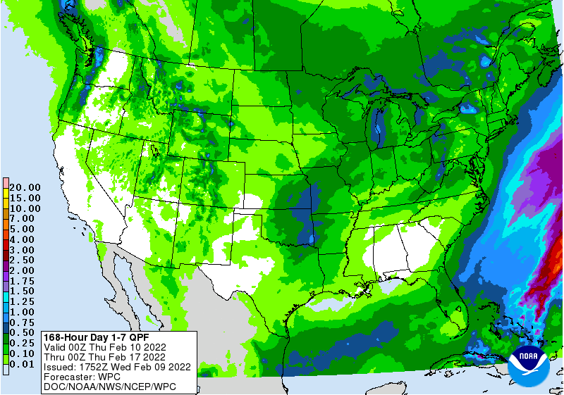
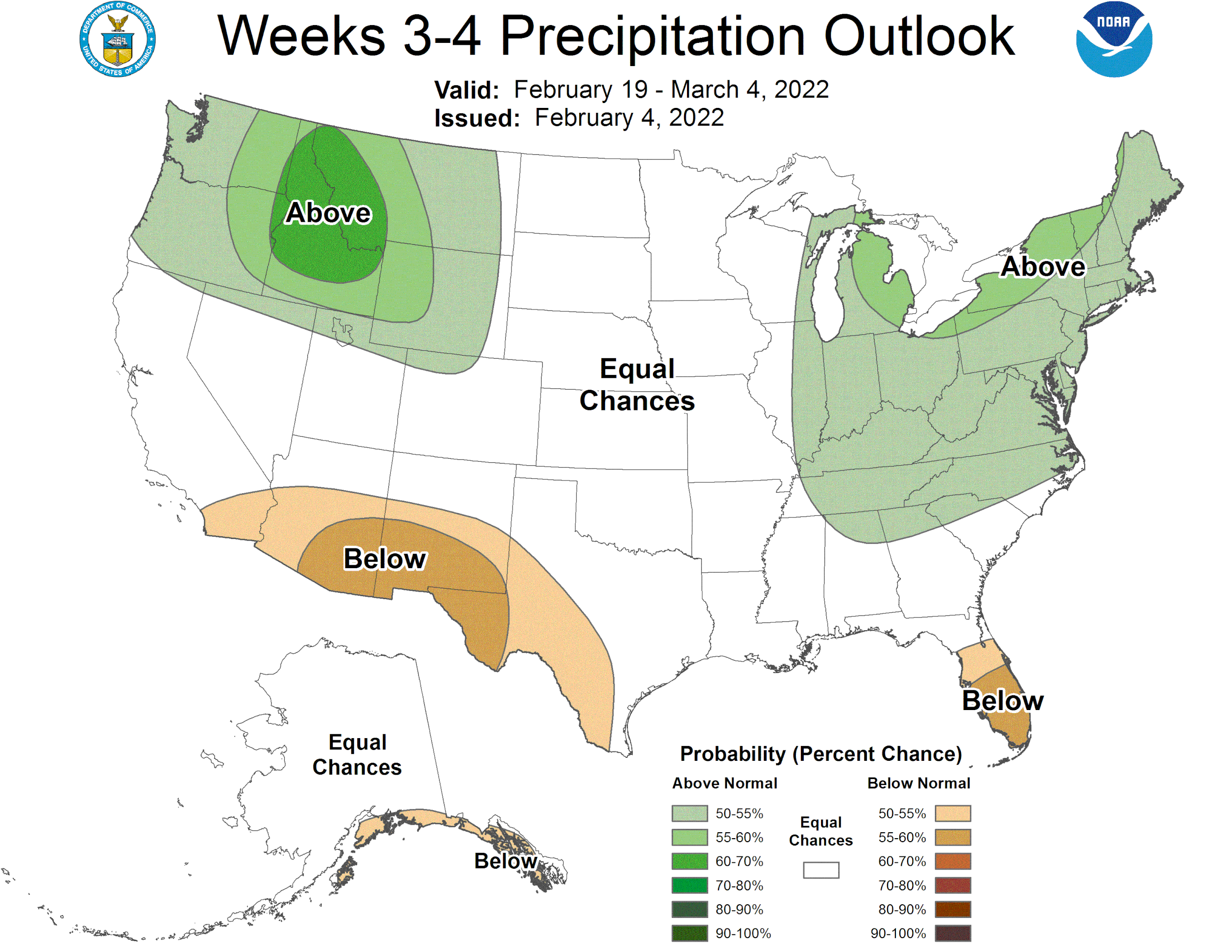
This past month if you have been out of state, holed up in a remote cabin, lost your cell phone, in a coma, incarcerated, or whatever, you haven’t missed much when it comes to the mountain weather. Since the very productive storm cycle that ended the first week of January it has been dry with just bits of precipitation (~1” precip last 4 weeks) . The big gains in snowpack accumulation was wonderful but after a dry 4 weeks we are starting to fall behind and we have a dry 7-day forecast in the offing. Fortunately, Eastern Colorado showed some improvements to drought conditions as a result of the snow last week. Hopefully change is coming, the NWS reports the persistent ridge we have been under is finally showing signs of weakening. A trough progression should arrive in our area sometime middle of next week, increasing our chances of widespread precipitation. But over Southern parts of the state a warm up will ensue over the next few days. It has, with the existing snowcover and clear skies, been pleasantly cold at night and mornings in the mountain valleys. But we are making the turn with the sun arriving earlier in the morning, staying later in the evening, and making the afternoons t-shirt weather. The absence of storms (we haven’t issued a storm report since Jan 1) has meant a lack of dust event opportunities. As reported in previous updates, there is a dust layer in parts of Southwest Colorado but we have not observed dust elsewhere in our mountain travels. We still have kept plenty busy with setting up new instrumentation and maintenance at Swamp Angel, digging snow profiles, holding dust-on-snow workshops and snow field classes.