

CODOS Update February 11, 2021: CSAS Survey, Snowpack So Far, SaharaN Dust in Europe
Greetings from Silverton,
Survey: To help us improve our organization we would greatly appreciate if you took a few minutes to complete a short survey. We wish to understand what resources you use and what you value about Center for Snow. Your responses will help shape where we focus our energy and resources and what we provide to the research and water management community. Being a small organization it will help us concentrate on priorities. All responses are anonymous.
Please Begin Survey Here
Current Dust and Snow Conditions:
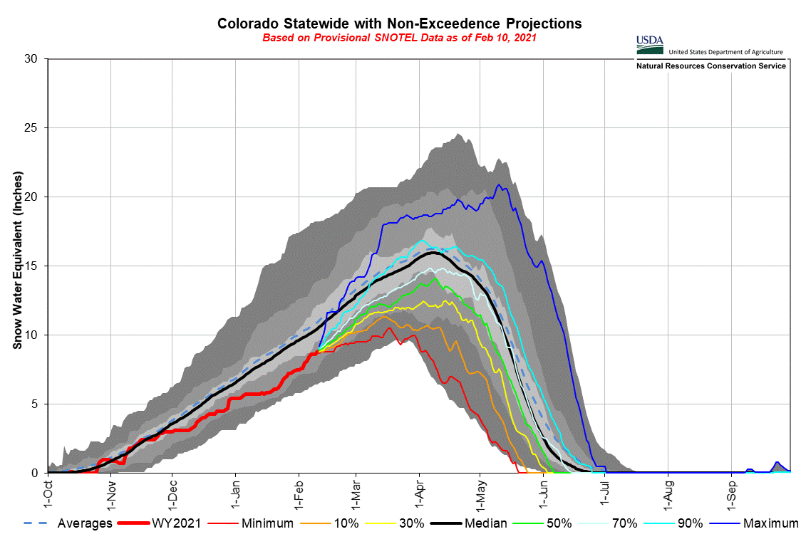
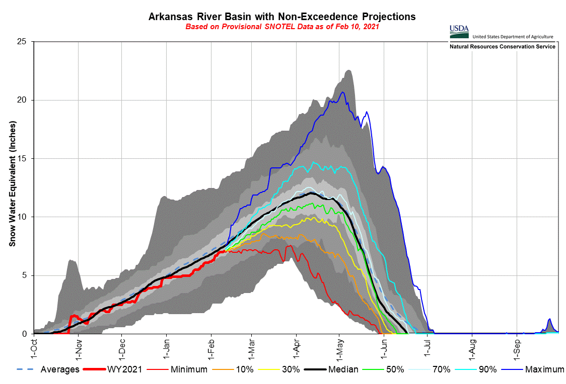
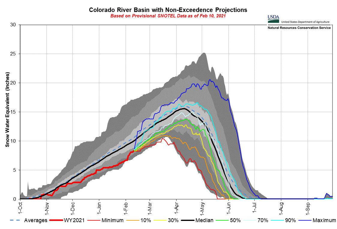
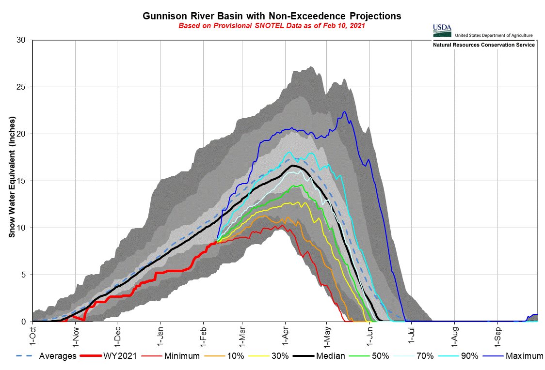
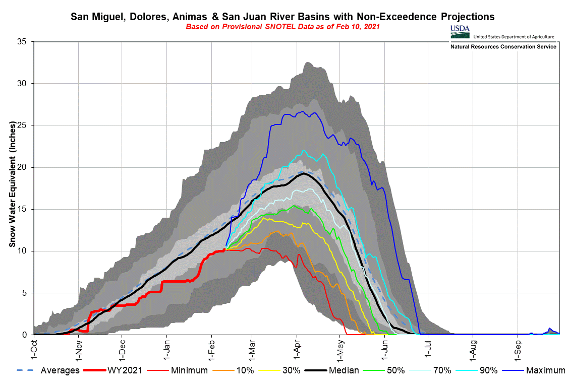
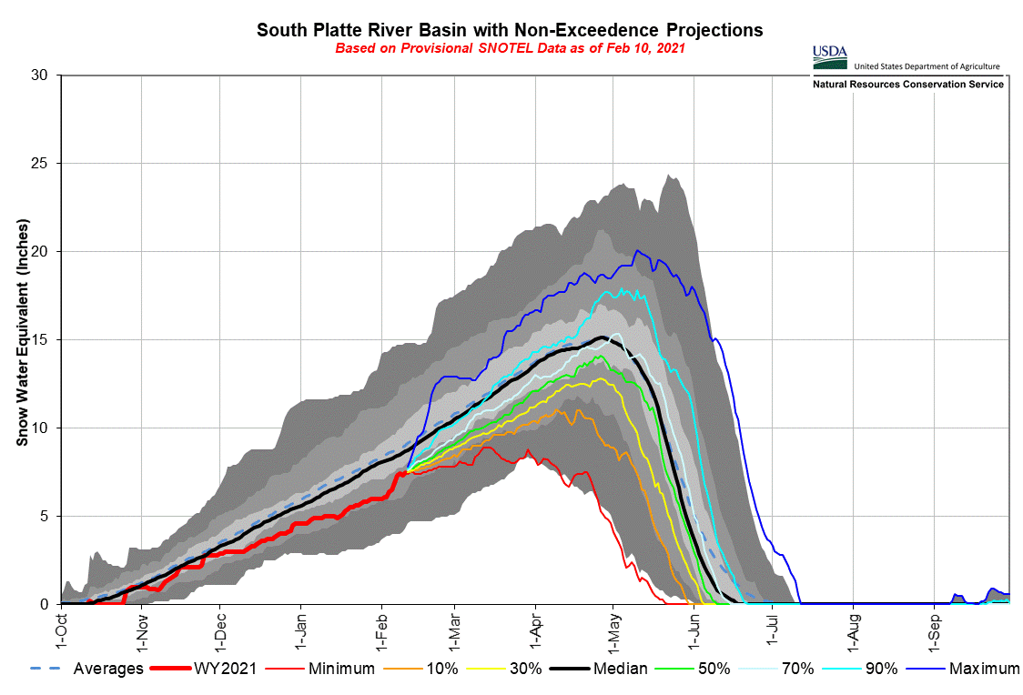
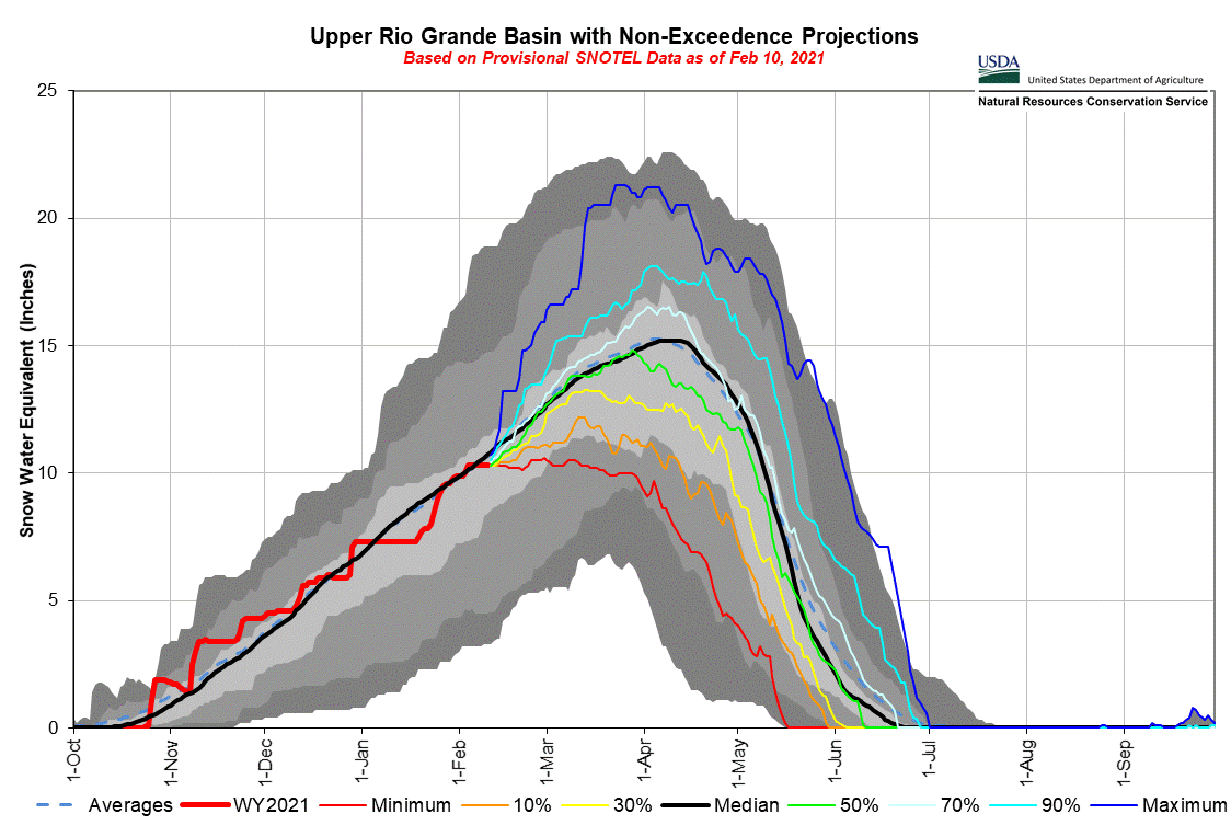
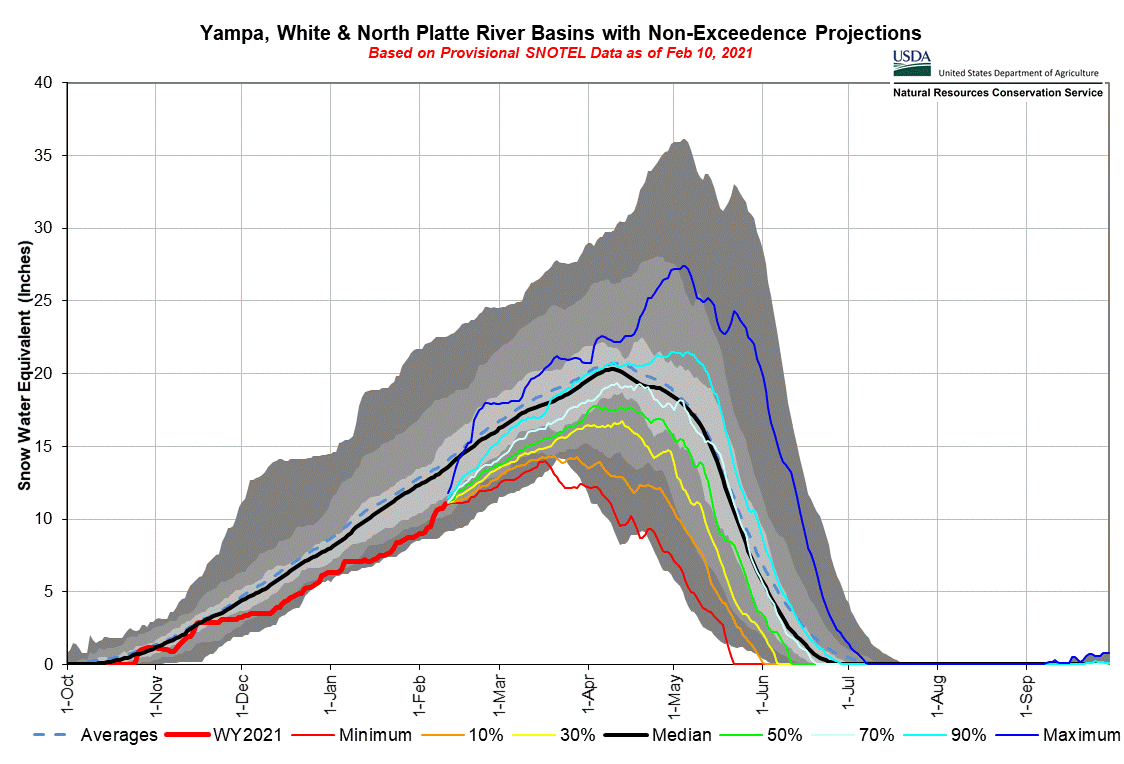
Over the past few weeks snow in Central and Northern Colorado have allowed these basins to slightly improve their status in terms of percent of median snowpack while Southern basins have held steady. But the snowpack is struggling and as you likely have heard many times already this winter the soil moisture deficit makes conditions worse than they appear if you were looking solely at snowpack conditions. The inflow forecast (to give an idea what it means for UCRB streams) for Powell sits around 46% of average.
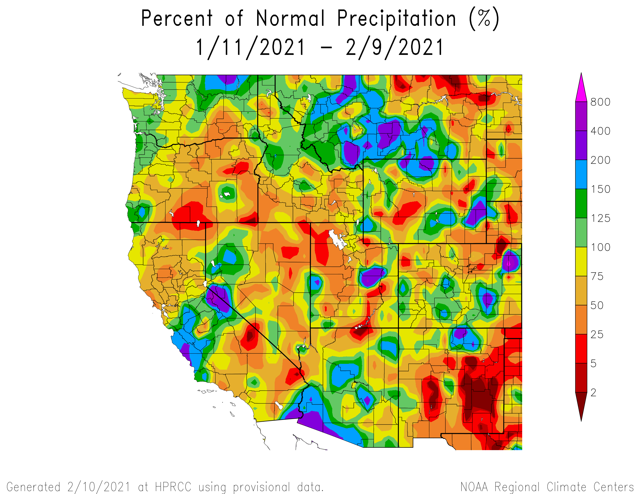
Fortunately we are in the middle of a very active weather pattern, to say the least. Things look to pick up again Thursday night (in the San Juan region) and a series of systems will hopefully dump snow thru the weekend and beyond. These systems have some atmospheric river components associated with it but by the time they reach Colorado will be weakened considerably. These initial systems look to favor central and northern Colorado. The system arriving Saturday evening will give southern Colorado better chances of precip. And cold, on the Front Range especially. The precip map below gives an idea of what to expect.
We have not talked too much about dust so far this winter. We are sitting pretty good on that front. With the active weather patterns recently none have produced noticeable dust in the San Juans. The predicted storms over the next few days do not appear to be accompanied with strong winds out of the Four Corners area, but we will take observations after the snow settles next week sometime.
Big Dust Event in Europe: Last weekend a Saharan dust storm reached the Mediterranean and central Europe resulting in a particularly nasty dust-on-snow event in the Alps. A persistent High over the Arctic and northern Europe with an atmospheric river to the south dragged storm systems from the Atlantic into southern and central Europe. One of these systems turned the jet stream from the south, from the Saharan desert. The pictures make it seem someone dropped a bag of fine sand across the snow surface. This link describes what happened. A lot of good pictures in this link. More good pictures in this link to the Guardian. How this will effect snowpack properties the rest of the season and how fast the snow melts in the Alps will be interesting. I will keep you updated as spring progresses.
The Institute for Snow and Avalanche Research in Switzerland (of which our organization was modeled) mentioned that operational models do not yet account for these events in Europe. That is also the case here in Western U.S., but there are processes in place to try and take it into account, such as the Colorado Basin Rive Forecast Center incorporating a radiation snowmelt force factor called MODDRFS (MODIS Dust Radiative Forcing in Snow). This is used to tweak input temperatures in their SNOW-17 model. My understanding is this product is only used in the San Juan river basin in areas above tree line. Fortunately, of course, there is the Colorado Dust-on-Snow Program. With our station data and ground-based snowpack observations across the state, we inform the water community of the state-of-the-snowpack and what we are seeing in your watershed, and what to expect in terms of snowmelt. There is no substitute for ground observations which happen no matter how cloudy or stormy it is . Snow profiles give predicative ability as to when dust will emerge at the surface and eyes on the snow give a reliable estimate of severity and spatial distribution.
Take Care,
Jeff Derry


Take Care,
Jeff Derry