

CODOS Update January 29, 2021: State of the Snowpack, Minimal Dust
Greetings from Silverton,
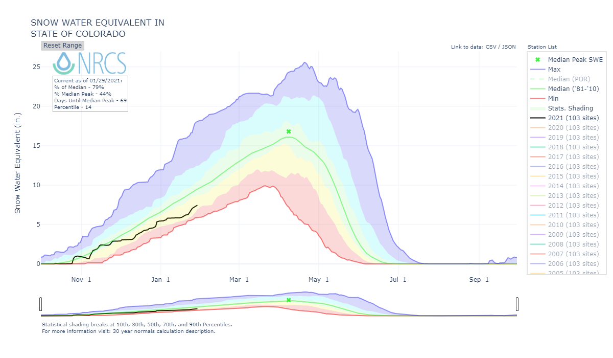
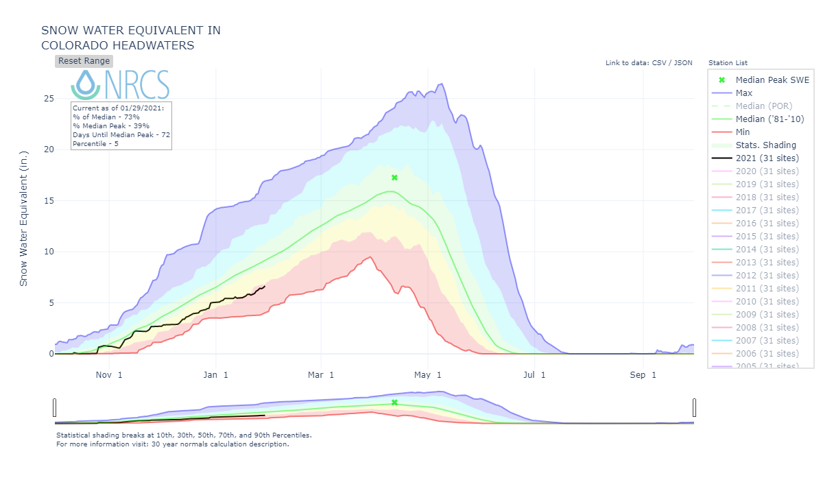
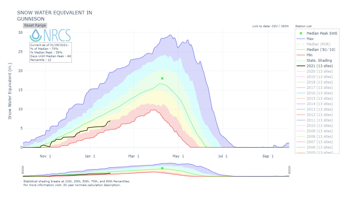
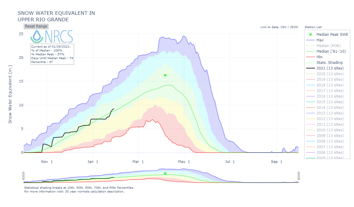
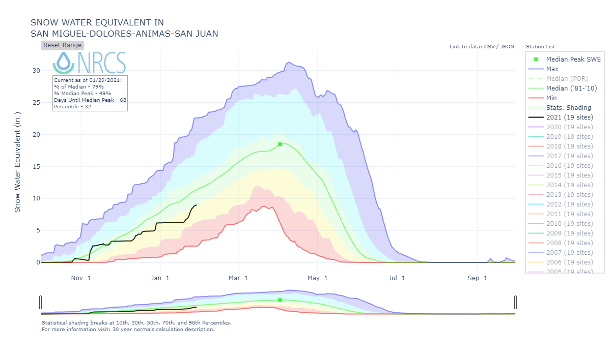
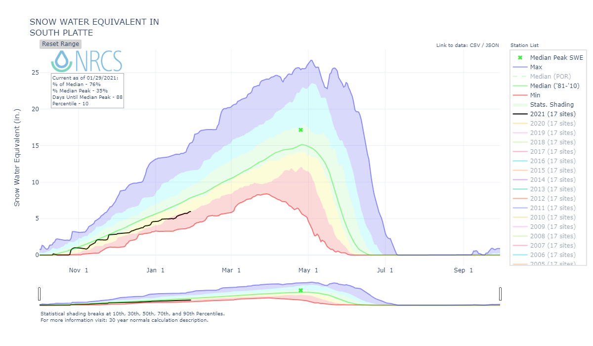
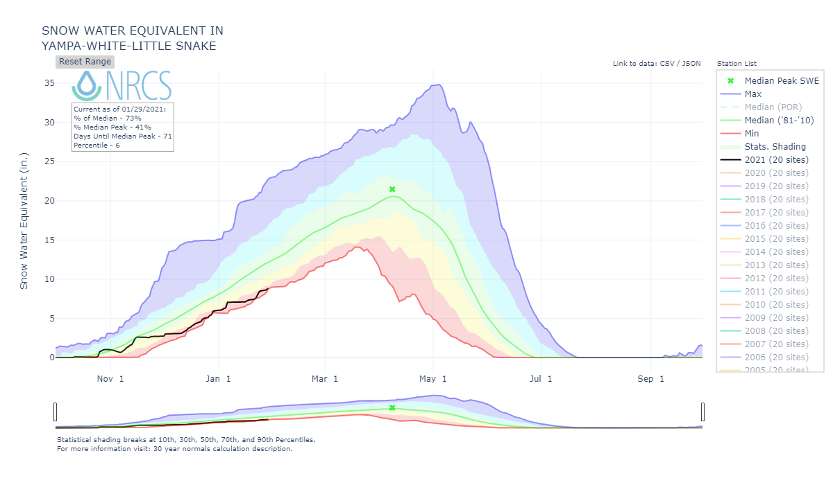
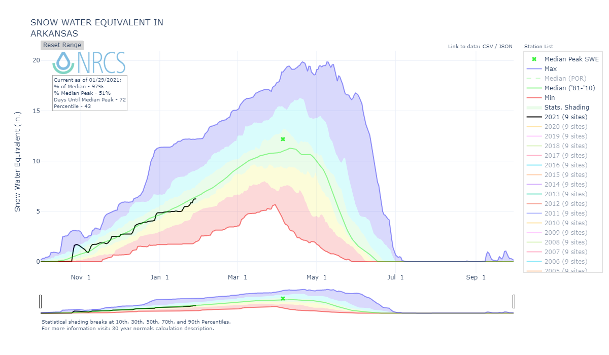
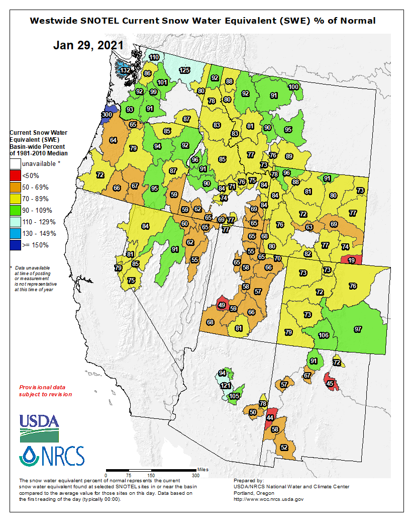
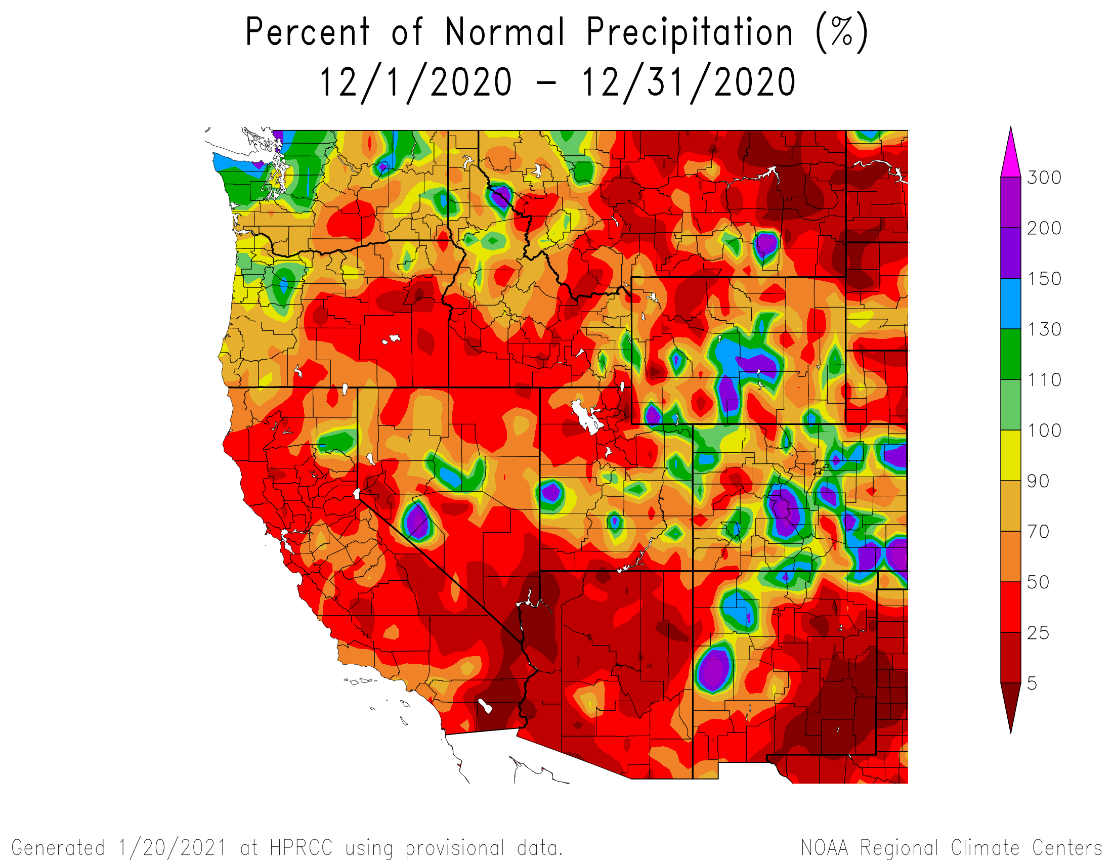
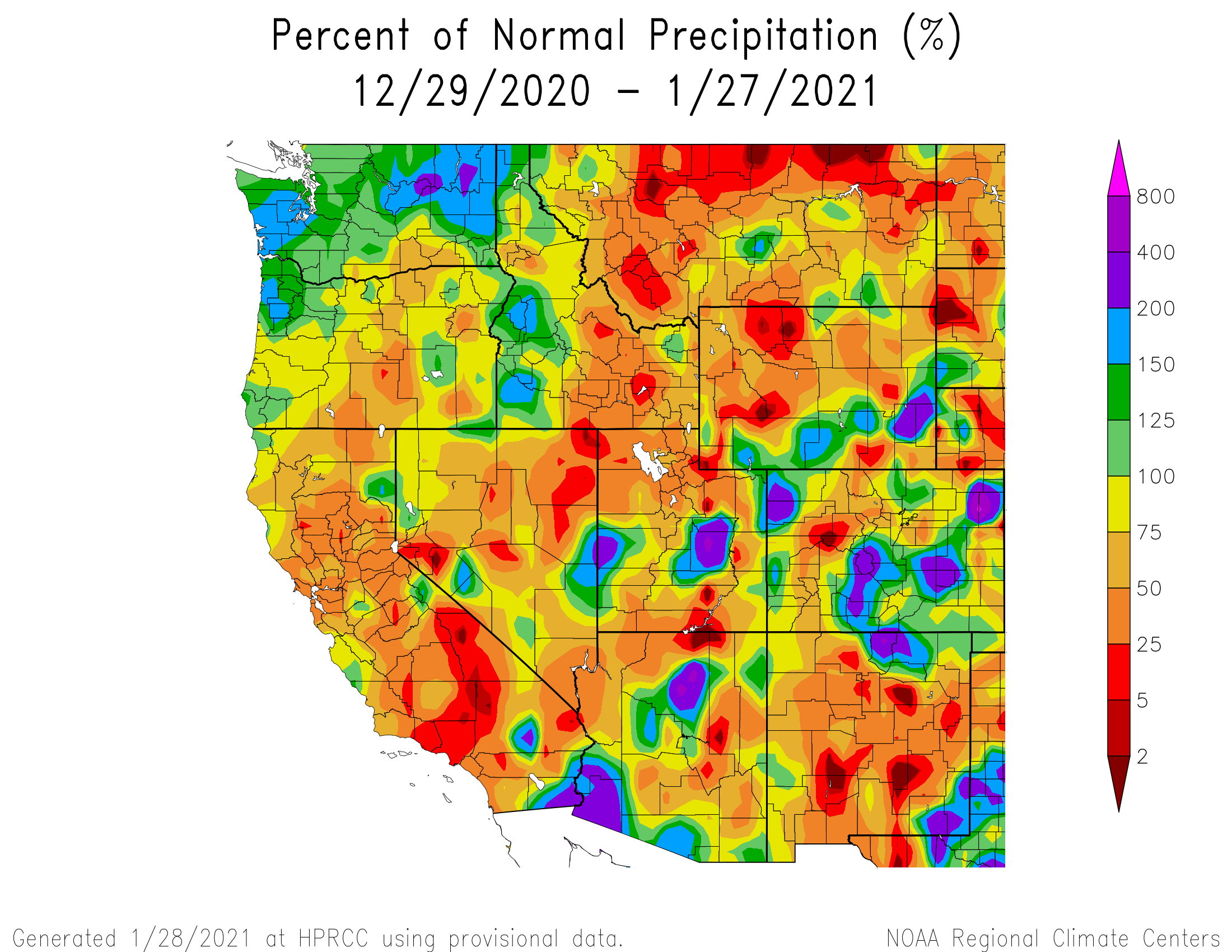
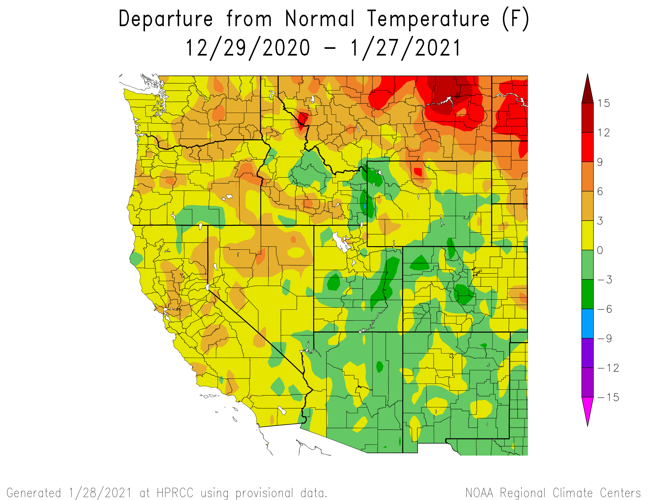
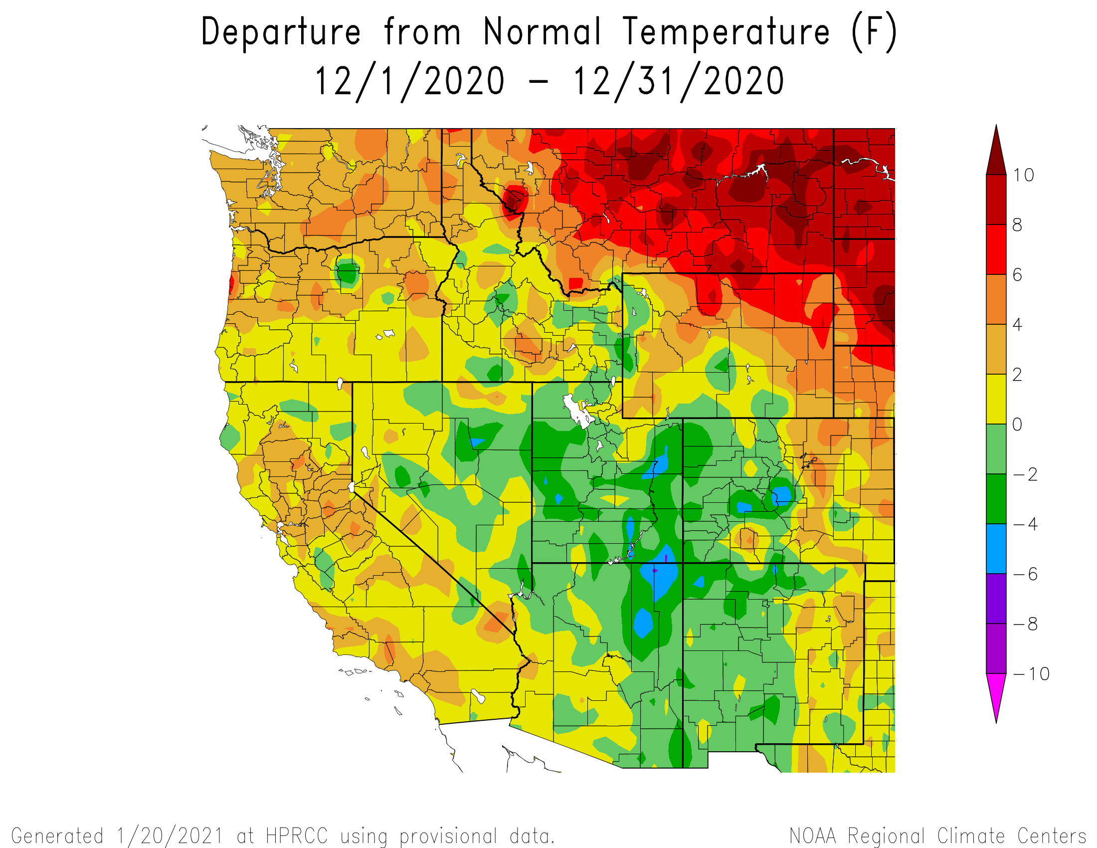
January is almost behind us and overall the Colorado snowpack continues to struggle. Last week the persistent ridge gave way to some active weather with the San Juan Mountains benefitting the most from a string of systems entered Colorado out of the Southwest. Over five days Senator Beck Study Basin received 2” of precipitation as 17” of snow accumulation. The result was a welcome uptick of SNOTEL SWE observations in the Upper Rio Grande and San Miguel/Dolores/Animas/San Juan Basins but moving towards central and northern basins accumulation amounts were a fraction of that observed in the south. As of now the Yampa, Colorado, North Platte, and Gunnison Basins are around 73% of median snowpack, the South Platte is 76%, Southwest Basins are slightly better at 79%, the Arkansas is holding onto 97% and the winner so far this season is the Upper Rio Grande at 106%. Considering the lack of snow and the dry soils standing in line to get replenished, the Bureau of Reclamation estimates inflow to Lake Powell to be around 53% right now, but it could get as bad as 33%.
The next opportunity for precipitation will arrive Friday night into Saturday. This atmospheric river has brought record precipitation to California but our inland mountains are expected to see only 4-8”. Again this system is looking to benefit the San Juans the most but all of the Colorado mountains look to receive some portion of the storm. So far this morning it is overcast and we have received a trace of snow. As the storm moves through and starts to wrap around from the northwest, the NWS forecasts a possible gorge event for the Northwest San Juans, a setup that can really benefit the Red Mountain Pass region.
No significant dust events have been observed to-date at SBB. The early season dust event we documented in November is mild and so near ground as to not factor into spring albedo and snowmelt rates. Fortunate because we have received a number of storms out of the southwest that had potential to produce dust. As a switch, Eastern Colorado saw significant dust action on January 15 that was caught on the GOES imagery. The current system that is moving across the Four Corners into Colorado is showing a spattering of mobilized dust in the GOES products. This storm will pass thru Saturday, so we plan to dig a snowpit and look for dust beginning of next week. Stay tuned.
SnowEx is well underway at Senator Beck and 6 other sites across Colorado, Montana, Utah, and Idaho. This is an exciting project that we have hosted since its inception in winter 2016/17. Even with a less than ideal snow season we are still getting a wide range of science done this year.


SNOW SCHOOL CANCELLED THIS YEAR, LOOKING AHEAD TO NEXT YEAR
It is worth reminding folks that if you think you might be interested in taking “Snow School for Water Professionals” next winter to contact me as to what dates might work best for you. Usually we hold the class around February in Silverton, where, using a mixture of classroom discussion and hands-on field sessions aim to enhance understanding of snowpack processes, snowpack monitoring, and snowpack data. If I know that you are interested we can likely adjust when the class is held to accommodate your availability.
Take Care,
Jeff Derry