CODOS Update April 22, 2024: statewide observations
Greetings from Silverton,
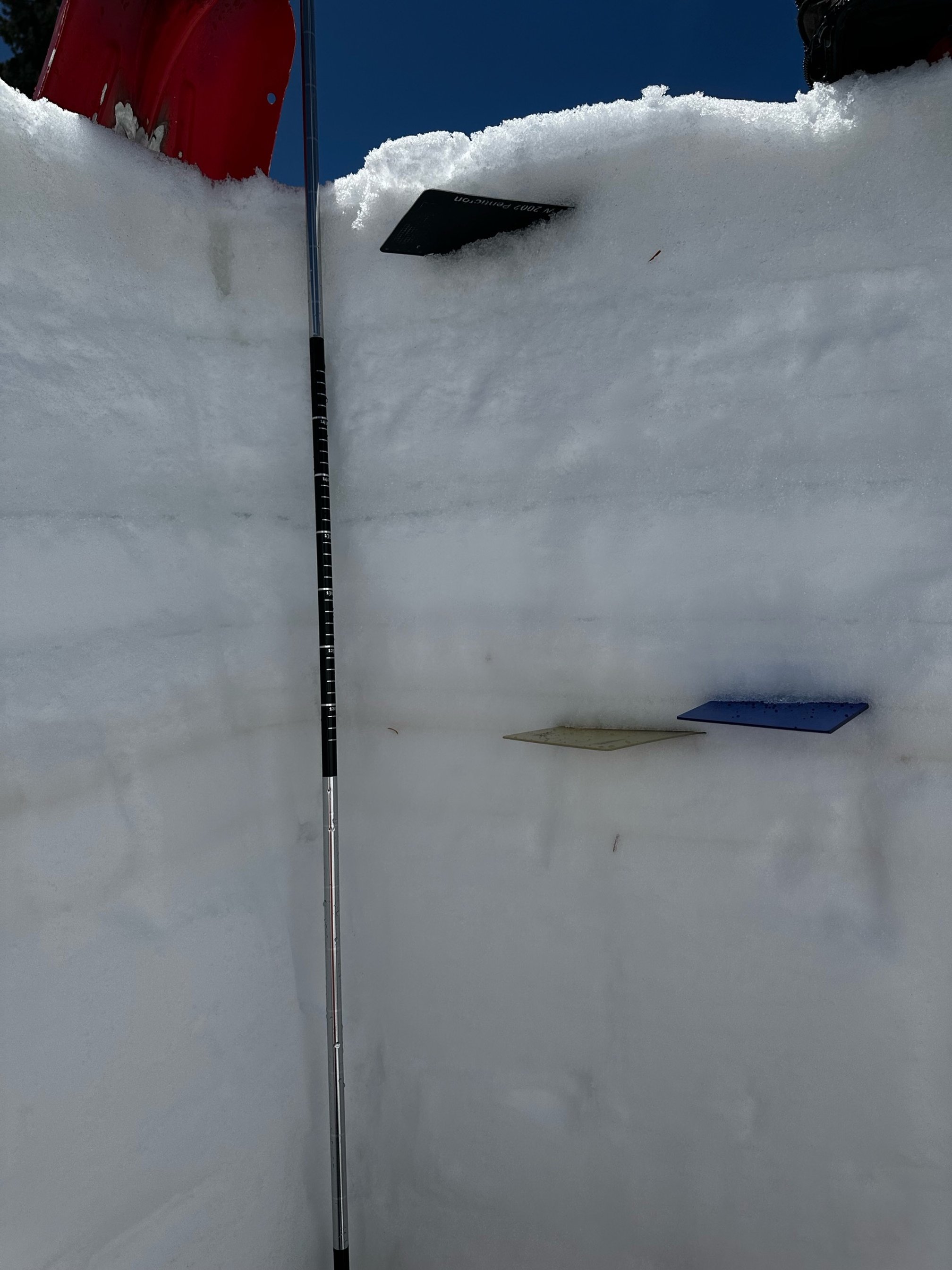
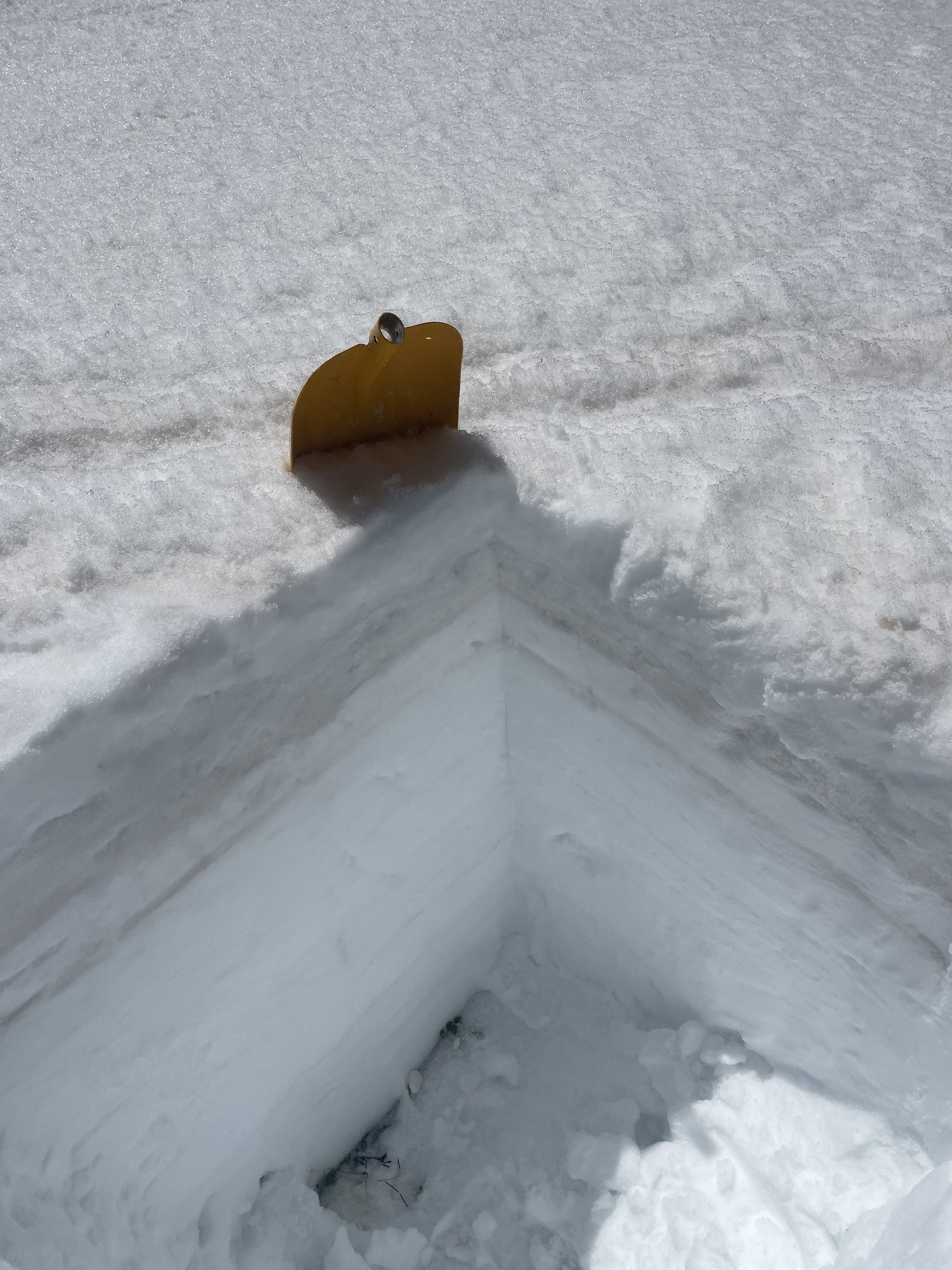
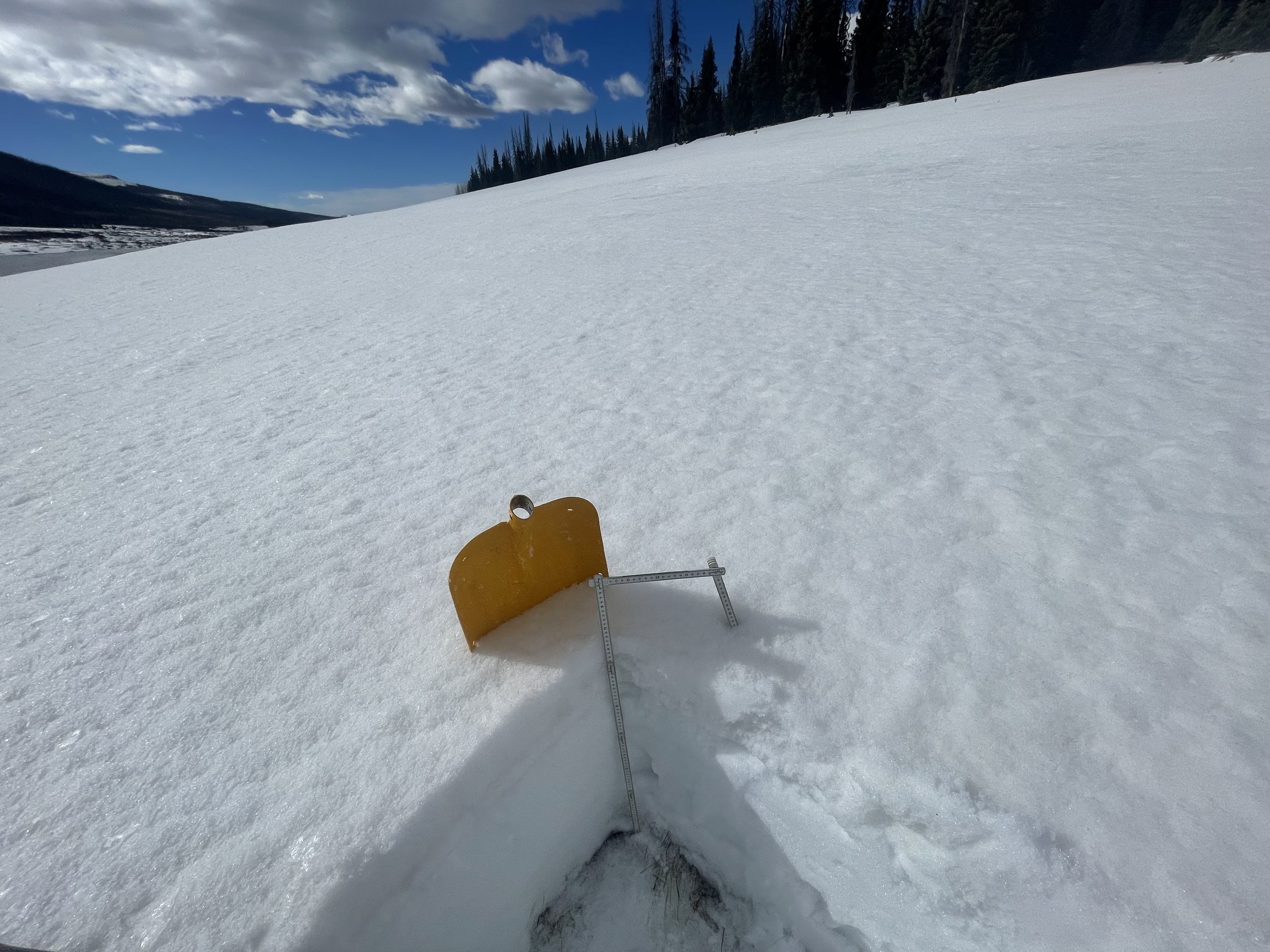
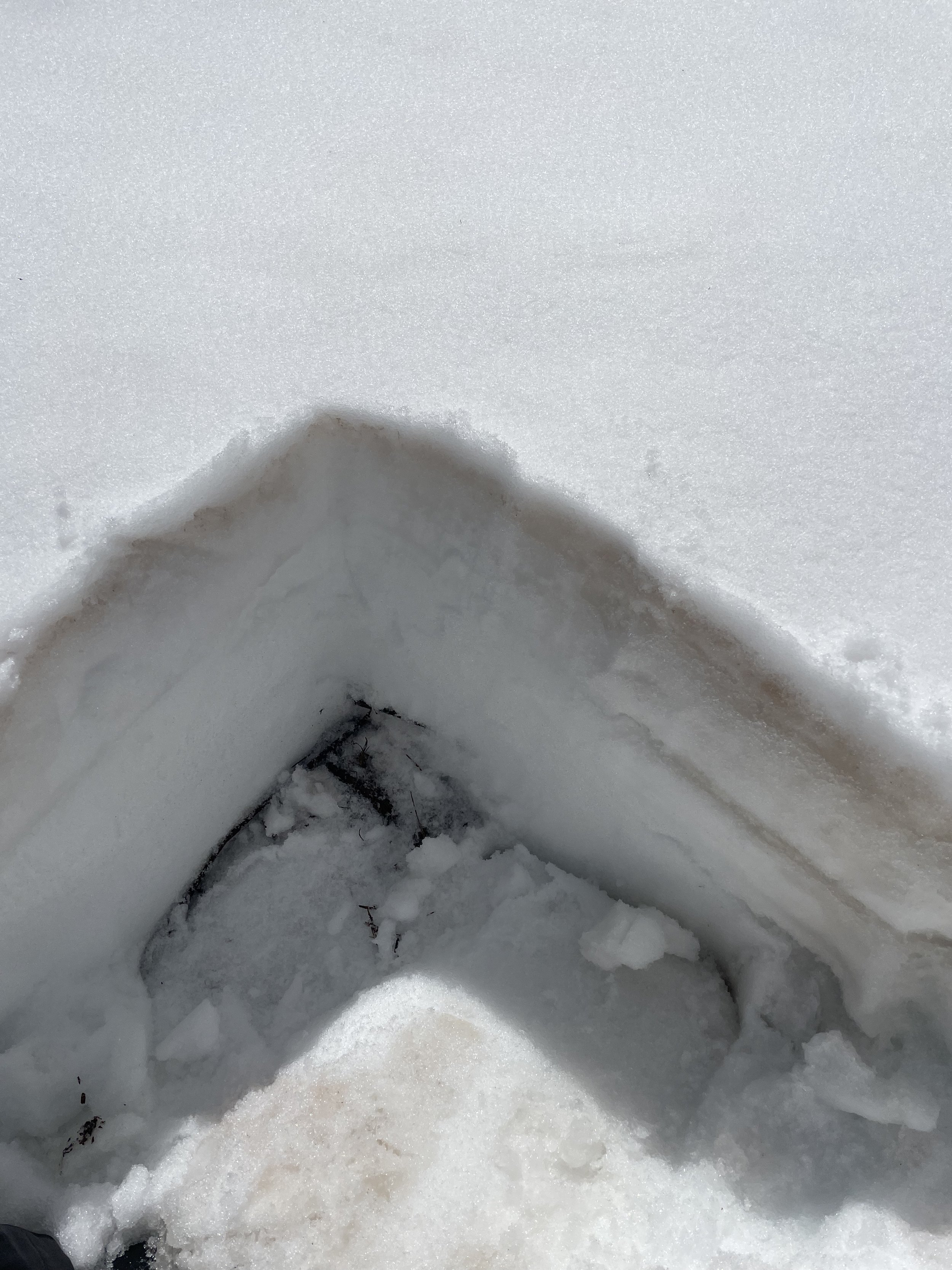
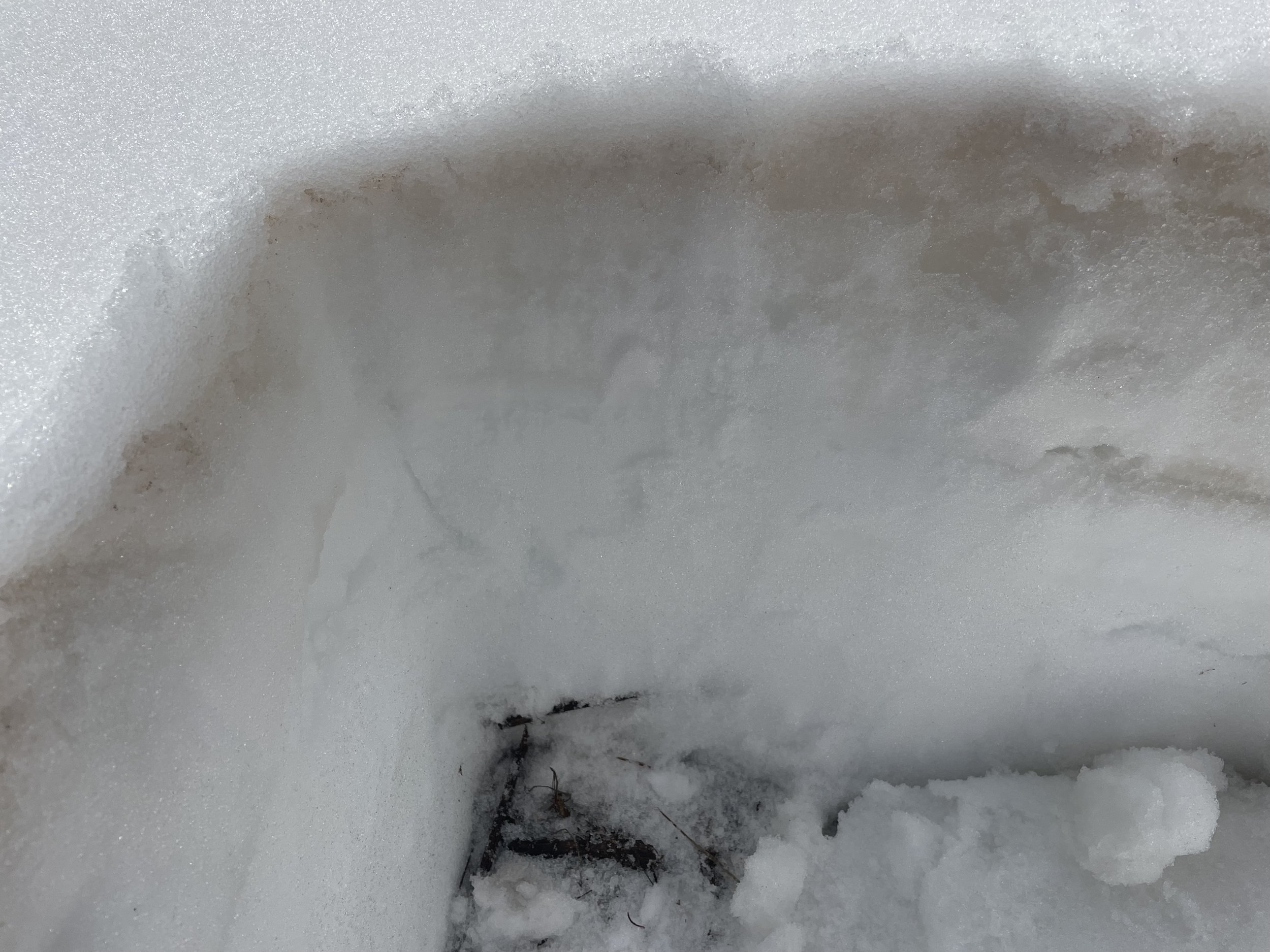
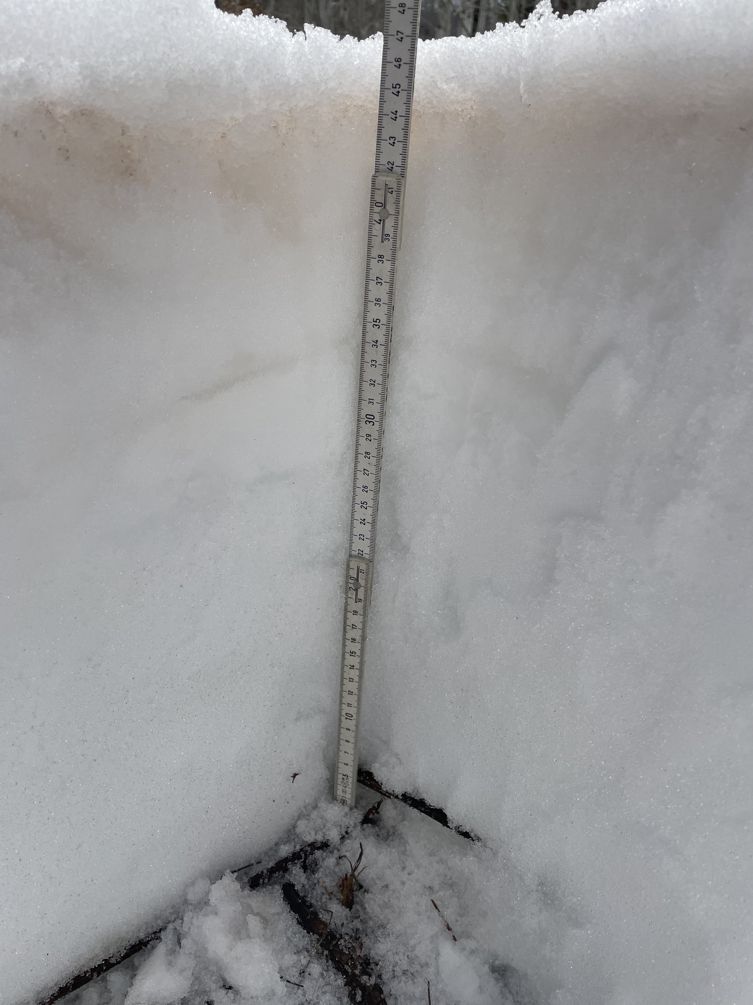
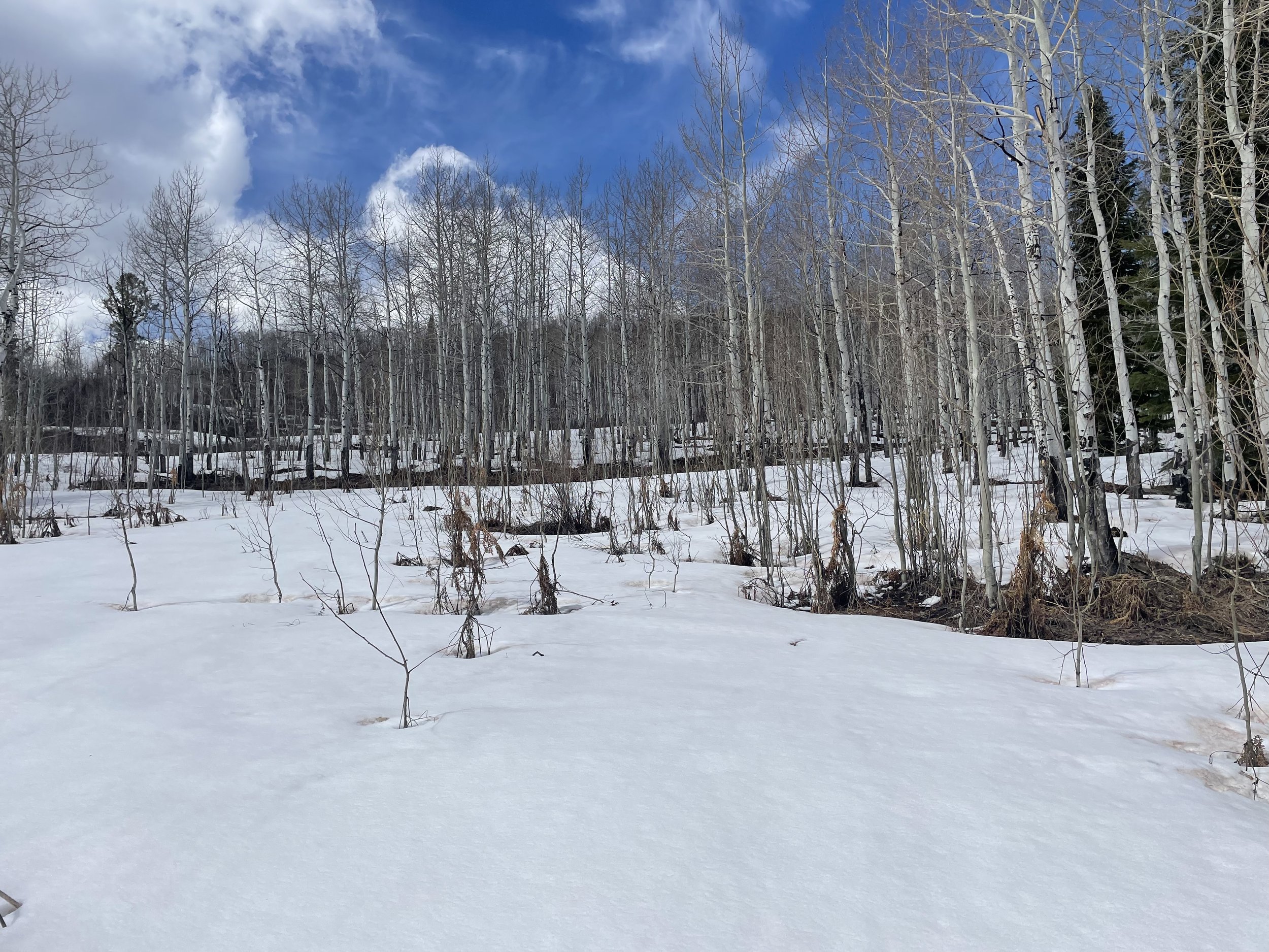
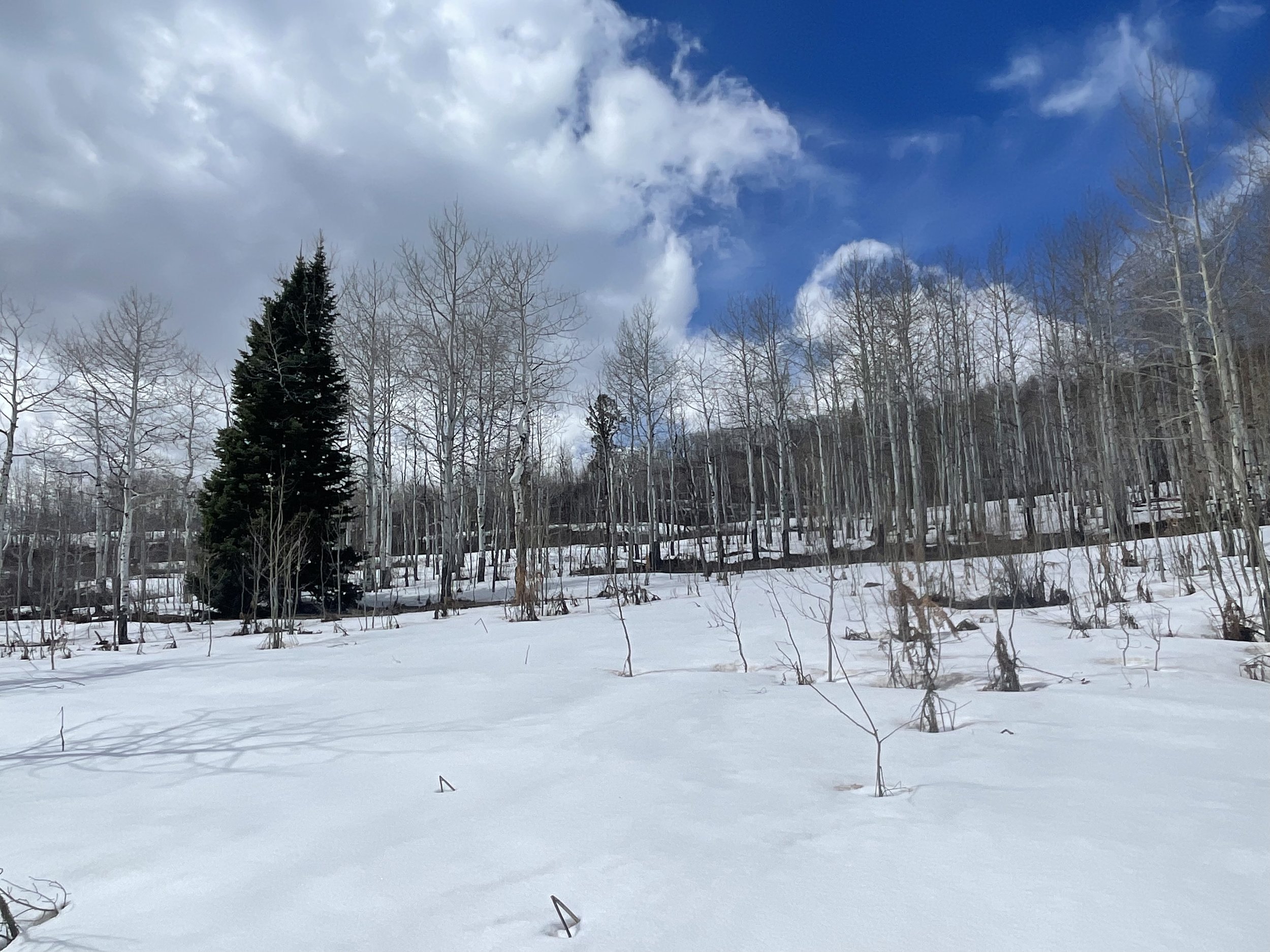
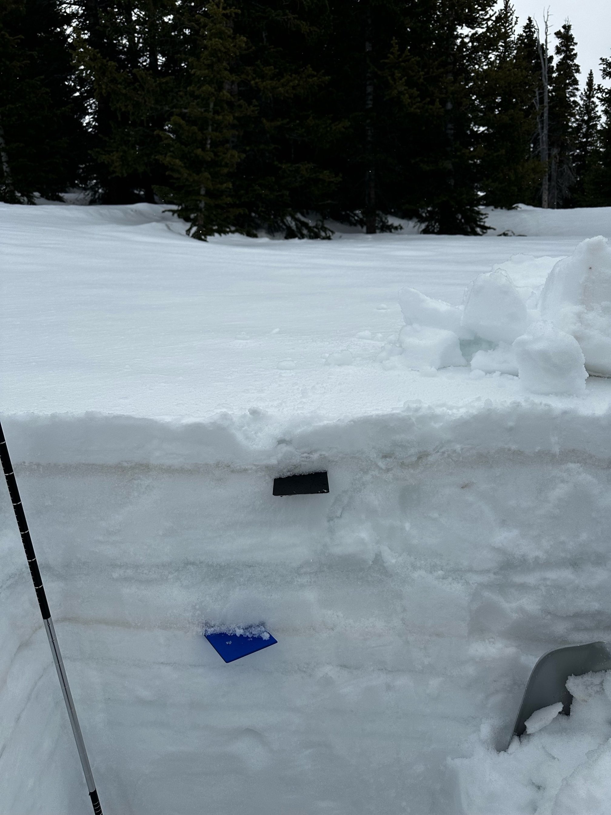
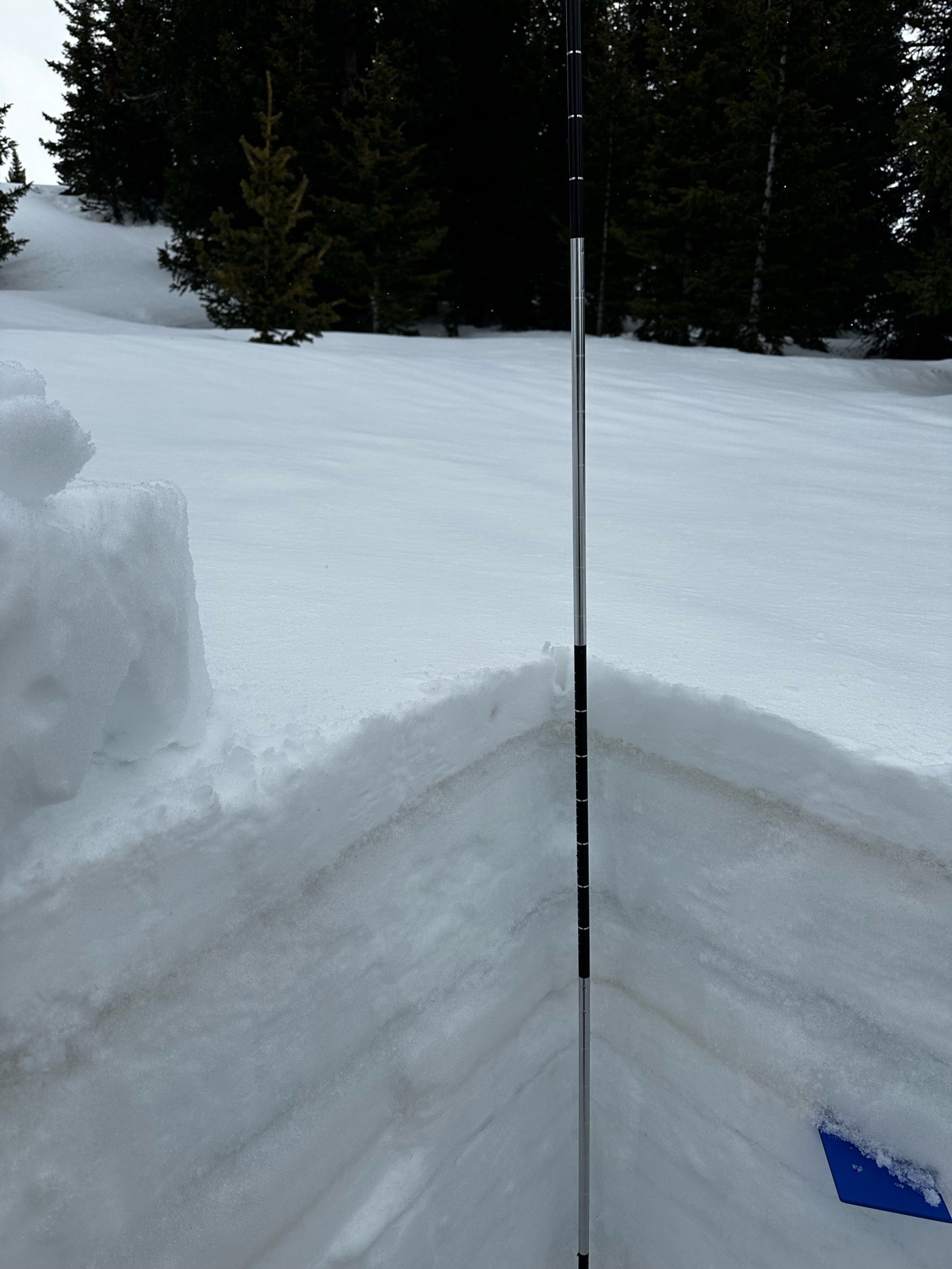
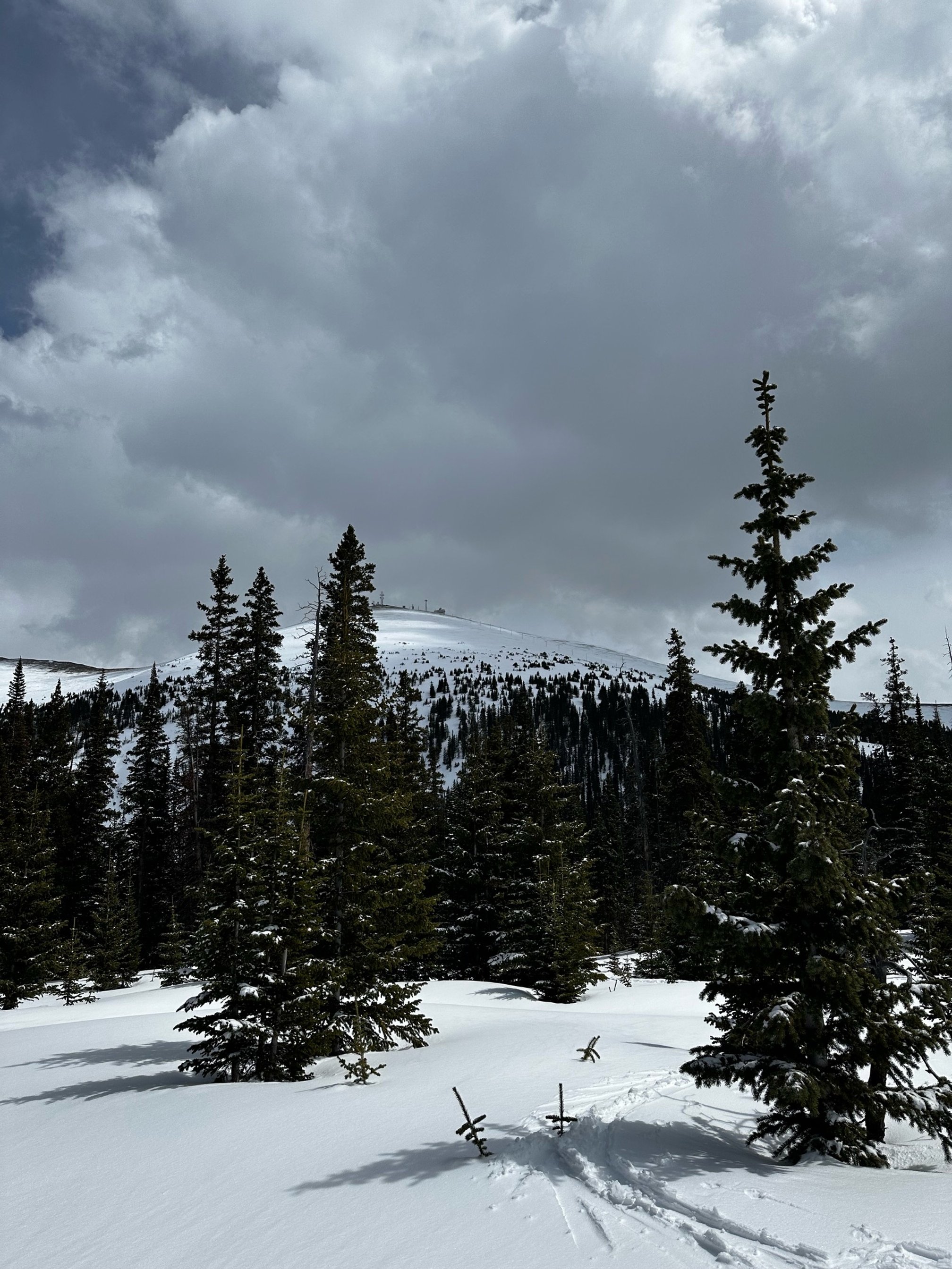
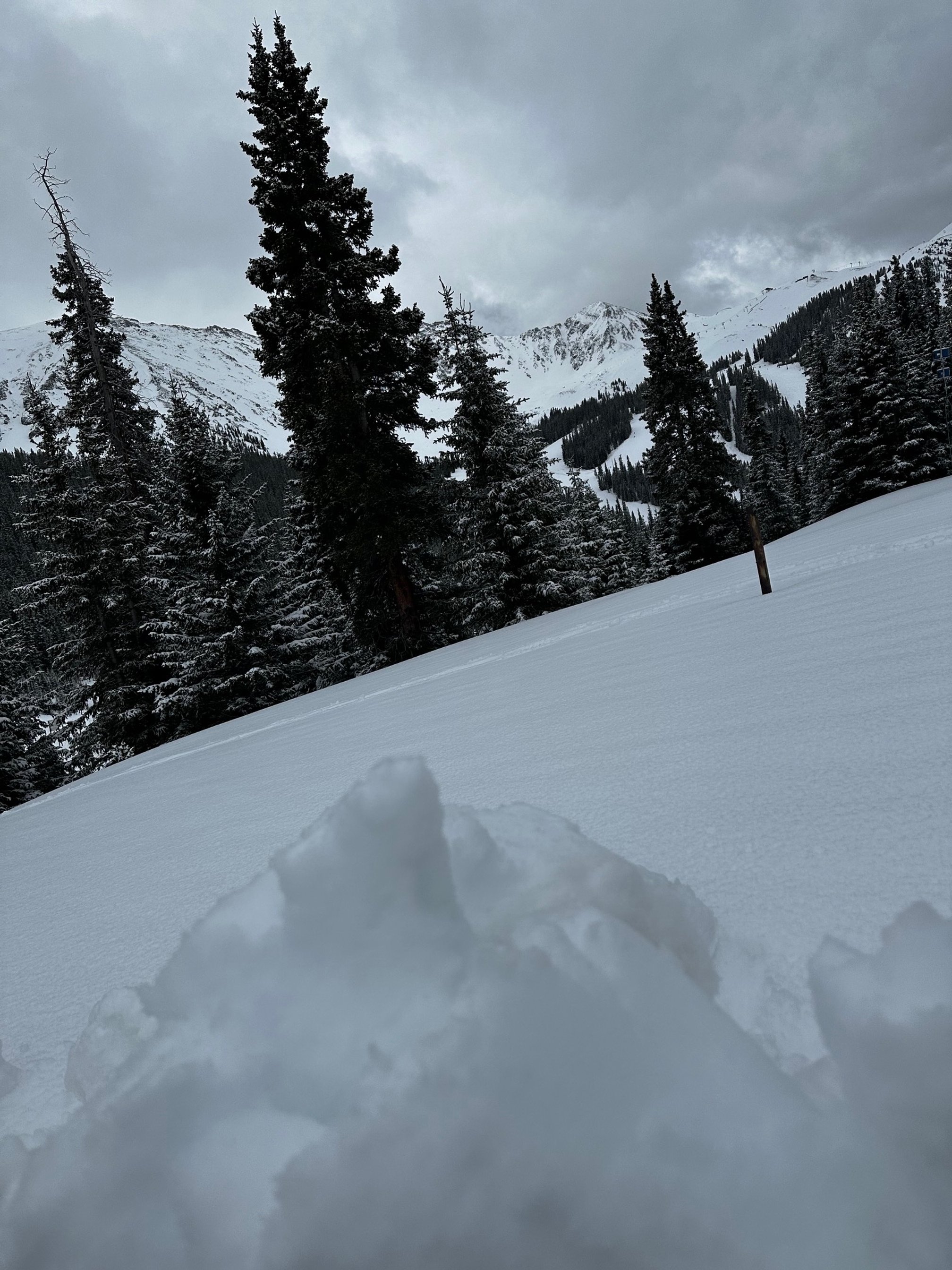
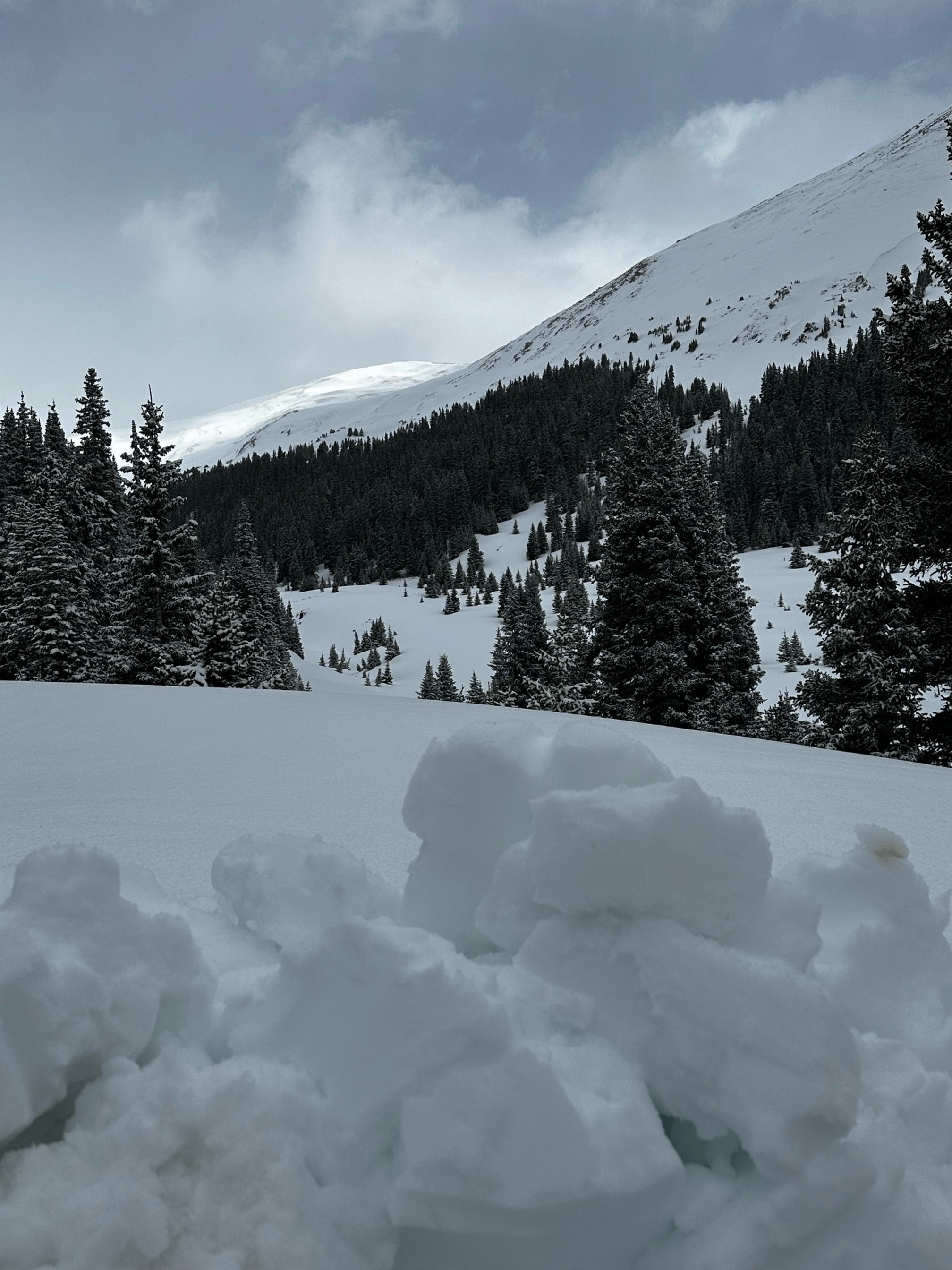
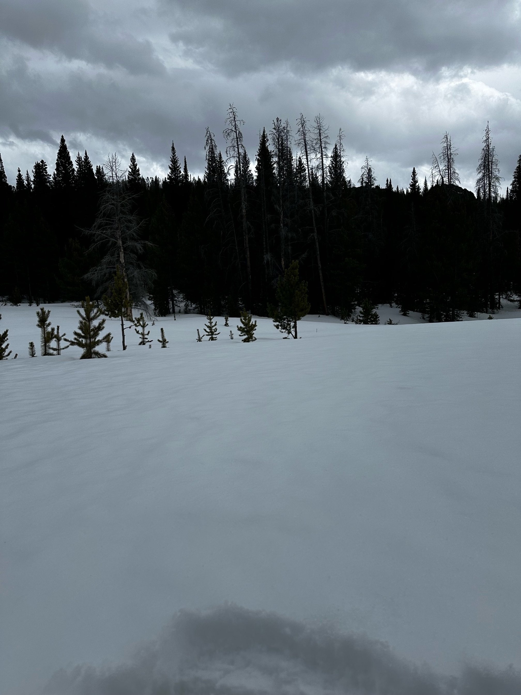
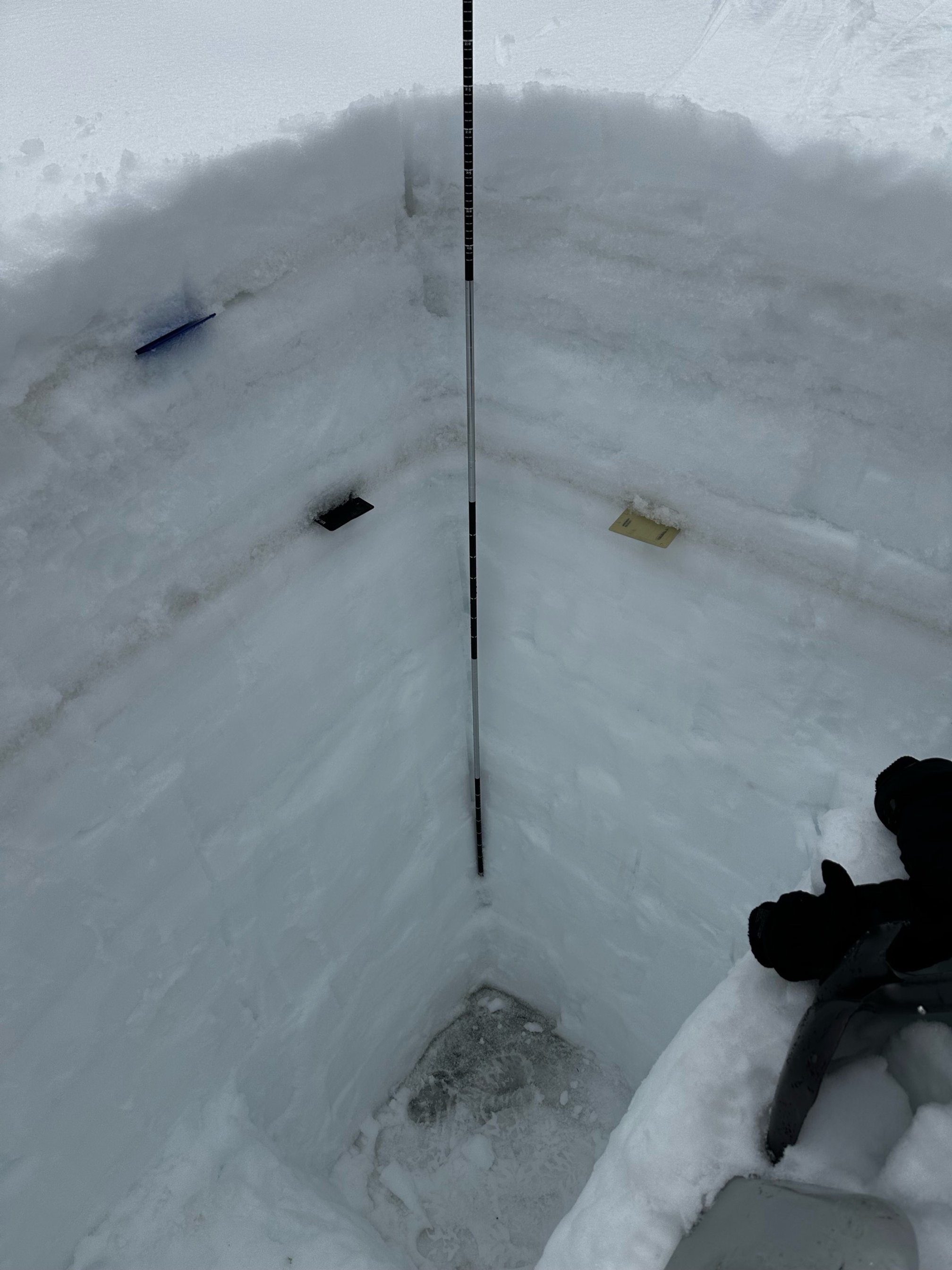
The location of dust layers in the snowpack are pretty consistent throughout the Colorado Mountains. We visited our 11 sample sites the end of last week ending on Saturday. Of these sites, where the snowpack is deep (> 4 feet) dust layers D1 and D2 that occurred close together around the first of March are essentially merged together and approximately 1’-2’ under the snow surface depending on the location. This dust layer is the most severe dust layer in the snowpack. The second dust layer comprises of D3 and D4 that occurred close together as well around April 1. This layer is under approximately 5” of recent new snow accumulation towards the Eastern and Northern sites, and at the surface towards the Southern. Where the snowpack is naturally shallow (McClure, Spring Creek, Park Cone, Willow Creek) all of these dust layers are essentially at the surface of the snowpack.
Dust severity is consistent along the Front Range sites (Hoosier, Loveland Pass, Berthoud Pass) including Willow Creek and Rabbit Ears Pass, where the uppermost layer is of moderate severity while the deeper layer is a good bit more severe. Towards the Central Mountains, McClure Pass and the Roaring Fork region is having another bad dust season where the severity is much worse than surrounding regions. In the San Juan Mountains, Wolf Creek Pass is the dustiest location observed of the Southern sites, there are even 1-2 more dust layers observed in this snow profile. Perhaps, besides the Roaring Fork region, overall dust severity is in the “average” category, but don’t believe, combined with the weather, it can’t have drastic affects on snowpack ablation.
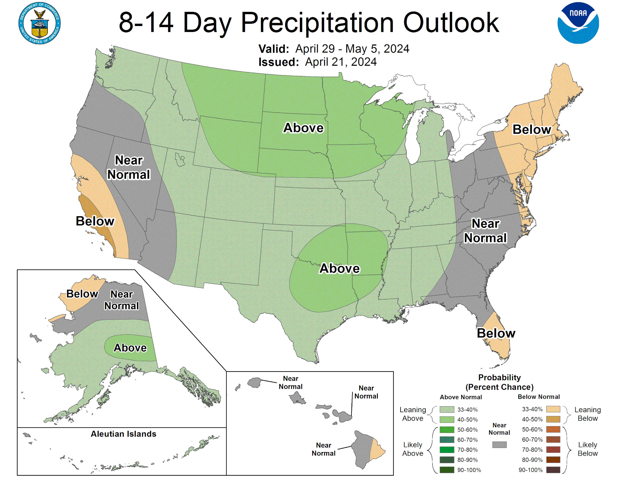
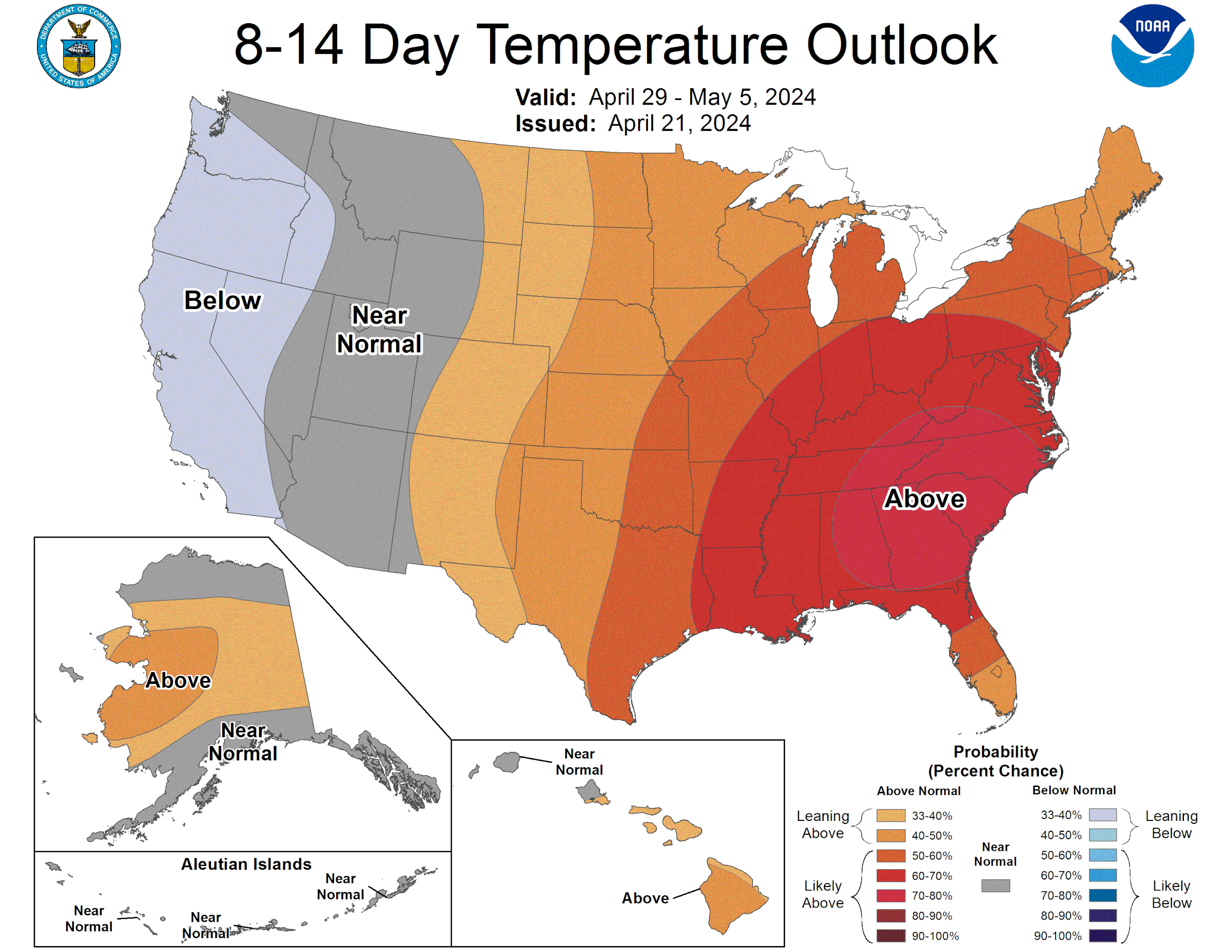
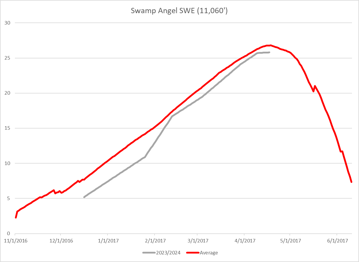
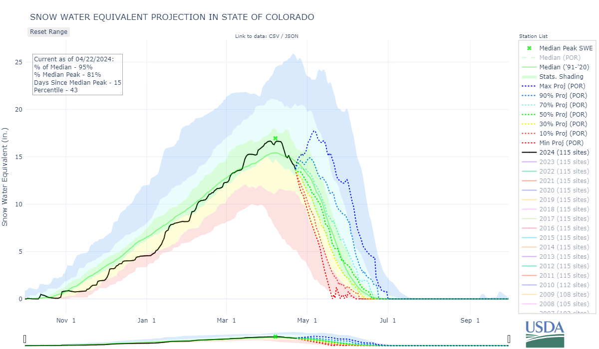
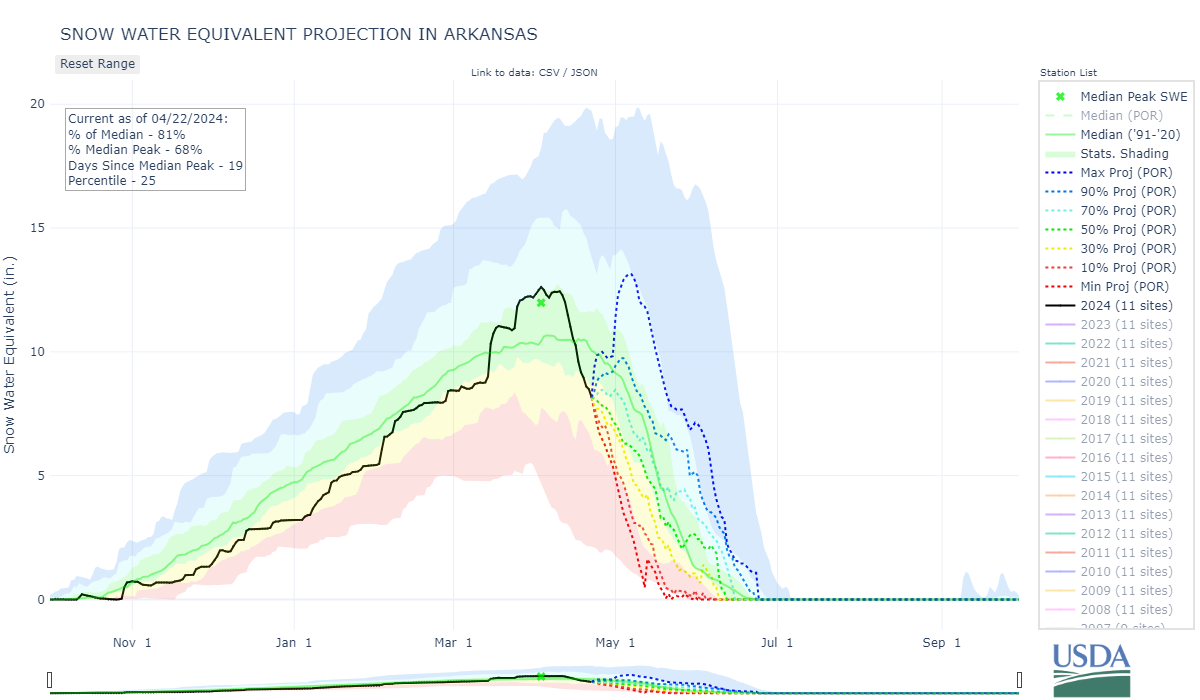
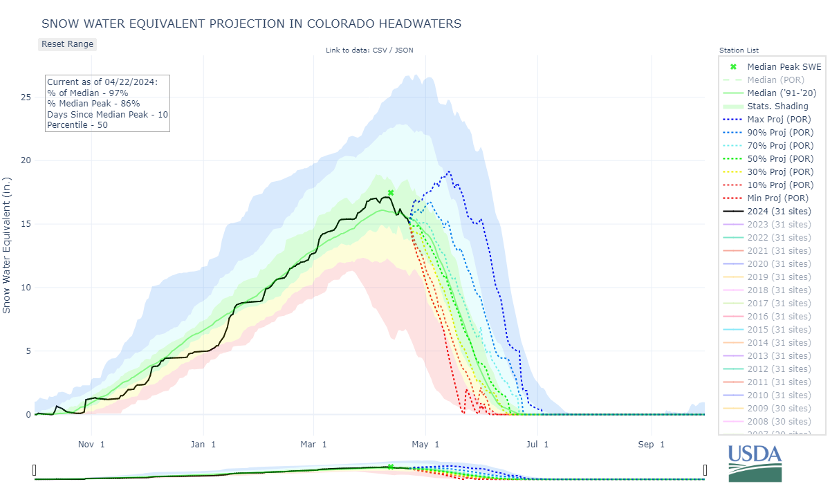
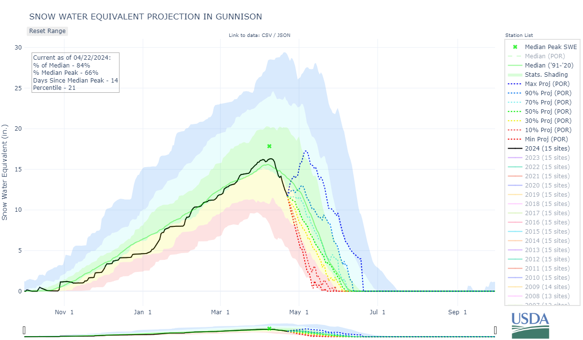
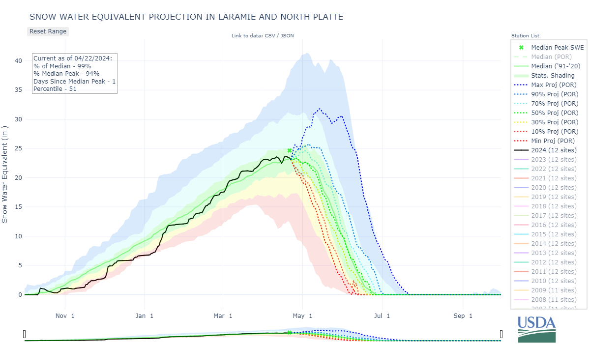
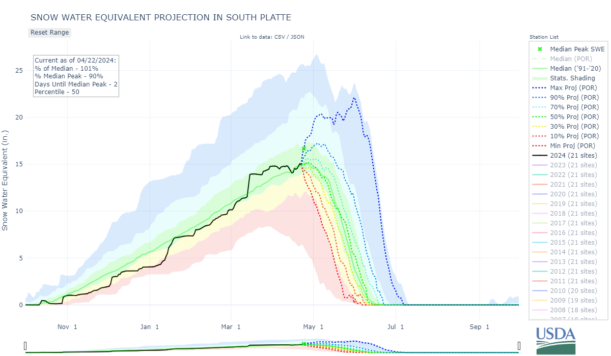
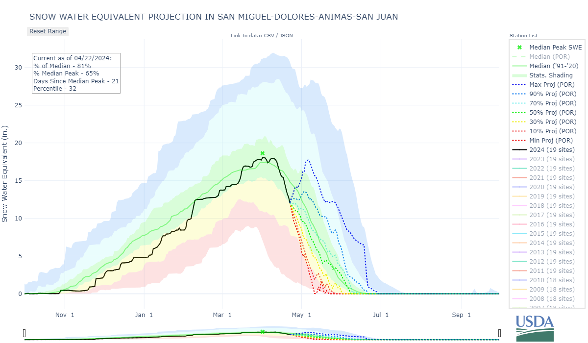
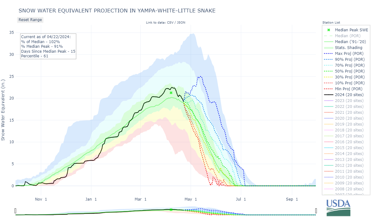
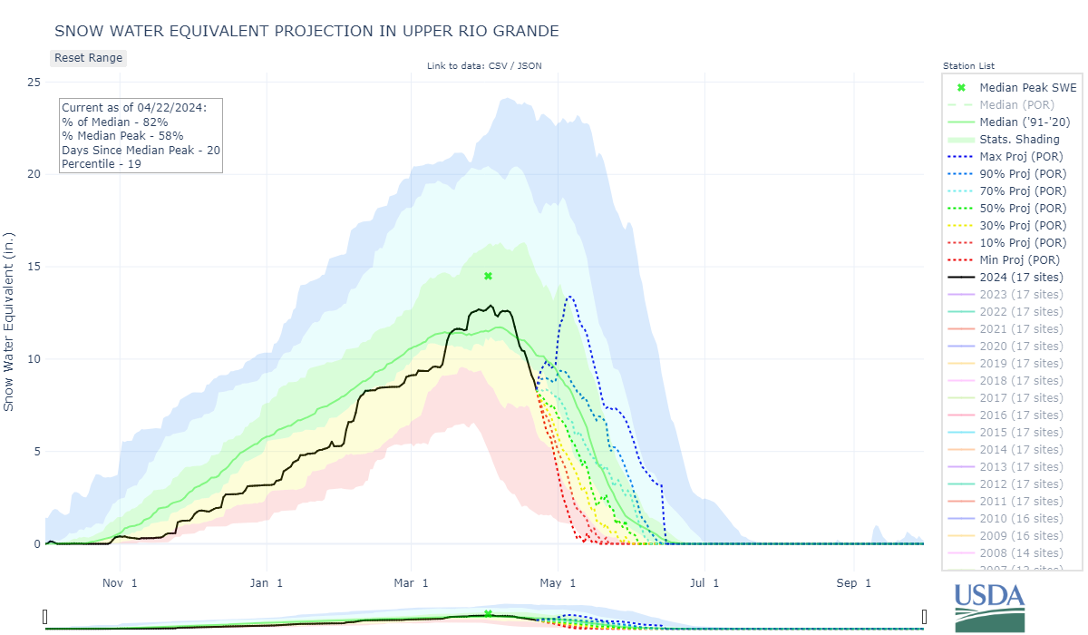
With dust at the surface in the Central and Southern Mountains, lack of significant precipitation, basin averaged SNOTEL data is showing a big nosedive in SWE over the last ~11 days (see graphs below), and a corresponding pop in streamflows. And it is going to keep ramping up as the more severe dust layer pops to the surface. Without some meaningful precipitation snowmelt season could be over quickly.
There isn’t much excitement in the forecast for Central/Southern Colorado over the next few days, but the NWS says cooler and unsettled conditions move in Thursday ushering in a series of systems that has potential to bring substantial mountain snow. Hopefully at the very least it will result in a significant albedo reset. After that? Stay tuned.
For specifics about our observations please see pictures and comments below. If you have any questions about your neck of the woods don’t hesitate to call or email.
You can view the snow profile forms here.
Take Care,
Jeff Derry
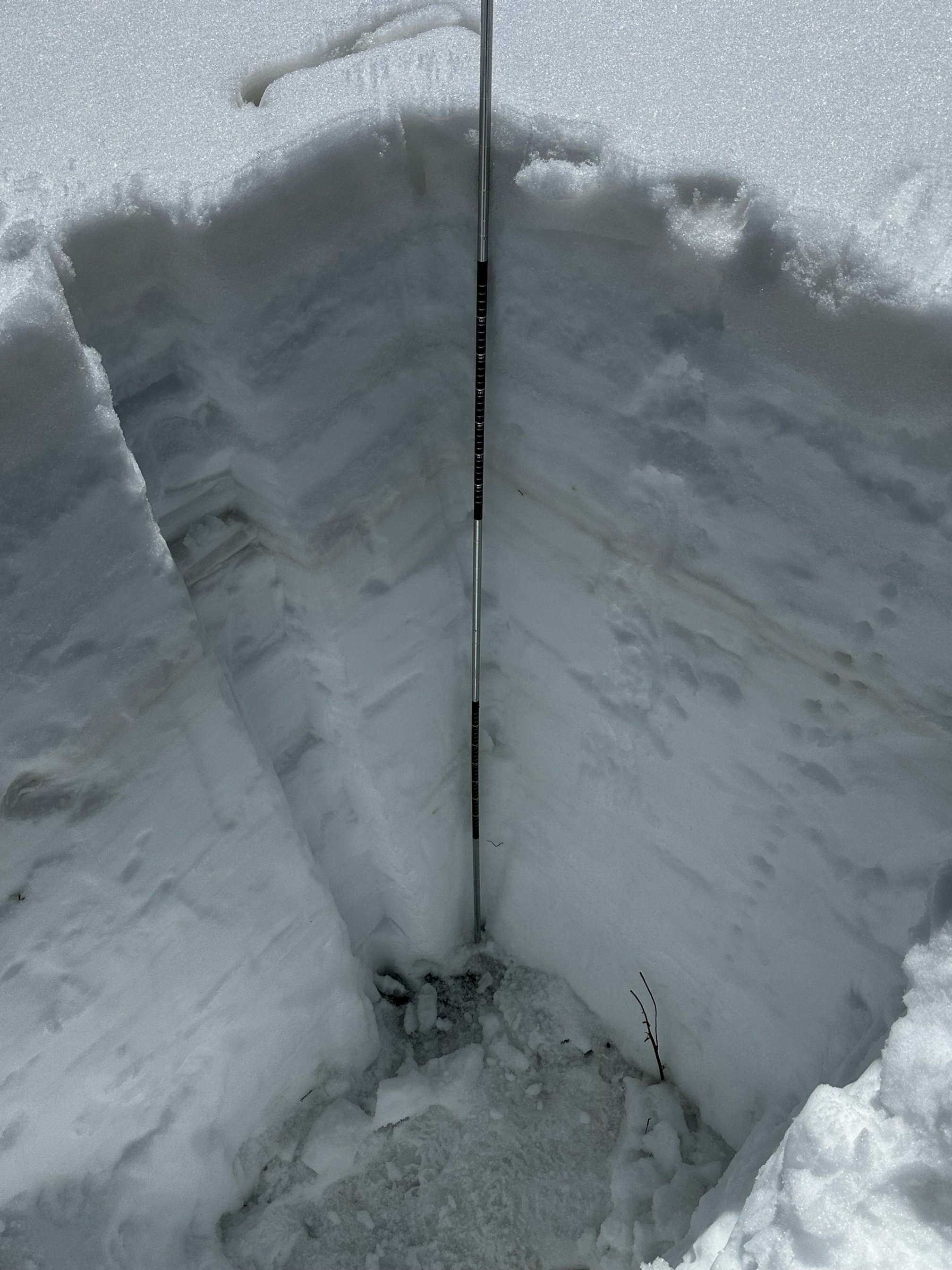
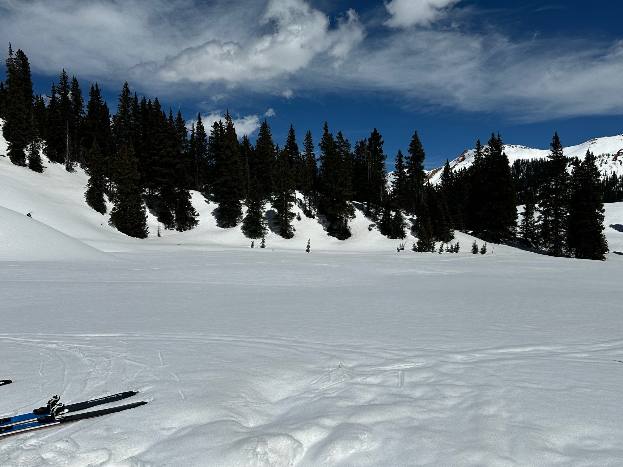
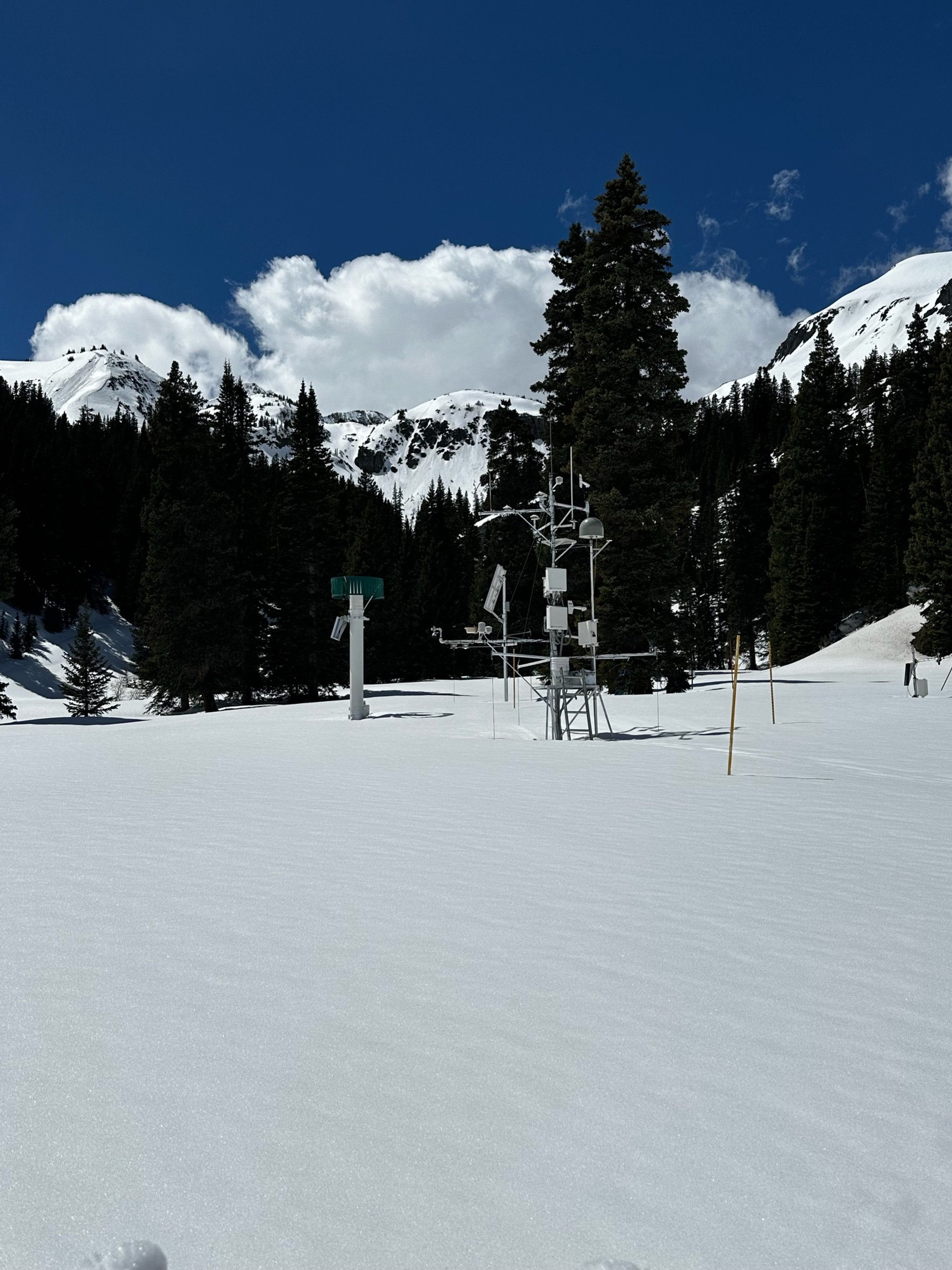
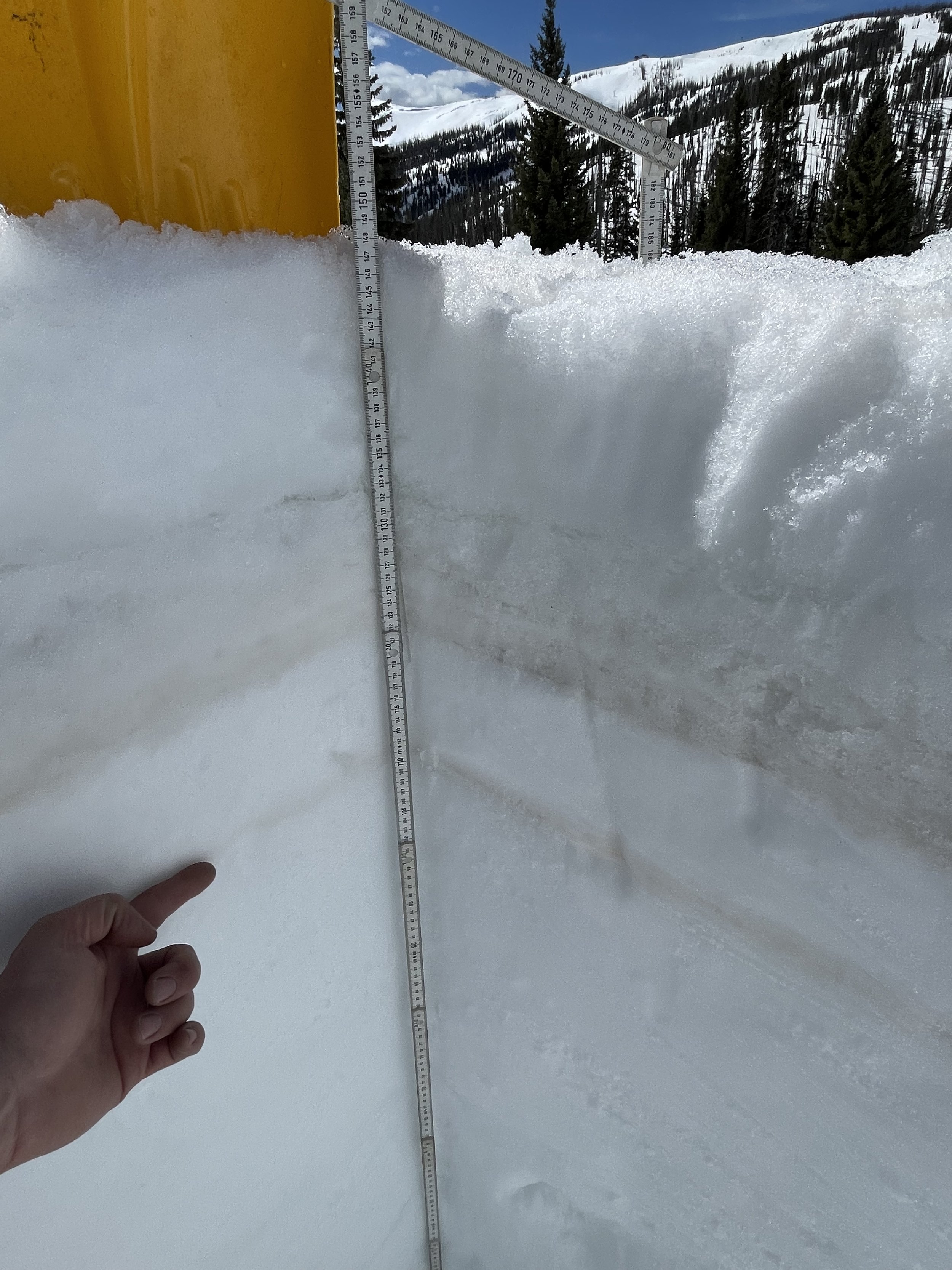
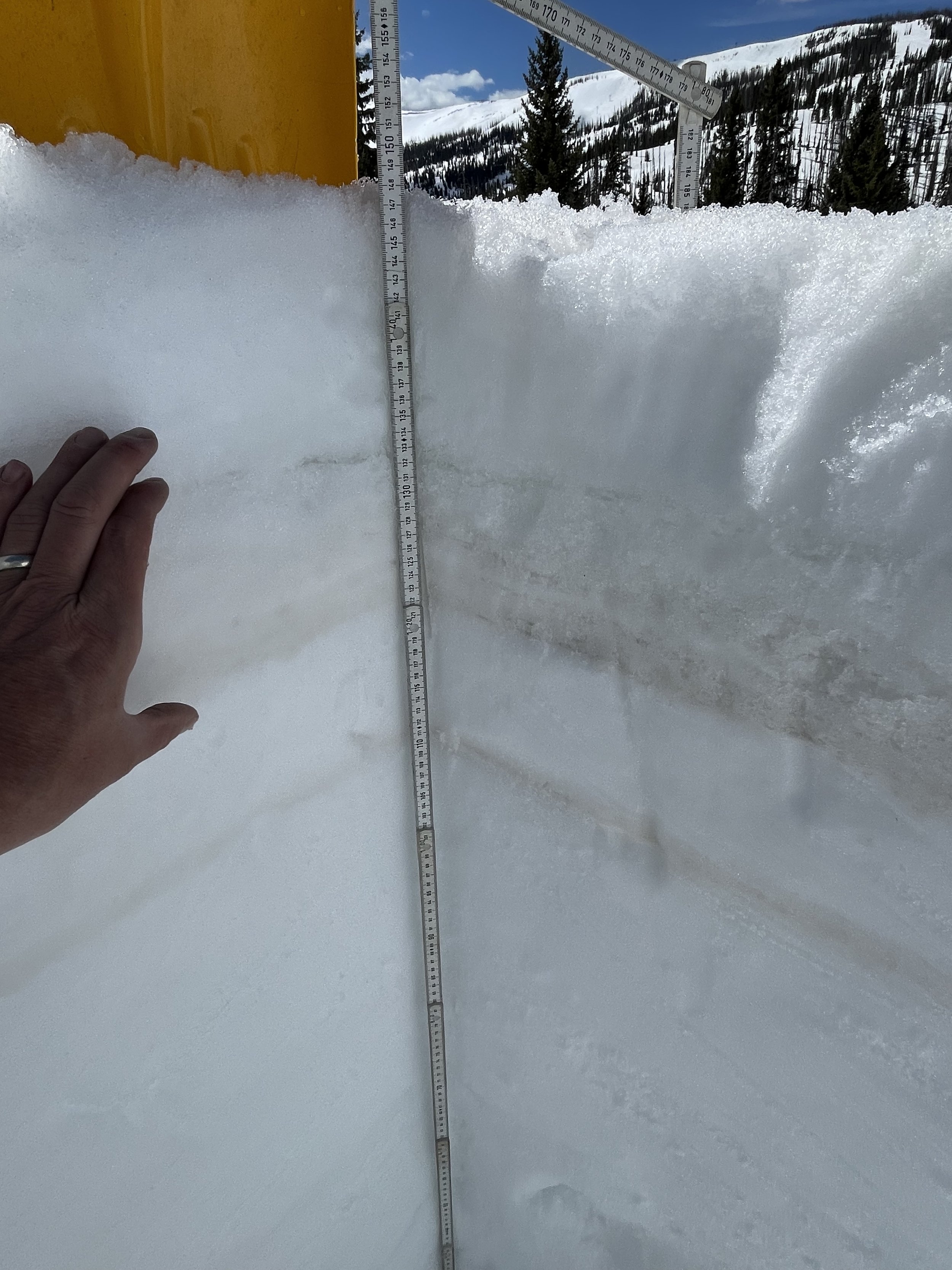
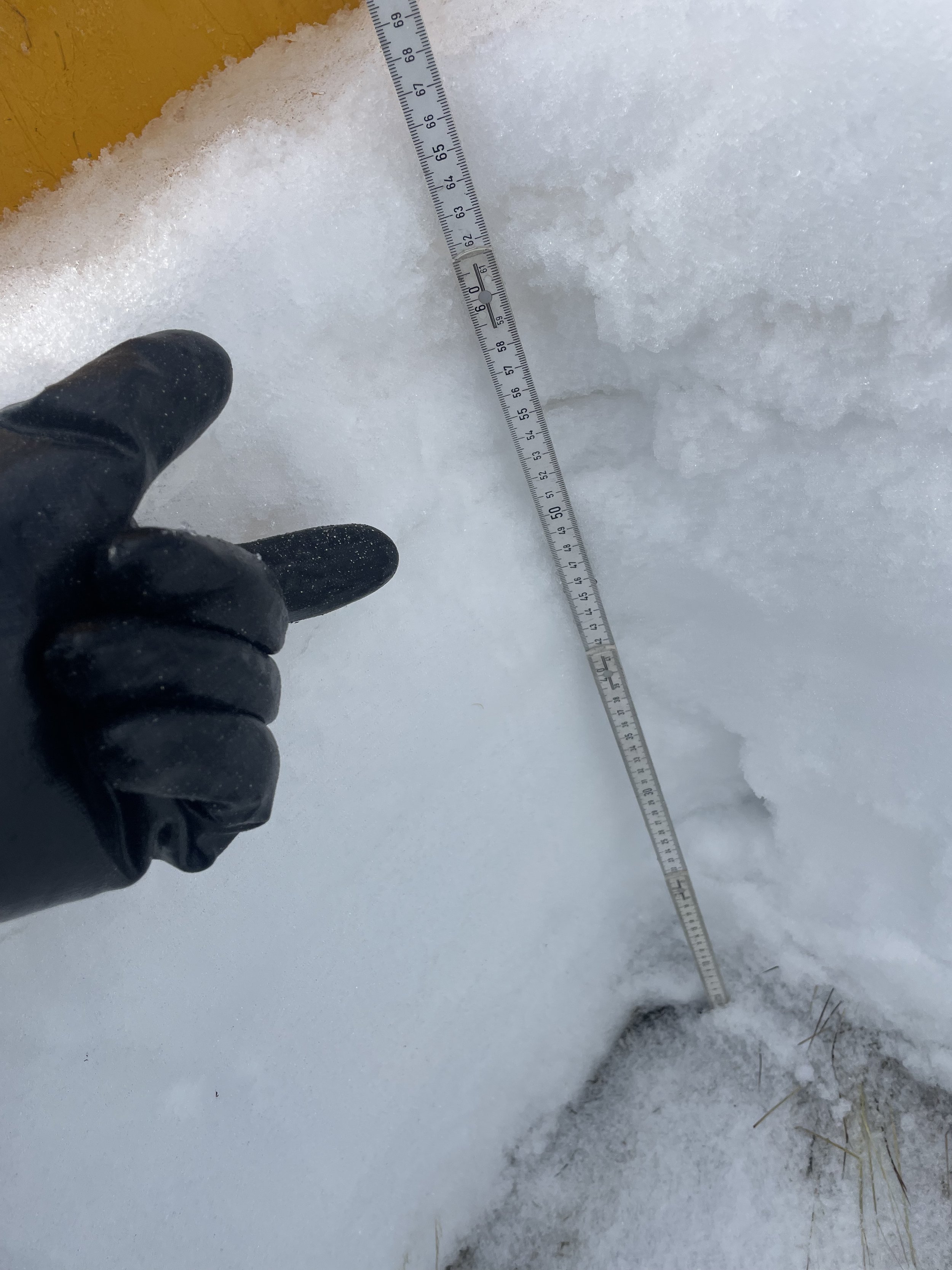
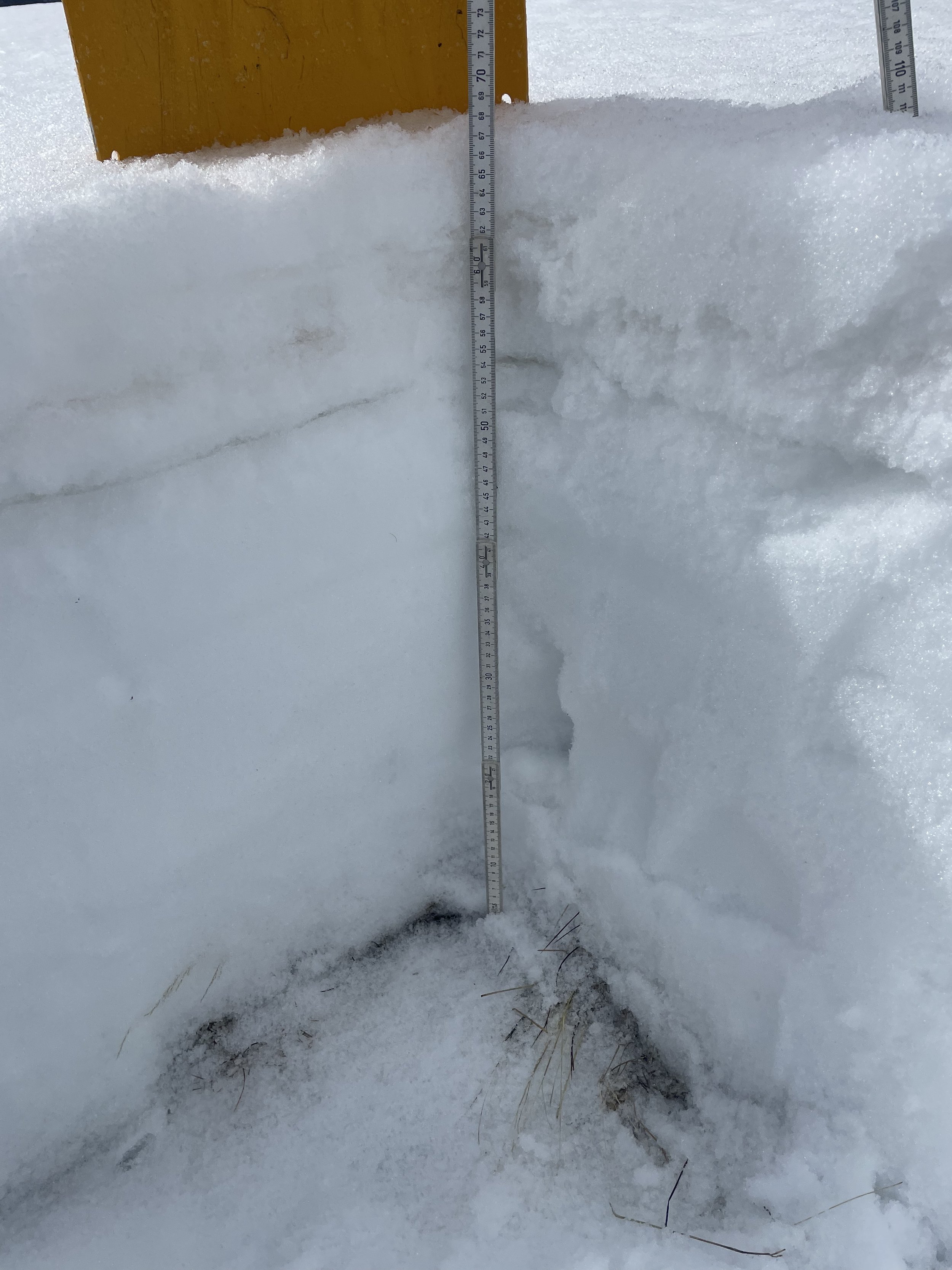
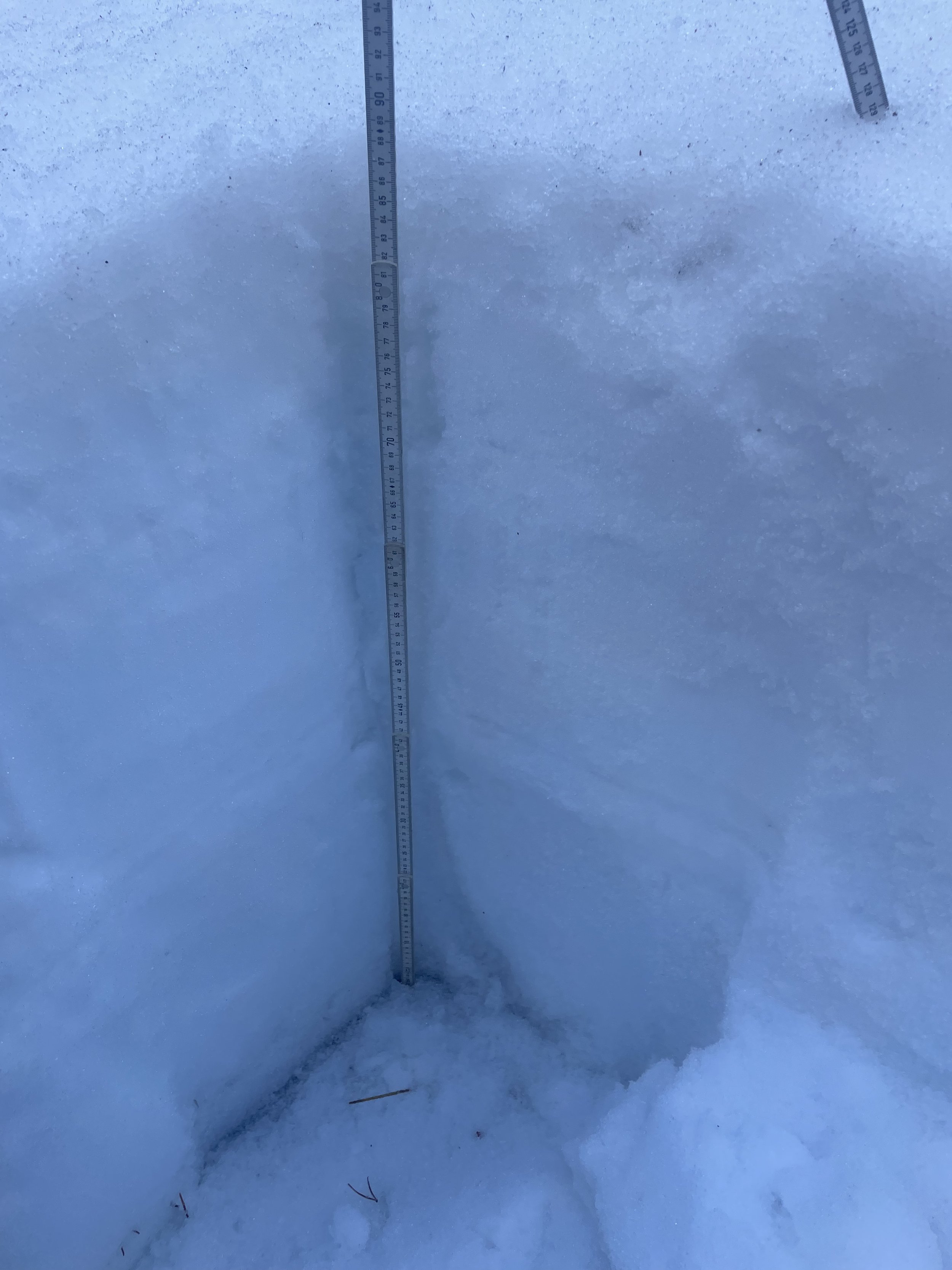
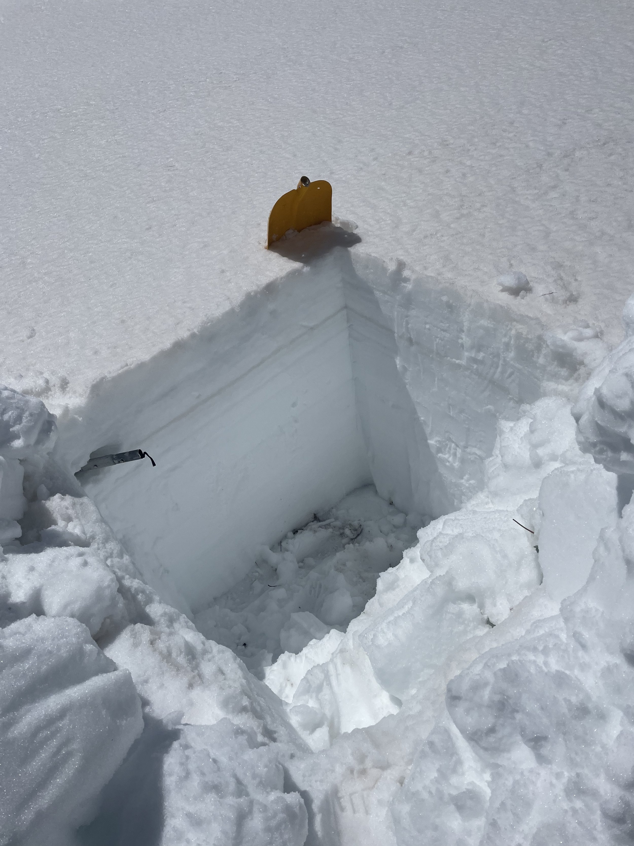
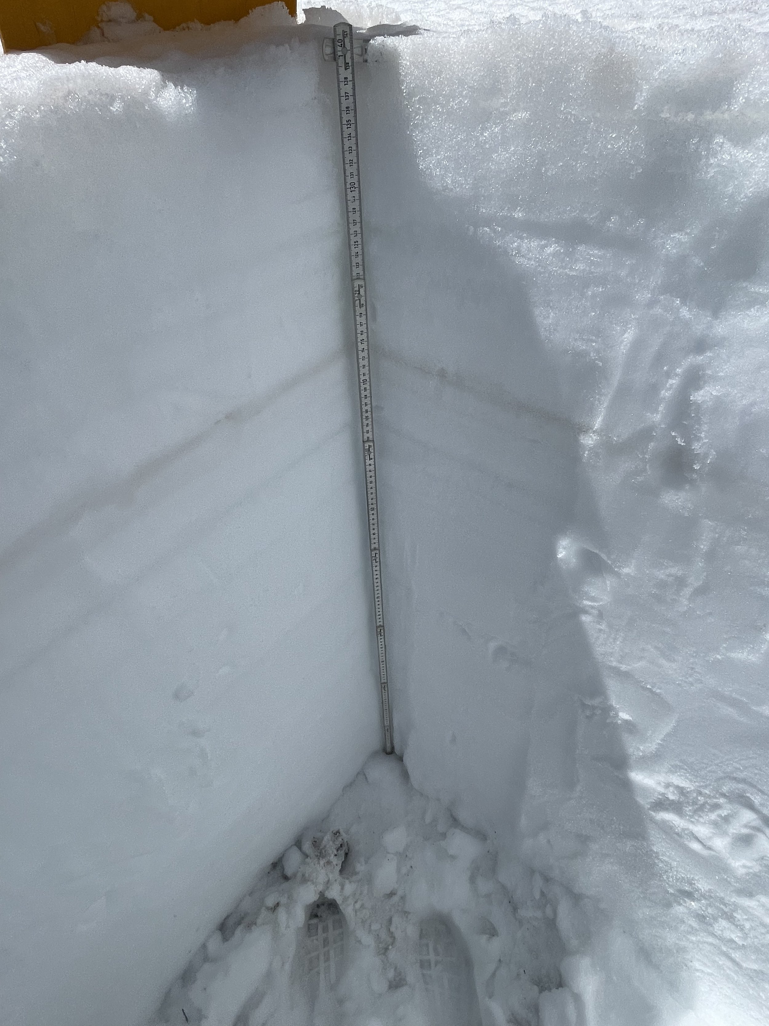
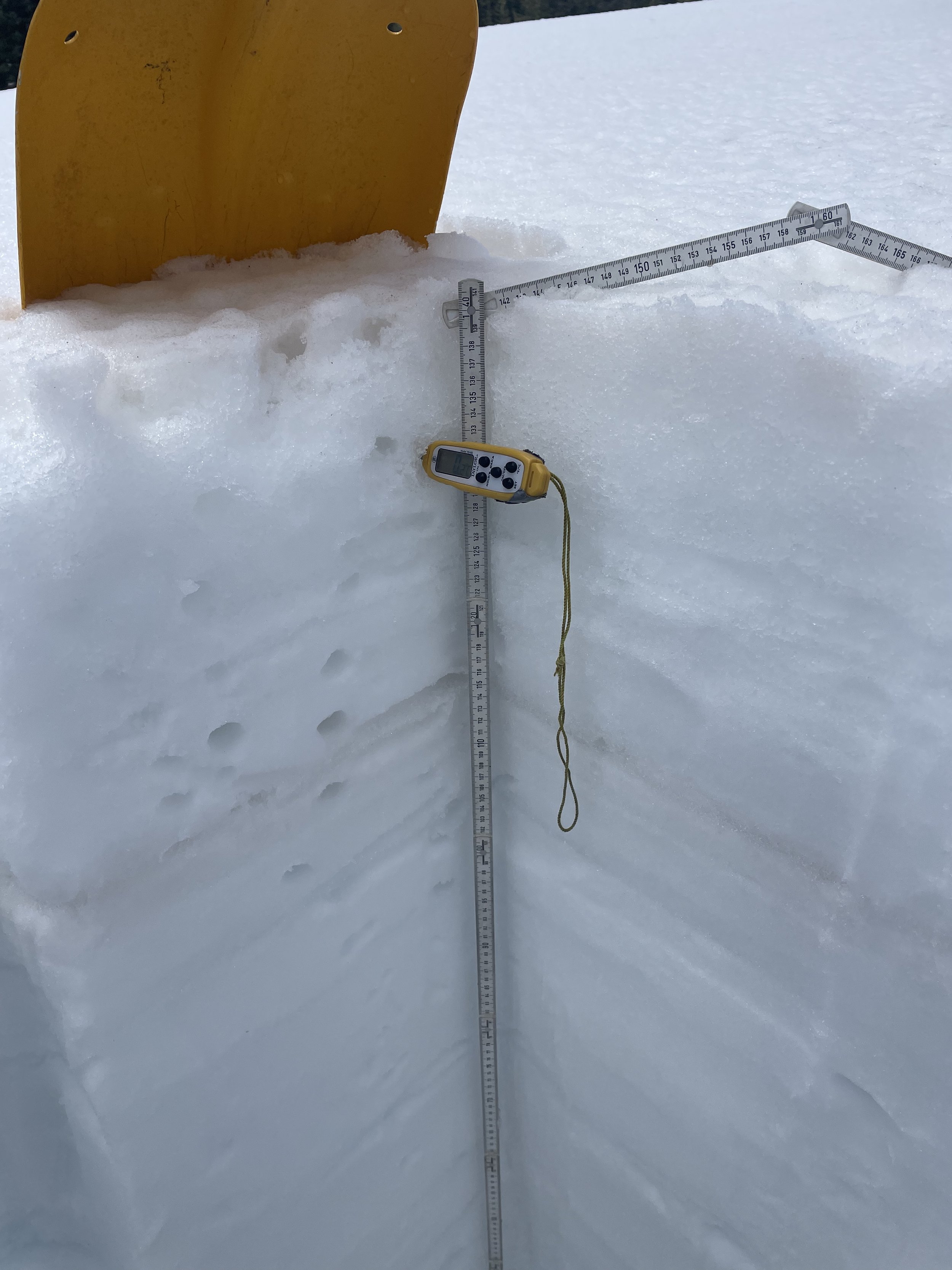
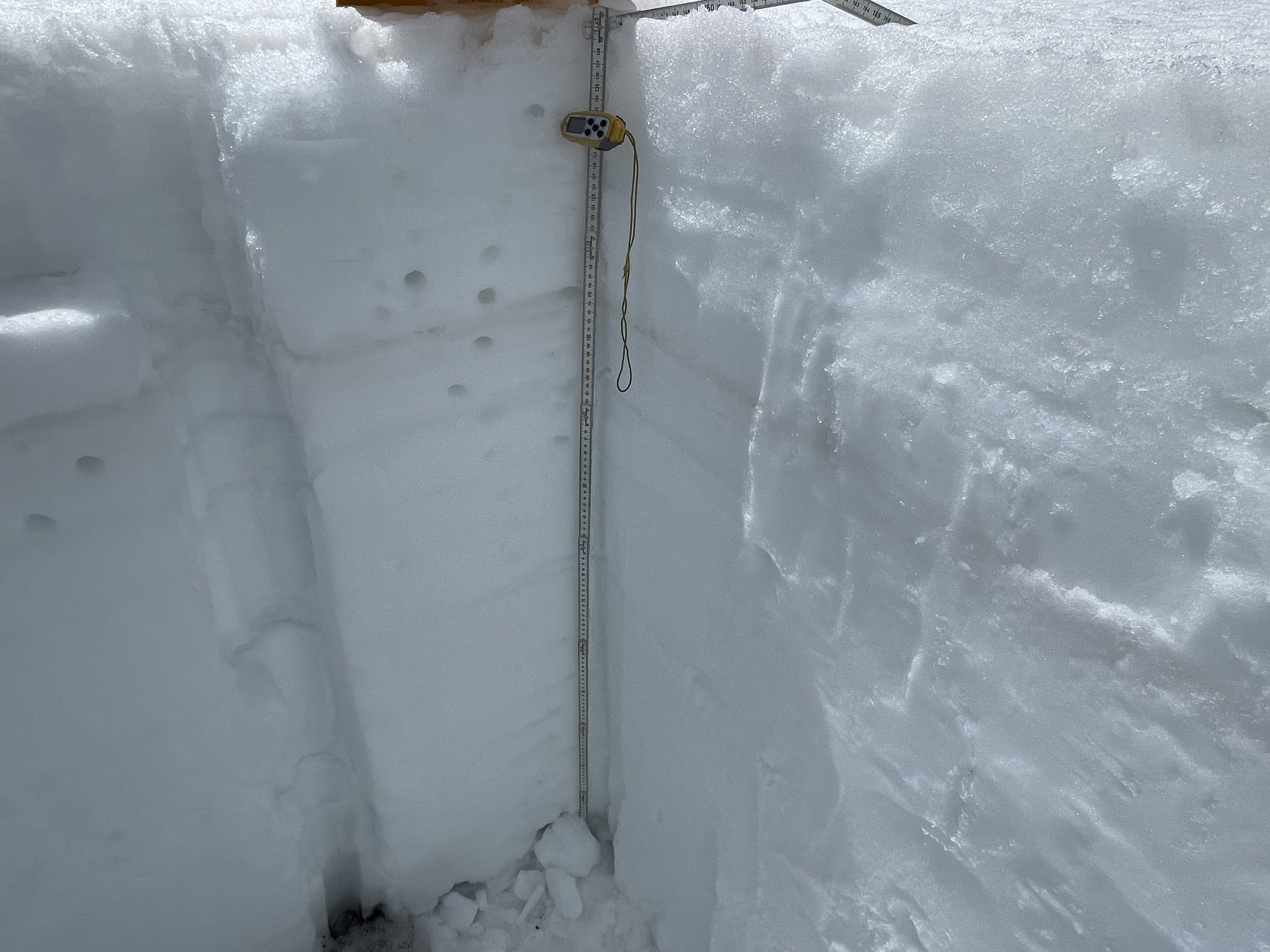
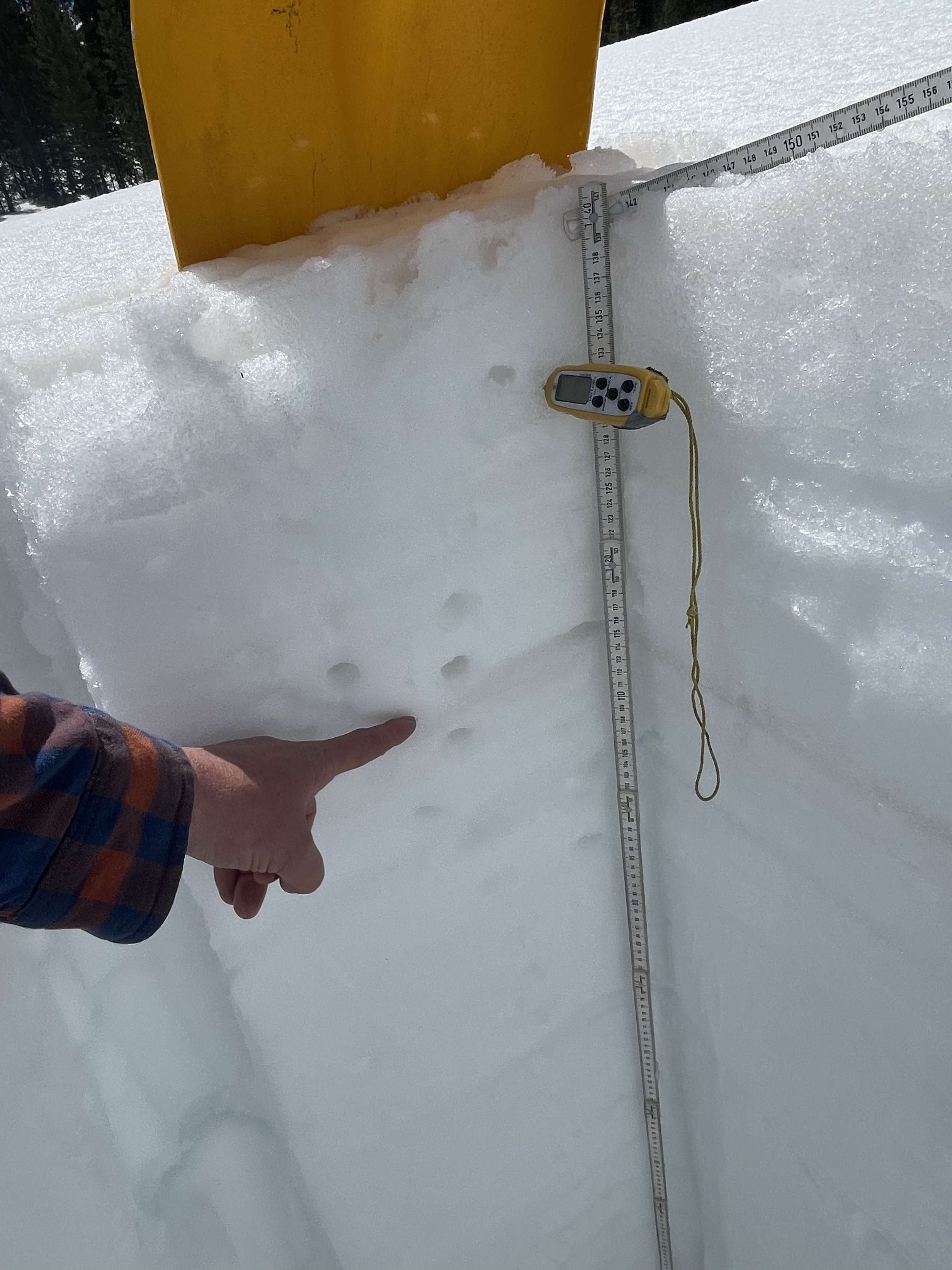
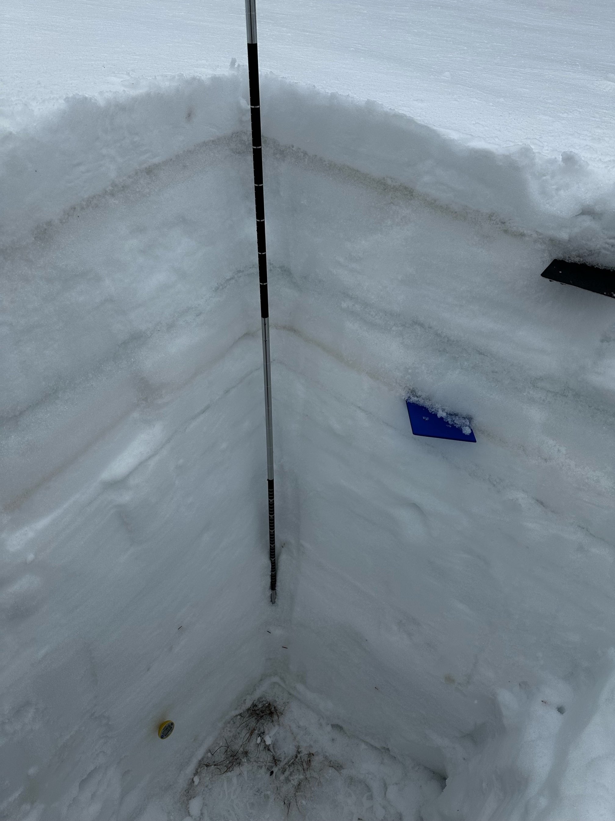
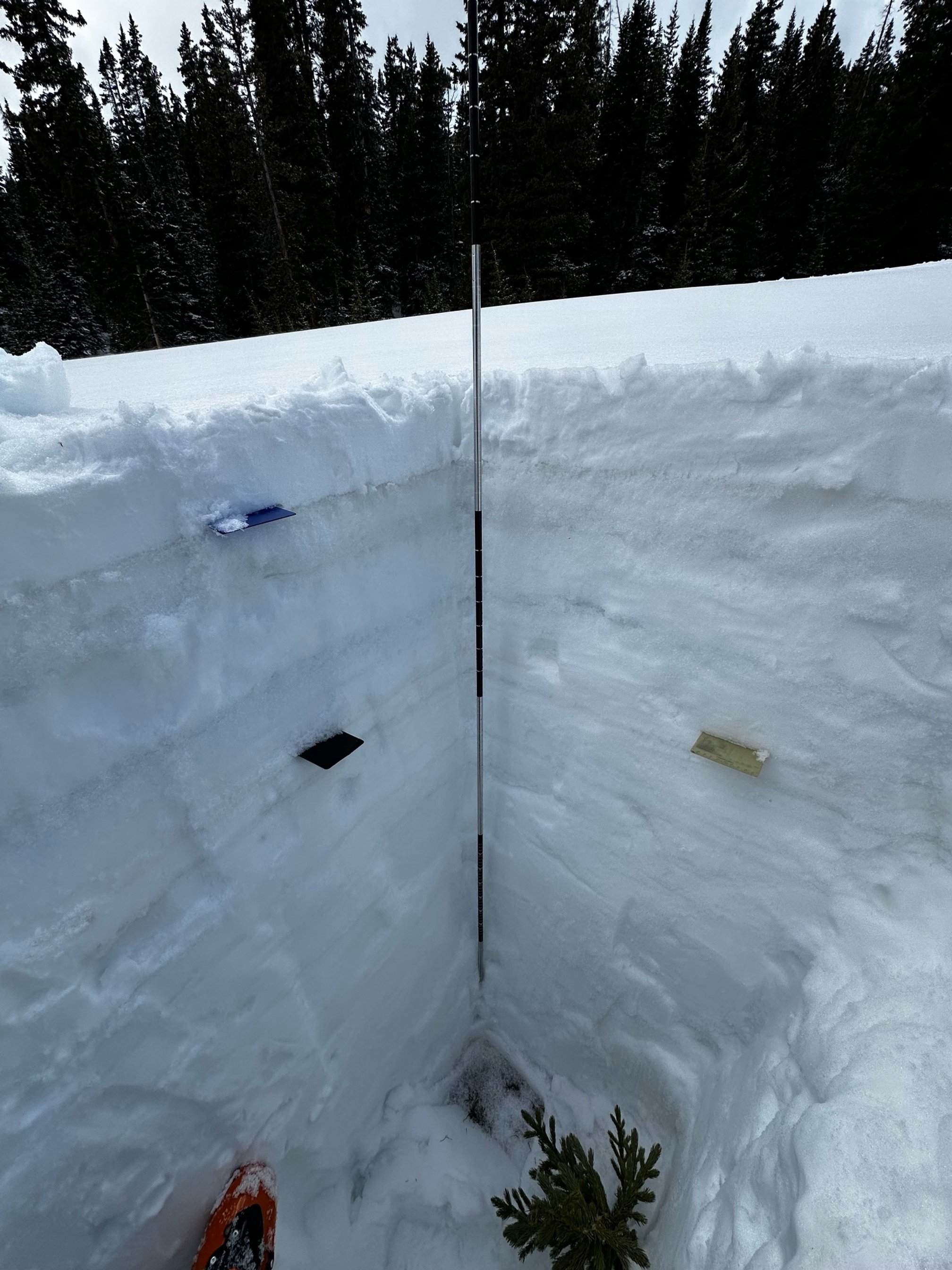
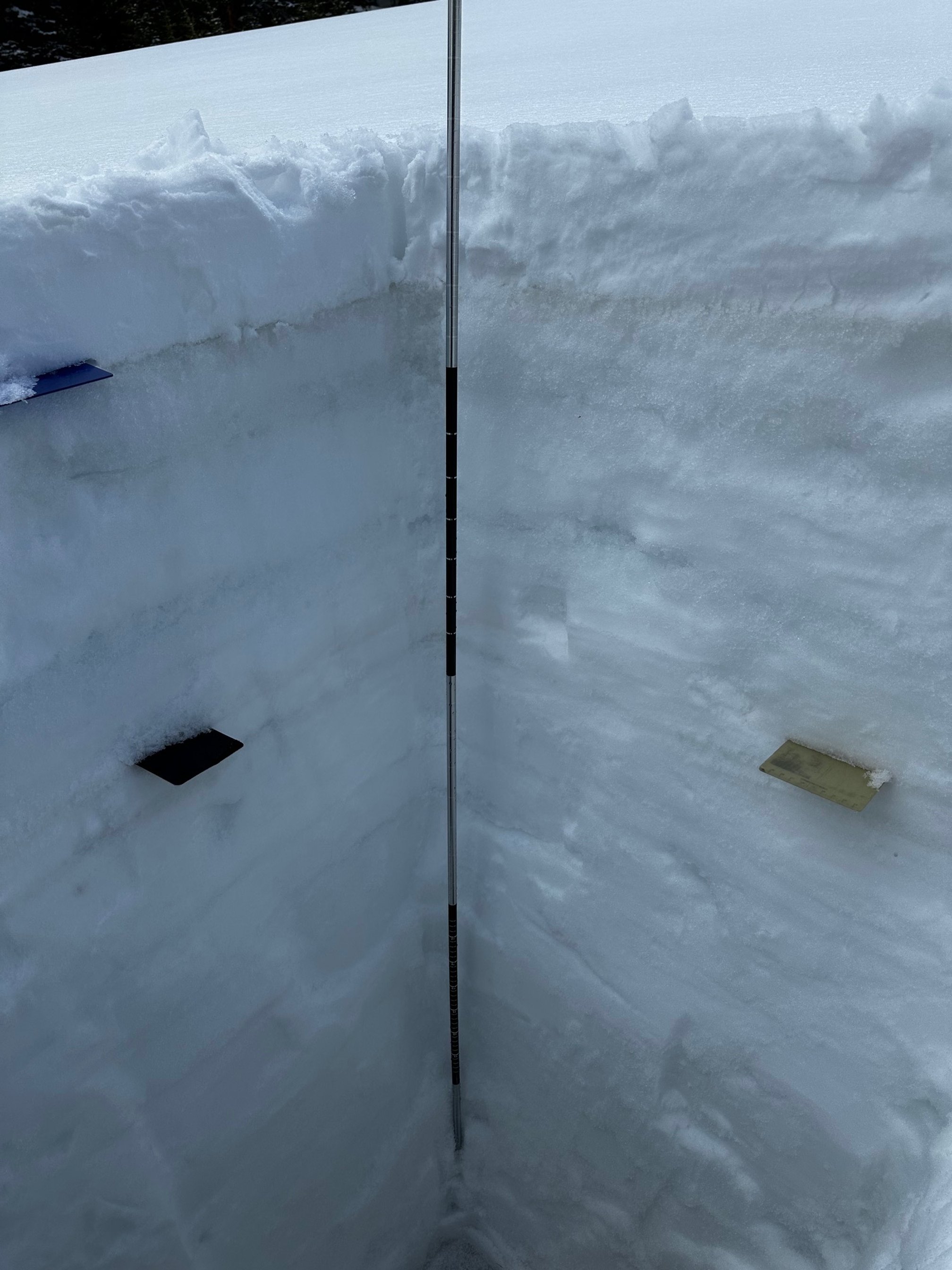
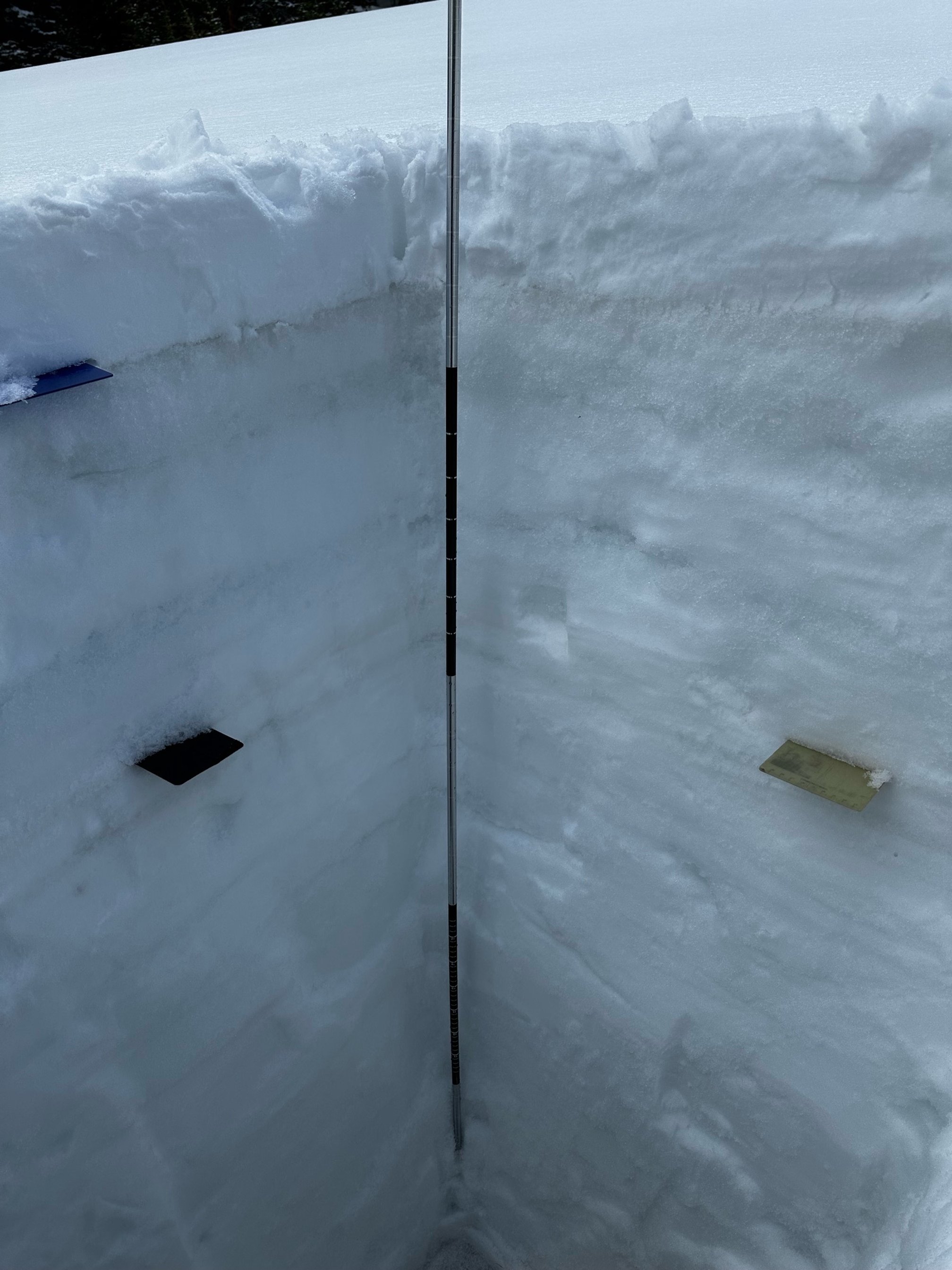
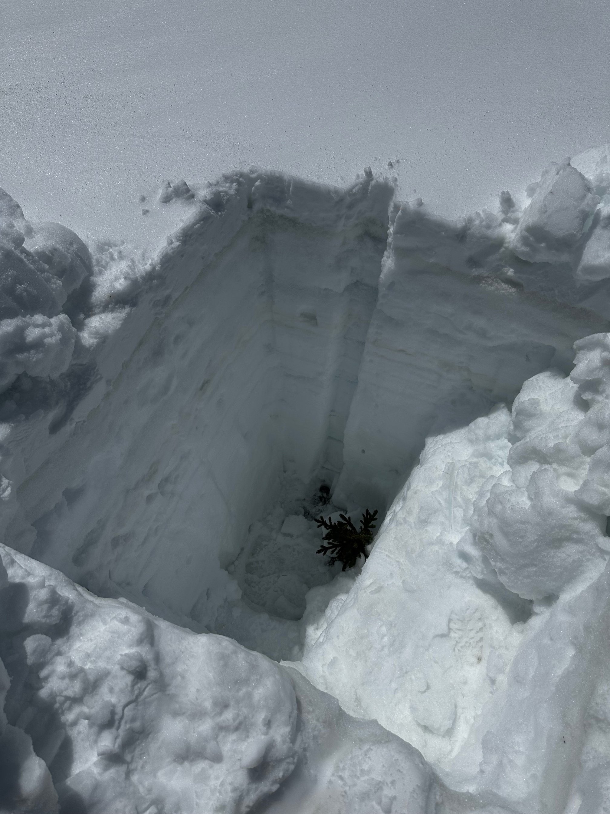
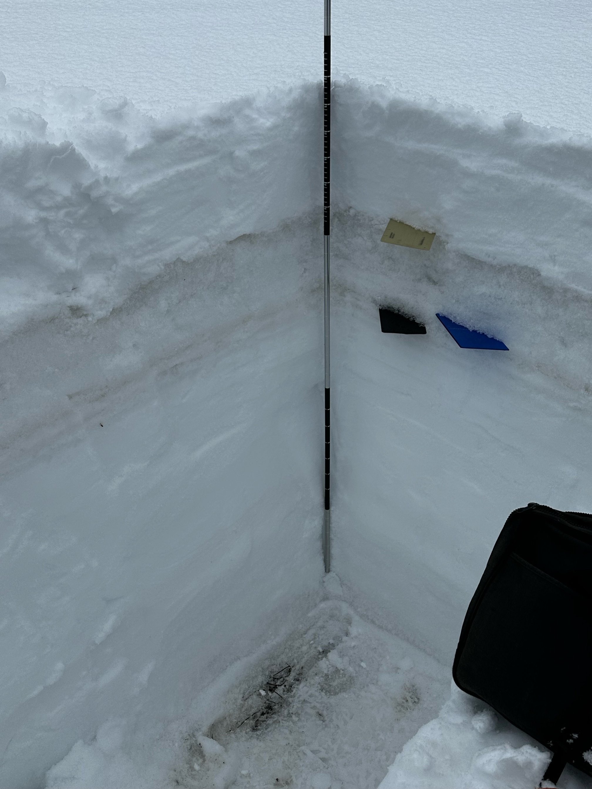
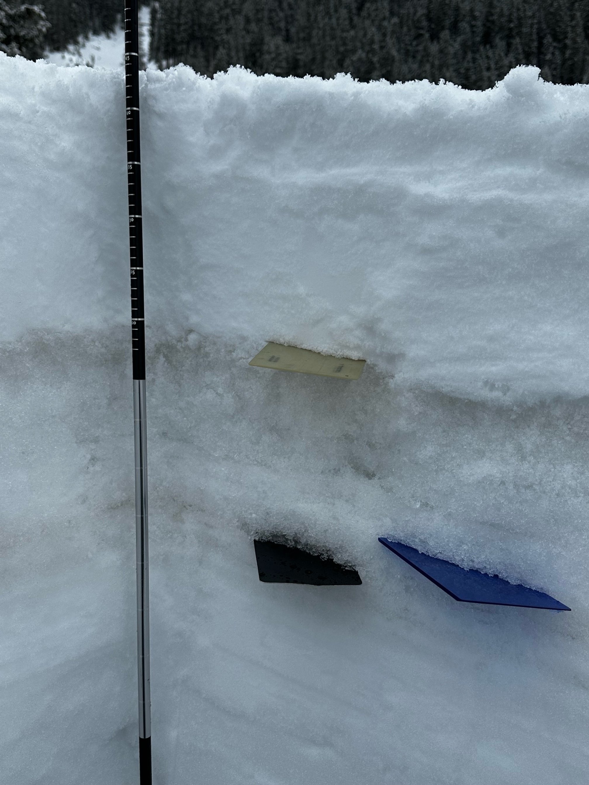
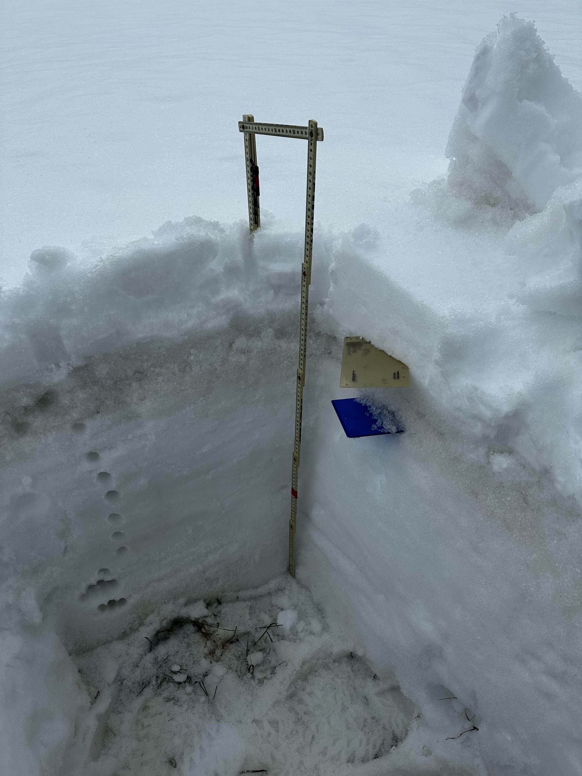
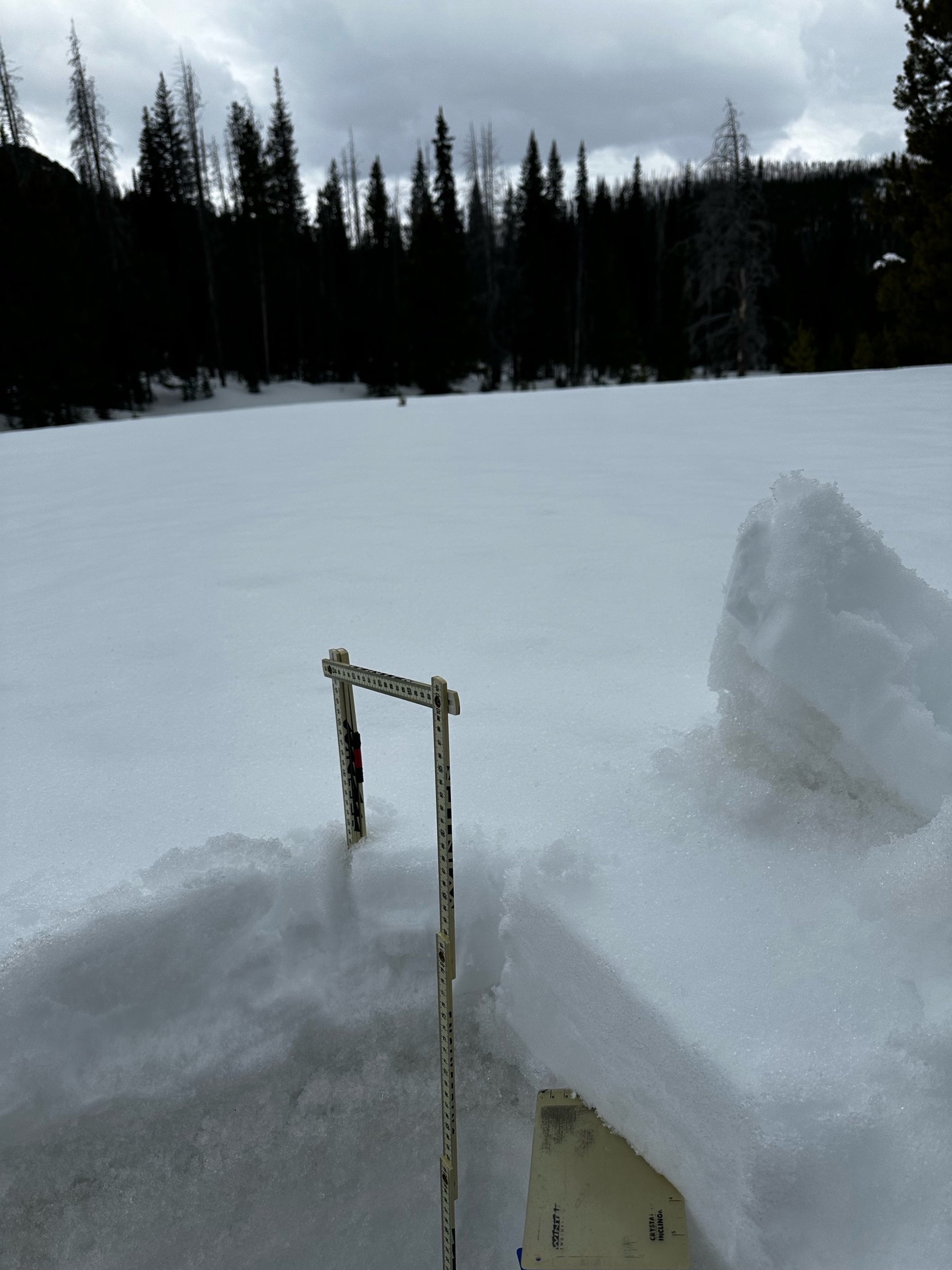
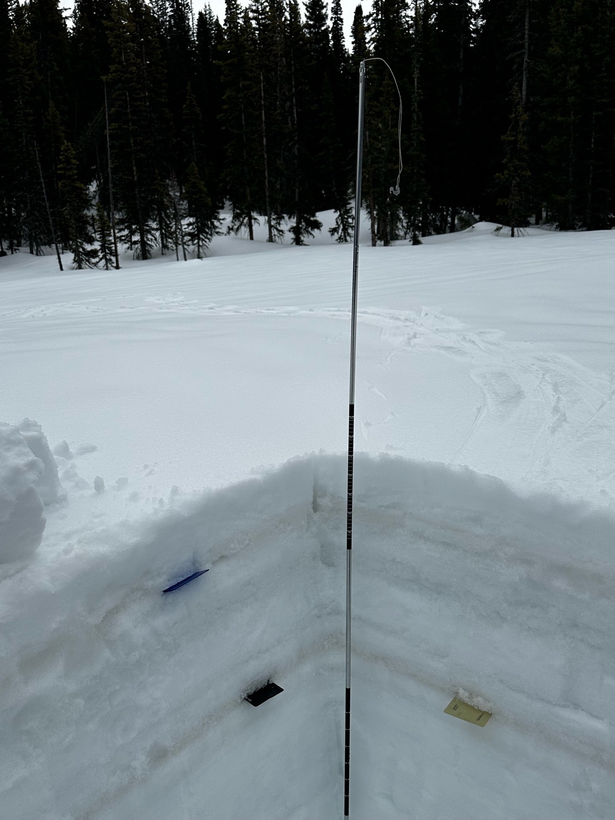
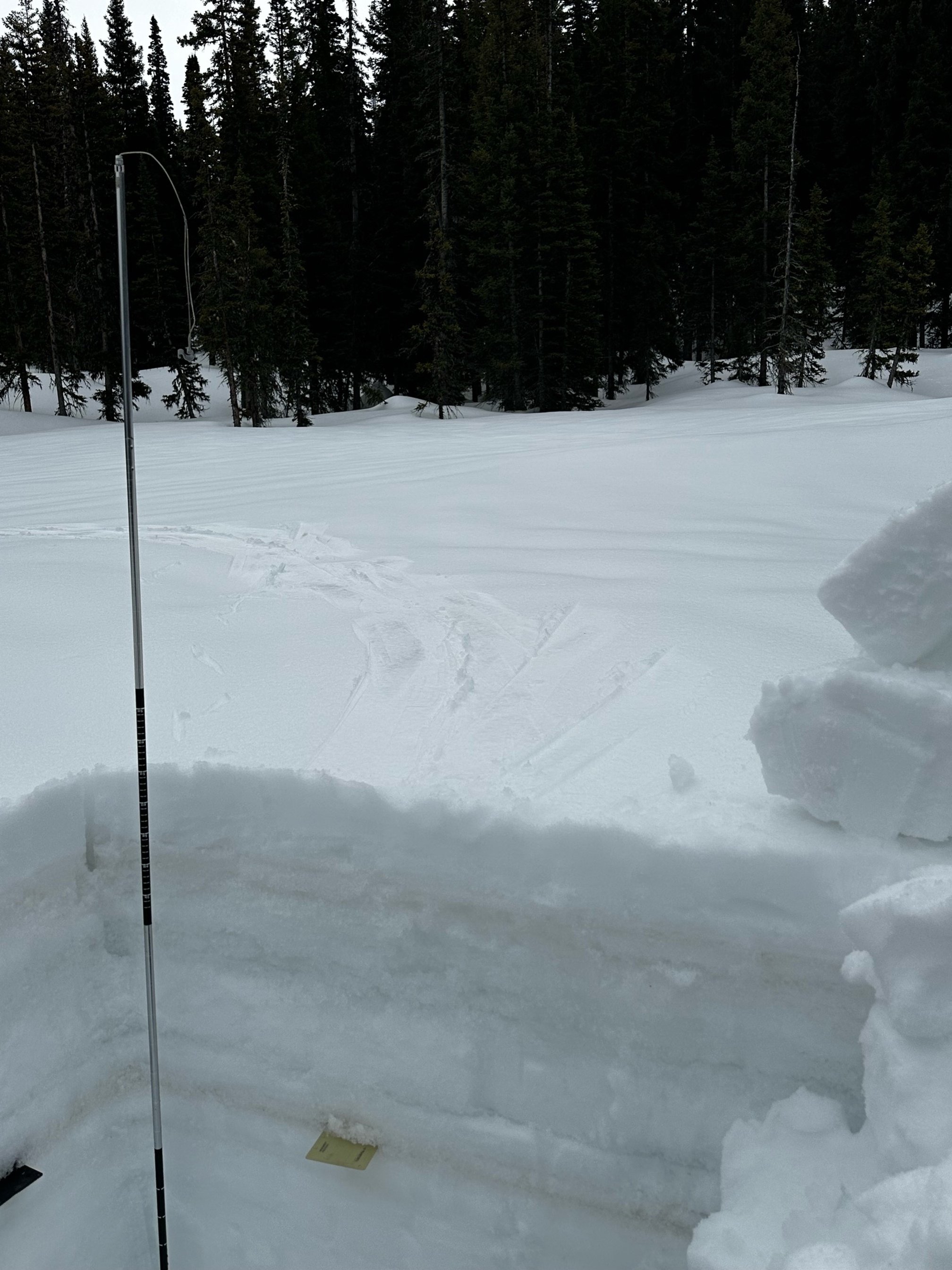
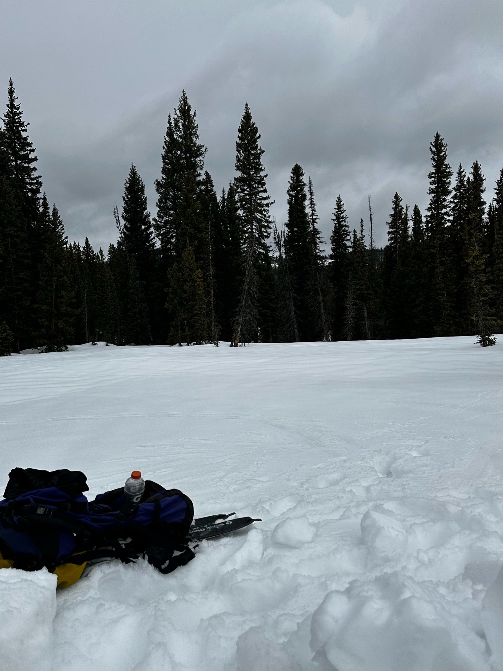
SWAMP ANGEL (Red Mt Pass): April 17
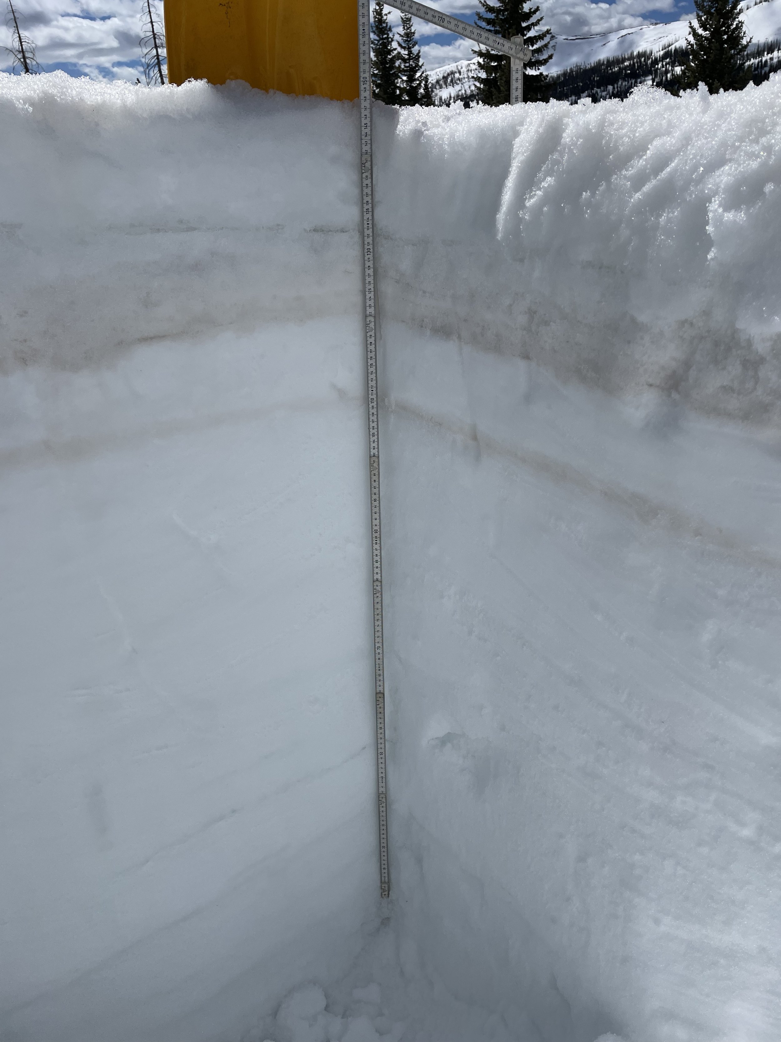
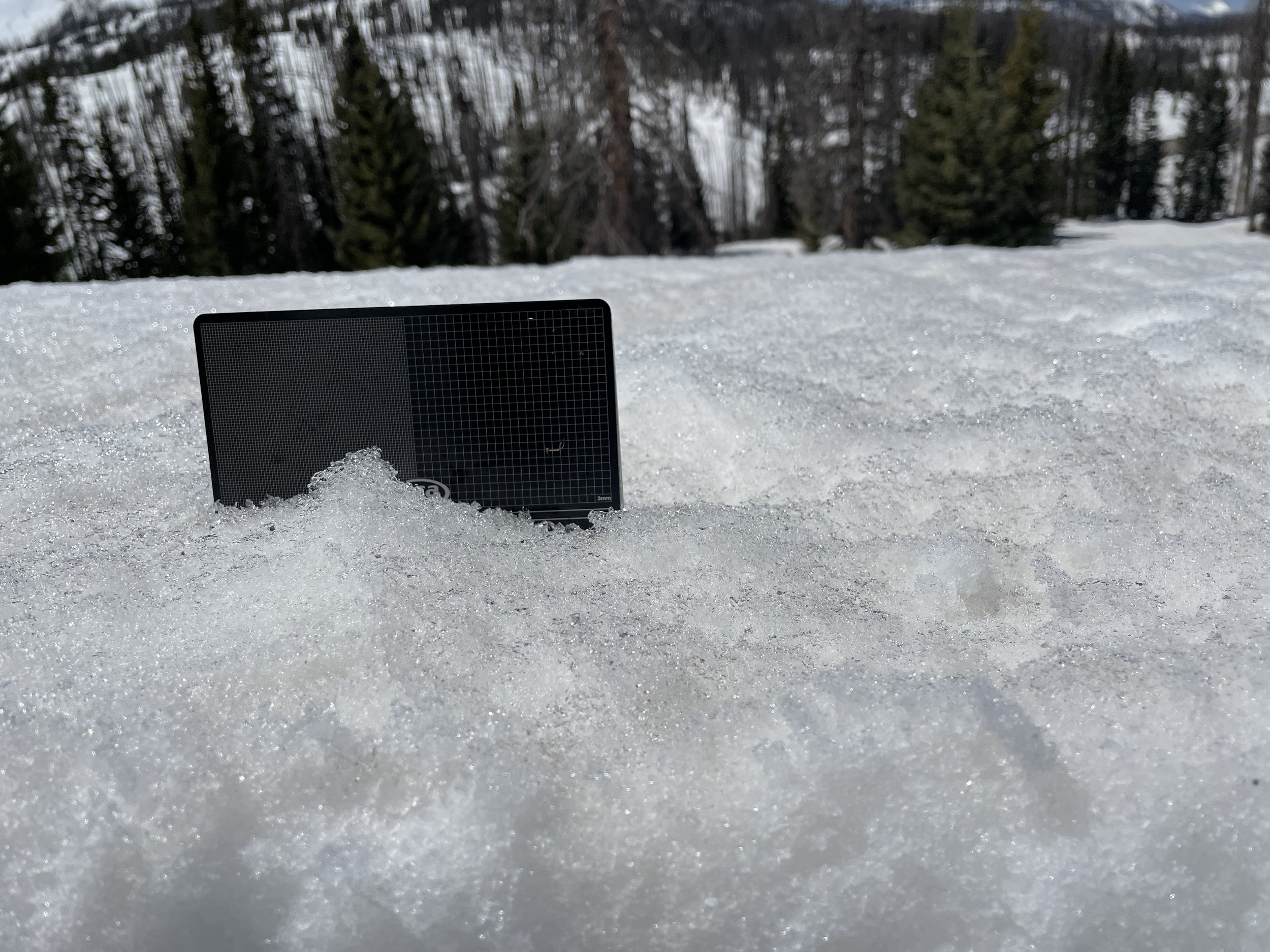
On April 17 we measured 25.8” SWE at Swamp Angel. Nearby Red Mt SNOTEL reported 21.6”. Dust event #3 and #4 are on the surface of the snowpack and comprises the top 4” of the snowpack. 20” below the surface is the dirtier D1/2 dust layer, very obvious in the photo. With the forecast calling for mostly sunny conditions the surface dust will hasten melt, and once D1/2 reach the surface melt will kick-in in earnest over majority of remaining snow. The snowpack is moist and isothermal.
WOLF CREEK PASS: APRIL 18
Wolf Creek and the surrounding region has the worst dust conditions in the San Juan Mountain region. Dust is on the surface, 10” - 15” below surface, and a light layer 30” below surface. Melt and streamflow has really ramped up the last ~10 days and looks to continue going by the forecast as well as the significant dust just below surface. SWE at the site was 21.5” while Wolf Creek SNOTEL reported 25.7”.
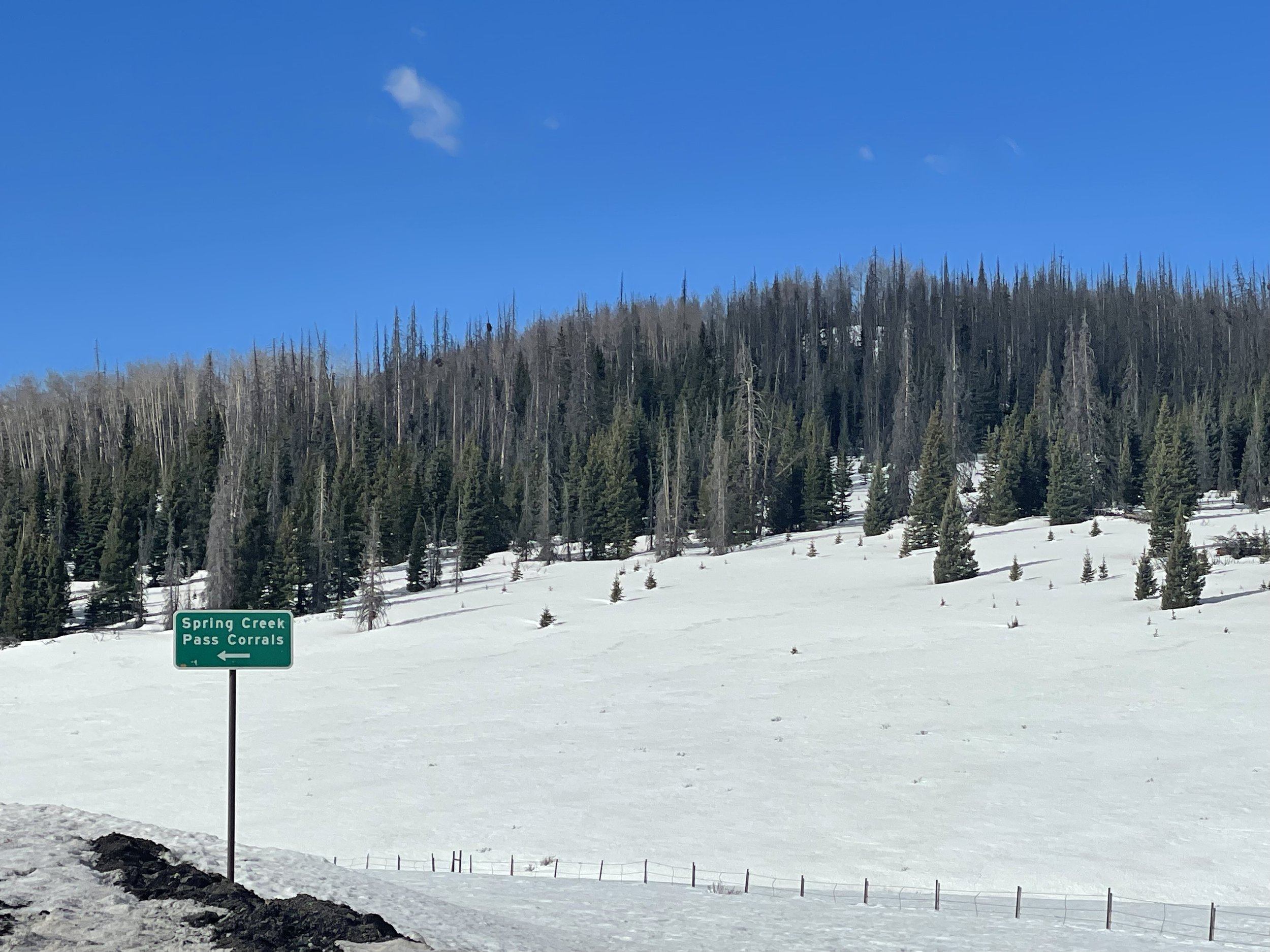
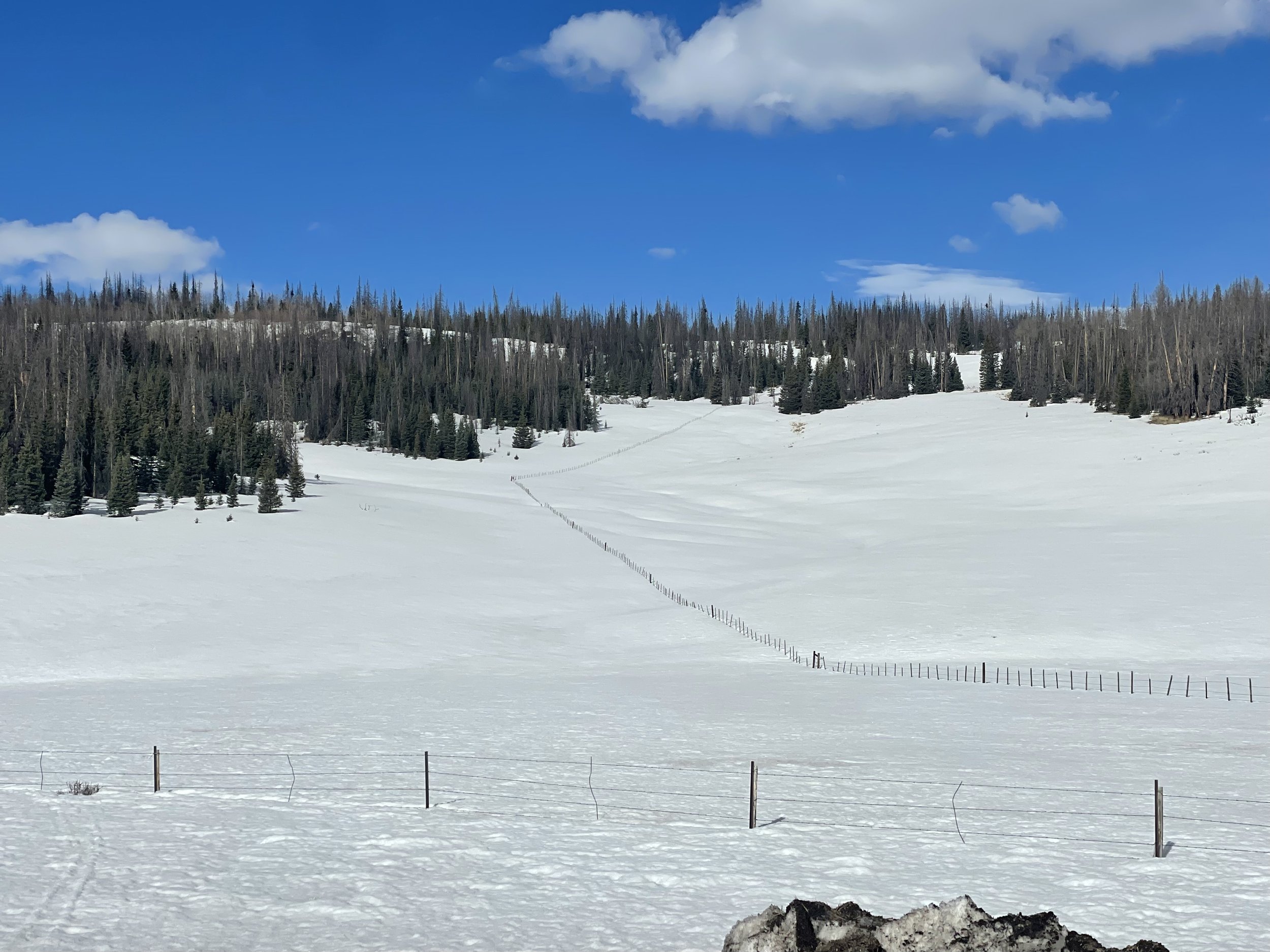
SPRING CREEK PASS: April 18
Spring Creek had 8.3” of SWE. Dust was on and very near surface and very apparent on landscape. All total it appears of moderate severity.
PARK CONE: APRIL 17
All dust layers are merged at the surface. Dust is typically less severe at this sample site but indicative of dust received in the region to date. Measured SWE was 12.5” while Park Cone SNOTEL was reporting 12”.
GRAND MESA: April 17
Grand Mesa has average but still significant dust. At the sample site dust was at the surface as well as ~10” below the surface. The buried dust appears to be easily the most severe. SWE was 20.2” while Mesa Lakes reported 14.1”.
McCLURE PASS: APRIL 17
As noted last codos tour, McClure Pass and the Roaring Fork region was hit pretty hard from the March 2 dust event. All dust is 1-2 cm below the surface (essentially at the surface). Snow at McClure is melting rapidly. Measured SWE was 8.8” and adjacent McClure SNOTEL was reporting 11.2”.
HOOSIER PASS: APRIL 18
As is typical of most other sample sites Hoosier has two distinct dust layers. The upper most layer is 2.5” below surface, while the slightly dirtier layer is 2’ below surface, 6.5” of SWE sits on this buried dust layer. Snow melt will ramp up once the thin fresh snow melts and top dust layer is exposed. Our measured SWE was 20.6”. SWE at Hoosier SNOTEL reported 18.2”. The snowpack is essentially isothermal.
Berthoud PASS: April 19
The top dust layer is 6” below surface, under the fresh accumulation. The second layer is 21.5” below surface. The snowpack is moist throughout but not melting significantly yet. We measured 24.9” SWE and the SNOTEL a few feet away reported 22.4”.
Loveland PASS: APRIL 19
We measured 17.7” SWE at Loveland Pass as Grizzly SNOTEL reported 17.7", exactly the same! The uppermost layer is 9.5” below the fresh accumulation. The second dust layer is 17.3” below surface. Currently 3.9” SWE sits on the second dust layer.
WILLOW Creek PASS: APRIL 19
All of the dust sits about 6” below surface under fresh accumulation. Dust severity is pretty bad for the Willow site. Willow Creek has 11.1” SWE. Willow SNOTEL reported 15.8”.

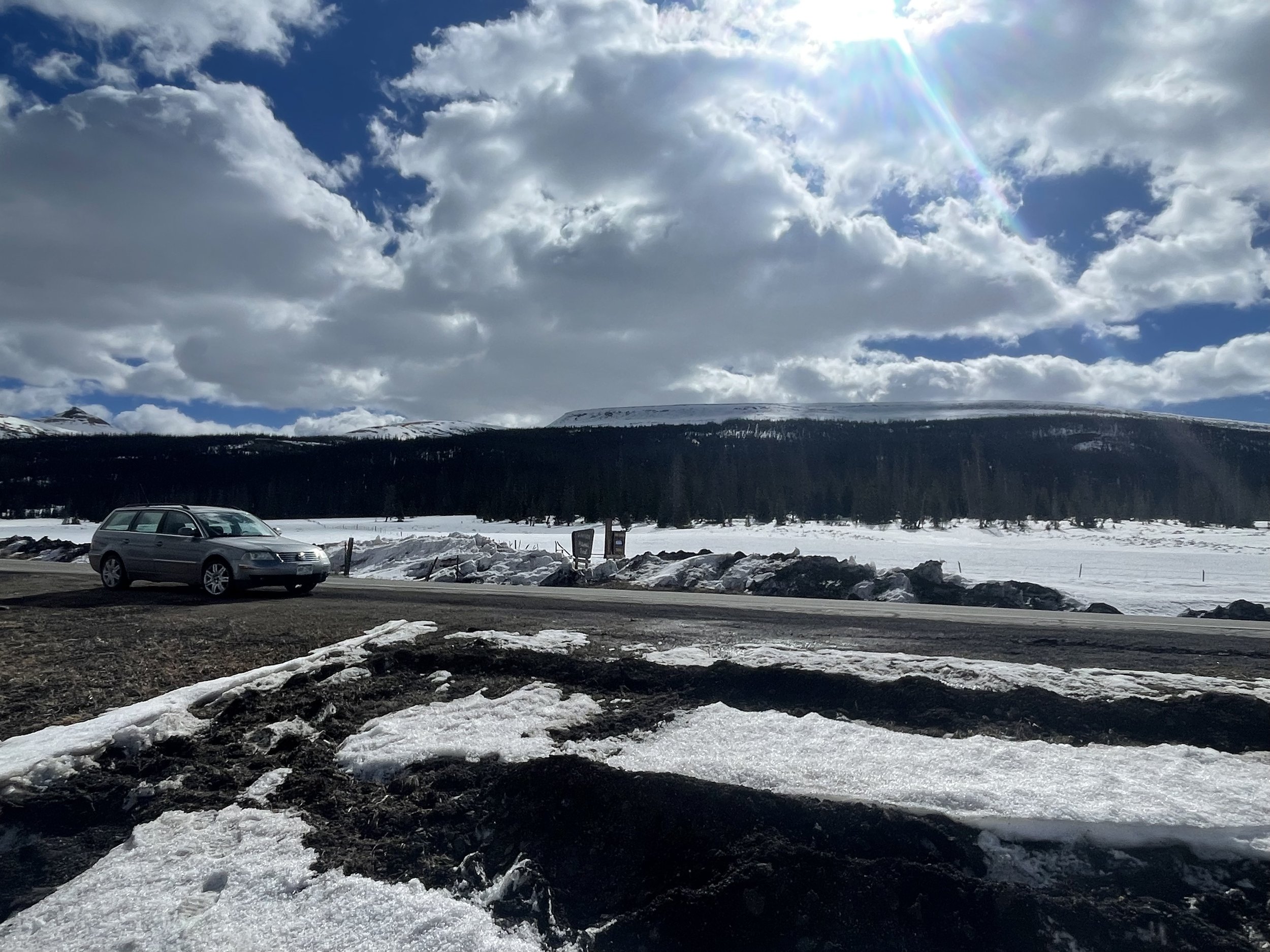
RABBIT EARS PASS: APRIL 20
Rabbit Ears snow pit was a typical back breaking 7’ deep. The upper most dust layer is 6” below fresh accumulation and just shy of 2’ below lies the deeper, more severe, layer. We measured 35.3” SWE while Rabbit Ears SNOTEL reported 28.7”.


Red Mountain Pass forecast.