

CODOS Update April 2, 2022: Brief Update
Greetings from Silverton,
Driving up towards Silverton from Durango shows largely a clean, reflective snow surface, however in some areas you can see a brown hue just a bit under the surface. We were intending on doing a snow profile to mark the location of the dust layers in the snowpack at a lower elevation than Swamp Angel (11,060’) at Red Mt Pass. The SNOTEL station Cascade #2 at elevation 8,920’ was our location of choice but the station sits on a south facing aspect and was devoid of snow - about 12 days earlier than normal. So we went higher to Molas SNOTEL at 10,500’ (and a little bit further south than Red Mt). Digging a profile at Molas SNOTEL showed a thin and faint dust layer at the base of the new snowfall that came in Thursday night and deposited ~7” in Silverton and a similar amount in the region.
We have chances of some precipitation forecasted for Sunday thru Monday night, and a bit on Tuesday. A warm-up is expected heading into next weekend. The April forecast isn’t looking very promising with hotter, drier conditions expected.
With that in mind it will be a few days before a real warm-up (increased solar radiation) begins the process of exposing D4 and D3 which are 4" and 7", respectively, under the surface. Heading south towards lower elevations (and where the dust is more severe) we can expect dust exposure to happen quicker. It is early, the snow ablation season is just getting underway. Peak accumulation of the Colorado snowpack is right around now, give or take a week or two depending on location. We have only received 4 dust events this year so far but they are pretty severe (in the southern basins) and will be a big factor in timing and rate of snowmelt starting early in the ablation season. And we usually receive the majority of our dust events in April/March/May, in that order. So with the month of April just beginning we could easily see a lot more dust added to the top of the snowpack. Accelerating snowmelt at an alarming rate.
Take Care,
Jeff Derry
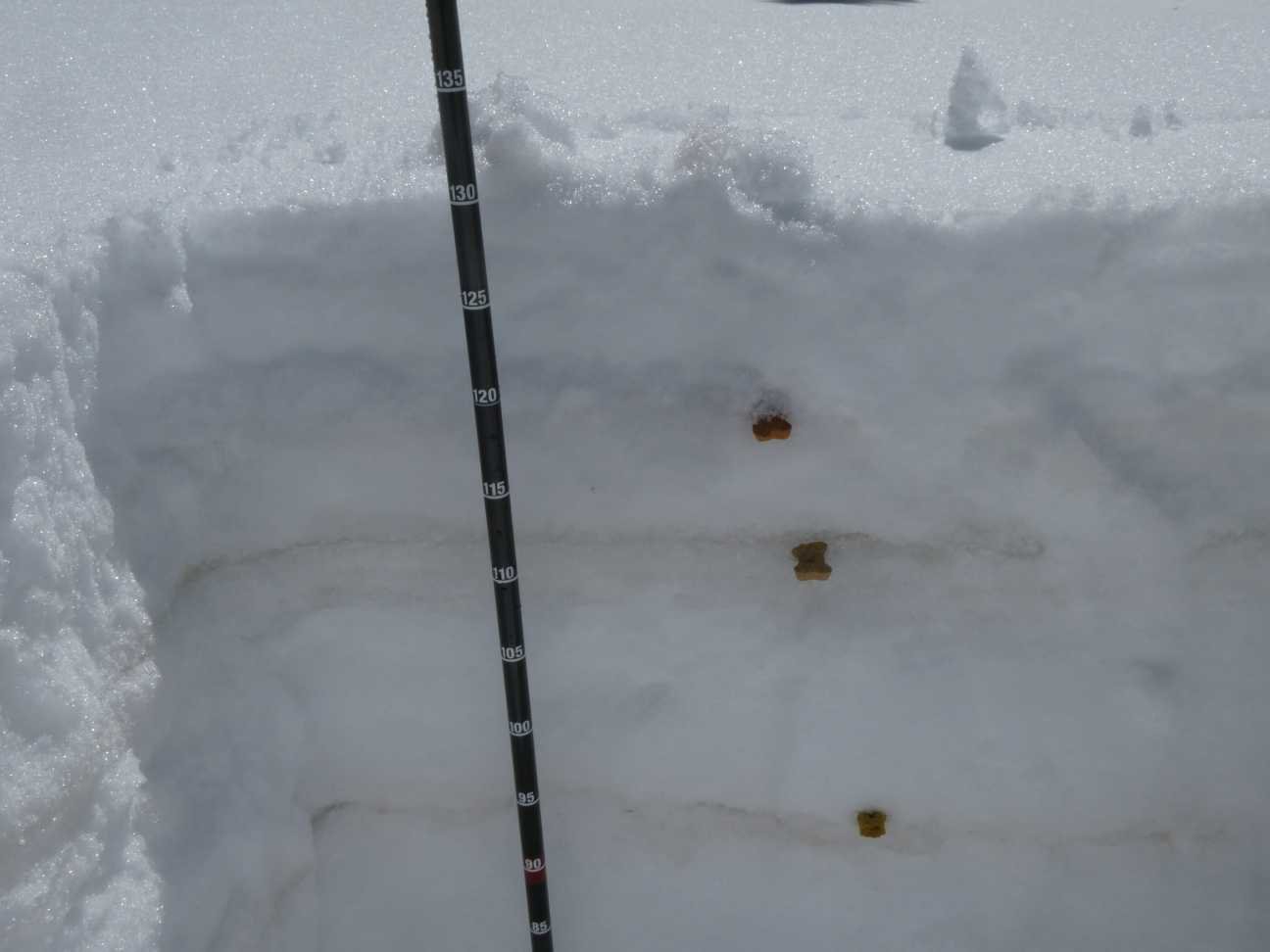
Above: Snow profile of top portion of snowpack near Molas SNOTEL. Total snow depth = 50.8". Dust layer D4 (topmost dog biscuit) = 46.5". D3 = 43.3". D2 (bottom biscuit) = 36.6".
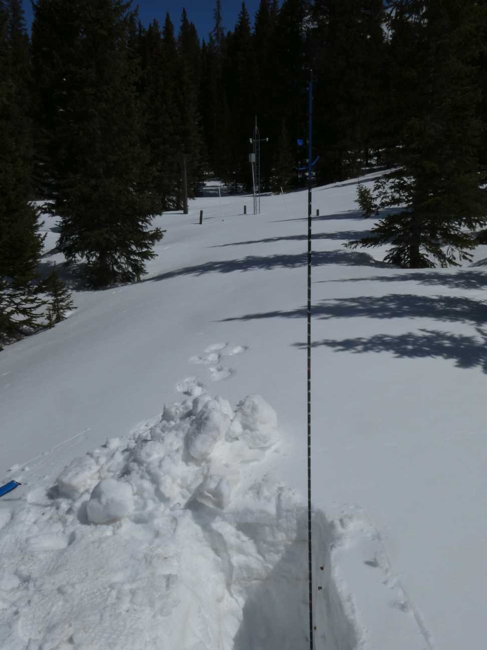
Above: Snow profile with Molas SNOTEL in background.

Wind rose for dust event #4