CODOS Update April 8, 2022: Swampy Obs, Warm-Up Then Wind & Precip
Greetings from Silverton,
A pretty uneventful 7 days. The cooler and windy conditions these last few days, along with a few millimeters of precip on Sunday that provided a bit of an albedo boost, together minimized snowmelt at least higher up in elevation. The wind whipped the snow around a bit and kicked up dust in numerous areas like New Mexico, Texas, eastern Colorado, Kansas, etc.
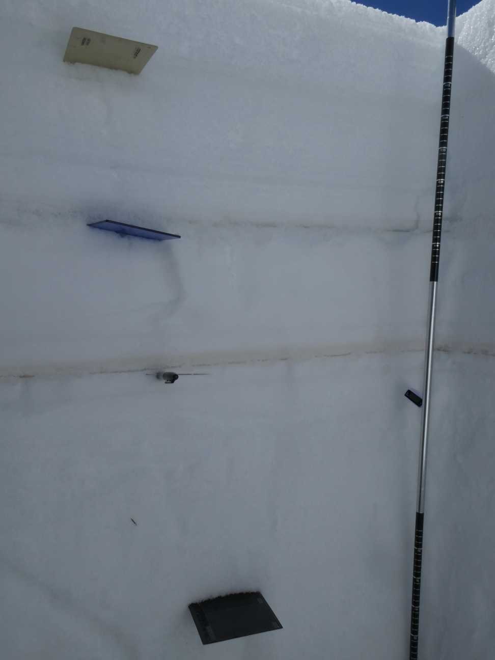
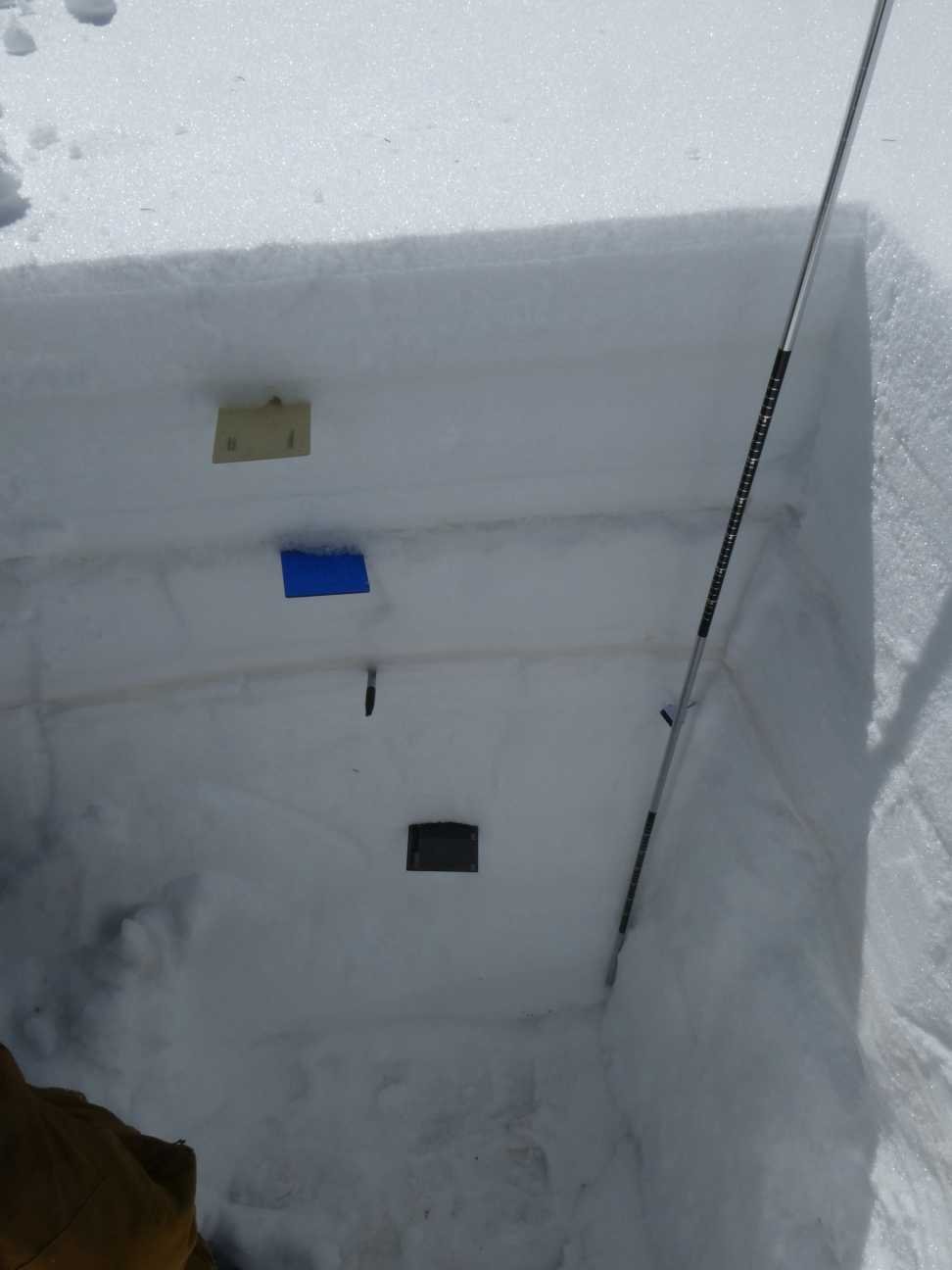
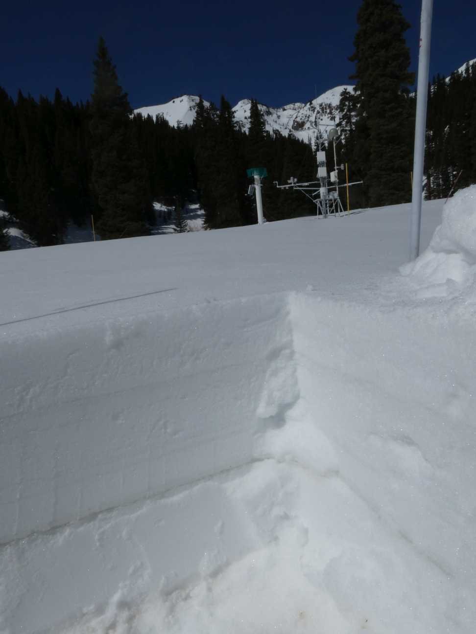
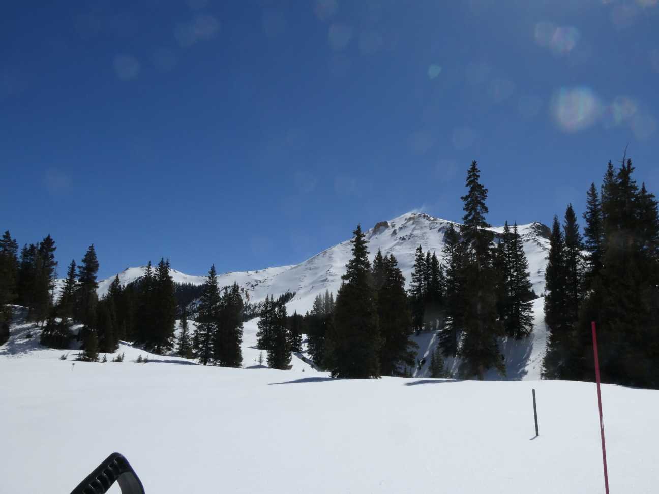
We visited our Swamp Angel study area yesterday (elevation 11,060’). No new dust was observed besides what was reported a week ago. The snowpack still has some cold content being at a consistent -0.2 degrees C starting a foot under the surface. The cold and clear last few nights have put a good freeze on the top portion of snowpack. Please see pictures and dust description below.
Looking north of the San Juan’s, we have not received a wind/dust episode that would have been conducive of dust deposition in the Gunnison or elsewhere to my knowledge, Dust can make it to northern and central Colorado from other source areas like Uinta Basin and high winds are expected in that region this week.
The forecast is calling for very warm conditions heading into the weekend. Then the mountains are looking to have some chances of precip Sunday night (Saturday night up north) thru the week. But be ready for wind as it looks to be significant starting this weekend for a number of days. Expect dust. I been waiting for the other shoe to drop in terms of another bad dust event in the Colorado mountains. With the severe D2 layer close to a third of the way down from the surface another severe event in April will stay at or very near surface, accelerating snowmelt down to D2 where they would combine and accelerate melt even faster. Anyway, based on the weather forecast, expect a clean snow surface (high albedo) to be deposited once the snow falls, hopefully new dust will not be a part of the story.
It is that time of year where we start to show plots of hydroclimate variables to help inform what to expect of dust, albedo, and streamflow during the ablation season.
Take Care,
Jeff Derry
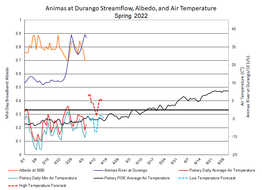
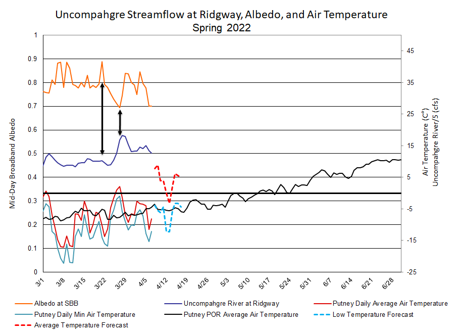
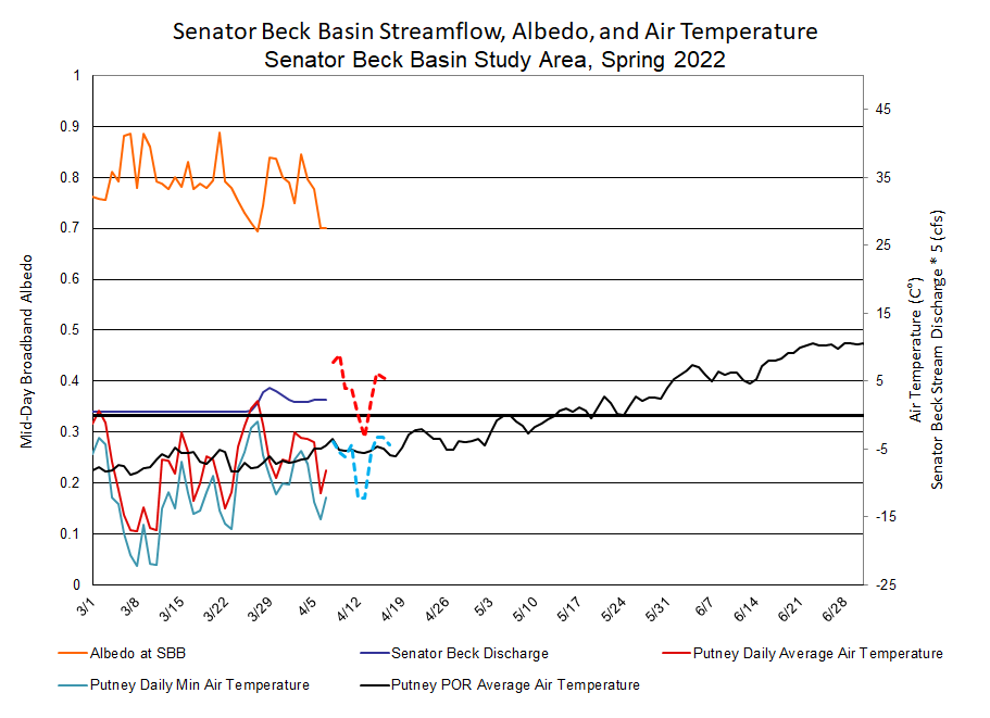
Below: Albedo at Senator Beck Study Basin with streamflow, temperature, and forecasted temperature. This time of year there is about a 2-4ish day lag from when albedo makes a move and when we see the response in streamflow. As spring continues the response time will be more efficient, usually 1 day. The air temperature information helps determine if, and to what degree, a nighttime freeze occurred. Once the snowpack is ripe, a warm evening without a freeze will leave the snow ready to continue melting in the morning, leaving the spigot on as it were.
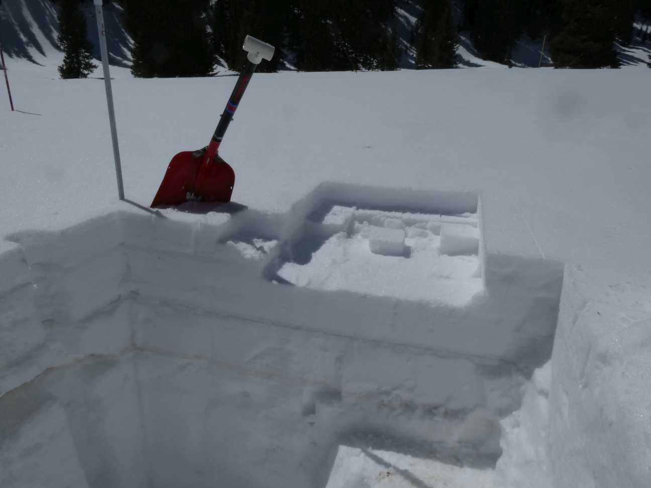
Below: Dust #4 (D4), top card, lies under 1.7” of SWE. D3 under 4.4”. D2, the severe layer, under 8.1” SWE. D1 is marked by bottom card. Total SWE of the snowpack is 22.7”. We did not observe new dust from the high winds these last few days, only redistributed pine cones and similar material.