CODOS Update March 12, 2026: Statewide observations
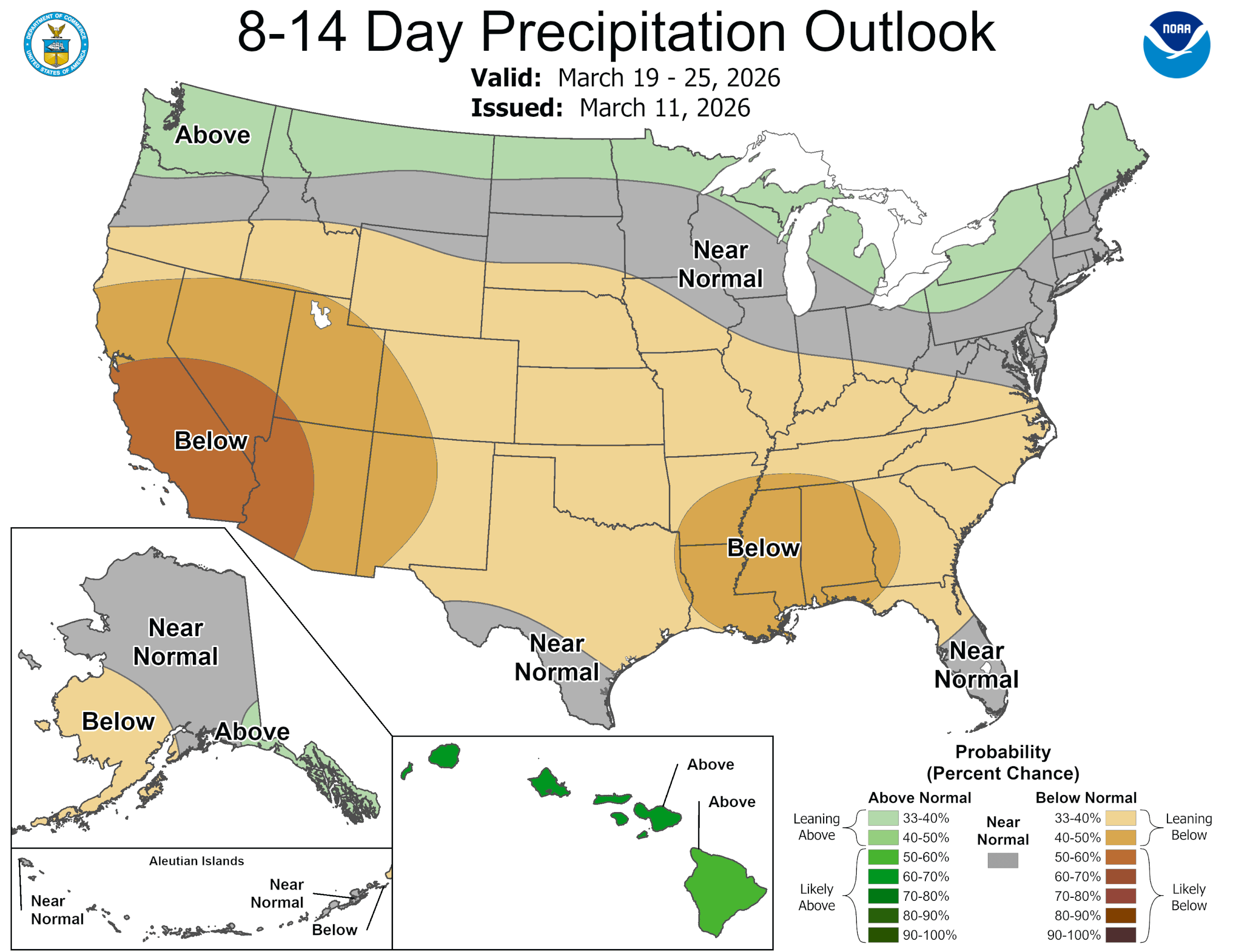
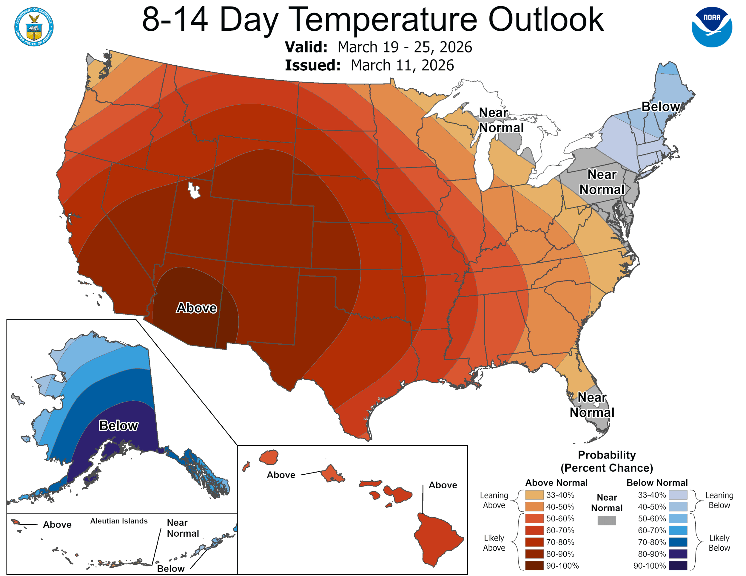
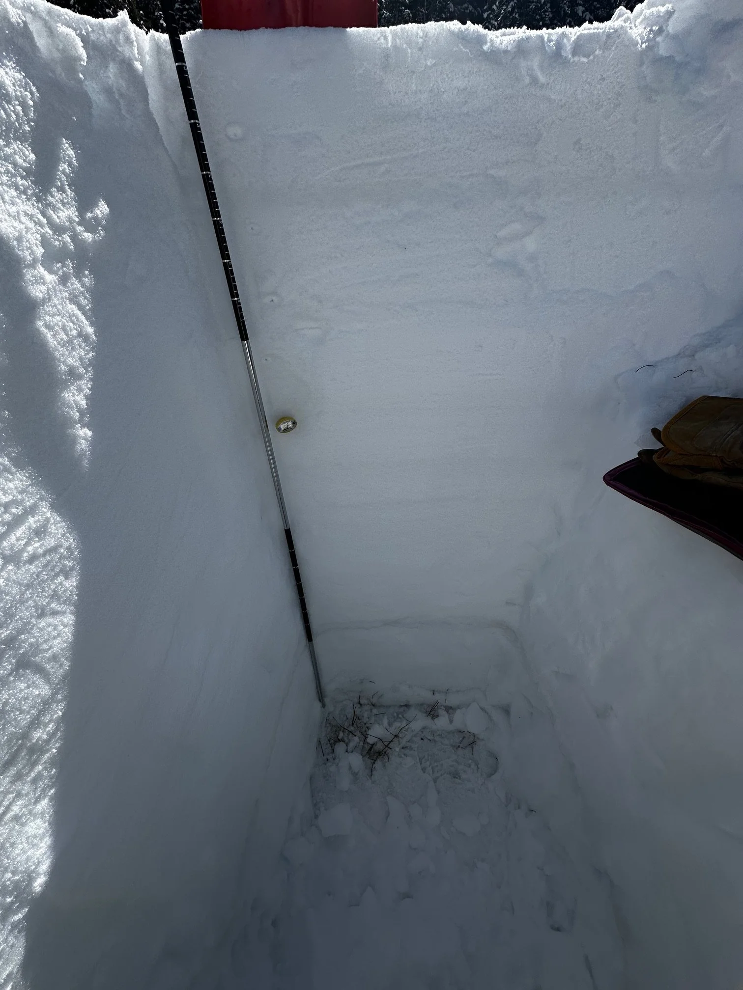
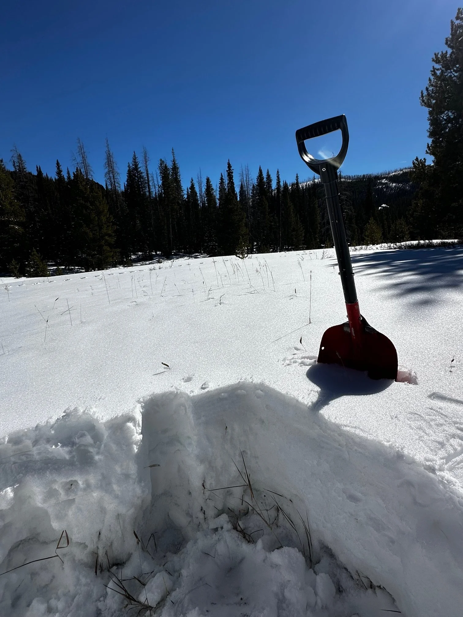
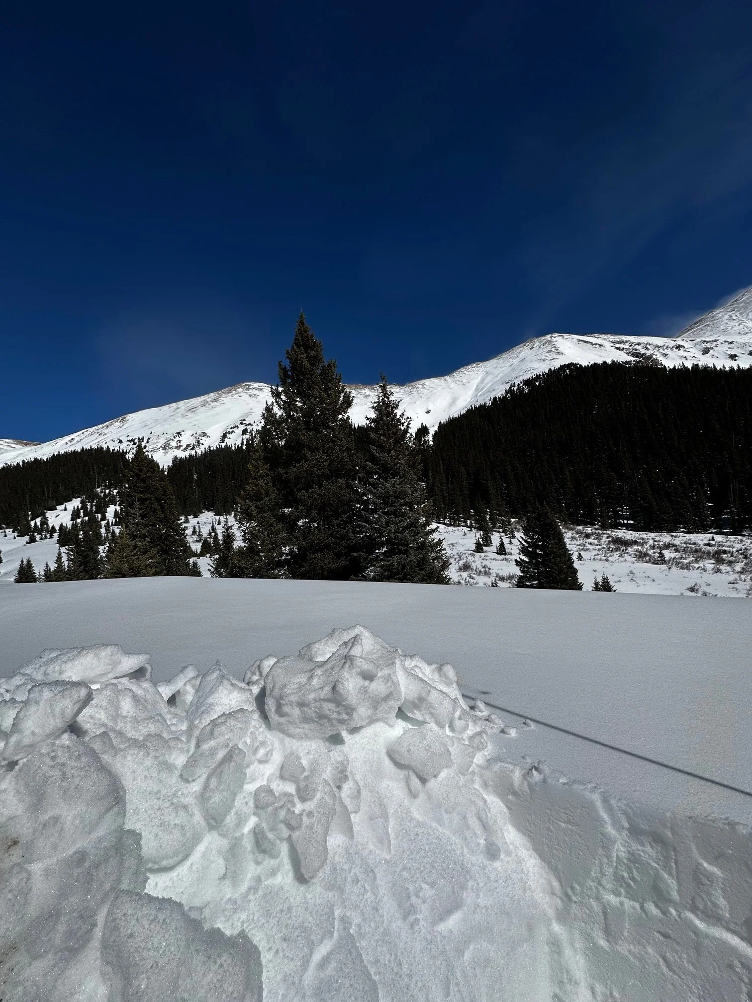
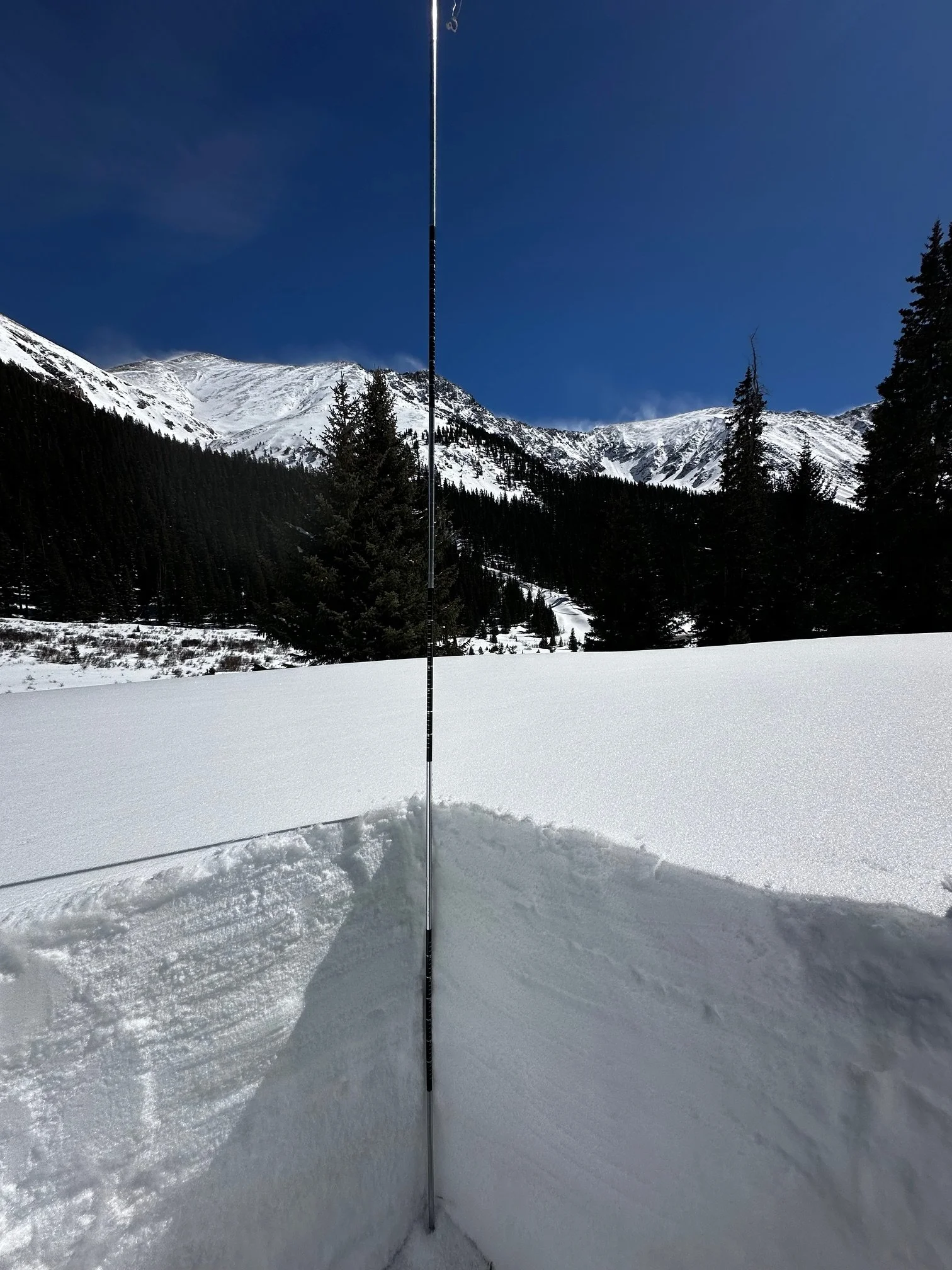
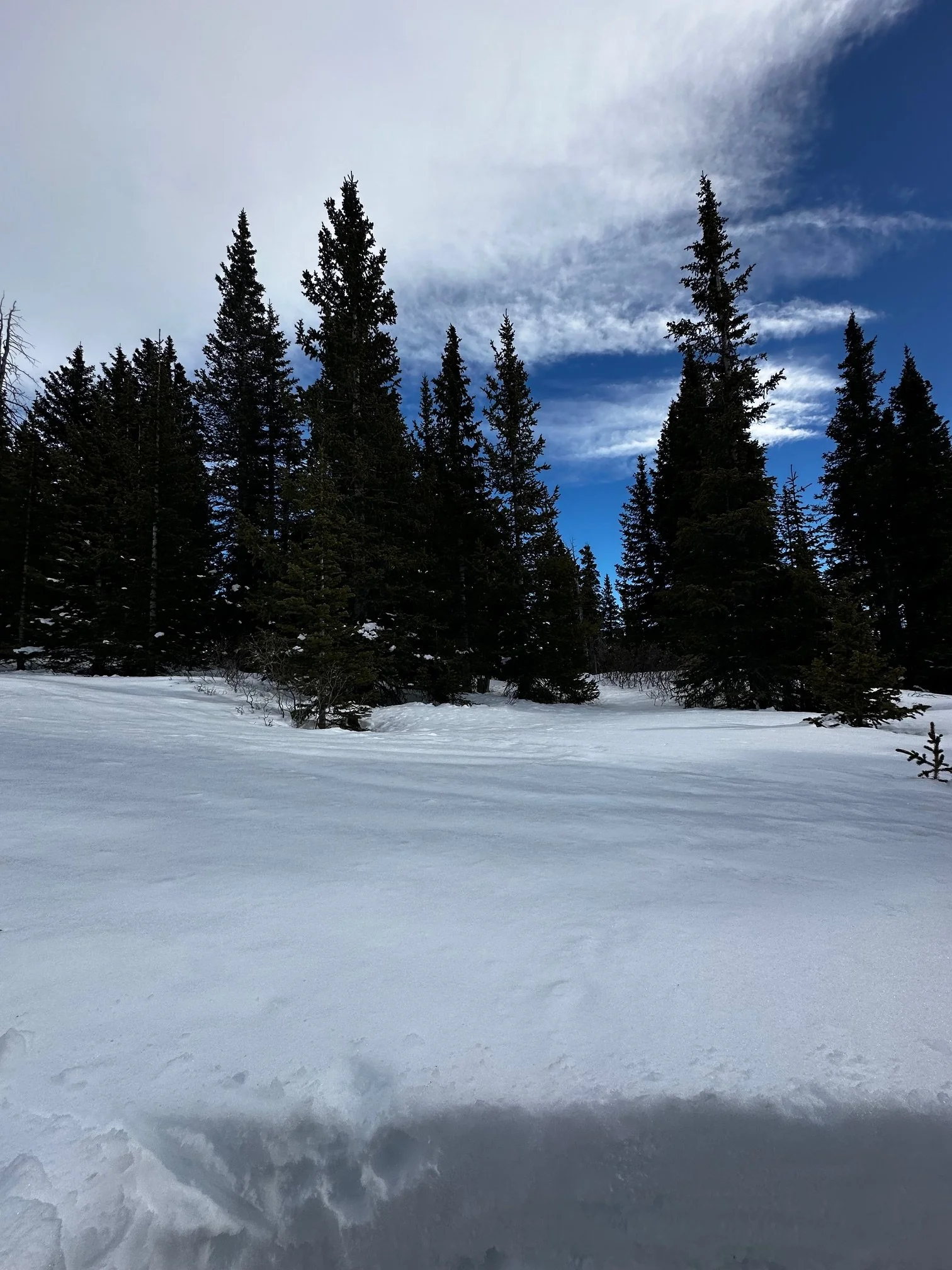
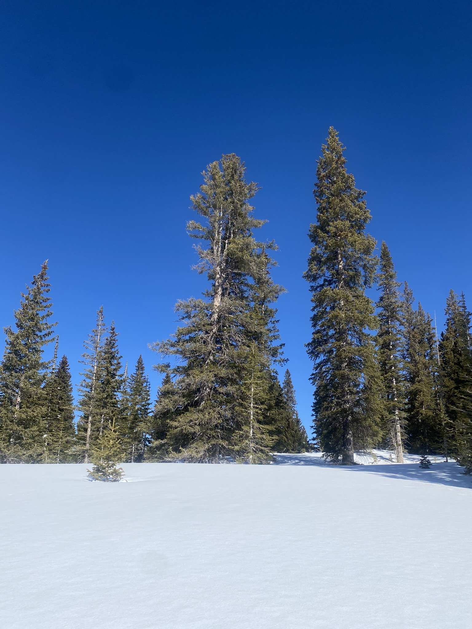
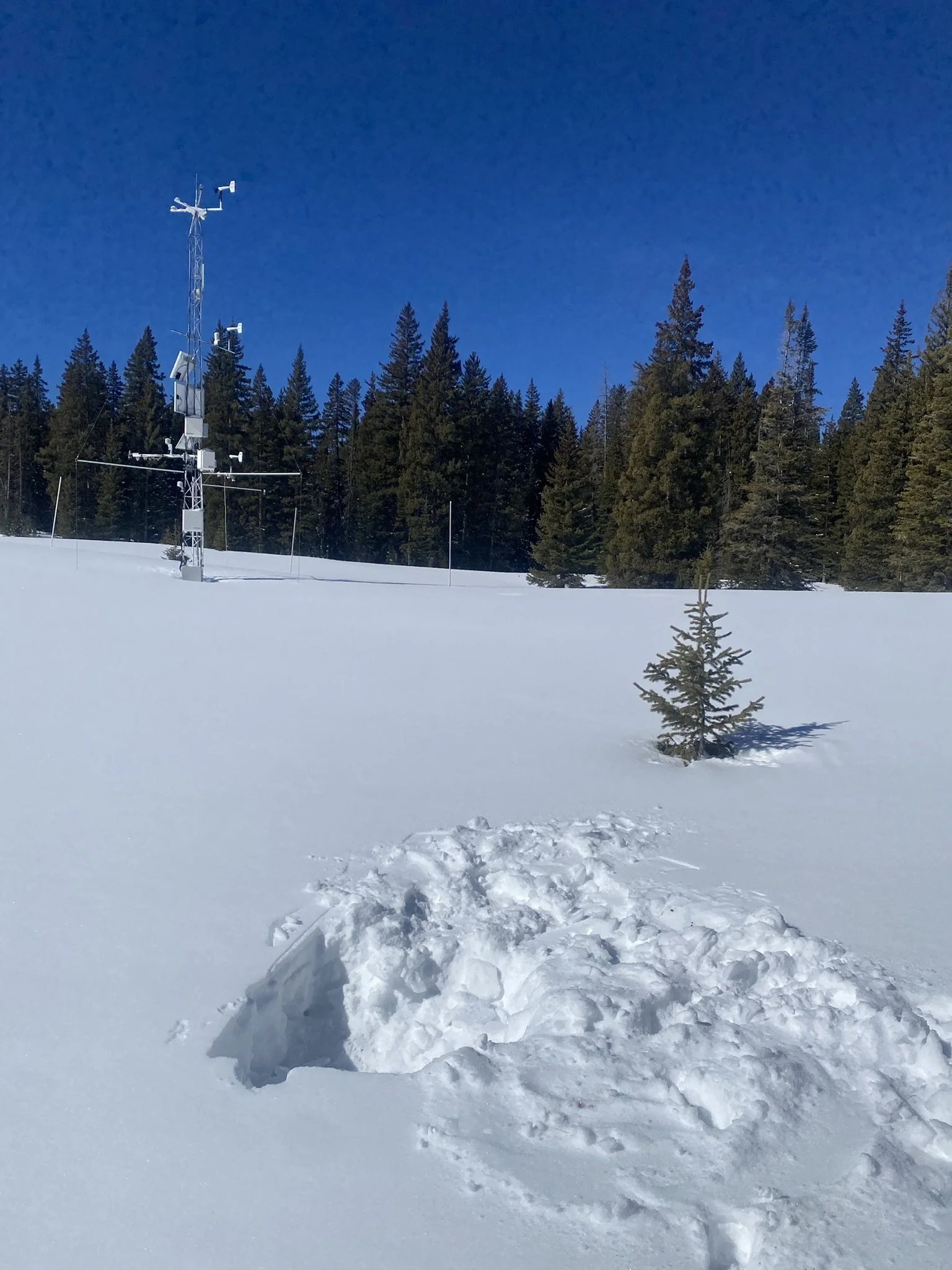
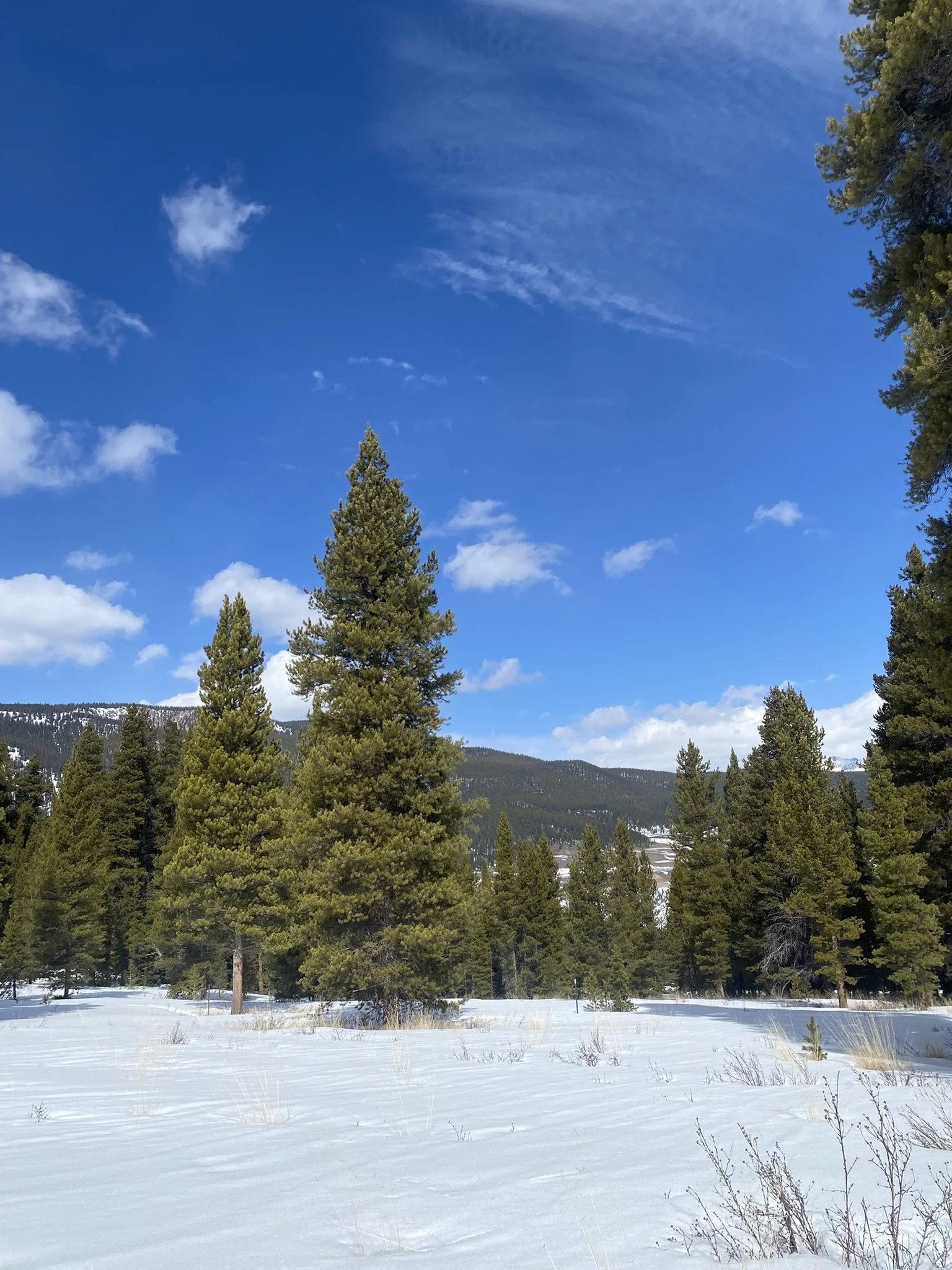
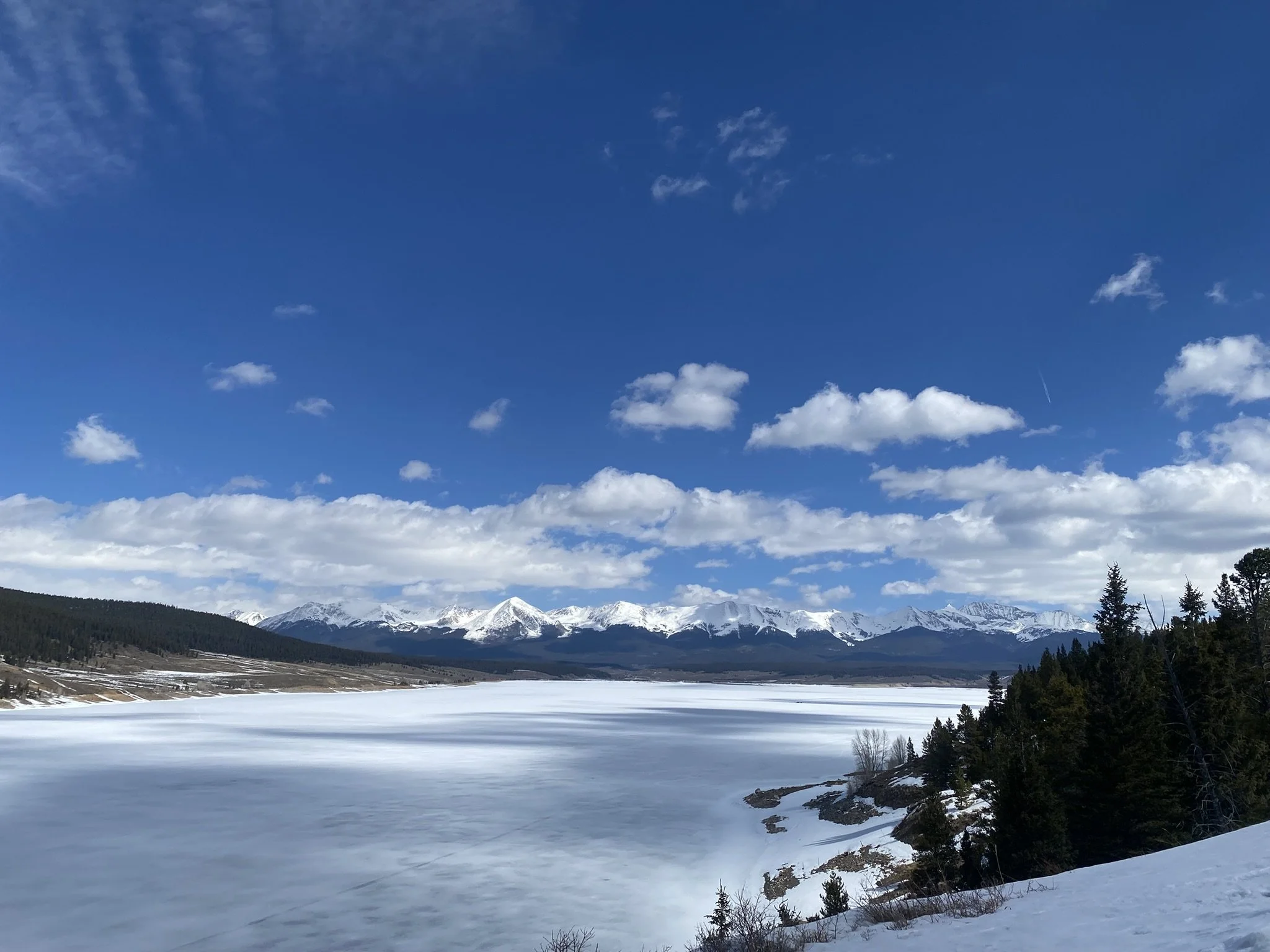
On March 8/9, driving the Northern and Central mountains, about Hoosier Pass up to Willow Creek and over to Rabbit Ears, was a little deceptive as it appeared there to be more mountain snow than was actually there. This region was favored in receiving a snow refresh on Friday, March 6, a couple days before we started the March CODOS tour, it wasn’t a huge amount, Berthoud appeared to benefit the most at a little over 1” SWE. But enough that even North Park showed good snow coverage and a clean, reflective snow surface. Arriving at our sample sites and digging the snow profiles revealed the grim truth, the snowpack seriously struggling. With all the exposed vegetation at a couple of our sites made it look almost unrecognizable, with small trees and grass being exposed where usually we just see snow. We all know this mainly through looking at SNOTEL station data, but our snow profiles offer another data reference. And right around the corner, in only about 20 days, April 1 snowcourse observations will be posted - an informative data record that goes waaay back. Looking at the weather forecast we may not see any precipitation between now and then (a bit cynical but that’s what it feels like, check out the NWS plots below).
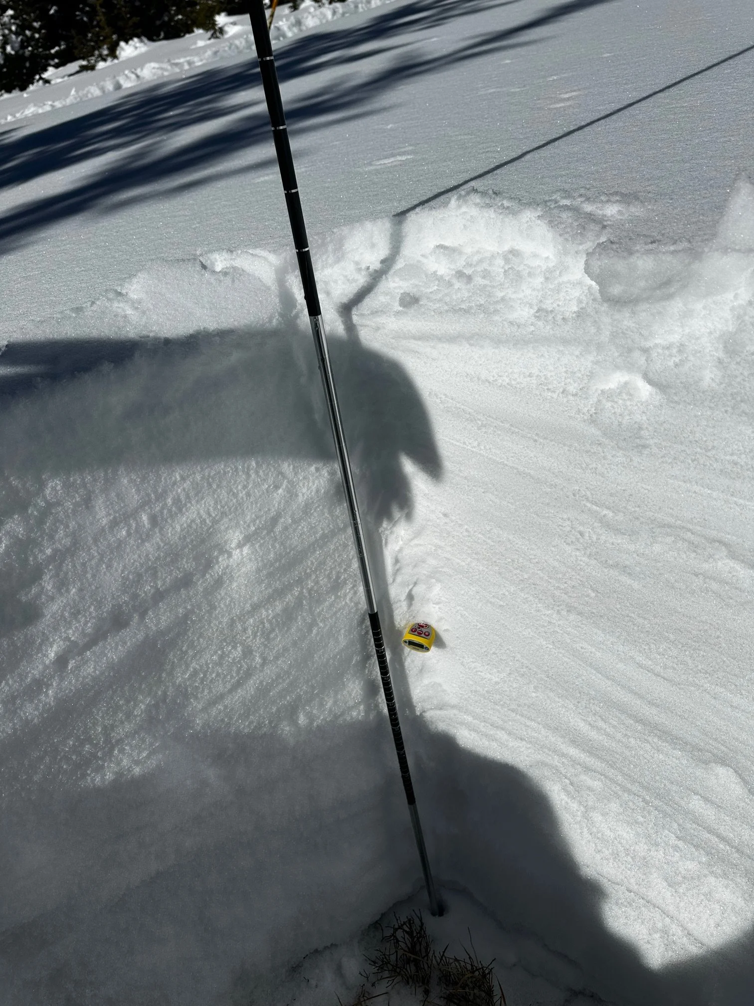
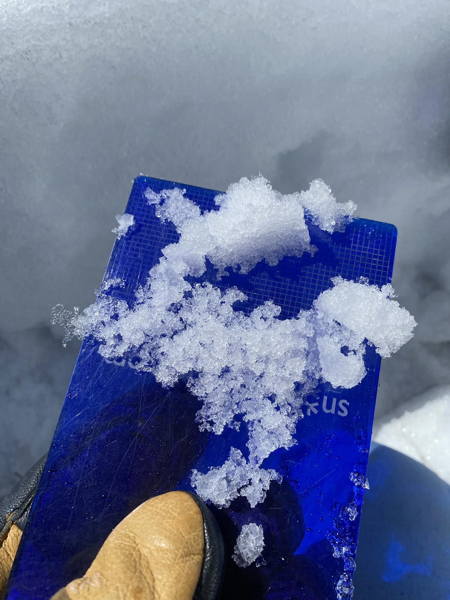
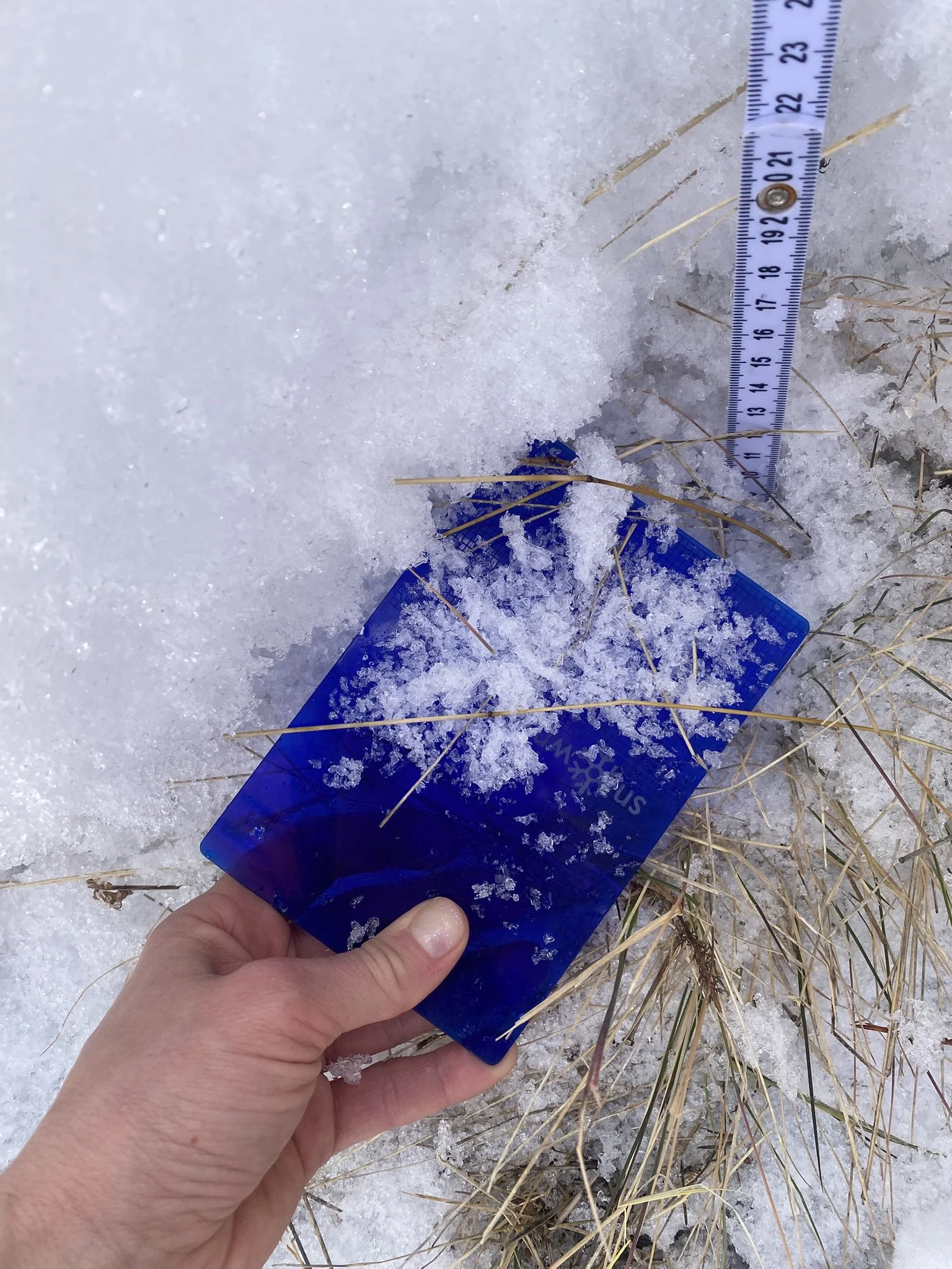
Dust-on-Snow: I guess the good news is we did not observe dust in the snowpack at any of our Colorado Dust-on-Snow sample sites or elsewhere in our travels. It is uncommon to go this deep into winter without seeing dust. The reason this year is unique is because we have not received as many storms (~11 compared to the average of ~18) and only a handful have come out of the Southwest, the biggest dust producing region in the country. And of those storms, a number were brought in with low wind speeds. Another factor for one or two storms is the Southwest had a few periods where ample precipitation likely inhibited dust mobilization.
But March/April/May is our biggest dust-on-snow producing months. So we will get dust. In this record low snowpack year - and hot!, see plot below - hopefully there will still be snow on the ground for the dust to fall on. I would gladly take all kinds of dust if it meant some meaningful snow to go with it.
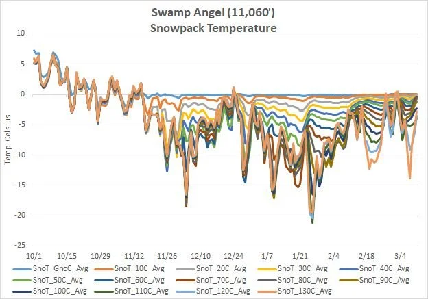
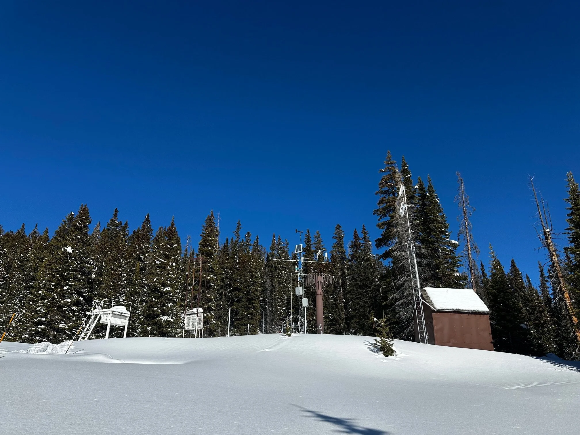
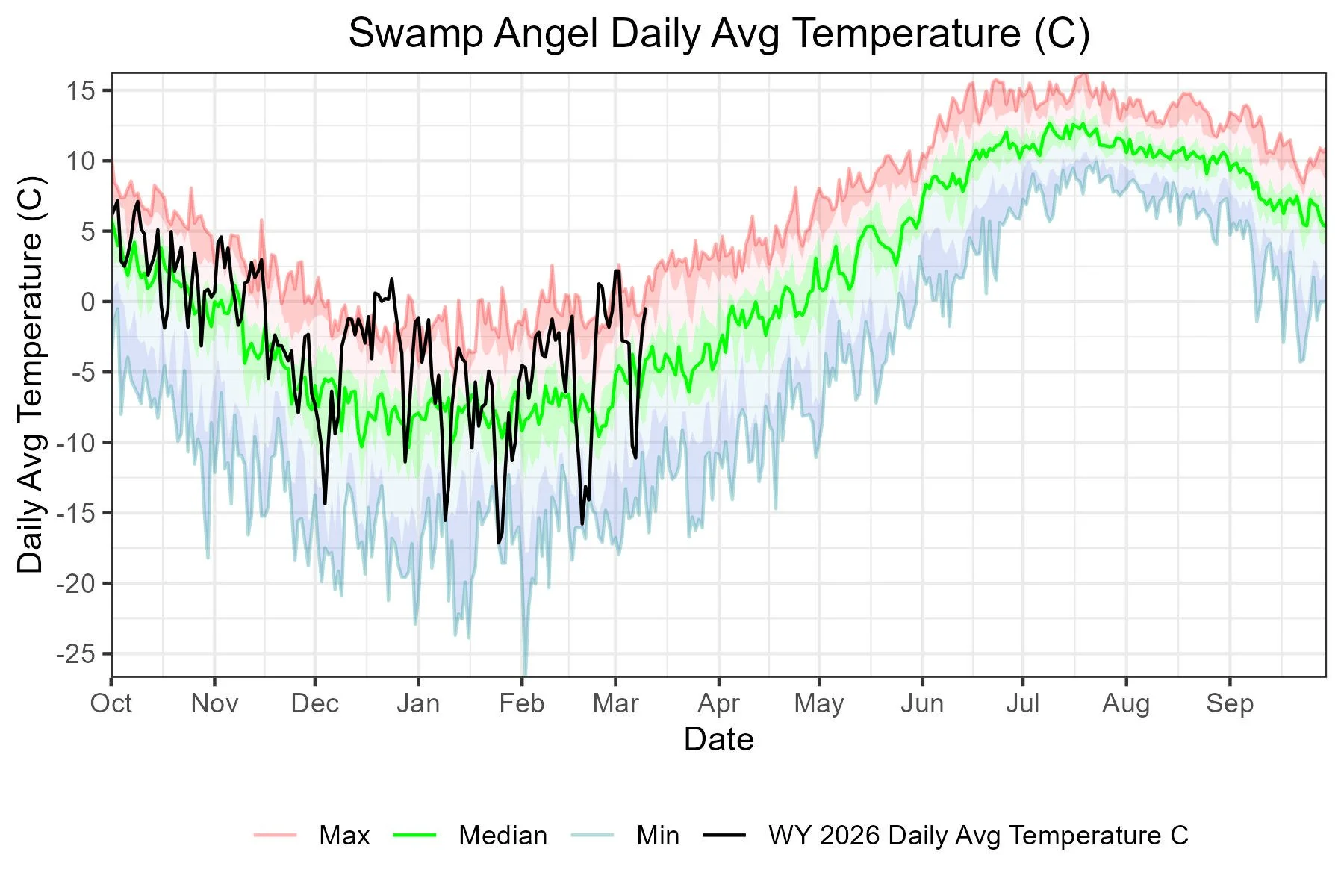
Below: Snowpack temperature profile at Swamp Angel and Senator Beck Station. The storms February 17 and March 8 cooled the top foot or so for a short spell. Currently at Swampy all but the top 6” or so is -5 degrees Celsius or warmer of the total 3.6’ total depth. At Senator Beck the bottom 16” is below -5 degrees of the 2.5’ total depth.

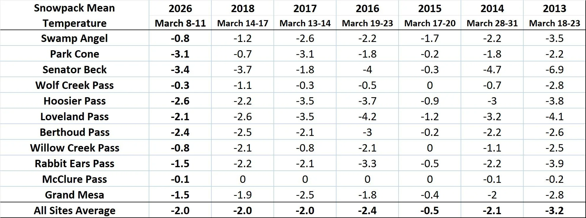
Below: With the snow falling under warm conditions and it being warmer overall, it would be expected to see the influence on the snowpack. The below table compares our March CODOS snowpack temperatures with a few different years. The snowpack is warmer than usual for this time of year. As an example, the average snowpack temperature is the same as WY2018, but the observations were made around a week earlier in WY2026.
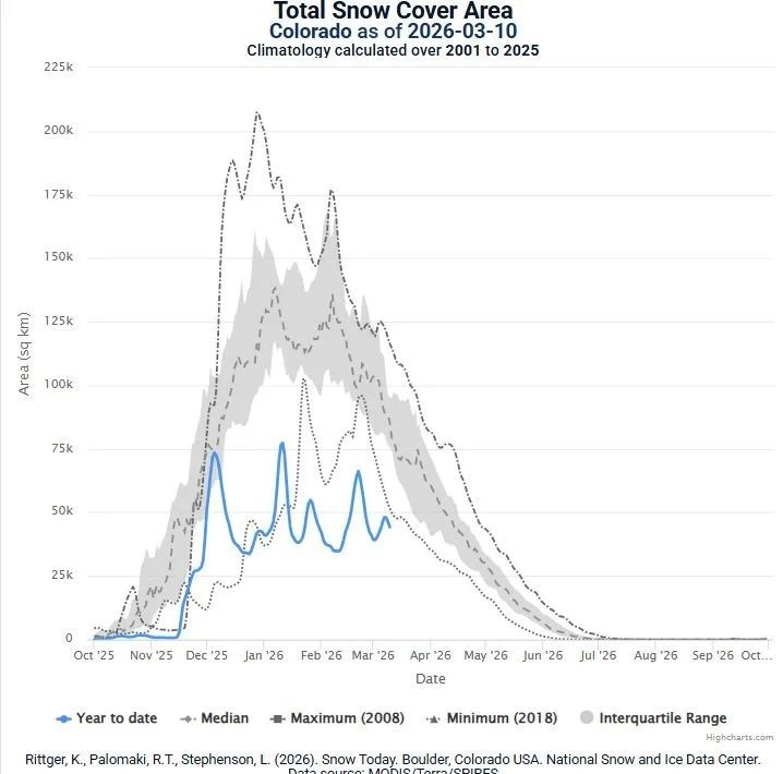
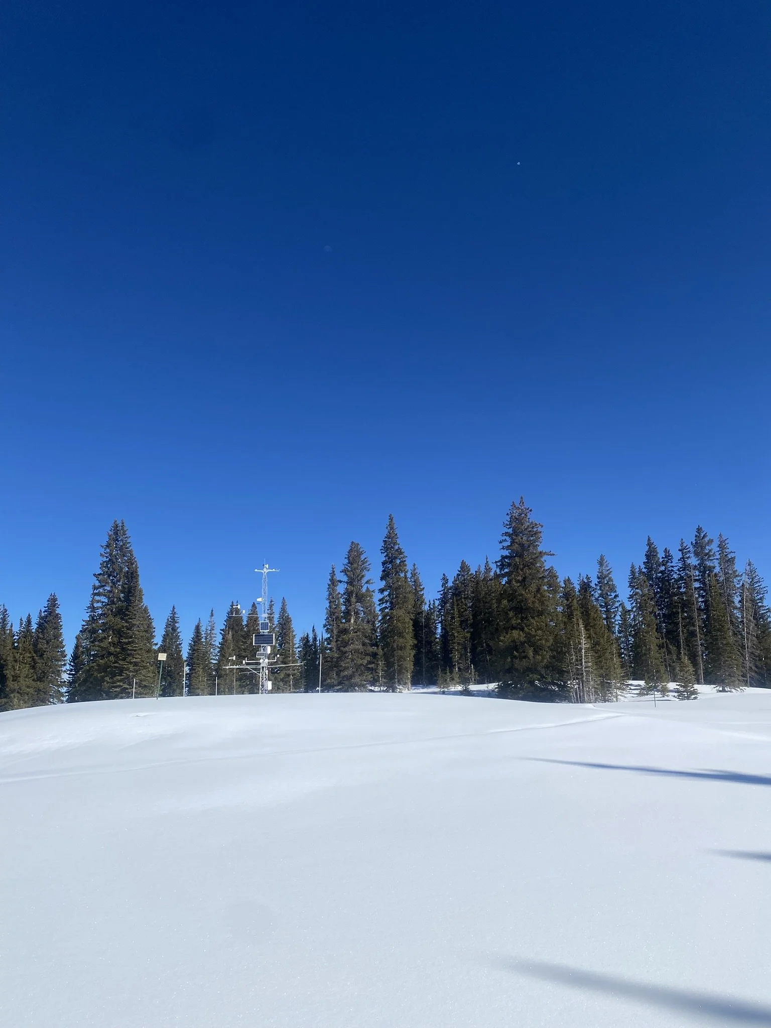
Below: Snow cover in Colorado is about 37 percent of average. The lowest in a 26 year data record.
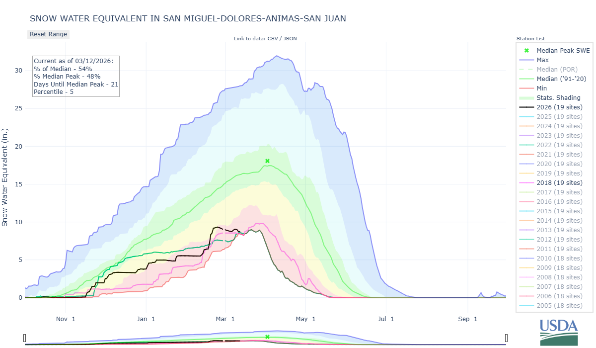
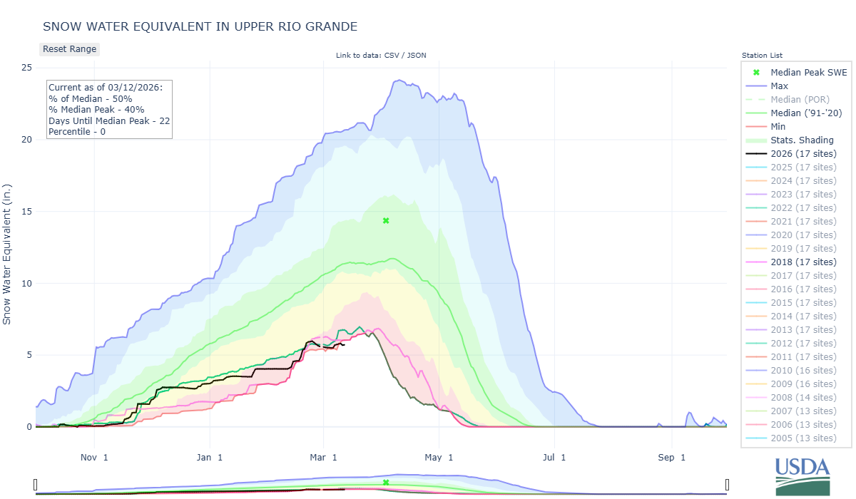
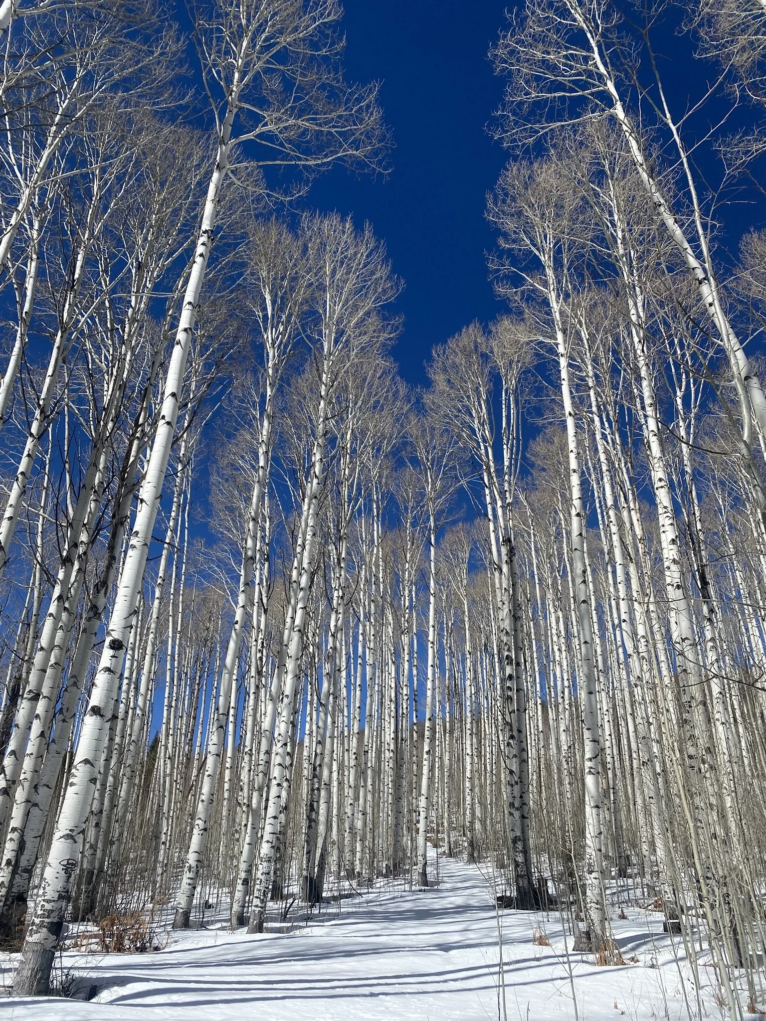
Some SNOTEL basin plots show a good comparison with WY2018, another very dry year particularity for the Southern Basins. This may be the case for this but a big difference that makes WY2026 more severe is snow covered area is much less due to snow falling as rain and also it has been consistently much warmer, possibly the warmest on record. This double whammy of warm/dry of course means no snow that would typically see at lower elevations because the precipitation fell as rain initially or melted after falling as snow. And it doesn’t end at lower elevations as there is a lot of bare ground on southerly aspects and elsewhere up higher.
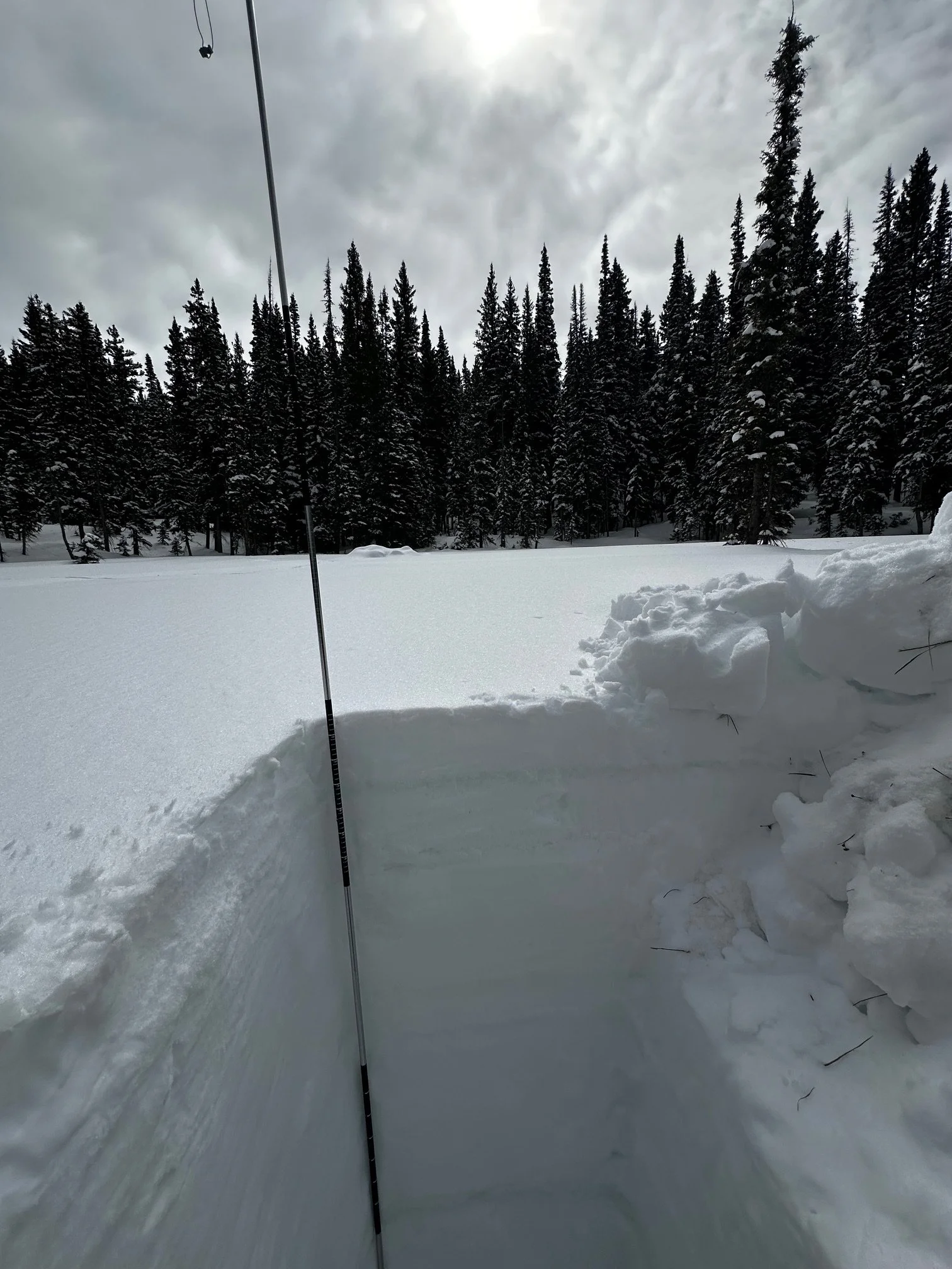
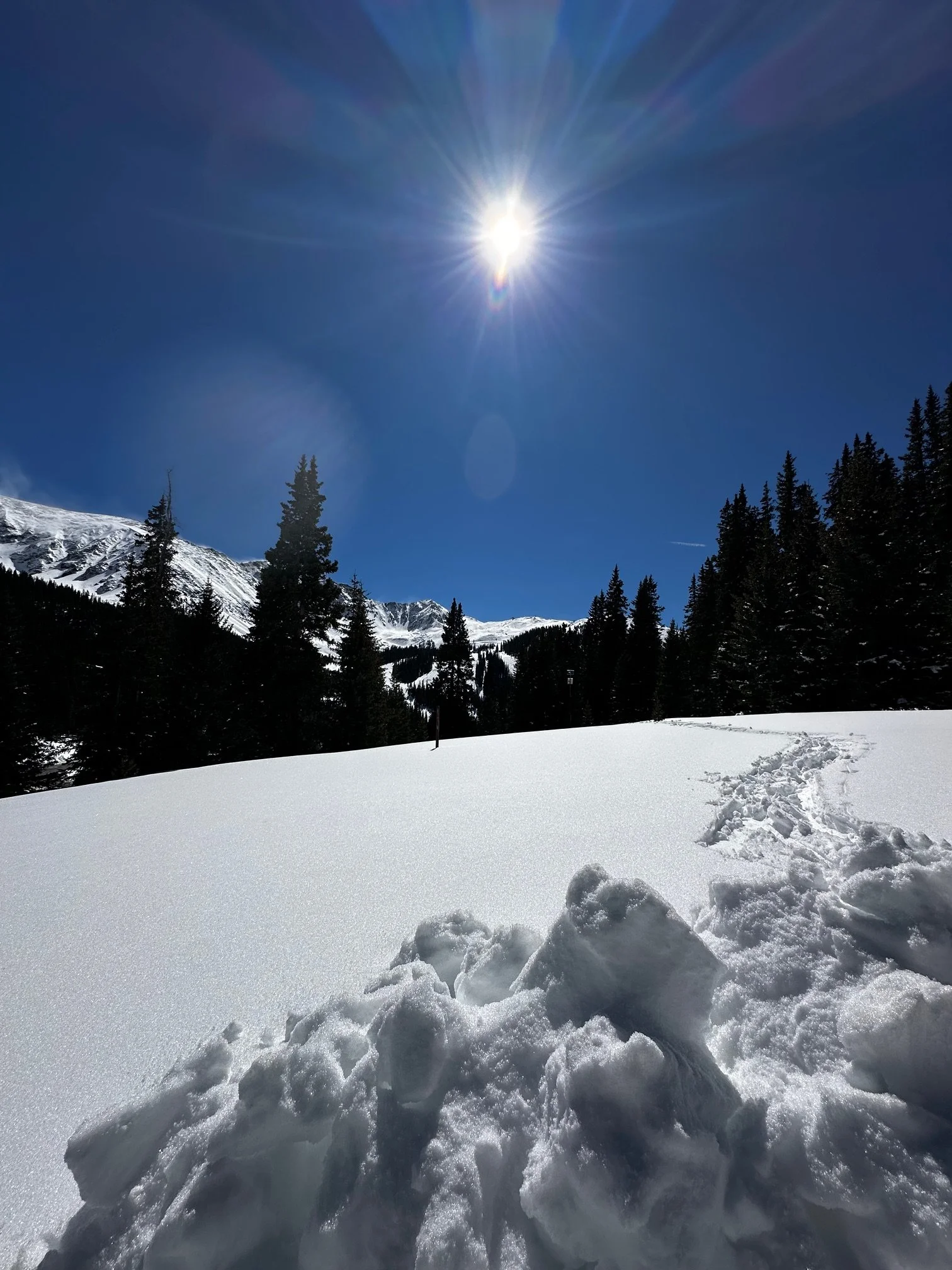
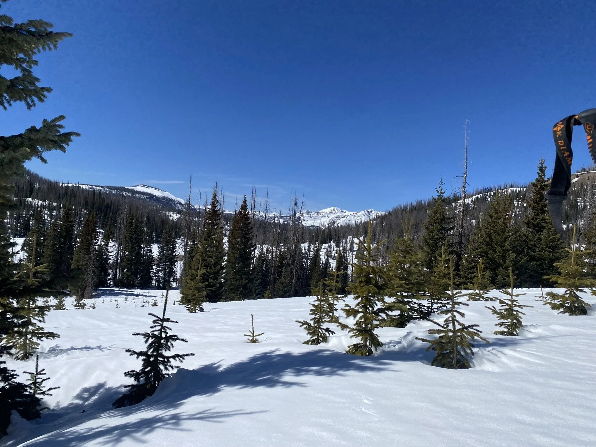
Rabbit Ears Pass: MARCH 8
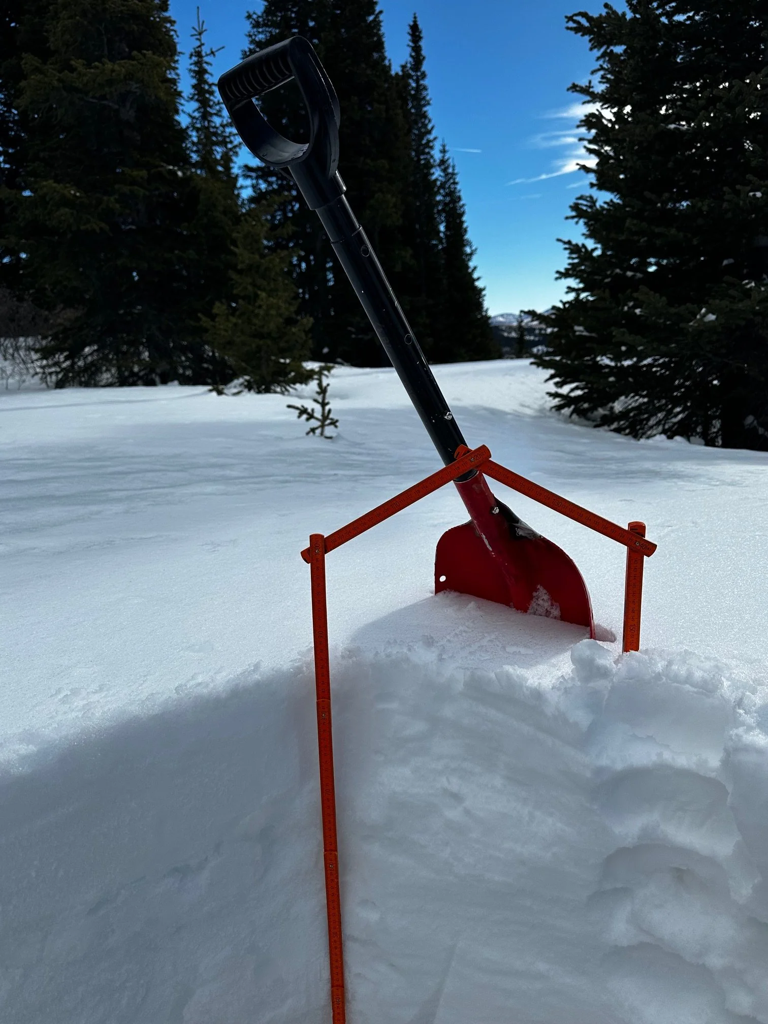
The Rabbit Ears Pass region had received a few inches from the March 6 snowfall but the snow surface was still clean and highly reflective. Pit depth was 1.48 m (4.8’) which is pretty shallow for Rabbit Ears. SWE was 442 mm (17.4”). Nearby Rabbit Ears SNOTEL was reporting 12.9” SWE and 43” depth.

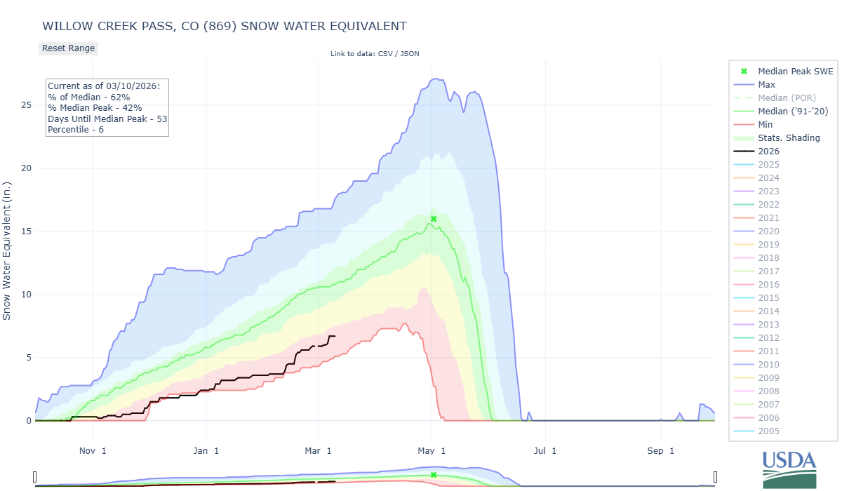
Willow Creek Pass: March 8
Willow Creek typically doesn’t have a deep snowpack where we do our sampling, near Willow Creek SNOTEL, but it was drastically thin when visited on 8th. Grass and small shrubs were visible through the snow. At our CODOS site, we had a depth of 54 cm (1.8’) and SWE of 125 mm (4.9”). The Willow Creek SNOTEL was reporting 30” depth and 6.7” SWE.

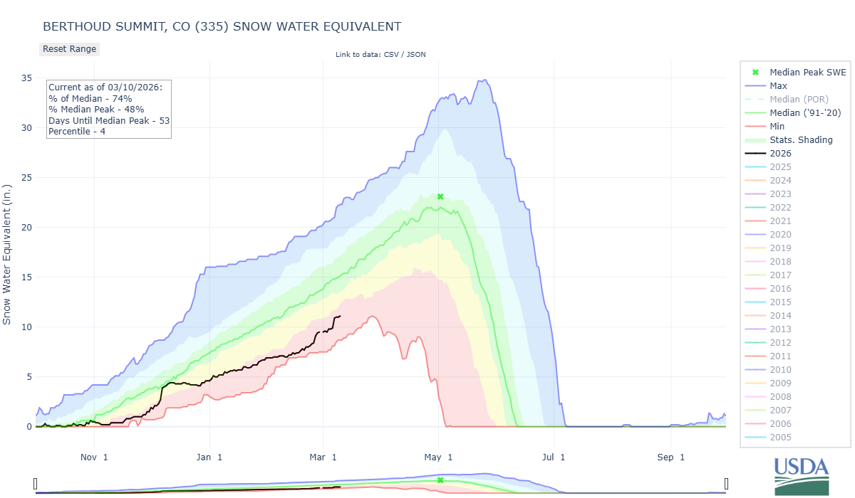
Berthoud Pass: MARCH 9
At our CODOS site, we had a depth of 1.19 m (3.9’) and SWE of 290 mm (11.4”). The Berthoud Summit SNOTEL was reporting 44” depth and 11” SWE. The station recorded 1” of new SWE (and 1’ new accumulation) from the March 6 storm.
Loveland pass: MARCH 9
Our CODOS site had a depth of 1.04 m (3.4’) and SWE of 258 mm (10.2”). The Grizzly SNOTEL was reporting 40” (3.3’) depth and 9.4” SWE. The area received just shy of 1” SWE from the event on the 6th.


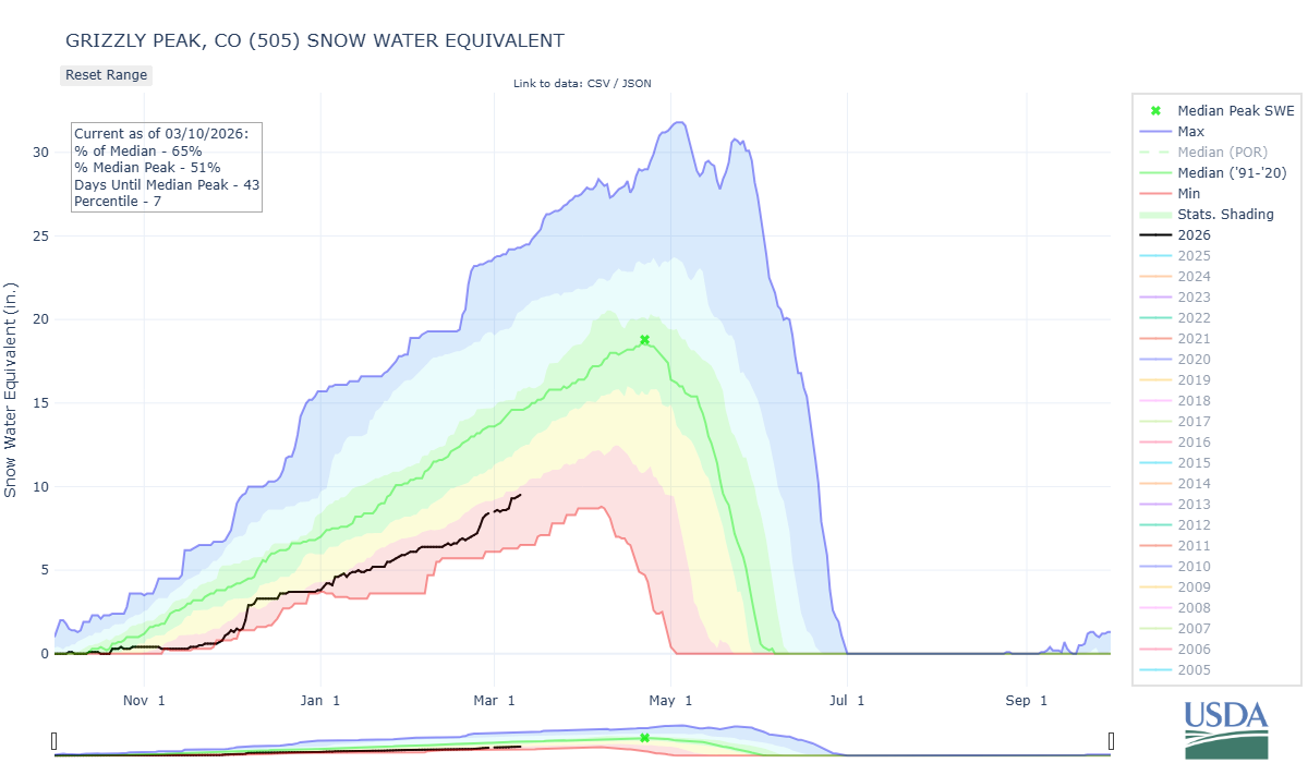
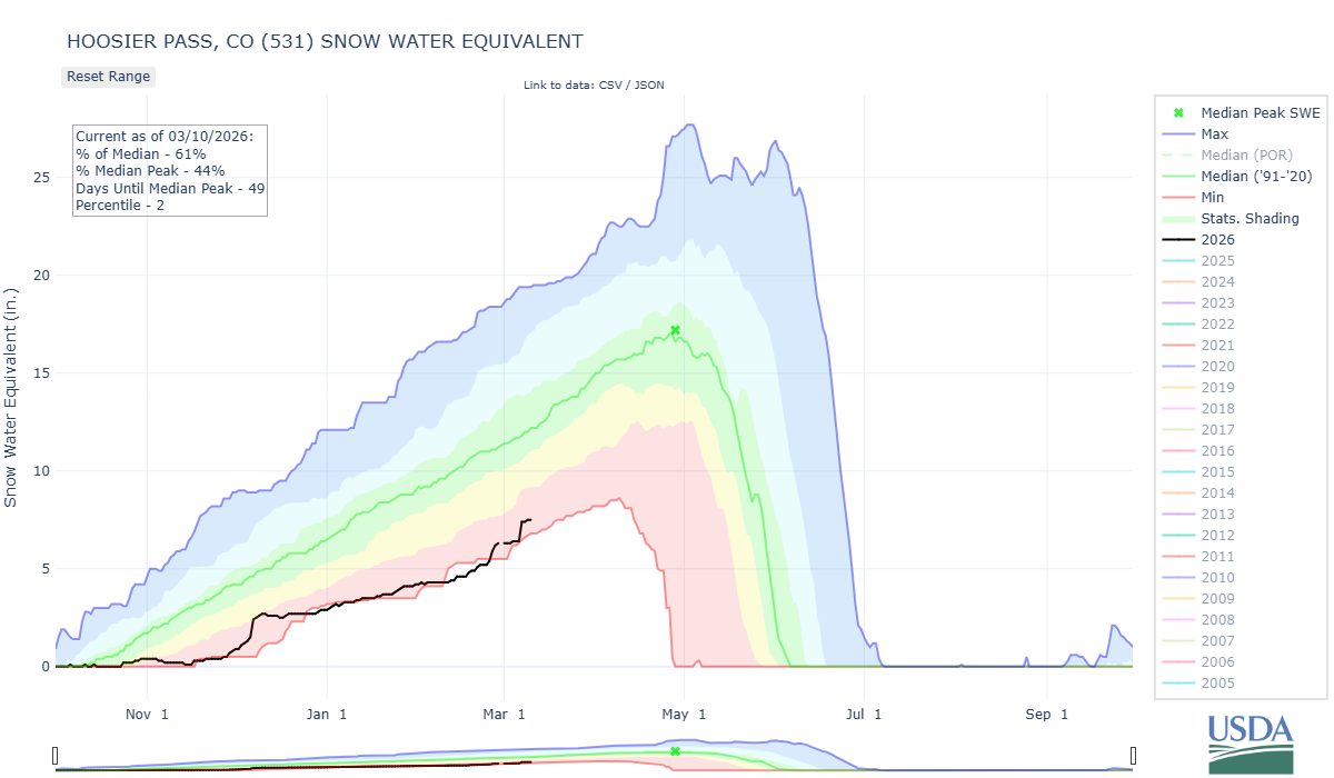
Hoosier Pass: MARCH 9
At our CODOS site, we had a depth of 86 cm (2.8’) and SWE of 172 mm (6.8”). Hoosier SNOTEL reported 7.5” SWE as 33” depth.

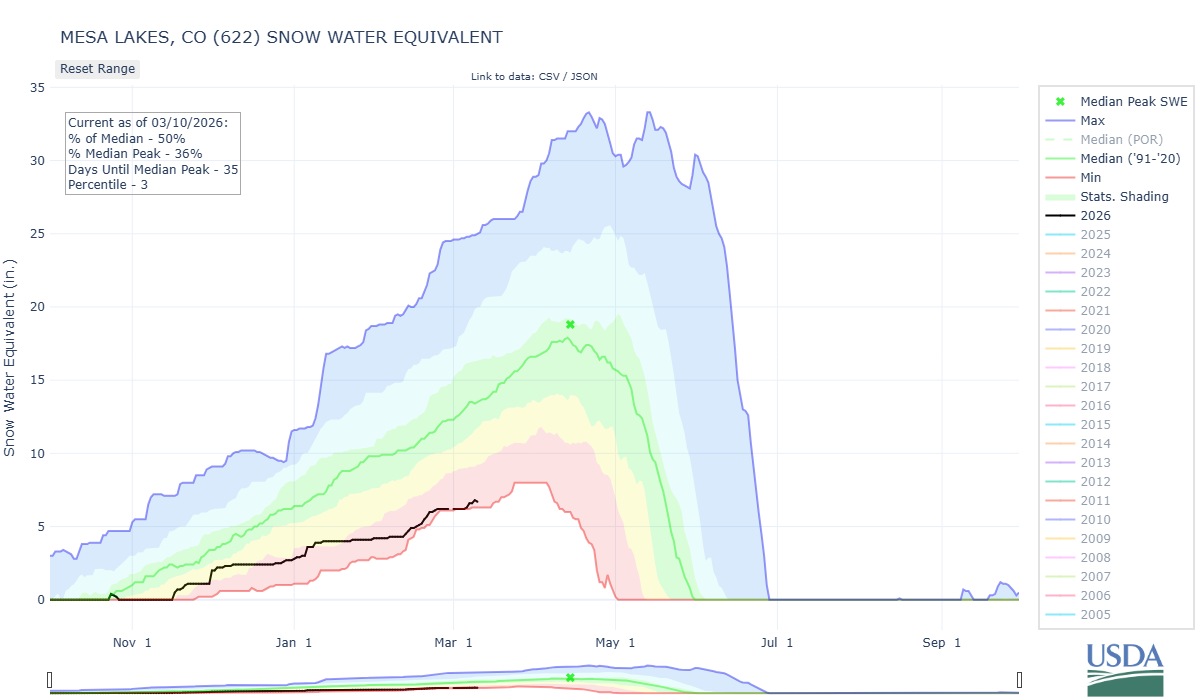
GRAND MESA: MARCH 9
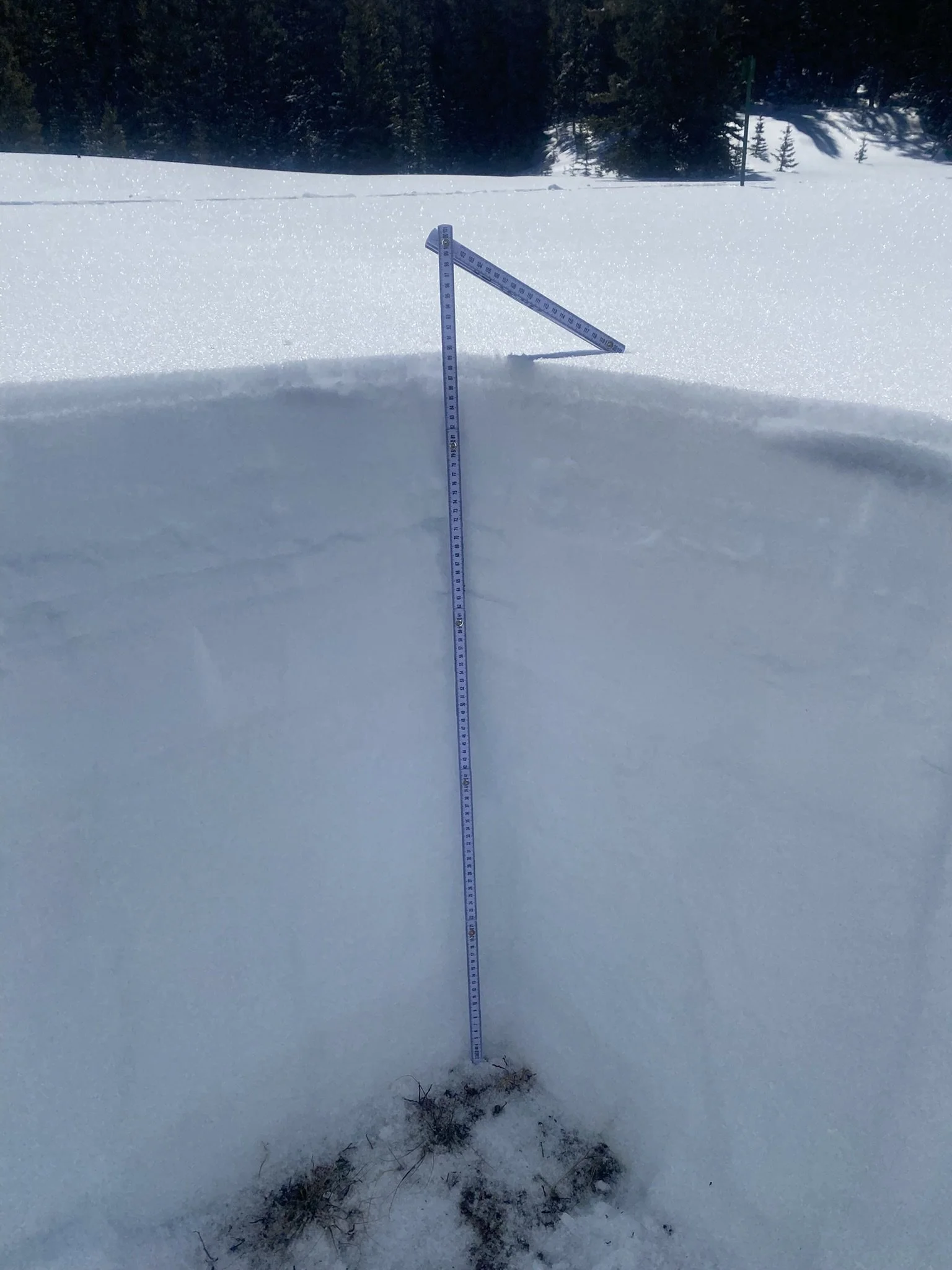
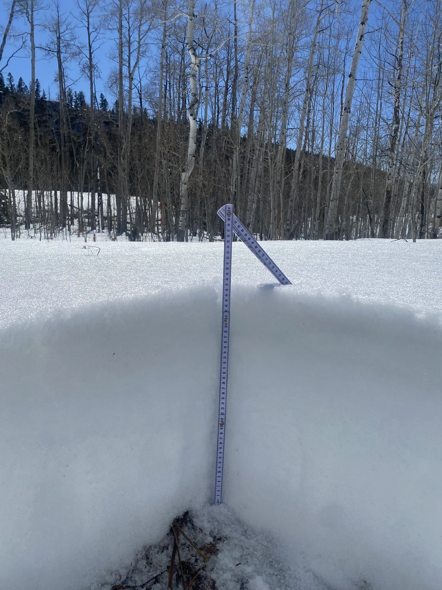
Driving up the south side of the Mesa, it wasn’t until ~8,300’ that snow patches began to appear. With Mesa Lakes SNOTEL reporting 25” depth and 6.8” SWE, 50% of the median, we weren’t expecting to be overwhelmed by digging. At our CODOS site, we had a depth of 89 cm (35”) and SWE of 238 mm (9.4”), a bit higher than the nearby SNOTEL. There was a surface melt-freeze crust and many ice layers. No dust was observed.

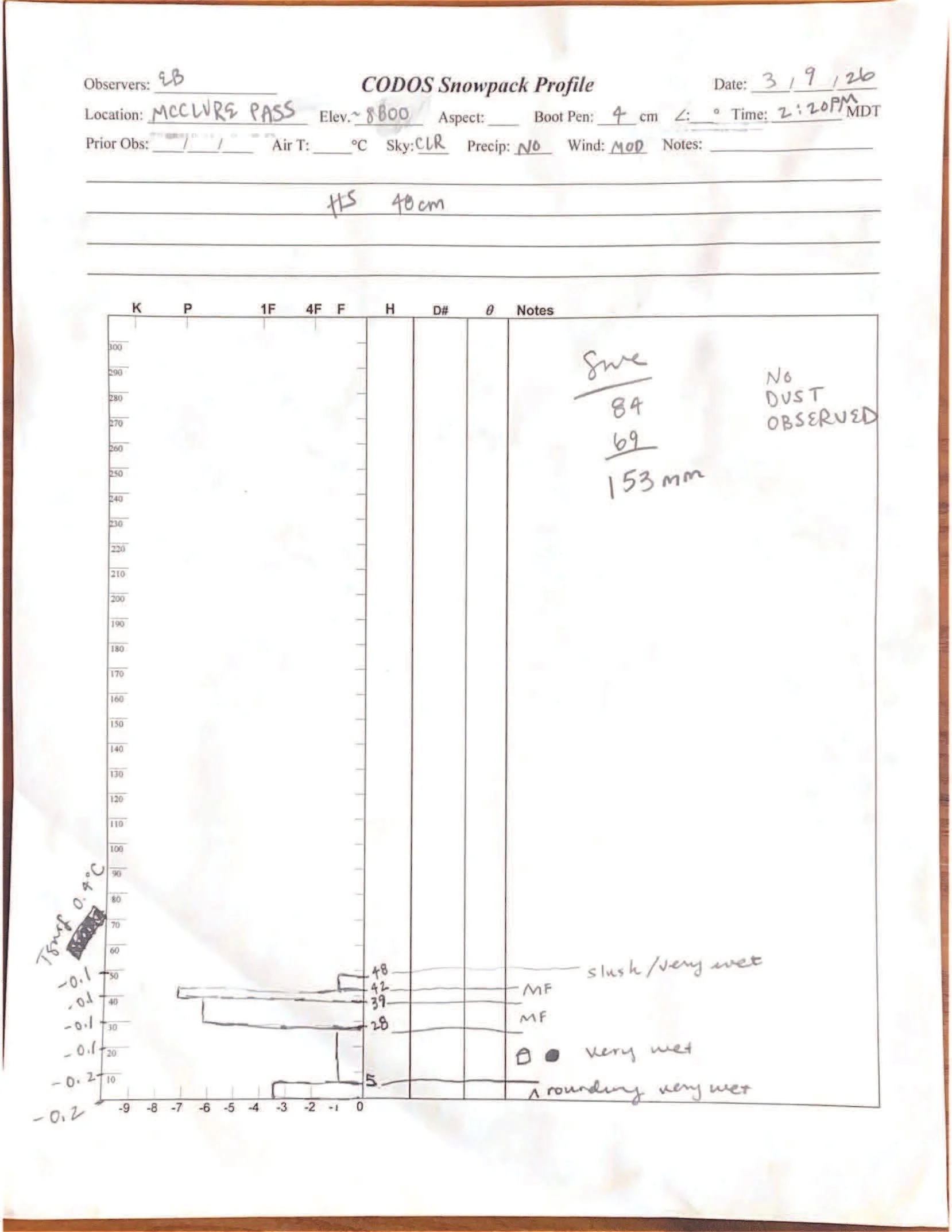
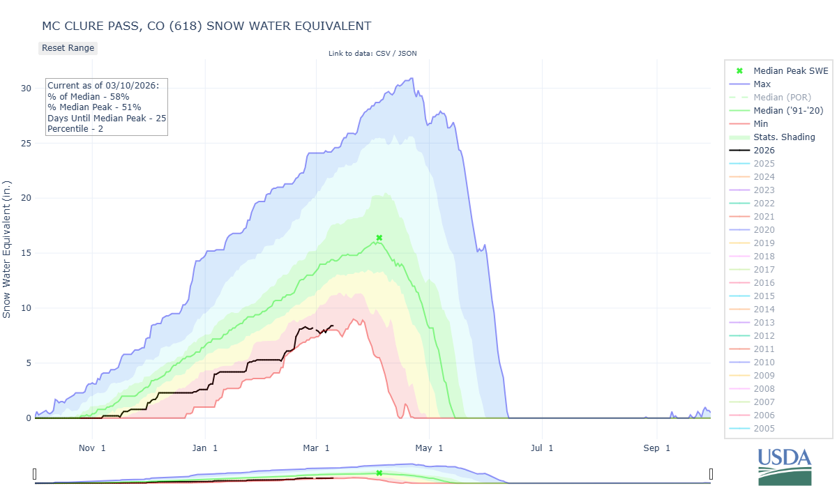
MCCLURE PASS: MARCH 9
The snowpack McClure Pass at around 8,700’ was very wet and isothermal - air temperature at the nearby SNOTEL at 2:00 PM around when we dug our pit on March 9 was 49.1 F. Pit depth was 48 cm (18.9”) and SWE was 153 mm (6”). The McClure Pass SNOTEL was reporting 24” depth and 8.4” SWE. No dust was observed in or on the surface of the snowpack.

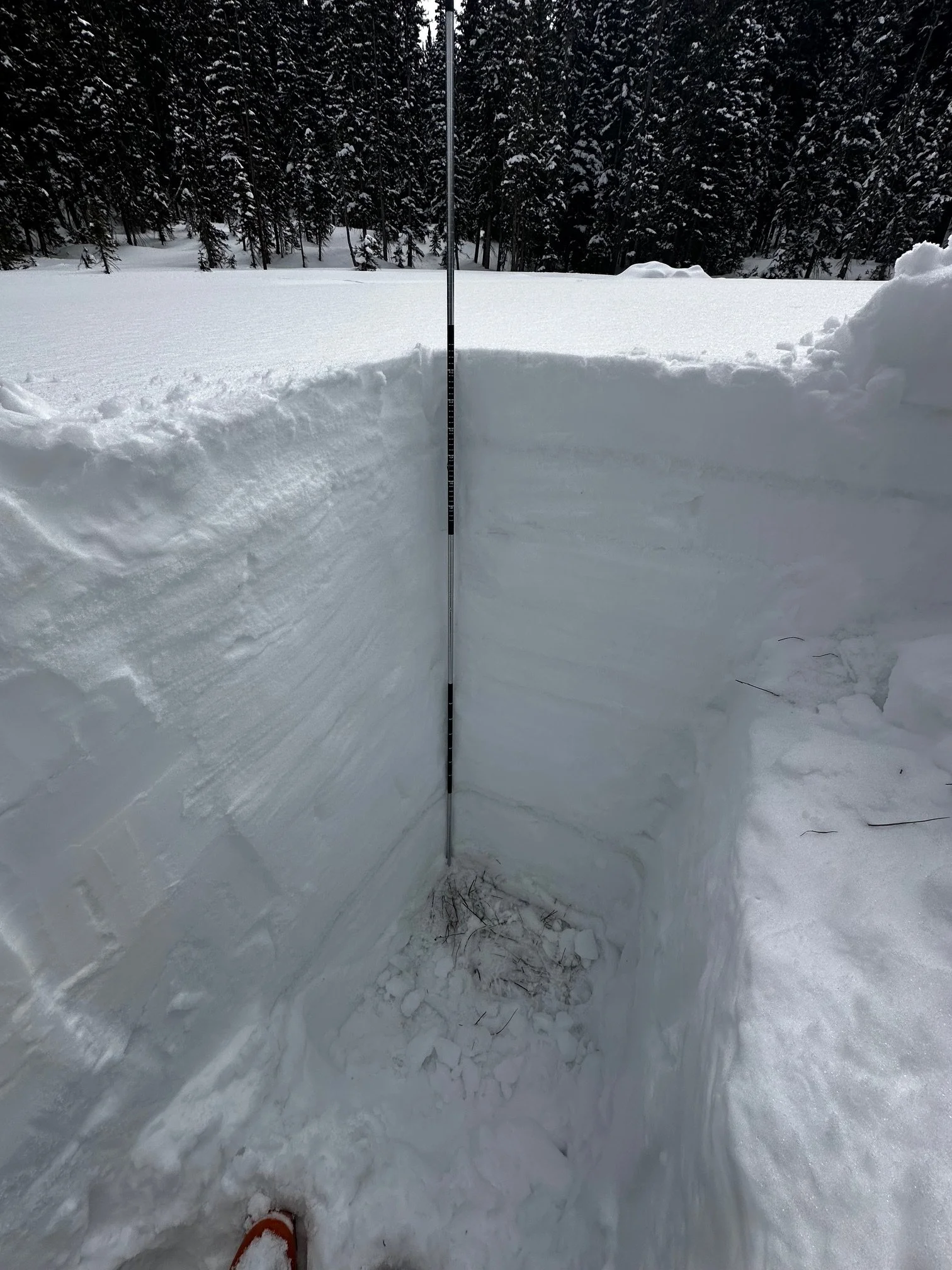
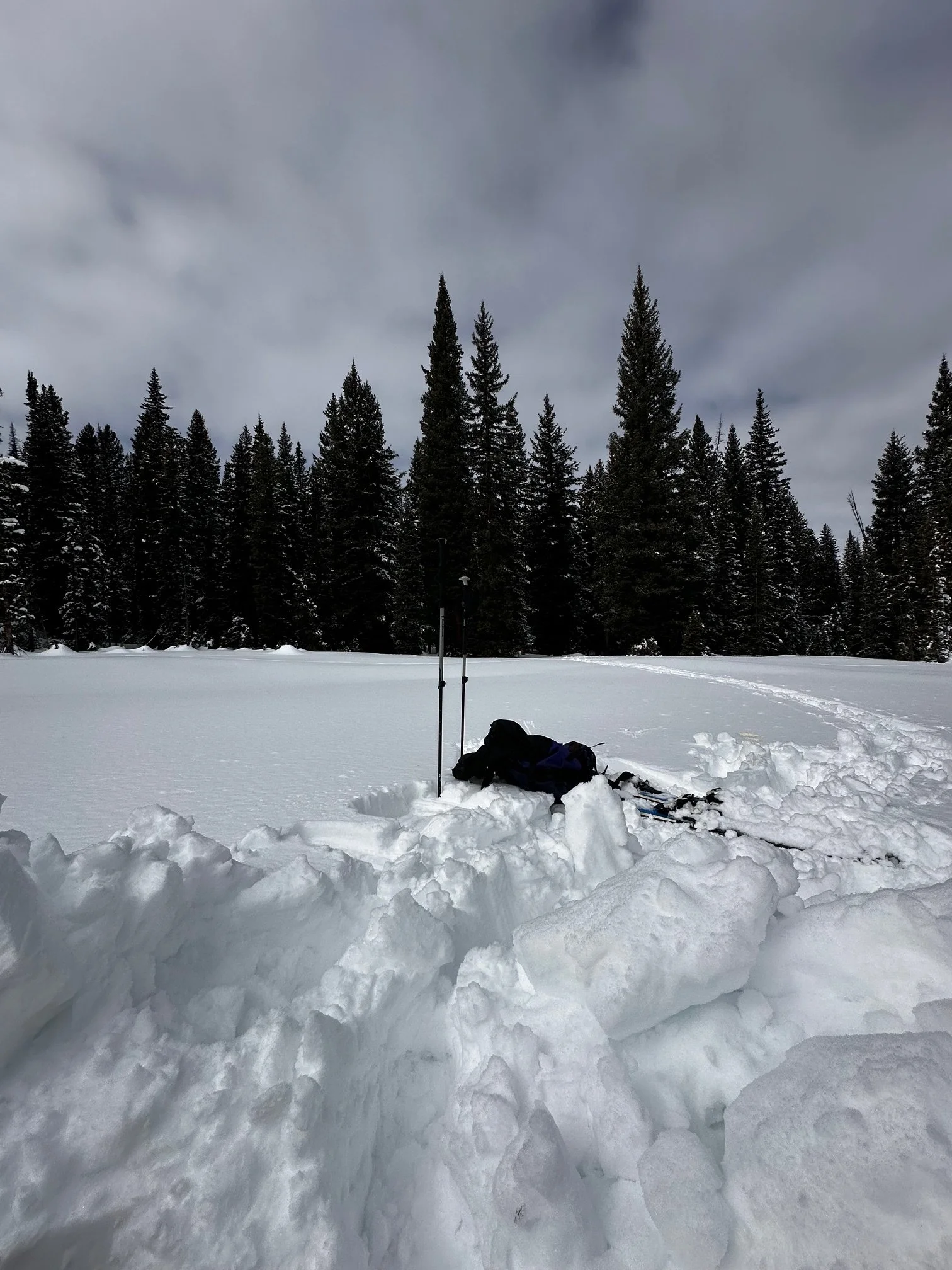
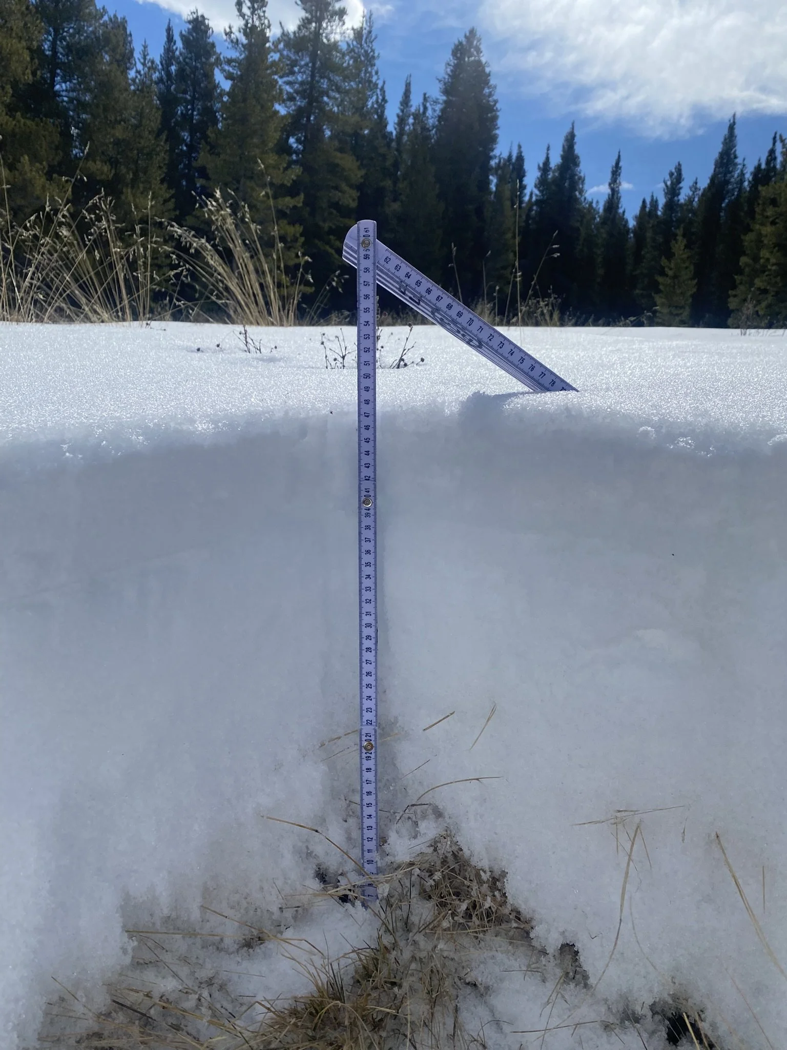
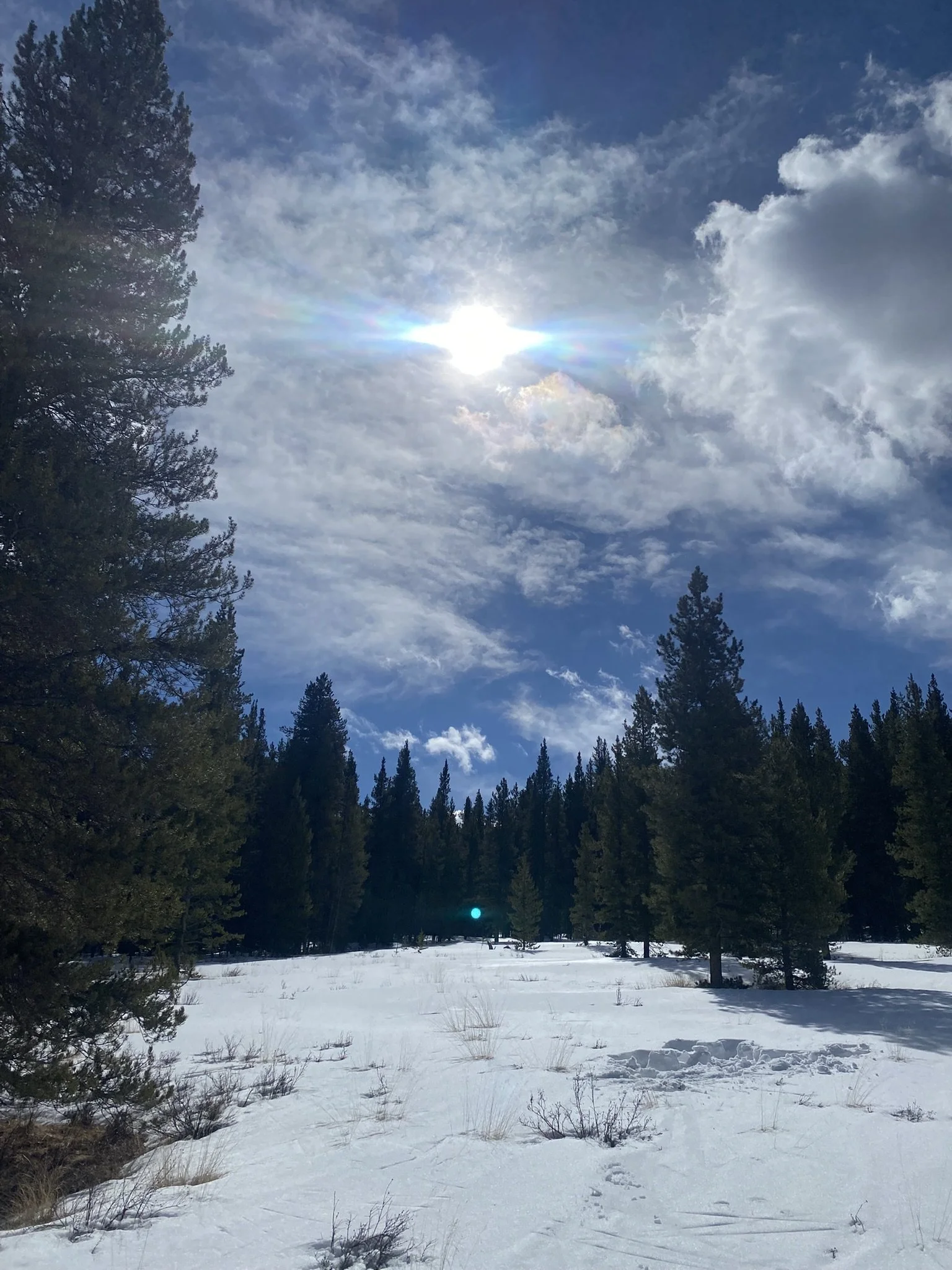
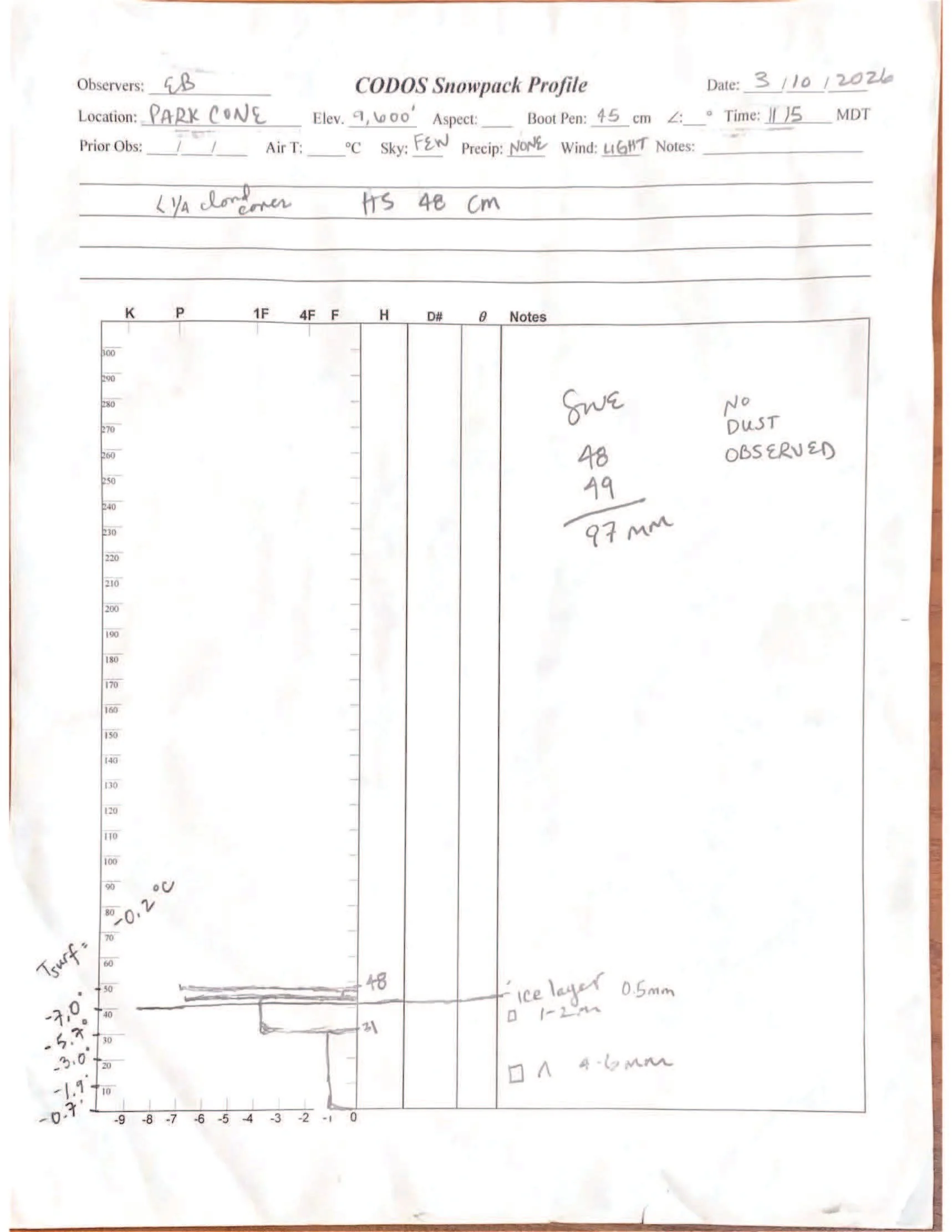
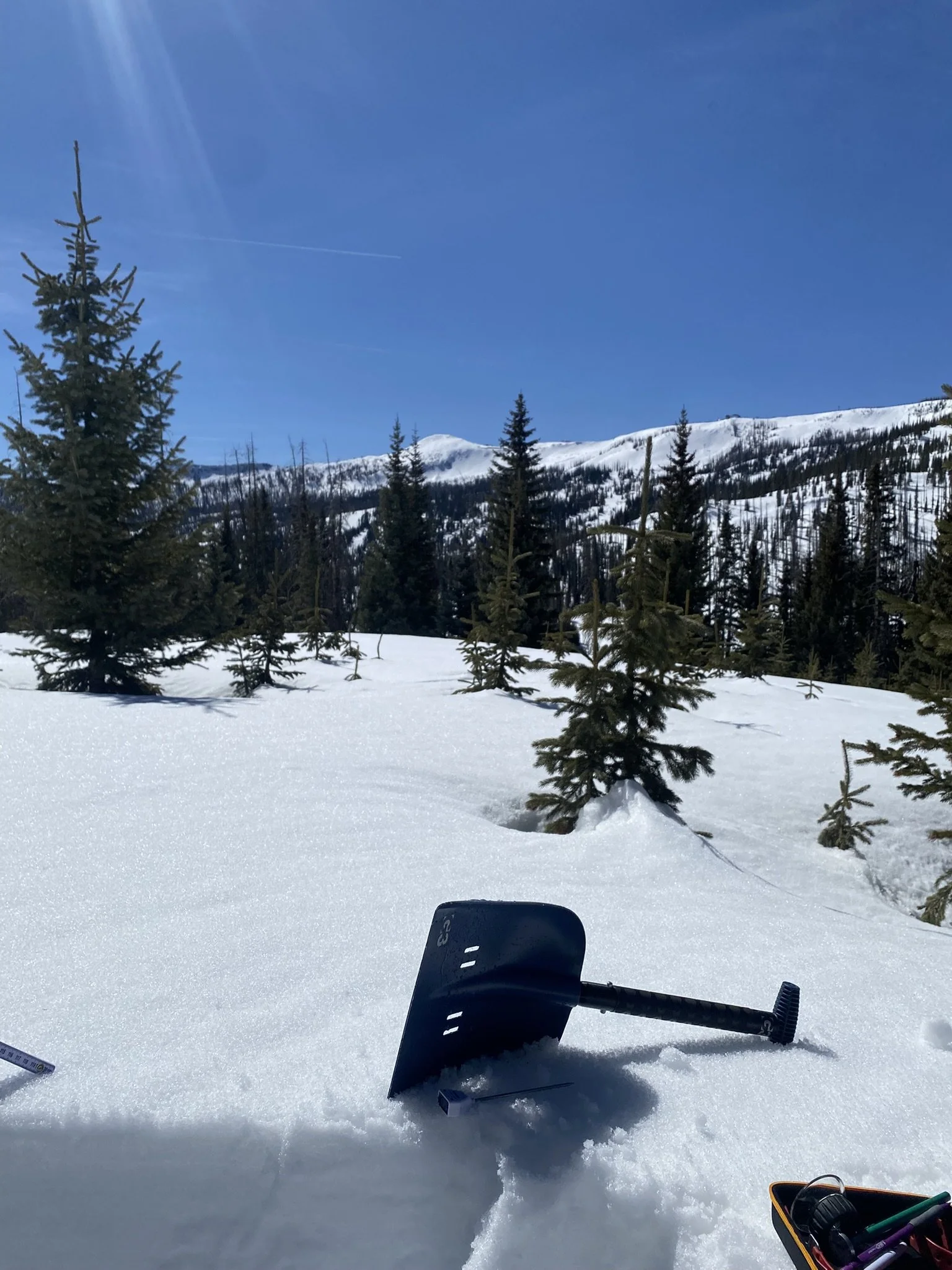
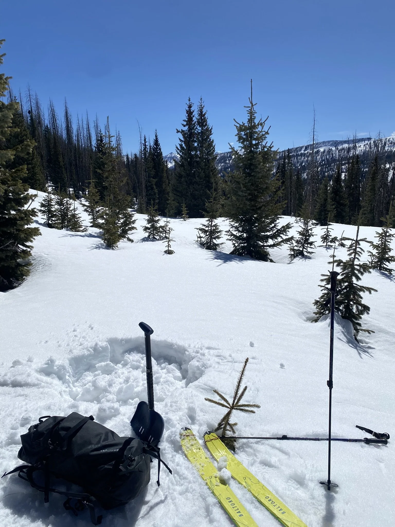
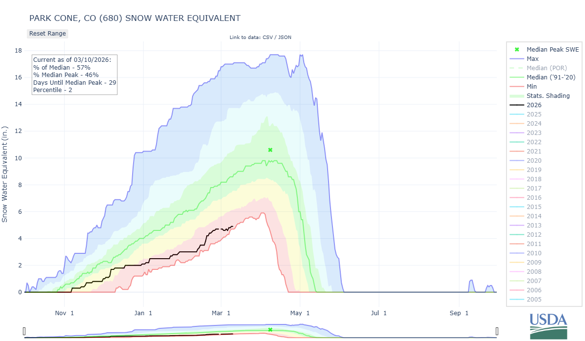
PARK CONE: MARCH 10
A storm forecast evaporated in the few days leading up to Tuesday of the CODOS tour, and just light winds and scattered clouds were overhead during the Park Cone pit site visit. The snowpack gave a loud, whispery collapse as I skinned up to the open meadow off the road, near the Taylor Park reservoir, a reminder of the weird not-spring persistent slab avalanche problem lurking in the mountains despite balmy temperatures. Grasses and willows poked up through the meadow’s snowcover, not something we usually see at this site in March. Pit SWE was 97 mm (3.8”) and depth was 48 cm (18.9”). The nearby SNOTEL was reporting 4.9” SWE, 57% of the median, and 20” depth. No dust was observed.
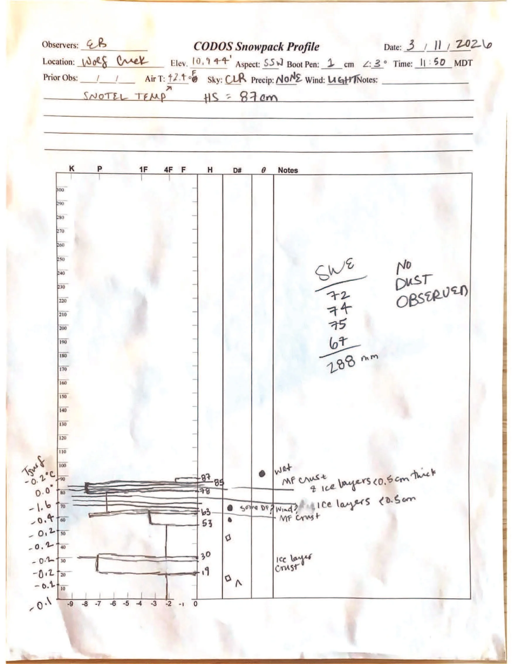
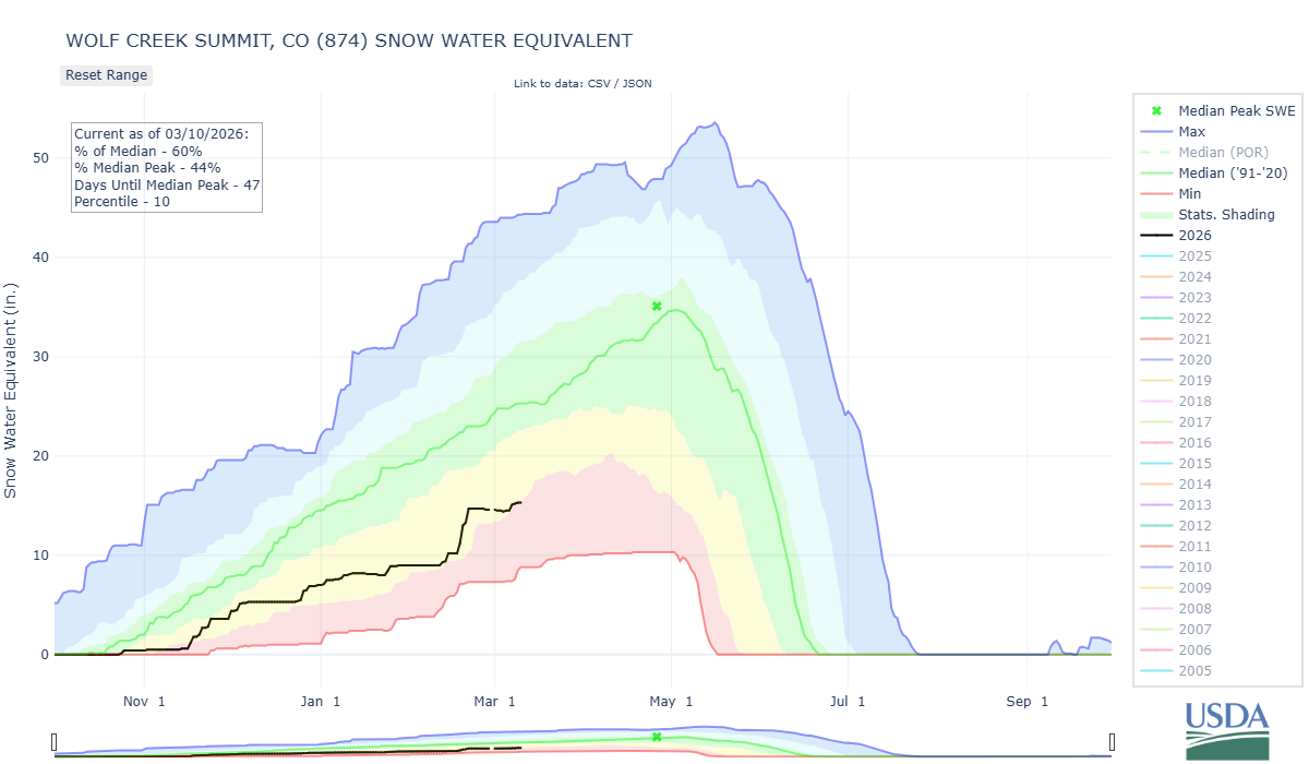
WOLF CREEK PASS: MARCH 11
Our Wolf Creek CODOS site yielded a springtime pit with many ice layers. Pit depth was just 87 cm (34”), and pit SWE was 288 mm (11.3”). As we have found across the state, no dust layers were observed in this snowpack. The Wolf Creek Summit SNOTEL station reported 50” snow depth and 15.2” SWE, 60% of median SWE for this date.

Below: The end of February set new daily temperature records for us, and after a brief storm early March, we’re likely back in the red for awhile now.
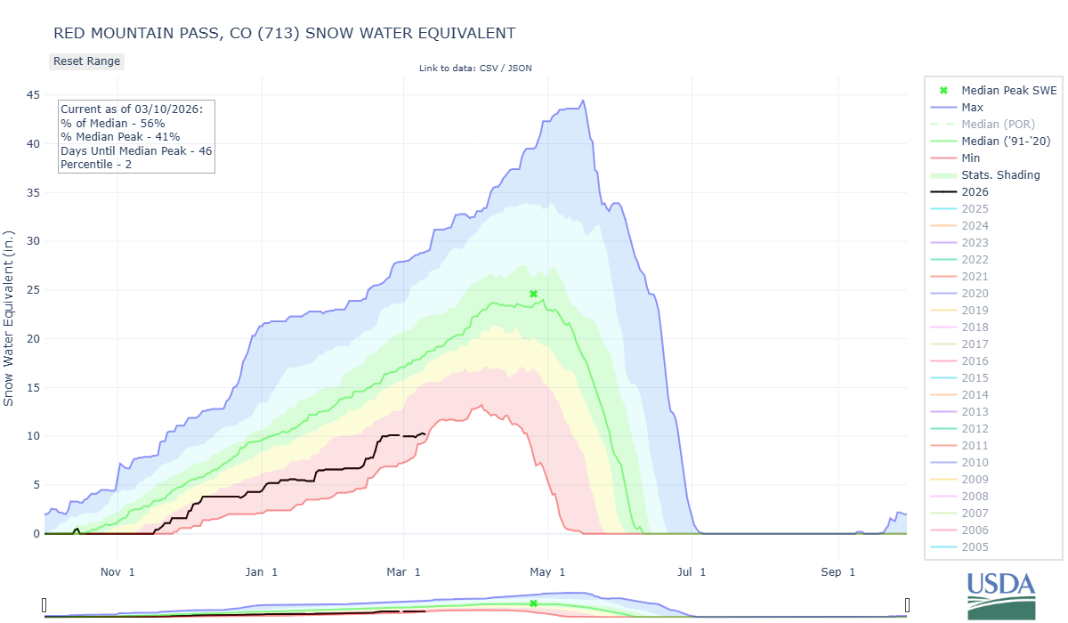
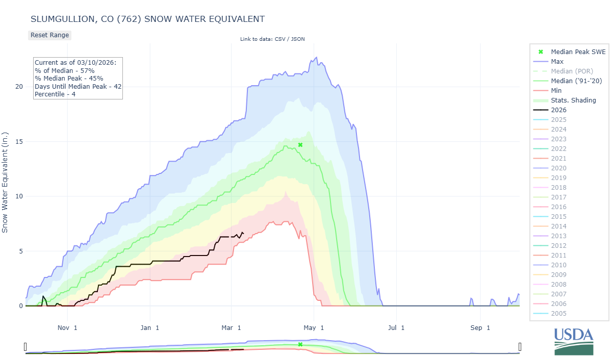
Below: SWE plots for stations co-located with CODOS sample sites:
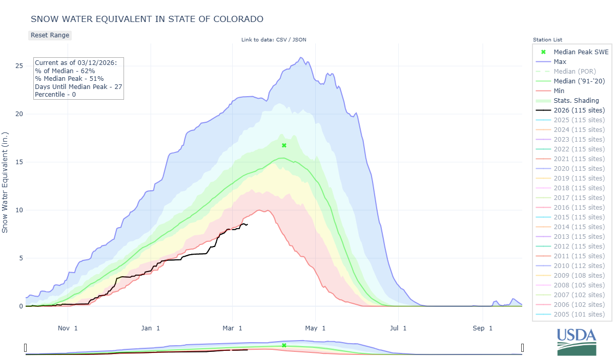
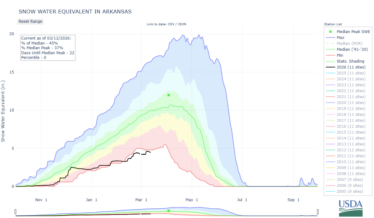
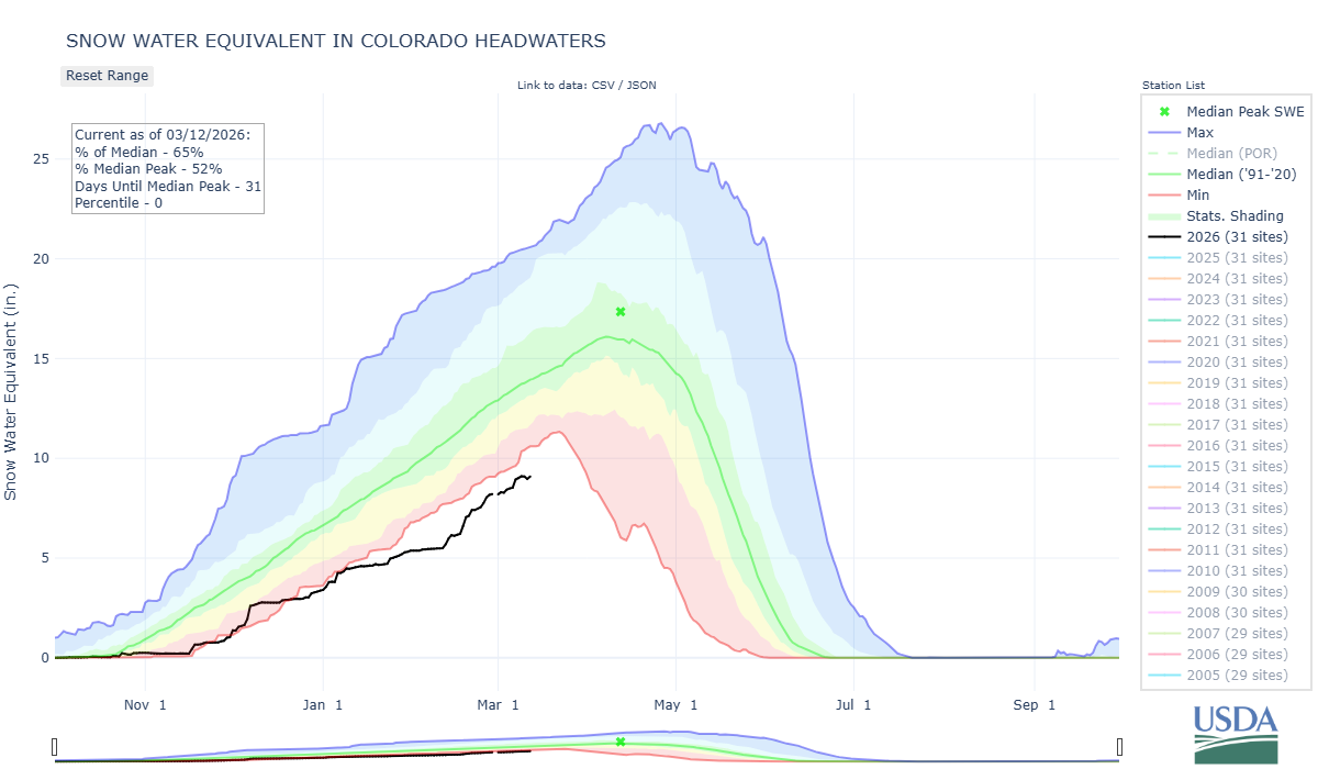
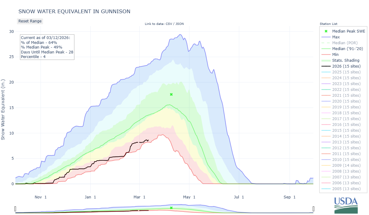
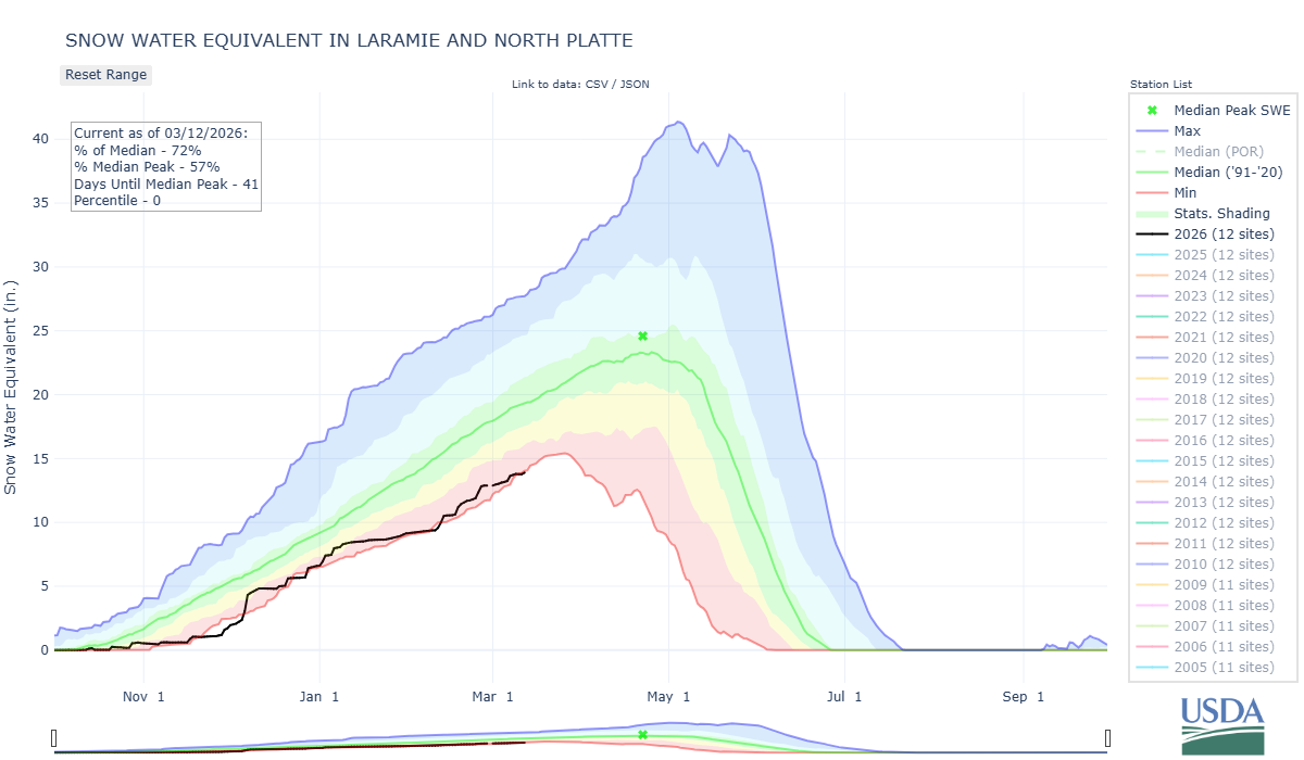
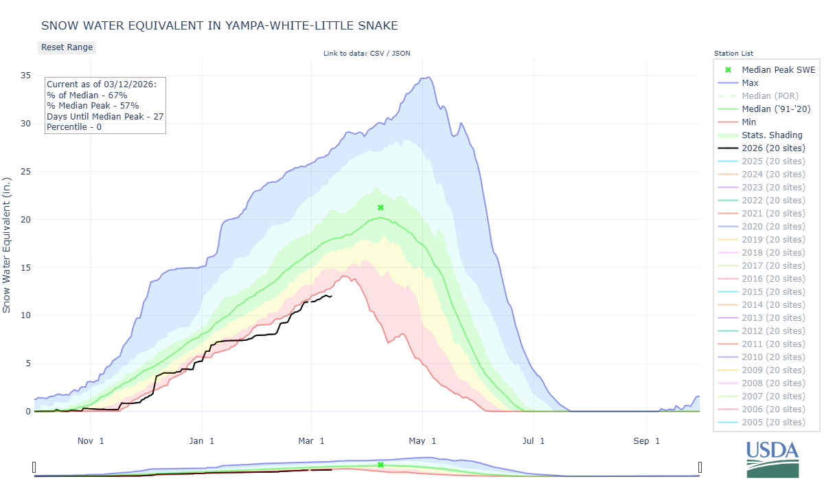
Below: SWE plots for major basins in Colorado.