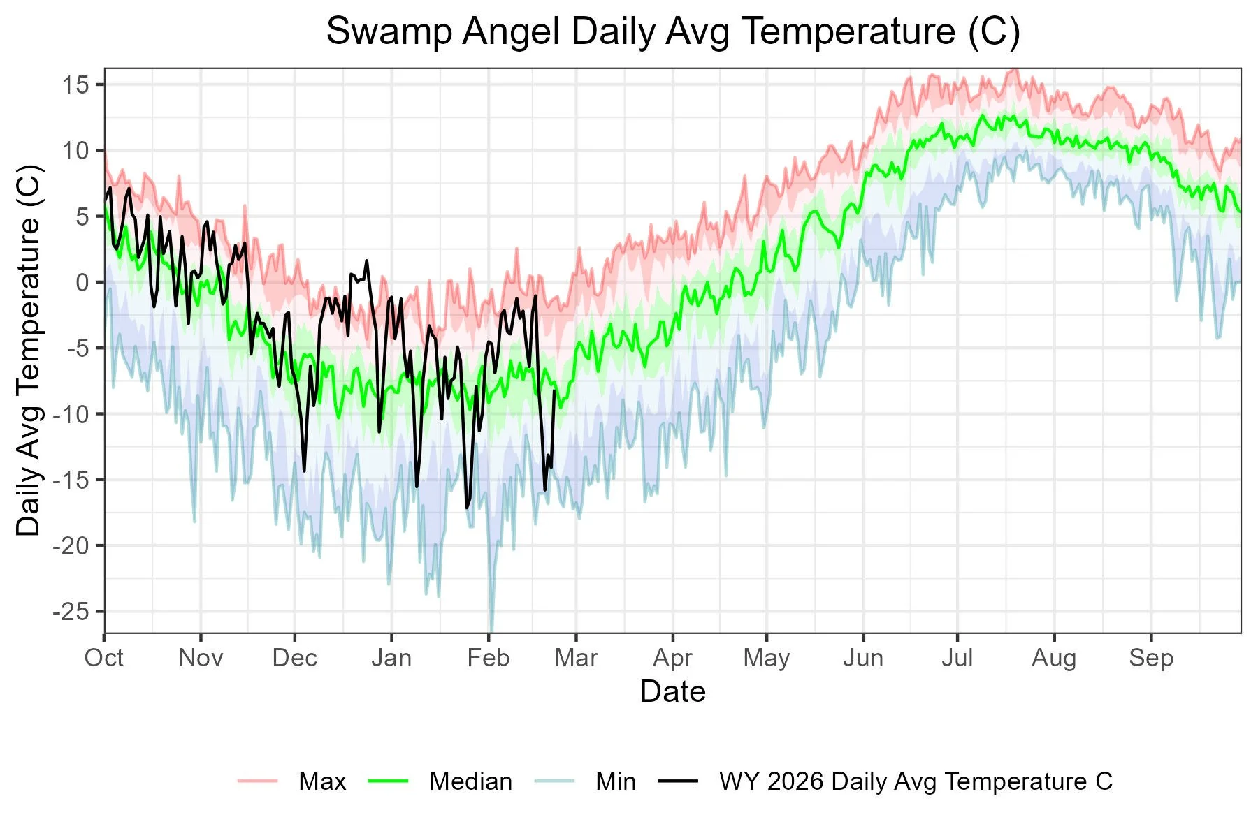
CODOS Update feb 24, 2026: Nice storm cycle, a lot more Needed
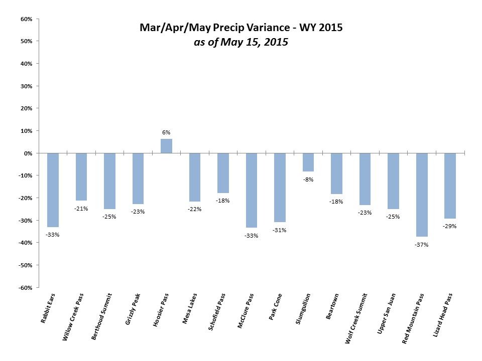
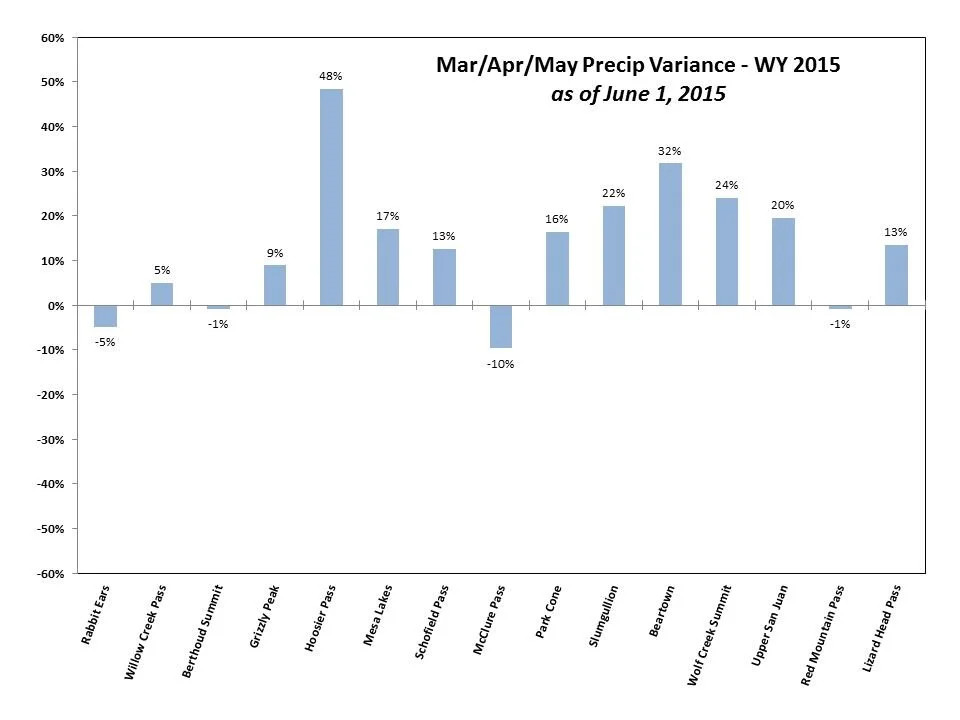
It’s not like we didn’t know how bad snowpack conditions were throughout Colorado prior to the cycle of storms that hit starting February 12 and ending on February 18, after receiving a couple feet of snow as 3.7”of SWE one would think “this should give the snowpack a big boost”, but actually looking at the scale of things it was pretty modest in terms of what is required to get us close to the ballpark of normal. And the weather forecast isn’t encouraging. Besides a blurp of potential precip on Wednesday a broad ridge will sit over the west sticking around for at least 7-10 days. That will put us into March, the start of the slide into spring. The accumulation season wraps up roughly around April 1 depending on the location, leaving very little time to whittle away at our deficit. Of course receiving more precipitation after peak SWE would boost the snowpack, soil moisture, and streamflows. The almost legendary example most of us like to refer to is the miracle May in WY2015, where an extremely wet May where the snowpack melted rapidly and at the same time rain/snow was being adding to it, making up for an entire season’s struggling snowpack. Just to say there is always hope. For fun, check out the precipitation variance plots of our reference SNOTEL’s below.
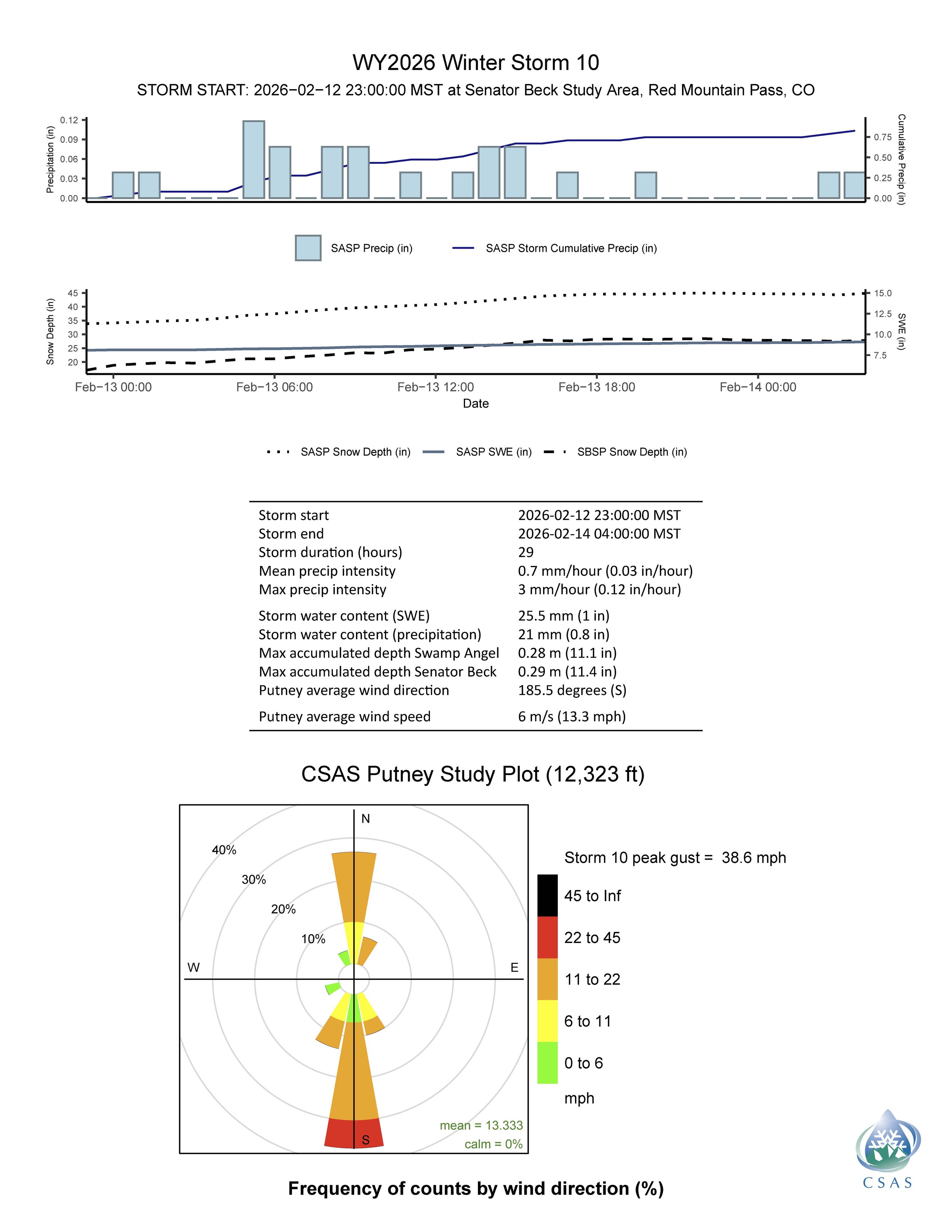
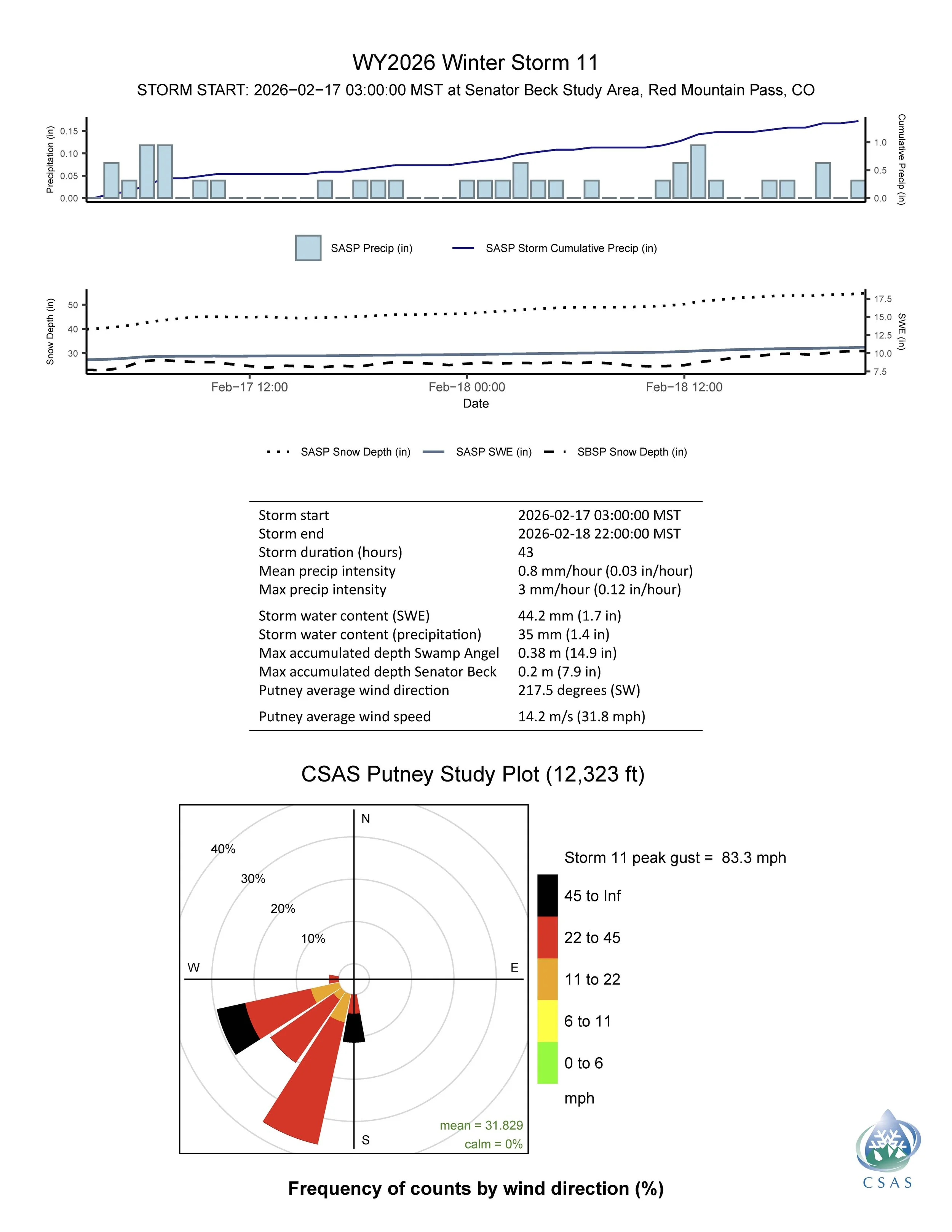
Dust-on-Snow: The system that hit this past week came up out of the southwest with some pretty high wind gusts hitting 83 mph. No dust was observed during or after this event. This is rare, but currently we do not have any dust in the snowpack. The lack of storms and the direction of the storms that we have received has produced nothing so far. That said, March marks the beginning of when dust events are most frequent, continuing through until snow all gone.
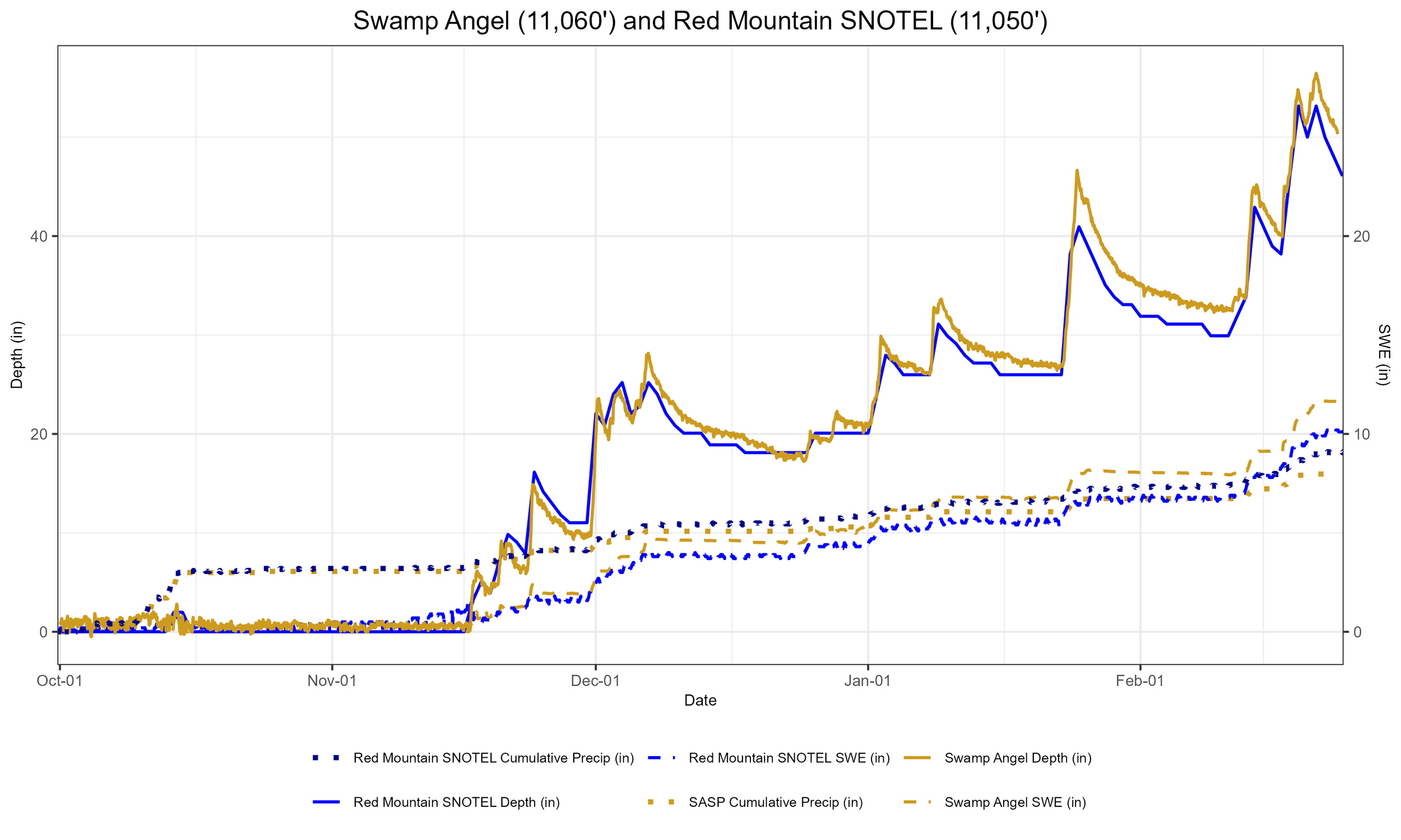
Below: Precipitation variance for CODOS reference SNOTEL stations in WY2015. In just a couple weeks the season went from abnormally dry across the state, to bountiful conditions.
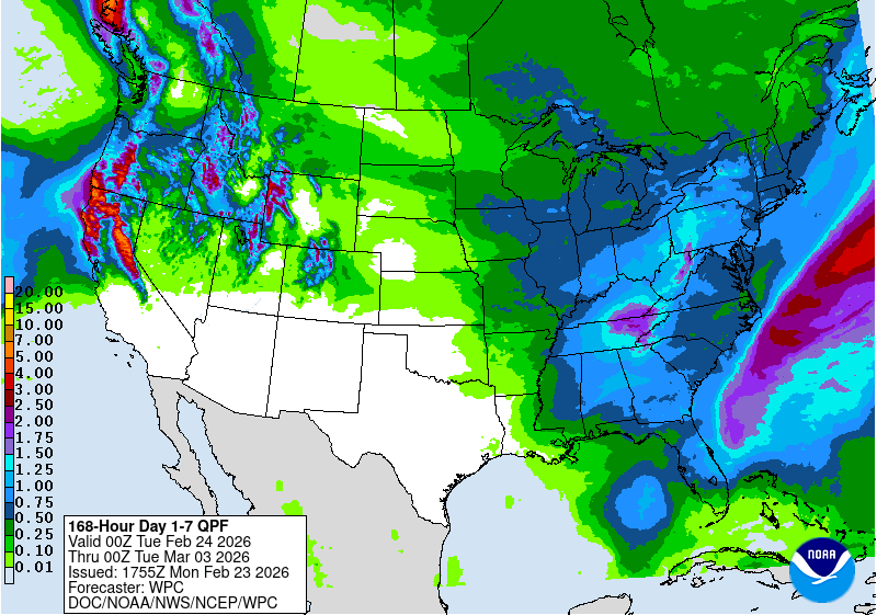
Below: Storm reports for the last cycle of storms. The active period added 3.7” SWE to the snowpack at Swamp Angel.
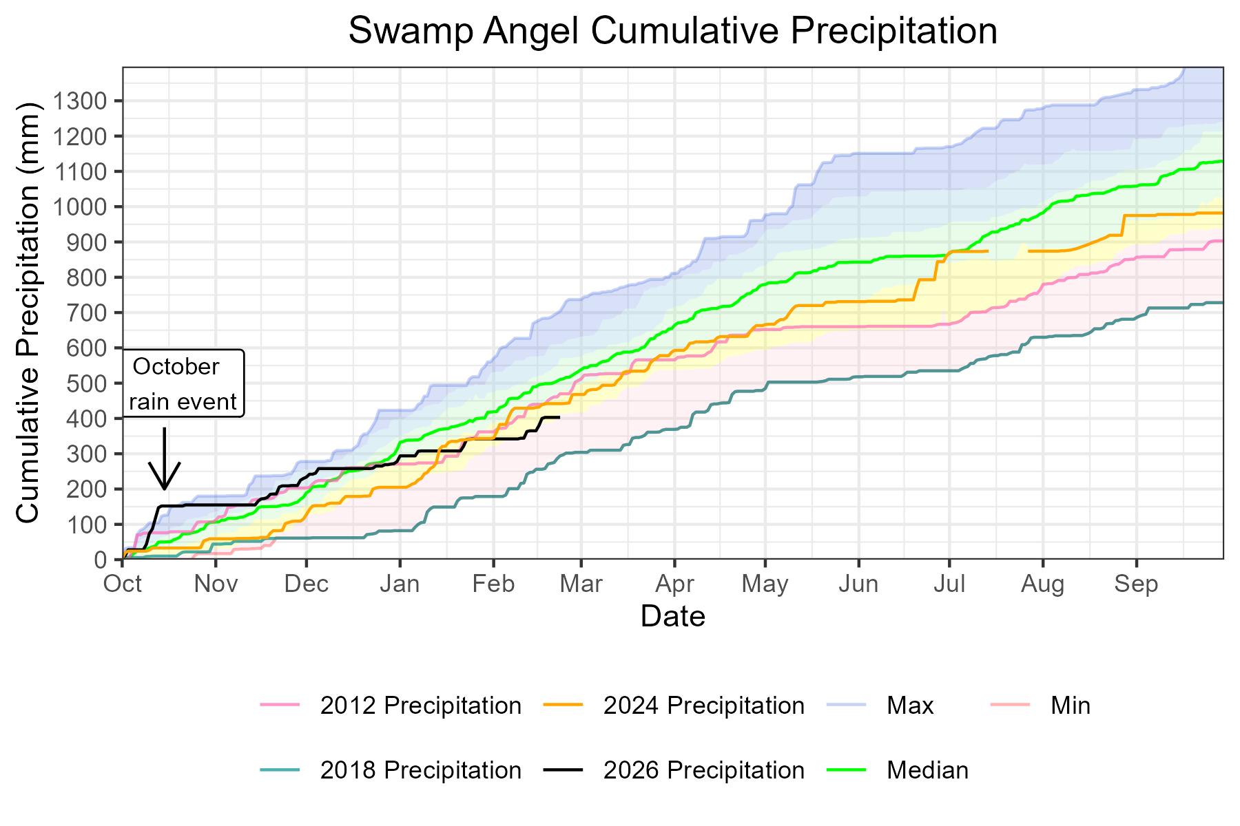
Below: Swamp Angel precipitation has made some gains and reached 78% of the median.
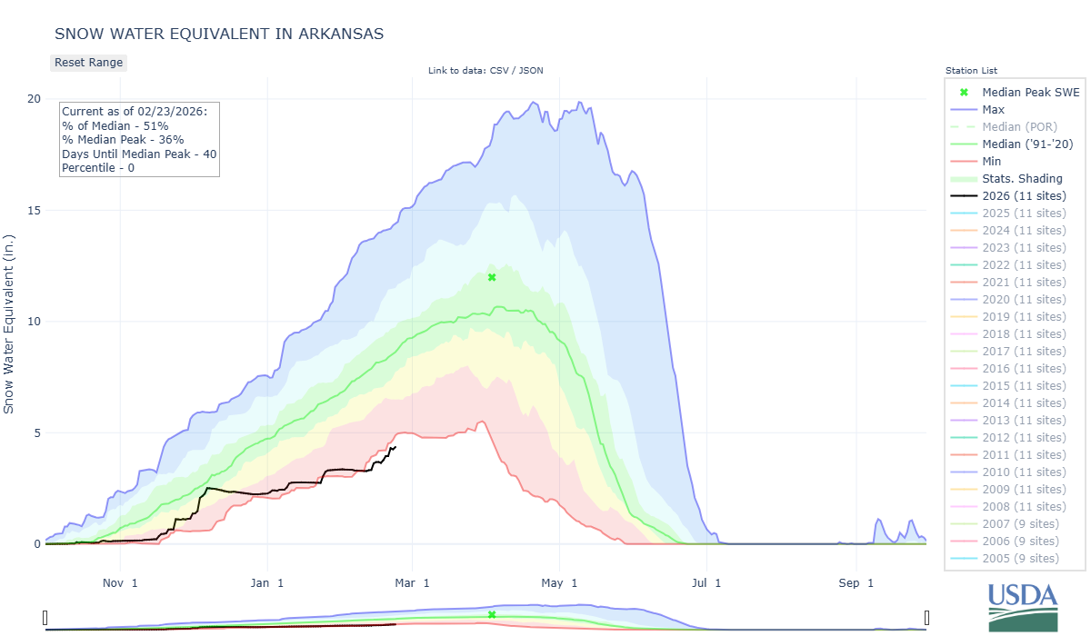
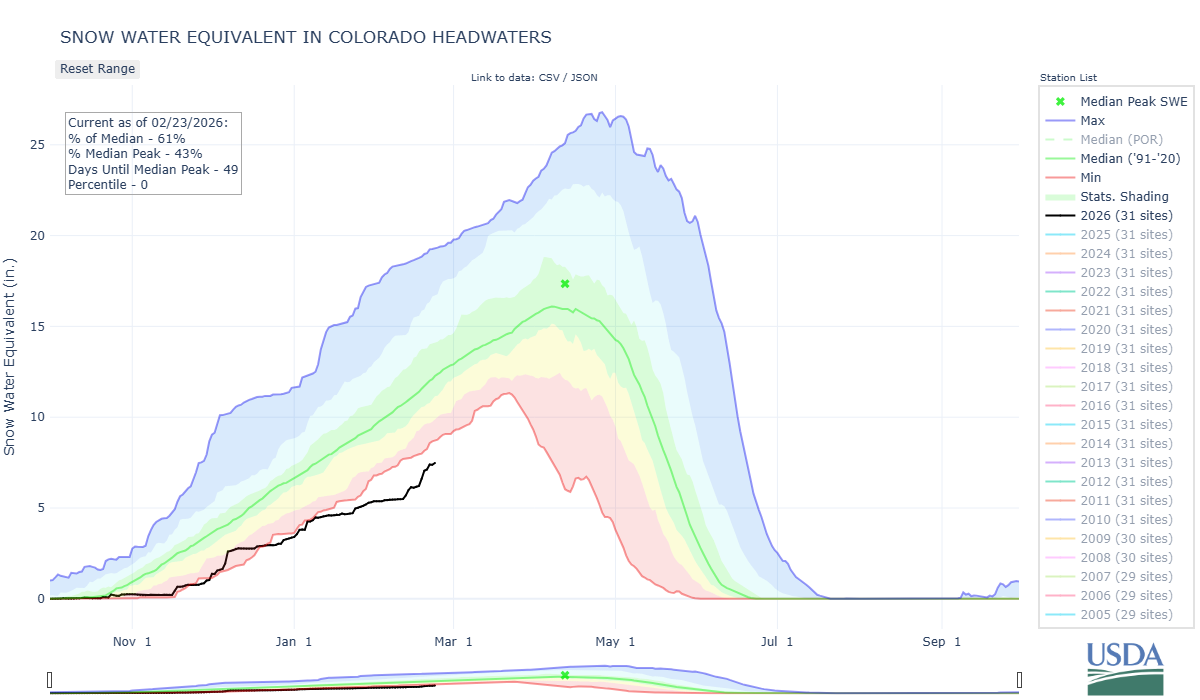
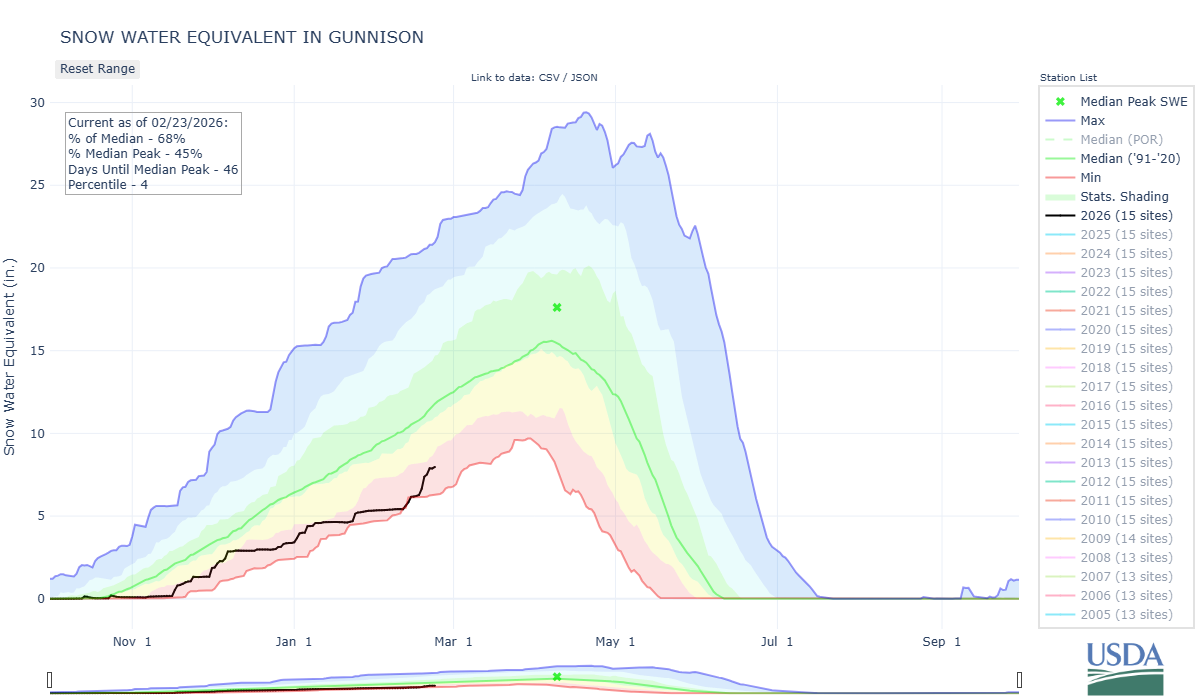
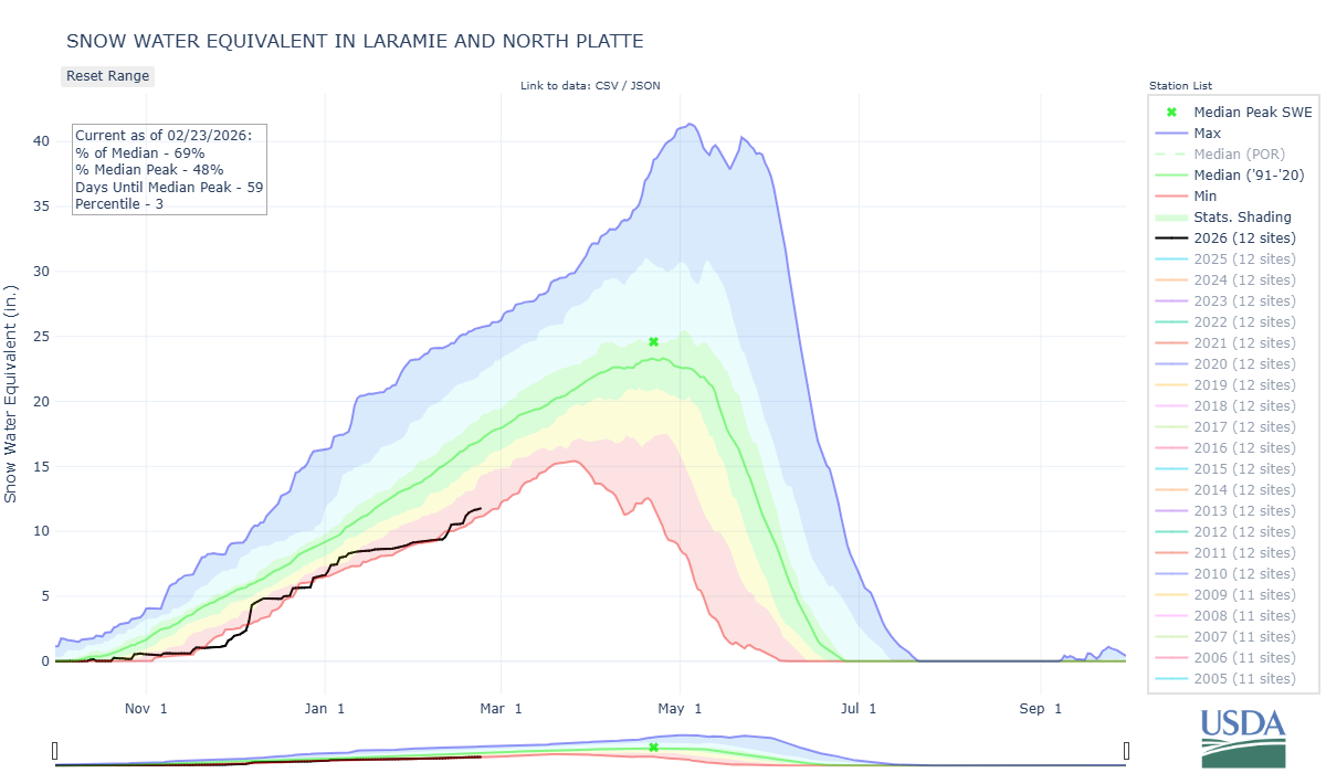
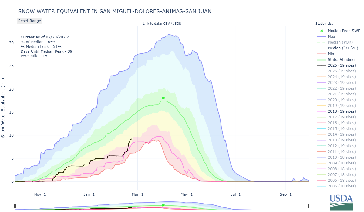
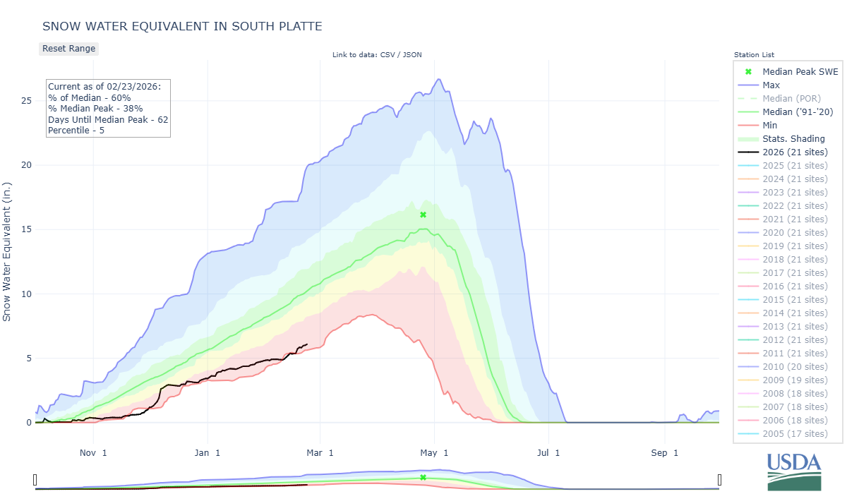
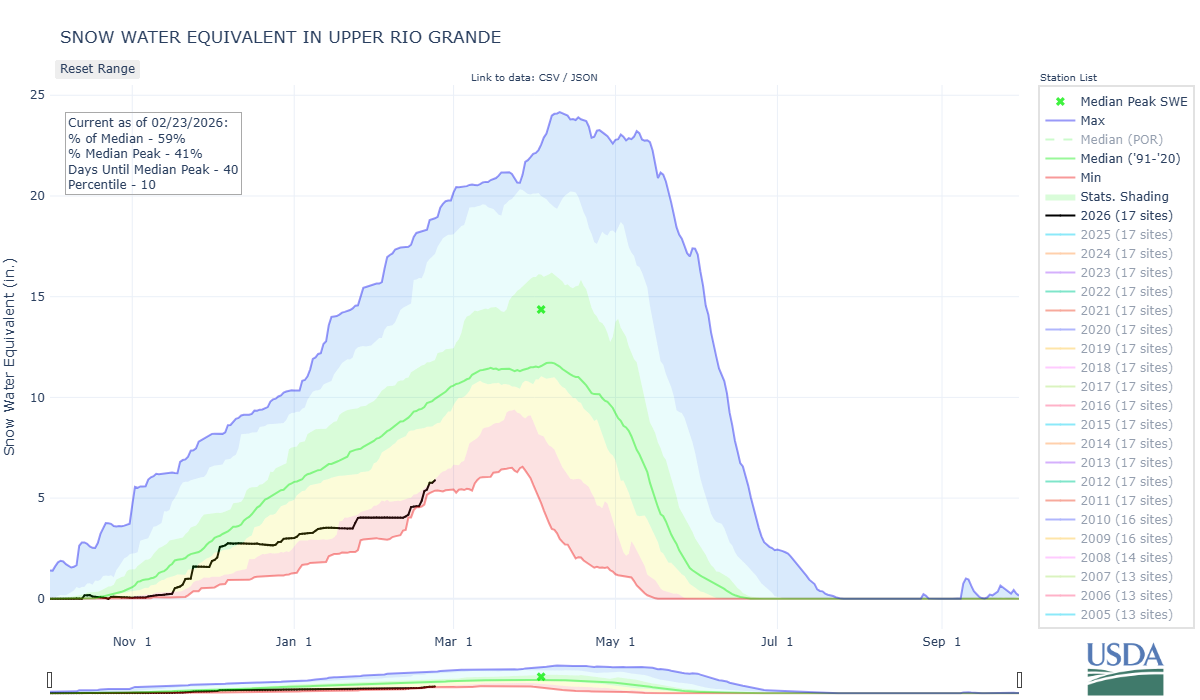
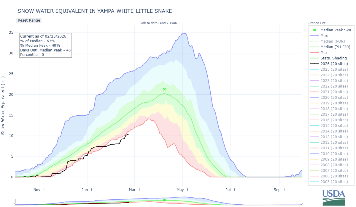
Below: SWE plots for major basins in Colorado. The storm cycle that came up out of the Southwest benefitted all of Colorado to a degree, but the Southwest Basins the most. The Rio Grande gained 1.8” SWE, Gunnison 2.6”, and the Southwest Basins 4.6”.