CODOS Update February 13, 2026: Winter returns for a spell
Greetings from Silverton,
It is lovely to watch the snow fall, and in this near record-setting snowpack year, it hasn’t been happening enough. More often, it has felt like a sunny spring day. This week Colorado is finally getting a bit more winter - over the last couple days, Swamp Angel picked up 7-8 inches snow depth and 0.5 inches SWE. Forecasts are calling for another 3-6 inches before it clears up on Saturday, and another more significant storm event (12-16” on Red Mountain Pass?) across the state starting on Monday, February 16. This is a bit of good news.
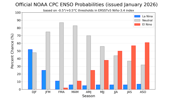
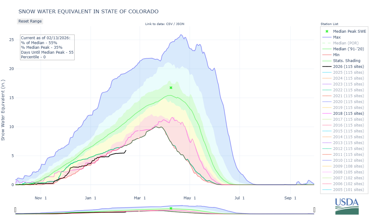
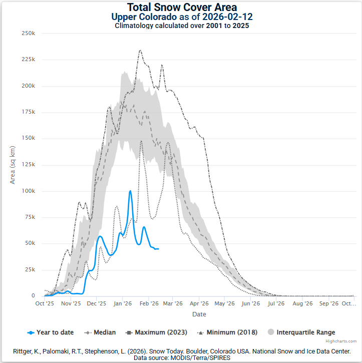
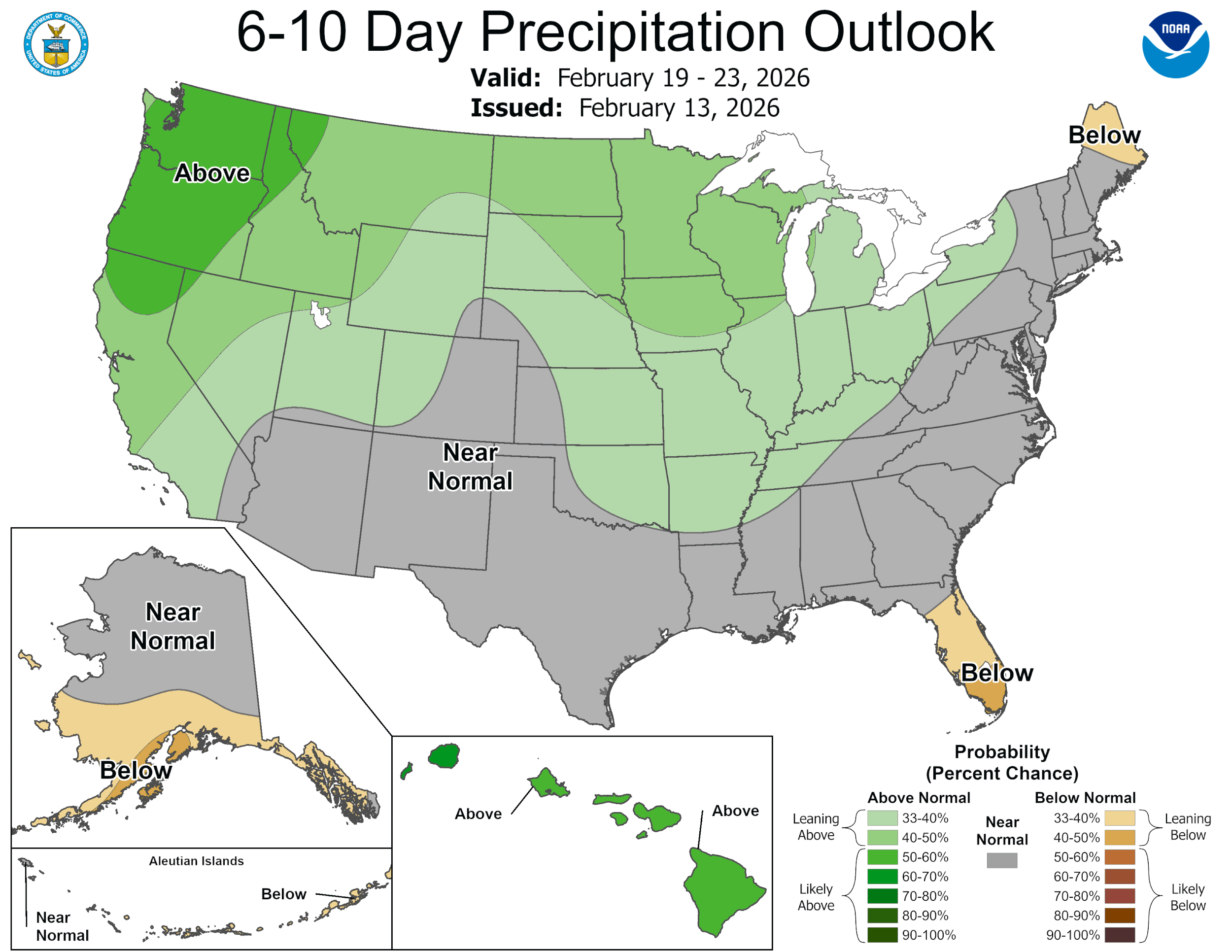
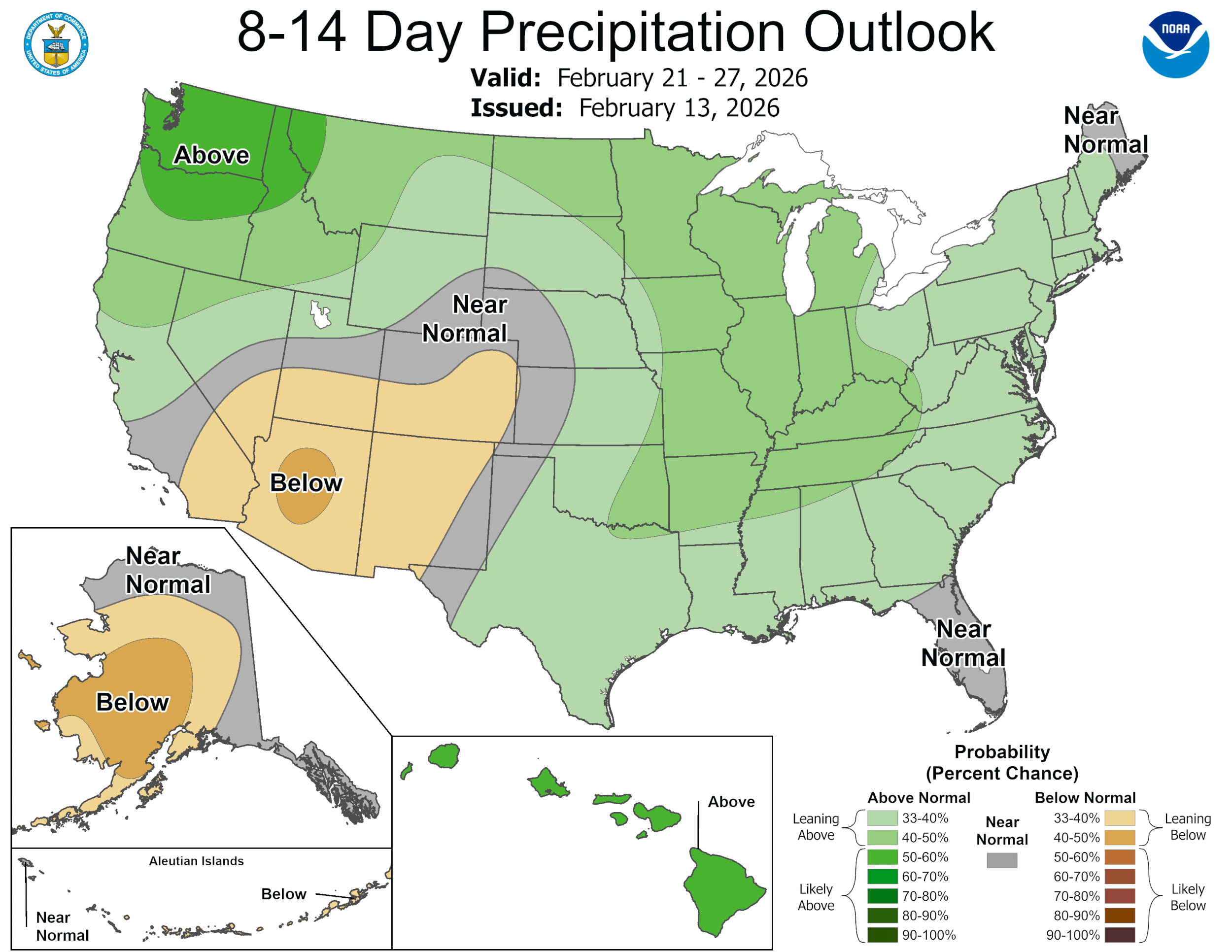
That being said, the state of Colorado is still sitting at the worst snowpack in over 40 years (Colorado Climate Center). Snow cover across the Upper Colorado river basin is the lowest it has been since 2001 in MODIS satellite imagery (see images below). Longer-term seasonal outlooks are predicting a warm and dry spring in general. As many of you know, many conditions play into springtime water availability in streams. Low snow covered area and warm temperatures will have a big impact on runoff efficiency this spring. Throw a dust event in the mix and it could result in earlier, faster runoff. Critical levels at Lake Powell and paralysis in decision-making there will likely result in more water released from our headwaters basin reservoirs, impacting our local communities. The CPC is predicting a transition into an El Nino phase by the end of the summer; unfortunately, this likely means higher probabilities for above normal temperatures. Many of us in Colorado start thinking about the summer when we’re in the midst of a warm and dry winter/spring.
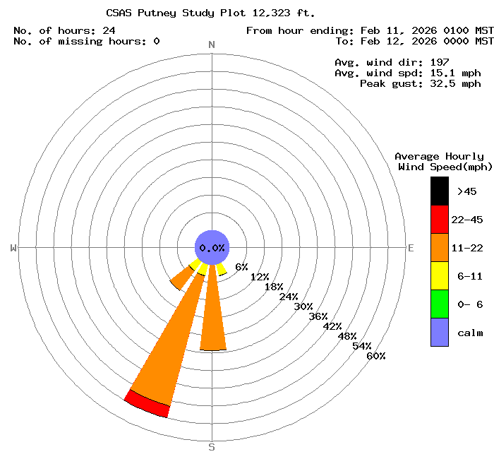
Currently, the snowpack is free of dust. Gusty wind conditions are forecasted in the Four Corners area next week ahead of the next storm, though as these storms pass over the region it will deliver some moisture, which could tamp down dust generation. At Putney (12,200’), we’ve been clocking winds from the SW to SSW with gusts up to 35 mph. We’ll keep an eye on the conditions as the week progresses.
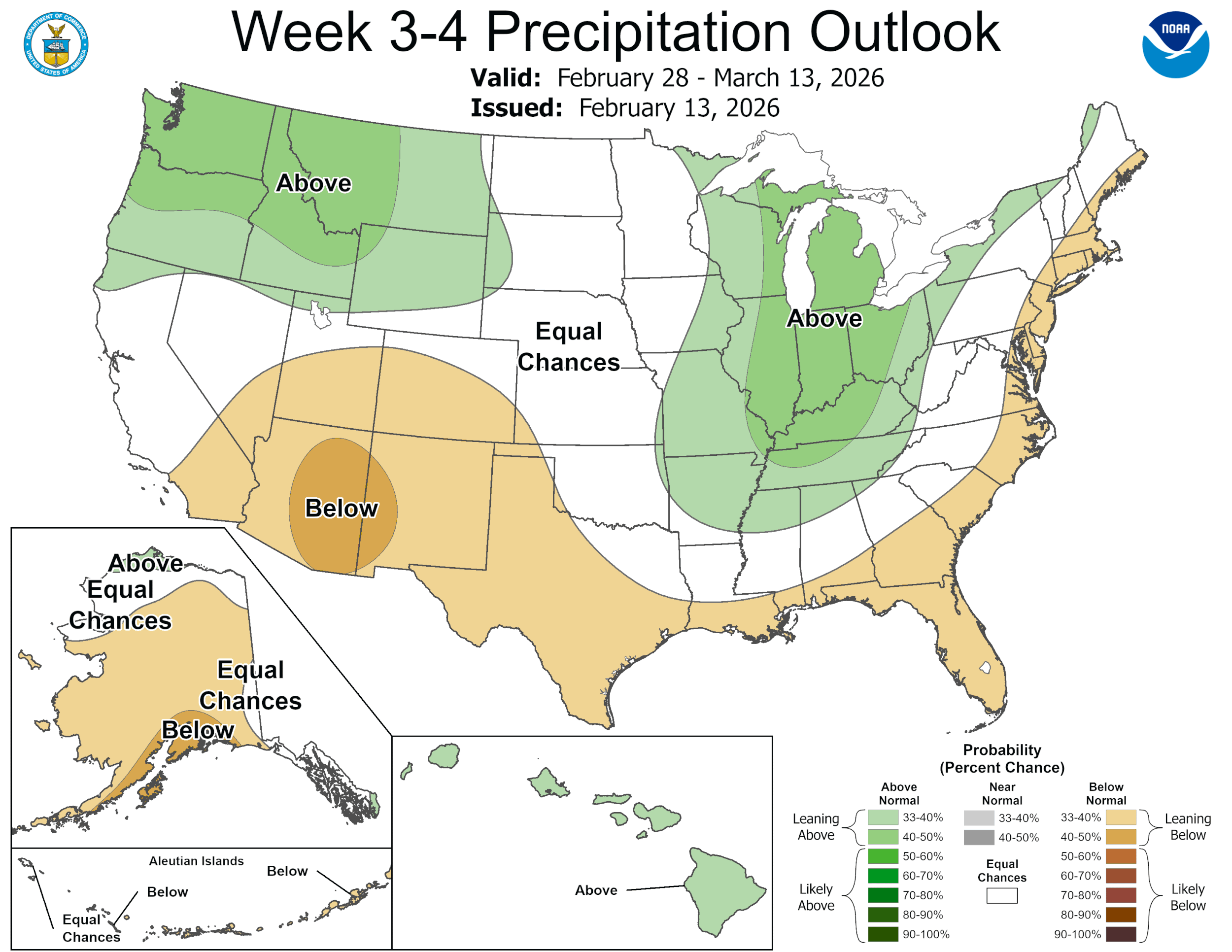
Please see images and plots below.
SNow School!
This is the last plug we’ll put for Snow School for Water Professionals taking place February 25 - 27, 2026. The class is perfect for anyone wanting to learn more about the role of snow and our mountain environments as it pertains to water resources, designed to enhance understanding of snowpack processes, snow monitoring and data.
Plus, we will have guest lectures by Colorado Water Conservation Board staff about the Weather Modification Program as well as the Colorado Airborne Snow Measurement Program (CASM) and a personalized tour of Red Mt SNOTEL by NRCS staff!
The combination classroom and field course will begin on Wednesday morning at our office in Silverton and end on Friday afternoon (2.5 days). Click here to download flyer, please circulate in your workplace forward announcement to folks you think might be interested. You can pay with credit card at snowstudies.org. Please do not hesitate to contact me with questions.
Take Care
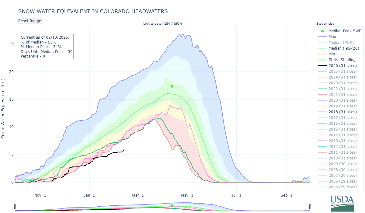
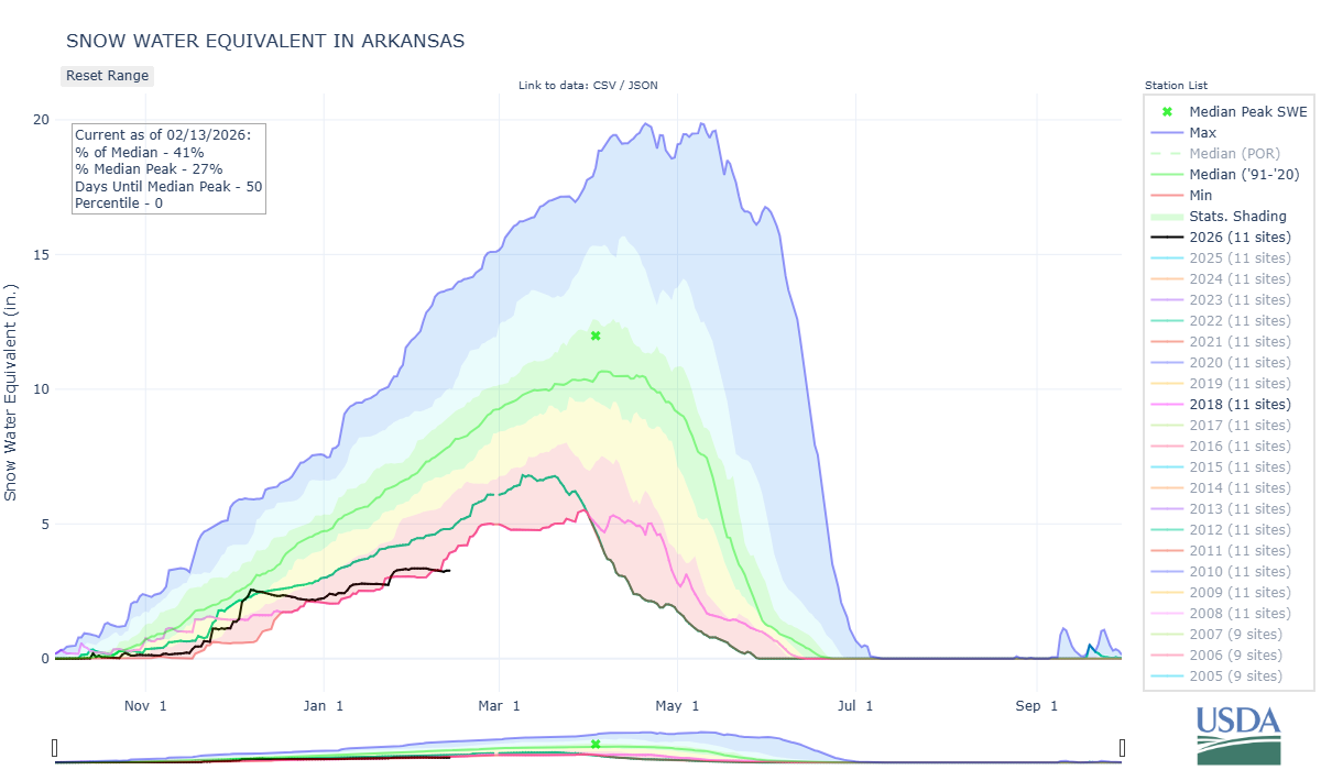
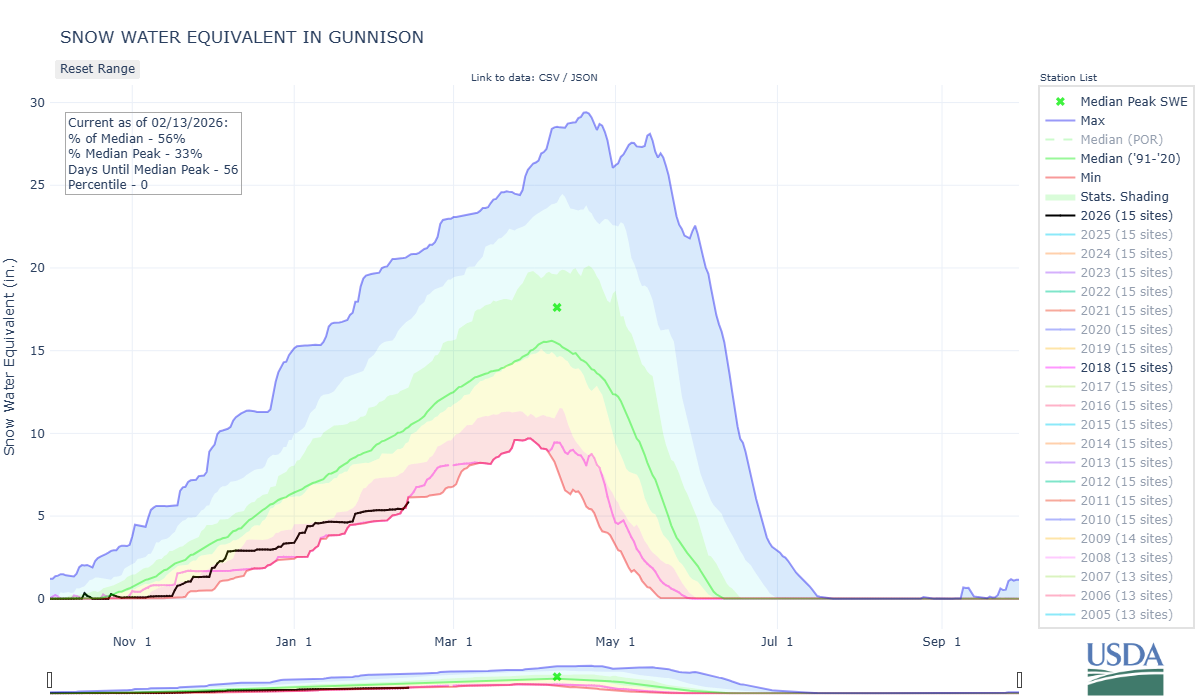
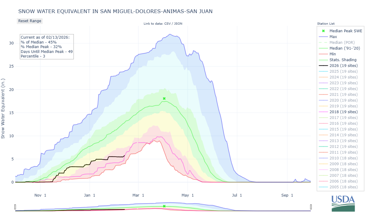
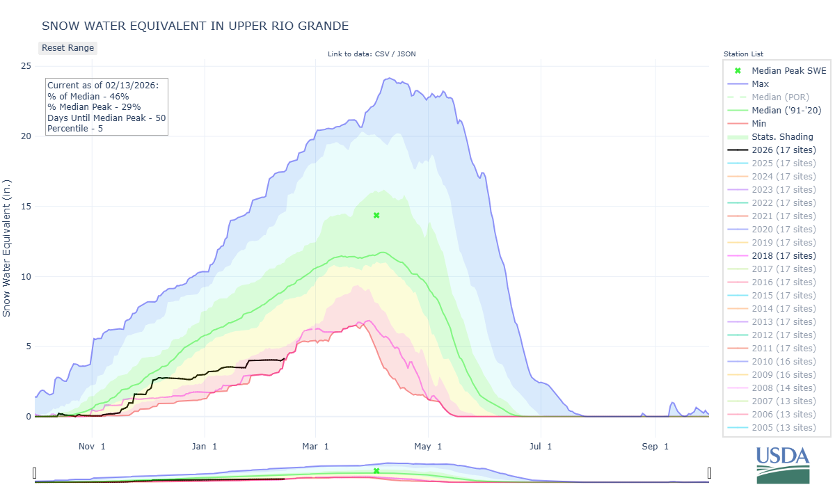
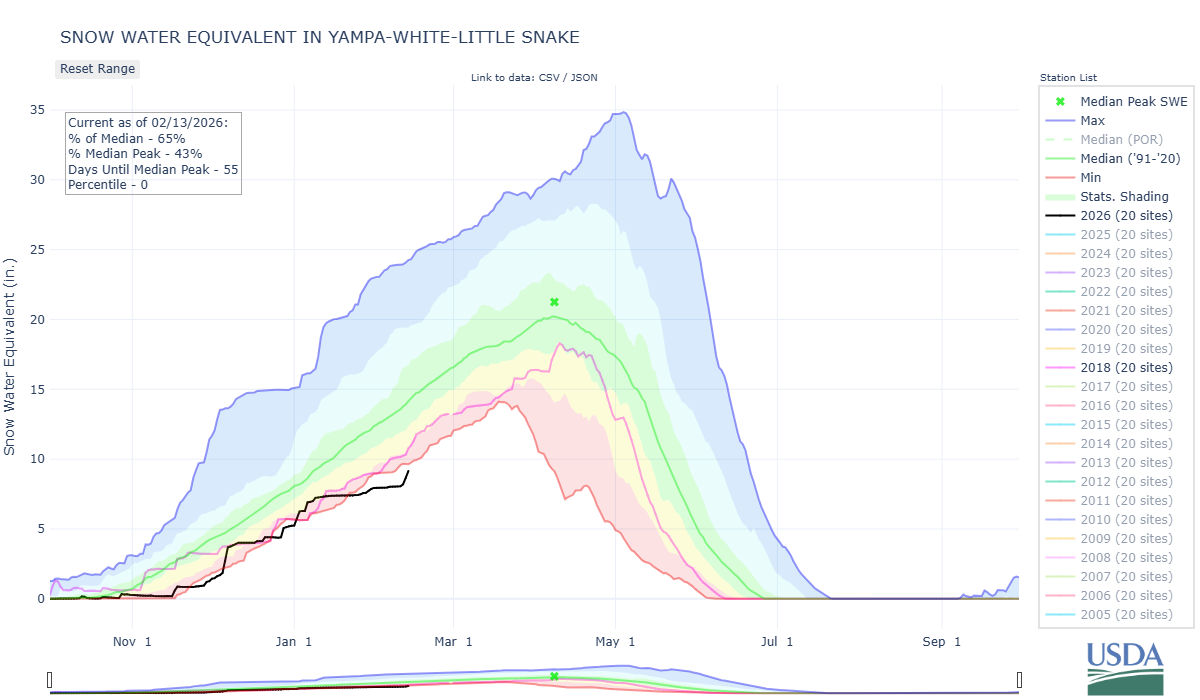
Below: Plots of SWE for major Colorado Basins as observed by SNOTEL stations. WY2018, a recent and notorious dry winter is shown in pink. 2002 is green.
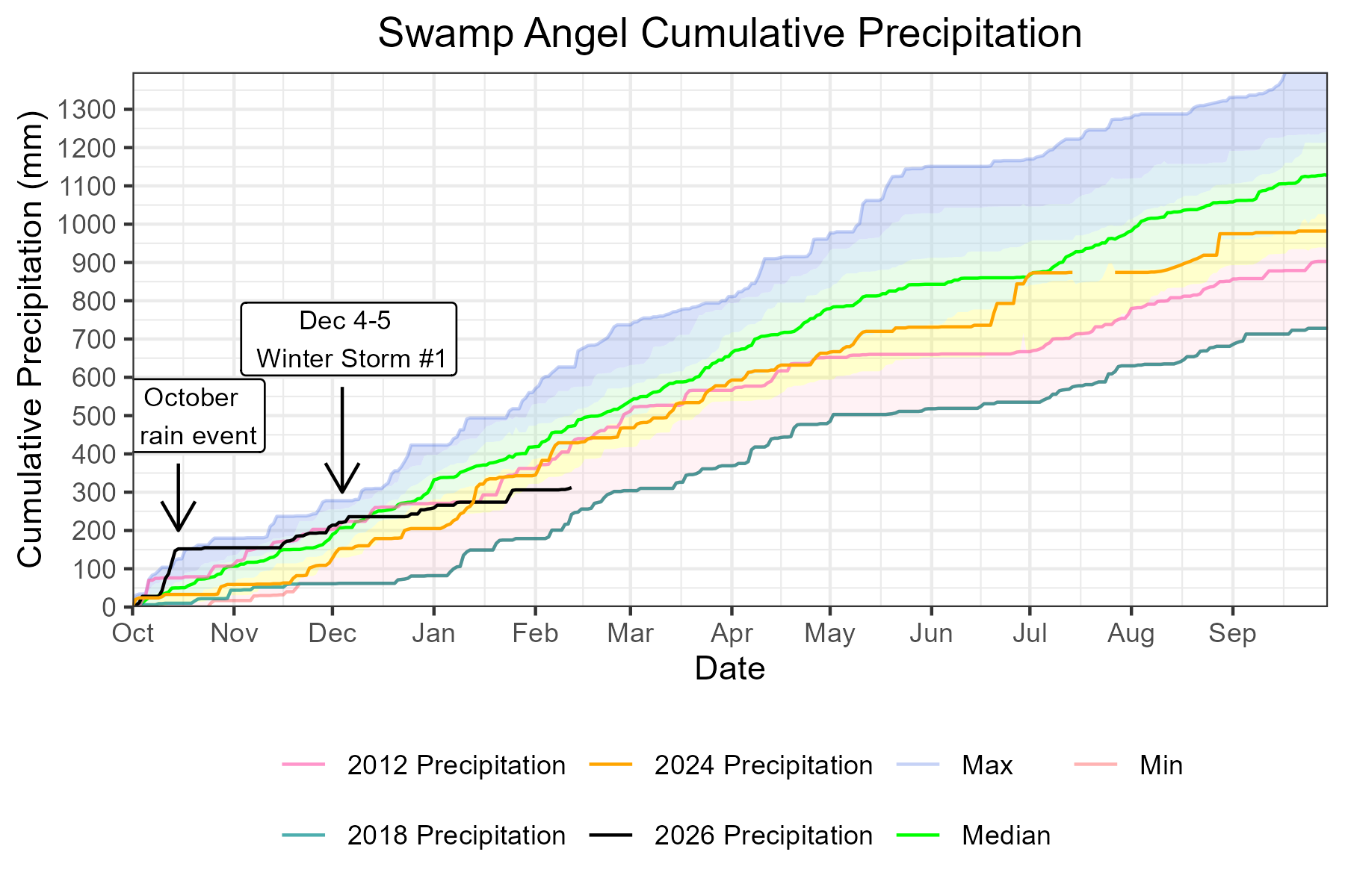
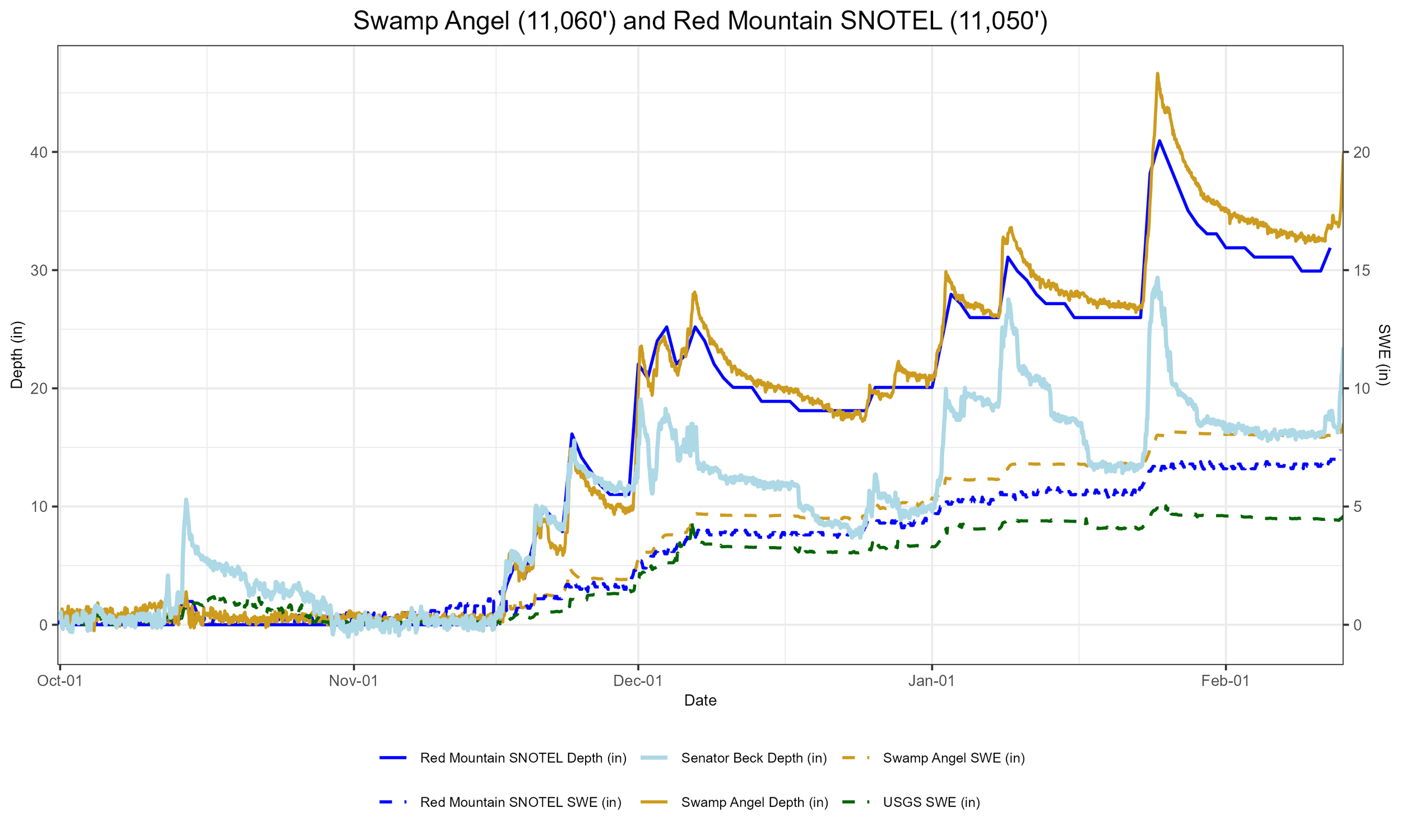
Below: Snow depth at Swamp Angel is almost 3.5 feet, with 8.7 inches of SWE. Cumulative water year precipitation at that site is approximately 67% of the median, but this includes the October rainstorms at the beginning of the water year, and misleads the read of the snowpack.
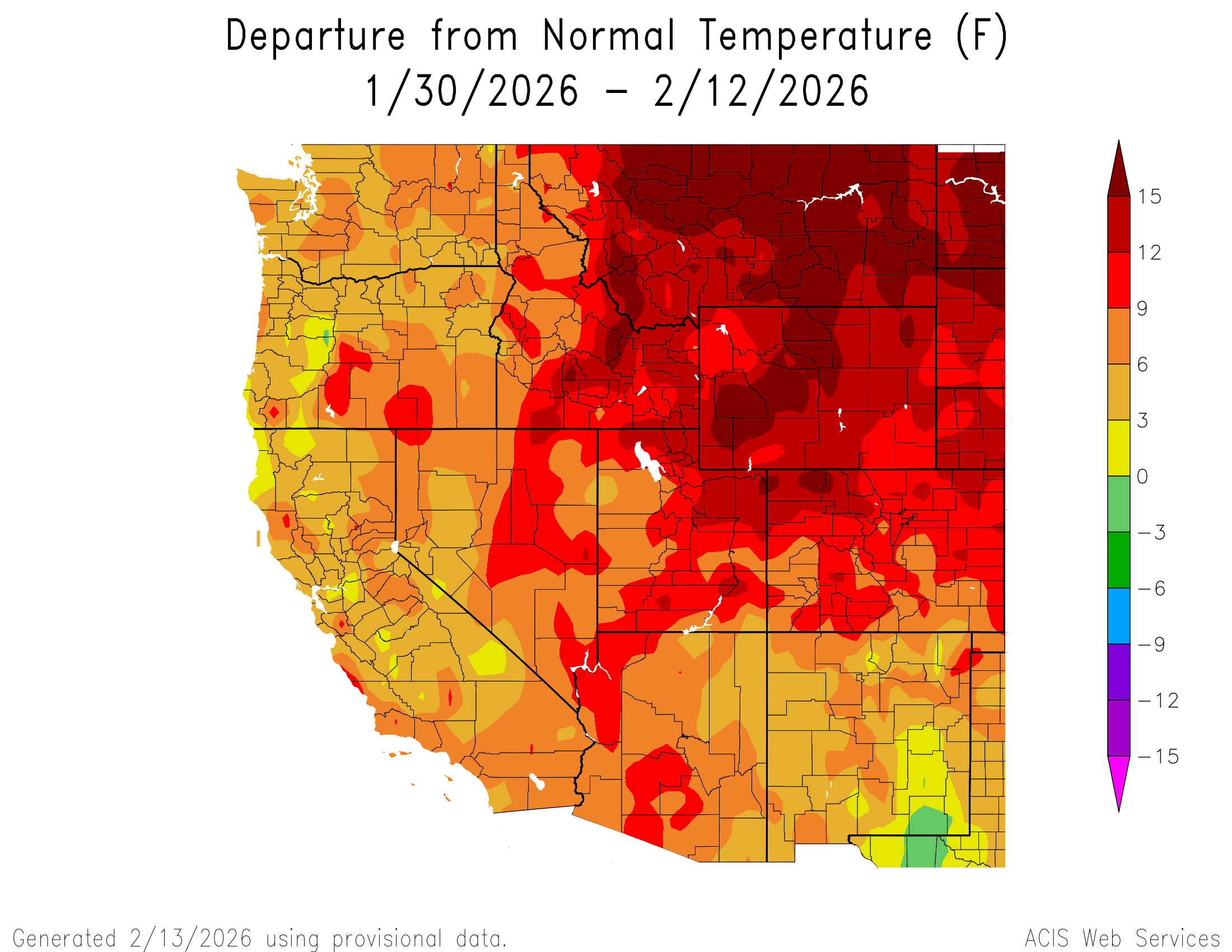
Below: It was a warm start to February, but didn’t quite set any new daily records. With stormy weather, we keep an eye on where the wind is coming from - prevailing winds at Putney study plot have been from the SW-SSW.


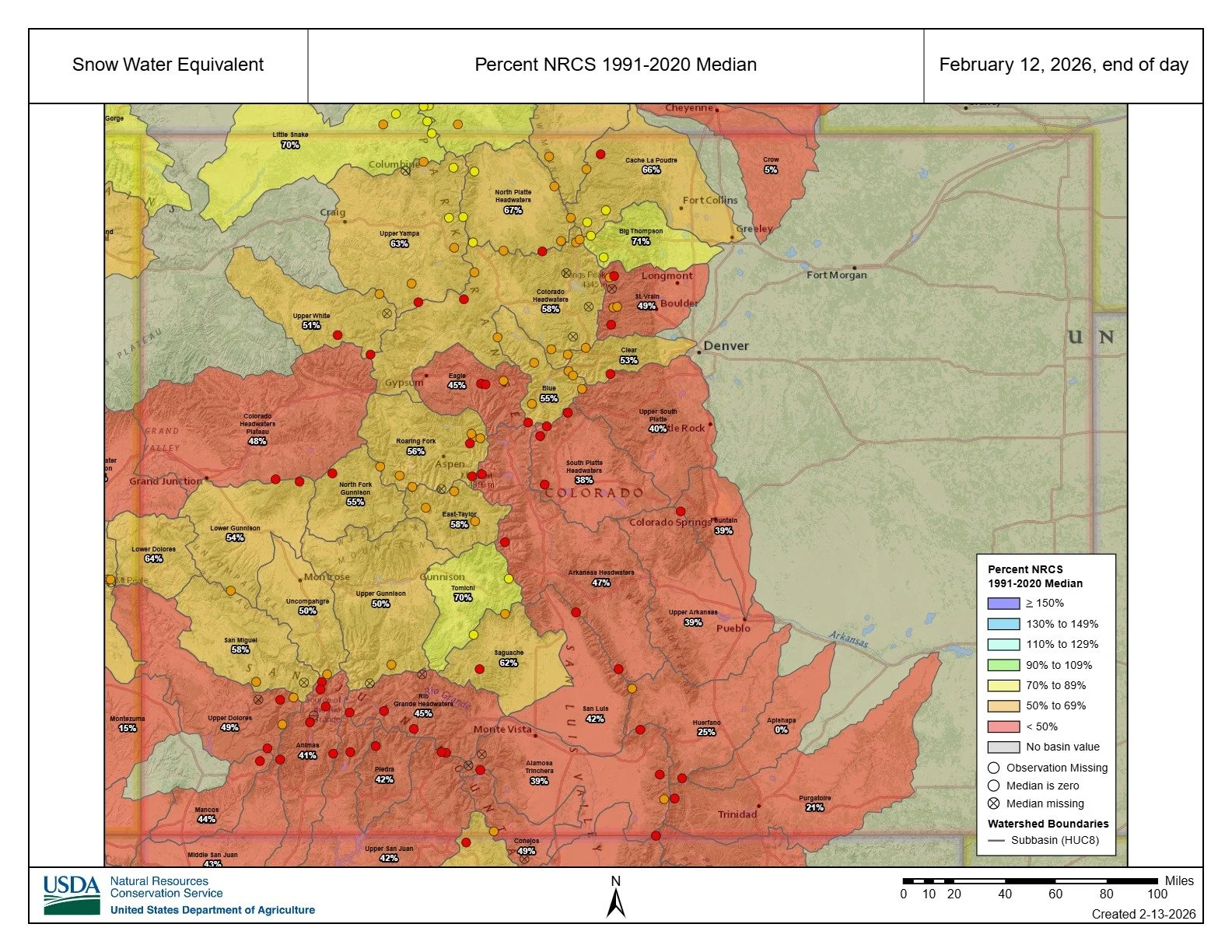
Below: Some subbasin SWE percent of the median are Animas - 41%, Upper Dolores - 49%, San Miguel - 58%, Uncompahgre - 50%, Upper Gunnison - 50%, Arkansas Headwaters - 47%, Rio Grande Headwaters - 45, Colorado Headwaters - 58%, North Platte Headwaters - 67%.
Below: The red line is the boundary of the Upper Colorado river basin.

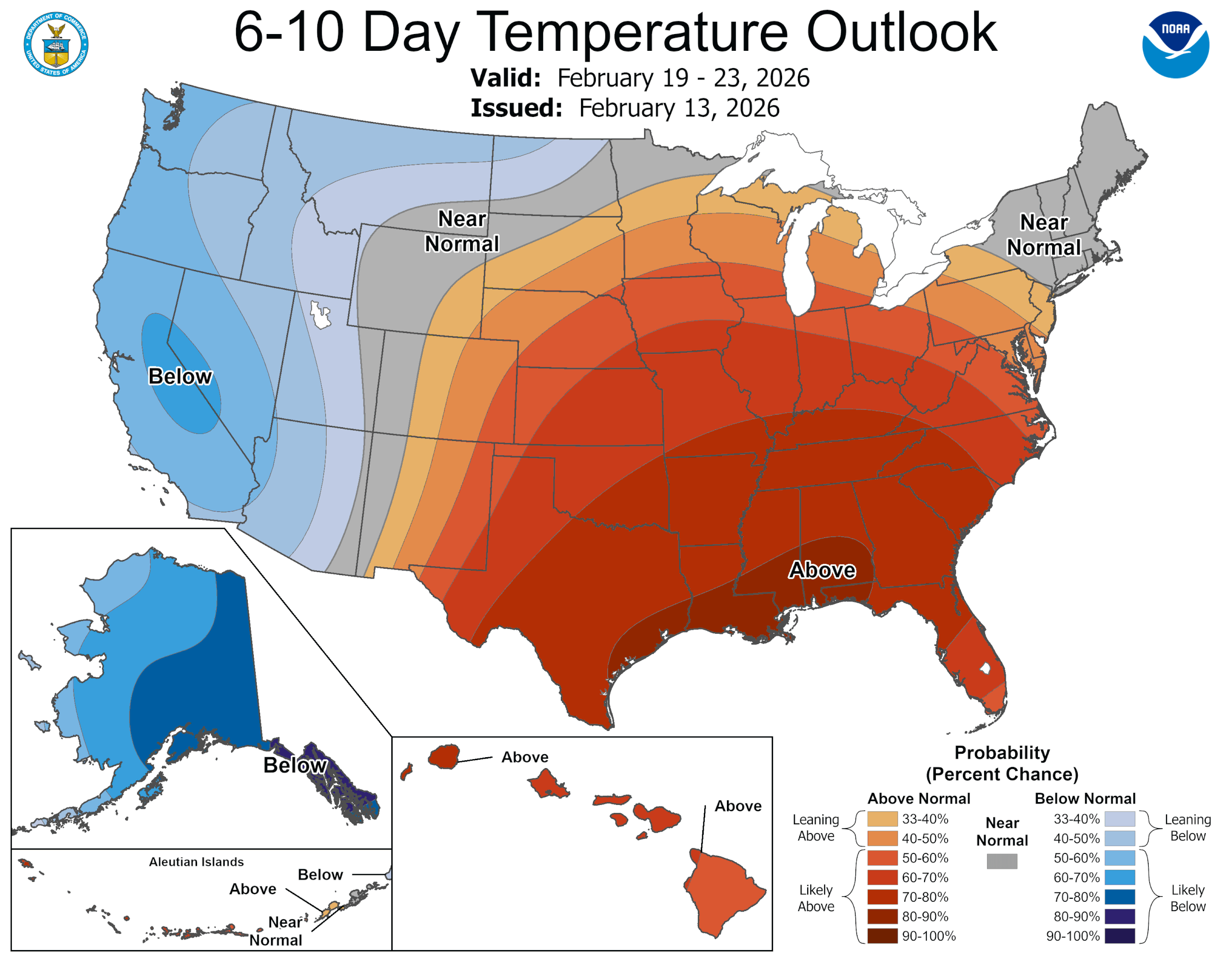
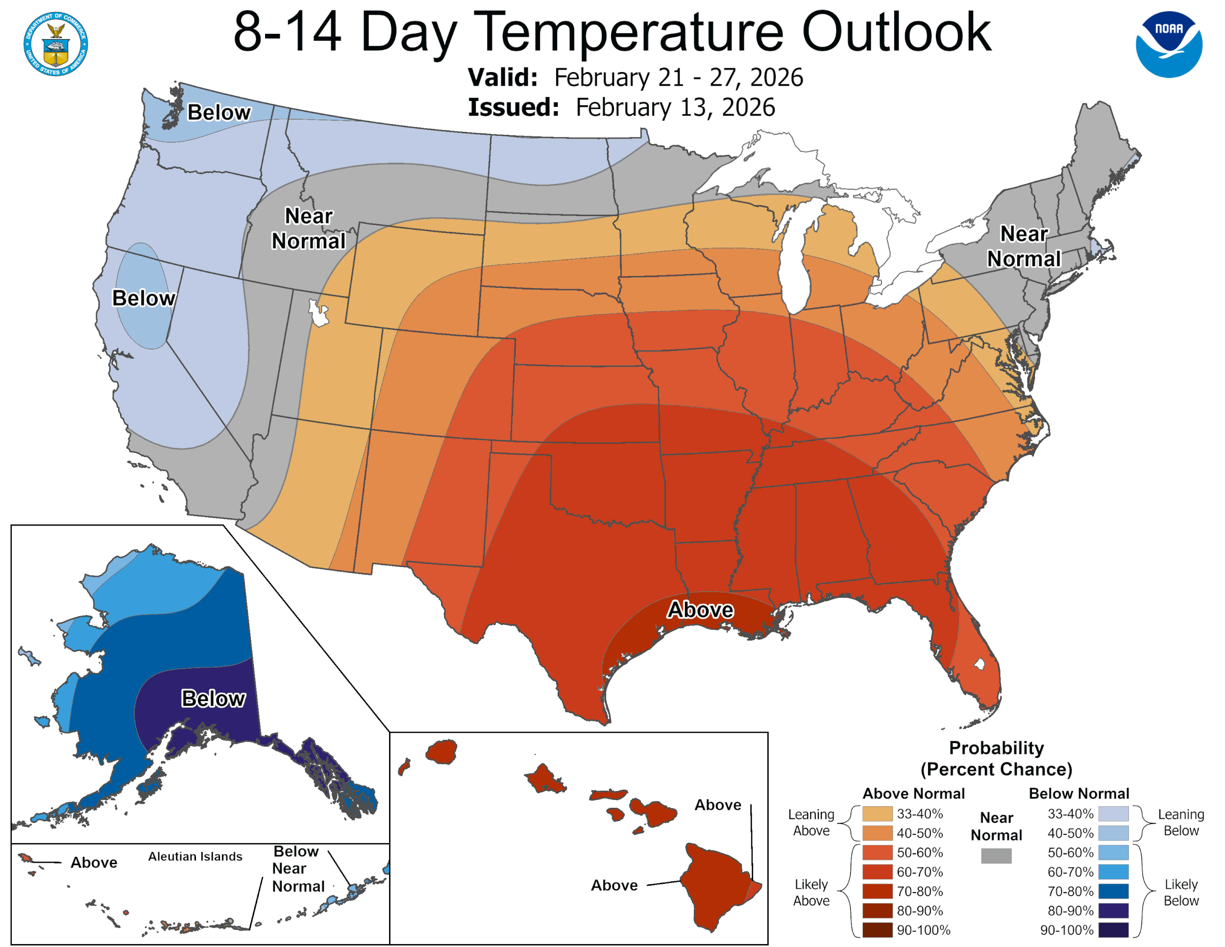

Below: A likely transition to El Nino could bring higher chances of above average temperatures.