Colorado Dust-on-Snow Program (CODOS) Update November 19, 2025: Winter Begins, Hourly Station Images, Dust-on-SNow Booklet, and more…
We thought the first snow storm of the year hitting the San Juan Mountains made for a good intro to our first update of the winter. The first month of the water year kicked things off with a bang, with southwestern Colorado experiencing one of the largest rainstorm and flooding event on record. Some stream gauges, like the San Juan River at Pagosa, saw a streamflow peak eight times what the snowmelt peak provided in early June. It was nice to see the rain after such an underperforming winter and dry summer, but it would have been nice if came in over a couple weeks, allowing for the water to infiltrate the soil and minimize the destruction.
Storm Report:
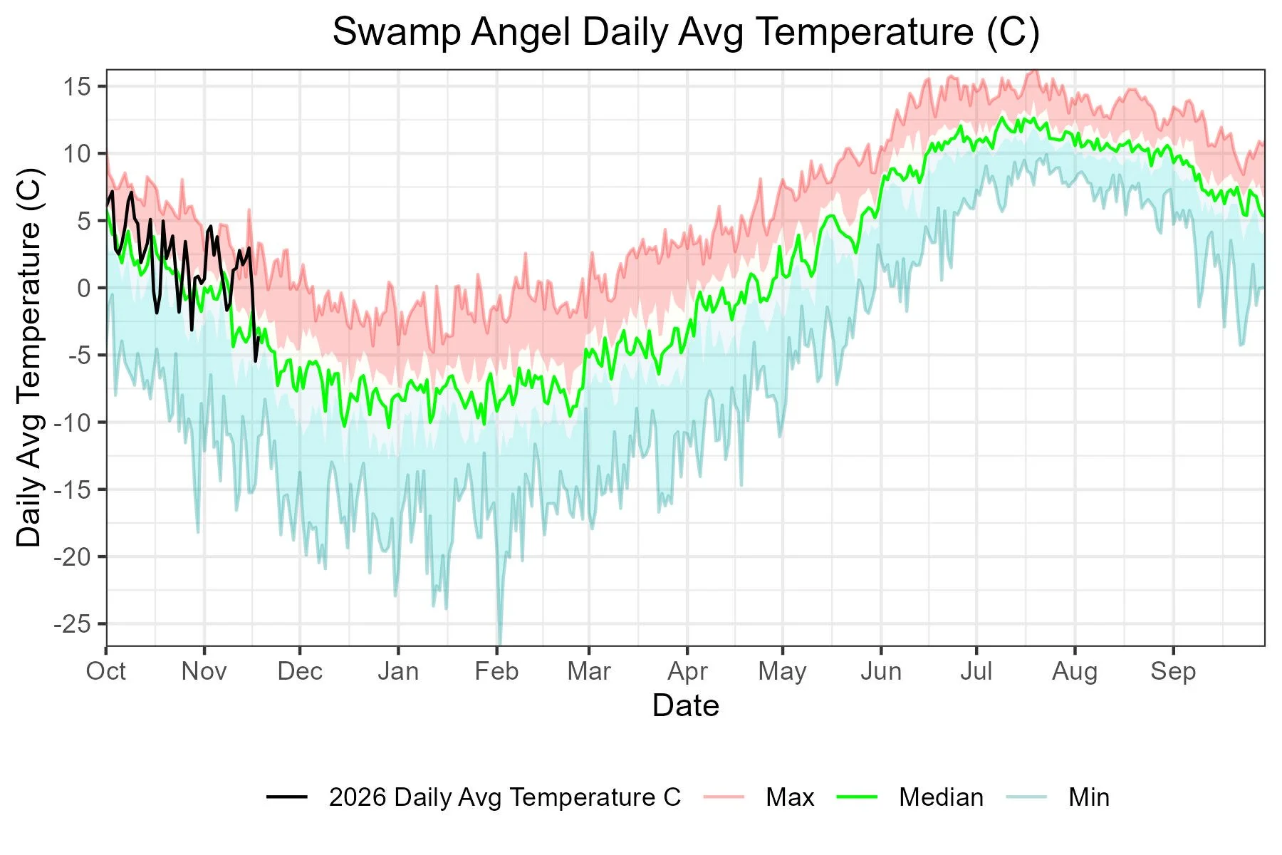
Our first winter storm arrived at Senator Beck Study Basin a bit more than fashionably late this year. With a median Storm 1 date of October 27th, this year’s November 15th Storm was the 4th latest on our 23-year record (2004-2026). The storm began Saturday afternoon with the most intensity, and continued snowing intermittently through noon on Sunday. Swamp Angel Study Plot recorded 0.74” precipitation, and about 6” of snow depth. The winds came primarily from the southwest. We issue a storm report when we receive at least 12mm (0.47”) precipitation with no break in precipitation greater than 12 hours. You can see all of the reports for the season here. It is looking like we will be issuing another storm report here in a day or two.
Hourly Images at Stations:
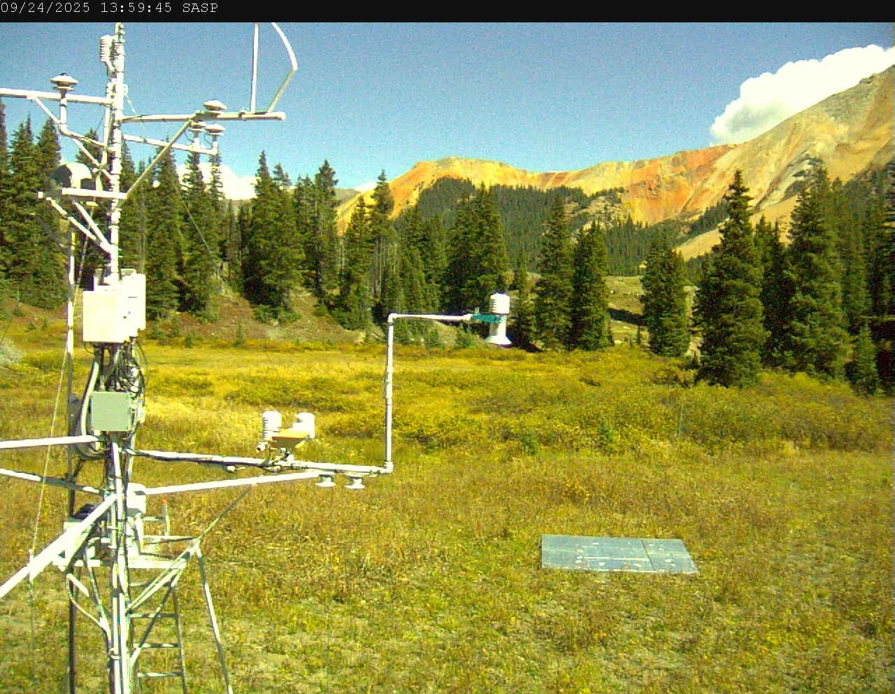
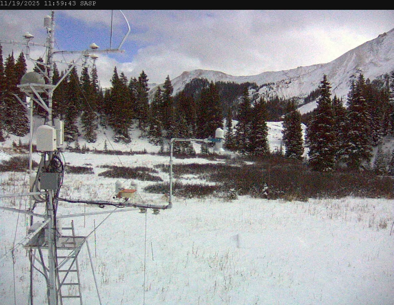
Last summer we did a massive upgrade of our climate stations in Senator Beck Study Basin (SBB). Part of that upgrade included installing three cameras in SBB, one at Senator Beck, Swamp Angel, and Putney. This past summer we worked out the programming to download hourly images from the stations. They are now available on our website at snowstudies.org. The intention of these cameras was not only to monitor the snowpack, dust-on-snow appearance/disappearance, and condition of sensors, but also to serve the emergency management community, CDOT, and of course the backcountry recreation community. See sample images below. If you value these images, our station data, and field observations, please consider supporting the effort be donating directly or through Colorado Gives.
Dust-on-Snow Symposium Booklet:
You may remember CSAS is a member of a working group of multidisciplined professionals coordinating to address dust-on-snow by restoring soil and ecosystem health in the dust source regions. The effort, Nexus of Land and Water: Southwest Initiative on Land Health and Water Resources, is organized by the Wright-Ingraham Institute. Last year we held a symposium in Cortez, Colorado. The presentations from that gathering and details about the approach of the working group are now available in a booklet. You can download the booklet here. As mentioned, it is multidisciplined organization (ranchers, story-tellers, researchers, etc.) If you are interested in participating in one of the working groups get in contact with CSAS for more information.
Snow School for Water Professionals:
If you are considering attending Snow School for Water Professionals this February 25-27, 2026, please let us know. Due to cuts in federal funding, it may be likely that many federal employees will not be able to attend. If we have too few people registered we may not offer the class this year.
The combination classroom and field course will begin on Wednesday morning at our office in Silverton and end on Friday afternoon (2.5 days). The class is perfect for anyone wanting to learn more about the role of snow and our mountain environments as it pertains to water resources, designed to enhance understanding of snowpack processes, monitoring and data. Please see details in the link above. Please email me (jderry@snowstudies.org) with any questions.
WSRF Grant:
Being a small non-profit, we work off a very modest budget and we are extremely efficient. Usually we receive some support from federal sources (BoR, Forest Service), it is not a huge amount but definitely significant. This year and going forth that funding looks to be in jeopardy requiring us to look elsewhere to fill that void. But we are fortunate to have a stable core group of donors that include many water districts, Denver Water, researchers, and typically a grant of some kind from CWCB. This Fall we sought support from CWCB and the roundtables of Colorado in the form of a Water Supply Reserve Grant (WSRF). For this request this summer and autumn we presented at eight roundtables. It is always enjoyable reconnecting with each roundtable and listening to their needs and concerns. Every grant recipient should go through this process. We found overwhelming support for the efforts of our organization that is humbling. This note is just to say thank you to the Colorado Water community for your continued support. If you know of someone who may enjoy receiving notifications of when updates have been posted to the website, please forward this posting to them.
Below: Image on left, Putney Station (12,325’) looking towards Red Mt Pass. See coordinates. Trico Peak is in center of photo. Black Bear Pass Road is visible left side of photo in summer. Senator Beck Basin is in the right half of photo. Swamp Angel station is barely off the photo in the trees located lower right. The image on the right is after the first snow storm of the year.


Below: Swamp Angel Station (11,060’). See map and coordinates. Image looking east/northeast just north of Red Mt Pass. Image includes snow depth sensor in center, up-looking and down-looking radiation sensors on tower. In summer the snow scale is seen in the lower right quadrant.
Below: Senator Beck station (12,200’). See map and coordinates. Image looking west from Senator Beck tower. Trico Peak is slightly off the image to the left. Meteorological station at lower left is part of the USGS’ Next Generation Water Observing System (NGWOS) network. Collocated with Senator Beck station for data comparison.