

CODOS Update May 6, 2022: Buckle-Up
Greetings from Silverton,
Since our last update the NWS prediction for more dust came through with wide spread dust events on May 1 and May 2. Last week we saw chances of precipitation and periods of cooler weather - but with dust exposure. At Swamp Angel we saw three trace precipitation events that subdued streamflow for a couple days.
Now, all dust layers except the first two events of the season (D1 and D2) occupy the to ~5” of the snowpack. We have severe dust conditions. Albedo at Swamp Angel (11,060’) hit 38% today. Albedo of dry sand is 38-44%! Senator Beck Station (12,200’) hit an albedo of 49%! See data here.
The forecast is for sunny/warm weather with minimum temps being near or above freezing. With all of this in place there is nothing keeping the snow from melting full tilt. From this point forward analog years in our period of record that may offer insight as to how snowmelt/streamflow might unfold are WY2006, 2009, 2010, 2012, 2013, and 2018. Most of these years were severe dust years. See here for analog years for your watershed. Some southern SNOTEL’s, like Wolf Creek, that have prolonged dust exposure have seen some record melt rates in April. We have not classified dust severity in southern basins as “severe” in 9 years. It is quite possible we will see events unfold in a way we never have before. I was hoping the May forecast would include a few sizable precip events to cover dust in a meaningful way, but that does not seem to be in the cards as of right now.
Please see pictures and plots below.
Take Care,
Jeff Derry

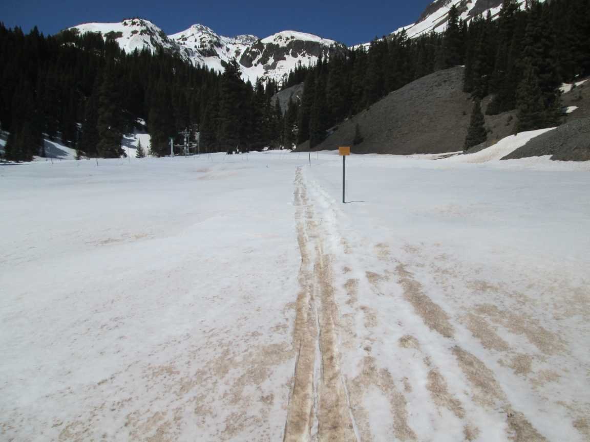
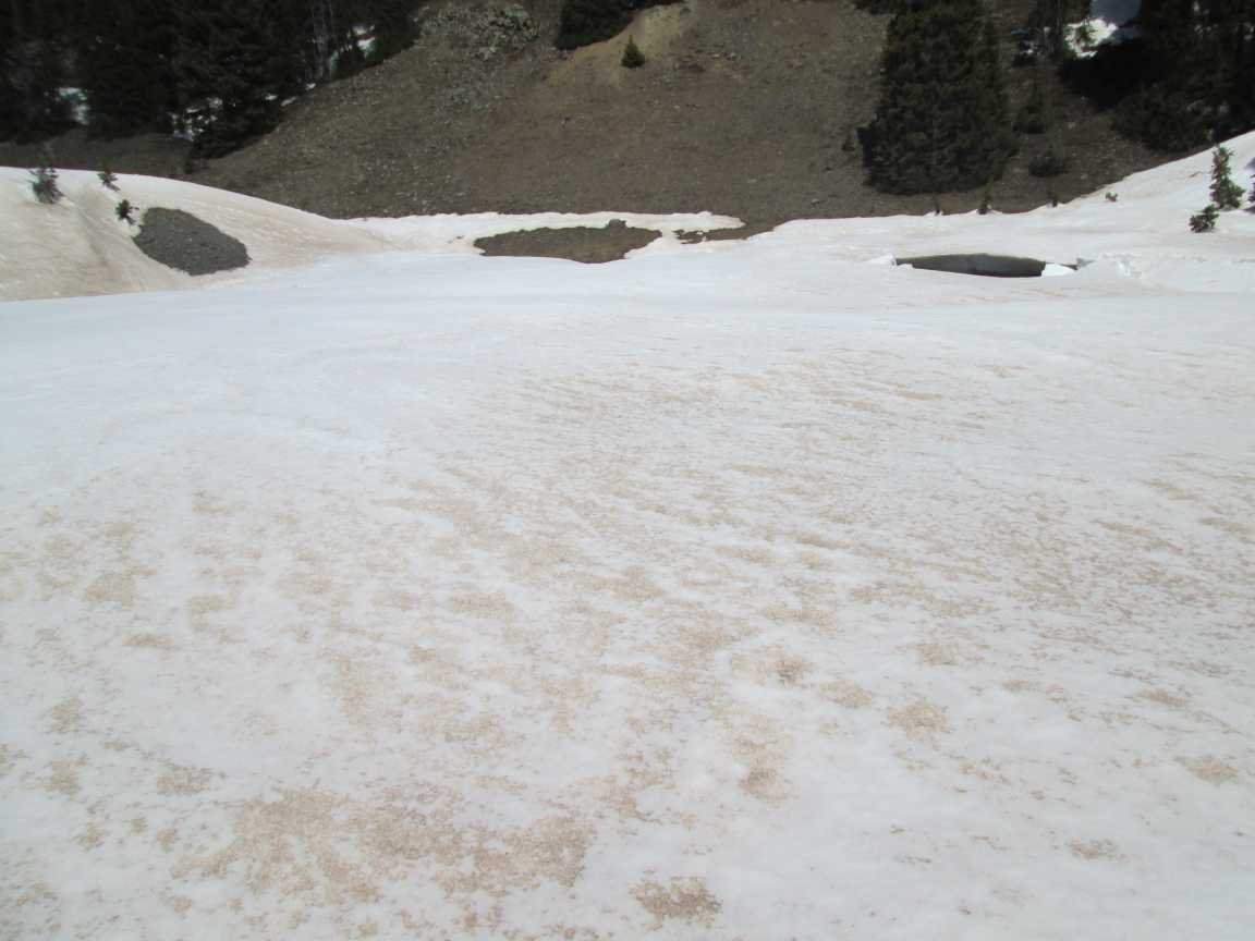
Upper San Juan SNOTEL on April 27. Photo taken by Valerie Lovett. Photo taken before additional dust events on May 1 and May 2. At Wolf Creek the severe dust layer #3 that was under 5.6” SWE on April 16 has been merged at surface for the last number of days now.
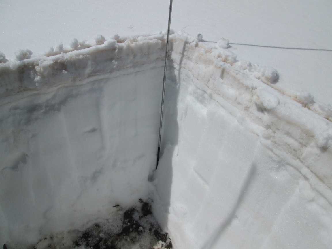
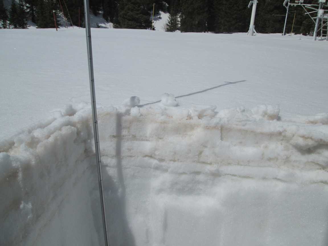
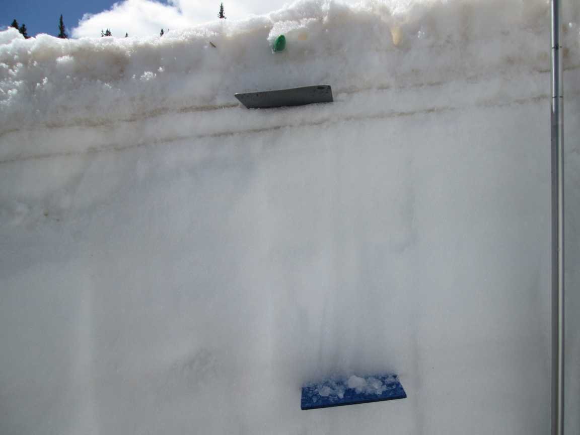
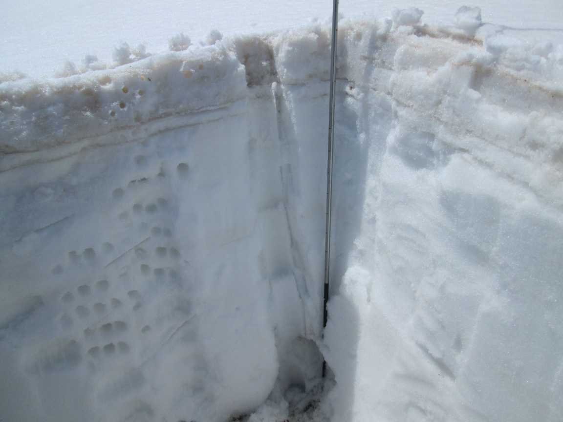
Above: Photos from Swamp Angel on May 5, 2022. Still noticeable is the trace precip received May 4. Dust events #3-#9 comprise the top 5” of snow surface. It would be reasonable to see record snowmelt rates the next couple weeks. See photos from the San Miguel Watershed here.

Albedo keeps tanking!!

Image Source: https://en.wikipedia.org/wiki/Albedo. Albedo of the snow surface is approaching that of dry soil!
Below: How windy was the month of April? In terms of the amount of wind it was nothing out of the ordinary. But in terms of number of days of high winds (greater than a daily average of 20 mph) it was the most except for WY2019 in the last 18 years.


