CODOS UPDATE May 15, 2025: Swamp Angel Observations
Greetings from Silverton,
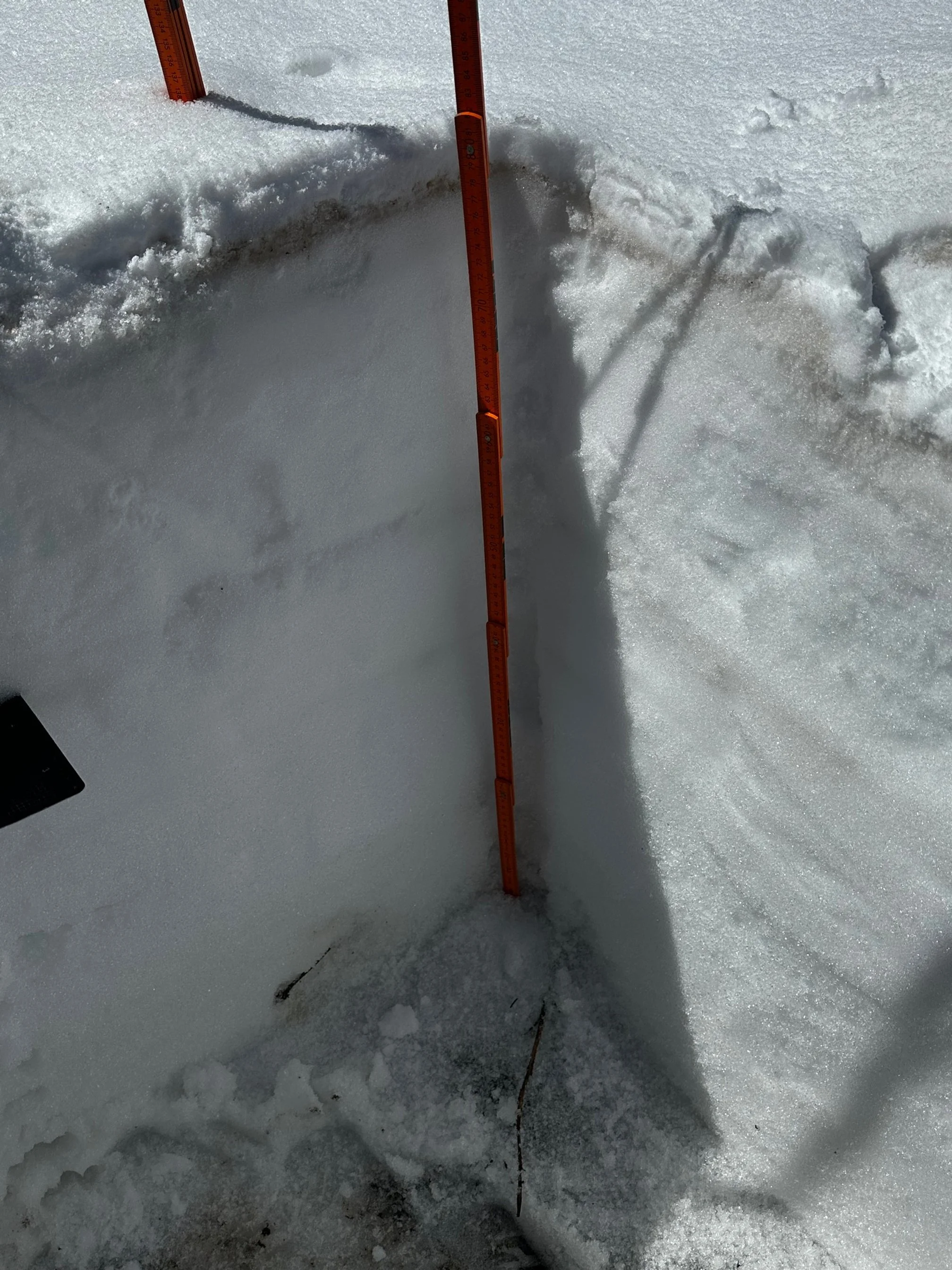
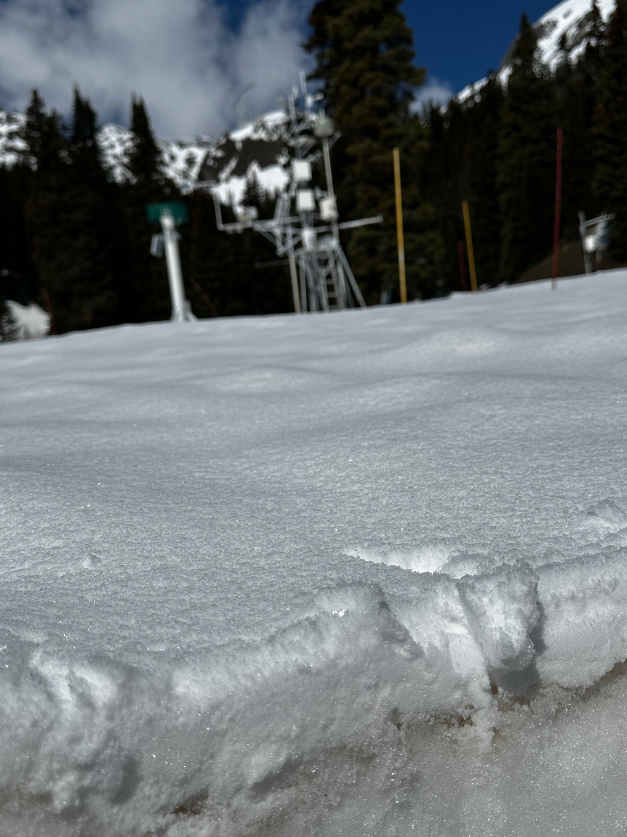
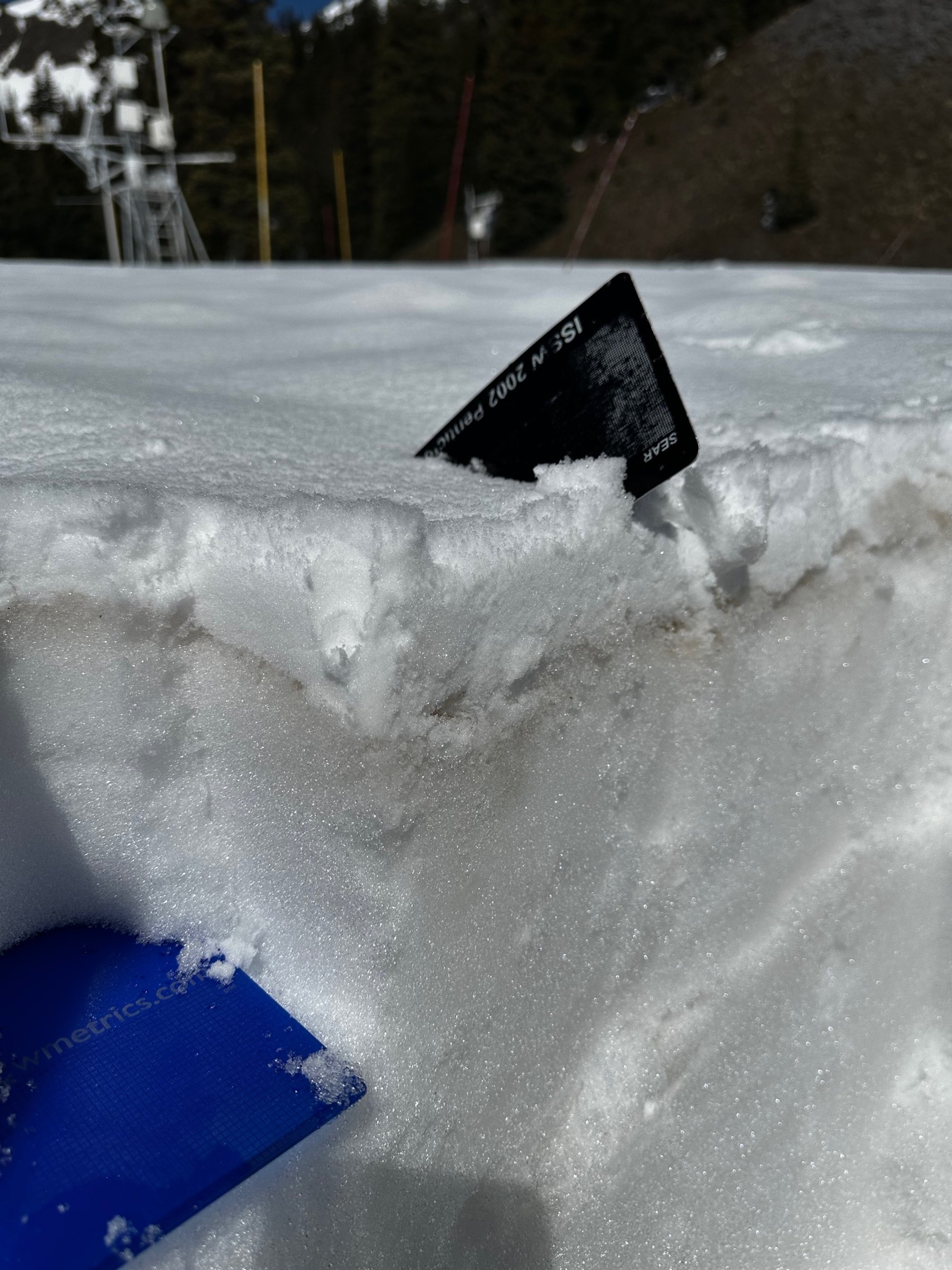
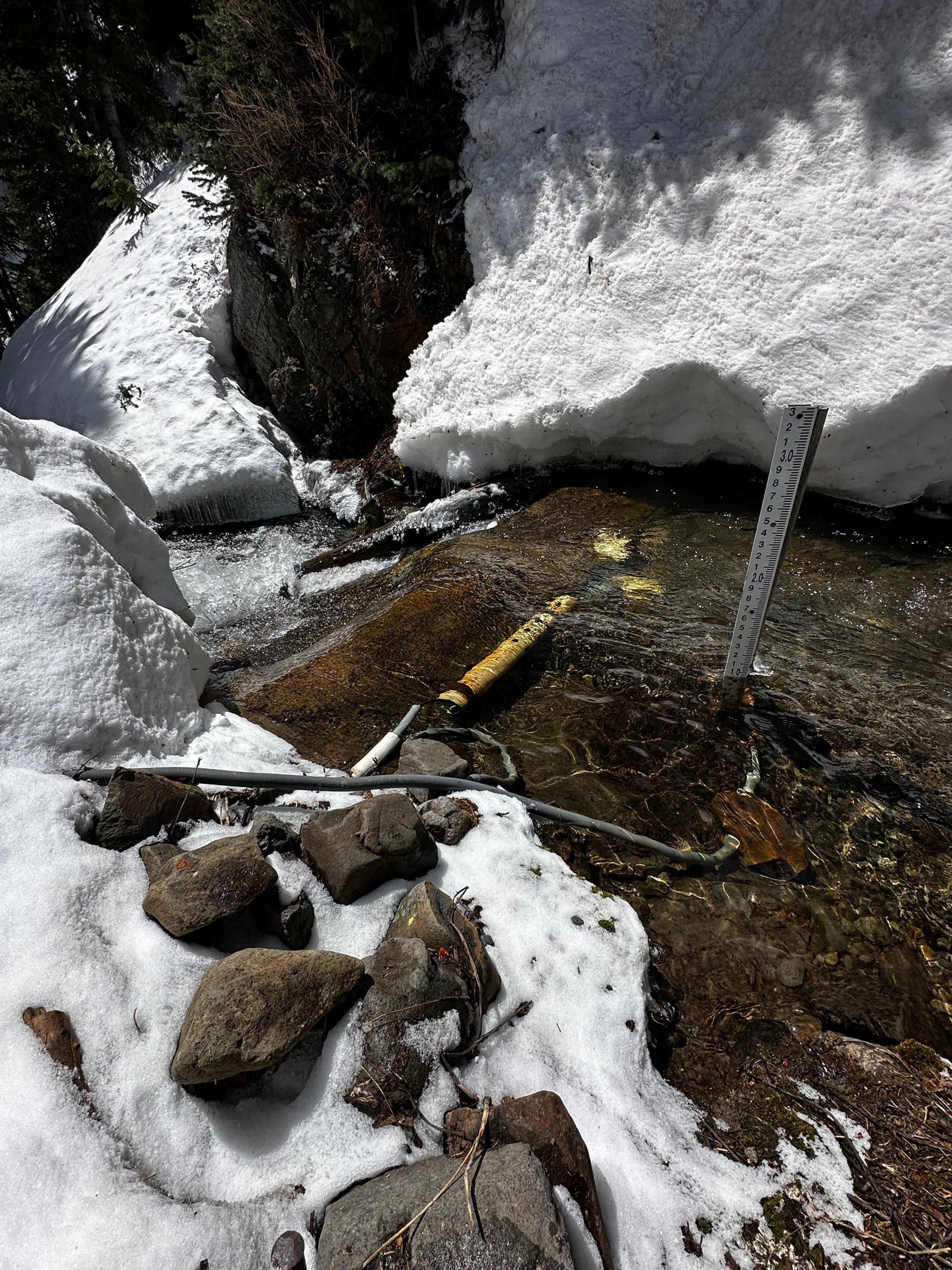
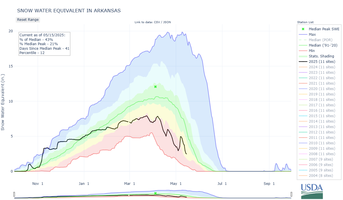
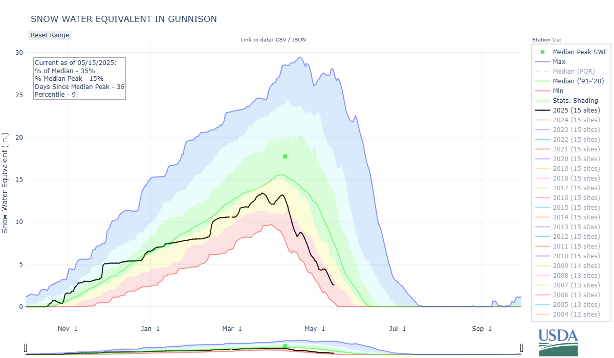
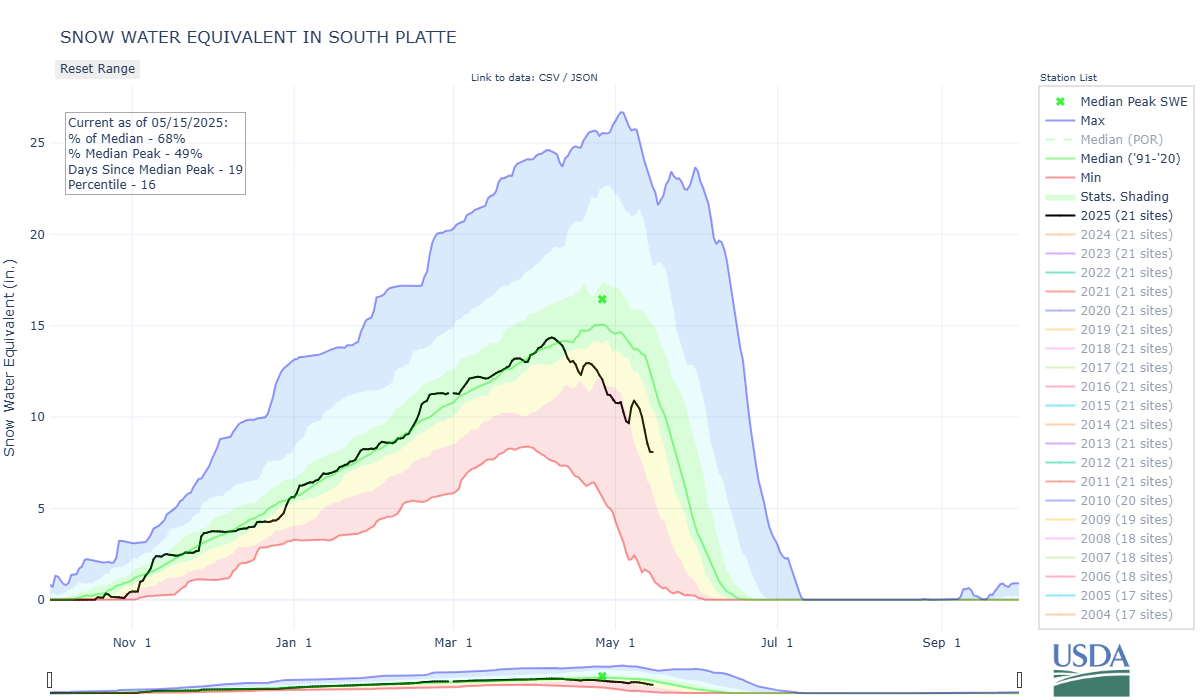
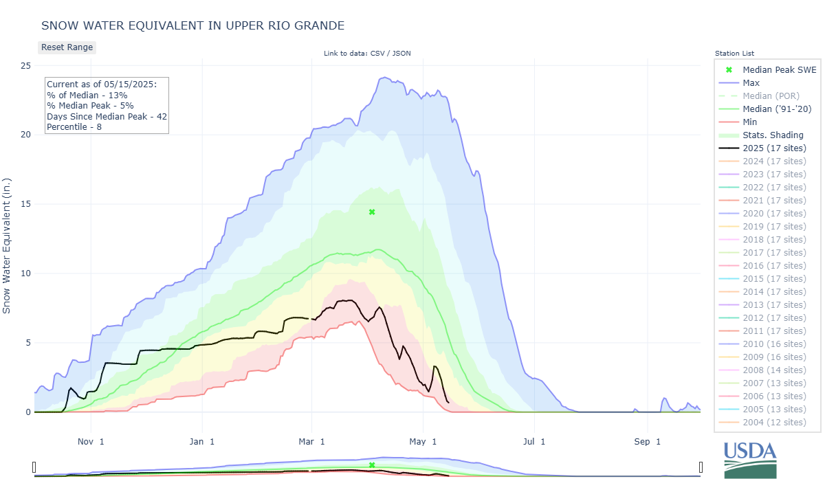
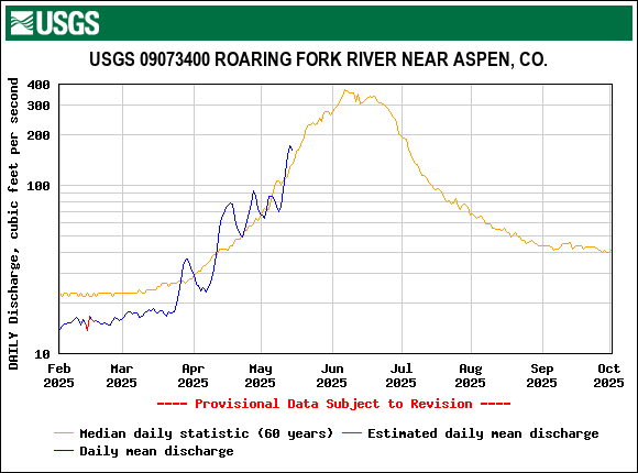
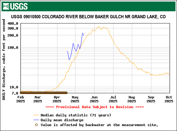
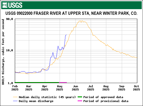
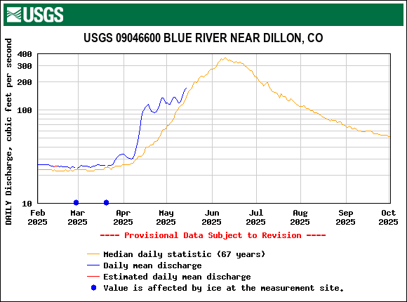
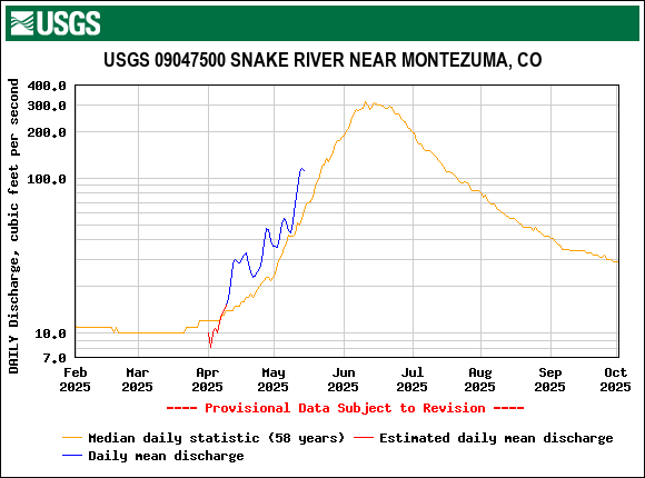
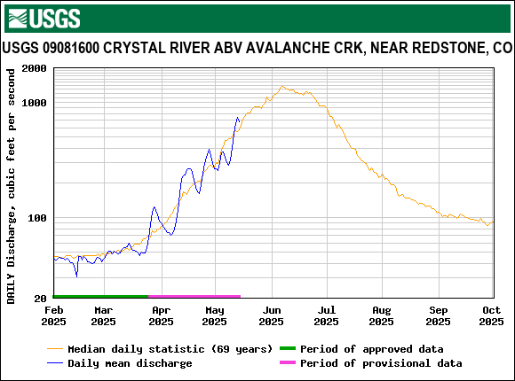
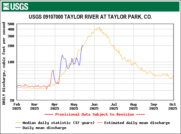
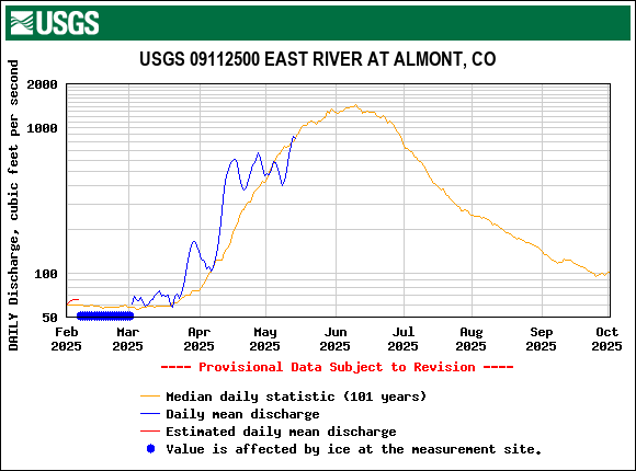
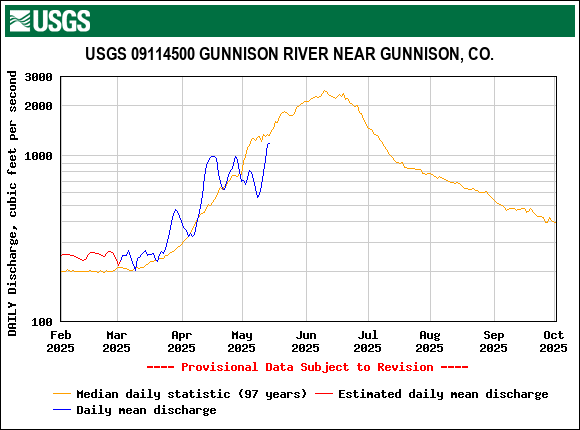
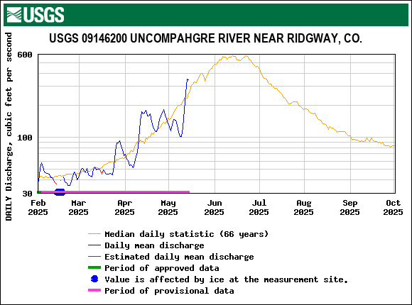
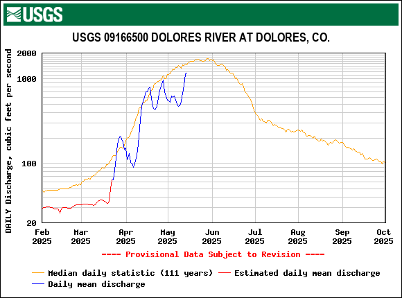
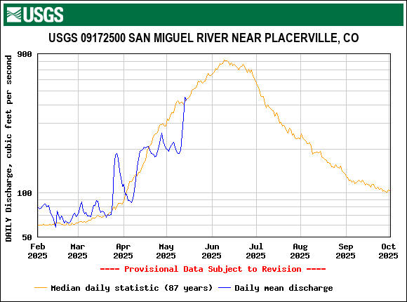
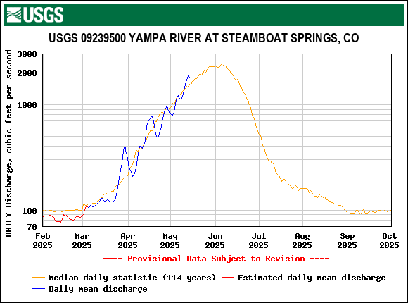
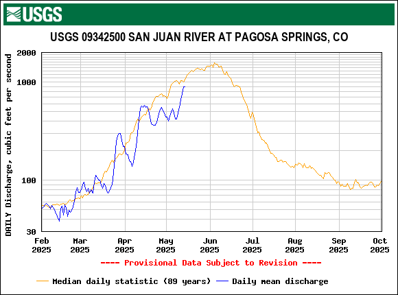
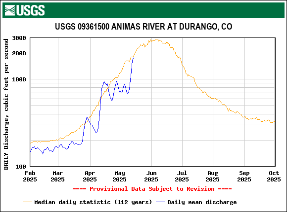
The rainy/snowy weather that visited the southern and central mountains the beginning of the month gave way to warm/sunny conditions that initiated a surge in streamflow. At Swamp Angel the majority of the season’s dust deposition is at the surface of the snowpack resulting in snowmelt rates over the last five days on average of 1”/day. Last night a passing storm left a thin (~1”) fresh snow cover that will provide a couple days of slower snowmelt, after which another system is expected to roll through Sunday and Monday hopefully providing few more inches of wet snow. The remainder of the latter half of next week looks to see a warm up with above average temperatures. In some locals, namely the southern basins, yesterdays fresh dusting along with the forecasted snow will likely push back peak flows by a few days. But across the board we are seeing snow ablation being at record or near record rates. We will see early peak flows. And streamflow forecasts are below or much below average.
Take care