CODOS Update May 14, 2022: Peaks Ahead
Greetings from Silverton,
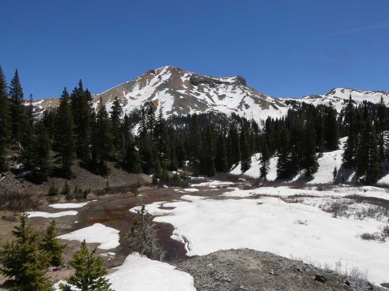
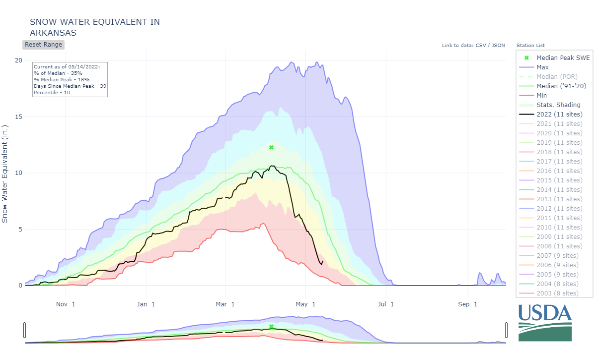
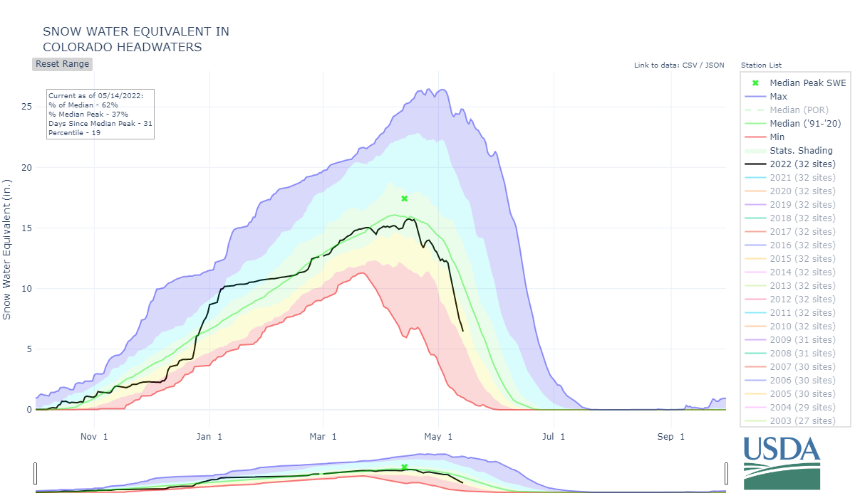
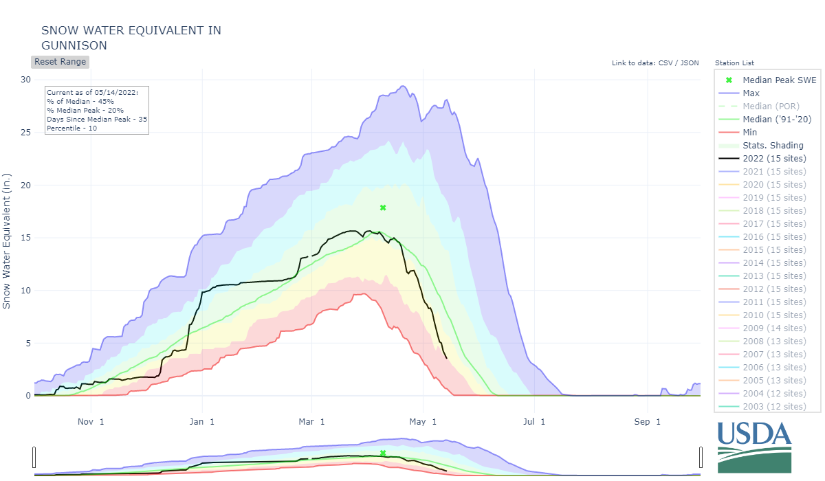
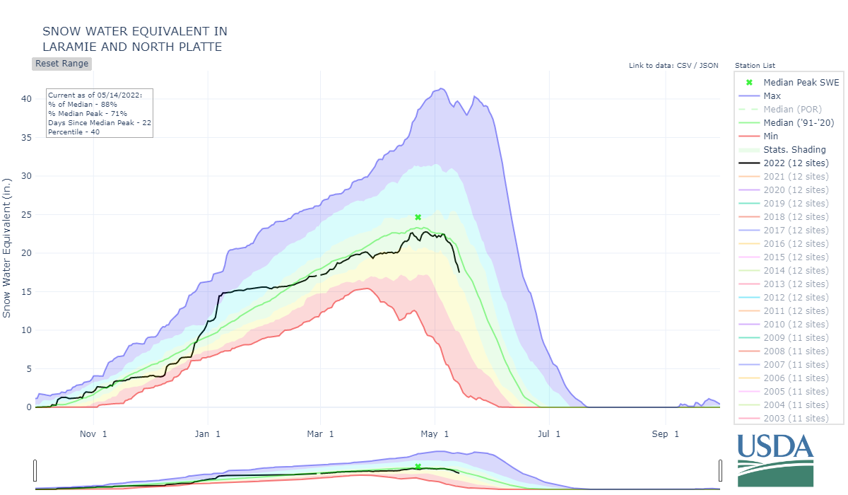
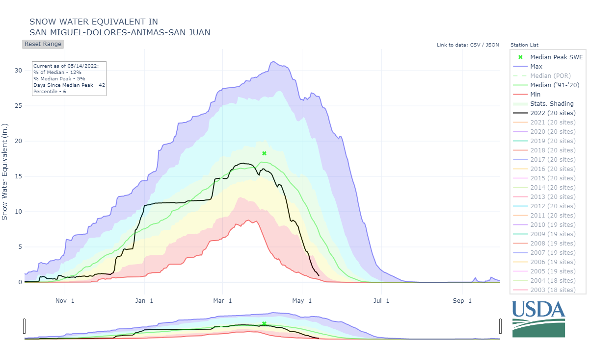
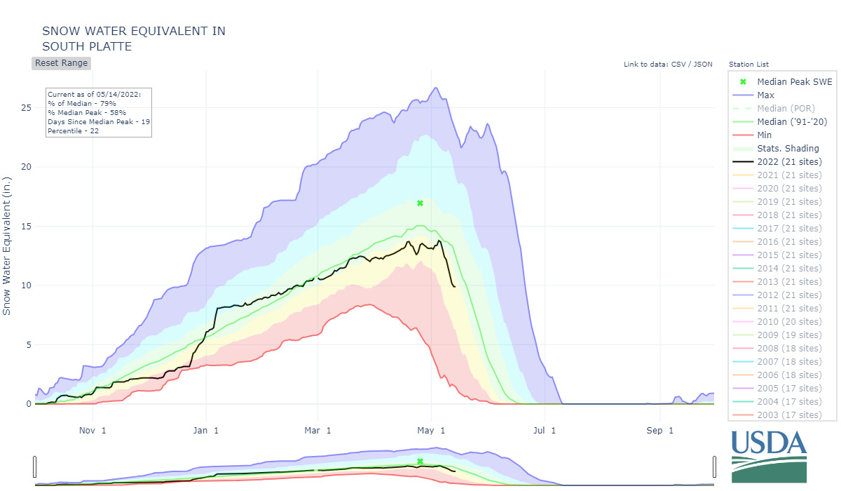
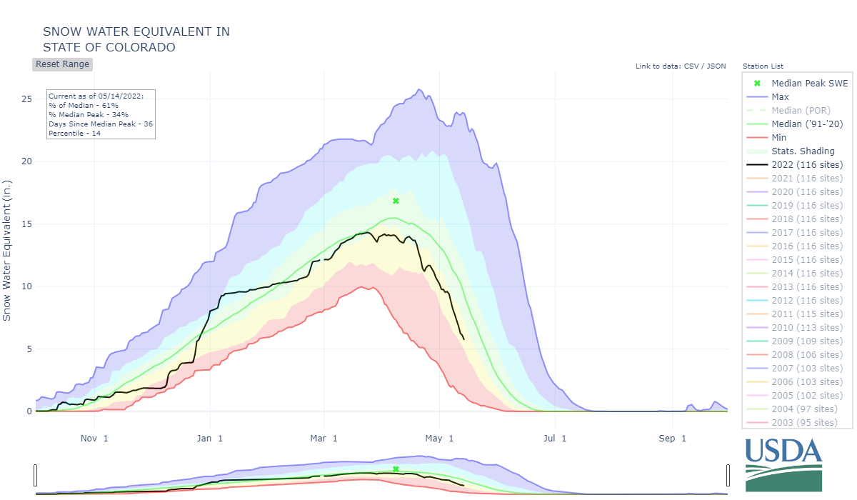
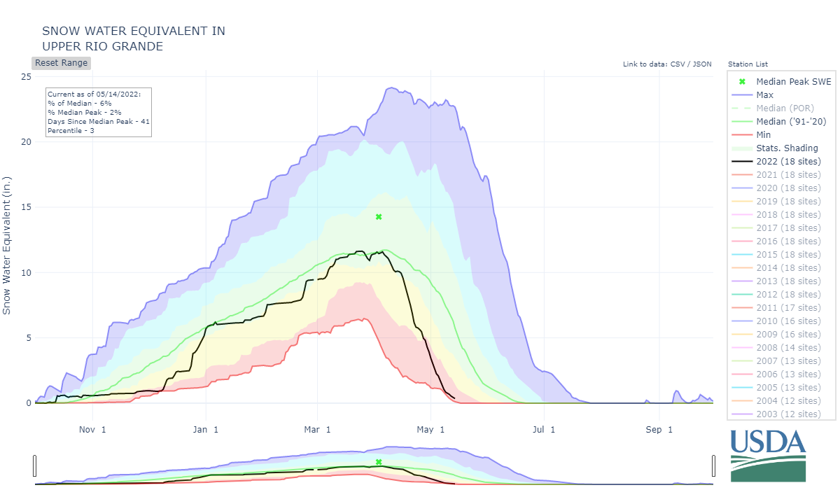
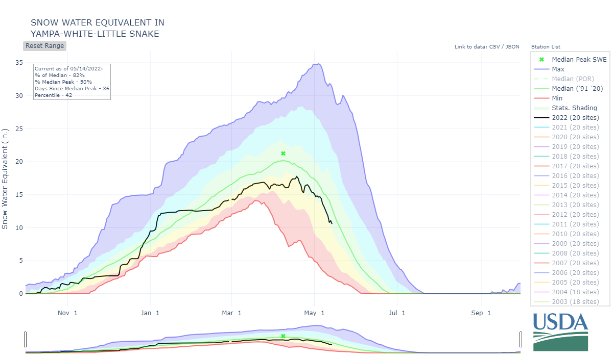
It’s happening fast. The sustained high melt rates from the long exposed dust, lack of precip, windy, warm, and dry conditions put ablation of the snowpack in high gear particular in the southern basins. The northerly basins received a bit more precip than the southern these last few weeks resulting in - even if the basin did not hit median levels - delayed rapid melt which pushed SWE amounts closer to median levels. Now, these basins are seeing melt ramp up over last the last week or so. It will be interesting to assess melt rates - like we do every year - this coming summer after field work tapers off.
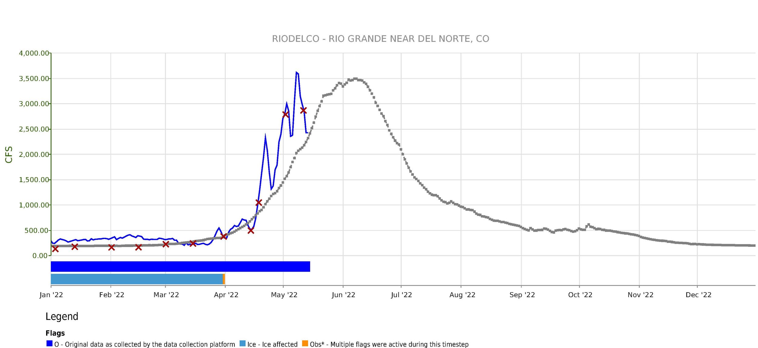
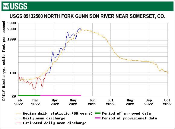
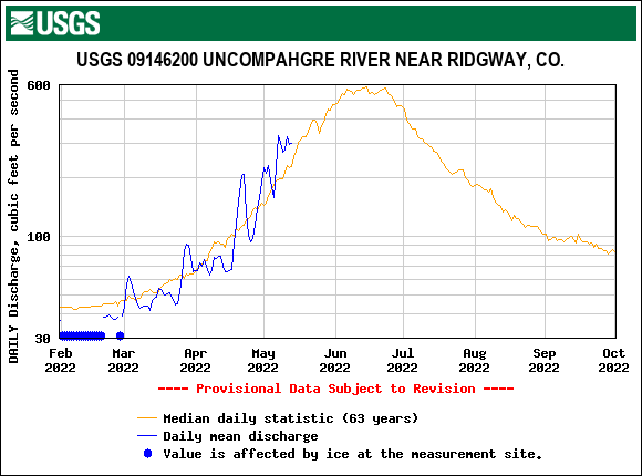
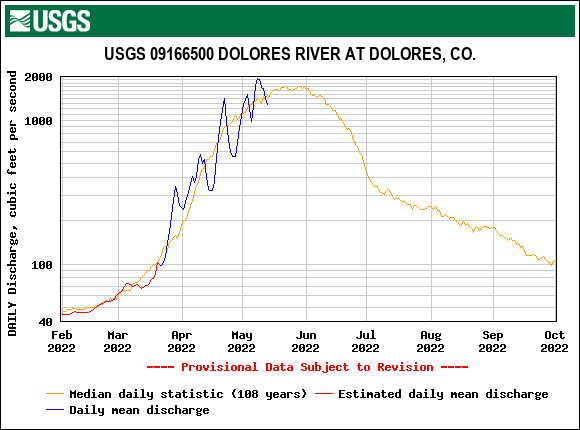
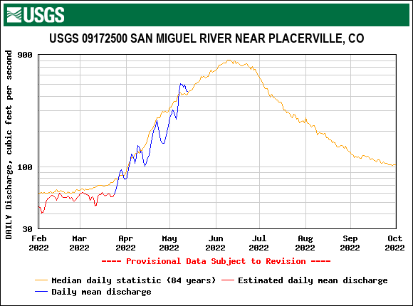
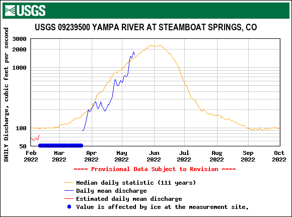
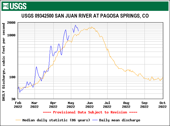
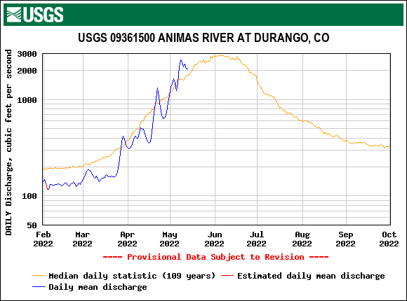
Senator Beck historical data point toward a peak discharge for many streams in these headwaters (Animas, Uncompahgre, San Miguel) here in about three days. The CBRFC forecast agrees with this along with a number of other streams in Colorado. High elevation snowmelt as indicated by our Senator Beck station has been clicking along nearly as fast as Swampy. With the weather forecast calling for warm overnight low temps we might see the mid-elevation (11,000’) and high elevation surge happen very close together or overlap each other altogether.
Tomorrow we begin the codos tour to check-in on basins around the state.
Please see pictures and plots below.
Take Care,
Jeff Derry
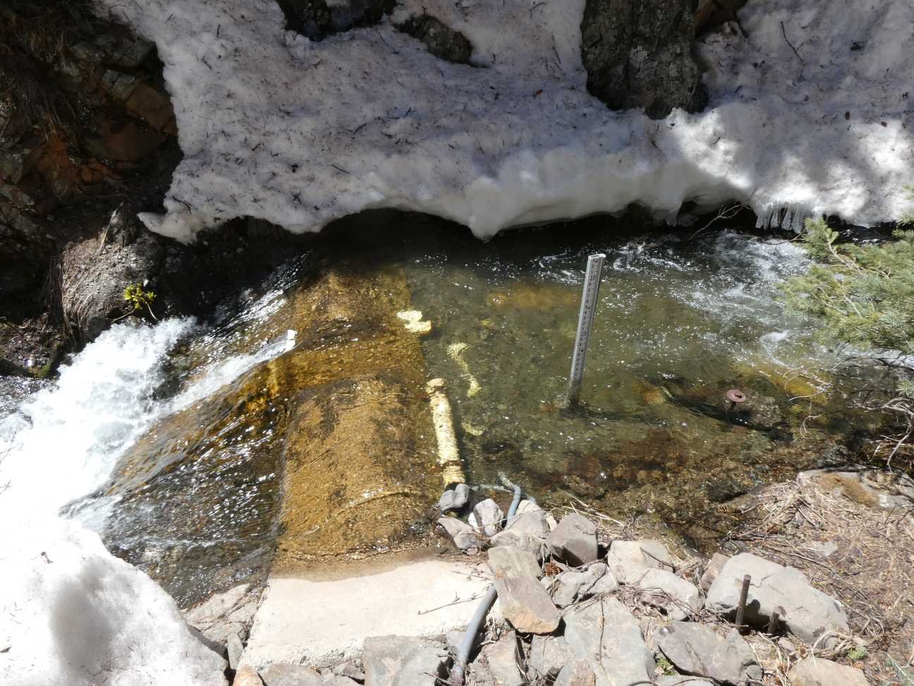
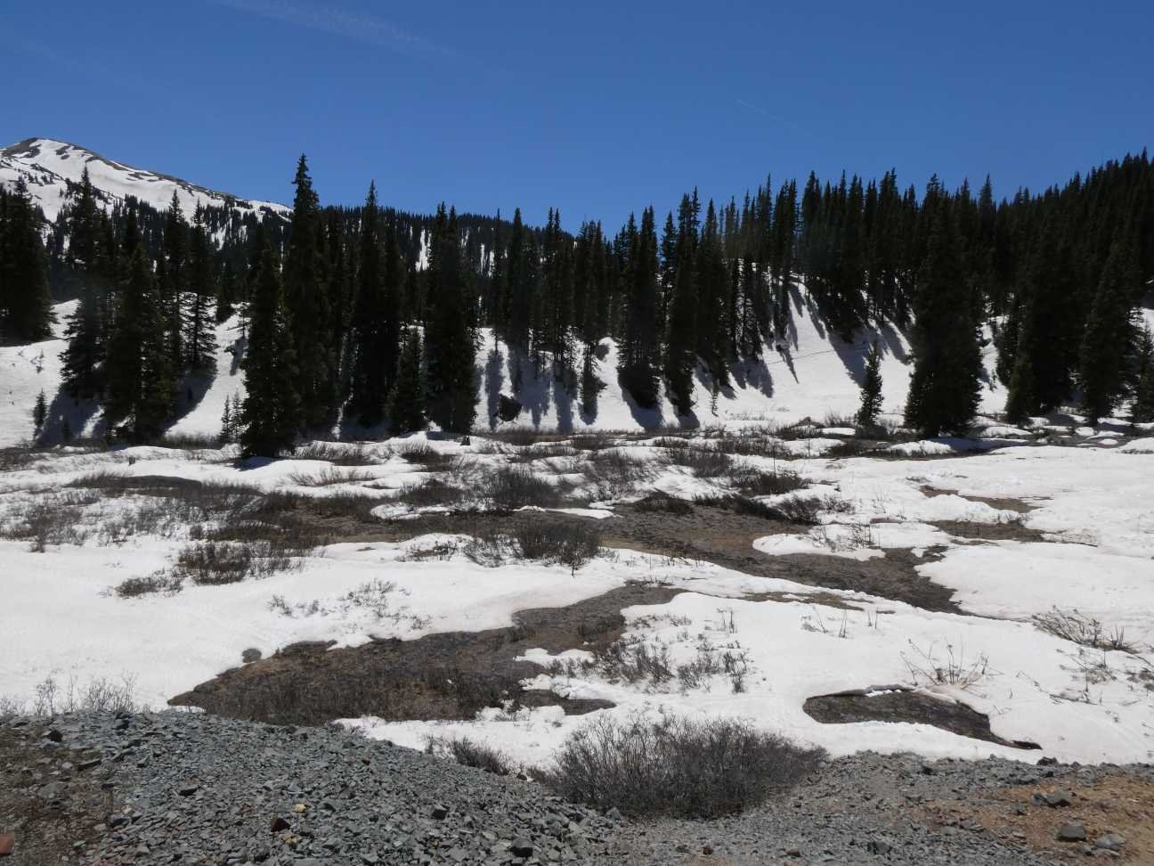
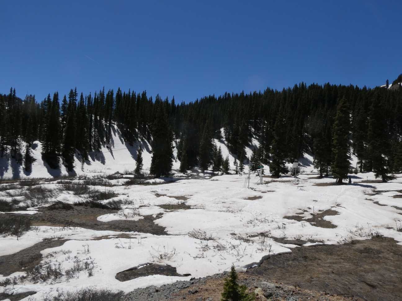
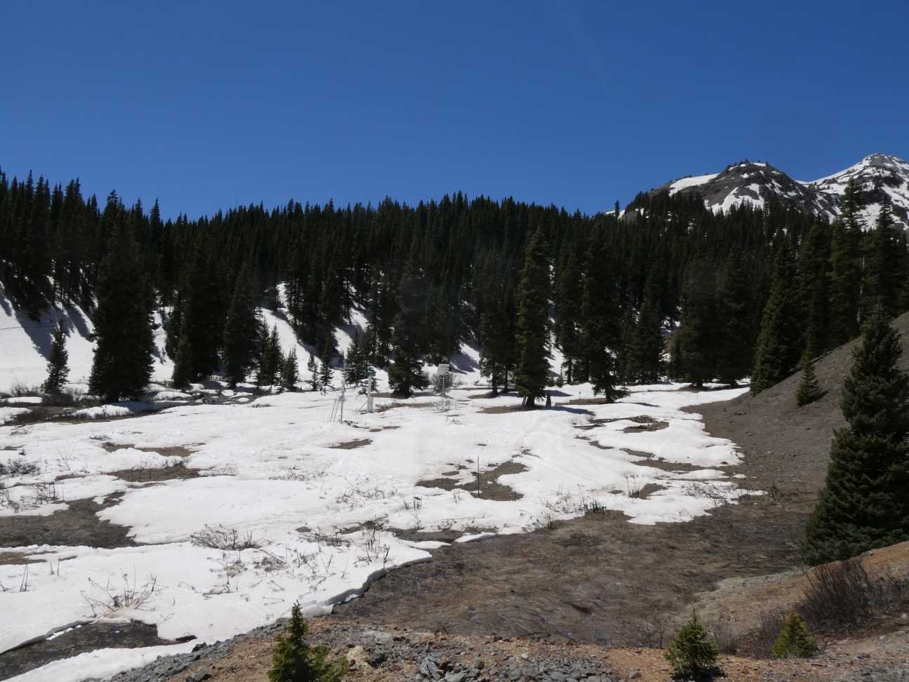
Below: Pictures from May 14 at Swamp Angel. The stream gauge is at 11,000’ and gives water managers a heads-up of what is coming down the hill from the high elevations. These are the last pictures from Swampy this year while snow is still on the ground since we are starting the codos tour tomorrow.
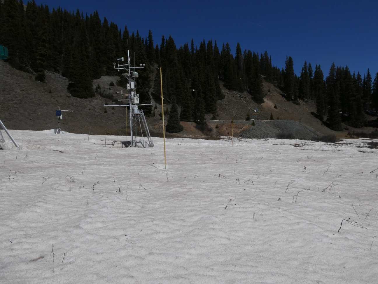
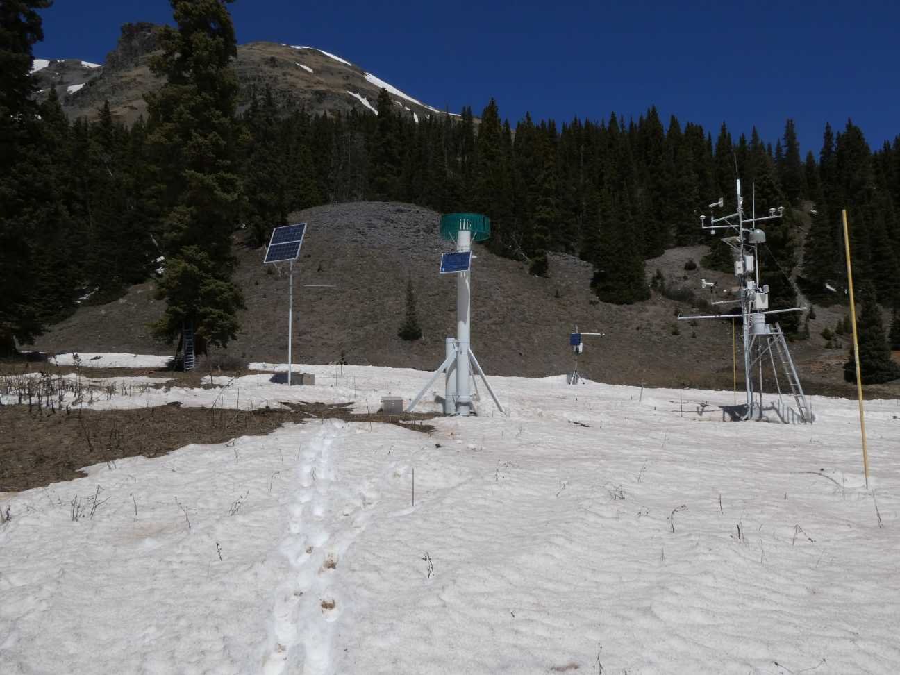
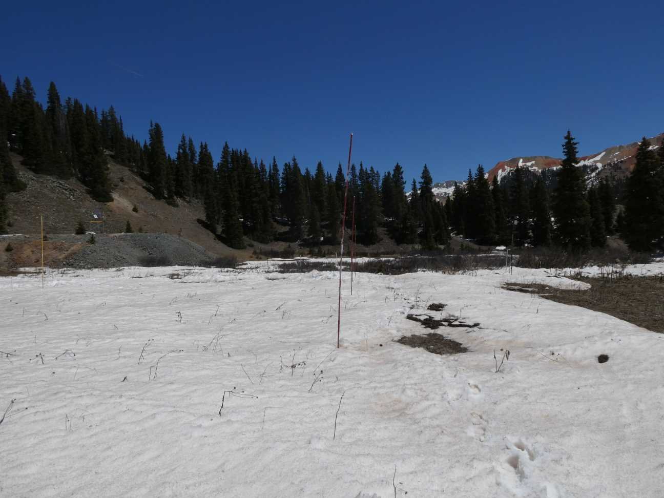
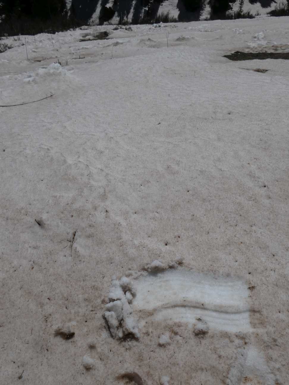
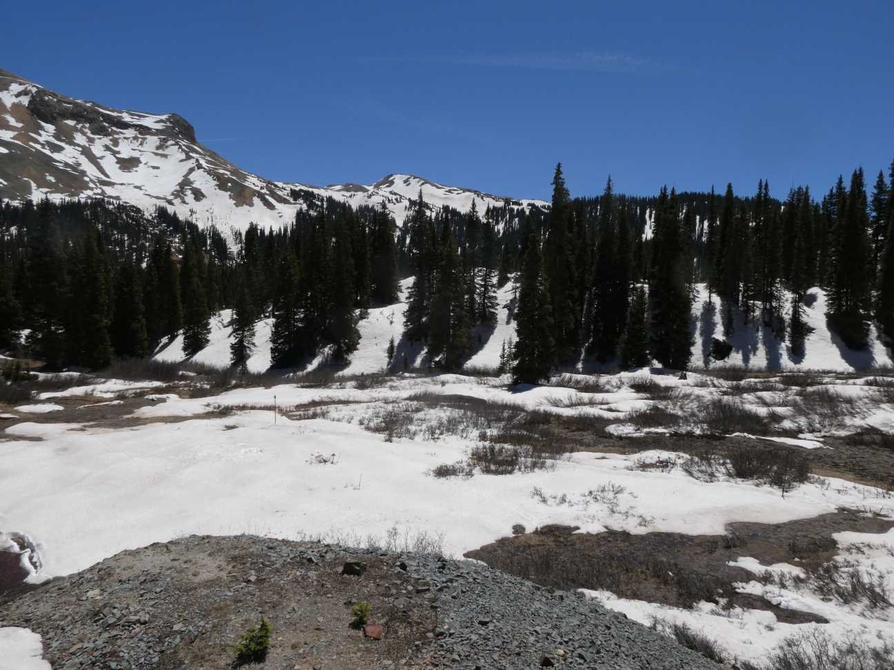
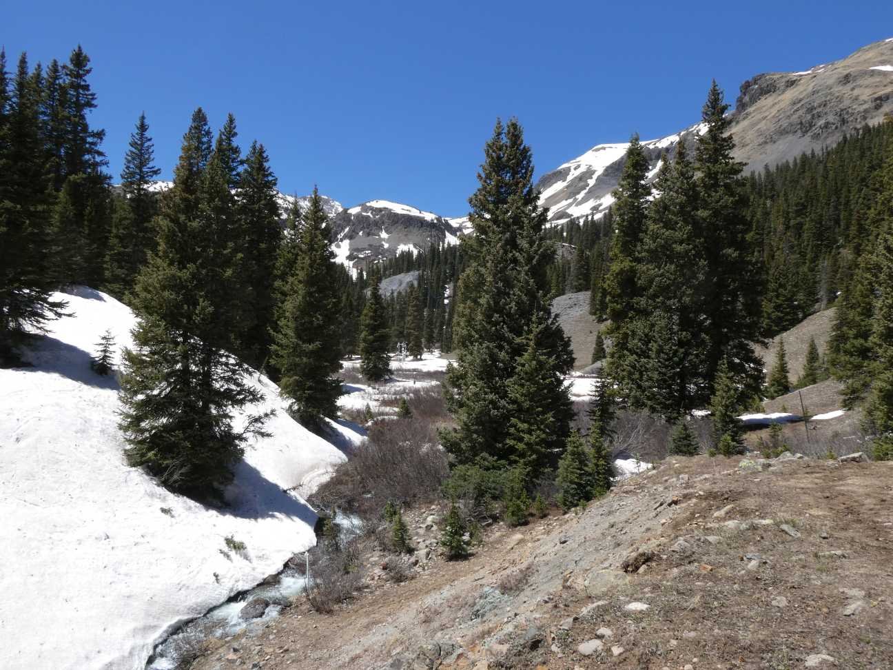
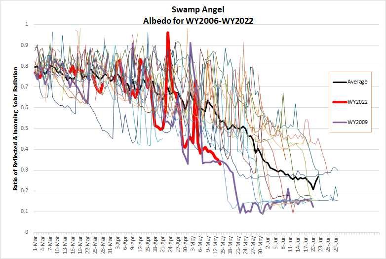
Above: Only about 8” snow depth remain under the sensor at Swampy. Albedo measurements will soon be that of bare ground. In 2.5 days is my guess at the melt rates we are seeing.
Below: A map of albedo for Western US from satellite data. Image from NSIDC. The image highlights Central and Southern Colorado Mountain’s fate of being downwind of the largest dust source region in the U.S.

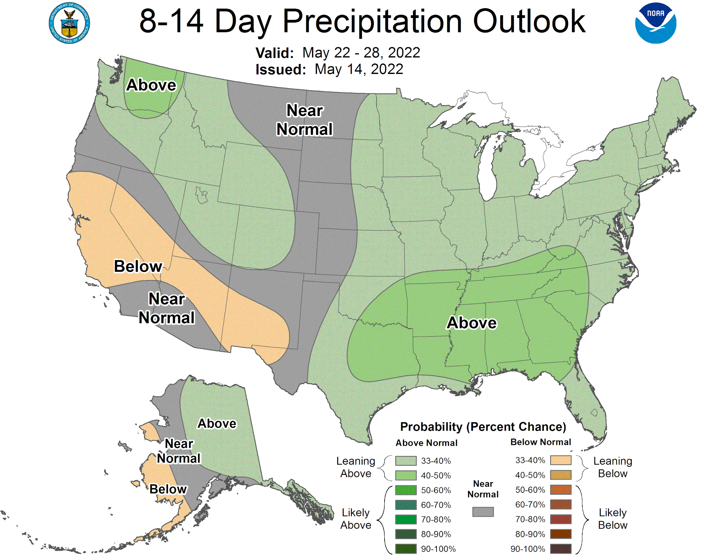
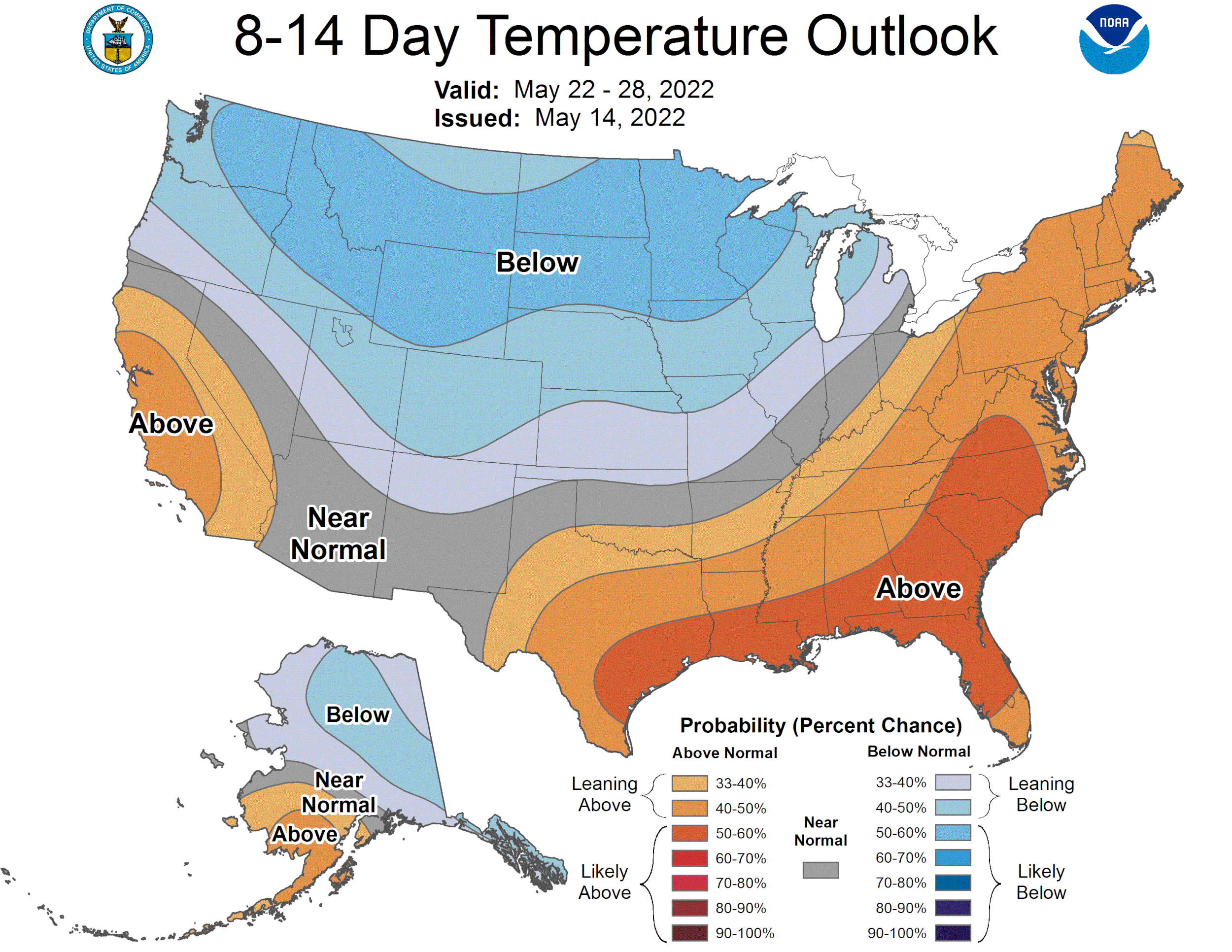
Below: It has seemed min temperatures have held onto slightly below normal conditions in many areas. The map below reinforces that. Making the high melt rates even more impressive. Above normal temps are expected this week, along with the dust, cranking up snowmelt.


Crazy huh?