

CODOS UPDATE March 24: Word FOR WY2023, “Epic”
Greetings from Silverton,
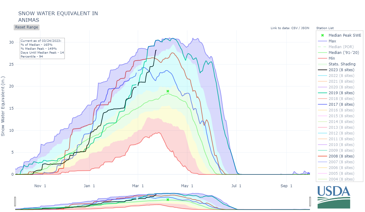
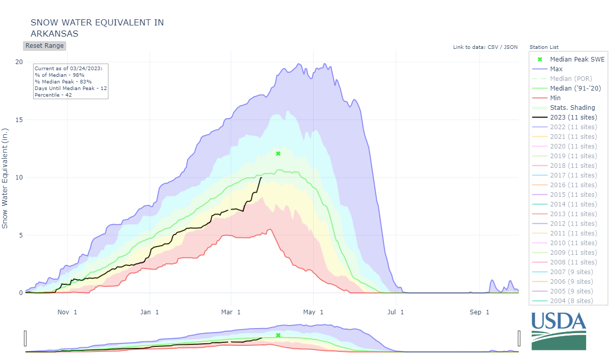
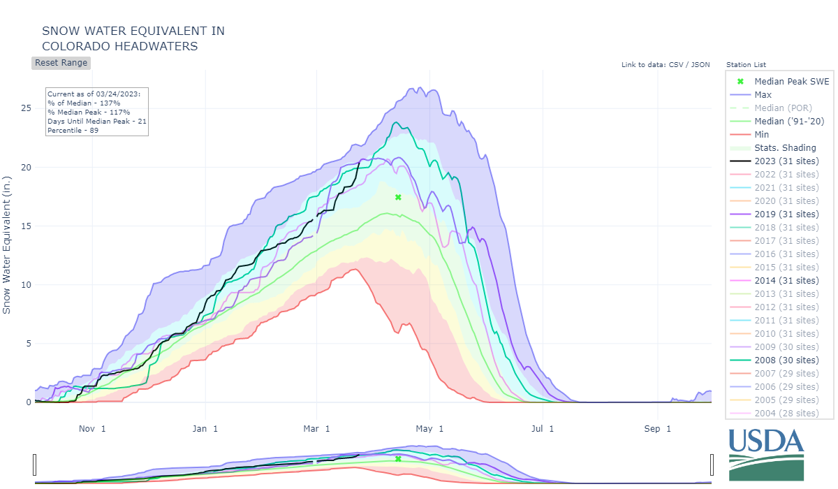
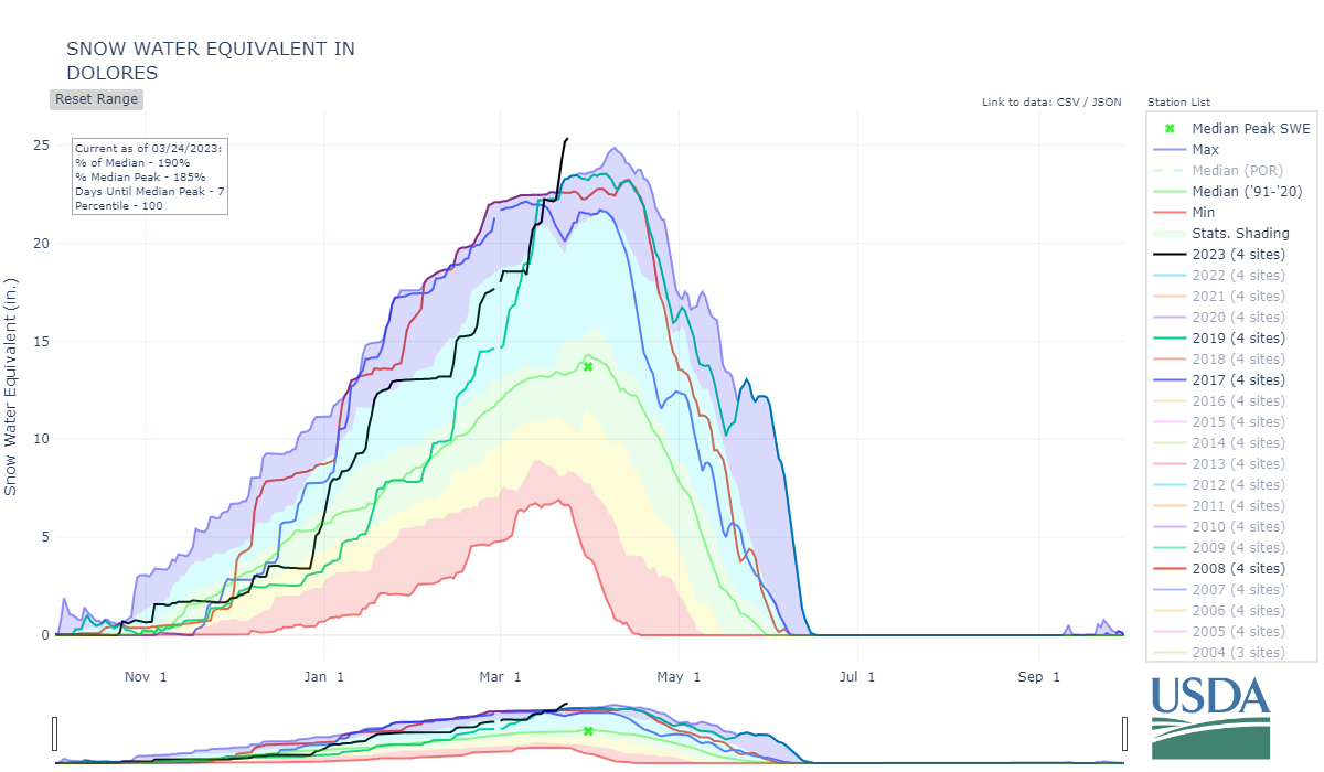
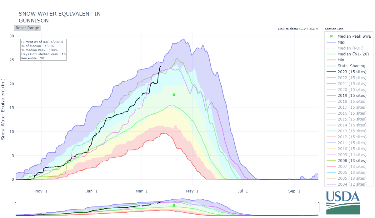
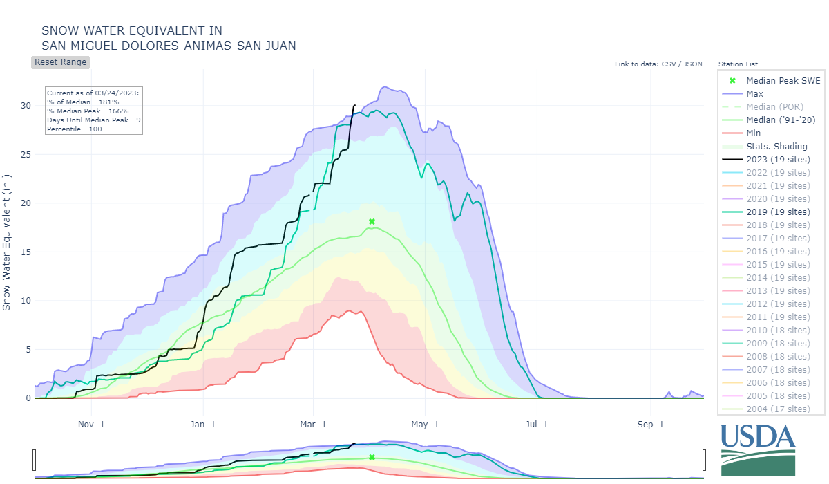
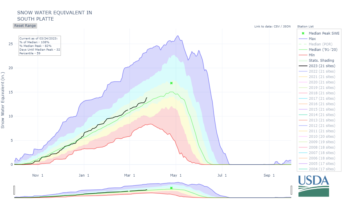
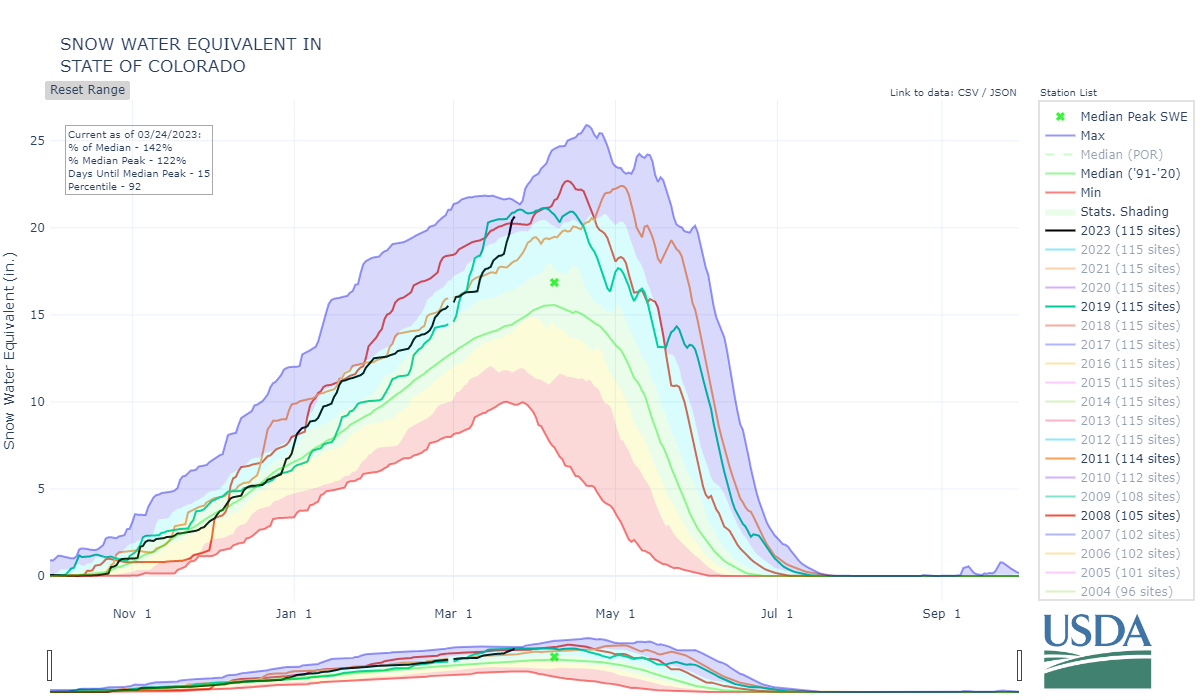
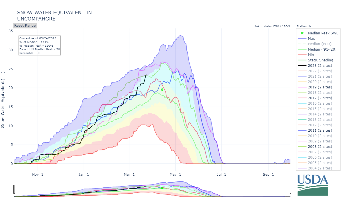
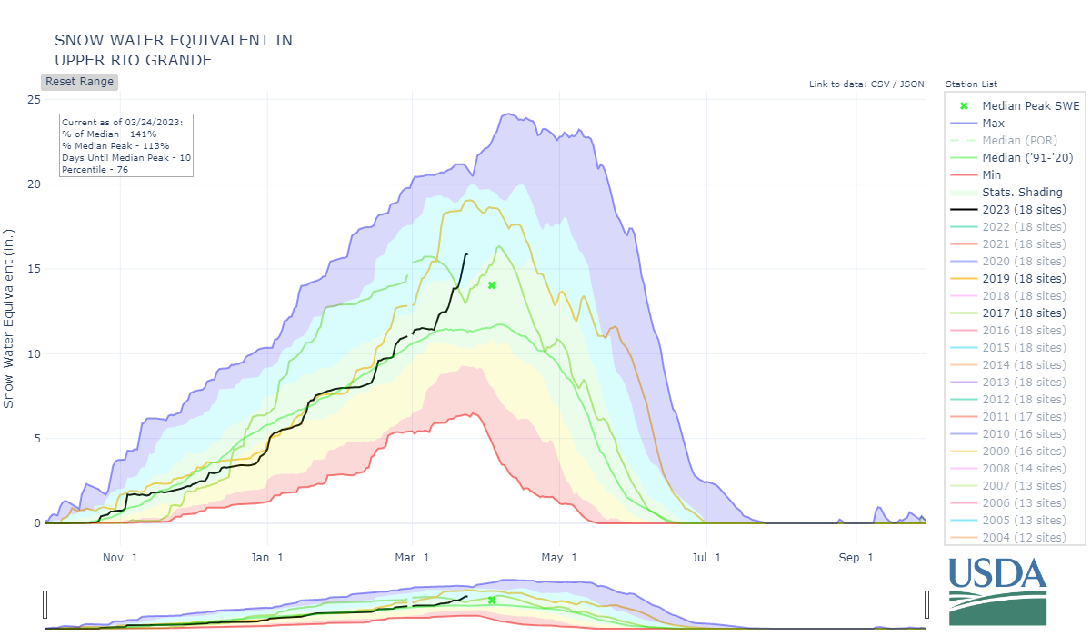
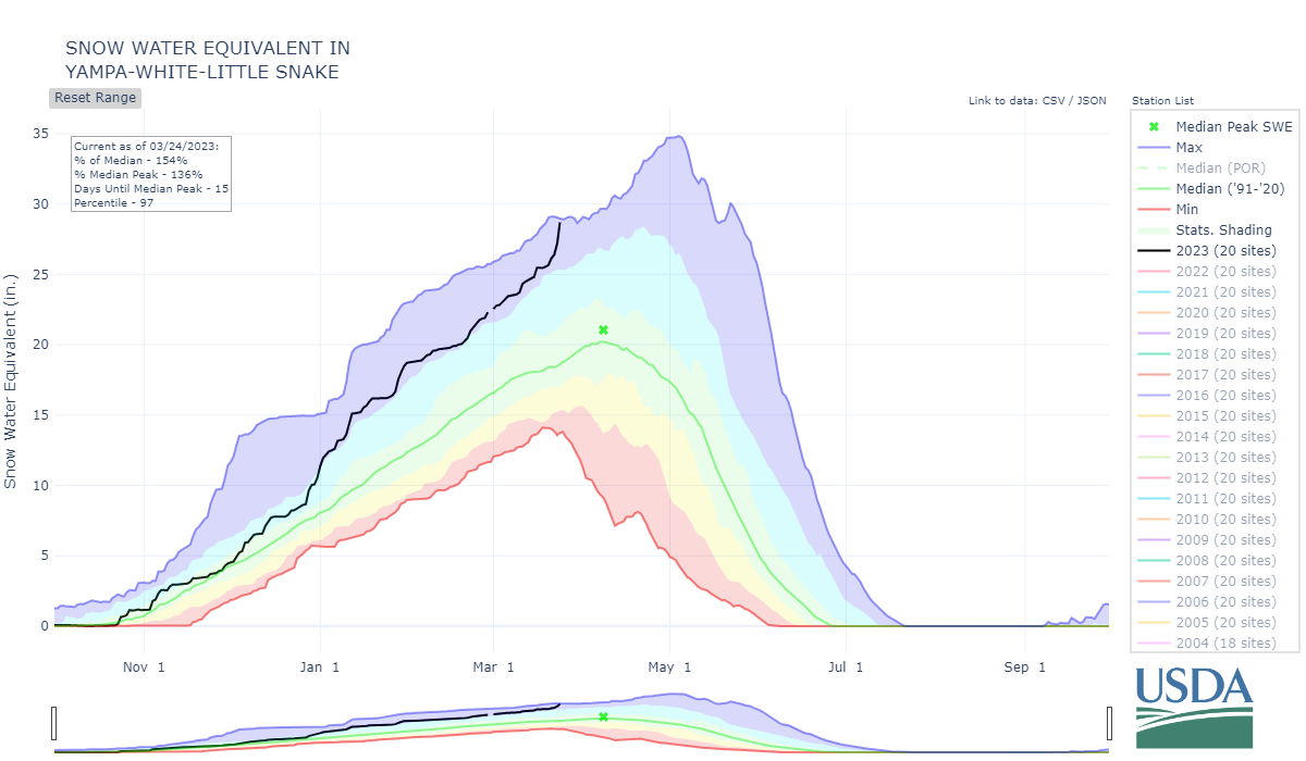
The California snowpack hit epic status a long time ago, going into the month of March the Colorado snowpack (except for the Arkansas) was very healthy yet not quite at epic levels. The forecast going into March was wetter than normal and that certainly proved to be the case. The month of March so far has brought 6.5” precipitation to Swamp Angel at Red Mt Pass. The Dolores watershed gained 6.8”. The Upper Rio Grande over 4”. The Animas gained 8.3”. The Gunnison gained 6.3”. Essentially SNOTEL SWE plots went vertical over the last three weeks pushing the needle into the “epic” category I would argue. Many basins and subbasins exceeded or are very near WY2019 snowpack levels, which was a big year for most of Colorado. This past week was a huge snow producer, even the Arkansas and Upper Rio Grande made sizable gains. Some southern passes just reopened while parts of 550 are still closed. See our storm reports at snowstudies.org.
The time of normal peak accumulation is nearing, then we start getting into snowmelt season. This is sort of a breath before the next stage. The forecast isn’t calling for anything crazy over the next week, it appears. There is a bit of snow in the forecast and cooler temperatures are to continue. Dust-in-snow conditions remain at minimum severity due to the wet conditions across the West. We will assess in detail once travel is possible. But if dust conditions remain at a minimum it will be a very interesting runoff season. Big snow, min dust and possibly cooler temperatures. A big contrast to last year where the snowpack struggled to meet median levels, it was a hot and dry spring, and dust conditions were severe (the Upper Rio Grande streamflow peaked a month earlier than normal).
More Soon,
Jeff Derry
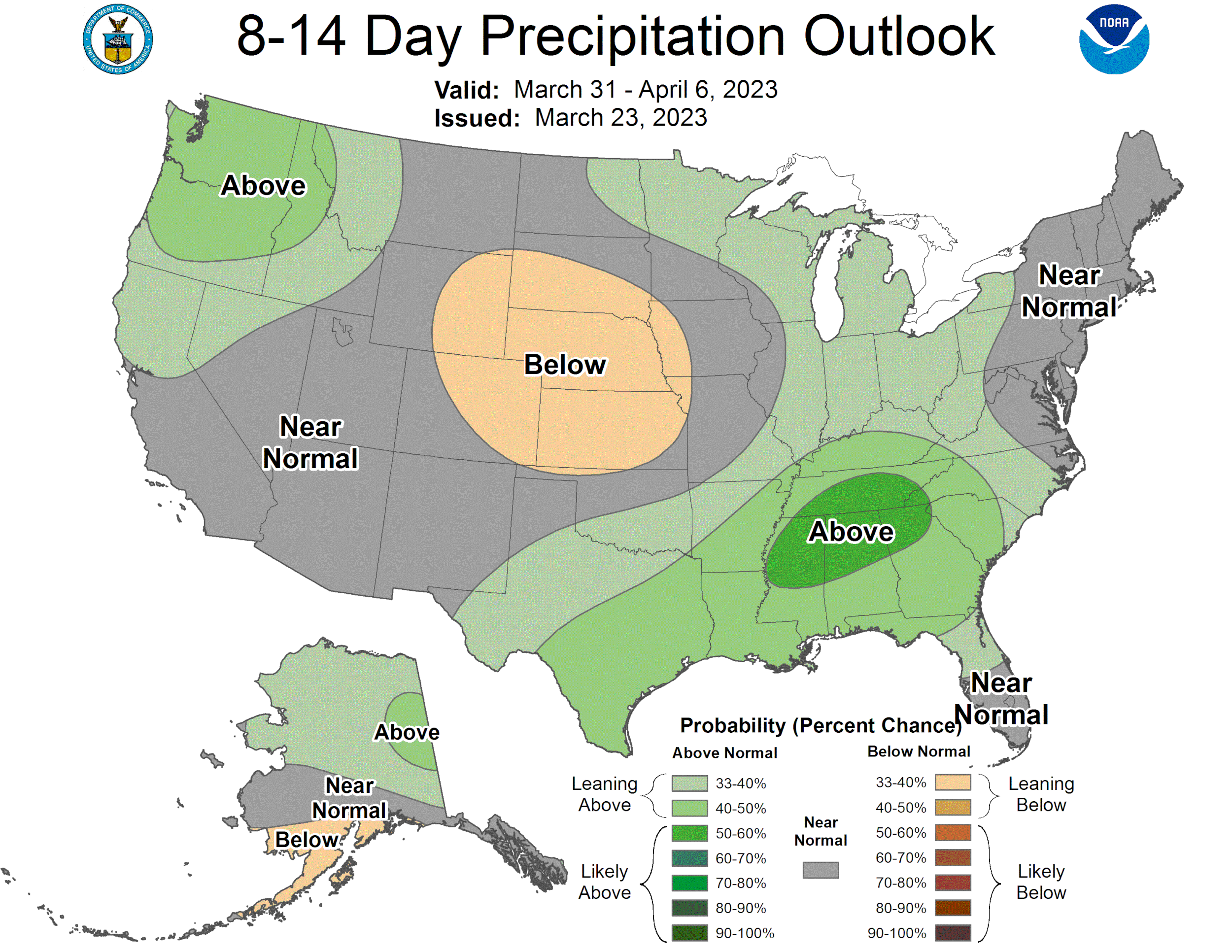
Below: A majority of the Four Corners region has received enough precipitation to help keep dust mobilization at a minimum.

Below: Snow depth at our Senator Beck Study Plot (SBSP) site at 12,200’, well above treeline. We will visit SBSP once avalanche hazards are reduced to collect SWE measurements. For now, the below snow depth plot gives an idea of how this snowpack compares with a few select previous seasons.


