CODOS Update April 28, 2020: Warm-Up Ahead, Rapid Snowmelt, Swamp Angel Obs
Greetings from Silverton,
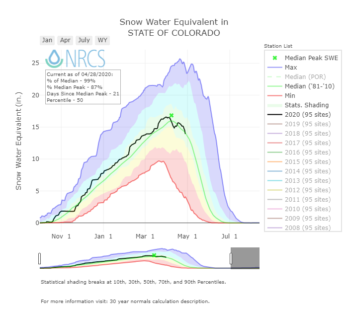
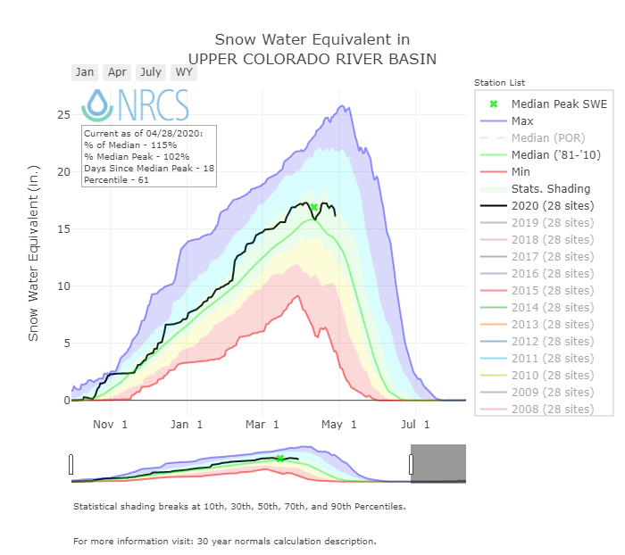
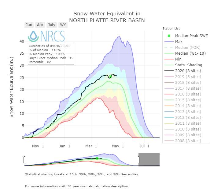
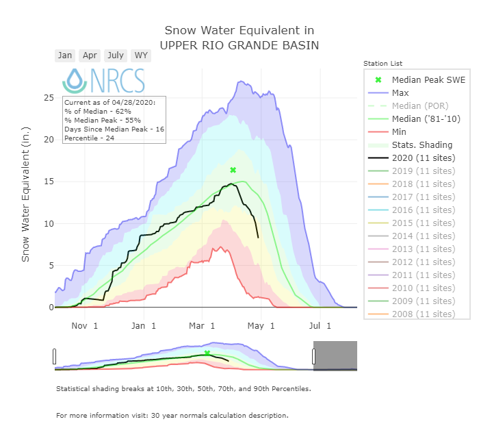
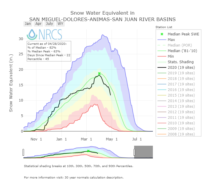
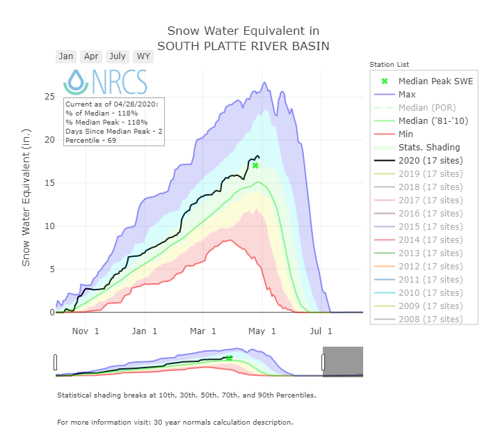
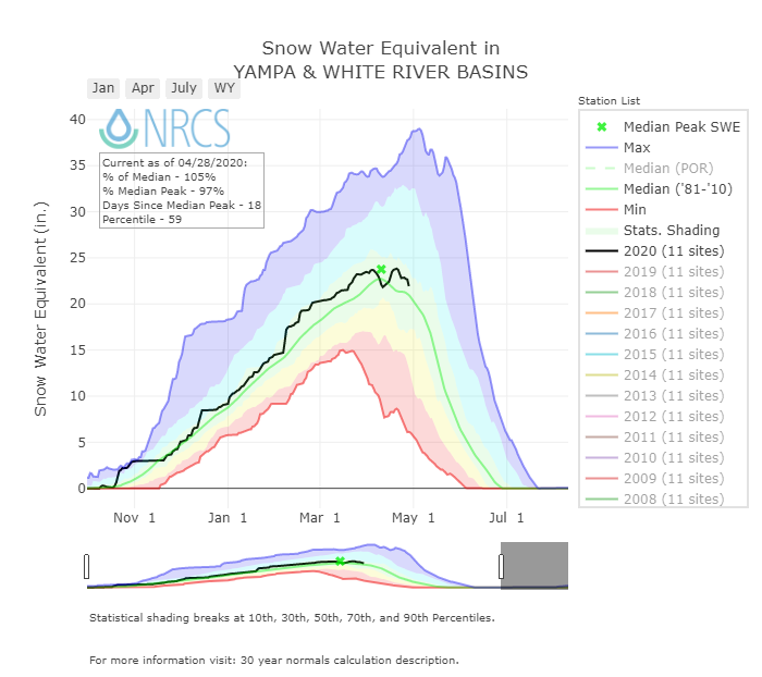
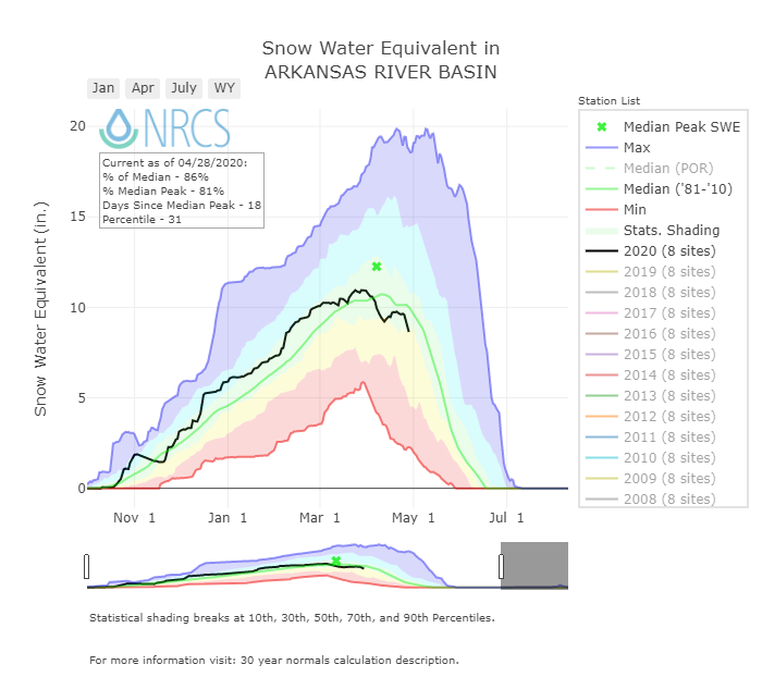
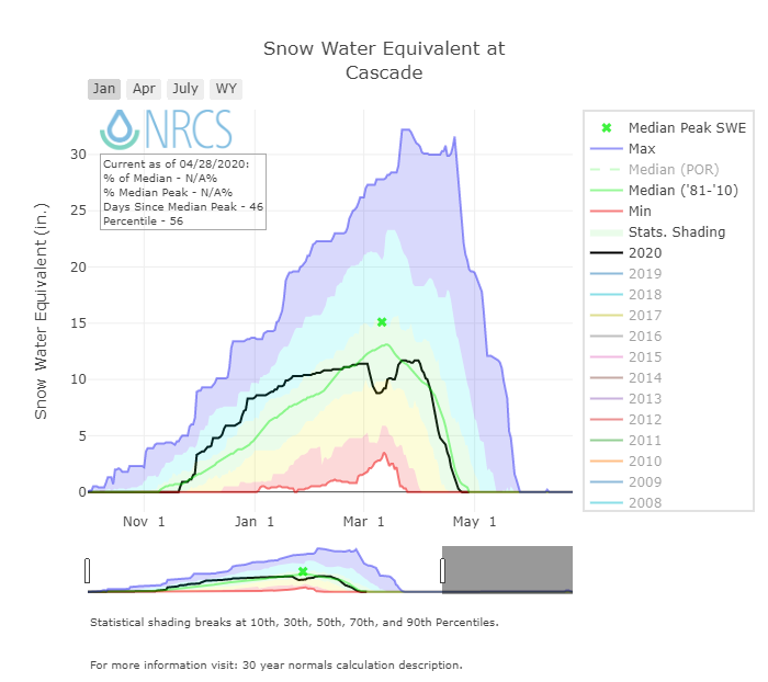
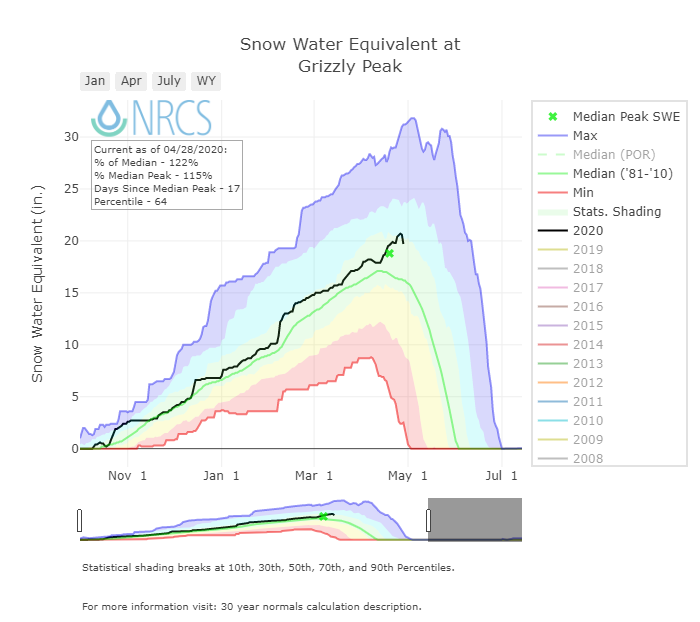
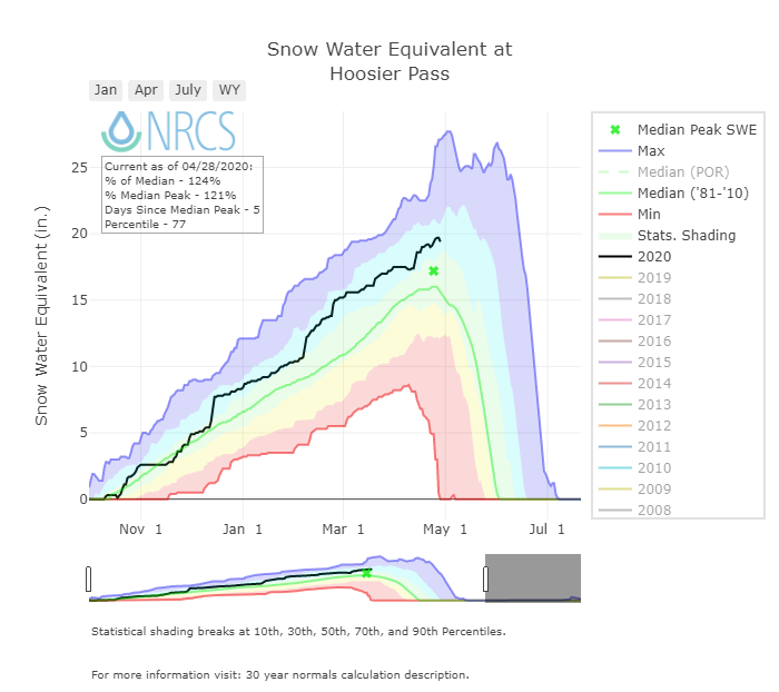
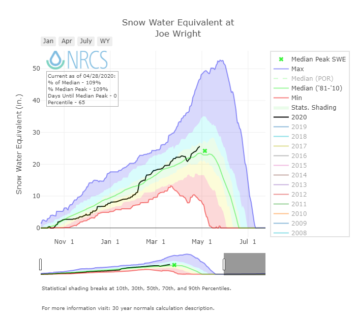
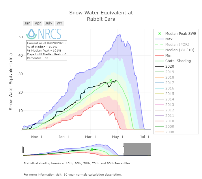
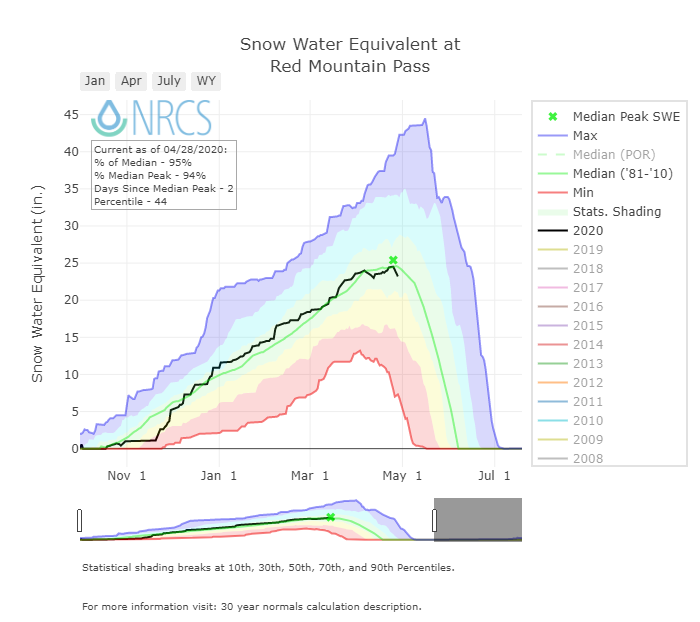
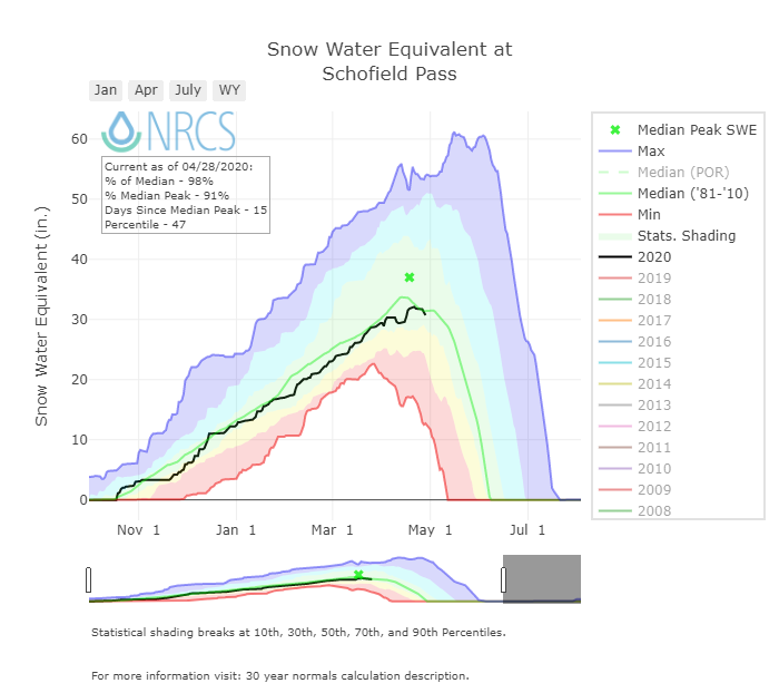
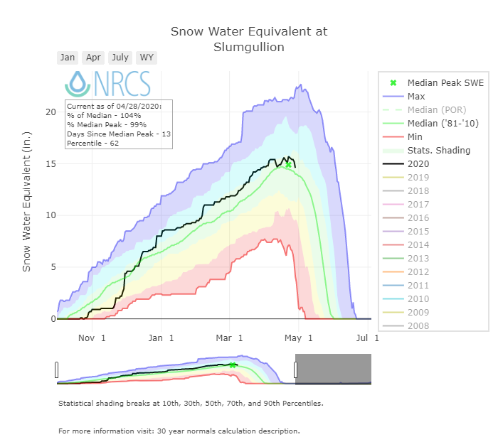
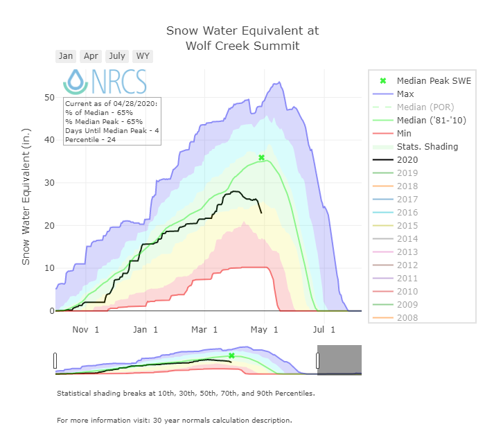
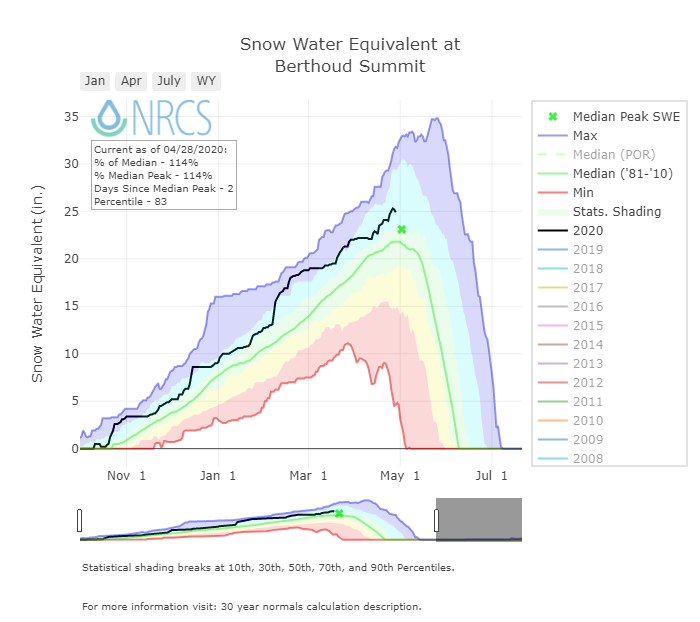
For a few days last weekend we saw a relatively flat SWE hydrograph for the Central and Northern Basins due to precipitation that provided an albedo reset. The Southern Basins did not see much of a slow down if any during that period. Over the last 11 days we received 6 days at SASP with measurable precipitation but only a couple of those events provided enough precipitation as snow to provide a temporary clean snowcover to slow snowmelt, thus over the last 4-5 days conditions have allowed for increasing snowmelt particularly in the Central and Southern Basins.
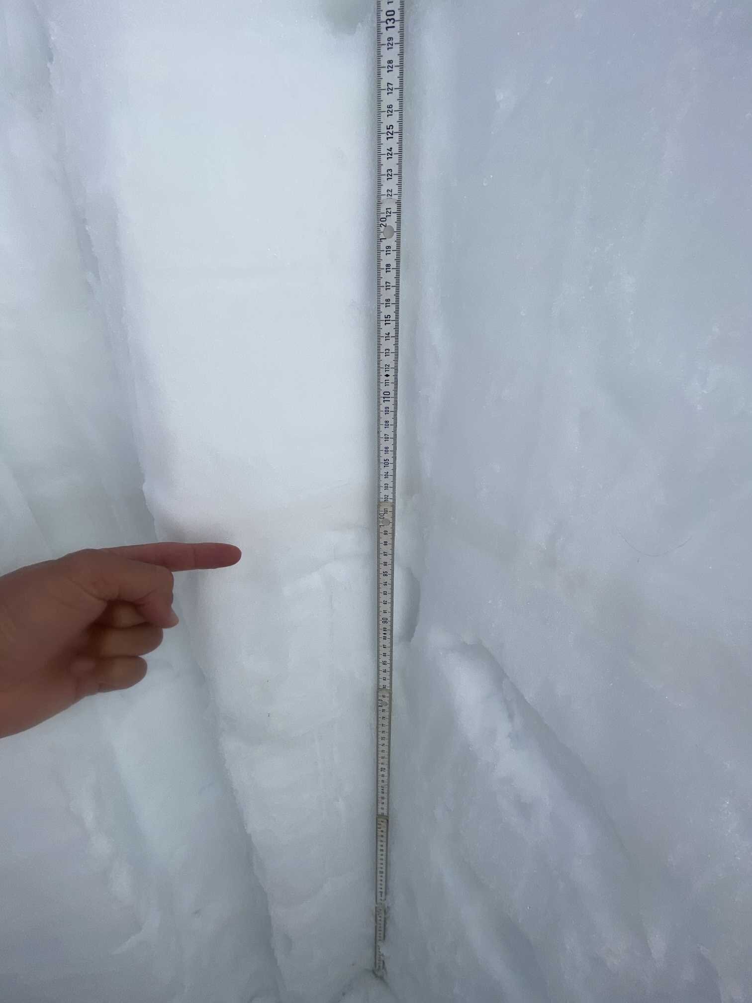
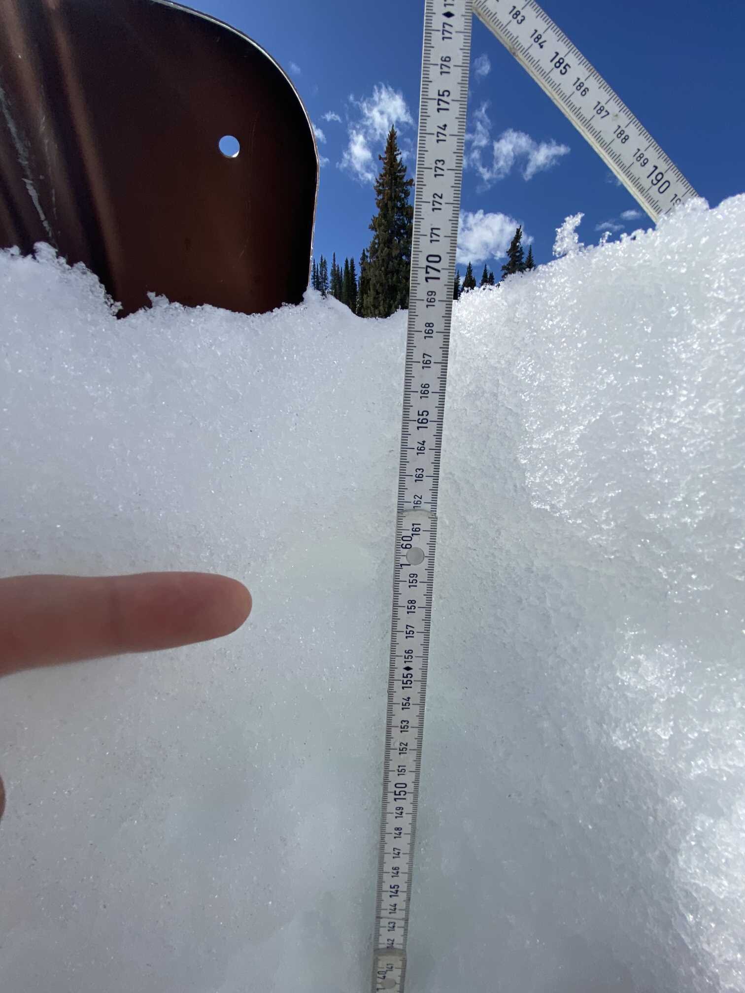
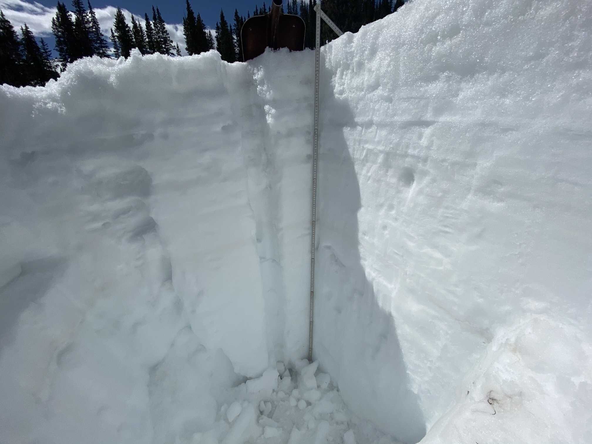
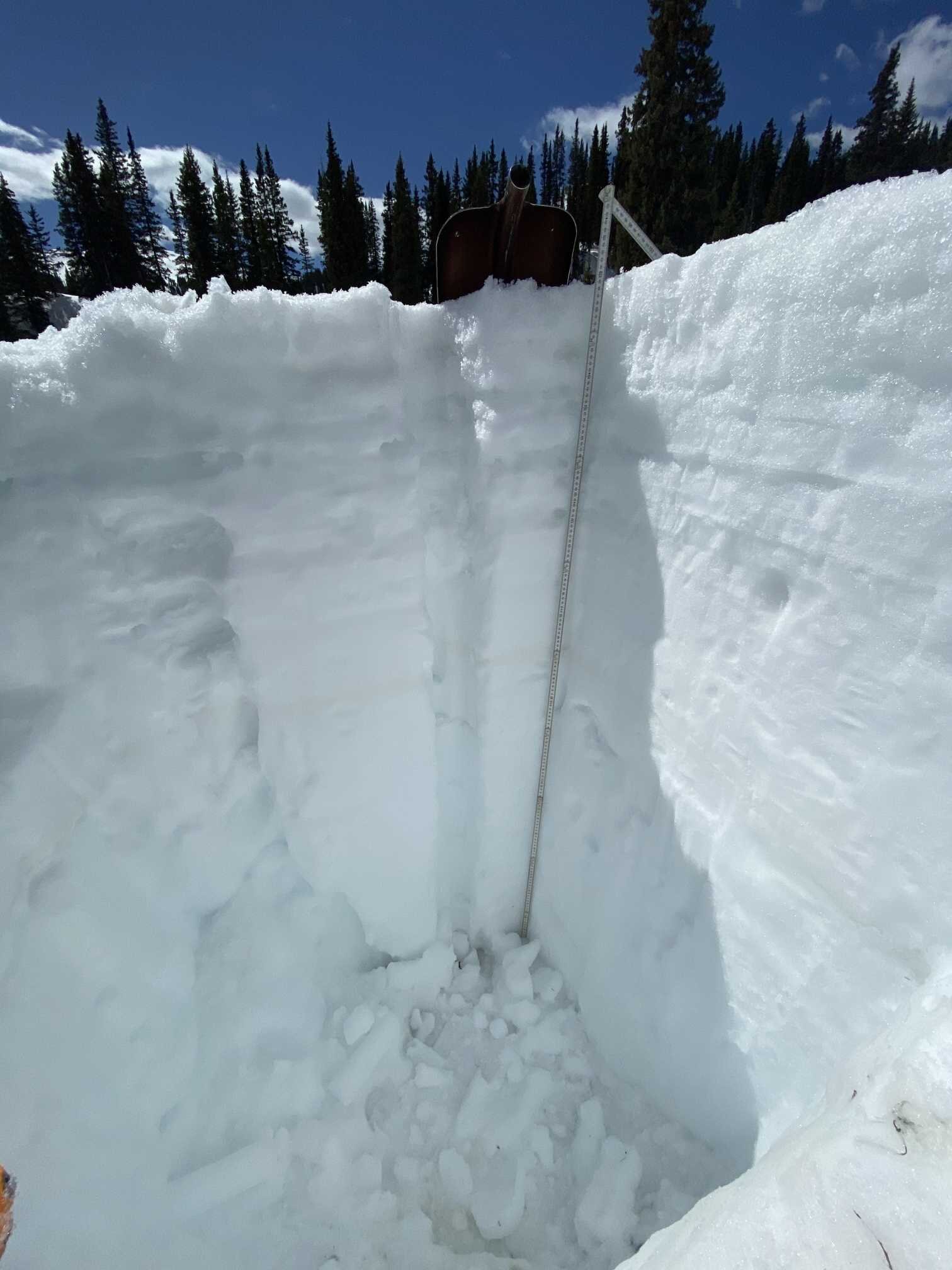
At Swamp Angel (11,100’) on April 20 we observed the most recent dust events D3/D4 about 3” under the snow surface. On Monday, April 27 dust was prevalent at the surface and just below a trace of new snow in some areas. The dust under the trace of snow will emerge very quickly. The snowpack has been isothermal since middle of April and is moist throughout with wet snow at the surface, at certain interfaces in the upper snowpack, and near the ground. The obvious dust layer D1 is currently 27” below the surface. The surface dust is relatively light but significant enough to increase absorption of solar radiation. The D1 layer is of moderate severity and will further darken the surface when exposed.
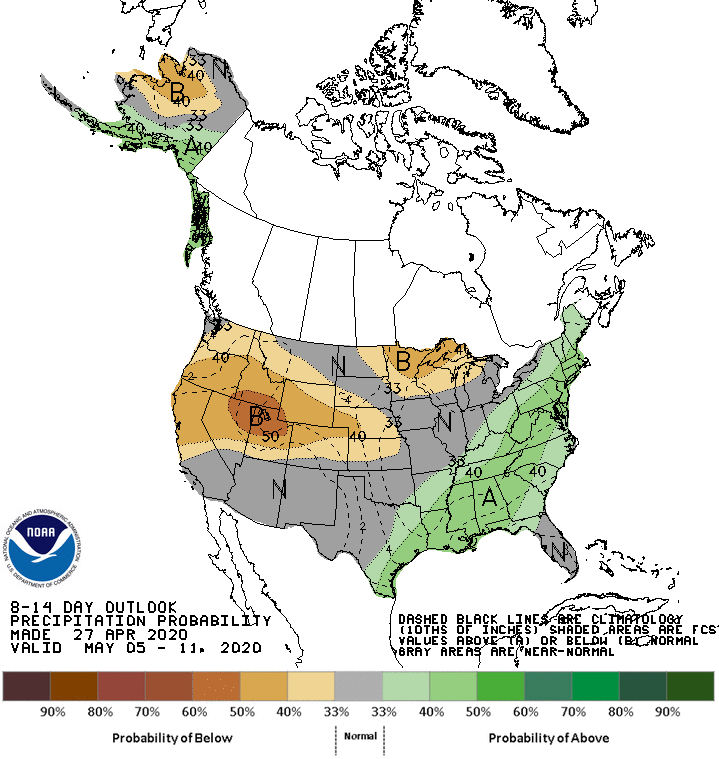
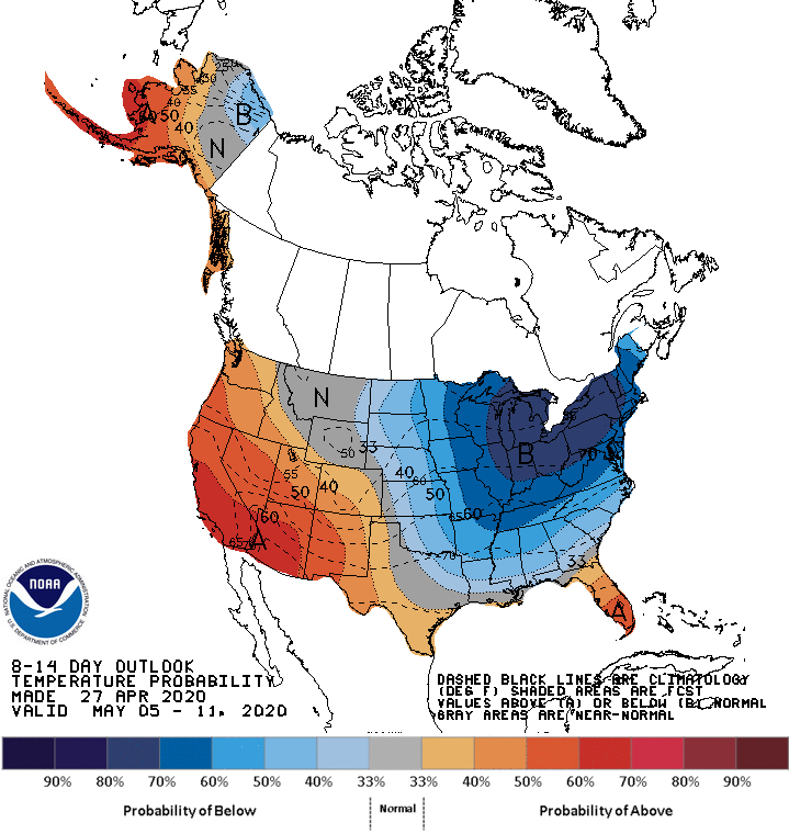
The forecast doesn’t look any fun. This week looks to be dry, 10-20 degrees above normal, and sunny. The NWS says we may come close or break record high temperatures in some areas. Please see forecast maps below.
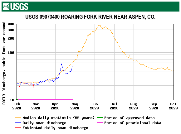
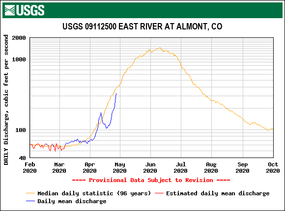
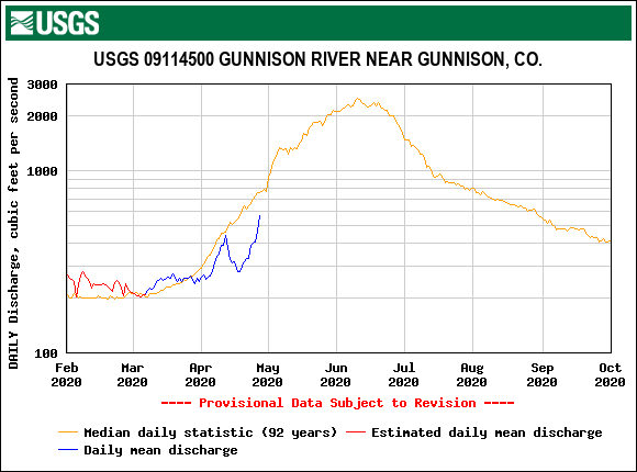
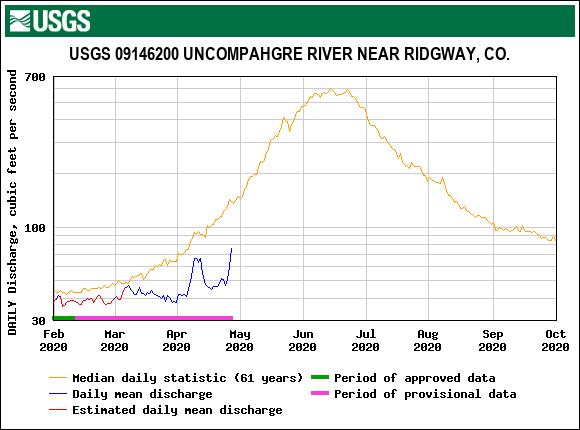
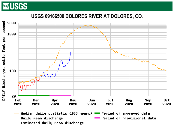
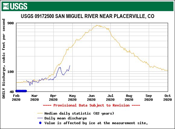
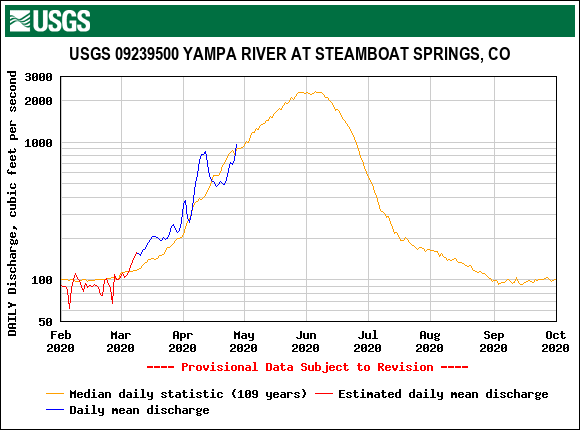
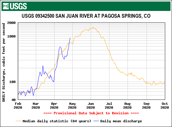
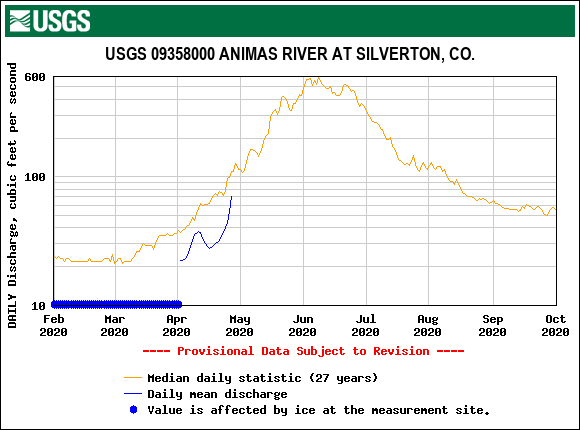
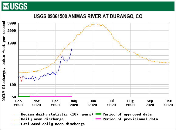
With the forecast and exposed dust expect snowmelt to continue in earnest. Some lower elevation SNOTEL’s have melted out already, some others are racing in that direction, and the mostly higher SNOTEL’s have started on a downward trend. Streamflows will, and have been over the last few days, respond to the increase in snowmelt with a significant increase in discharge. Overall volumes are low however due to the thirsty soils demanding replenishment before a larger percent of water can make its way to the streams.
Towards the end of this week we will conduct the final state-wide CODOS tour for this season. We hope to time the trip to offer stakeholders a comprehensive picture of what snowpack conditions look like as we go into the heart of ablation. And going by the looks of things the Southern Basins are on track to melt out before the typical median date.
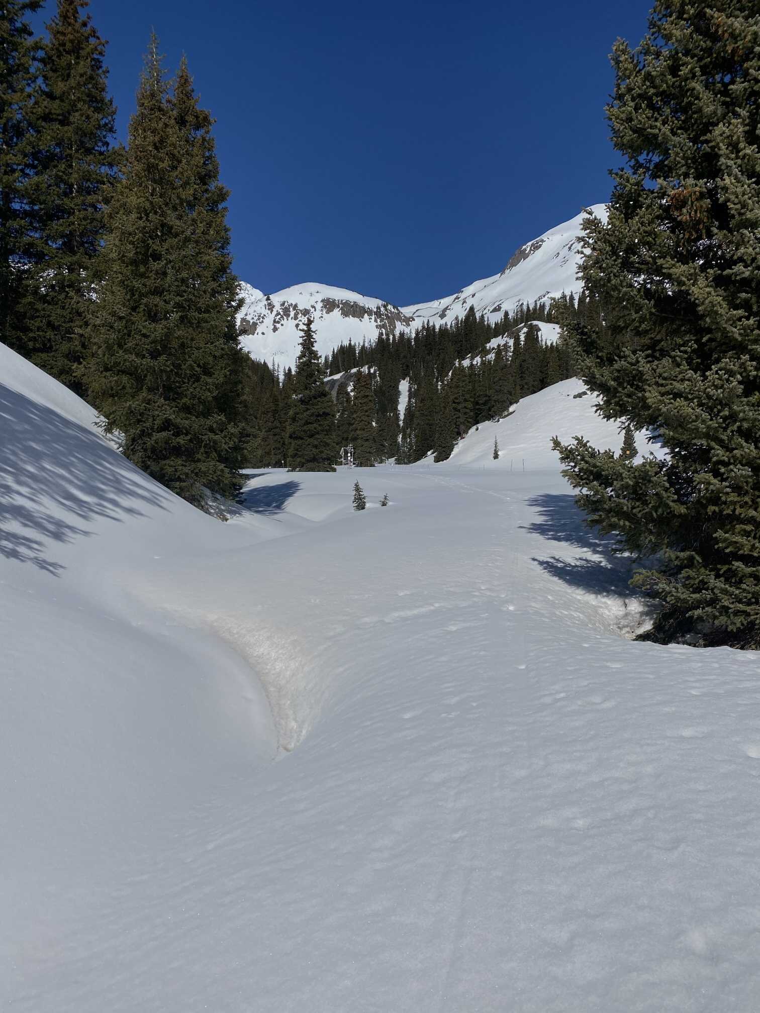
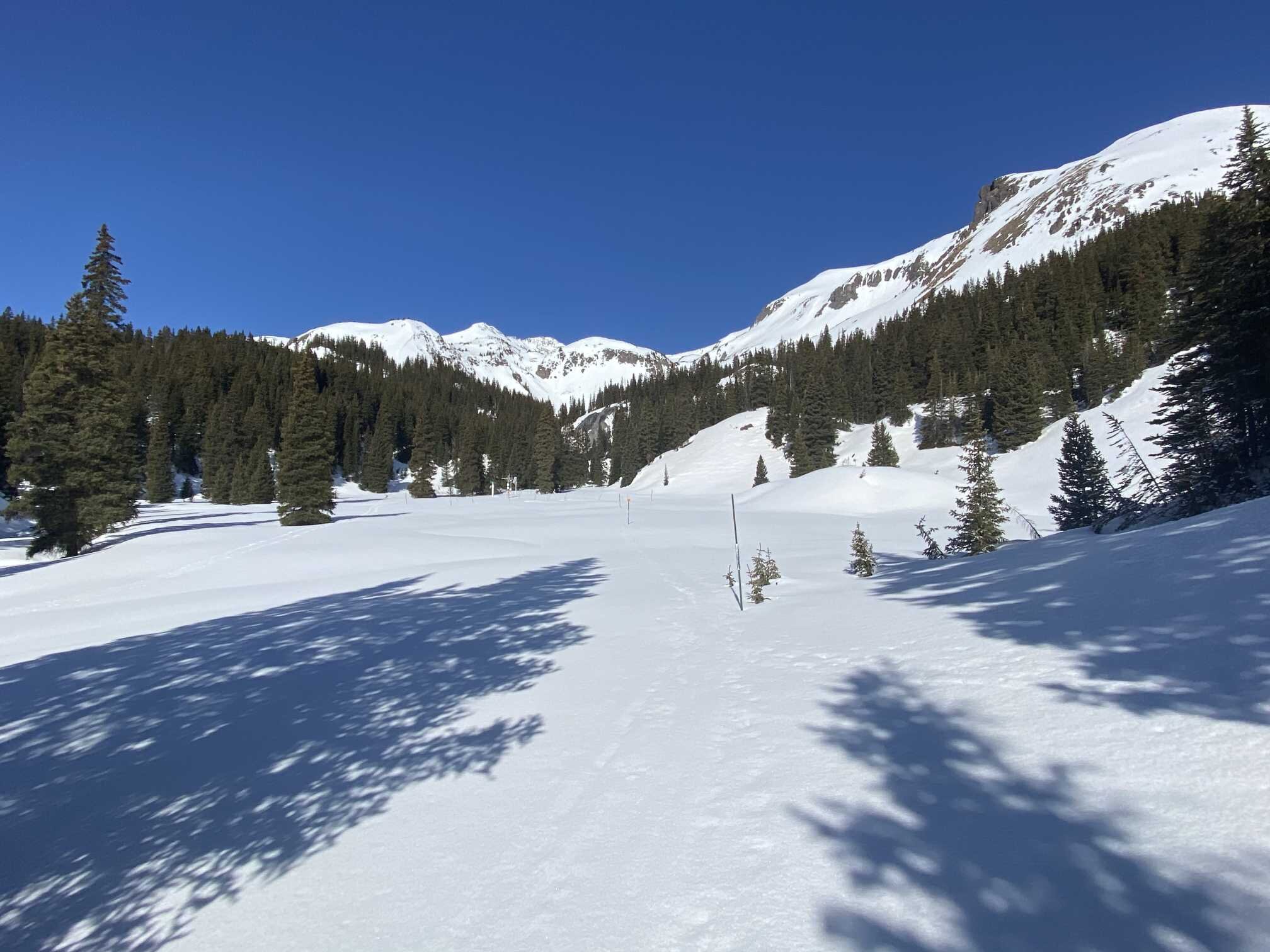
Below: Pictures of Swamp Angel on April 27. D1 is moderate at 27” below the surface. Surface dust is lighter in severity. The landscape photos give a good idea of current surface conditions, which will soon deteriorate a bit more as the trace amount of snow that is covering dust in some areas melts.
Below: The Senator Beck stream gauge is starting to show some life. With the current forecast calling for warm and mostly sunny conditions we can expect albedo (the orange line) to degrade a little further and stay low. A highly reflective snow surface has an albedo 0.8-0.9 and a dirty surface has an albedo of around 0.5-0.6. A low albedo increases absorption of solar radiation causing increased snow warming and melting, which we will eventually see in the hydrograph (blue line). Minimum air temperatures are forecasted to stay above 0 degrees C this week. With no freeze on the snowpack at night the snowpack can resume melting first thing in the morning. You can overlay streamflow for other rivers in the region and see a similar trend.