CODOS Update April 23, 2021: General Observations
Greetings from Silverton,
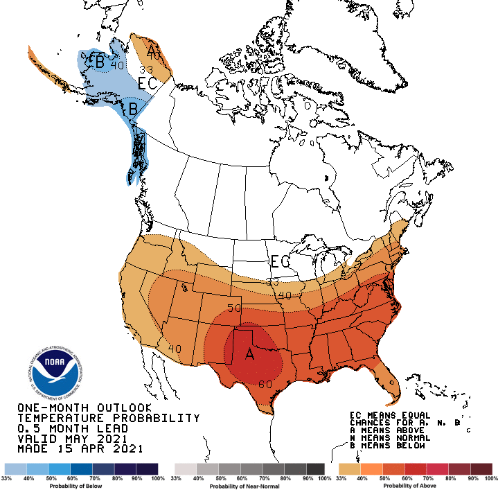
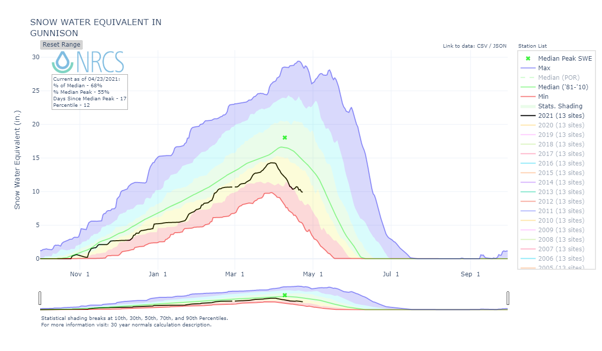
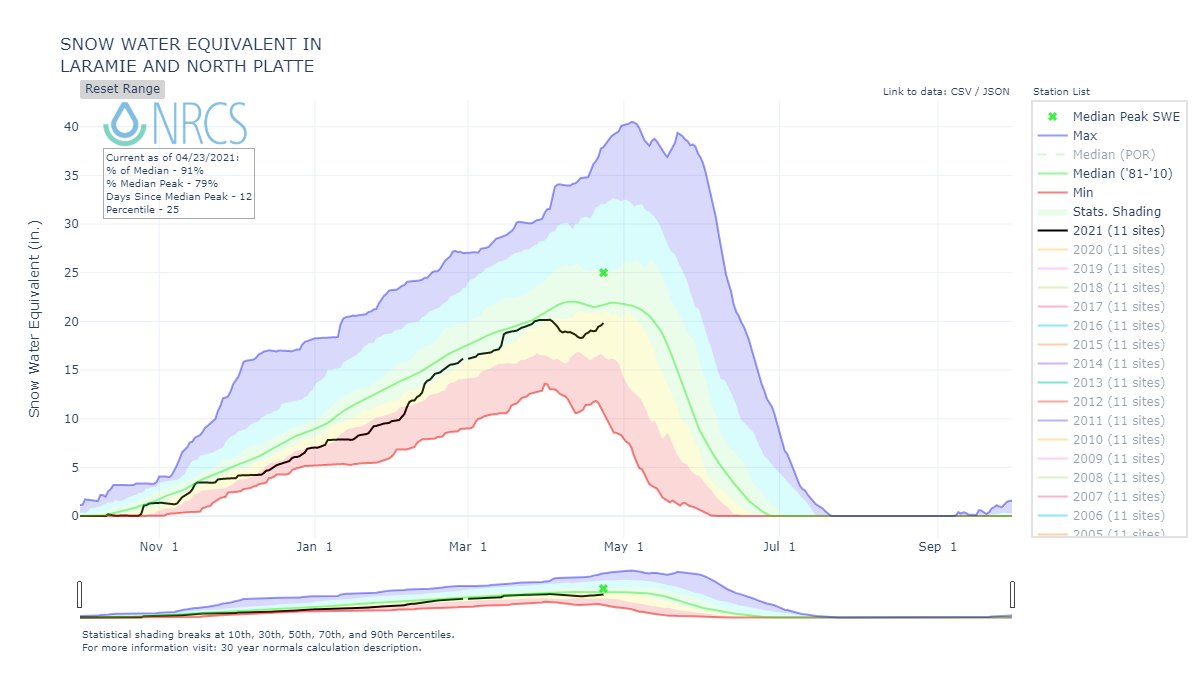
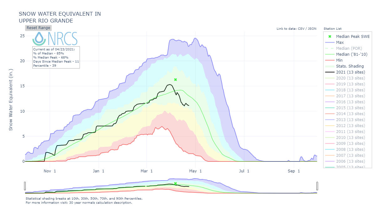
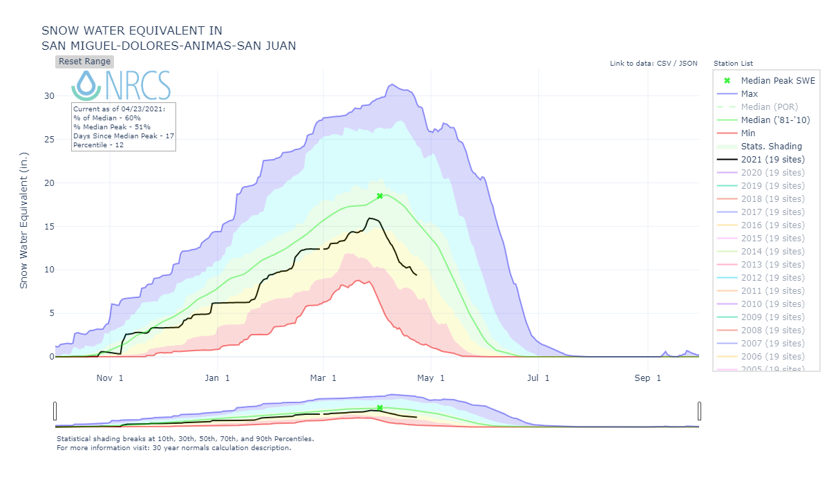
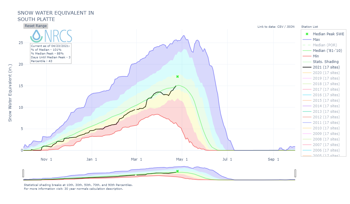
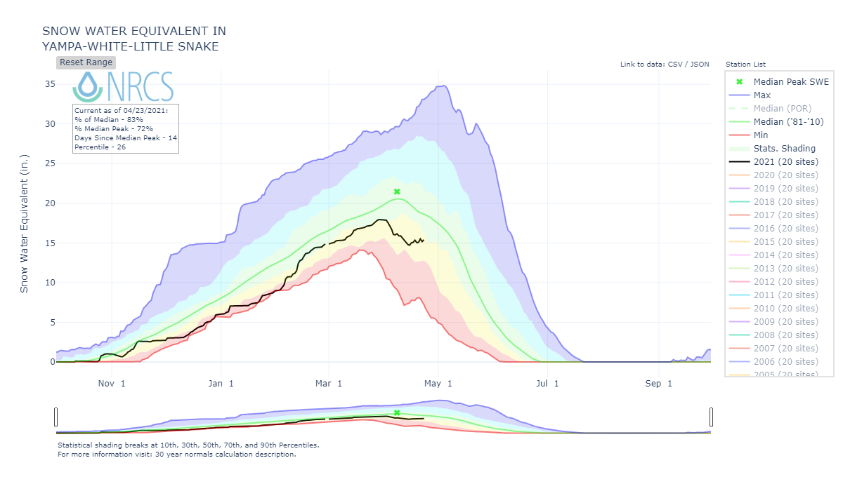
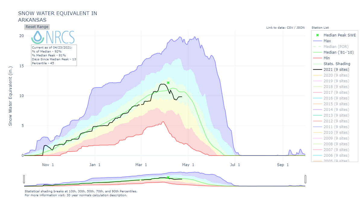
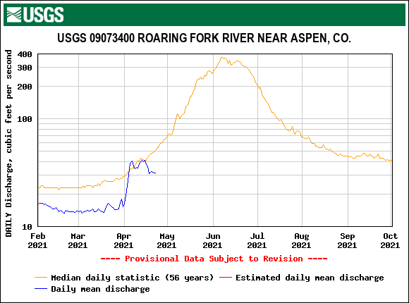
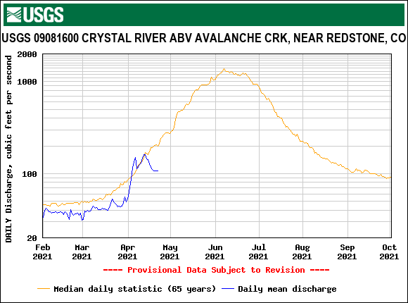
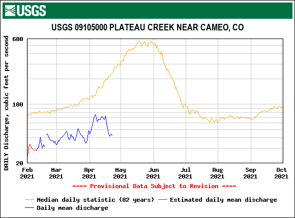
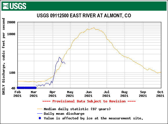
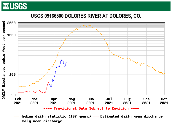
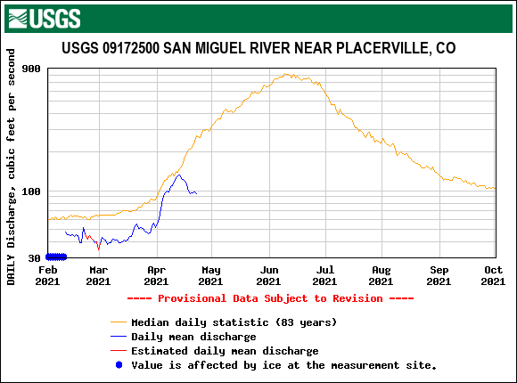
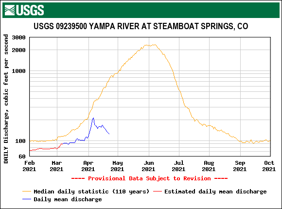
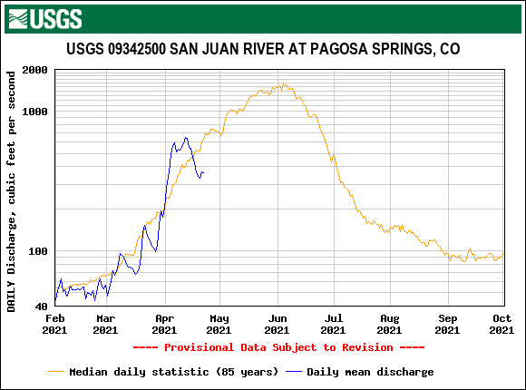
It has been an active and busy spring and not for all the reasons we would hope. Last week we completed the April CODOS tour of Colorado. In a nutshell, that tour revealed dust being prevalent statewide and mostly located at the surface or very near the surface. During the tour a mild storm covered the dusty snow surface with a few inches of clean snow. A few days later on Monday another mild storm hit the Front Range and adjacent mountains a tad bit – this contributed to the positive news that part of the northern Front Range is clear on the Drought Monitor! This is welcome news with a Drought Monitor steeped in reds and dark oranges for the rest of Colorado (the folks at Colorado Climate Center deserve a bow for all their hard work). SNOTEL data reflect these events with a minor bump in SWE. Stream gauges that are operating also noted this time-out of warming/melting of the snowpack from such a mostly dry April so far. April temperatures have not been too bad, even below normal for the majority of the state, but with lack of precipitation – lack of clean snow cover, cloud cover – the dust laden snowpack has been steadily warming at all elevations and melting at lower elevations.
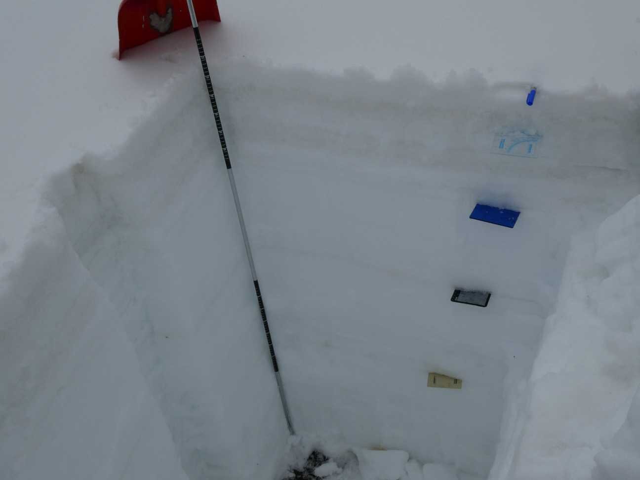
We been spending a lot of quality time at our Senator Beck study site these last few days. As of yesterday, very significant dust was at the surface and very significant dust just underneath the surface. See snow profile here.
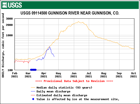
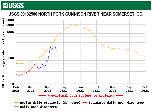
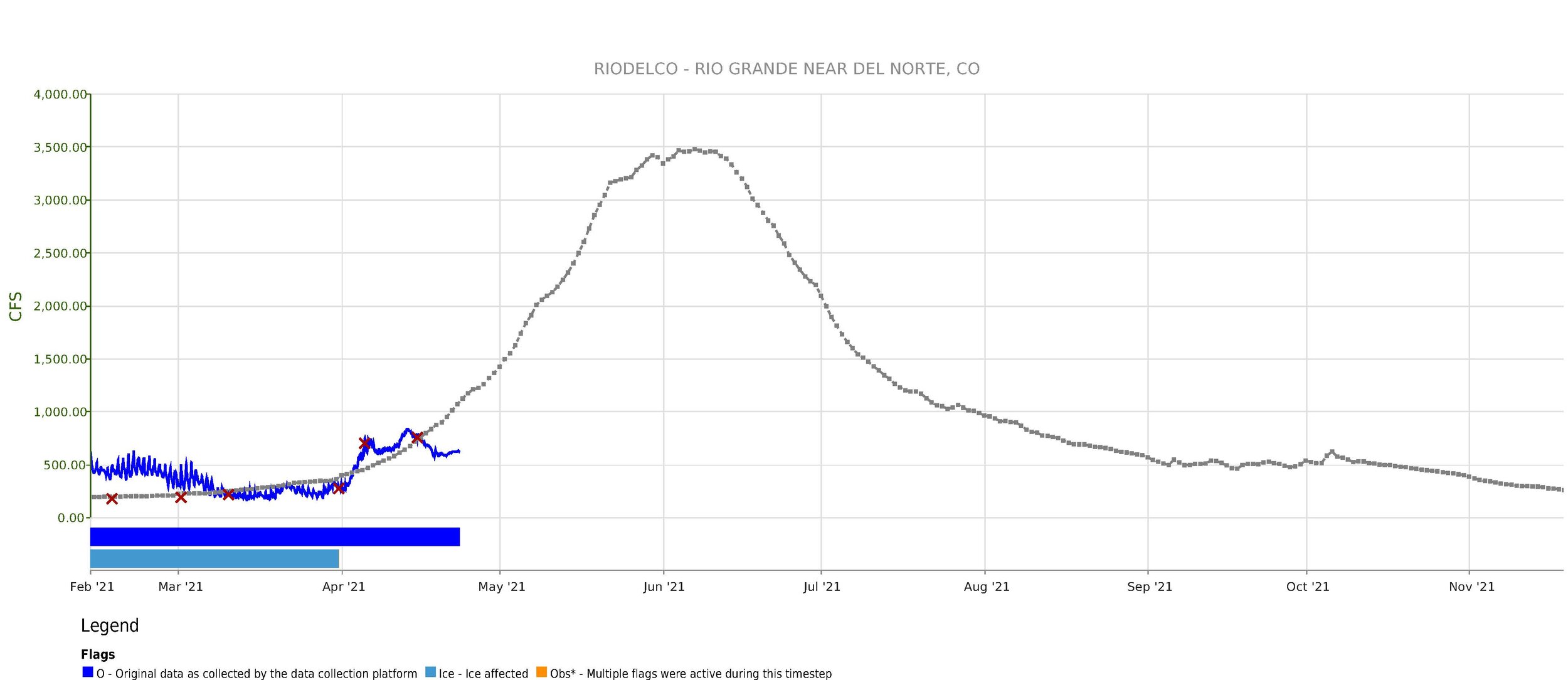
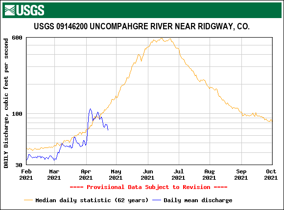
At Swamp Angel, the 11,060’ snowpack has been isothermal at 0 degrees C since April 8. Last Friday we received snow and last night we received 2” of wet snow accumulation. This will provide another temporary “cover” to slow further snowpack warming for the next day or two. Our stream gauge at 11,000’ has been operational since April 1 and, although subtle this time of year, shows these dust exposed, snow cover cooling episodes, clearly.
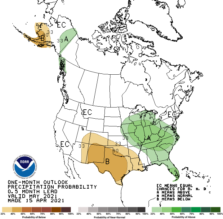
These last few weeks have been windy and in many instances carrying dust to the mountains. No major, dramatic, dust event has occurred but it has been incremental. For example on Wednesday we received another dust event (#6) at Senator Beck. It was relatively light and fell on existing dust so it is hard to ascertain the exact contribution from the event, but through our USGS partners we hope to figure it out with lab analysis. The practical affect is the snow surface is getting dustier and the forecast 2-weeks, 1-month, 3-months out calls for increased chances of below normal precipitation. A dry spring will keep this dust at the surface for majority of spring, baking the snowpack and causing early snowmelt state-wide.
It appears the mountains will continue with their chance of precip today, then we will see a couple days of sunny and windy conditions. Models show the chance of receiving more dust from these winds are very high. The start of next week the forecast is showing several inches of snow for the mountain regions. Mid-week we are back to dry conditions and warming temperatures.
Please see pictures and graphs below.
Take Care
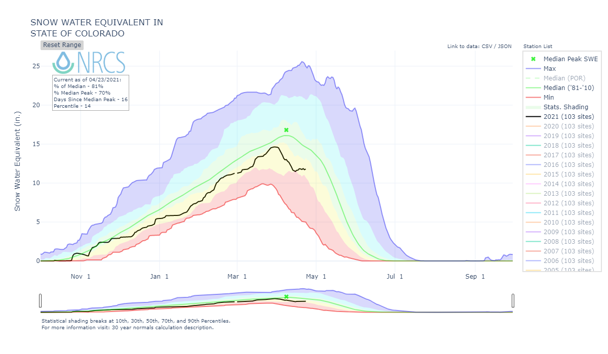
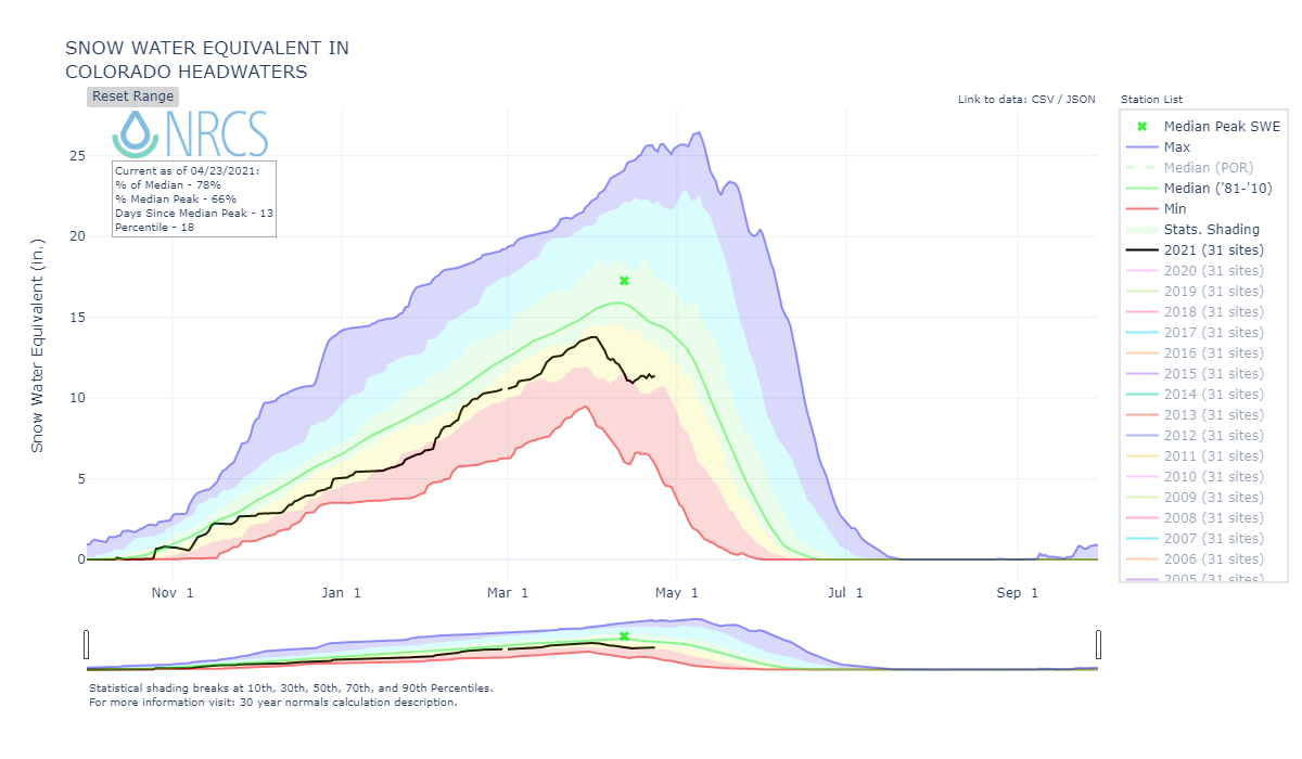

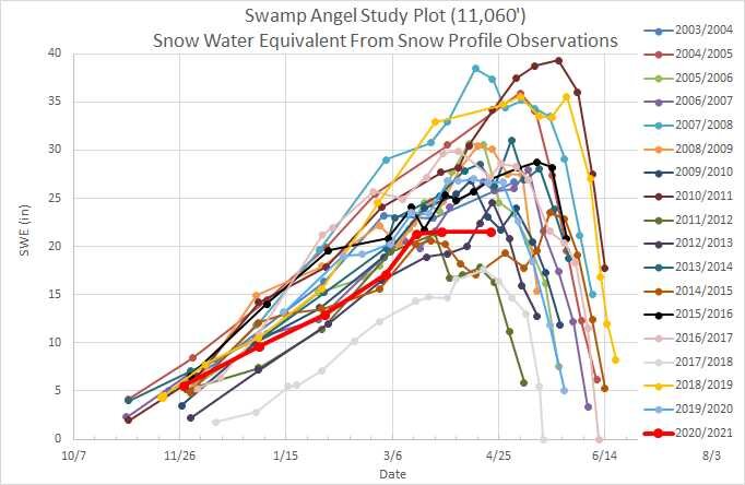
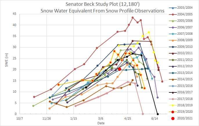
Above: The red dot and line is SWE for Swamp Angel and Senator Beck study plots for this year. Definitely the lower end of SWE in our period of record.
Below: Snow profile on April 21, 2021. Dust is at surface, a few inches down, and mid-way in snowpack (black card). Light dust is at the blue card and yellow card. After a couple inches of wet snow last night majority of dust will be covered for just a day or two.

Wind rose for dust event #6 on April 21 going into April 22.

So far April has been dry but for a couple isolated areas.