CODOS Update APril 10, 2026: Modified Snow-Flow Plots
Greetings from Silverton,
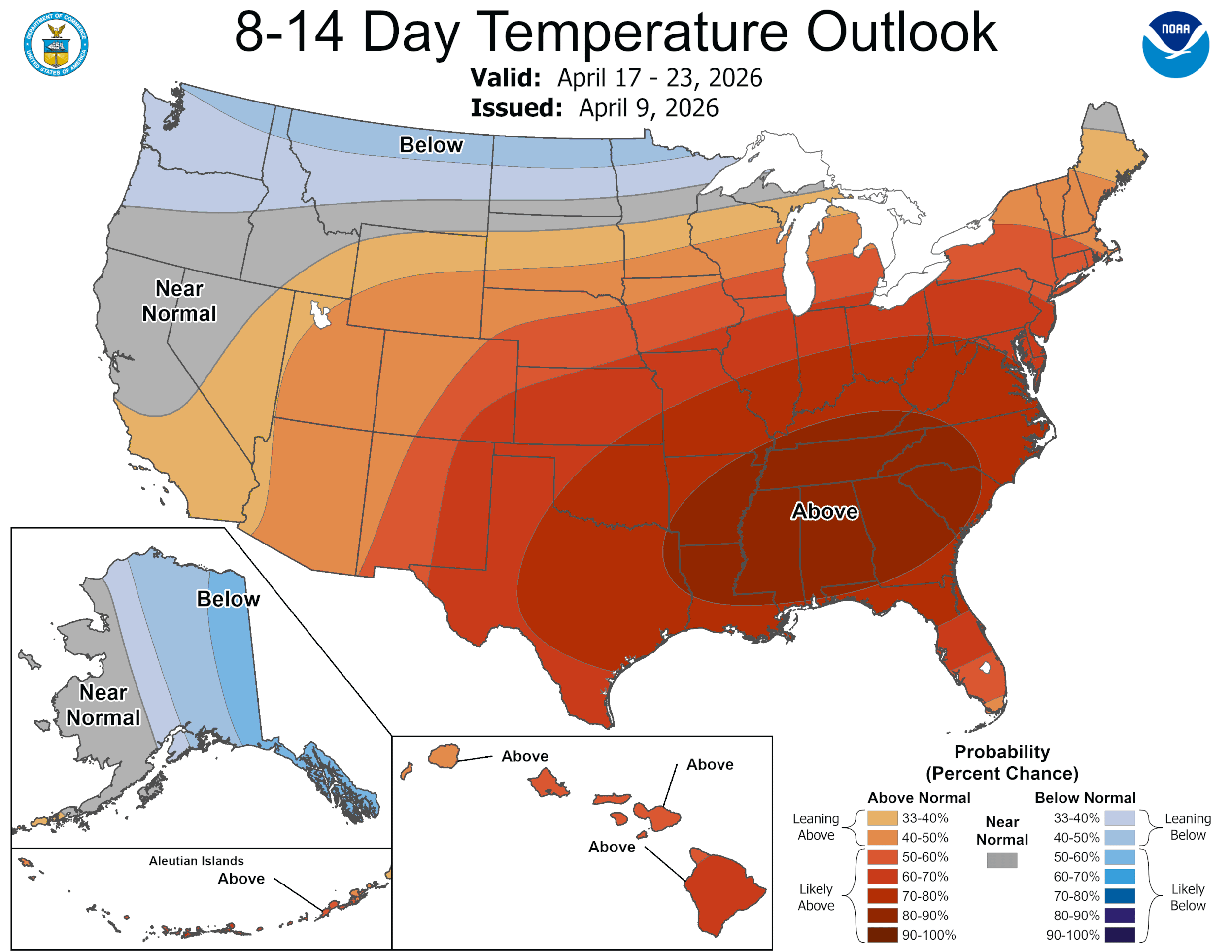
When looking at the streamflow forecasts remember that the biggest forecast errors occur in the extreme years. Even though streamflow volume is (was?) low this year it will still be interesting to see how timing unfolds, even more so now that we are in a somewhat active weather pattern that currently includes at least a couple chances of precipitation over the next couple weeks.
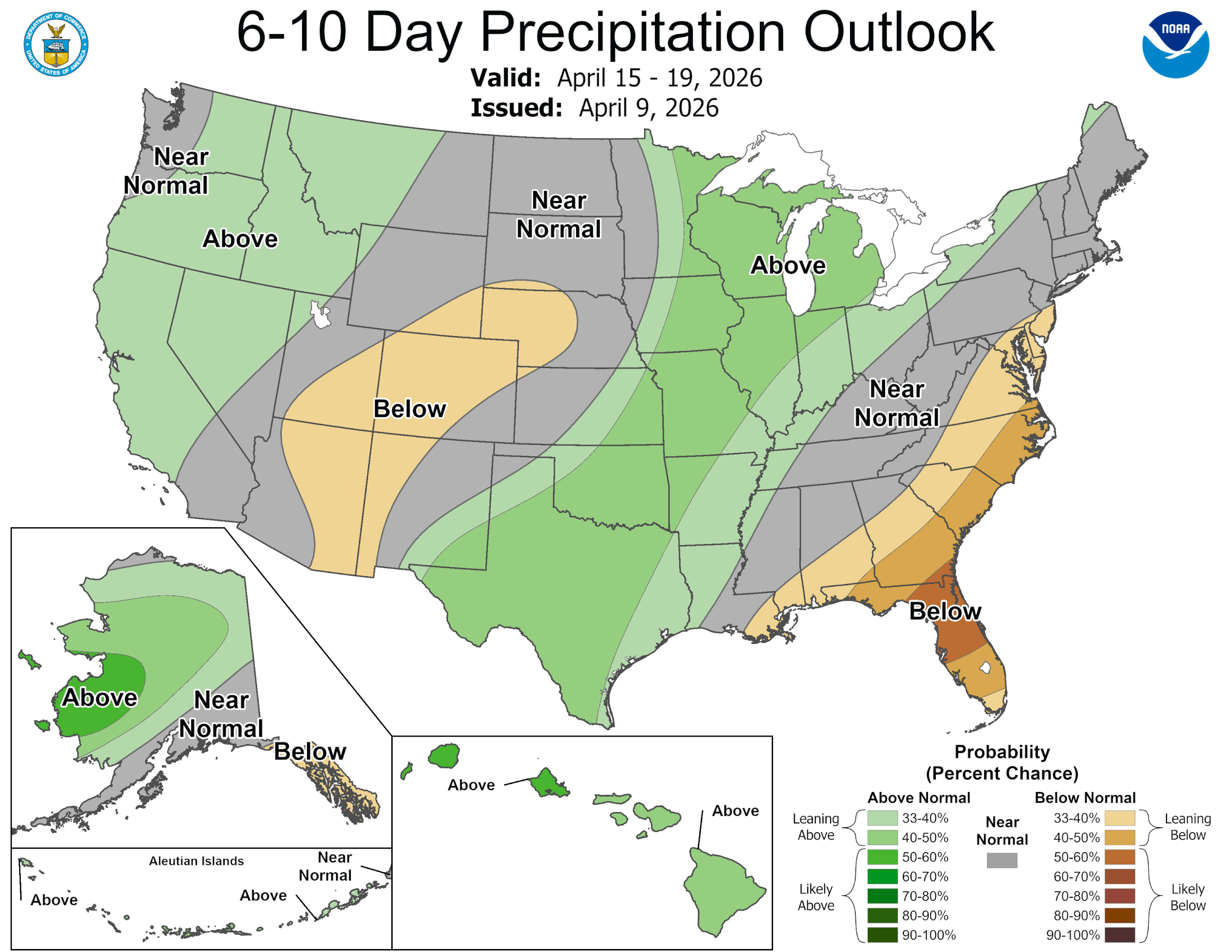
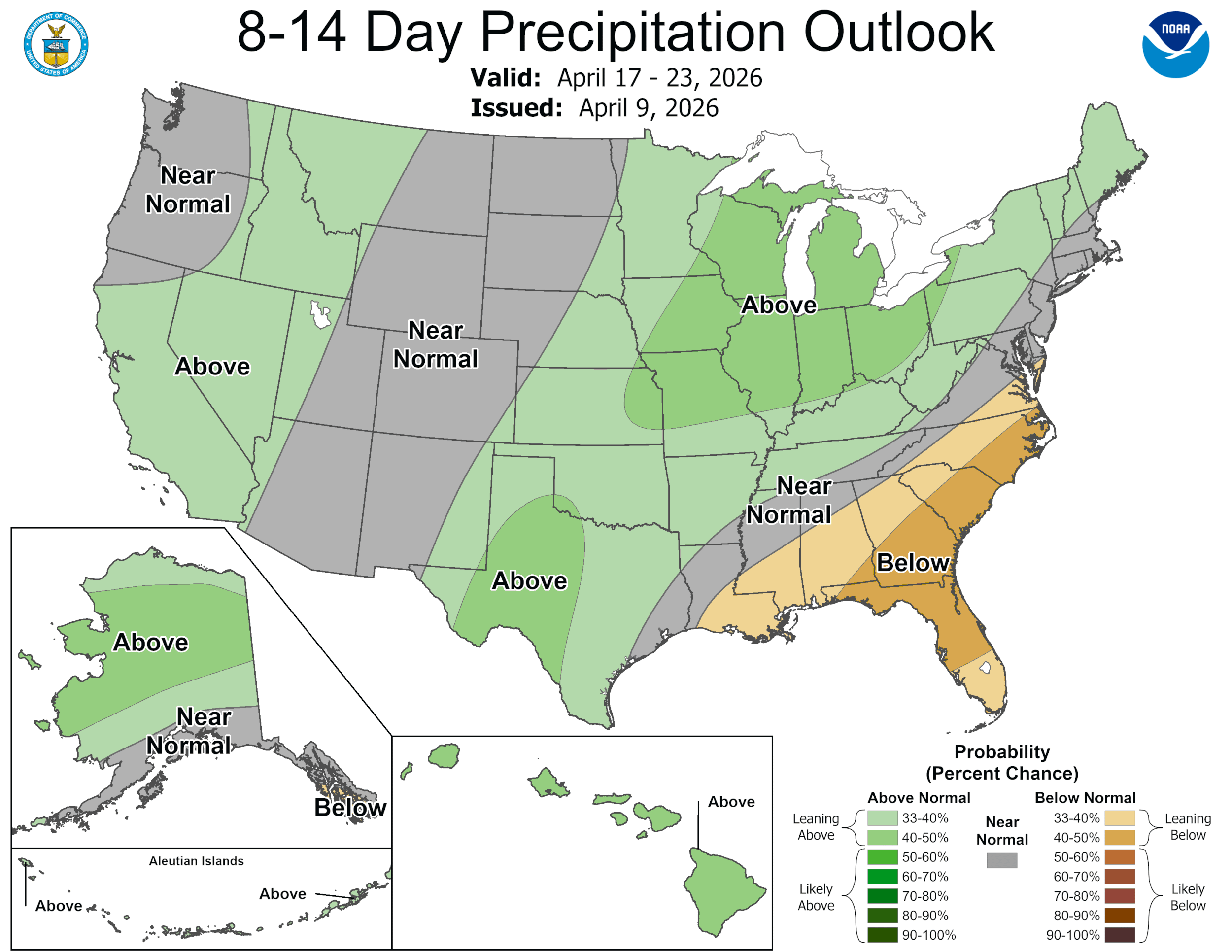
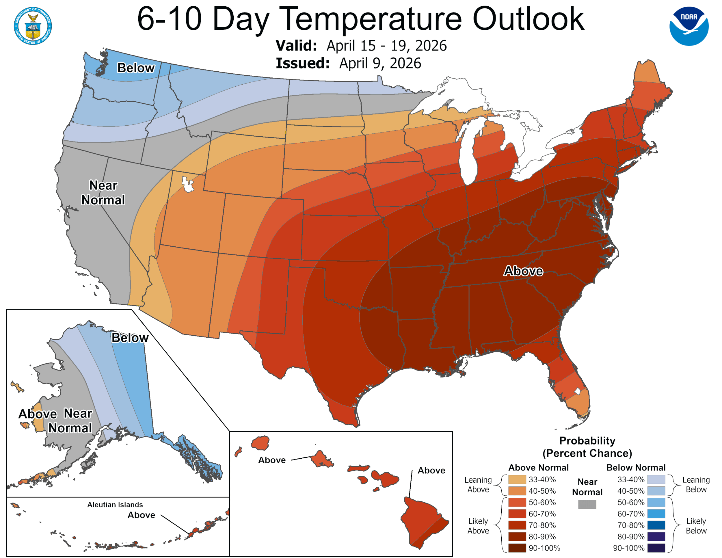
Weather Forecast: In the San Juan’s, rain/snow is expected to roll in tonight thru tomorrow. This will cool things down about 10 degrees and offer up minor amounts of rain and a couple inches of snow above 10,000’. Early next week is when a stronger low pressure system is set to move in. Timing and amount is not certain, but considering both systems the next 5 days or so may bring ~1” precipitation at Red Mt Pass, closer to 1.5” in the Upper Gunnison, 1” in the Loveland Pass region, a tad under 1” in the Yampa, and closer to 1.5” near Cameron Pass.
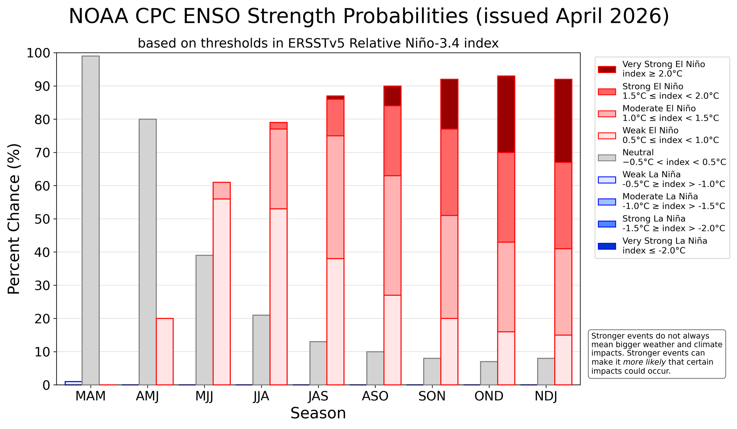
ENSO Forecast: NOAA issued an ENSO update yesterday stating “ENSO-neutral conditions are present and are favored through April-June 2026 (80% chance). In May-July 2026, El Niño is likely to emerge (61% chance) and persist through at least the end of 2026.” WY2027 could feature a stronger El Niño signal than average, including a significant chance of a “super” event (~25%), but confidence is still limited. The last “super event” Colorado experienced was the “Godzilla” event in WY2016 and that turned out to be an overall average snow year. It has the potential to vary greatly since Colorado sits on the transition zone favoring a wetter conditions to the south and tending more dry to the north. See this handout that was issued in WY2016 by Klaus Wolter - now retired from NOAA - that we still refer to. The possibility is a long way away, but seeing how WY2016 was the Godzilla El Nino, we would like to suggest that WY2027 will be the “Yeti” El Nino. Maybe by giving it a name will manifest the event. See ENSO bar graph below.
Take Care
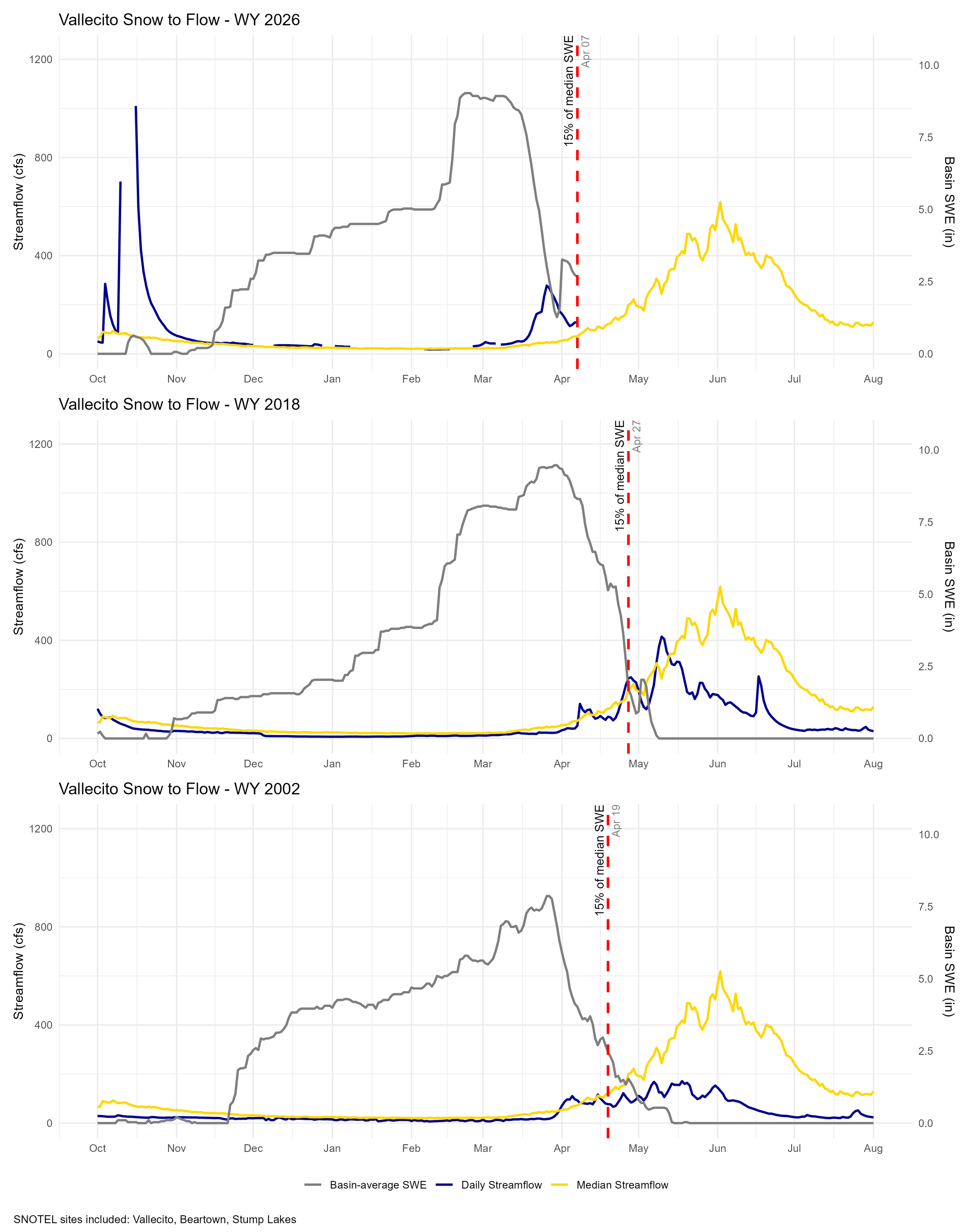
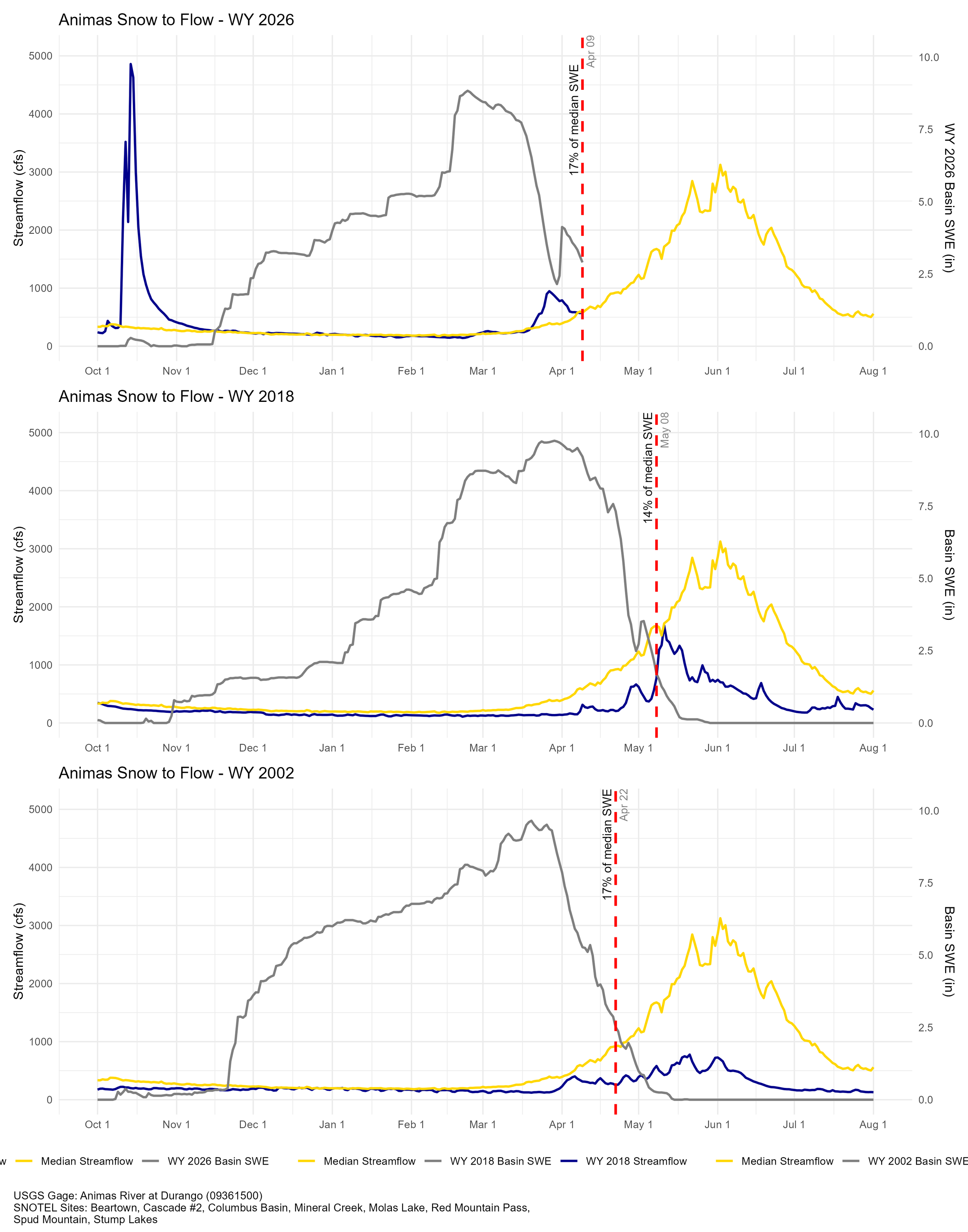
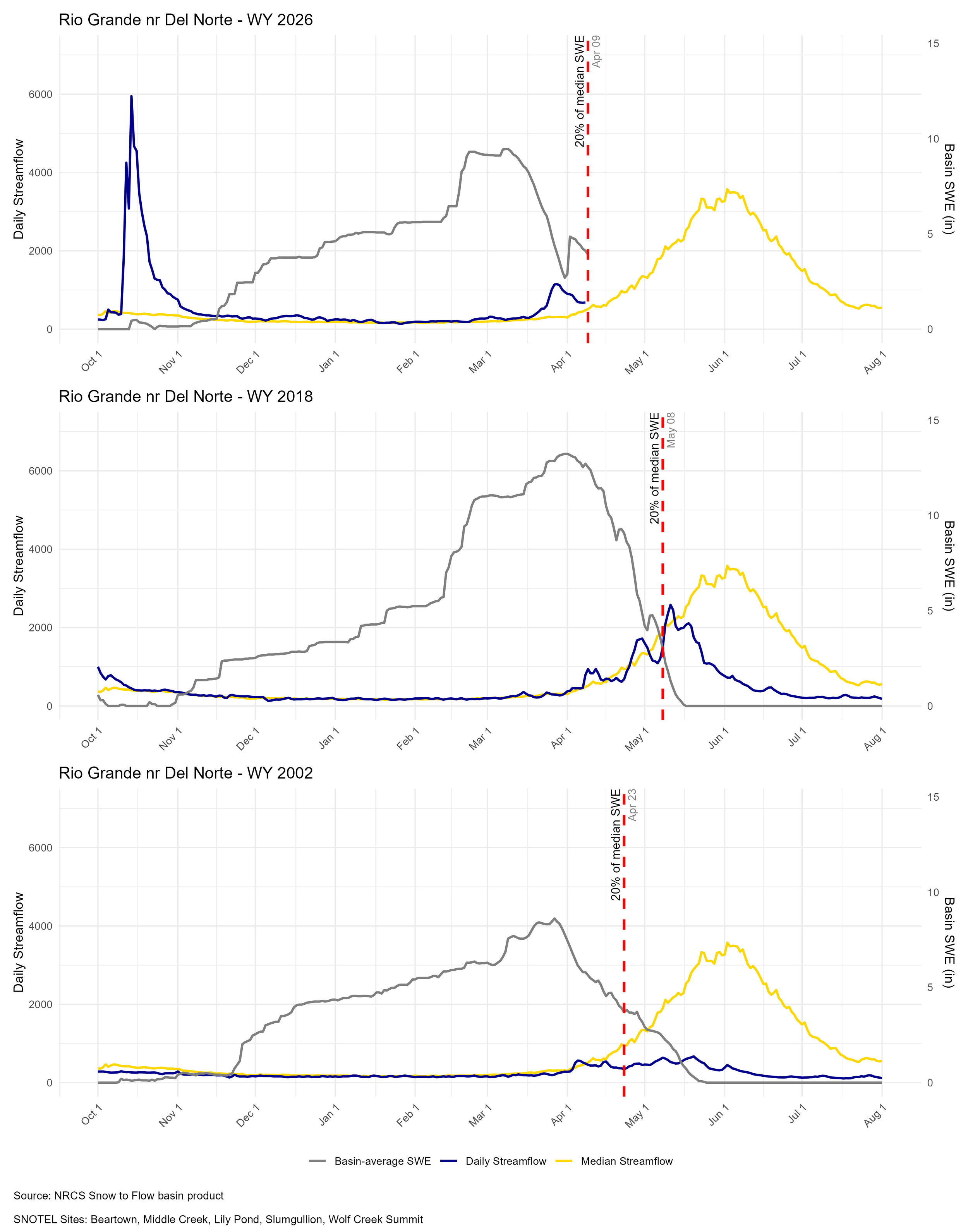
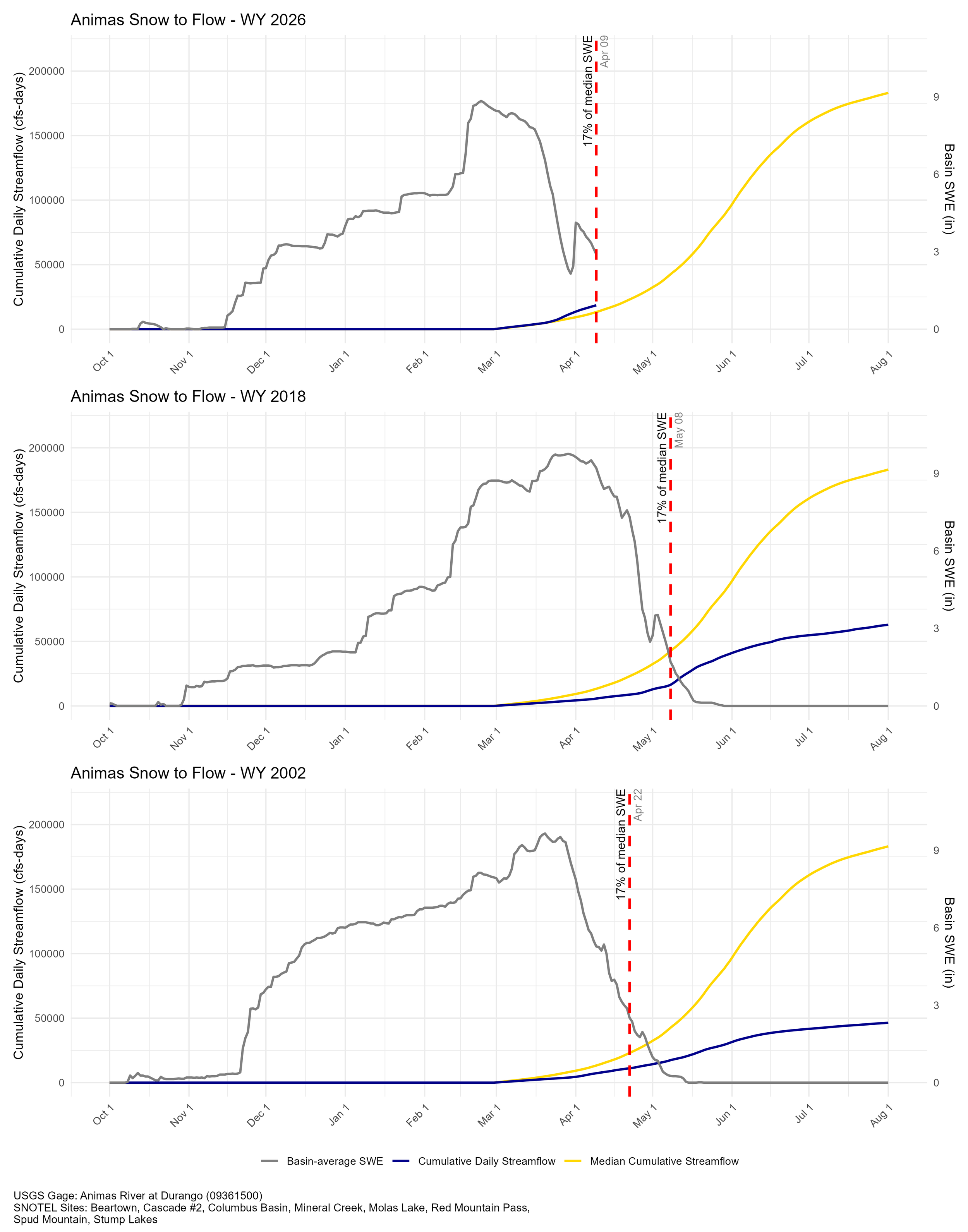
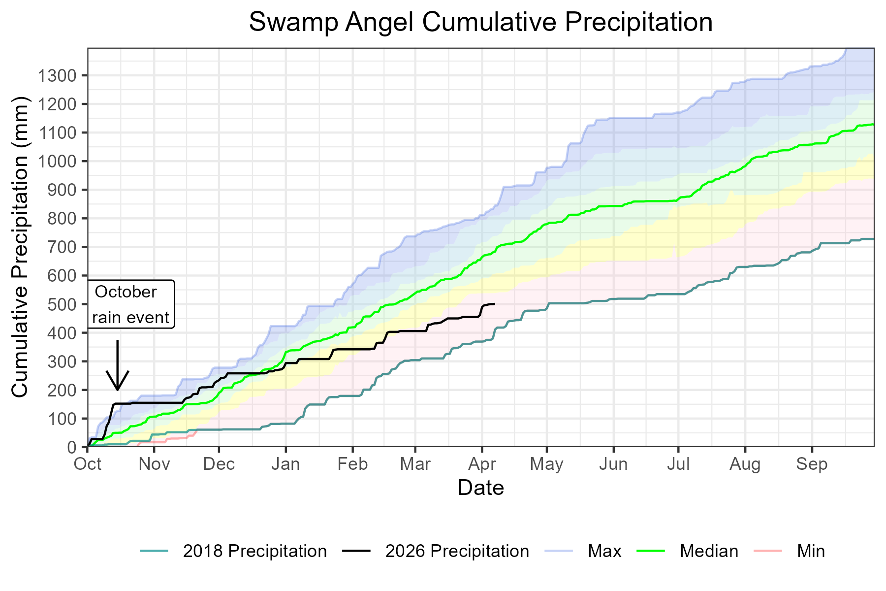
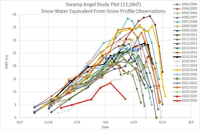
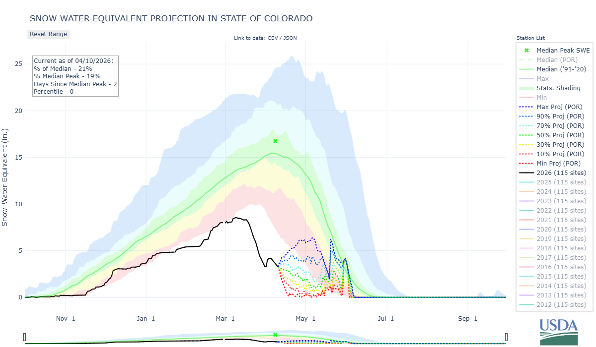
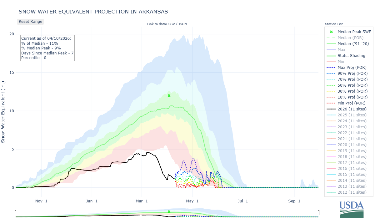
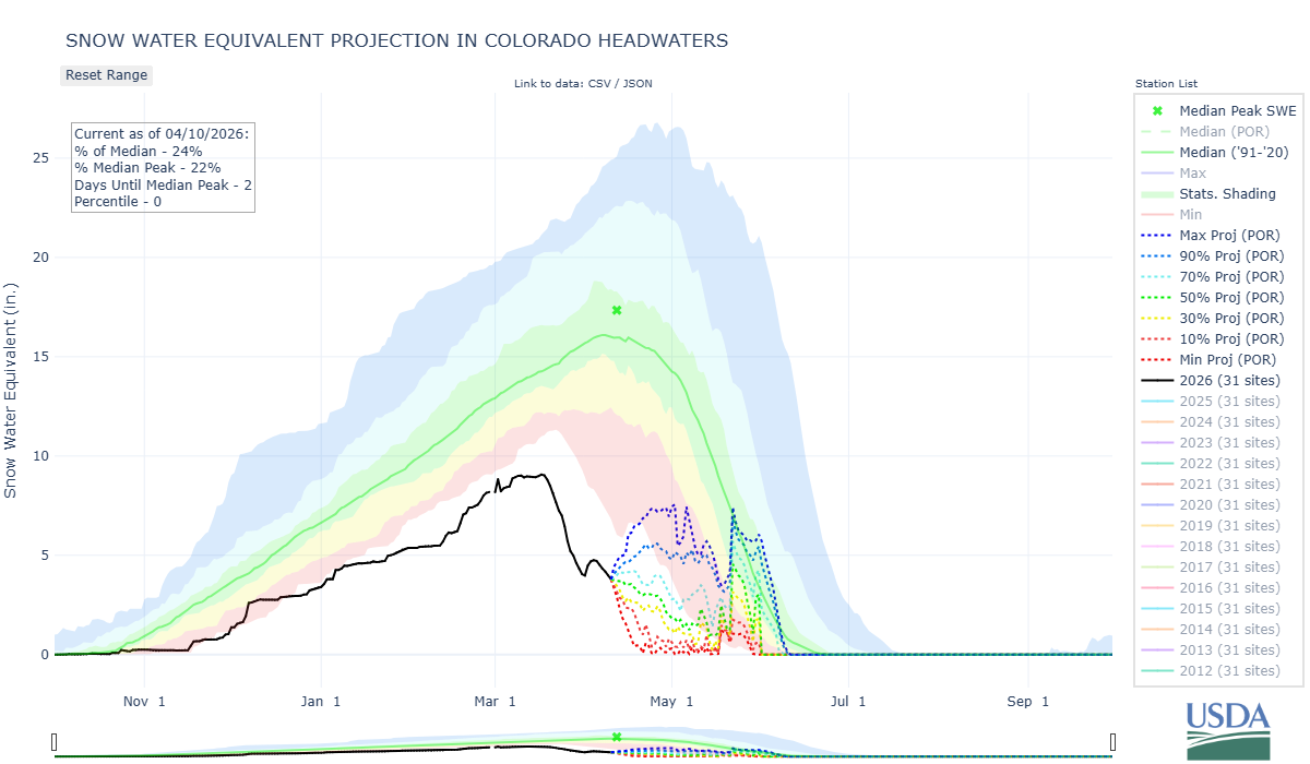
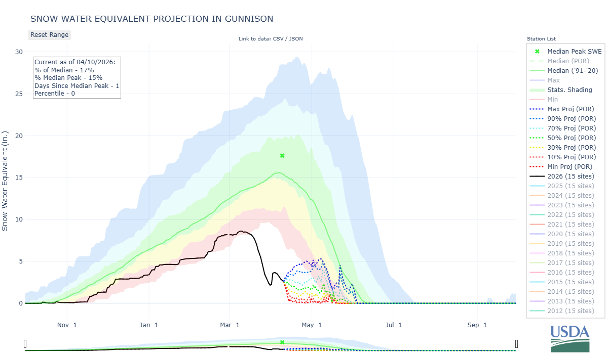
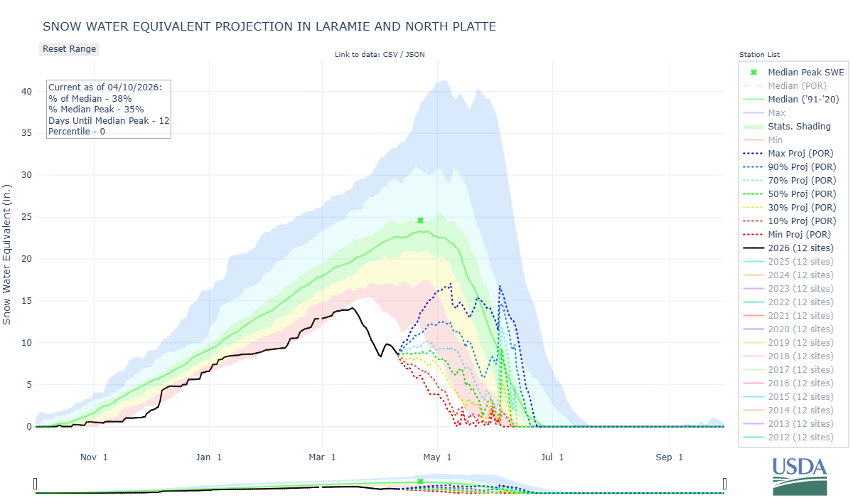
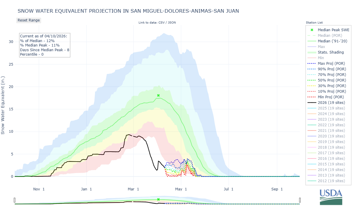
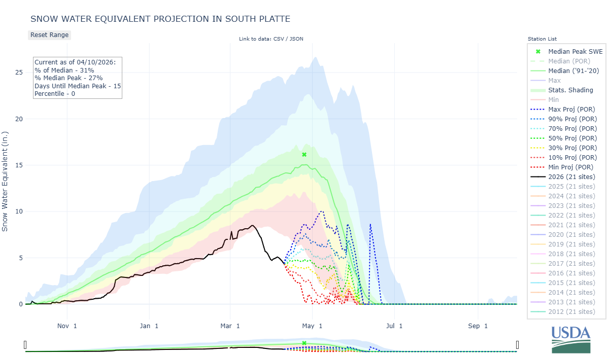
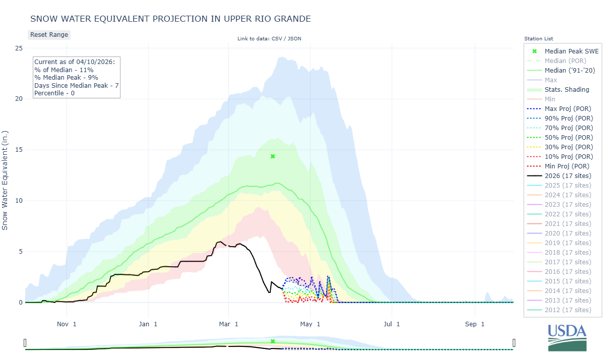
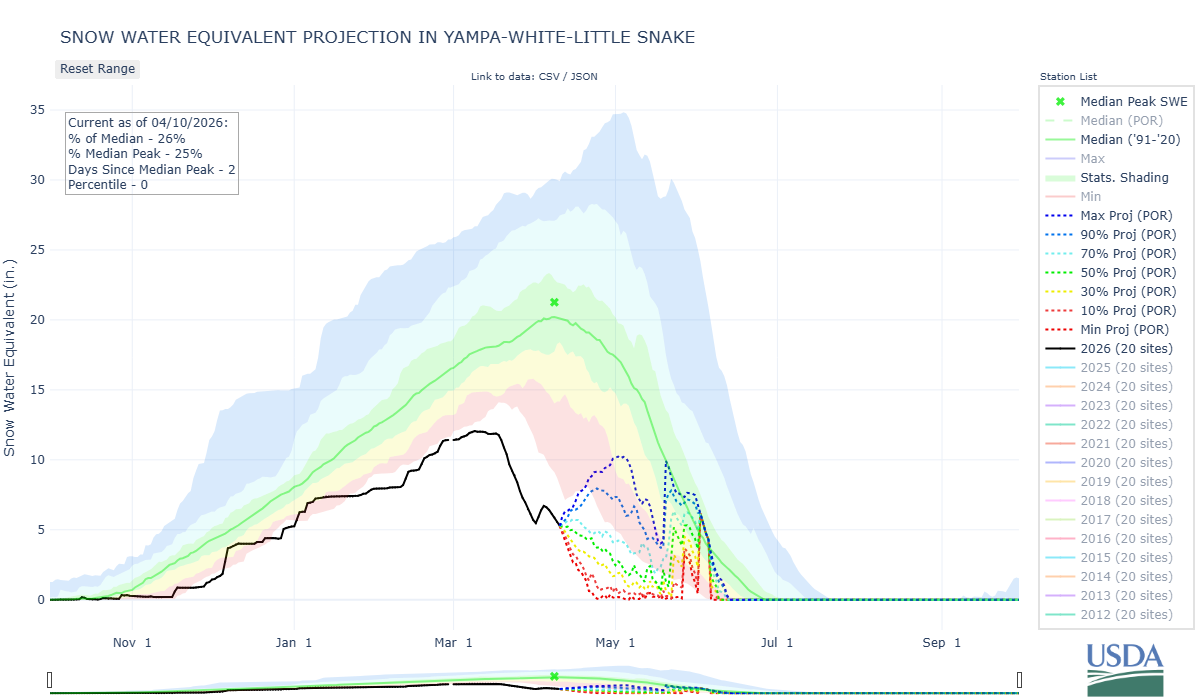
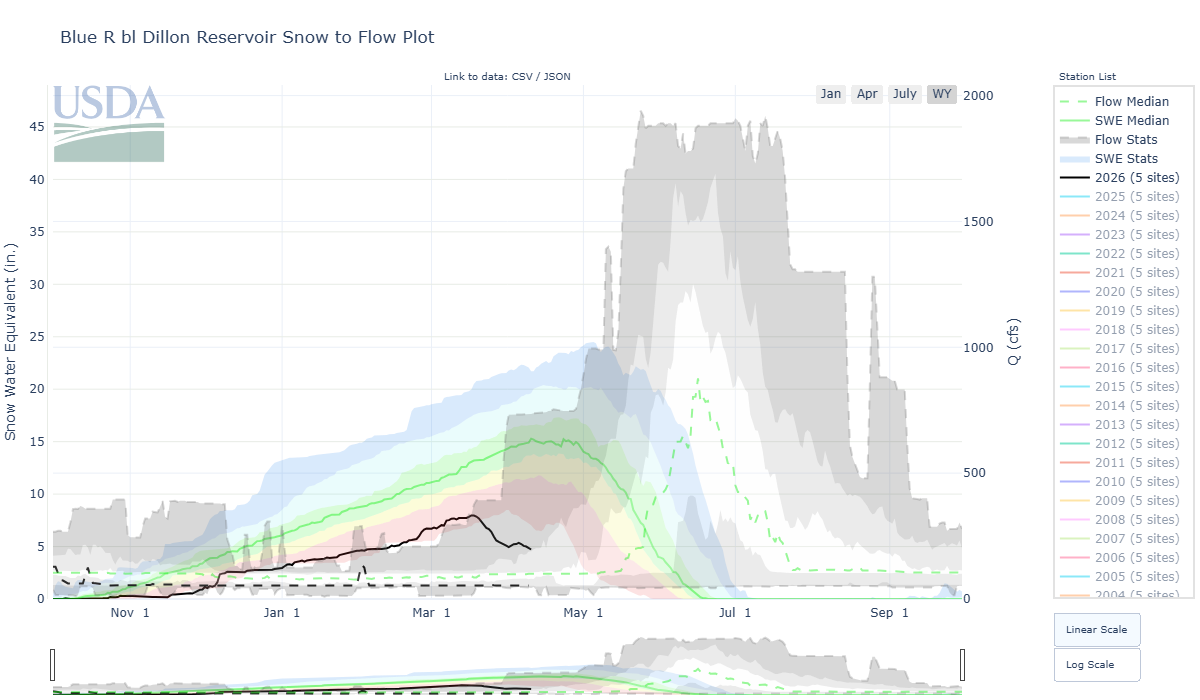
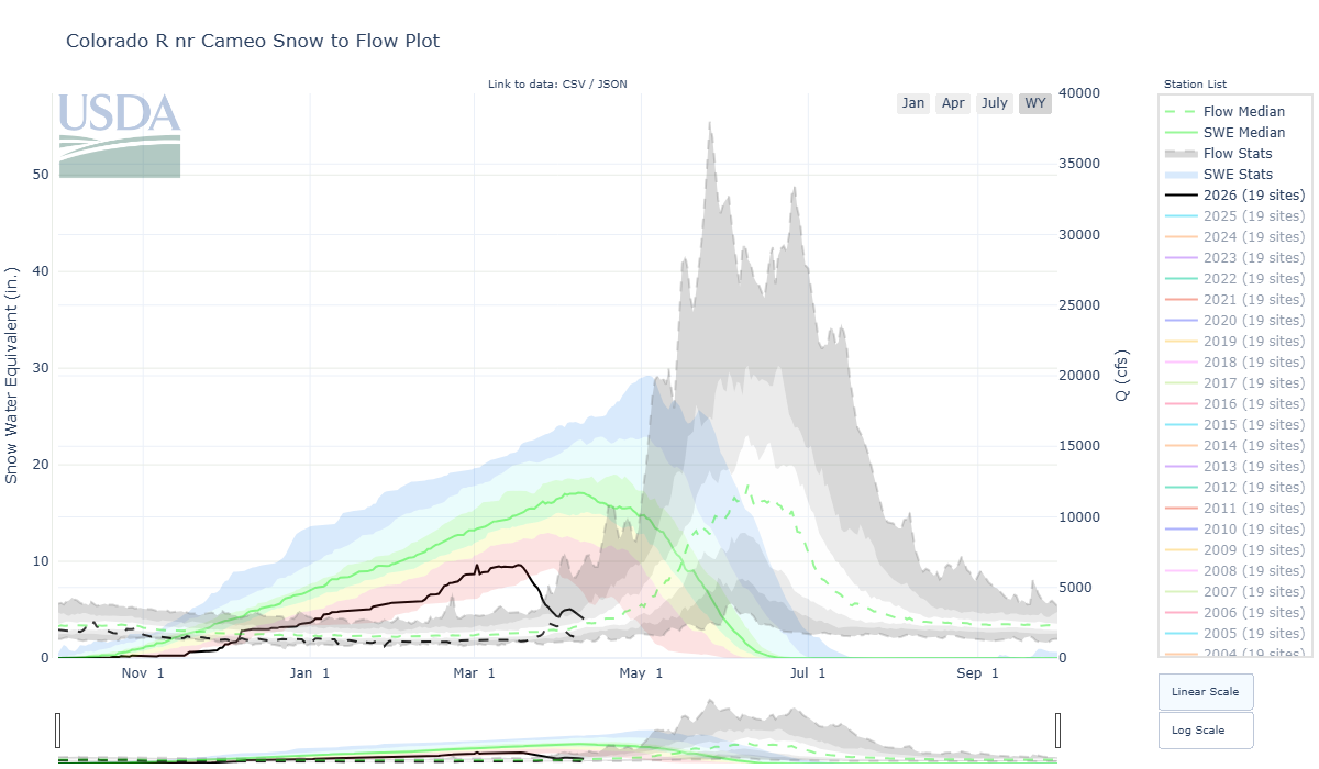
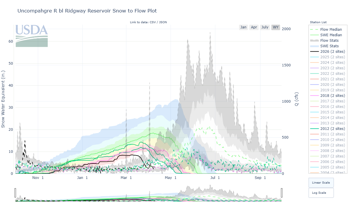
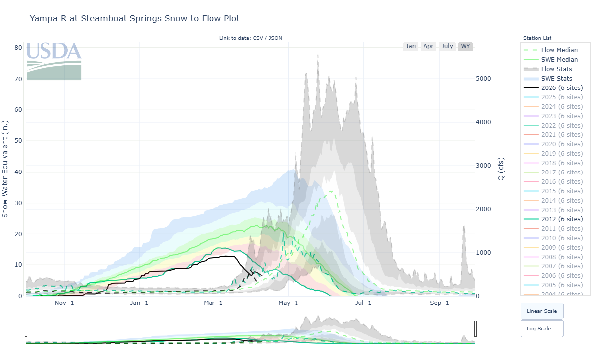
Below: What catches the eye in these plots is the start of snowpack ablation. Even in our two lowest recent years on record (in southern Colorado), the peak SWE and start of melt didn’t happen until the very end of March. This year, peak SWE occurred in the later part of the middle of February, over a month earlier than our lowest years ever. The same tendencies exist for the more northern basins.
This stage of snowmelt (17% of median SWE in the Animas) happened two weeks later in 2002, the second closest low snow year to the one we are experiencing currently. At best we hope for a streamflow experience in the shape of 2002, with small refreshes of snow here in April and May to keep the streamflow from bottoming out. There might be enough snowpack left to match our current peak streamflow at the end of April, but given this cloudy, cooler weather we have in the forecast for the next week, we might experience middling flows for a bit longer rather than a quick second peak which might drop the river to low flows much earlier than usual.
There’s always a chance of high elevation snow the rest of this month. And, there’s always a chance for rain to boost flows over the summer. However, a sizeable spring peak in the river requires a healthy snowpack, one which we do not have.
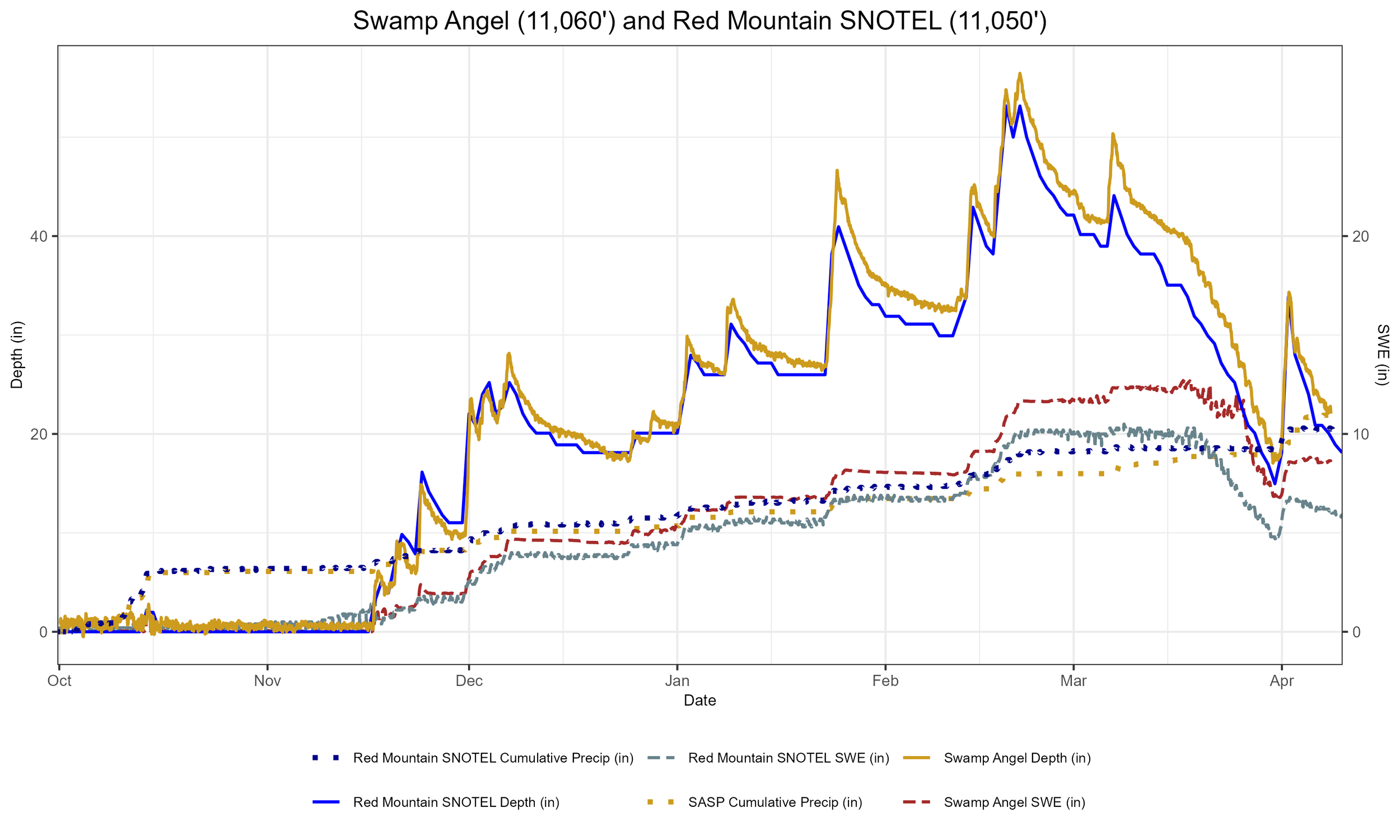
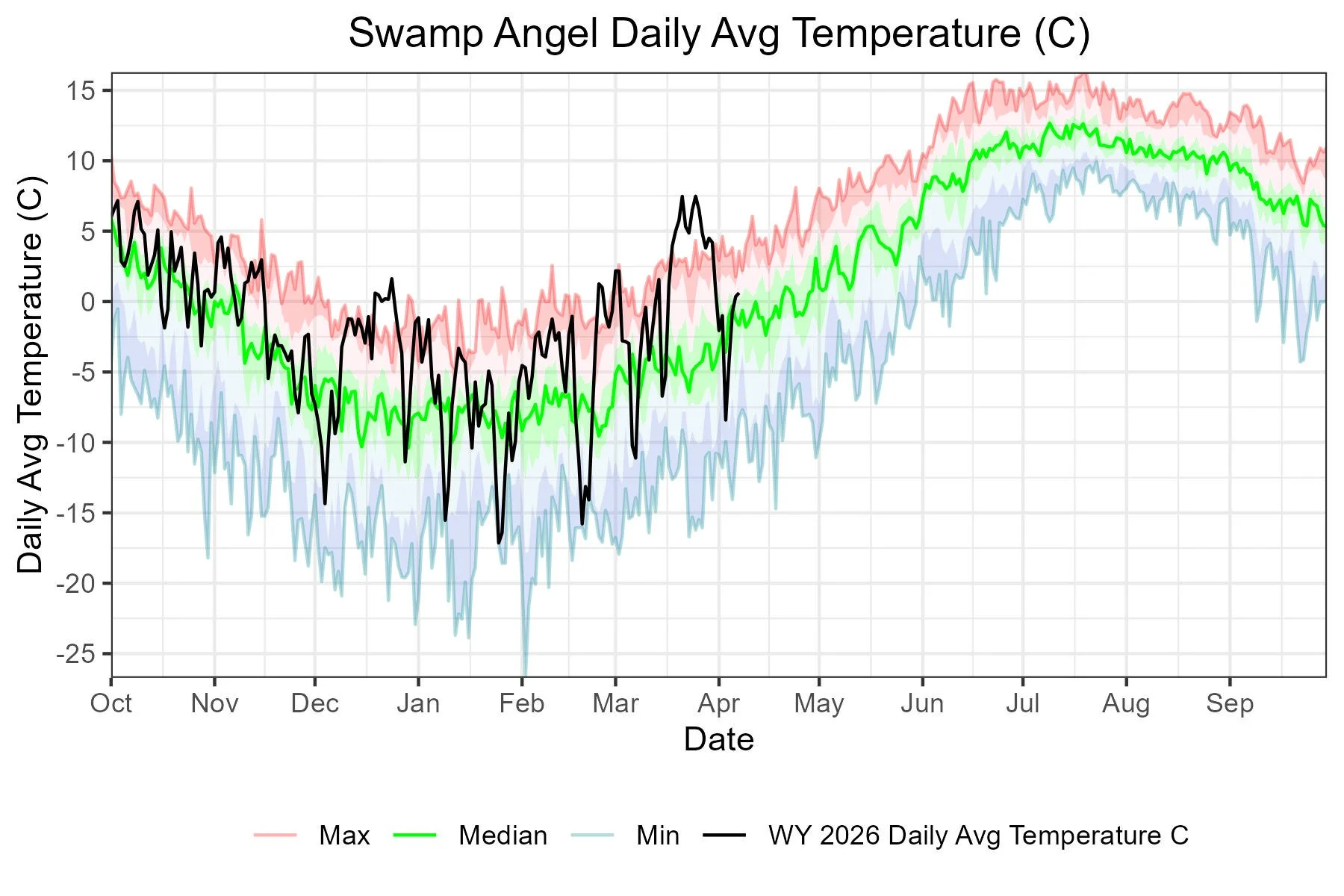
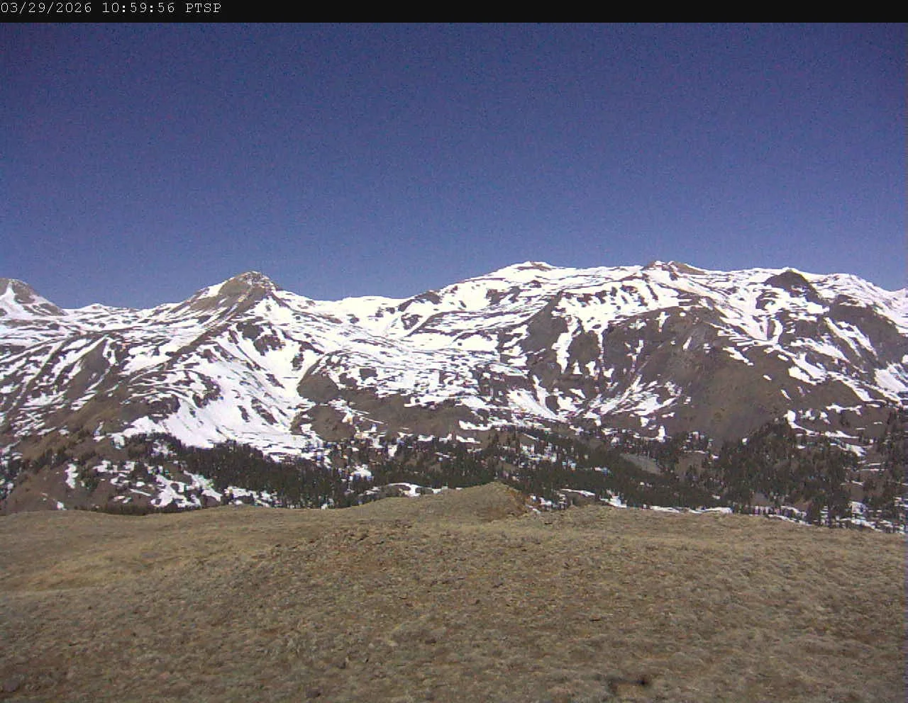
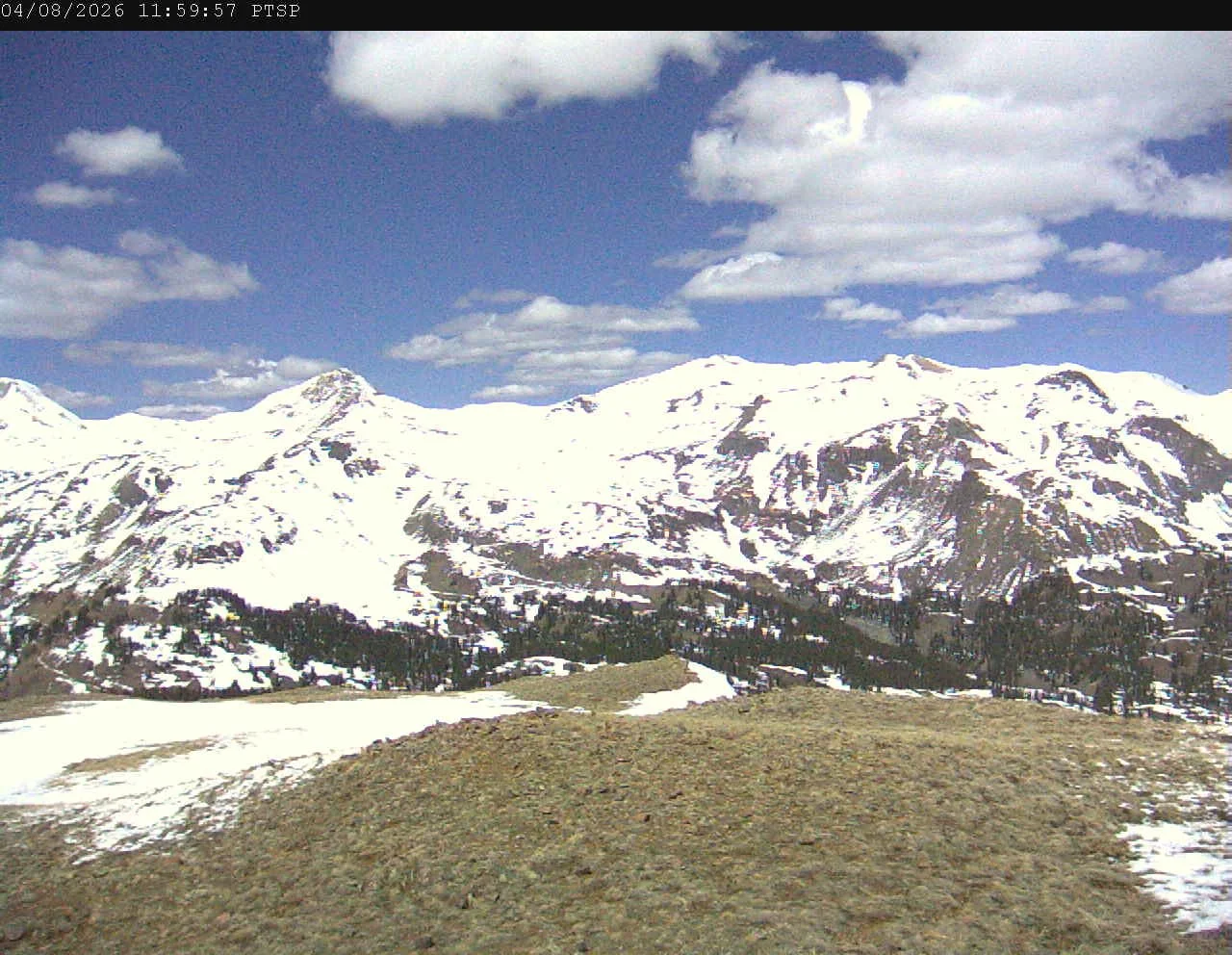
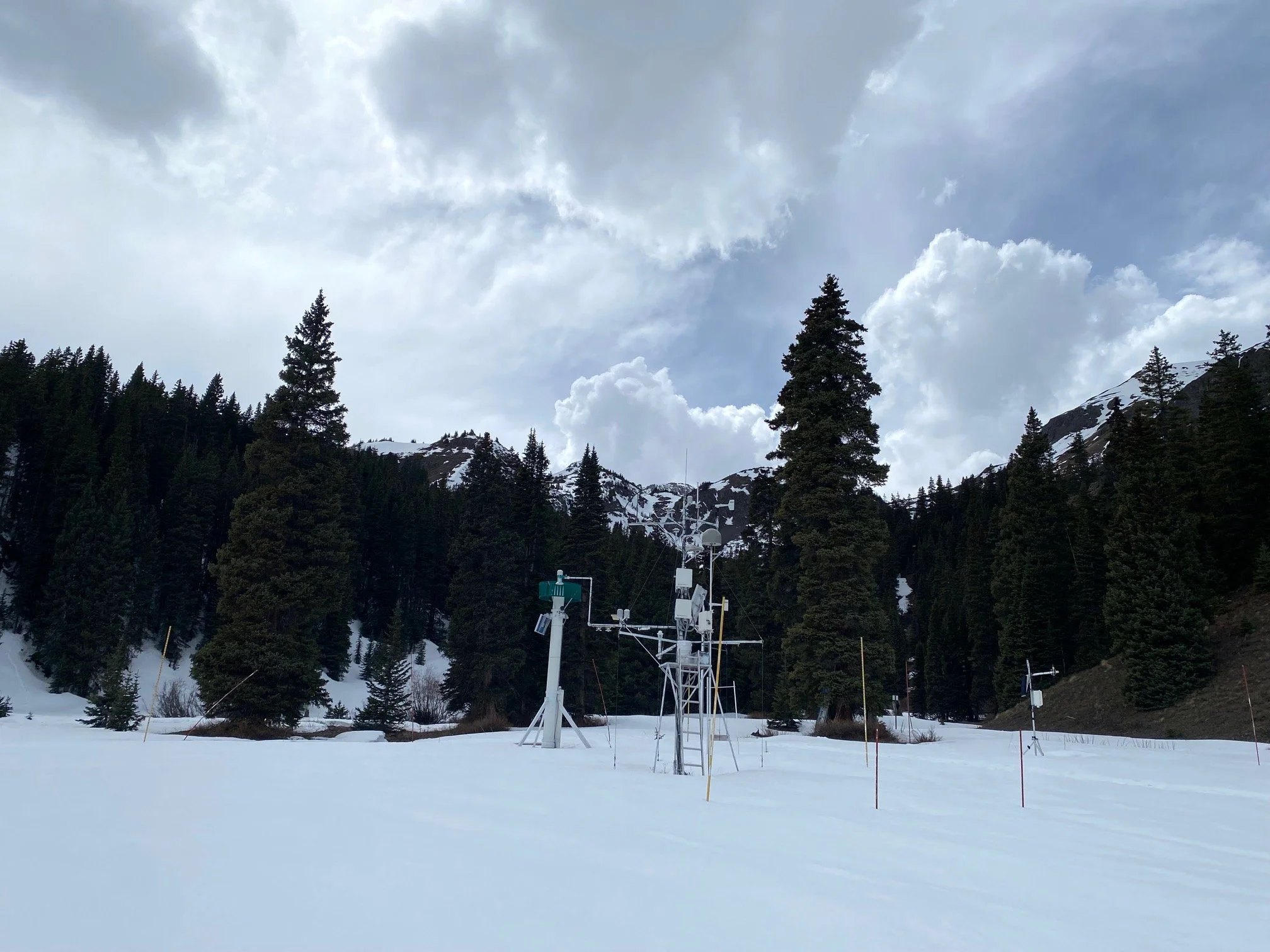
Below: The storm that brought at least 1.5” SWE to the Northern San Juans the end of March and first couple days of April still shows improved snow covered area in the high country a week after the event. Air temperatures in the evening have been a little cooler lately.
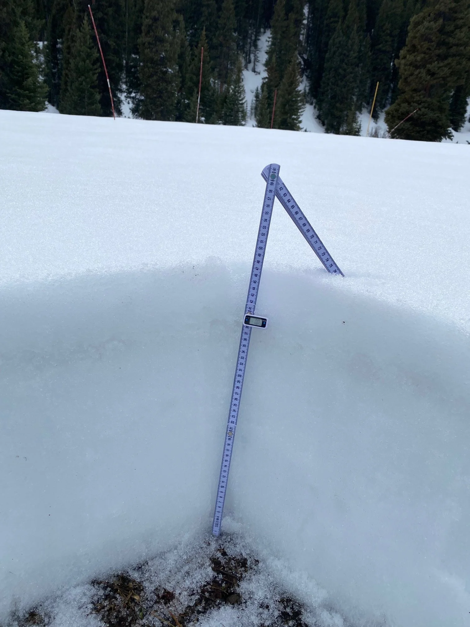
Below: Swamp Angel on April 10. SWE in the profile was 7.2”. Modest dust about ~5” under surface.
Below: Silly to be thinking about next winter, but a likely transition to El Nino could bring higher chances of above average precipitation next year.