
Snowprofile March 19th
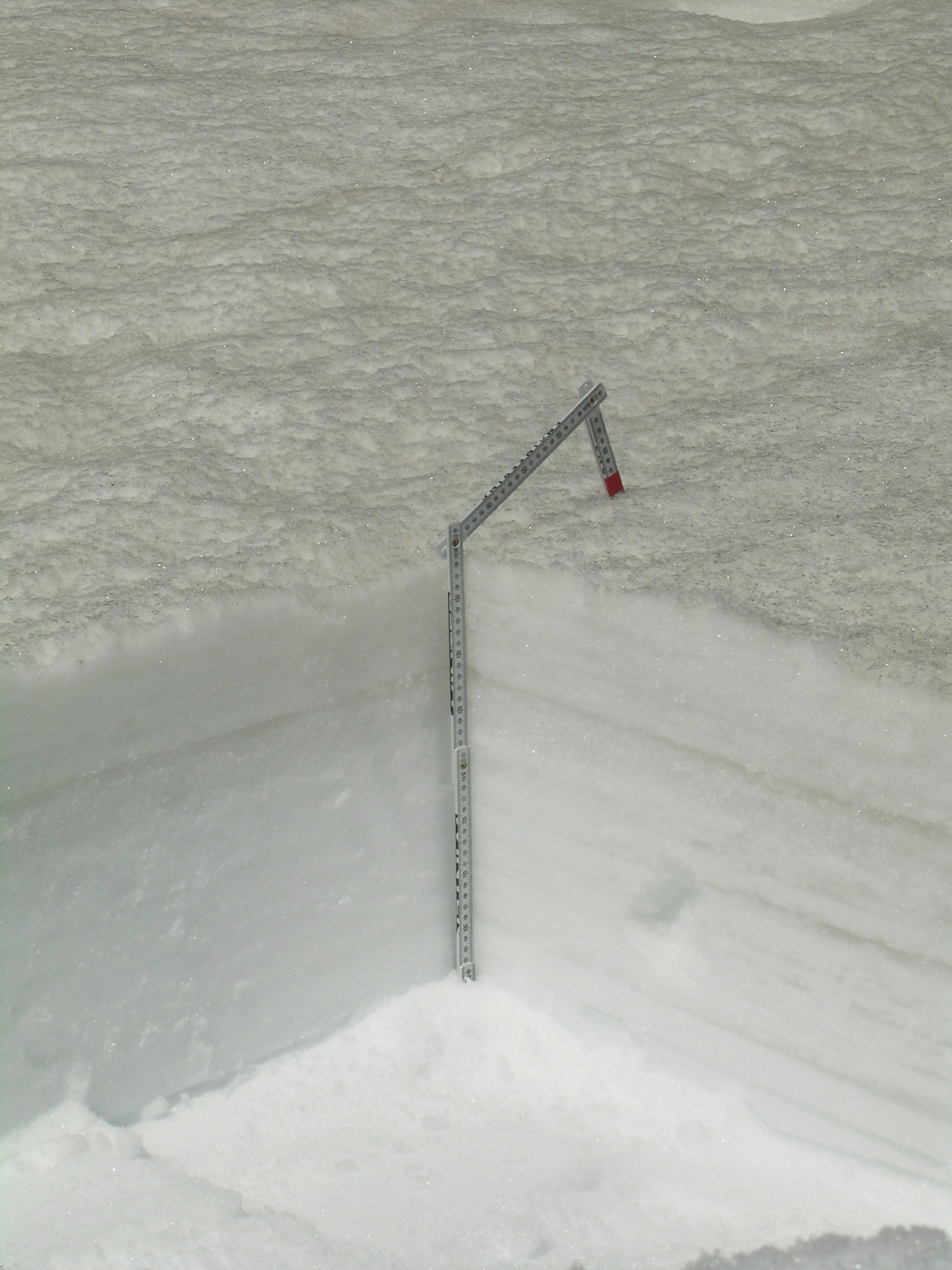
No dust layers were observed in this snow profile. A thin layer of new snow sat on top of a thick melt-freeze crust with a layer of clear ice at the base (seen about 5” below the surface, at 121 cm above the ground). Other ice “lenses” and layers were observed in the upper half of the snowpack and wetted “depth hoar” comprised the bottom half of the snowpack.
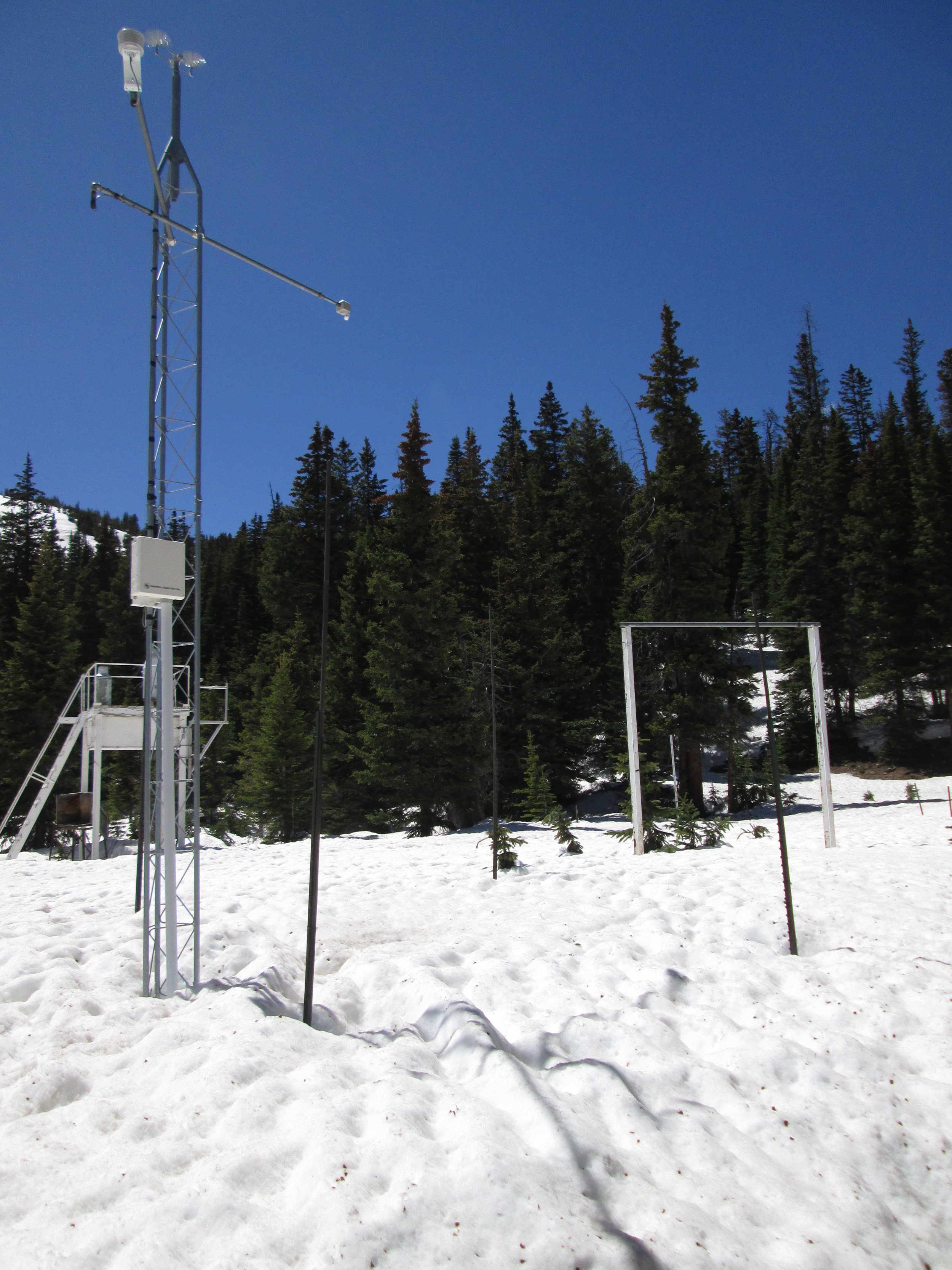
June 3, 2014
Among the ten Snotel stations proximal to our CODOS sites, nine are partially or heavily shaded by surrounding trees. The Berthoud Summit Snotel, on the other hand, is uniquely located in an open meadow with nearly complete exposure to direct solar radiation from the east, south, and west. As a result, Berthoud Summit Snotel SWE and snow depth data reflect the full impact of dust-on-snow on snow albedo and, therefore, on snowmelt rates. The snow pillow measuring SWE is directly beneath the snow depth sensor positioned at the end of the arm extending northward (away from viewer) from the top of the instrument mast. During the sunny period leading up to the June 3 site visit, snowmelt rates rose only slowly from 0.5-1.0” SWE loss per day, with clean snow from the Memorial Day weekend storm still at the snowpack surface and maintaining a comparatively high snow albedo. SWE loss was 1.4” on the day of the site visit, with dust by then widely exposed and snow albedo substantially reduced. Since then, snowmelt rates rose further to 1.8-2.0”/day as merged dust layers D3-8 further consolidated in the snow surface. As of this writing on Monday, June 9, more than half of the snowcover observed on June 3 has melted.

June 3, 2014
The 35” deep snow pit at Berthoud Summit on June 3 contained 15.5” of SWE, almost exactly matching the SWE being reported at the time by the Snotel just a few yards away. Merged dust containing at least events D3, D4, and D8 was exposed at the surface and an ‘all layers merged’ (ALM) sample was collected from an area measuring 1.00 m x 0.48 m, or 0.48 m2. Dirty melt water from the snow surface had percolated downward in “preferred flow channels” into the underlying clean snowcover before spreading laterally at a layer boundary within the snowpack and creating a layer of dust-stained slush, as seen here a few inches below the surface in the snow pit face. Nonetheless, the ALM sample did capture the vast majority of the merged dust material, for analysis of its chemical and other properties.

June 3, 2014
Adam Cwiklin, water and wastewater superintendent for the Town of Fraser and a participant in the Colorado Foundation for Water Education’s Water Leaders Program, assisted with the June 3 snow profile at Berthoud Summit. At the time, very high snowmelt rates had driven the Fraser River ‘out of bank’ and generated minor flooding in his service area.

April 25, 2014
Approaching the Berthoud Summit CODOS and Snotel site

May 21, 2013
During the final visit to Berthoud Summit, a concentrated sample of merged layers D8-D6/5 dust was collected for chemical and other analyses by USGS. The site and Berthoud Pass locale still retained a high snow albedo on that date but would soon reveal those merged dust layers, only to be re-buried in late May before a final, sustained emergence on June 3, with a very rapid acceleration in SWE losses at the Berthoud Summit Snotel (seen in the background).

May 10, 2013
The Berthoud Pass (Berthoud Summit) CODOS snow pit showing dust layer D8 prominently, and a weak layer D6 below. D8 was covered by clean snow containing 3.4” of SWE.
Snowpack accumulation was still ongoing in early May. The CODOS snow profile of May 10 found a very strong D8 dust layer buried under 16” of recent, clean new snow. However, clear evidence was found of surface melt associated with late April exposure of layer D8. That melt episode was brief and layer D8 was still separated from merged layers D6/D5 below.
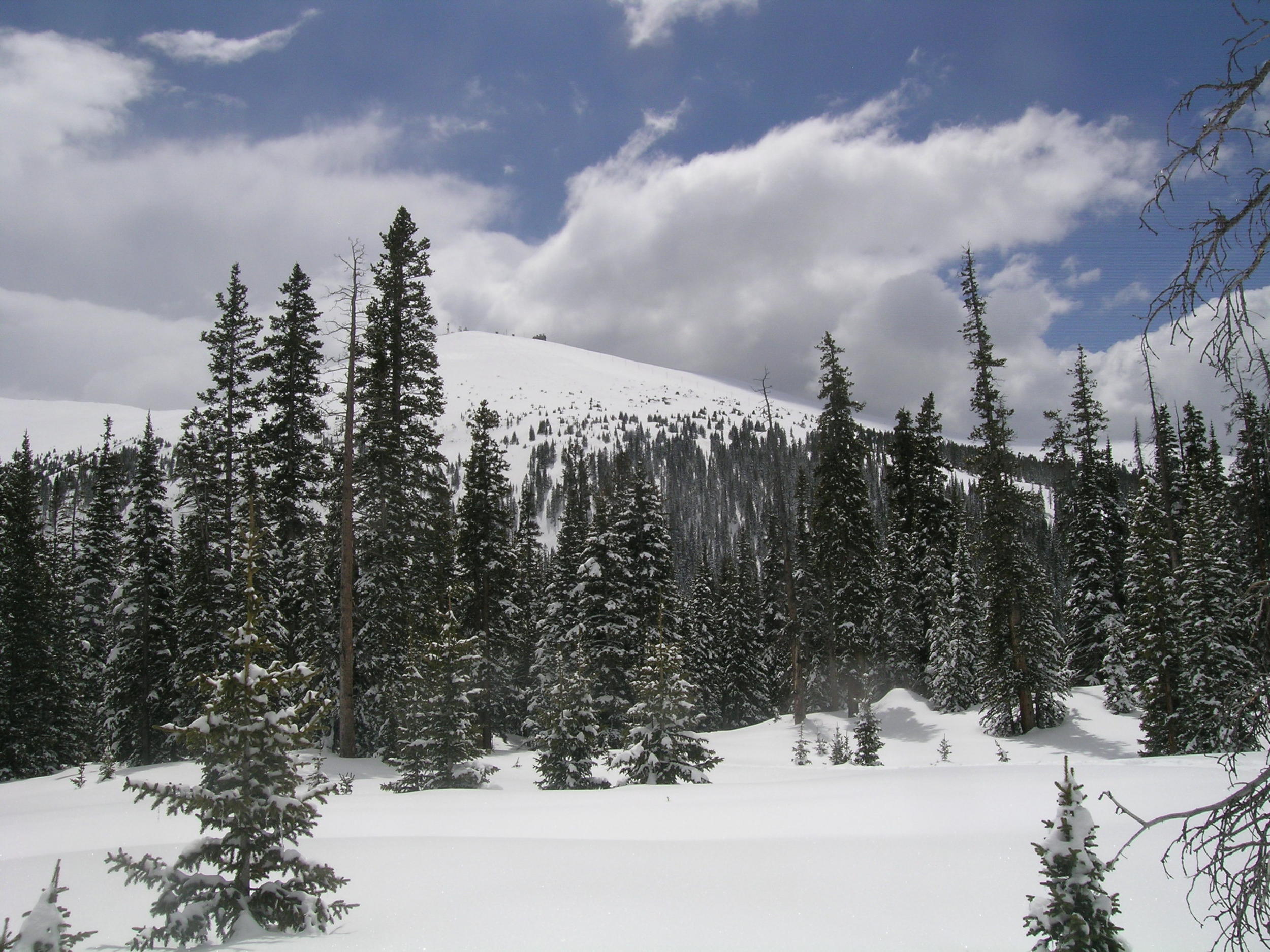
May 10, 2013
A view from the Berthoud Summit Snotel and CODOS site of Colorado Mines Peak (12,493’) above Berthoud Pass.
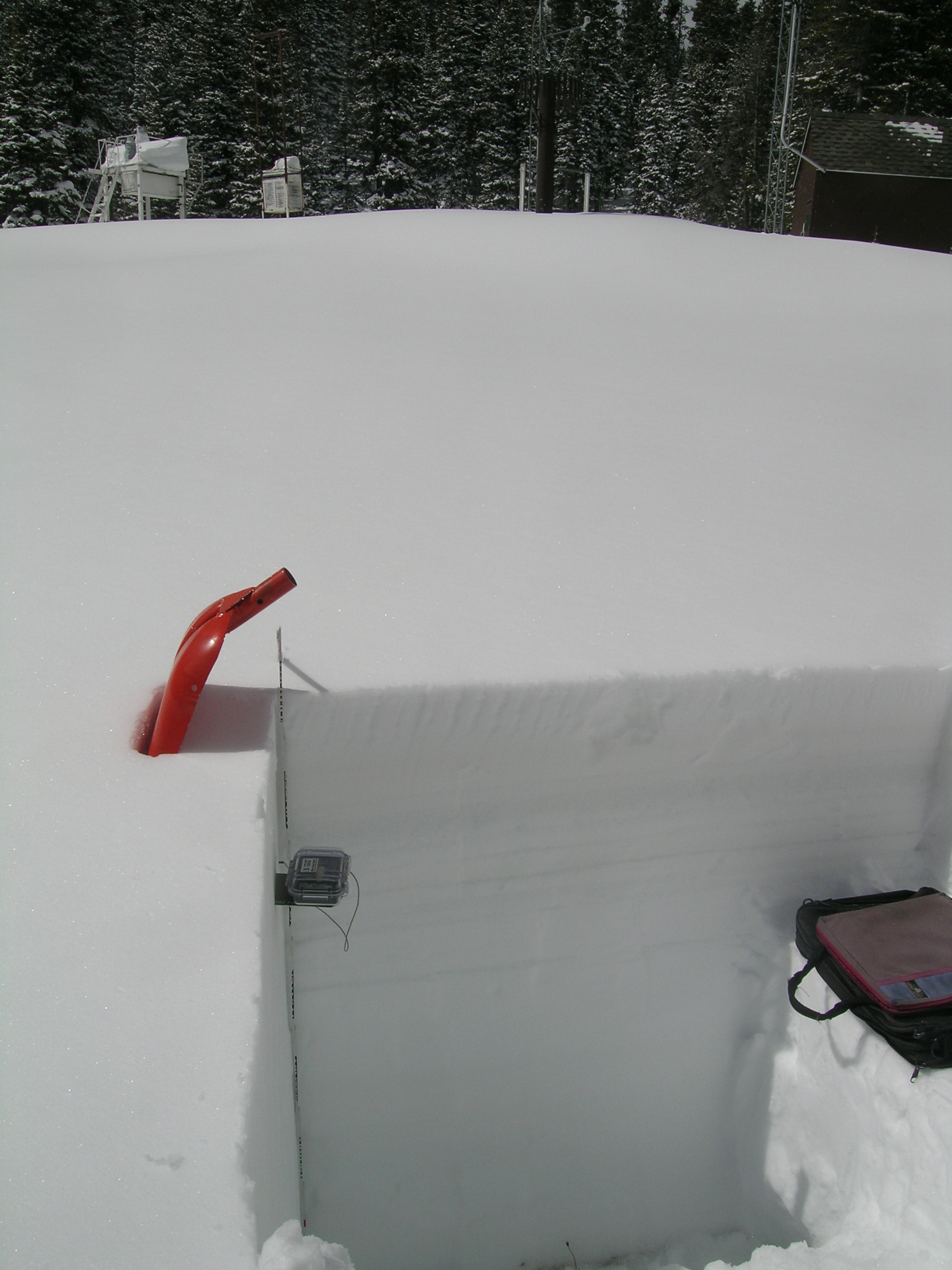
April 12, 2013
Dust layer D6 was weakly present in the snow profile at the Berthoud Summit CODOS site, buried 9” below the surface and dashing hopes for a clean WY 2013 snowpack. D6 may have been merged with event D5. Clear evidence of a surface melt episode was observed in the snow immediately below D6 and the snowpack had become effectively isothermal.
The comparatively weak, merged dust layers D6 and D5 are located in a thin band seen immediately above the thermometer case in the pit corner in this photo. Other dark bands in the snowpack are layers of clear ice, the result of surface snowmelt and/or free (melt) water percolation from the surface to deeper layer boundaries within the snowcover.

April 12, 2013
Snow pit walls are sawn to a depth of ~18”, then carefully shaved from there to the ground with a specialized shovel, to maximize the clarity of layering structure and dust layer detail.

March 19, 2013
The comparatively sunny and open Berthoud Summit Snotel station as seen from the CODOS snow pit. The solar panels at the top of the mast face south.
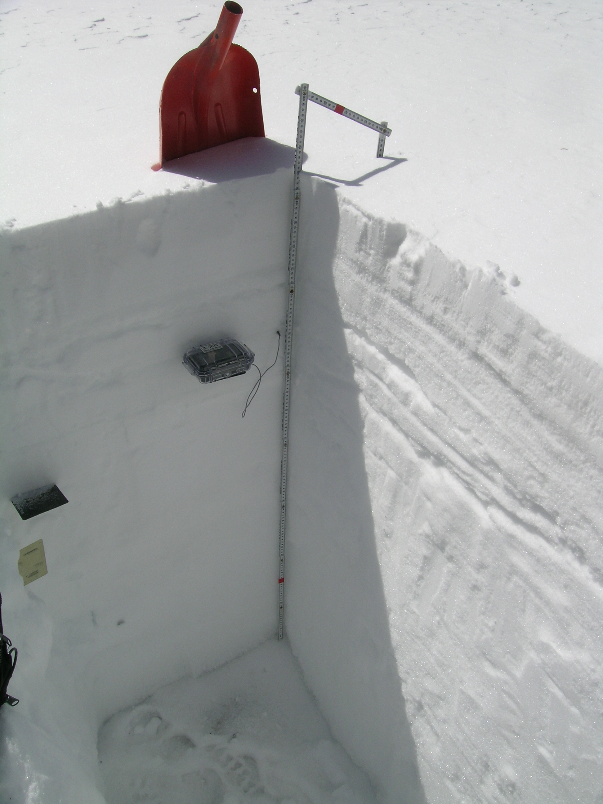
March 19, 2013
The March 19, 2013 snow profile at the open and sunny Berthoud Summit CODOS site. No dust was discernible in this snowpack, raising
hopes that this could be a dust-free season at this Front Range site. Snow temperatures were already fairly warm, at a mean of -2.6° C.

March 19, 2013
The completed snow pit, following measurement of total SWE in a continuous series of 'tube' samples collected in the left end wall of the pit, perpendicular to the ground (i.e., "slope normal"). Snow temperatures are measured first, in the shady corner of the pit, using a calibrated digital thermometer. The completed snow profile (as shown above) is seen in the open notebook.

May 2, 2012
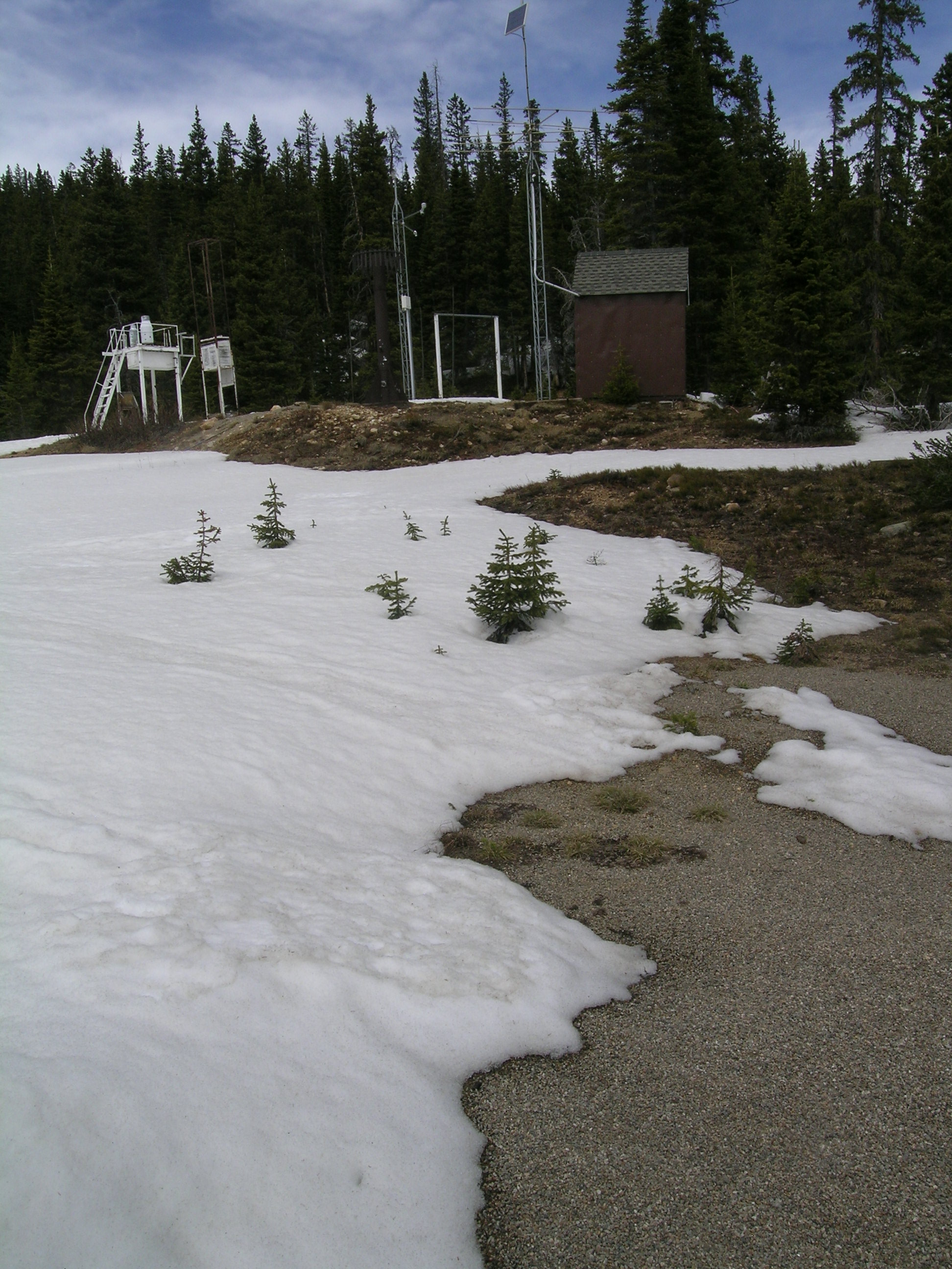
Comparison photo 1 of 3: Photos in 2012, 2011, and 2010 at the Berthoud Summit CODOS snowpit site showing the snowpack surface late in the snowmelt season, with all/most dust layers merged at the surface, show clear differences in dust loading and reduction of snow albedo, with the least reduction in 2012.
June 9, 2011
Comparison photo 2 of 3: Photos in 2012, 2011, and 2010 at the Berthoud Summit CODOS snowpit site showing the snowpack surface late in the snowmelt season, with all/most dust layers merged at the surface, show clear differences in dust loading and reduction of snow albedo, with the least reduction in 2012.

May 26, 2010
Comparison photo 3 of 3: Photos in 2012, 2011, and 2010 at the Berthoud Summit CODOS snowpit site showing the snowpack surface late in the snowmelt season, with all/most dust layers merged at the surface, show clear differences in dust loading and reduction of snow albedo, with the least reduction in 2012.
May 2, 2012
Berthoud Summit Snotel and CODOS Site

May 12, 2012
Berthoud Summit Snotel

May 12, 2012
Berthoud CODOS Site final snow pit of season

April 10, 2012
Completed pit at Berthoud CODOS Site

April 10, 2012
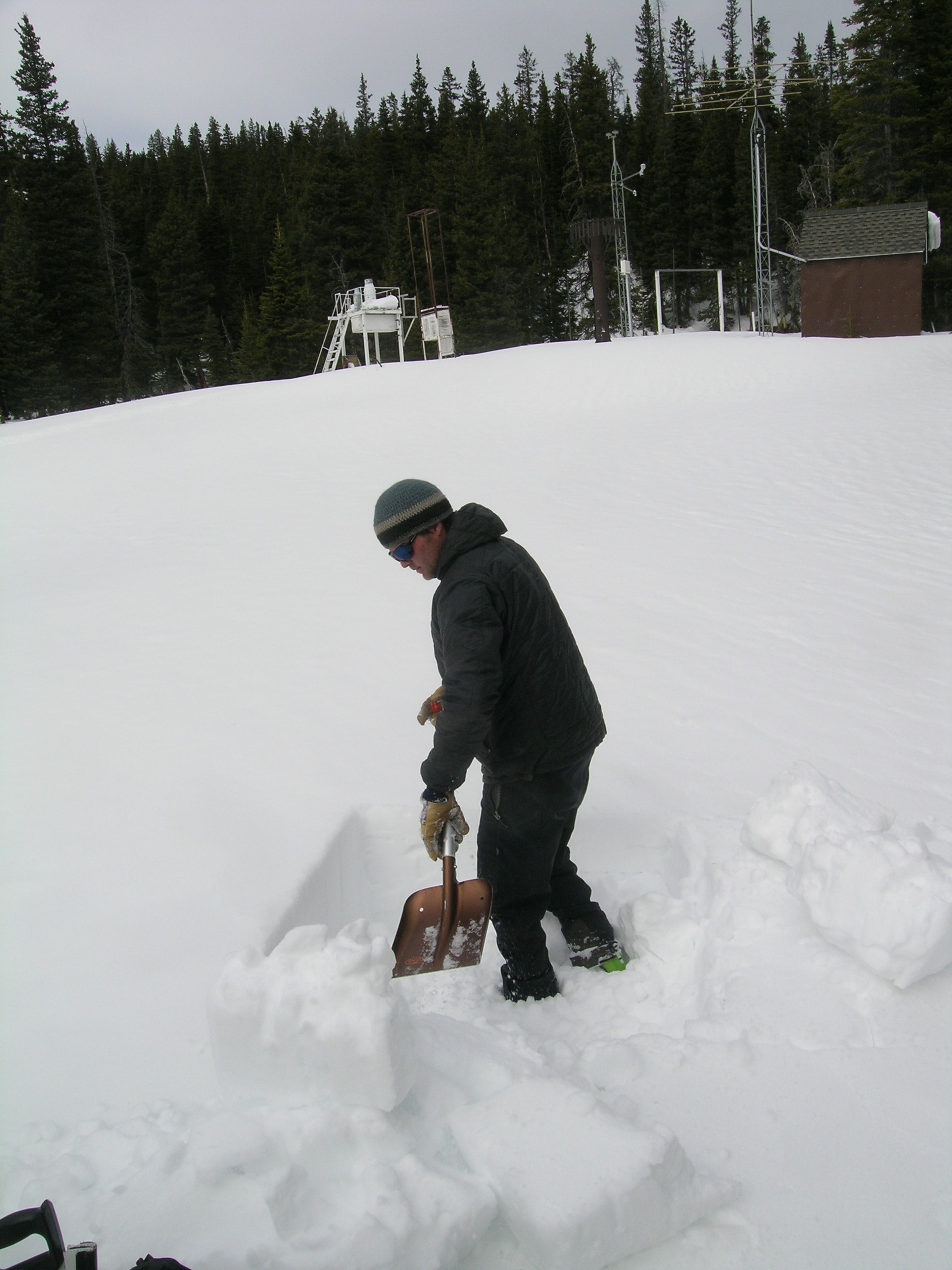
Berthoud pit with Berthoud Summit Snotel in background.
March 15, 2012
Andrew Temple begins digging the pit with Berthoud Summit Snotel in the background

March 15, 2012
CODOS snow pit with Berthoud Summit Snotel in the background

March 15, 2012
Berthoud snowpit


