

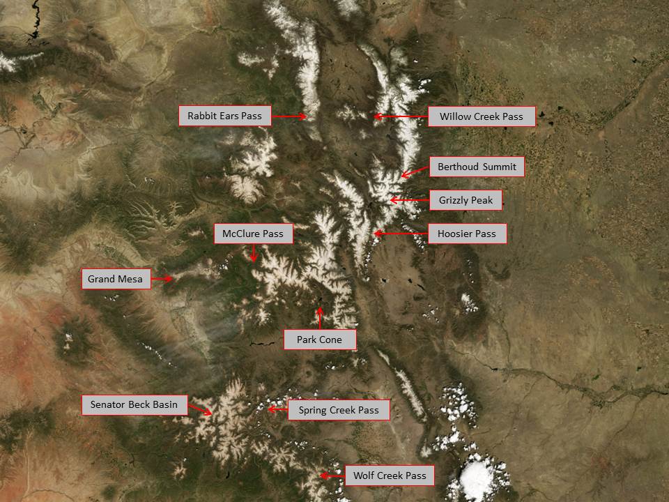
For more details, see the CODOS site atlas (pdf) and our Google Earth KMZ file. Contact jderry@snowstudies.org for more information. The first image below is a spring 2009 MODIS satellite image of Colorado's mountain ranges. The cloud tops in the bottom right of the image approximate the color of clean snow.

Senator Beck Basin is outlined in red, with the locations of the four study plots in yellow (from left to right): Senator Beck Study Plot (SBSP), Swamp Angel Study Plot (SASP), Senator Beck Stream Gauge (SBSG), Putney Study Plot (PTSP)