CODOS UPDATE may 8, 2024: 100mph winds=dust
Greetings from Silverton,
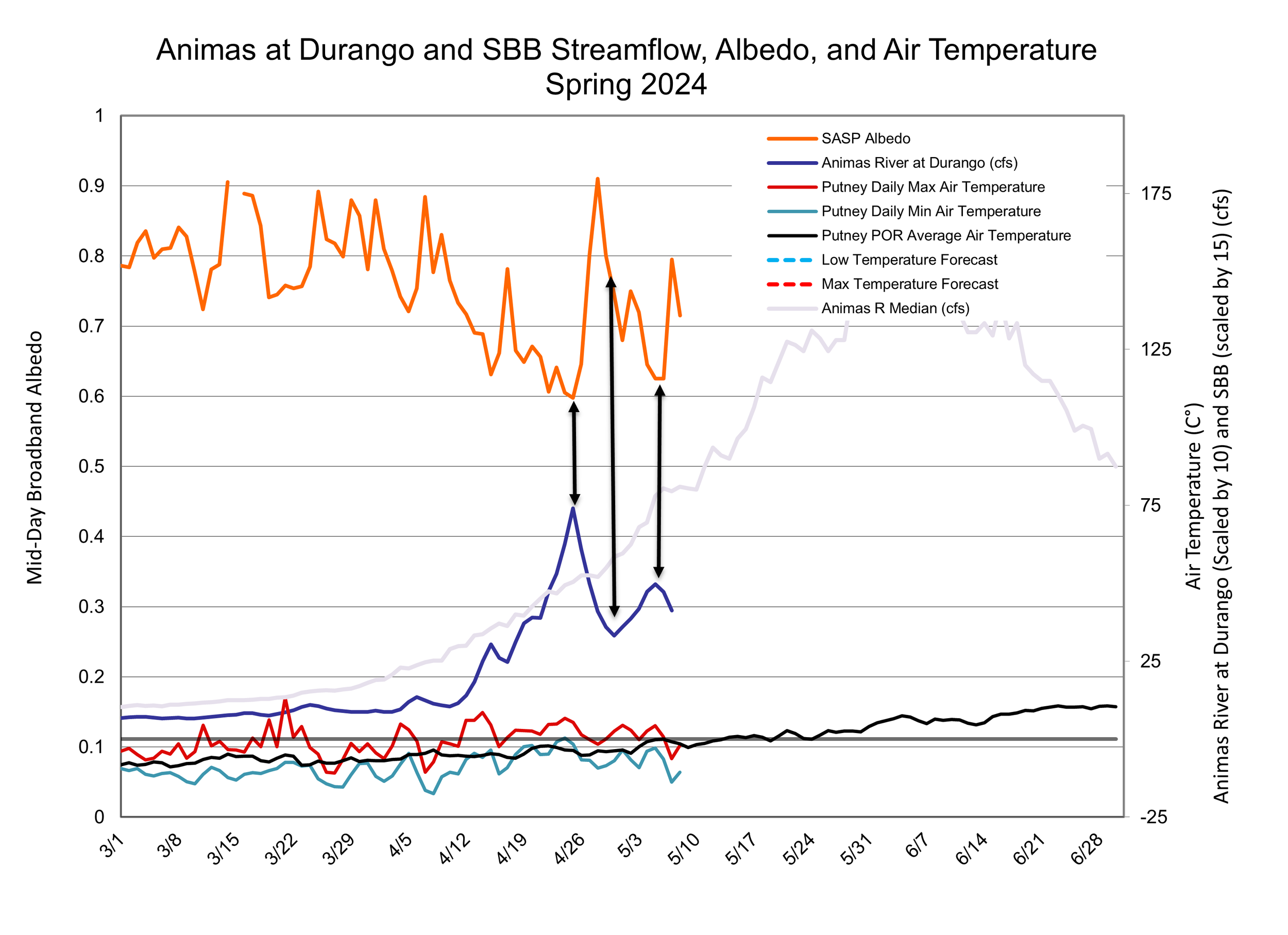
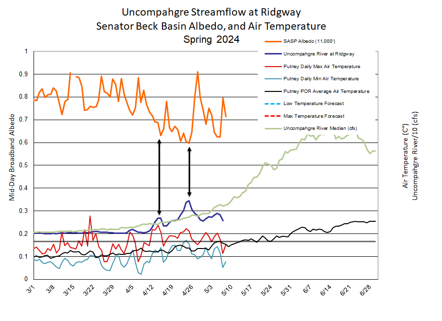
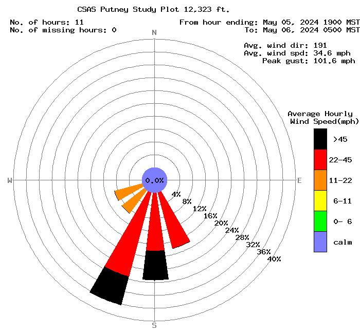
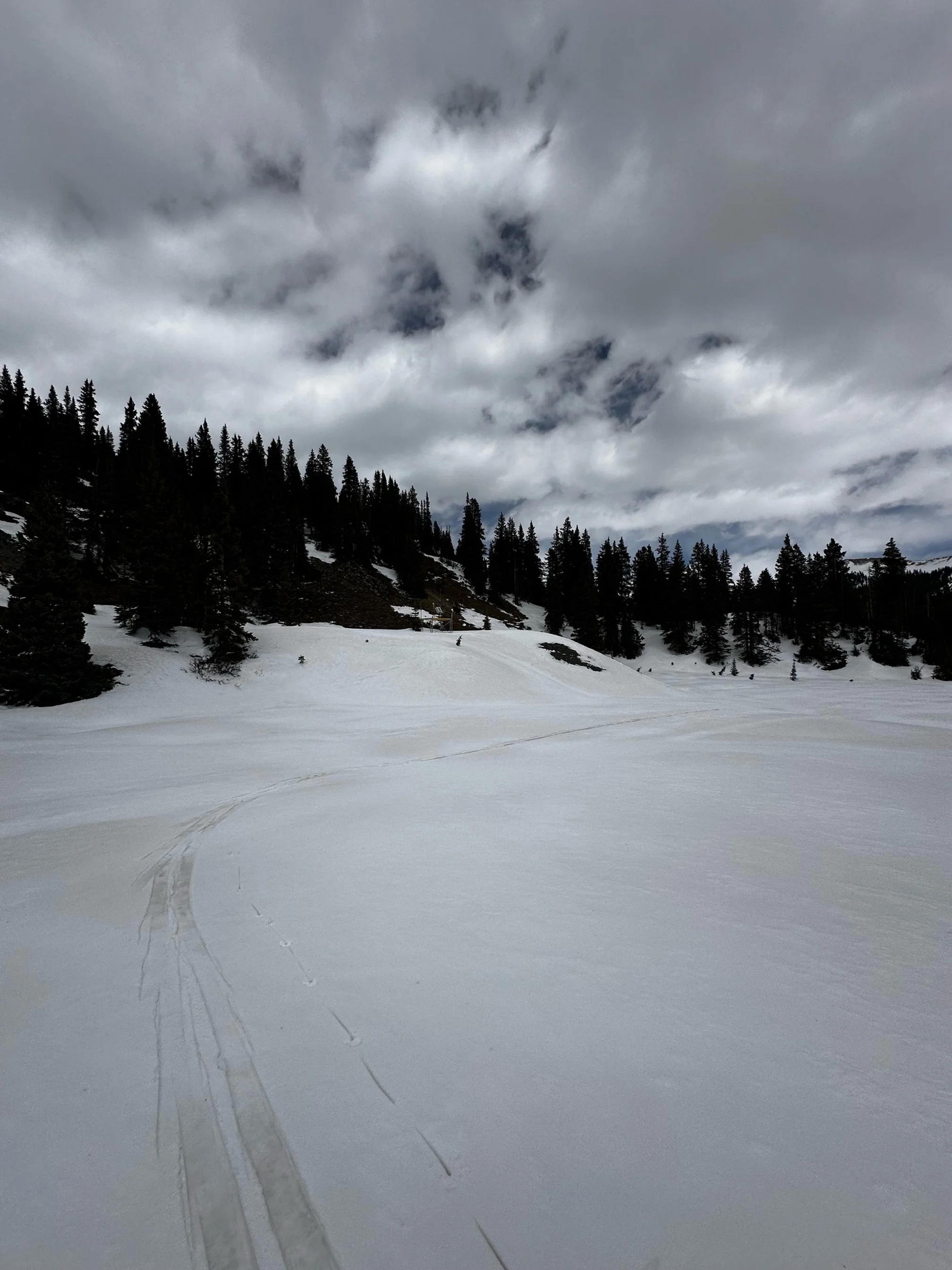
After the rather large and welcome snow and albedo reset April 27/28, the weather for the most part has remained cool, blustery, with a tad bit more snow. Colorado saw more moisture over this past weekend (May 4/5) that also brought very high winds. At our Putney station we clocked 100 mph wind gusts. When you have 100mph winds you’re gonna get dust. Satellite imagery isn’t clear if there were any dust hotpsots. At our Swamp Angel station new dust was deposited on existing surface dust, but it wasn’t too bad as the severity does not appear too much worse than previously.
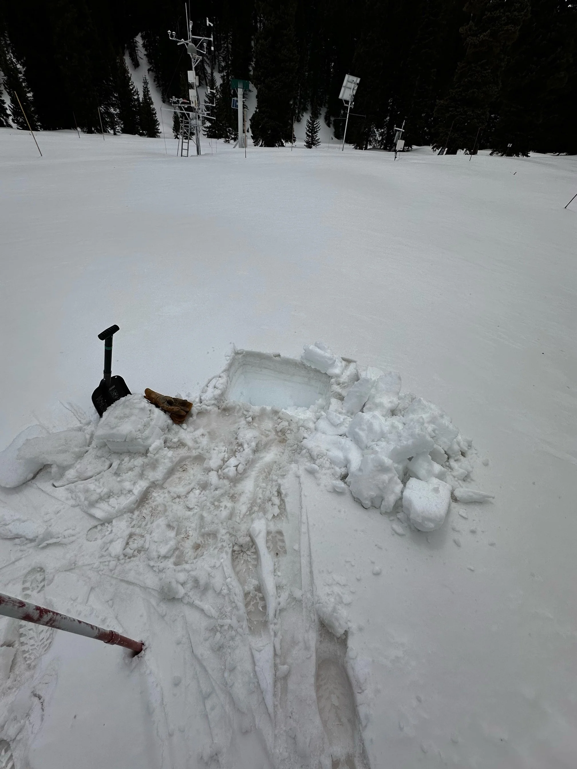
About a week ago the most dirtiest dust layer in the snowpack was about ~9” under the surface at Red Mt, now all of the dust layers of the season are merged into 1 layer comprising about the top 6-7” of the snowpack. The forecast is for cool and unsettled weather to persist the remainder of week but temperatures also look to gradually warm. Possible more snow this week may keep albedo values temporarily higher. Nighttime temperatures have been below freezing (at least around 11,000’ and higher). With the progression of Spring once nighttime temperatures stay at or above freezing the snowpack will have no brakes.
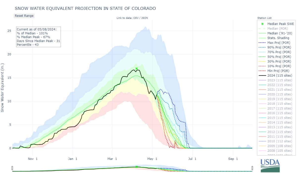
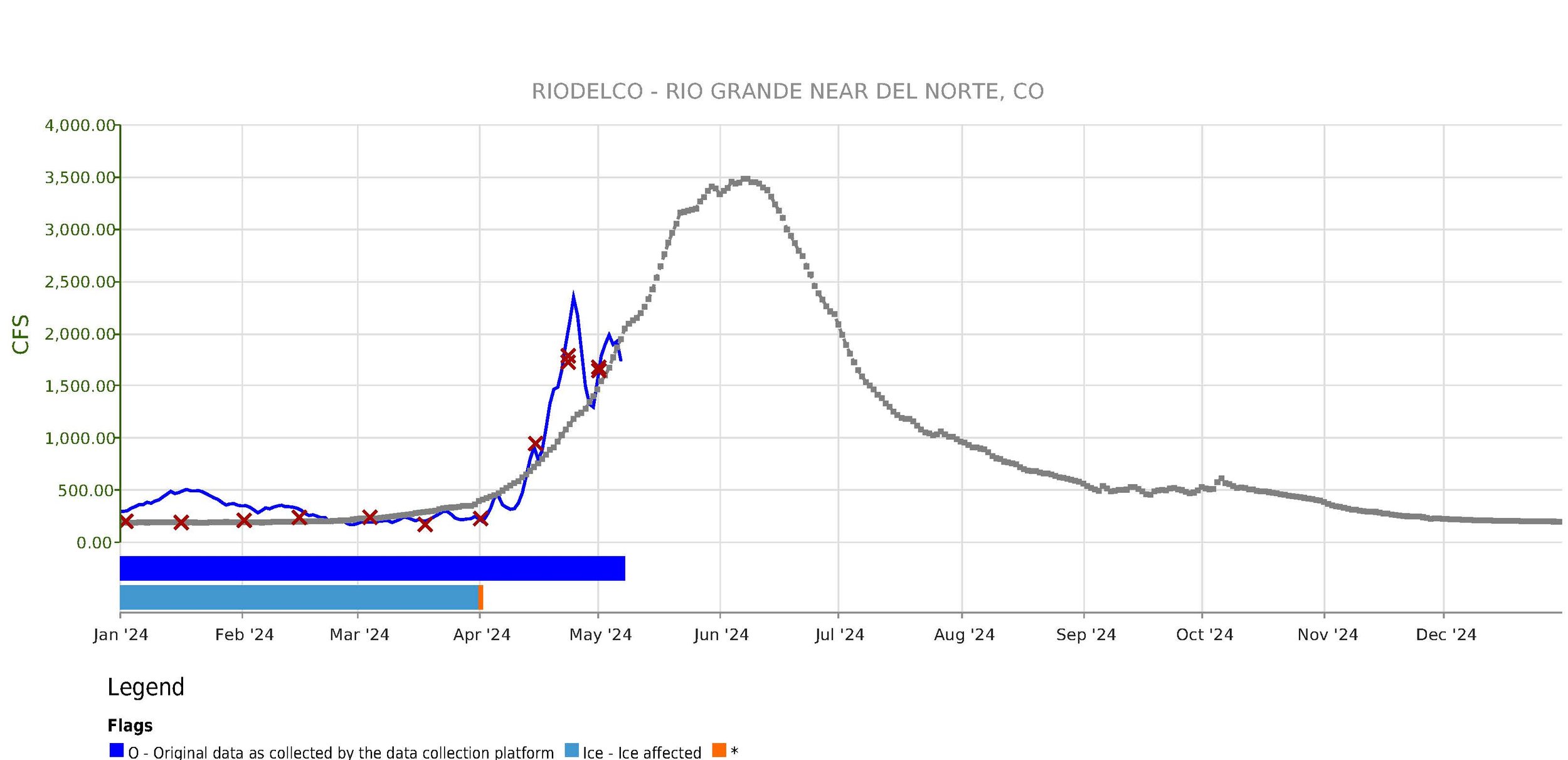
It was great to receive the snow and cooler temps the past 2 weeks, we desperately needed the slowdown of snowmelt. But now with all the dust mostly at the surface and springtime warming temperatures, once the warm/sunny conditions allow we may once again see record breaking snowmelt rates, as we did this past April, in parts of Colorado.
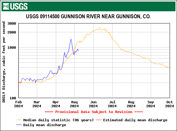
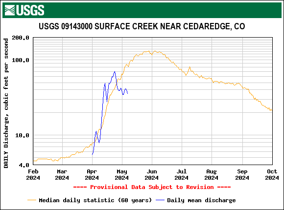
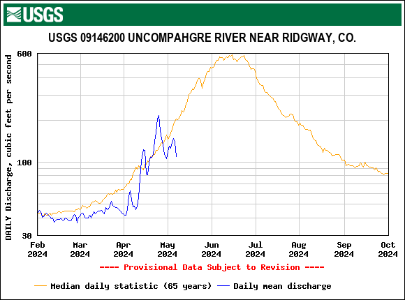
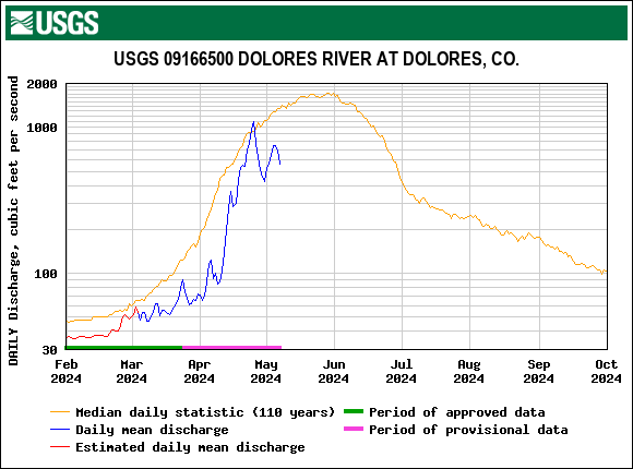
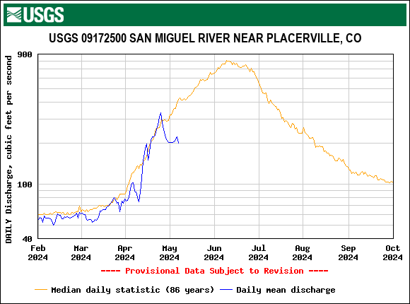
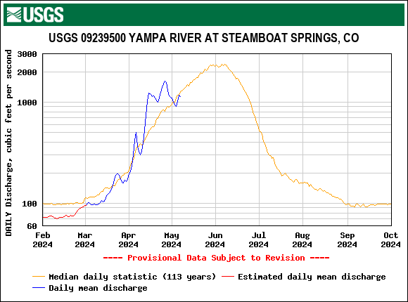
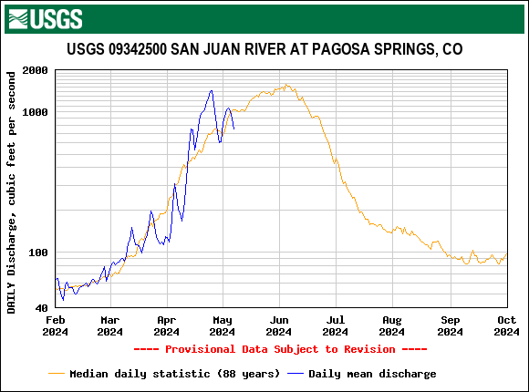
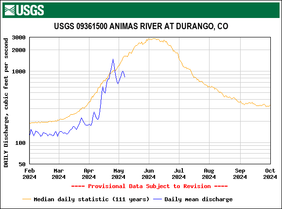
In our May 1 Update, we mentioned snowmelt rates worrisomely resembled WY2022, where in that year we saw record melt rates in Southern Colorado. Russ Schumacher with the Colorado Climate Center took it one step further and posted an analysis on the CCC blog. Check it out.
We hit the road this weekend gathering statewide observations to inform folks on what to expect with dust-in-snow the remainder of the season.
More soon,
Jeff Derry
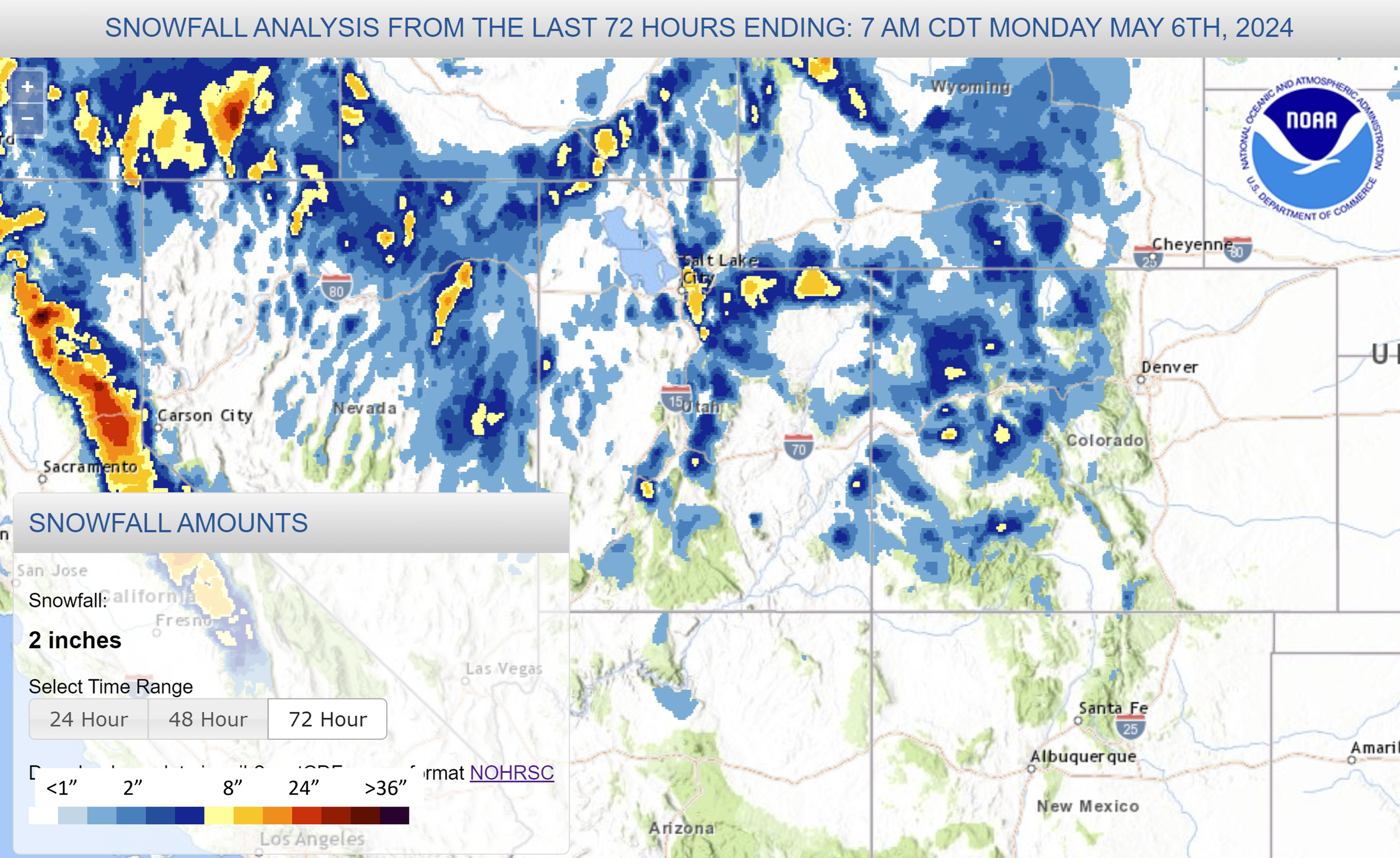
Below: Wind rose at Putney station at Red Mt Pass and snowfall accumulation map from over the weekend.
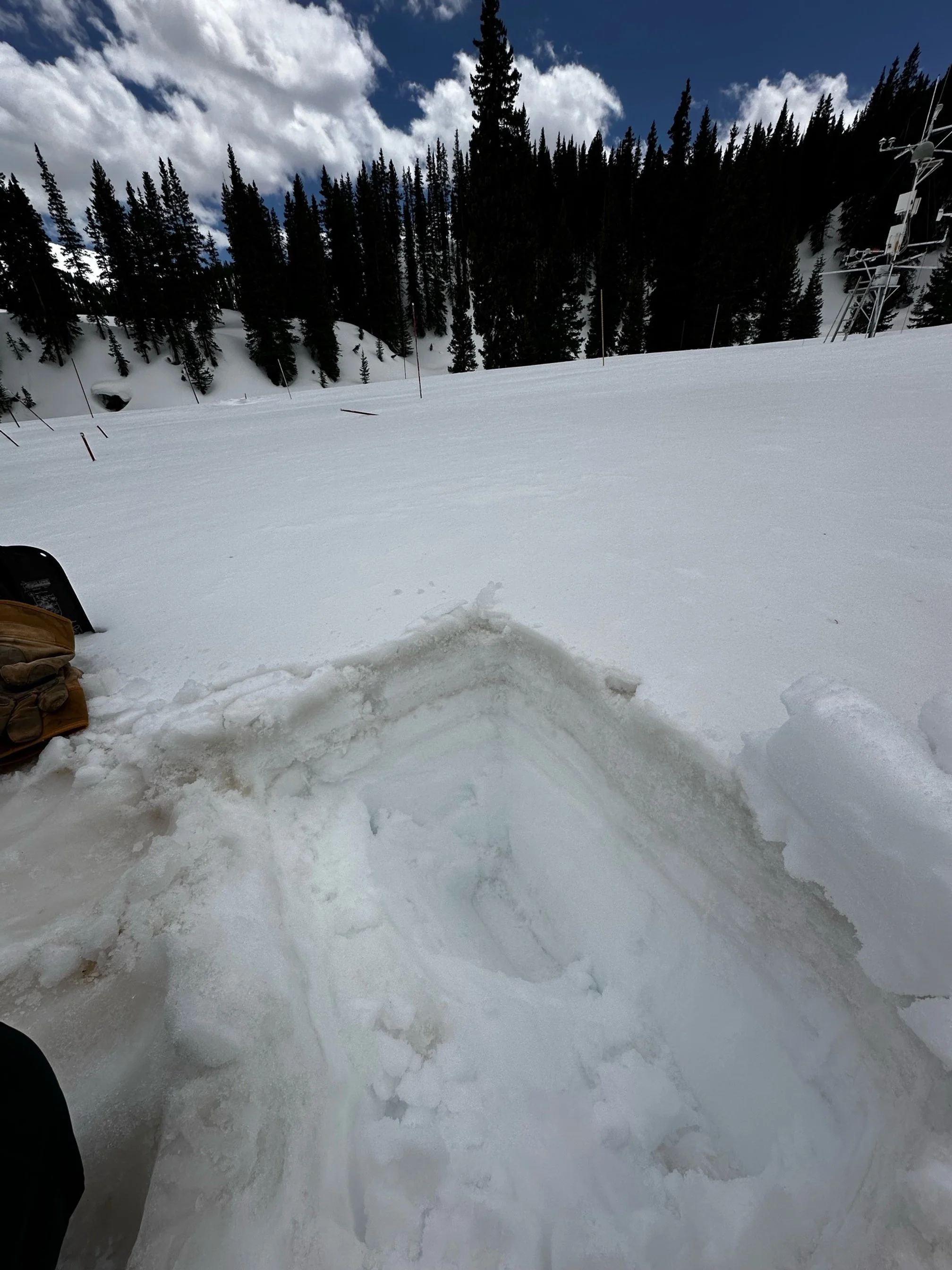
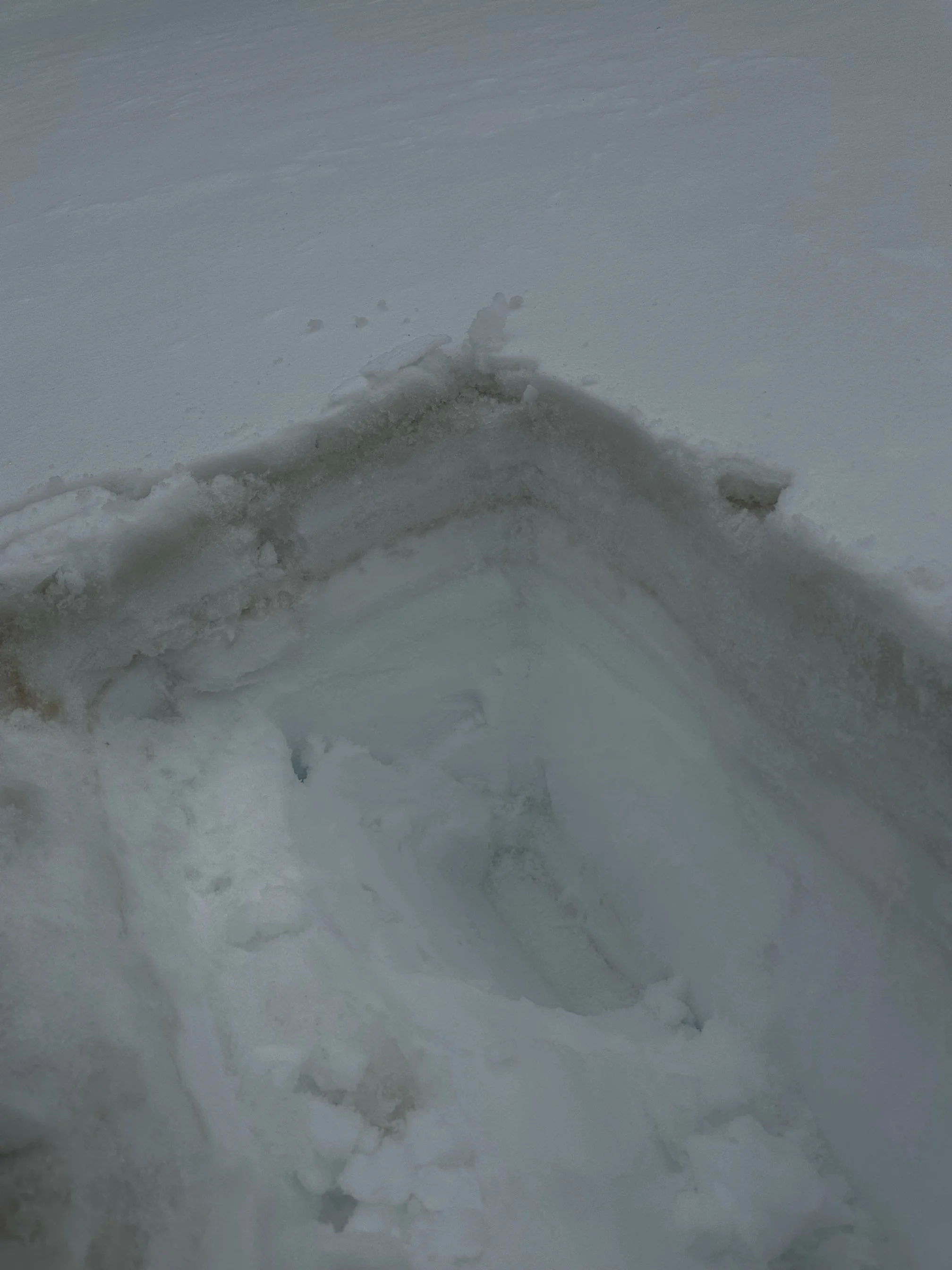
Below: Dust in top ~6-7” of snow surface at Swamp Angel. As we head into the last month or so of melt season we are loaded up with all dust at surface.
Below: With the fresh snowfall albedo jumped up, meaning the snow surface regained a highly reflective surface, sending the warming rays of the sun back into space. With all dust at surface snowmelt will crank up again when warm/sunny conditions allow.