CODOS Update March 25, 2021: March Statewide Tour Part II-Central and Southern Sites
Greetings from Silverton,
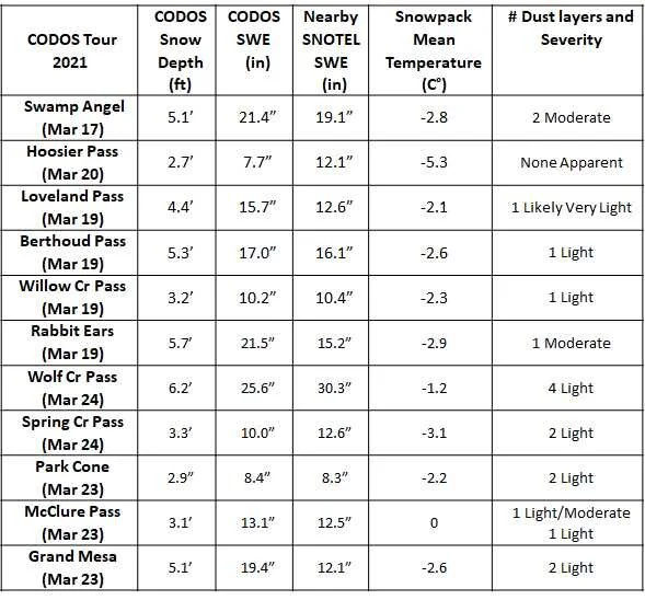
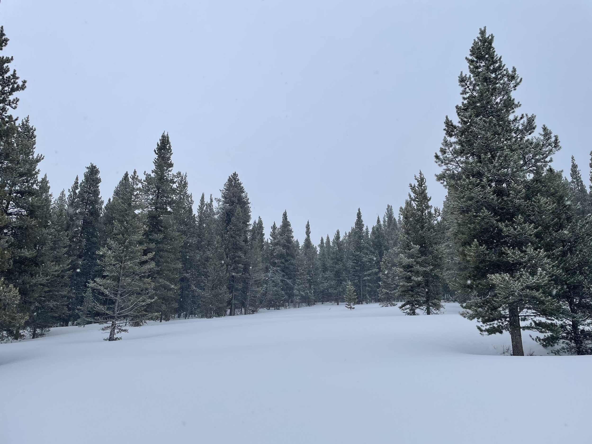
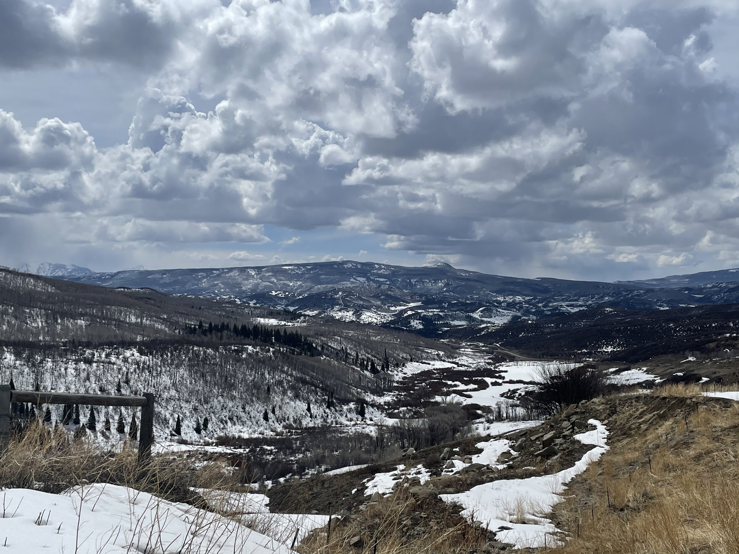
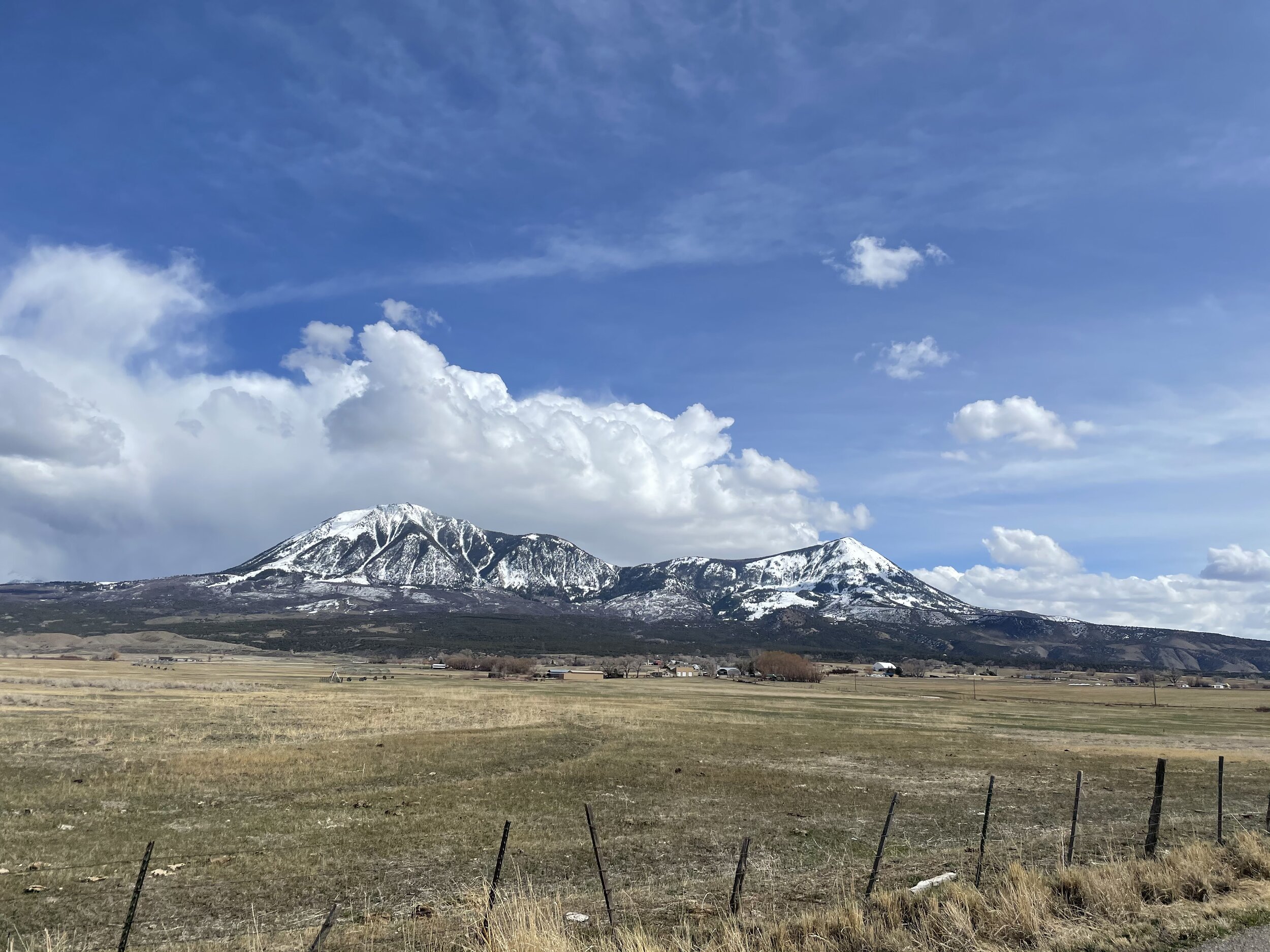
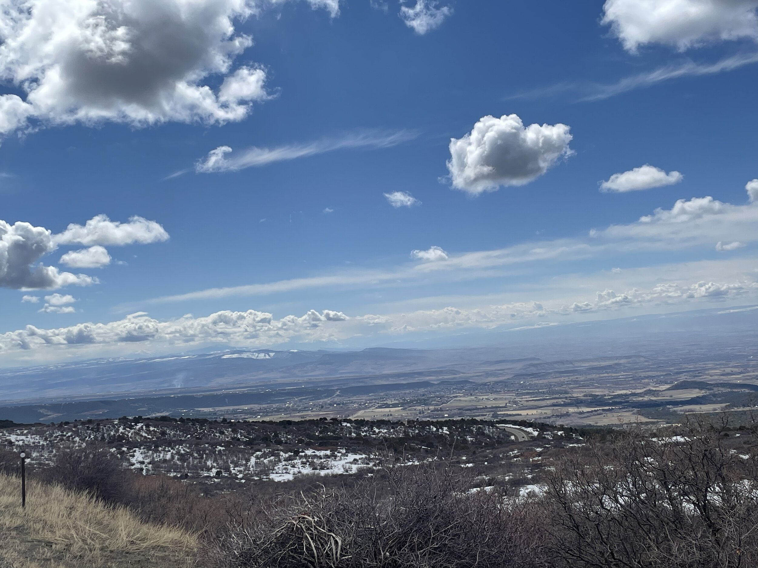
The second half of the CODOS tour, consisting of Wolf Creek Pass, Spring Creek Pass, Park Cone, McClure, and Grand Mesa, was completed Tuesday and Wednesday of this week. Some observations were not a surprise but other observations were. At Wolf Creek Pass it was expected to see at least as many dust layers as we documented at Senator Beck Basin (SBB). At SBB we have two layers each of moderate severity, whereas at Wolf Creek we noted four layers but each of light severity. Spring Creek, up the Rio Grande, where typically dust events are fewer and less severe, we saw two light layers. At Park Cone we also observed two light layers near surface. McClure was little unexpected not in that there were two dust layers at the surface, but one is light and the other close to being described as moderate. Moderate dust was expected at Grand Mesa and we noted two layers, both pretty light.
The forecast has snow continuing today and tomorrow. Over the last five days we have received 1.4” precipitation. We are now approaching peak snow accumulation throughout Colorado. At CODOS sites observed dust is within 1’ of the surface. Once ablation season begins these layers will emerge at the snow surface in relatively short order if we don’t see further snow events that would keep the dust buried.
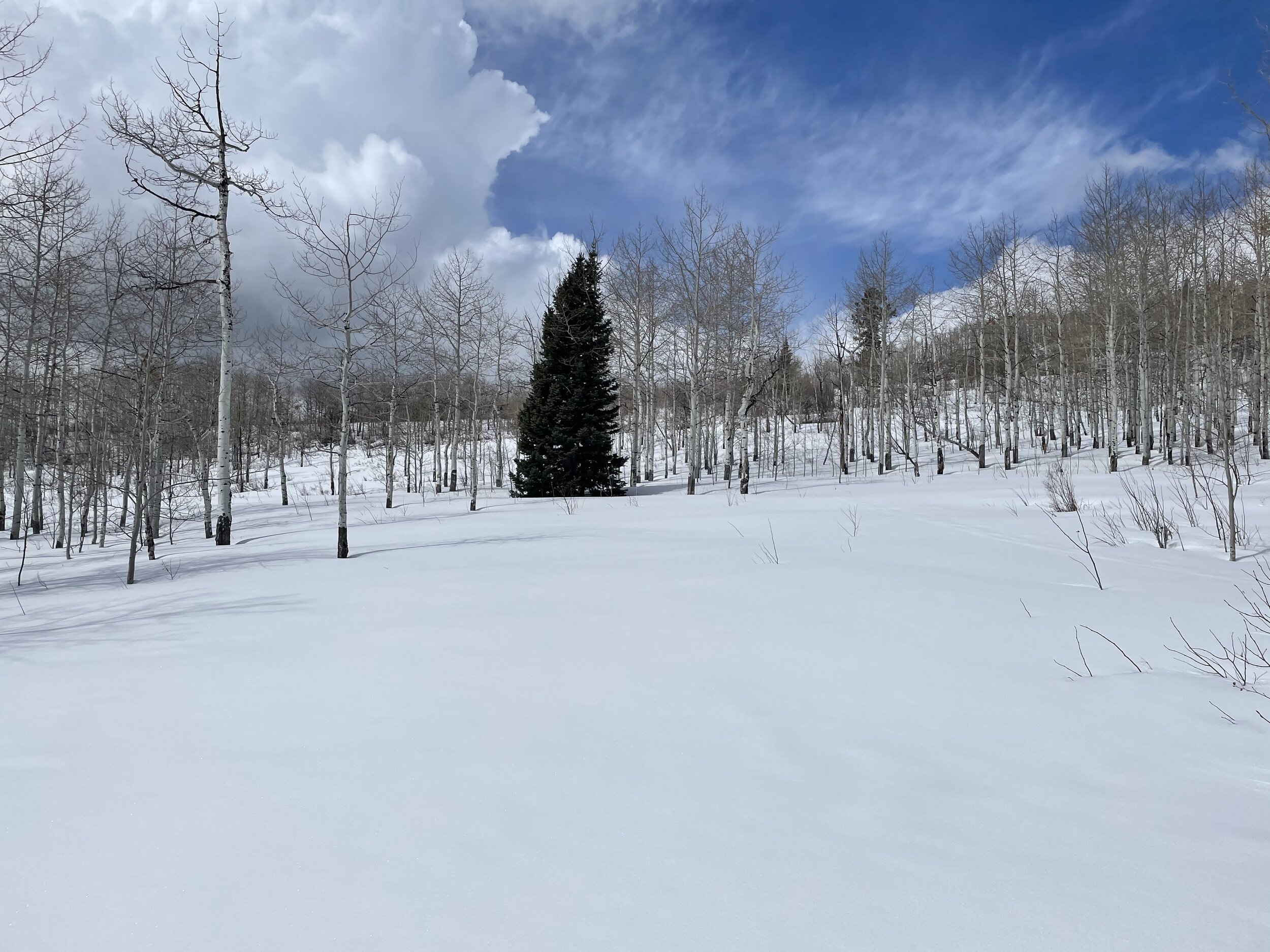
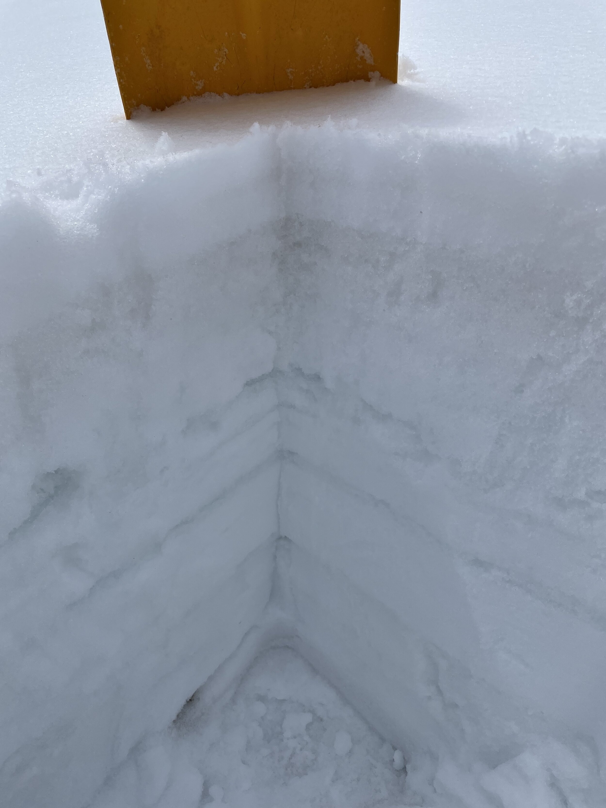
Please see pictures and profile forms below.
Take care,
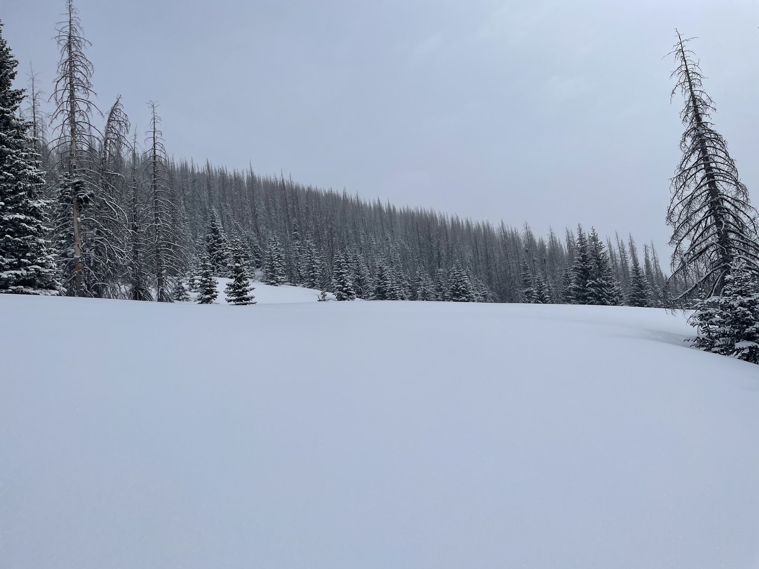
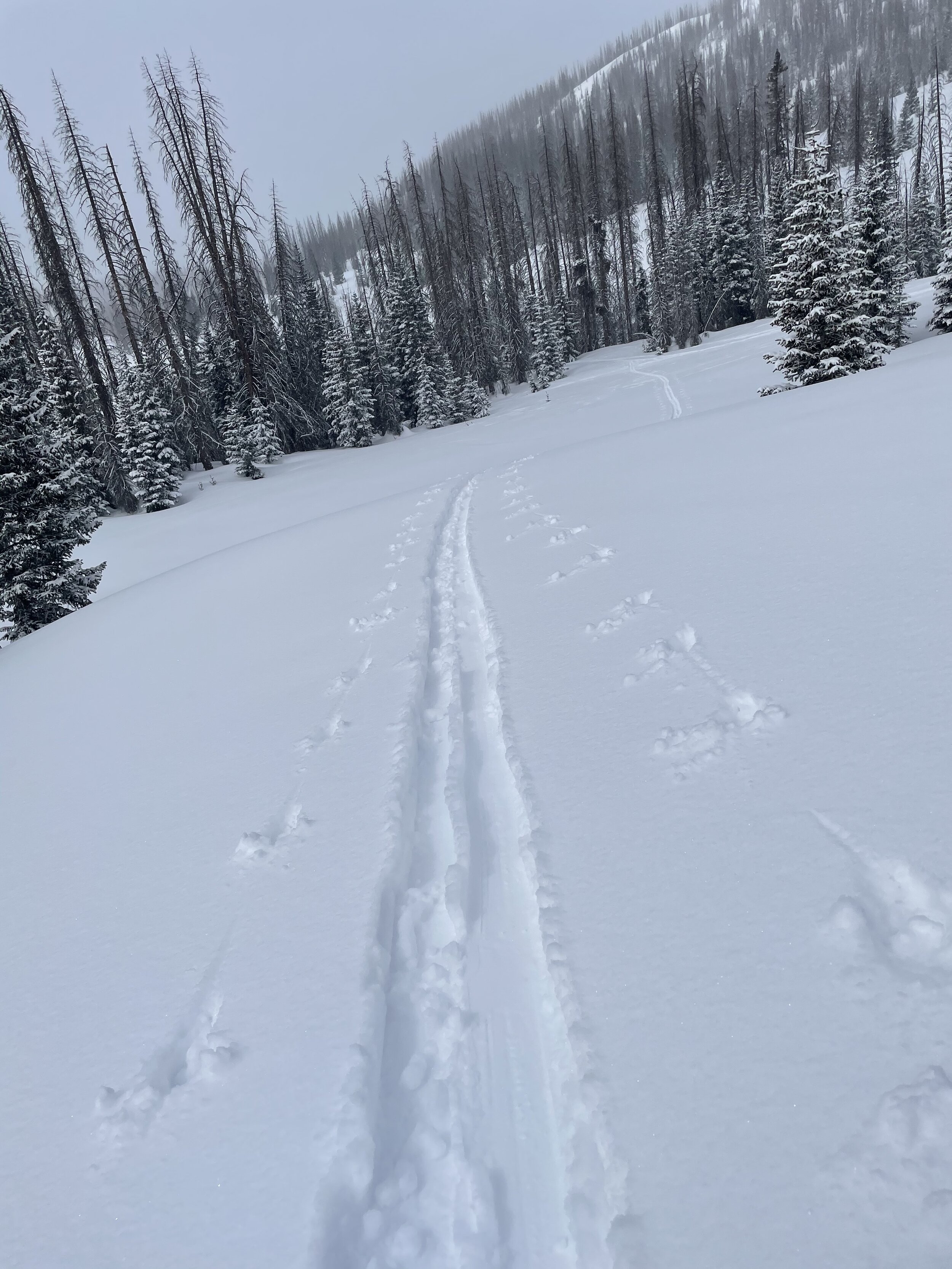
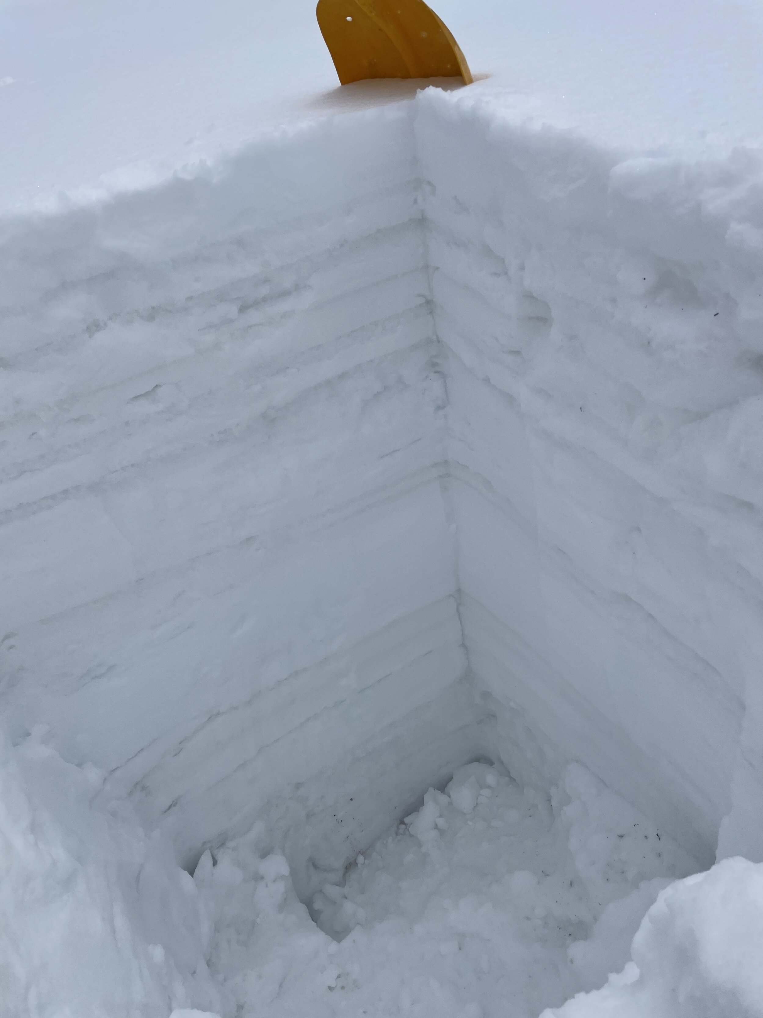
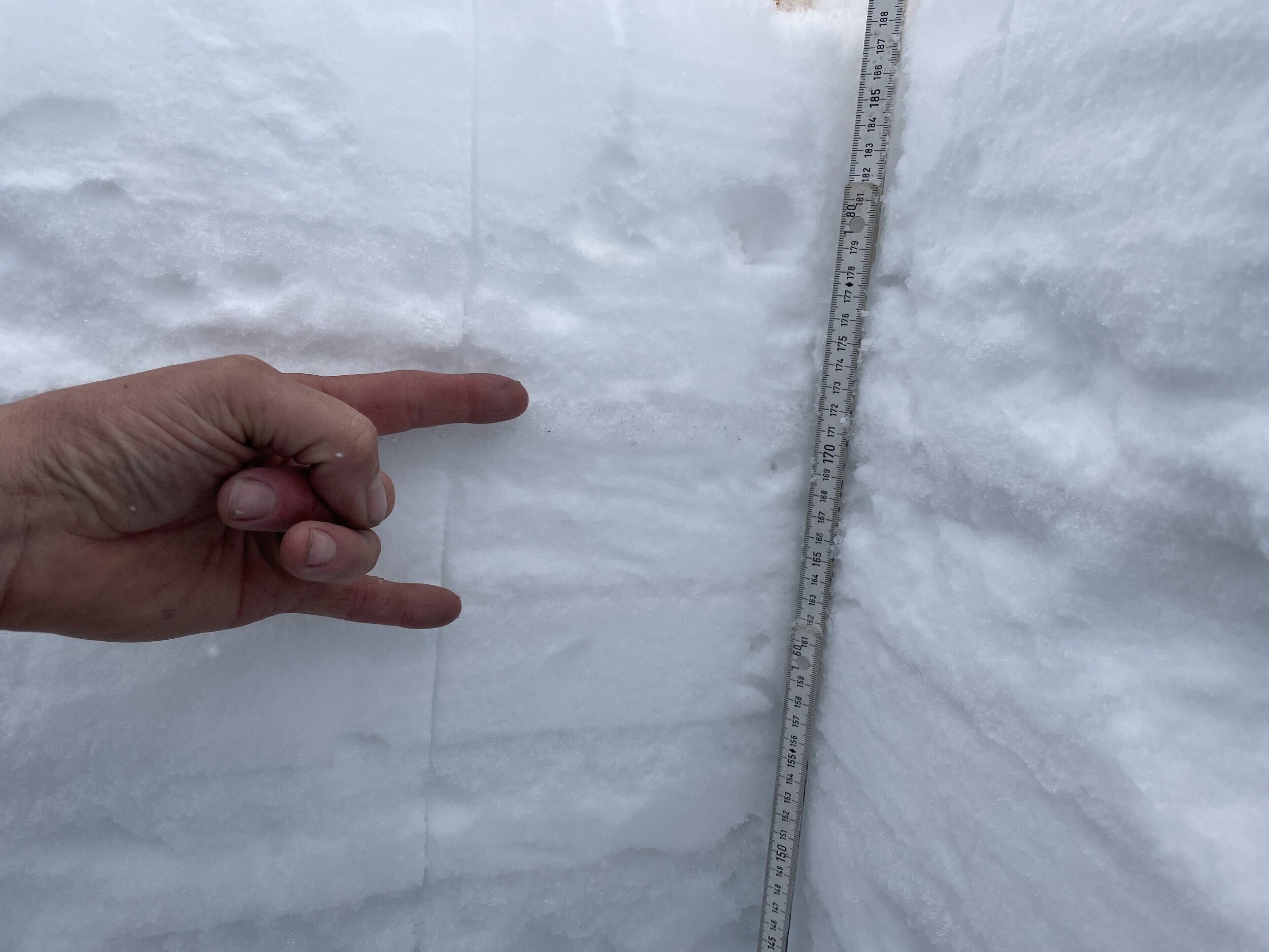
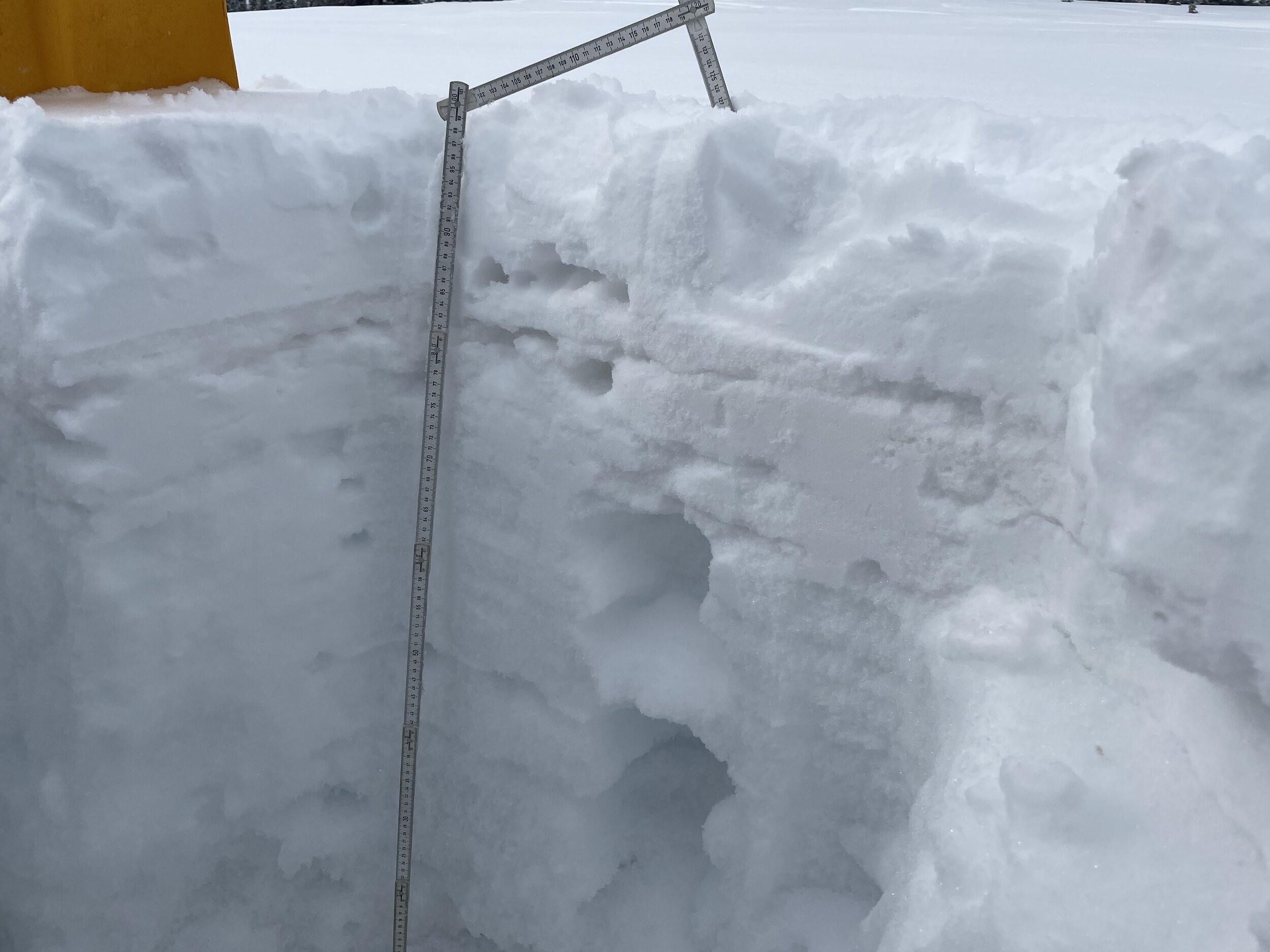
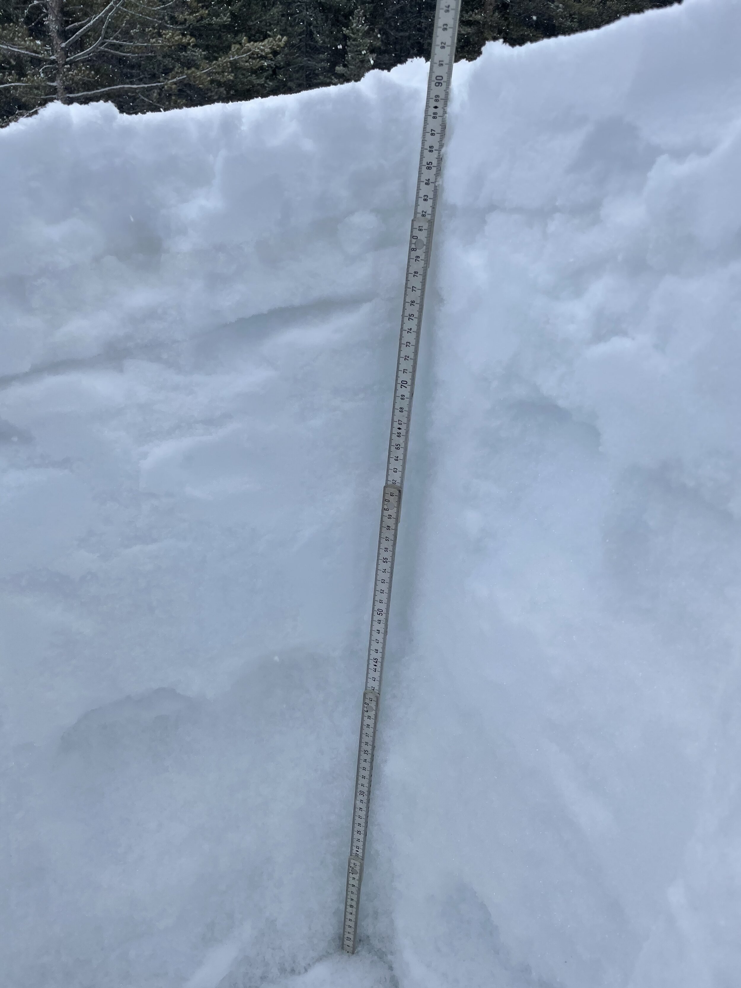
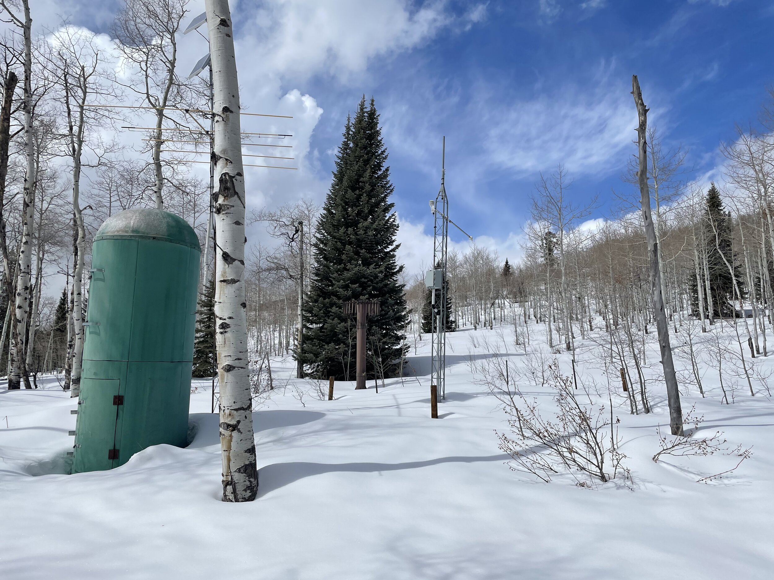
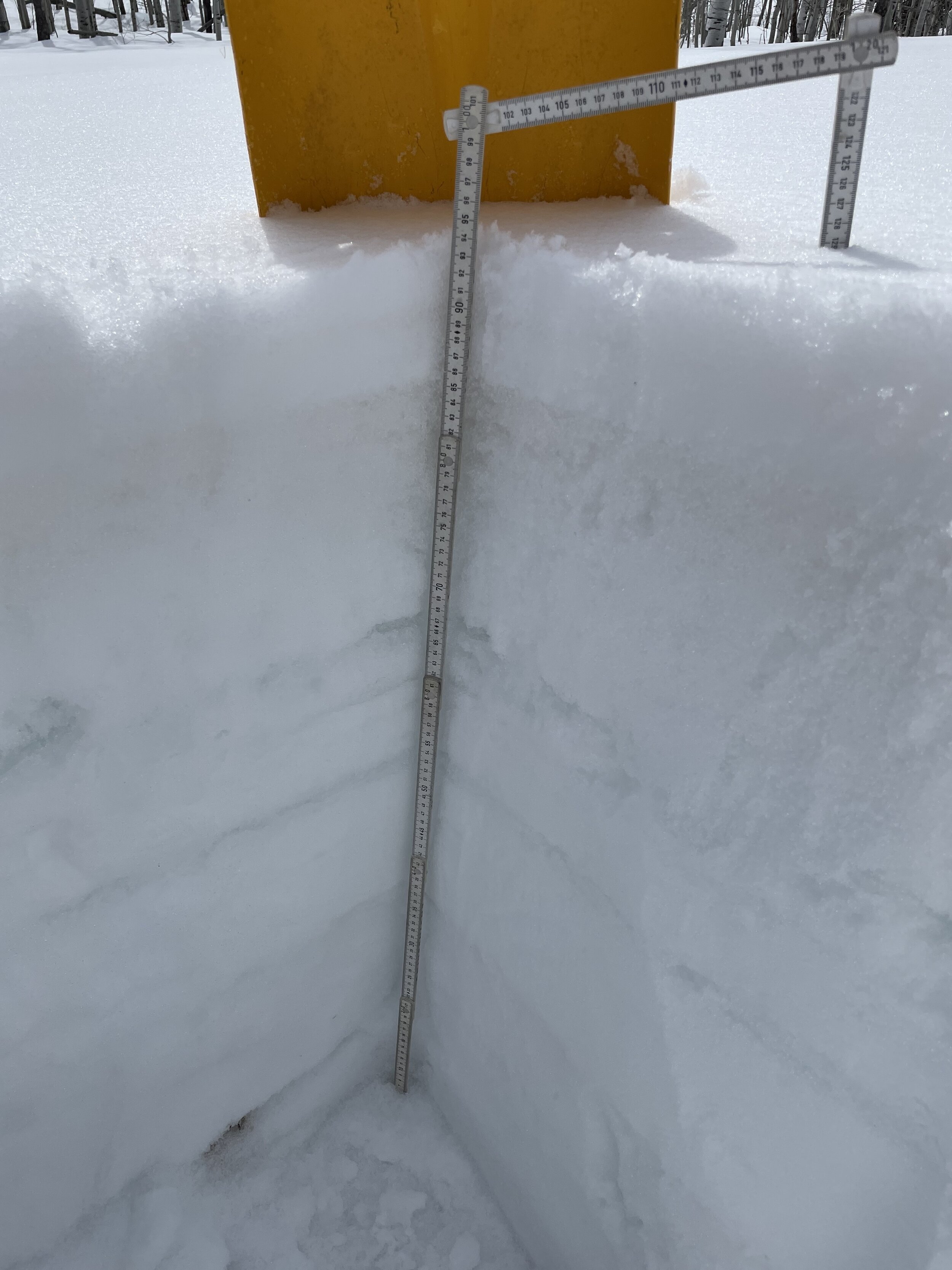
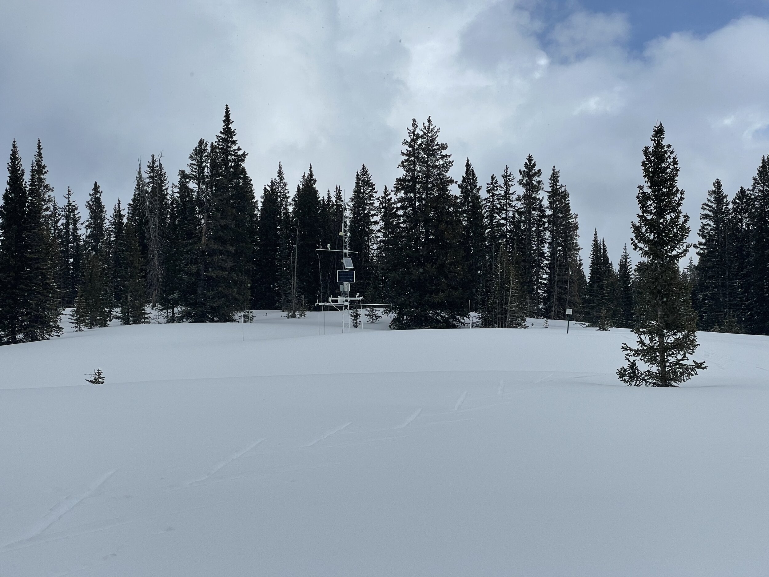
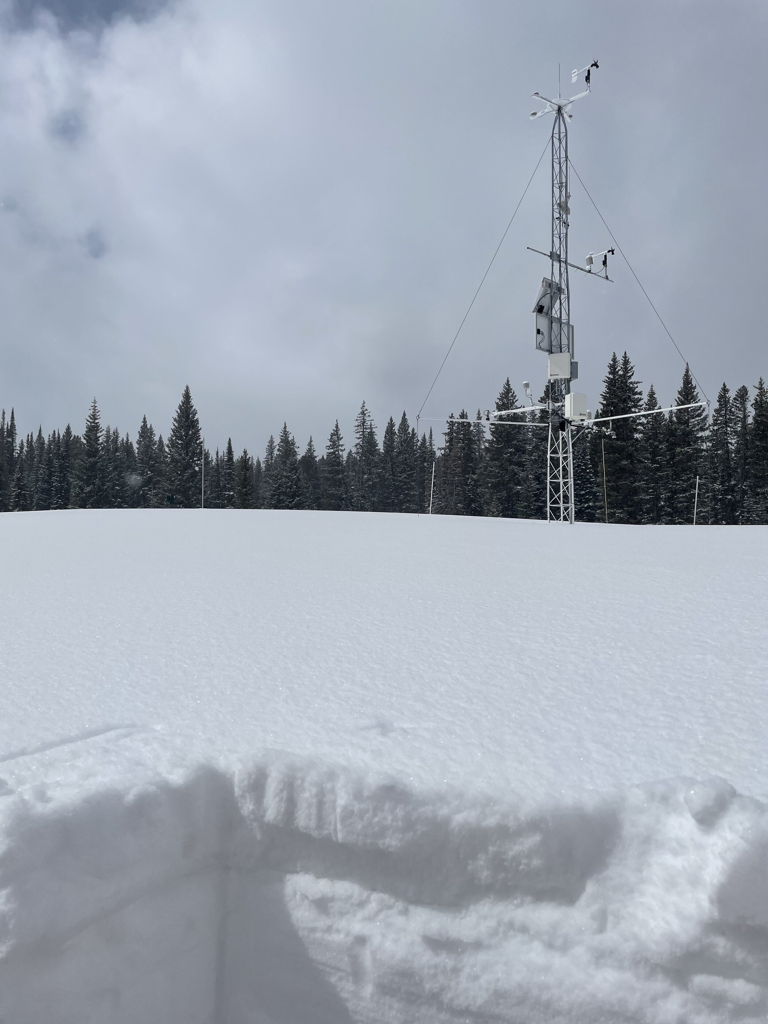
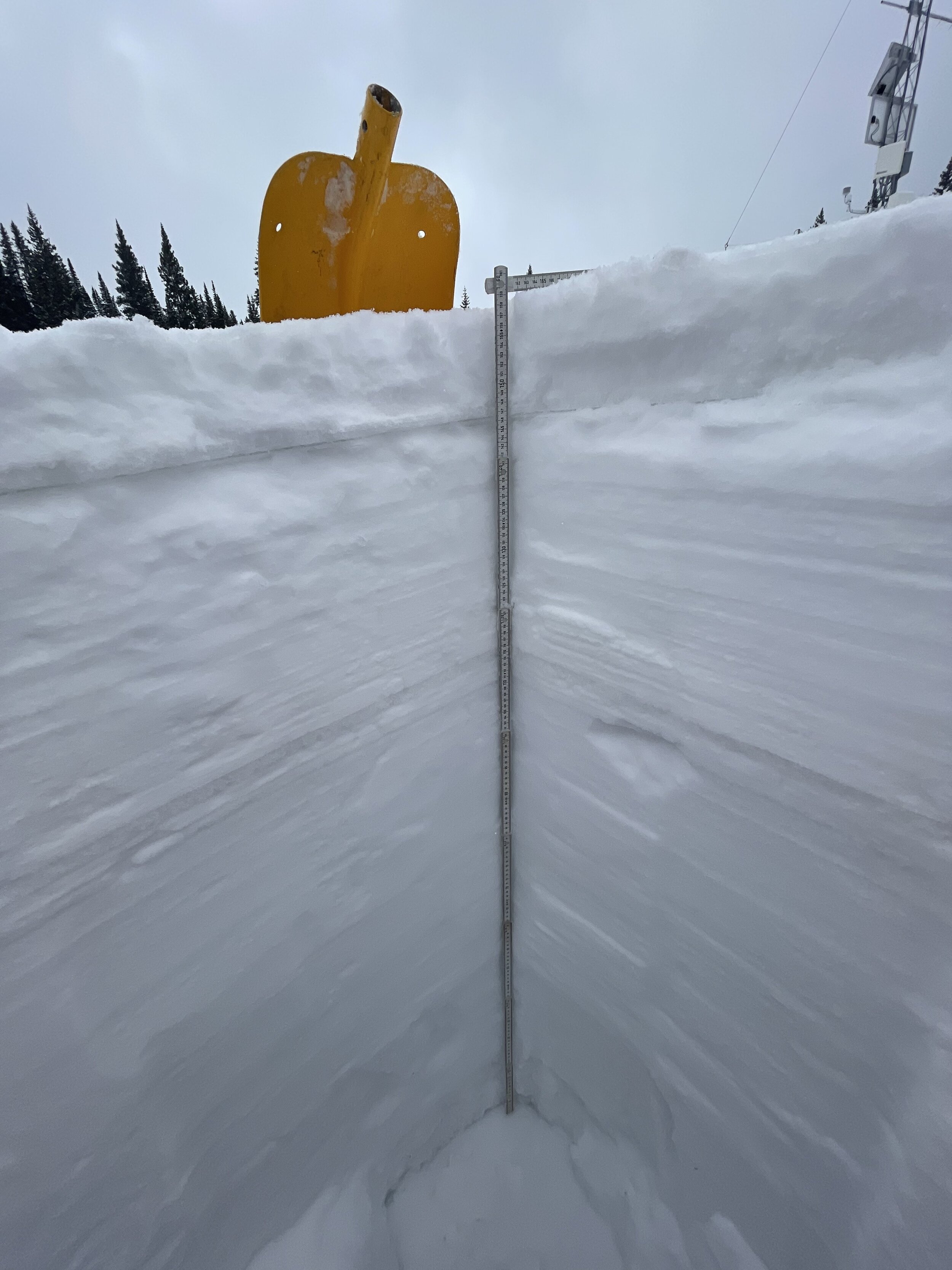
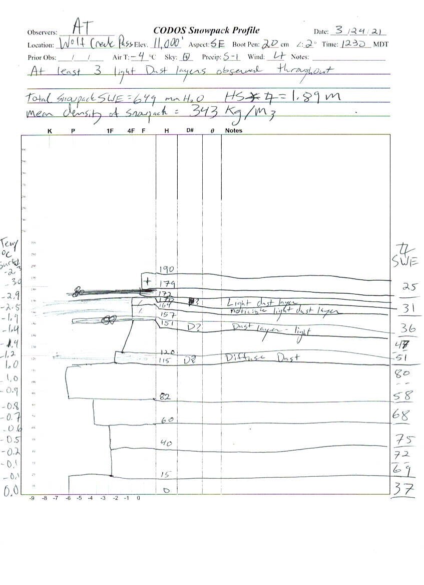
Wolf Creek Pass
What is becoming somewhat normal, Wolf Creek had two more dust layers (albeit light) than at SBB. SBB currently has 2 moderate layers. Wolf Creek with its four light layers taken together likely is about the same overall severity as SBB. Driving to CODOS sites it is very apparent that the lower elevations have very little snow. Given that SNOTEL stations are located in a relatively narrow elevation band it is easily possible that lack of snow outside of this band not be noticed when looking at the data. Snowdepth = 6.2’. SWE = 25.6”.
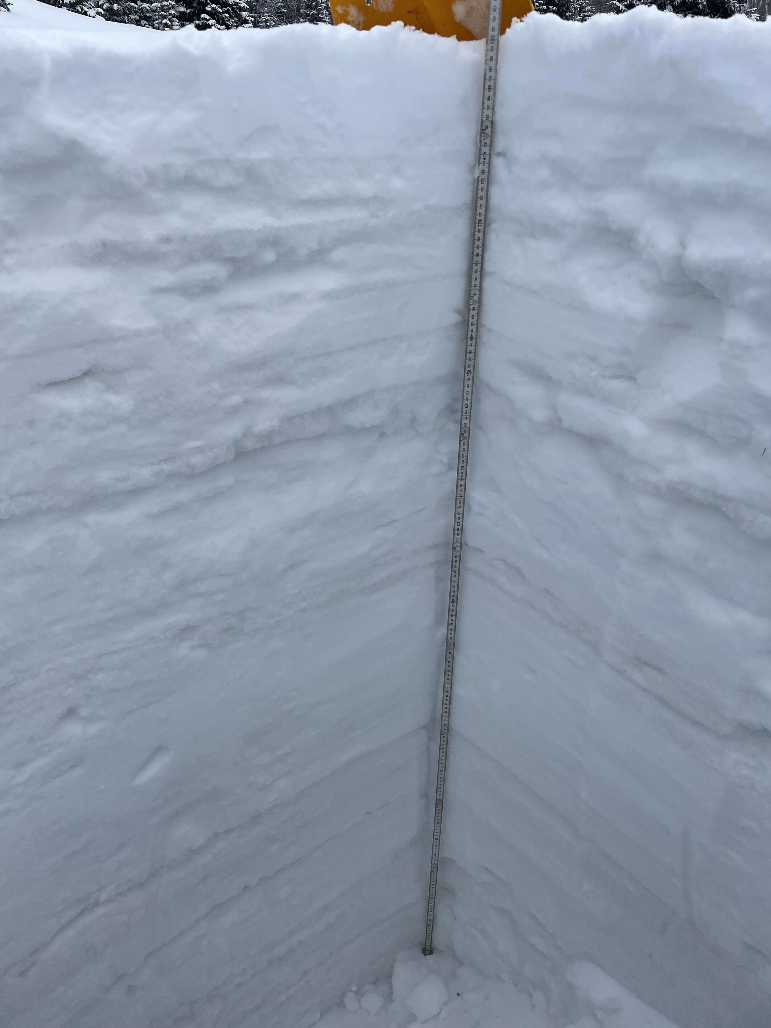
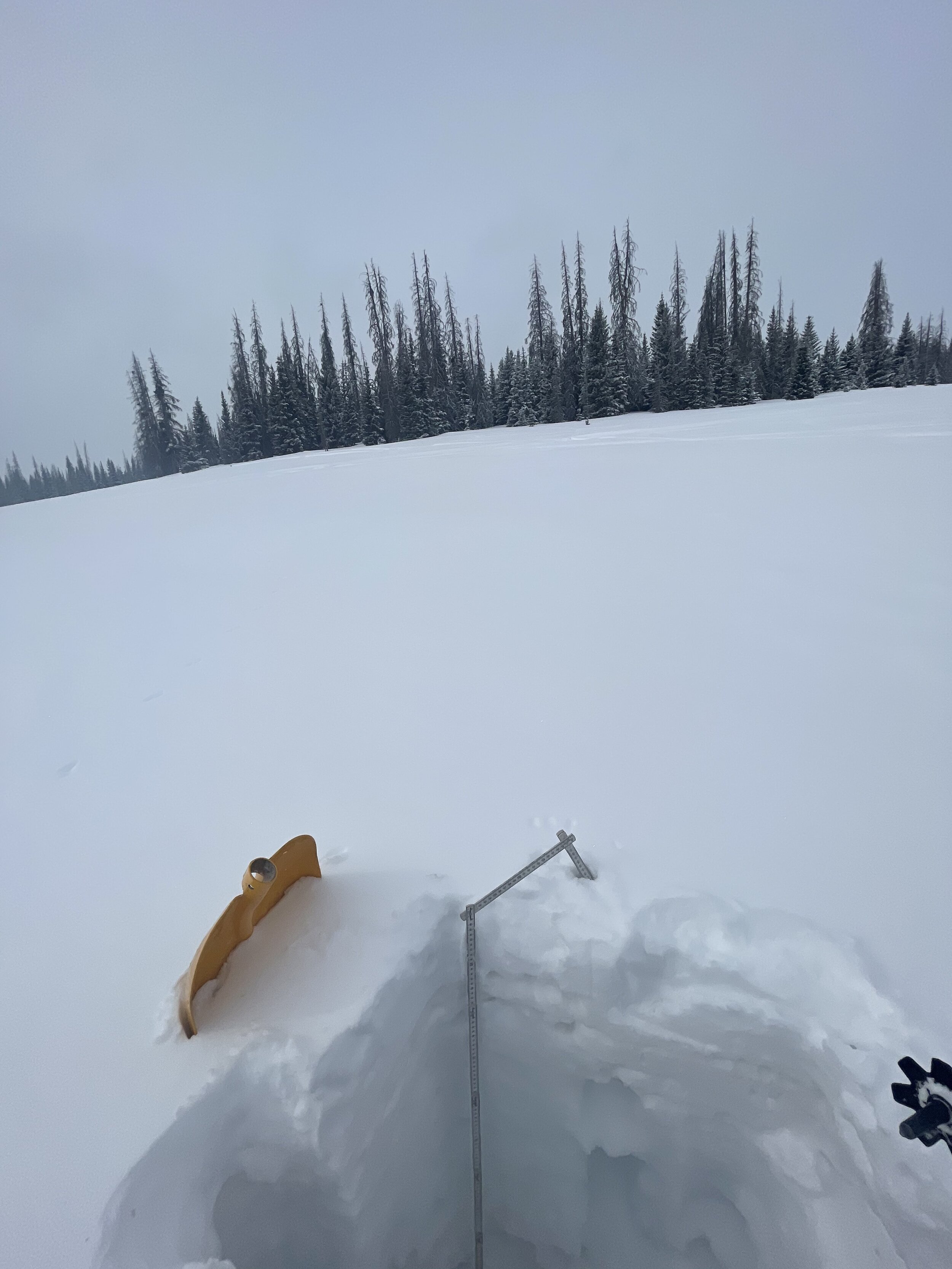
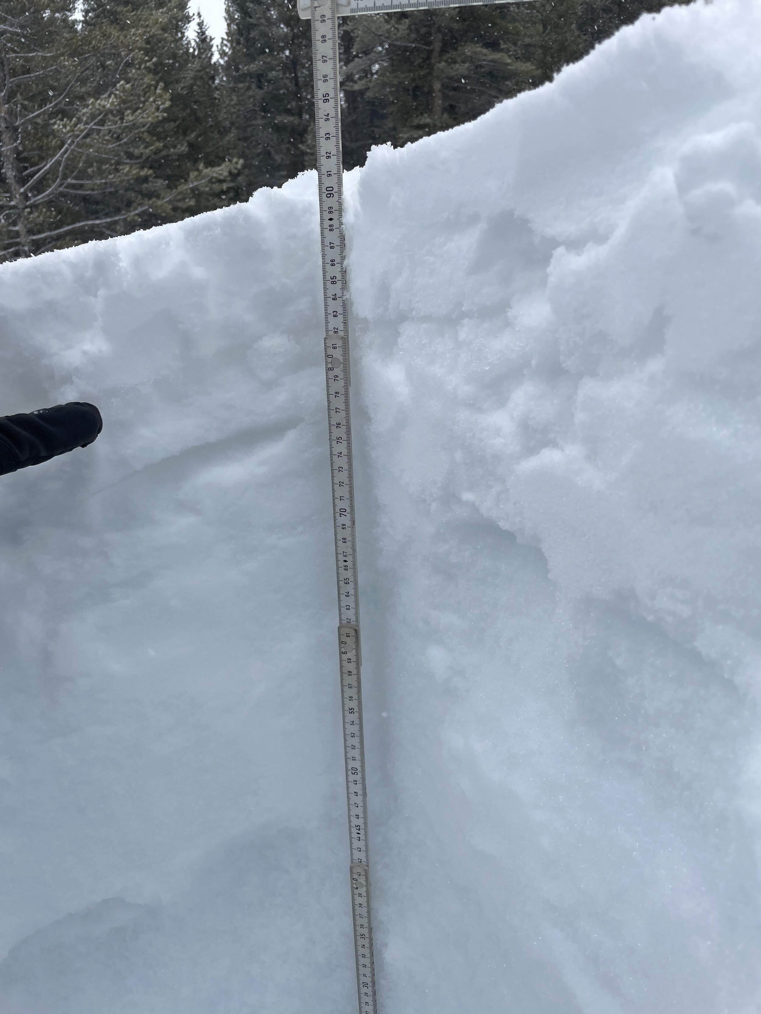
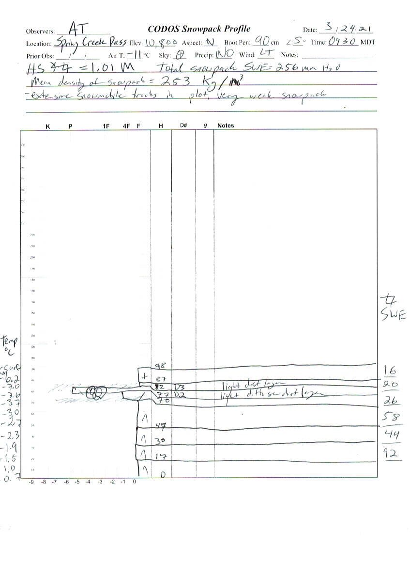
Spring Creek Pass
Spring Creek has 2 diffuse light dust layers within 6” of the snow surface. Snow Depth = 3.3’. SWE = 10.0”.

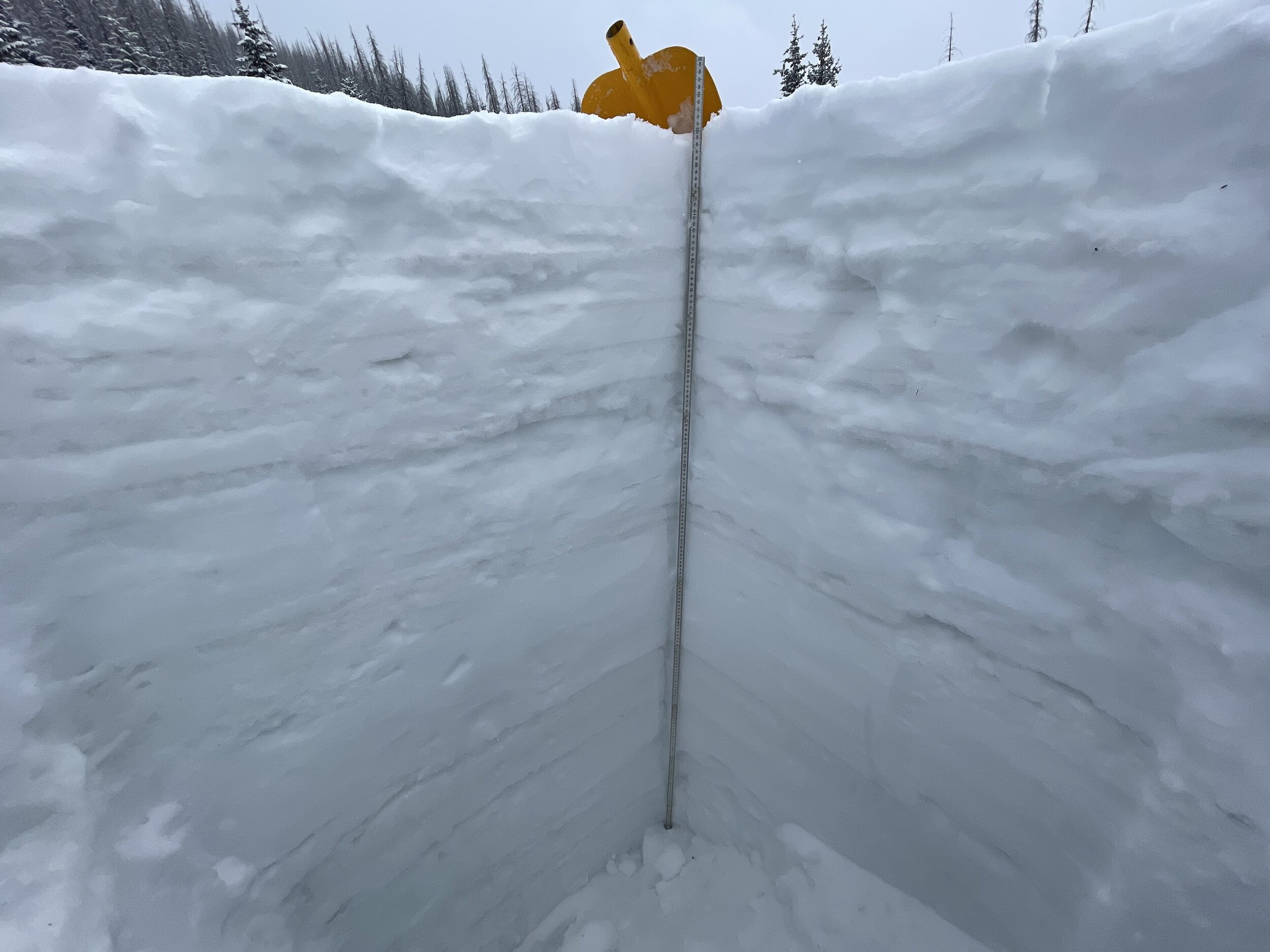
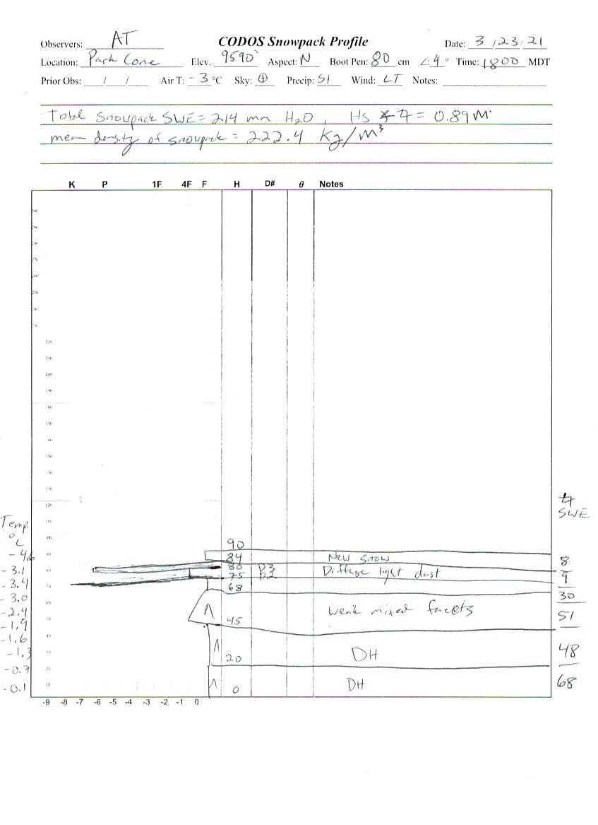
Park Cone
Park Cone, similar to Springs Creek, currently has 2 light layers within ~6” of the surface. Snowdepth = 2.9’. SWE = 8.4”.
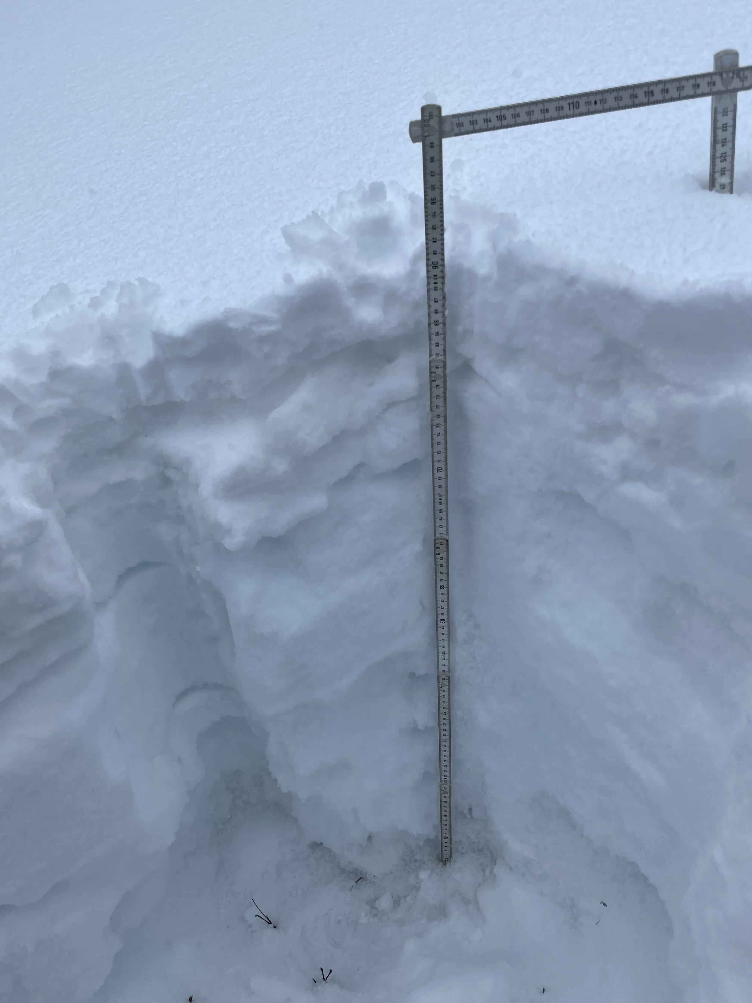
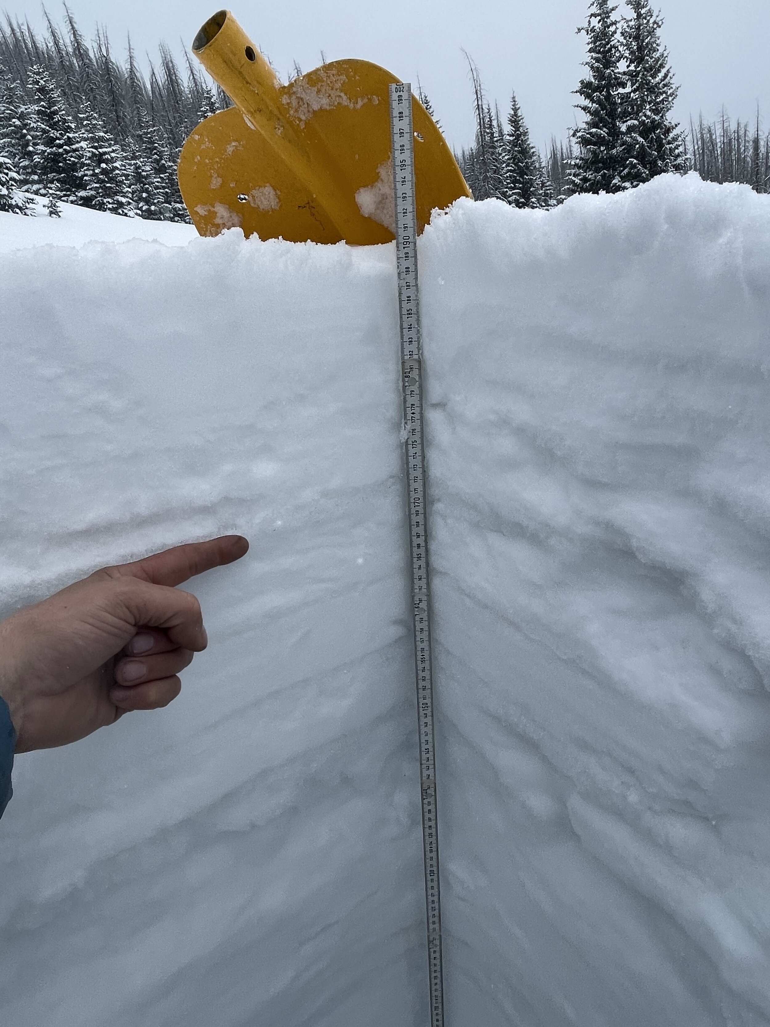
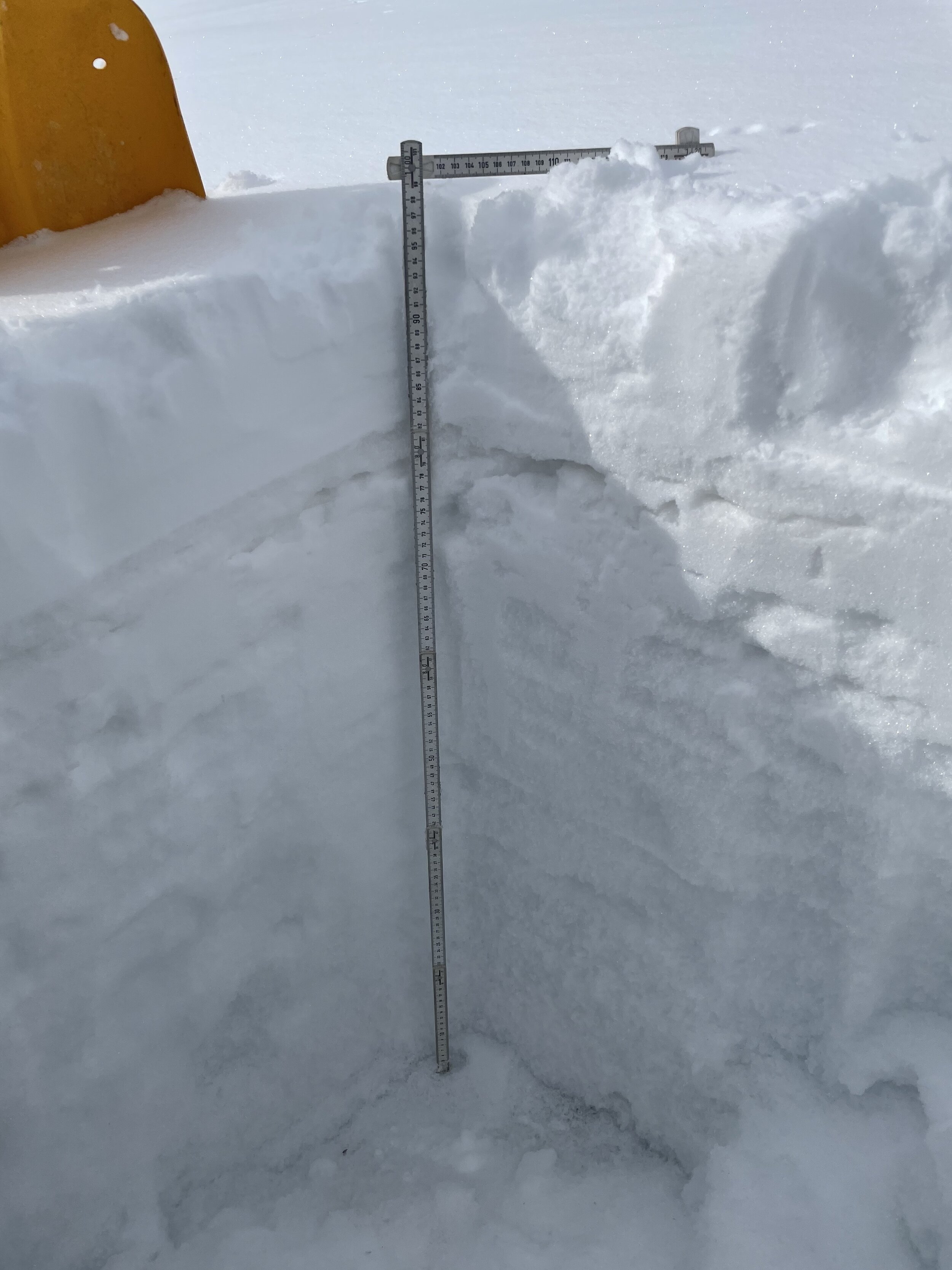
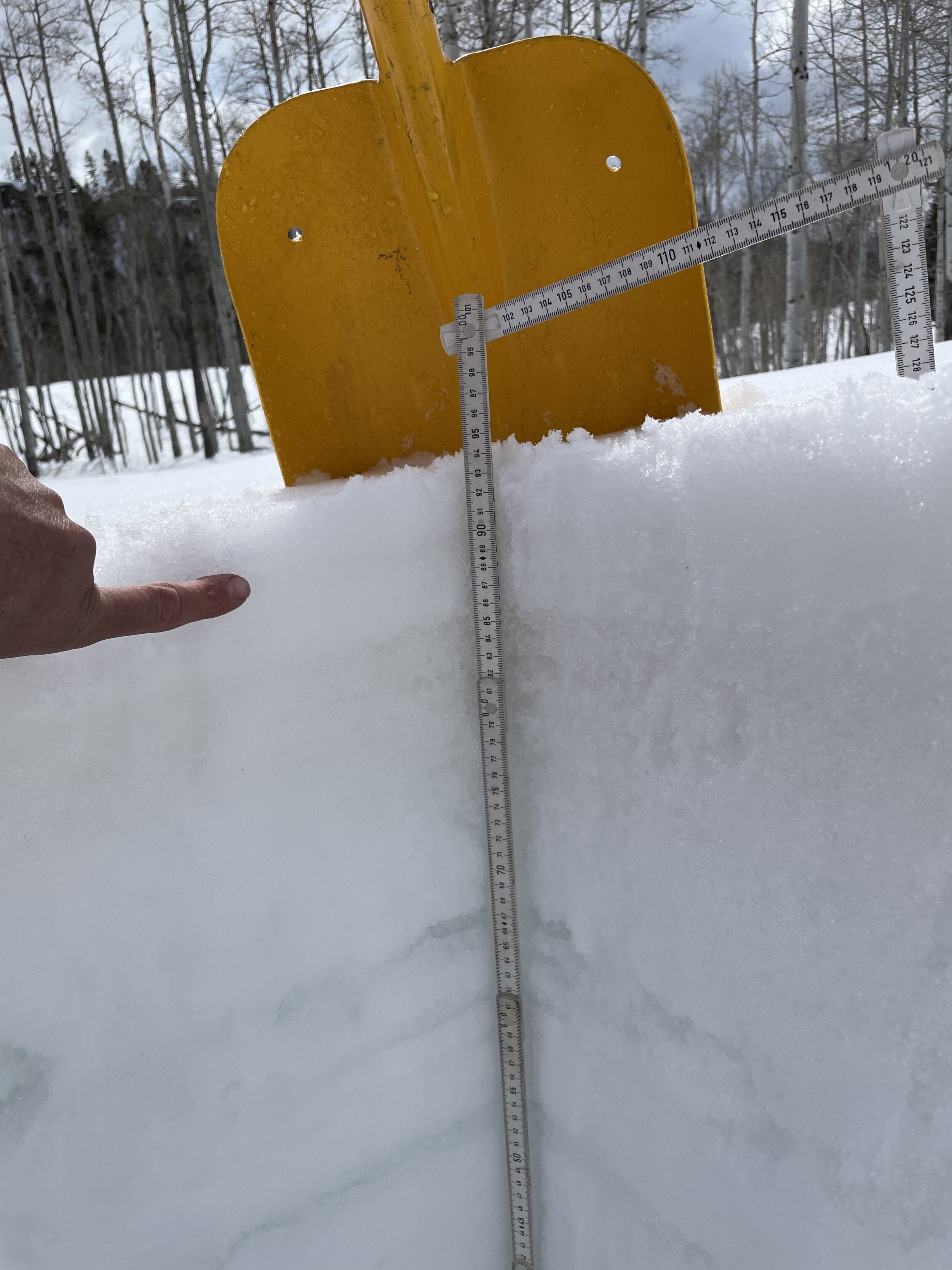
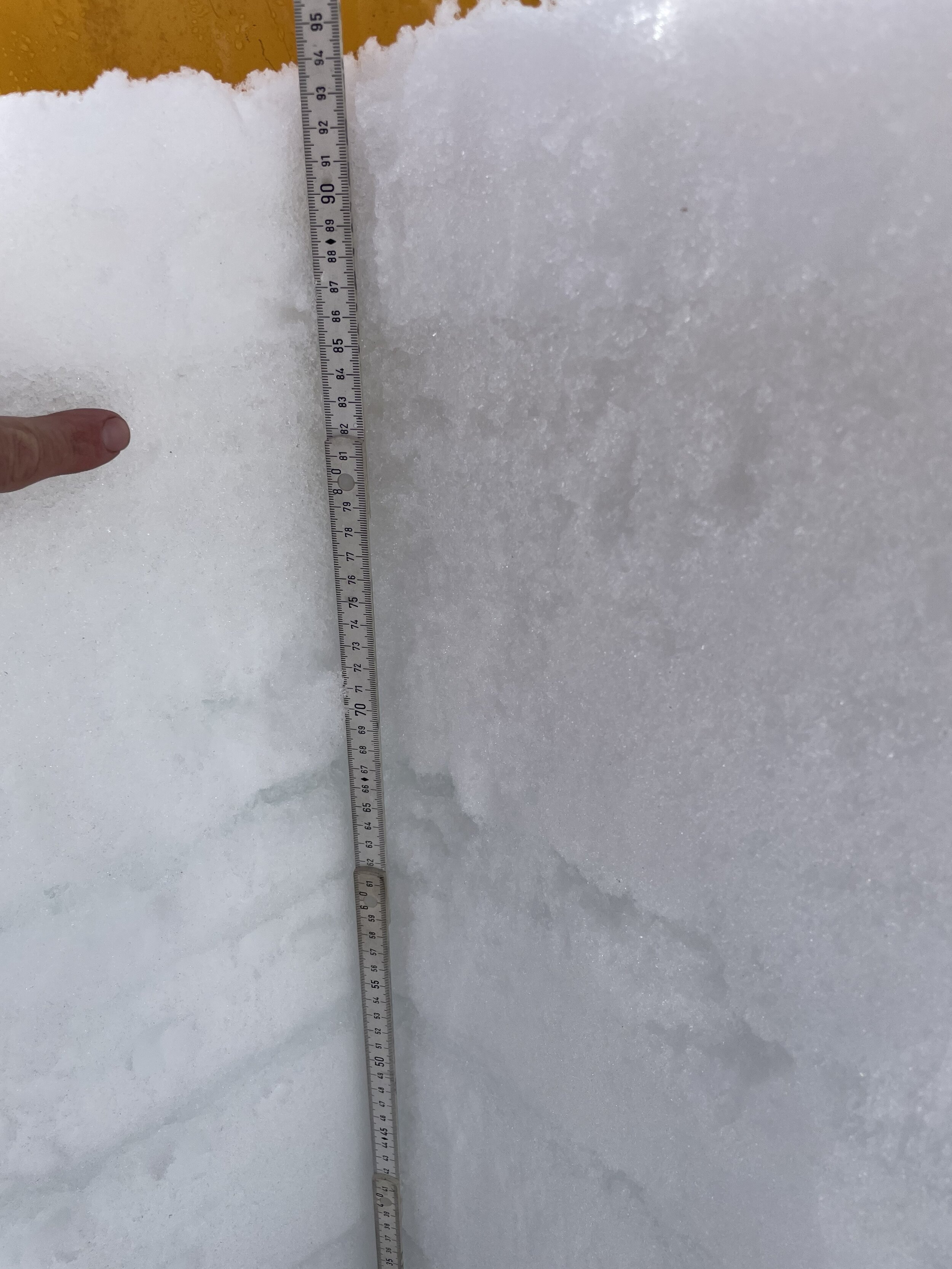
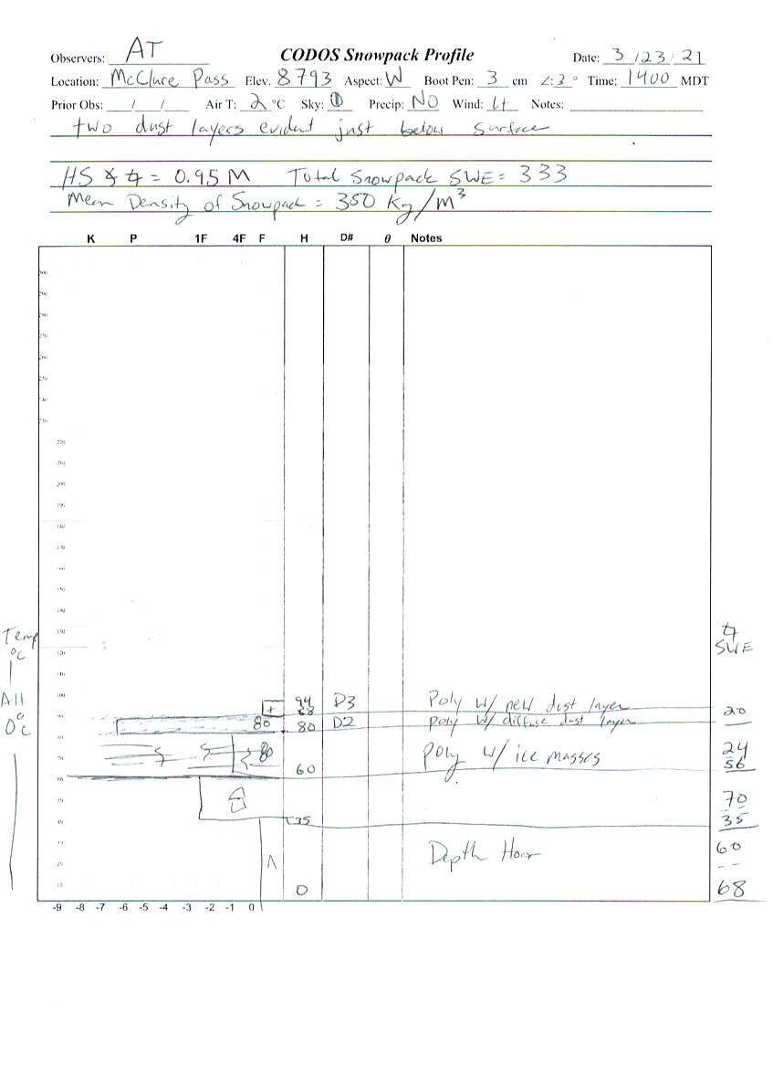
McClure Pass
There are two dust layers just below snow surface at McClure. One of the layers is readily apparent, tempting me to describe this layer as a heavier light event. Snowdepth = 3.1’. SWE = 13.1”.
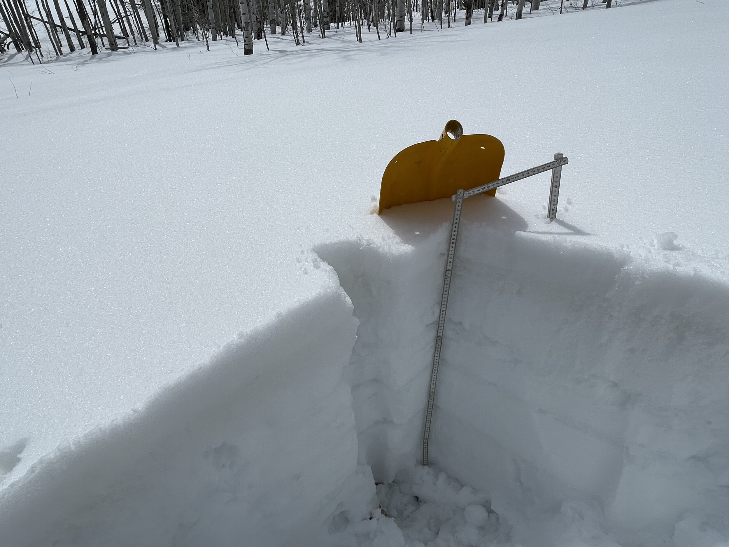
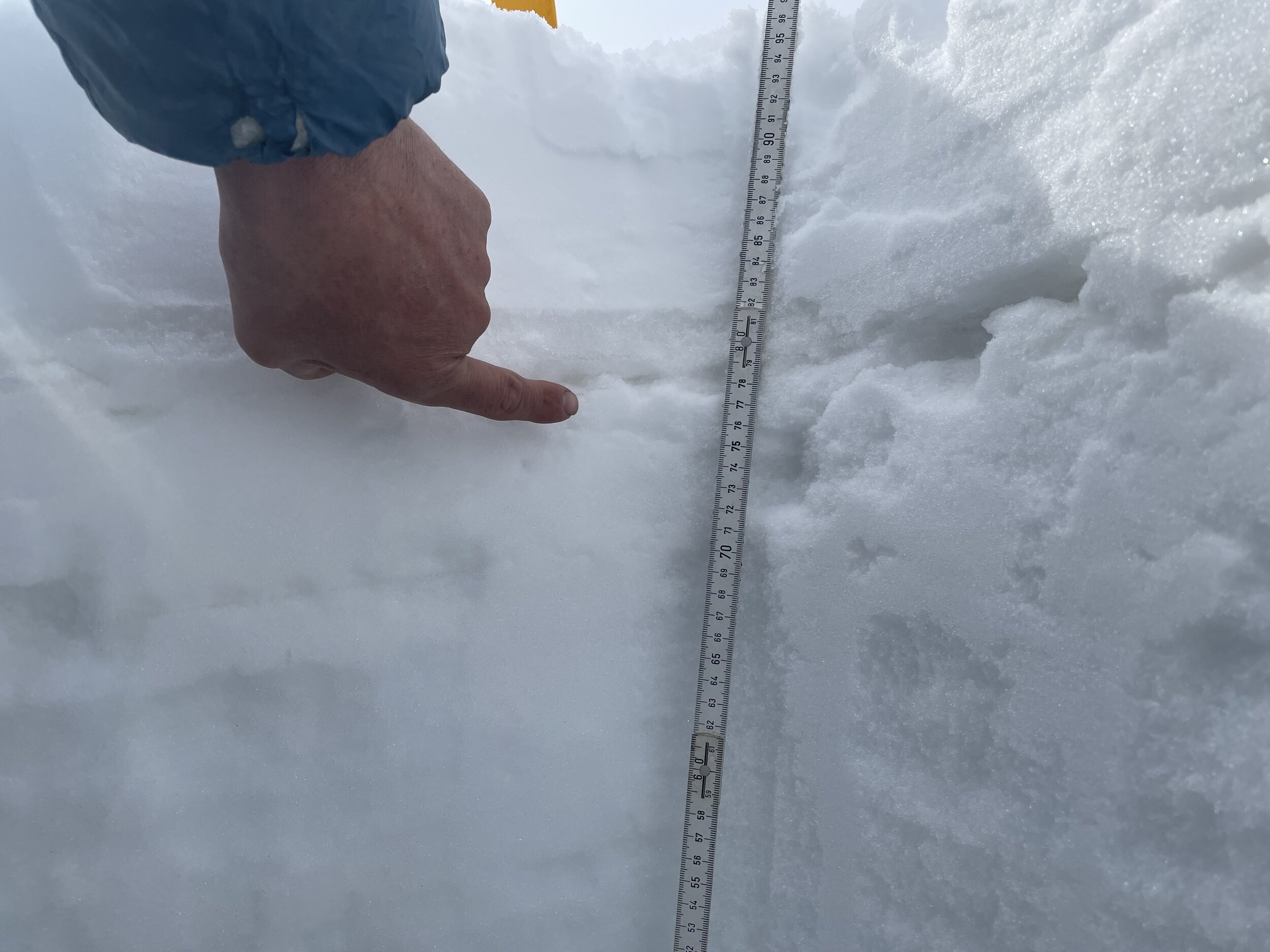
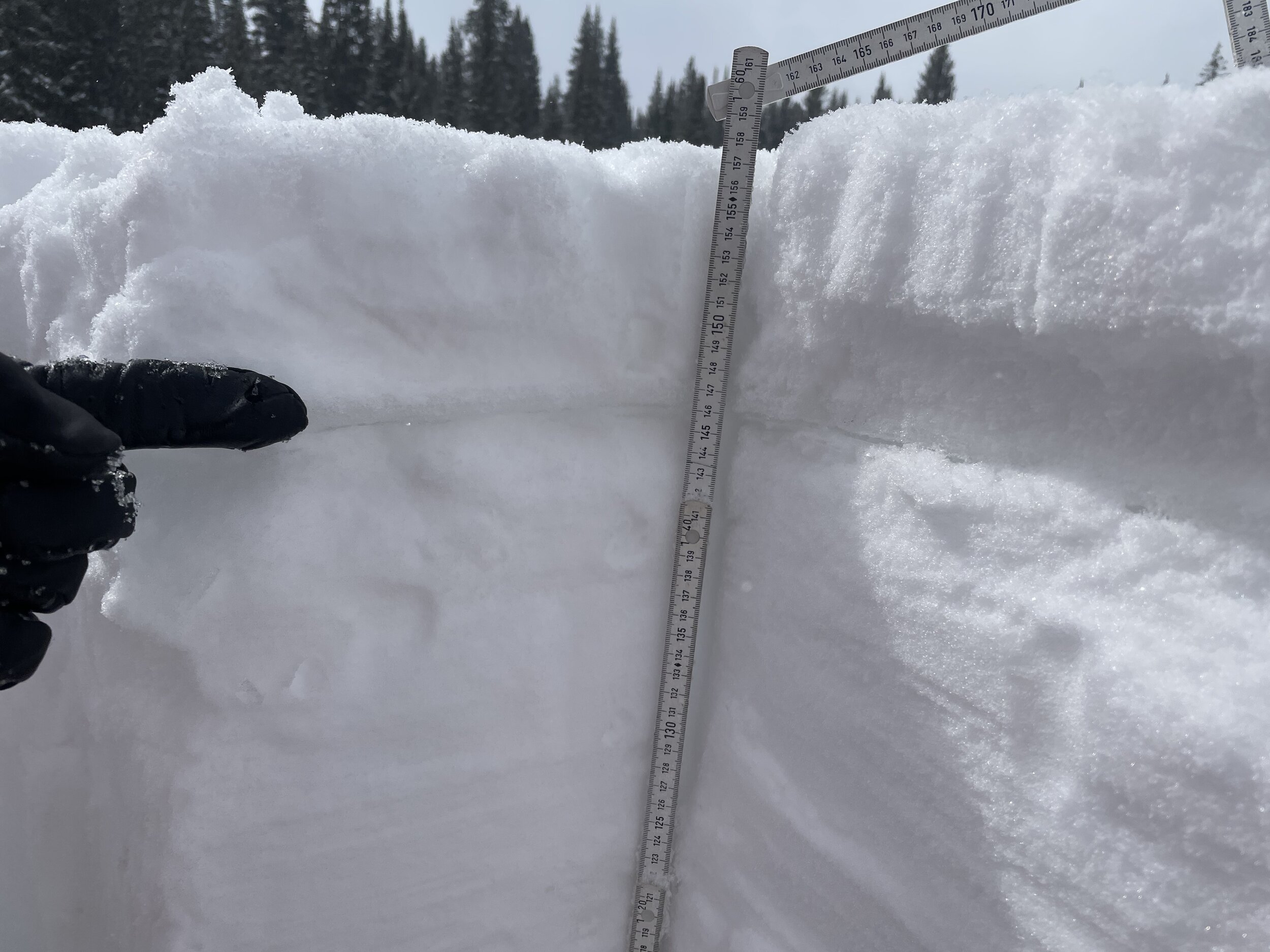
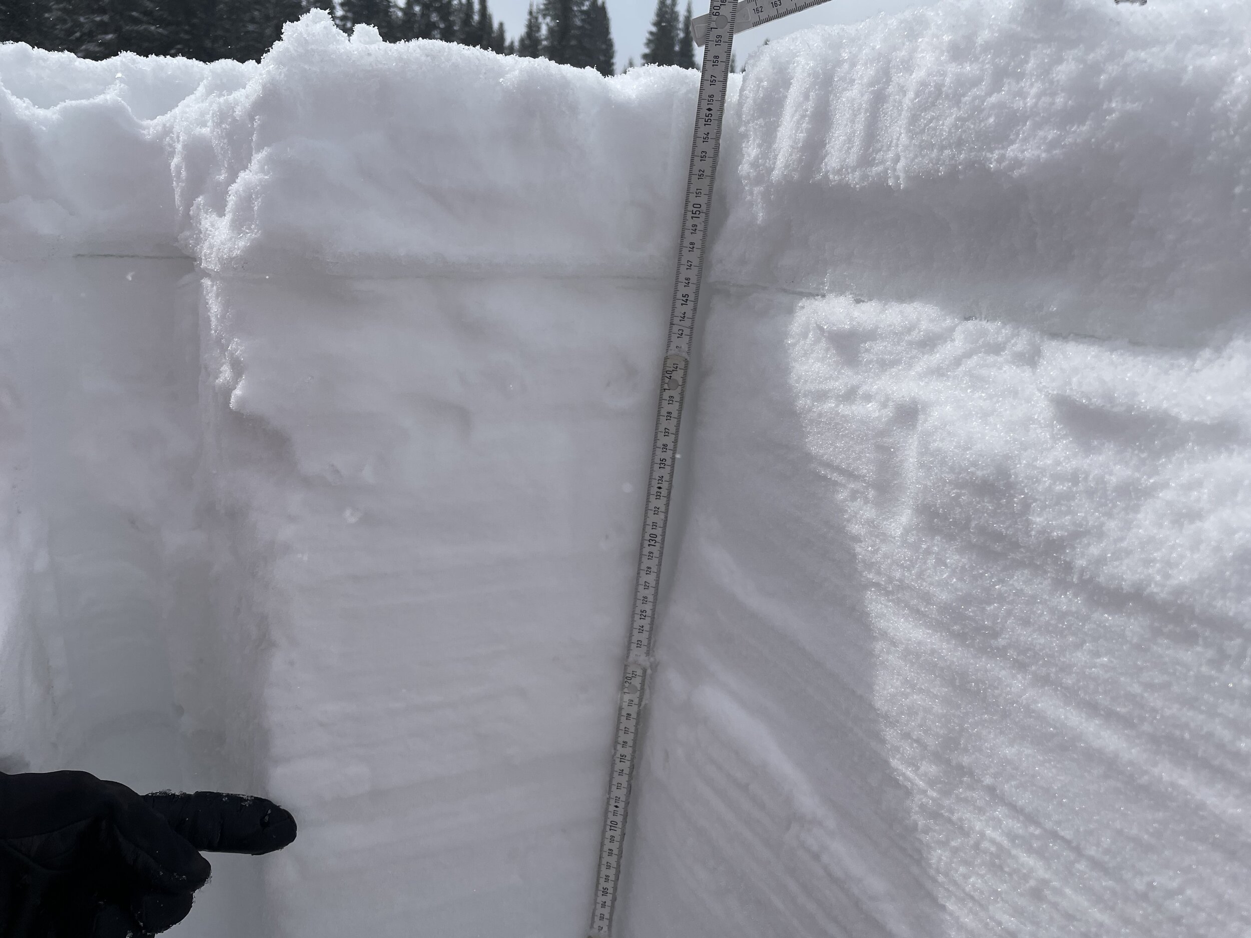
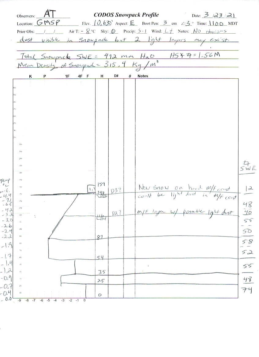
Grand Mesa
At Grand Mesa sample site we observed two light dust layers, the upper most layer being ~3” below surface and the bottom most ~18” below surface. Total snowdepth = 5.1’. SWE = 19.4”.

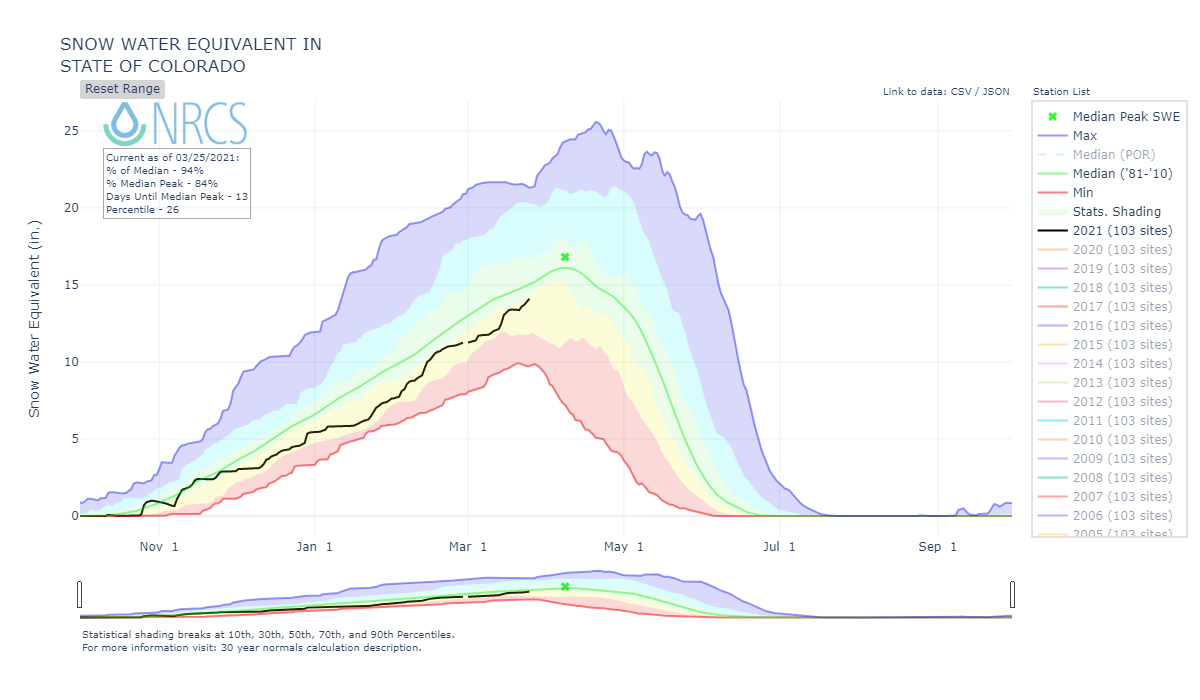
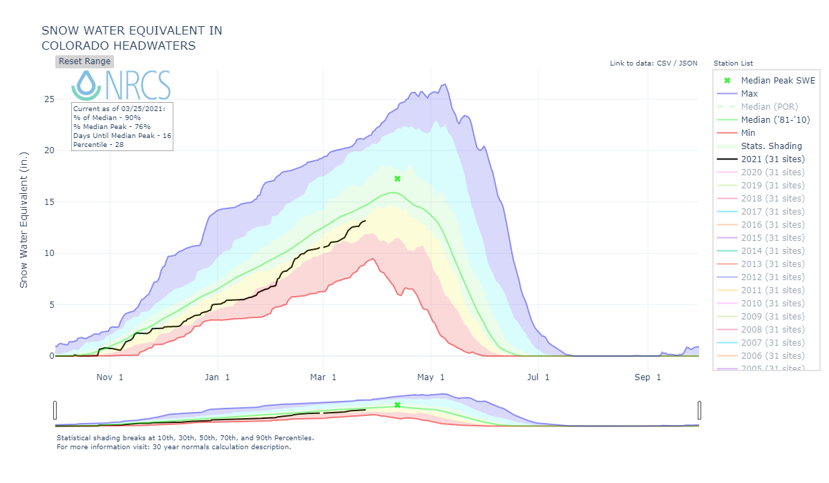
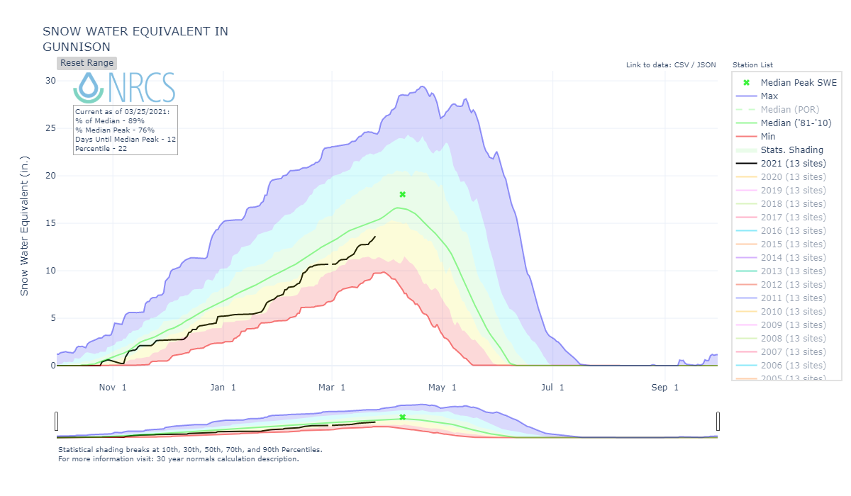
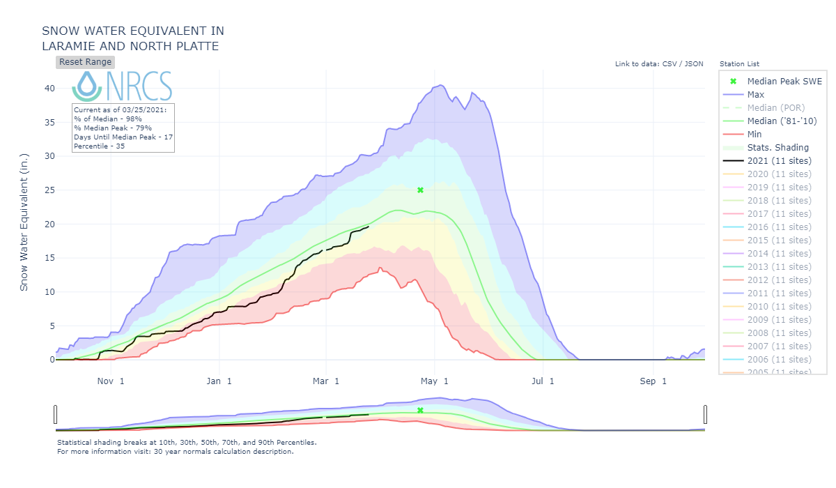
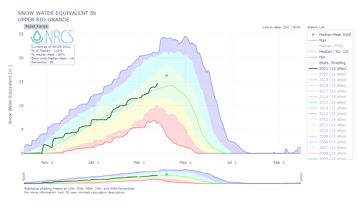
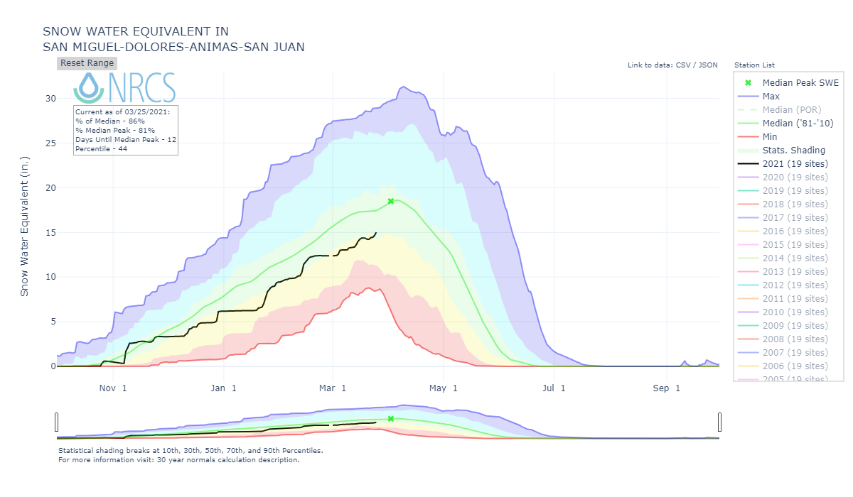
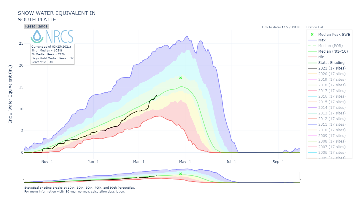
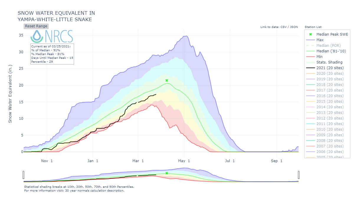
Below: Current SWE conditions by major basin and the state overall.