

CODOS UPDATE June 6, 2025: Rain, and a skimming of snow
Greetings from Silverton,
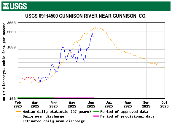
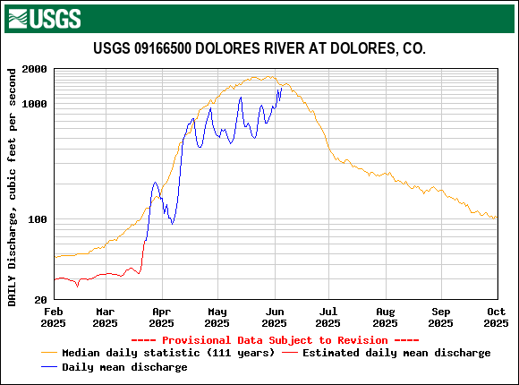
The string of rain storms that brought 1.4” of precipitation to Senator Beck at Red Mt Pass since Monday looks to have mostly tapered off. With the series of nice days going into last weekend (May 31) streamflow continued to rise until Sunday when it started dropping off slightly due to more persistent cloud cover. The largely high overcast and cloudy conditions slowed snowmelt considerably over the last 4-5 days. For instance, since Saturday, May 31, snowpack at Senator Beck has held steady, staying at 2.3’. The rain however brought a modest spike in streamflow. Some folks were worried about rain-on-snow causing a major melt event, but actually rain falling on snow departs very very little heat that can go towards melting the snowpack. Typically this time of year the scenario is streams and rivers are full due to snowmelt, and then a rain event comes along and quickly adds to the already swollen conditions.
A bonus to the spring rains was a skimming of snow in the high elevations on Wednesday. This wee bit of fresh snow cover will ensure snowmelt at the higher elevations will ramp up more gradually over the next day or two. The forecast is still calling for chances of rain this week but for the most part it looks to be mostly sunny. Snow was considered gone at Swamp Angel (11,060’) on May 30, coinciding with the uptick in streamflow. For the higher elevations, for it being an overall dry year, the snowpack has persisted and is near middle of the pack in terms of SWE for this time of year.
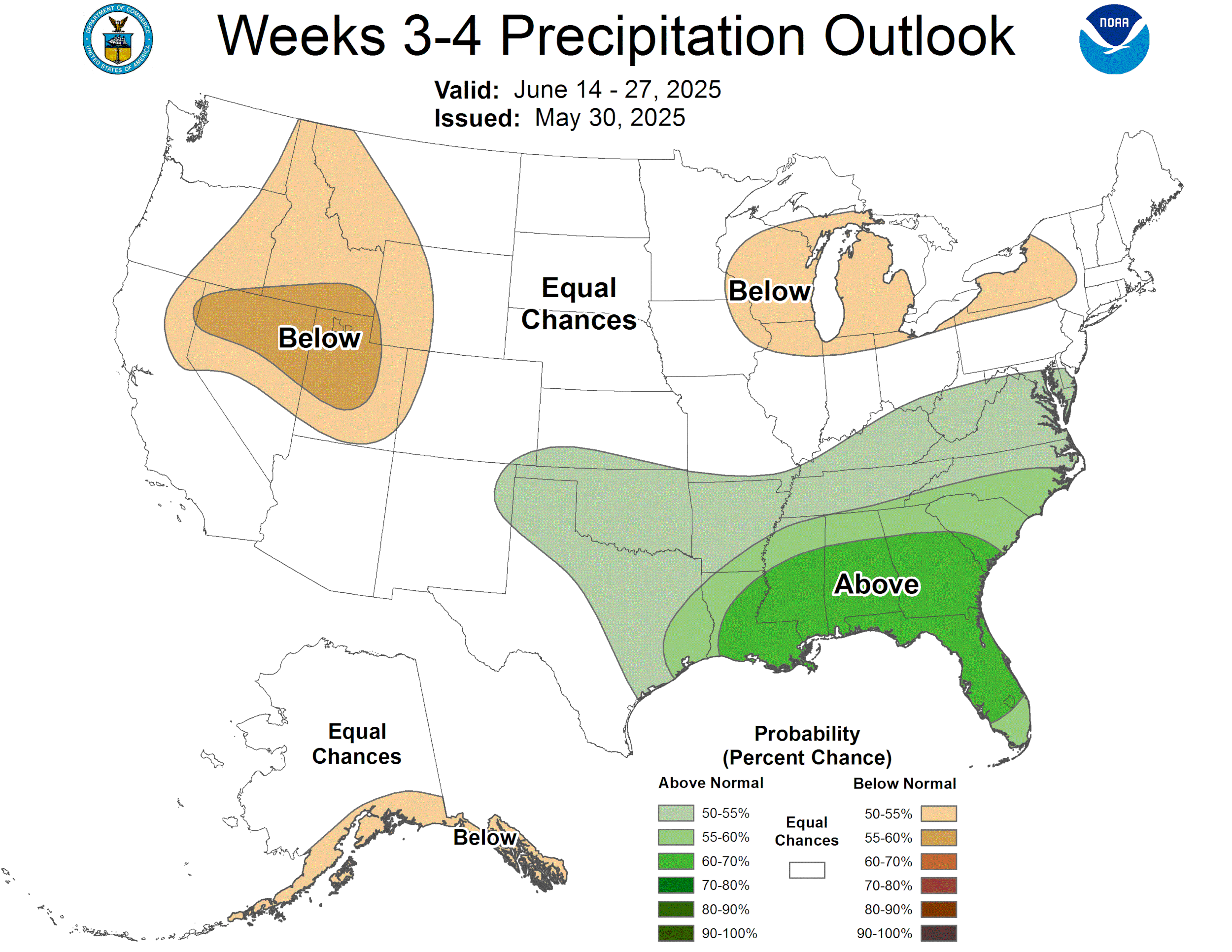
We are a week into June already, and these rains have us thinking forward to monsoon season. NOAA’s Climate Prediction Center (CPC) is showing increased probability (33-50%) of above average June precipitation from the southwest corner of Colorado into the central mountains. We’d be getting a piece of what looks to be centered around Arizona, which is expecting the best odds of above average rainfall (60-70%). As always, anything can happen.
Take Care


Below: We visited the Loveland and Berthoud Pass CODOS sample sites this week to collect the end of season all-merged-layers of dust on snow concentrated at the surface of the snowpack. When we visited these sites in May all dust layers had yet to completely merge at the surface.


Below: Senator Beck Streamflow plot. Recent cool weather and the melt-out of Swamp Angel Study Plot has lessened streamflow of late. However, with 27” of snow depth left up at Senator Beck, we’ll see another bump when warm, sunny conditions return and the high country melts out.

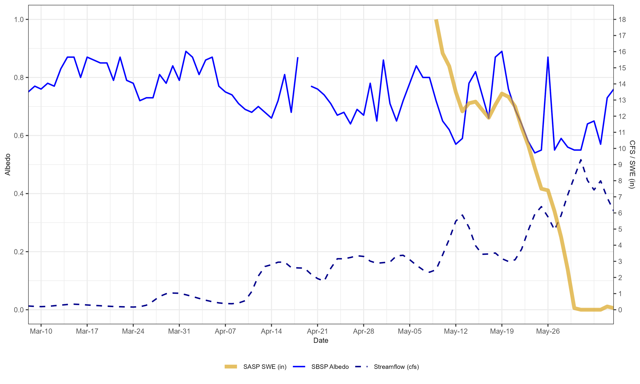
Below: Plot of Senator Beck Study Plot (12,186’) albedo, Swamp Angel Study Plot (11,060’) snow water equivalent from our snow scale, and the stream gage (11,030’). Our snowpack melted out at Swamp Angel, and recently cool weather and a fresh dusting of snow has lifted albedo in the high country, dropping streamflow the past few days.


Below: Senator Beck Study Plot snow profiles and snow depth, SWE, and cumulative precipitation for Senator Beck Study Basin and our neighboring SNOTEL station Red Mountain Pass.


