Greetings From Silverton,
Despite a dry and lackadaisical start to winter, persistent snowcover in Senator Beck occurred on November 21, we have seen a major turn-around with a steady stream of productive storms. We have received eight winter storms so far (Storm #8 Report was just posted) that in and of themselves have totaled ~10.0" of water. Snow depth at Swamp Angel is at 4.5’ and the wind effected Senator Beck site is lingering around 1.5’.
SNOTEL data indicate basins across Colorado are in good shape:

To add to the good news, so far this winter season we have remained dust free of any noticeable dust deposition at Senator Beck Basin Study Area at Red Mountain Pass. A bit of a surprise since the majority of storms were accompanied with high winds ranging from 65-95 mph (see wind rose plot for the month of December below). But despite the high winds the source area did not have the right combination of factors, largely due to wetting of the soil, which prevented dust becoming airborne. So barring any dust-in-snow observations from other locations, it appears so far the Colorado Mountains are dust free. Observations at Swamp Angel Study Plot in the western San Juans tend to represent the worst case scenario of dust deposition on the mountain snowpack, since this area is one of the first, and hardest hit with dust from the primary dust source of the southern Colorado Plateau.
Five other seasons, in our 14-year record, have we been dust free the months Oct/Nov/Dec. Remarkably, we have never received a dust event the month of January in our period of record. Though as you can see by the below bar graph, the dust season kicks into gear around March, and this is unfortunate since dust received in spring will be located at the top portion of the snowpack, being a confounding factor by likely enhancing snowmelt the majority of the melt season.
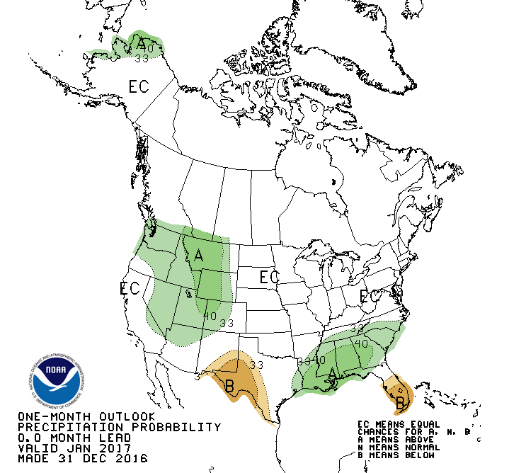
As always, we are on the watch for our first dust layer this season. In the meantime we can look forward to another atmospheric river (https://www.esrl.noaa.gov/psd/atmrivers/) bringing more snow starting on Sunday (see NOAA Climate Prediction Center outlook below). Keep an eye out for how much snow and rain this AR dumps on California (26.8” forecasted precip!).