CODOS UPDATE JANUARY 5, 2026: Little Precip, Hot temps continue, snow school
Greetings from Silverton,
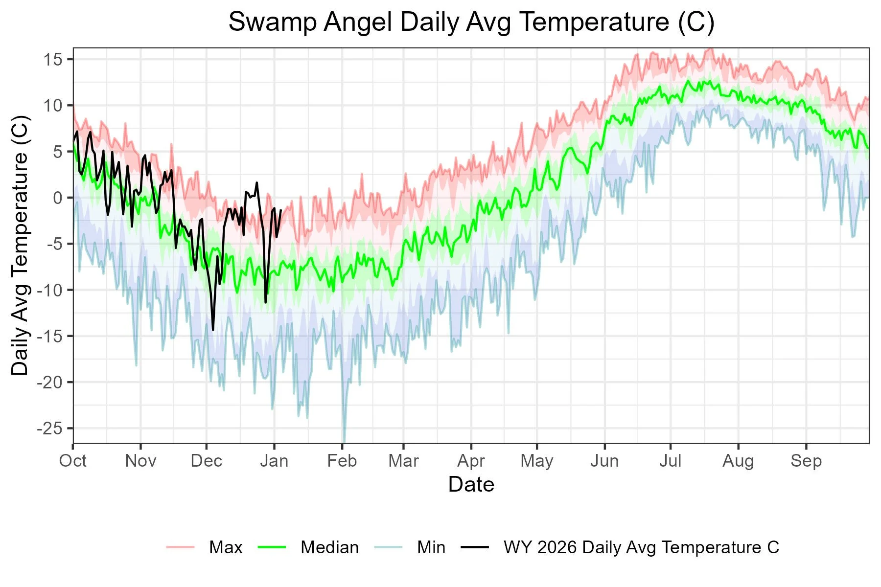
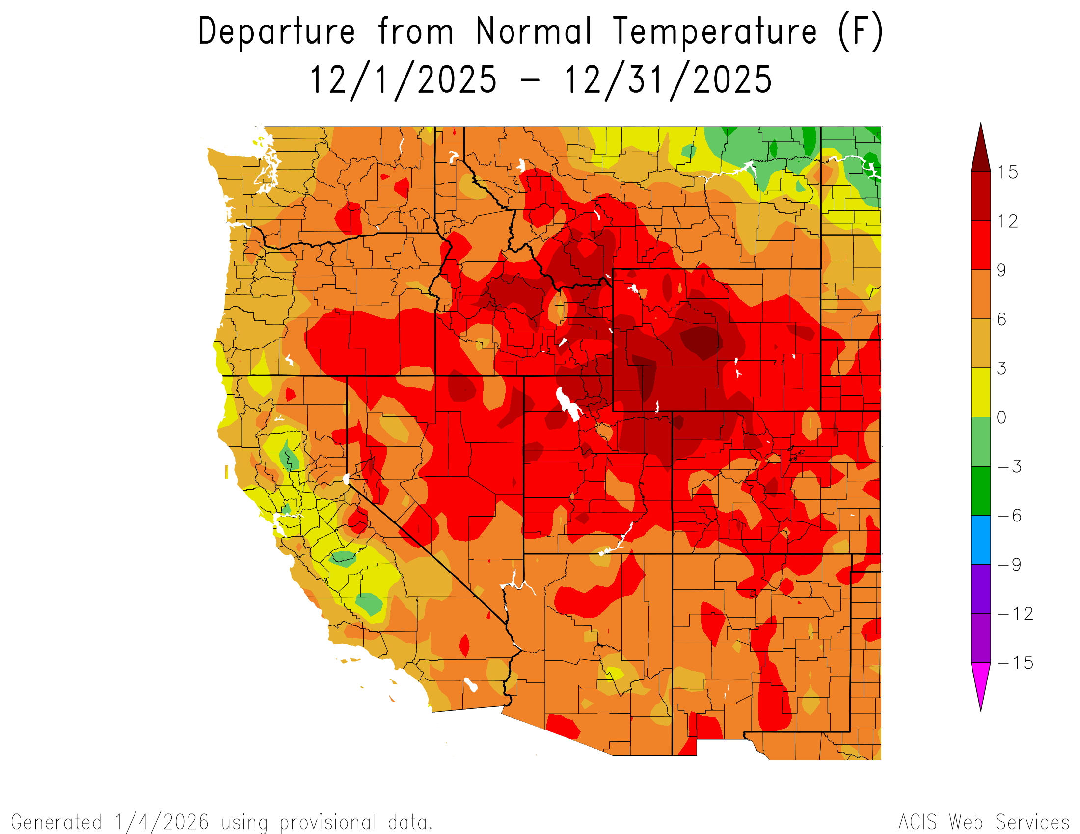
You know when you have a brief moment, usually in Spring or Fall, where you forget what season it is? We have had many of those moments this past month, it feels like Spring is here and it is only the first of January. It isn’t our imagination, it has been persistently hot. All of Colorado has been at least six degrees hotter over the past couple months, and there have been some much hotter periods within that time. Here at our Senator Beck Study Basin, we were well above average for long stretches in November, and hit a few record highs. All of December was warm and we hit record warm temperatures (average of 0 degrees C or warmer) a number of days the latter part of the month.
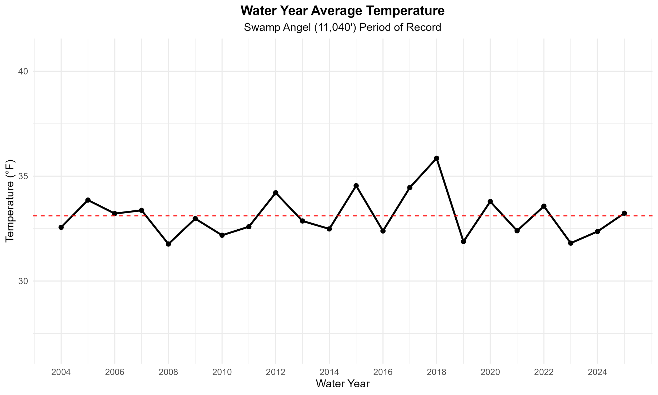
Both holidays, Christmas Day and New Years Day, there was rain in Silverton (we were not the only mountain town that experienced this) – reminder, Silverton is at an elevation of 9,318’. Up on Red Mountain Pass, Swamp Angel broke daily maximum temperature records for eight days in a row from 12/19 to 12/26 (and 10 days out of the month of December). Temperature anomalies were significant, which is saying something since our period of record begins in the early 2000’s after the megadrought had taken hold. Looking at average monthly temperatures back to 2004, this December is our hottest yet.
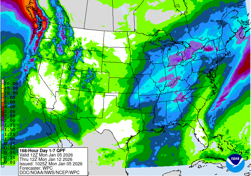
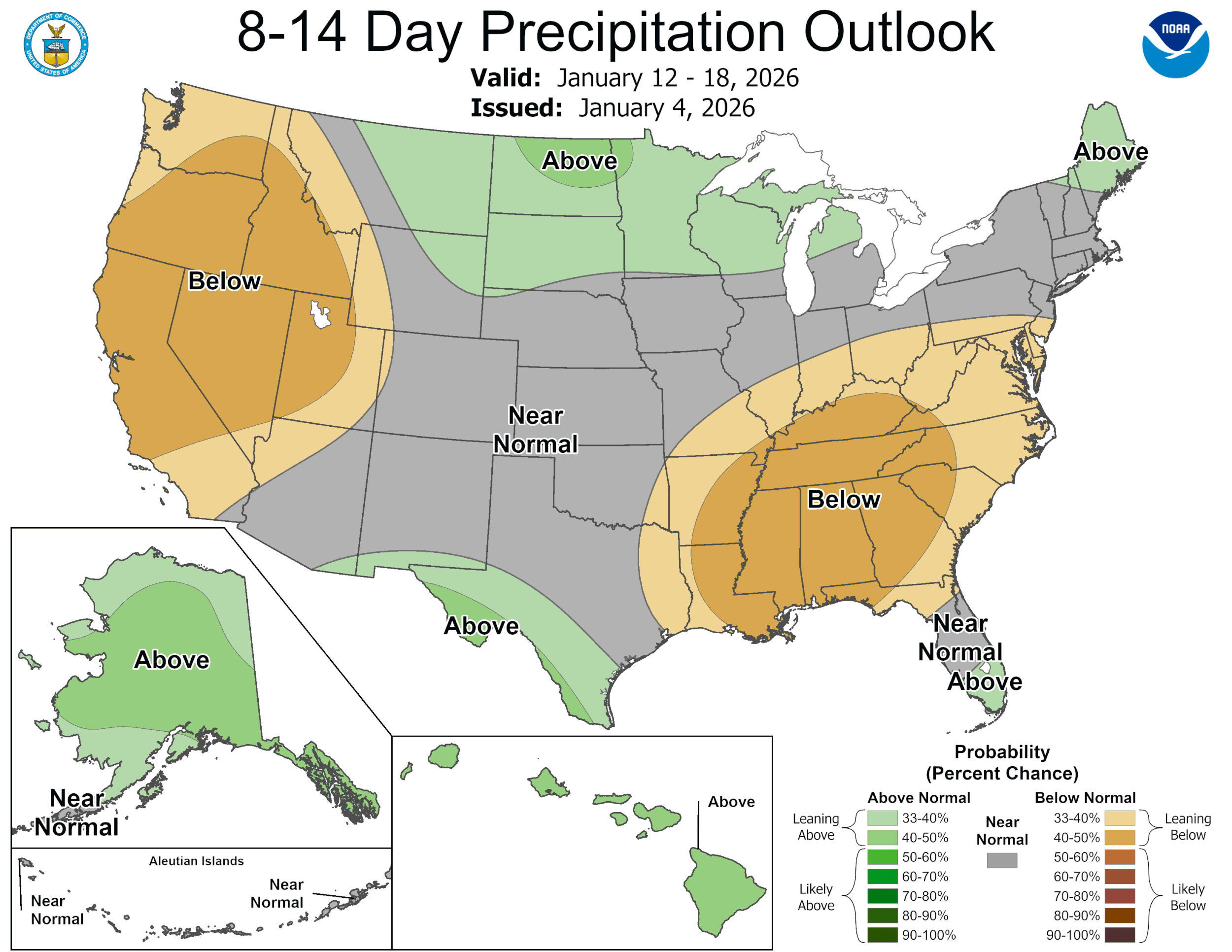
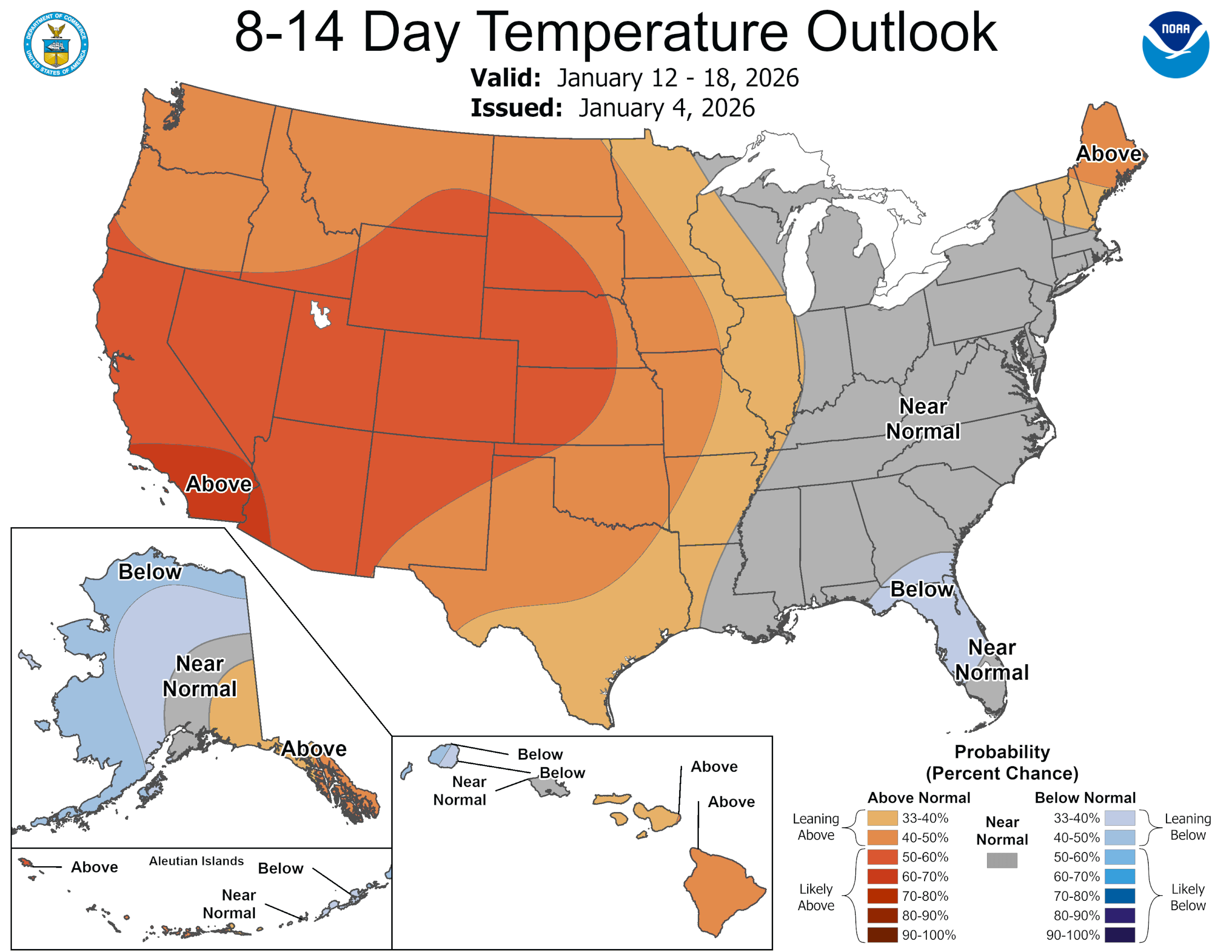
The forecast shows snowflakes this week but where and how much appears a bit fuzzy.
Please see plots below.
SNow School for Water Professionals
Snow School is a go. We are really excited to offer Snow School for Water Professionals for another winter season. This year the class will be held February 25 - 27, 2026. The class is perfect for anyone wanting to learn more about the role of snow and our mountain environments as it pertains to water resources, designed to enhance understanding of snowpack processes, snow monitoring and data.
Plus, we will have guest lectures by Colorado Water Conservation Board staff about the Weather Modification Program as well as the Colorado Airborne Snow Measurement Program (CASM).
And, we will get a personalized tour of Red Mt SNOTEL by NRCS staff!
The combination classroom and field course will begin on Wednesday morning at our office in Silverton and end on Friday afternoon (2.5 days). . Click here to download flyer, please circulate in your workplace forward announcement to folks you think might be interested. You can pay with credit card at snowstudies.org. Please do not hesitate to contact me with questions.
Take Care
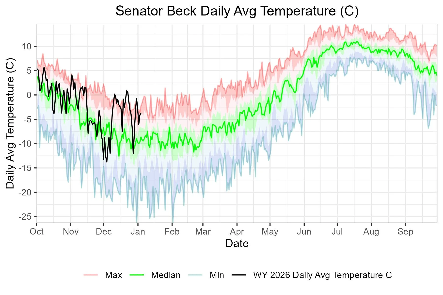
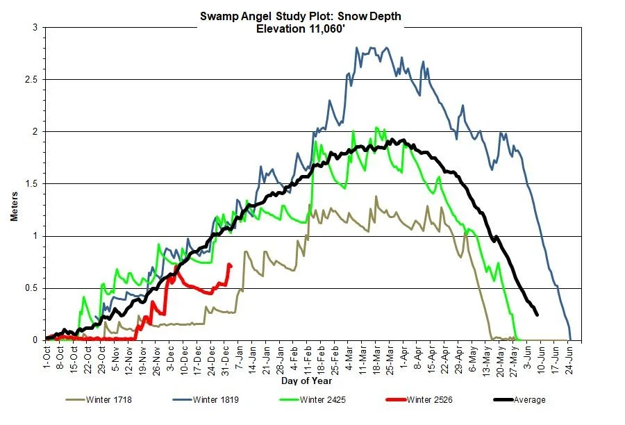
Below: Both our weather stations (Swamp Angel at 9,318’ and Senator Beck at 12,200’) broke daily temperature records at the end of December and on New Years Day. Looking back at average temperatures over the entire water year, WY 2018 stands out. In the slide deck below this one, in the cumulative precipitation plot, WY 2018 stands out again as the minimum cumulative precipitation Swamp Angel has recorded.
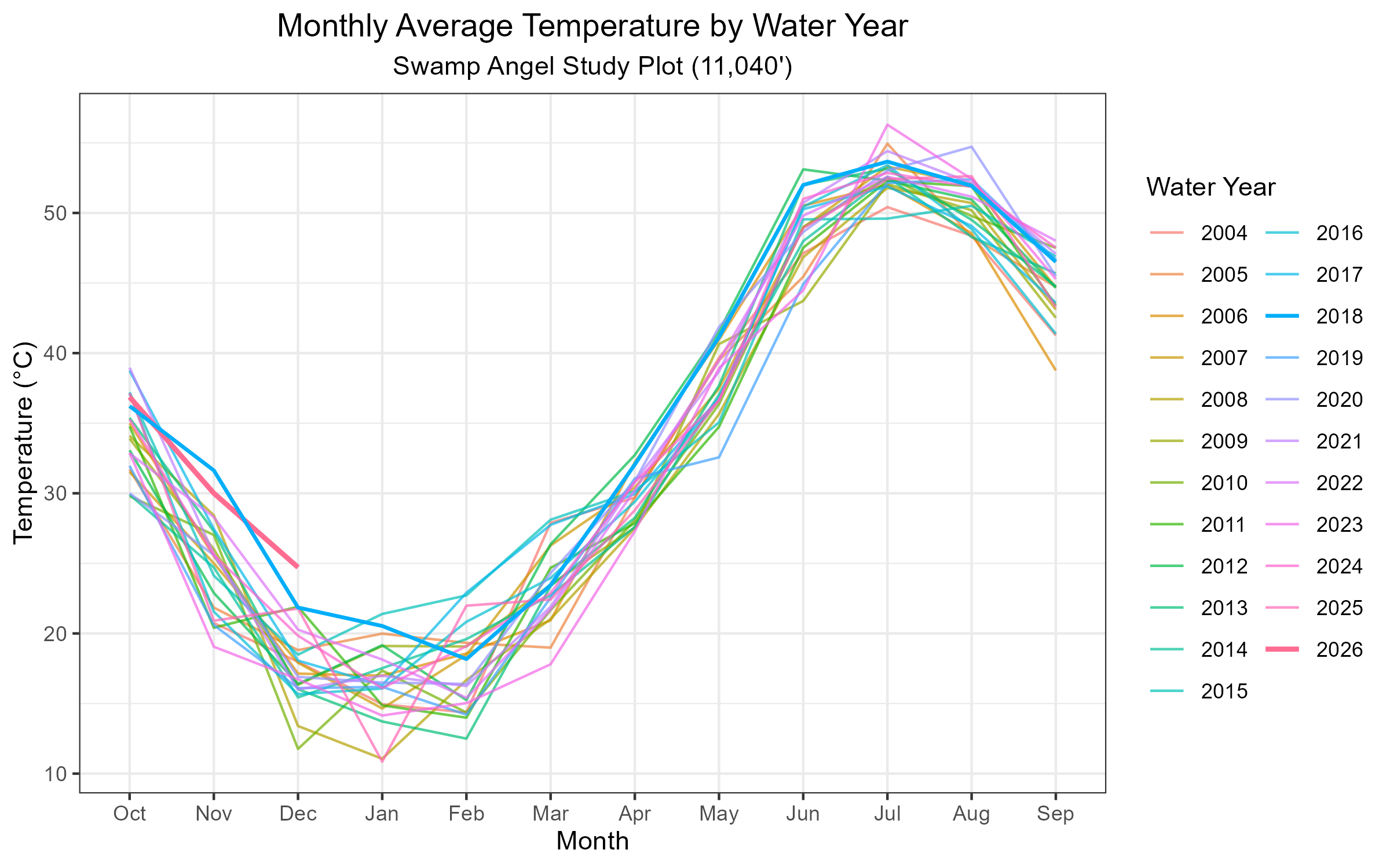
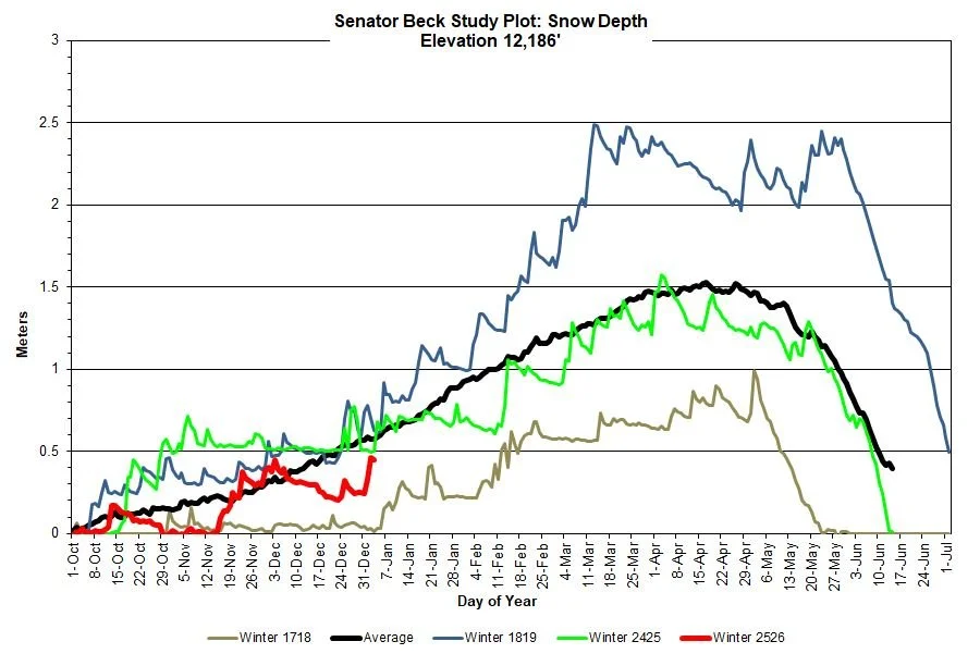
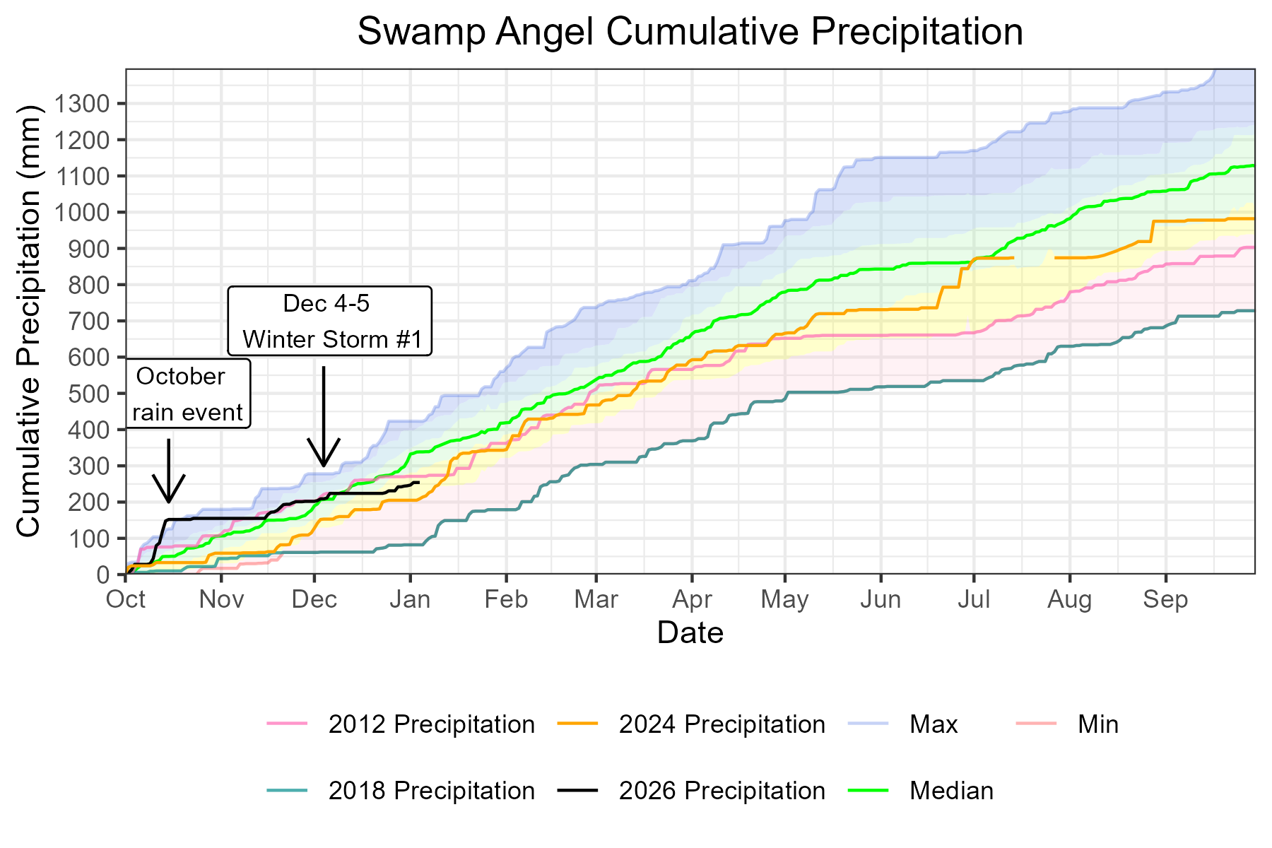
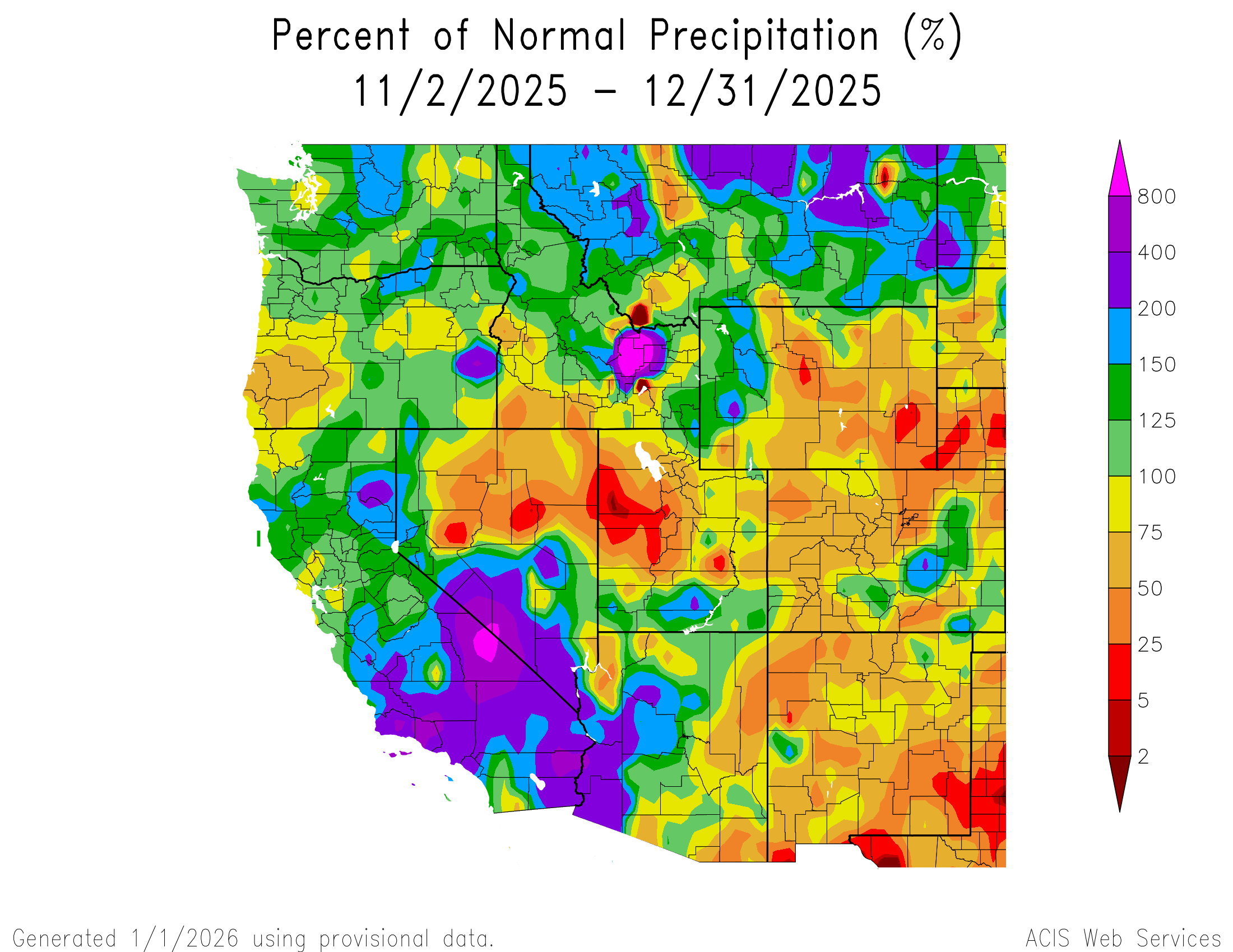
Below: Our cumulative precipitation plot makes it look like our snowpack might be sitting prettier than it actually is, due to the mid-October extreme rainfall event that occurred this year. Snow accumulation at SASP didn’t start until mid-November, and we didn’t record our first official “storm” until December 4-5th (CSAS defines a storm as 12 mm (approx. 0.5”) of precipitation with no break in precipitation longer than 12 hours). Of the five storms so far this season, only 2 in November carried any kind of punch. With that in mind, our winter precipitation might be more similar to water year 2018 at Swamp Angel, which coincidentally(?), was also the hottest year on average previously in our record.
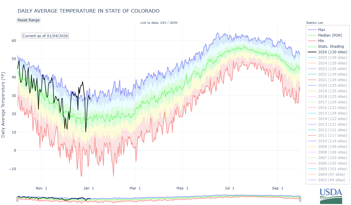
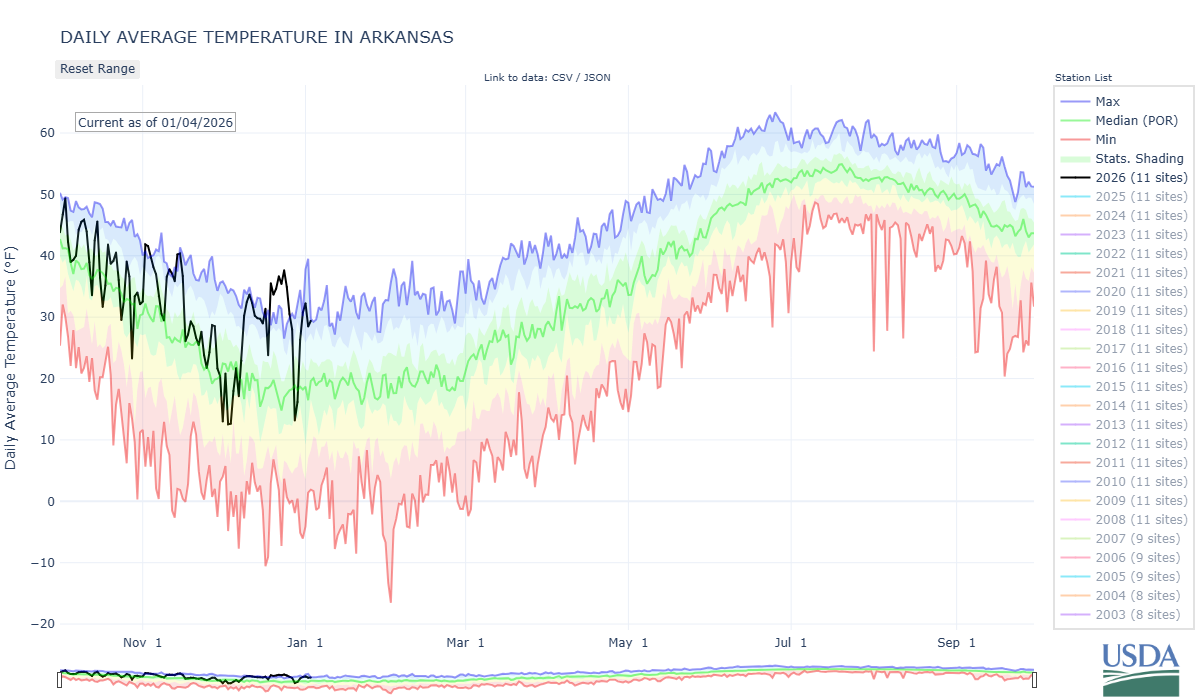
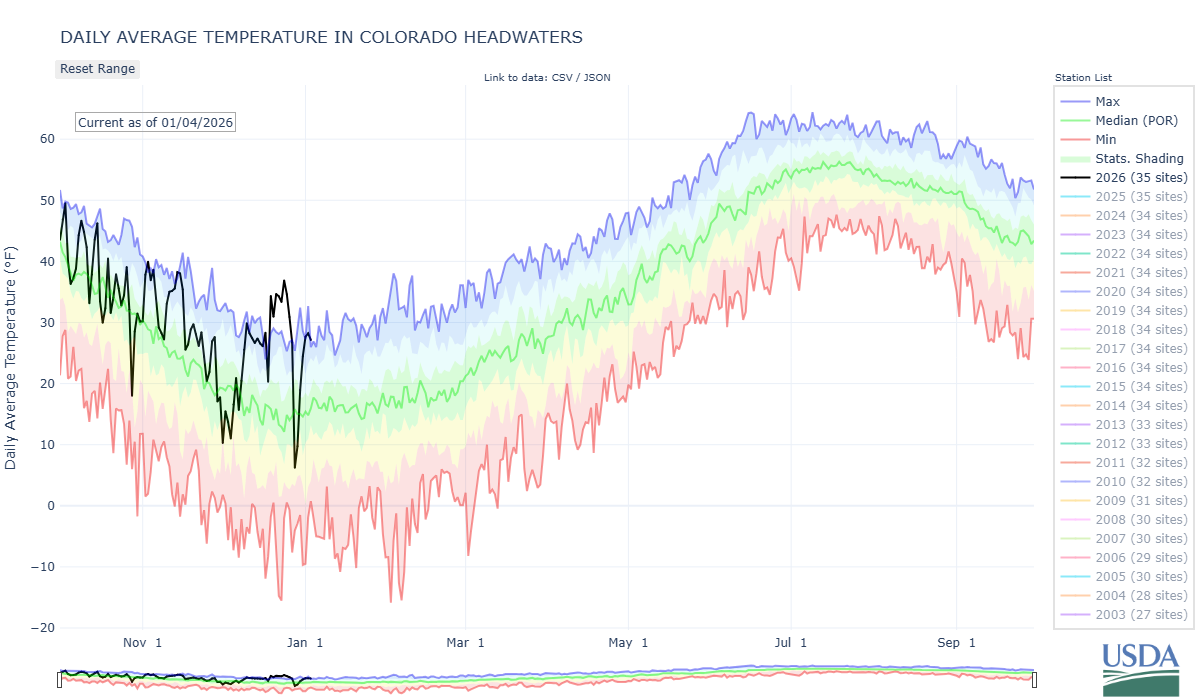
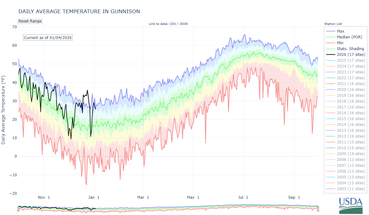
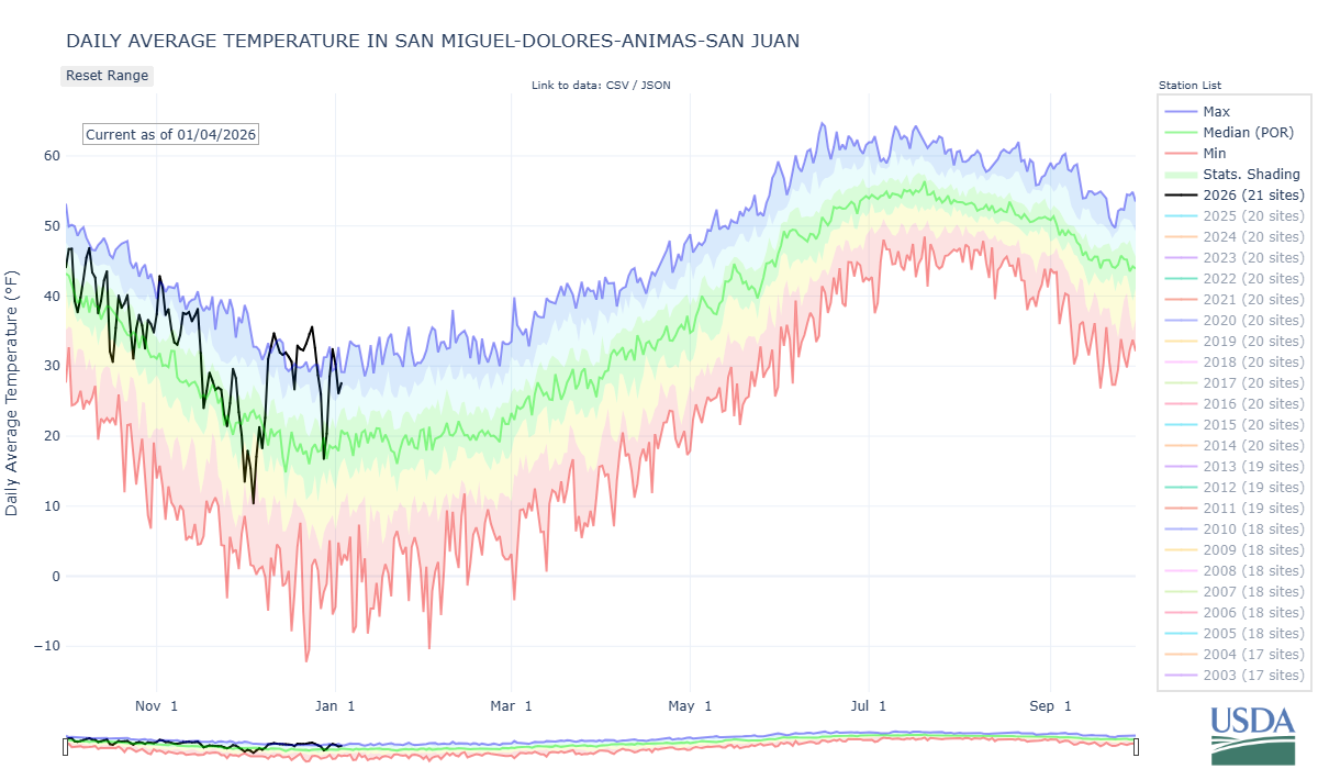
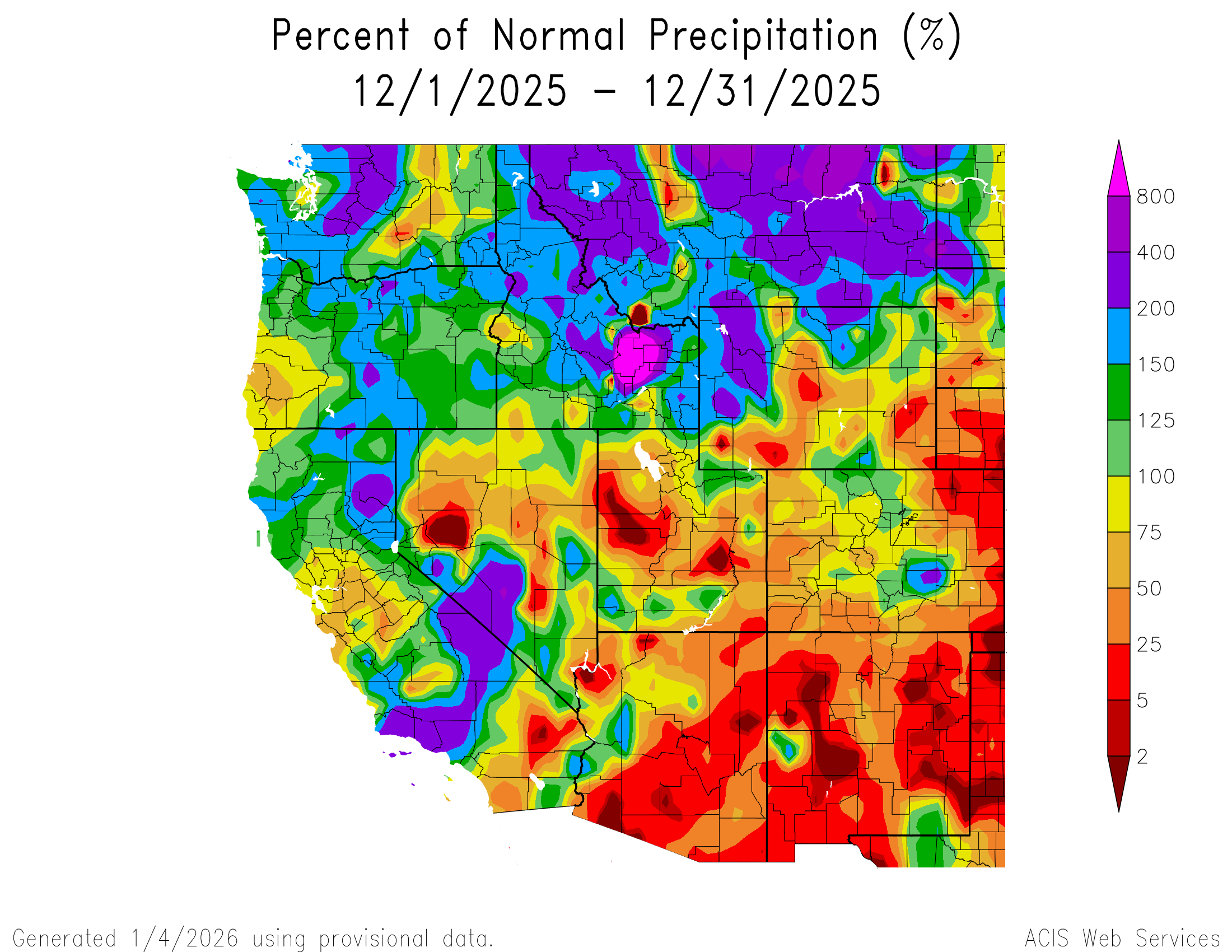
Below: It just wasn’t our stations that observed record highs, SNOTEL stations around state with longer periods of records also recorded sustained very warm temps and record highs during the same timeframes. Of course this is also detrimental to the snowpack. In many locations early season precipitation fell as rain instead of snow and what did make it to the ground was gobbled up by the high temps.
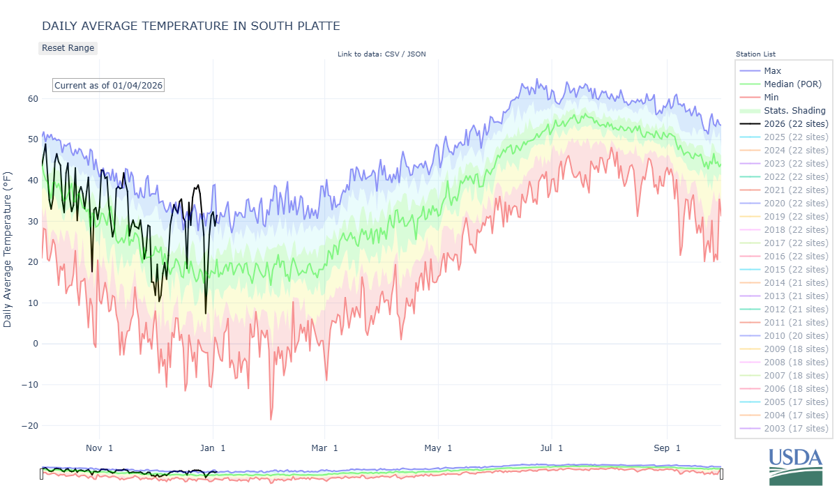
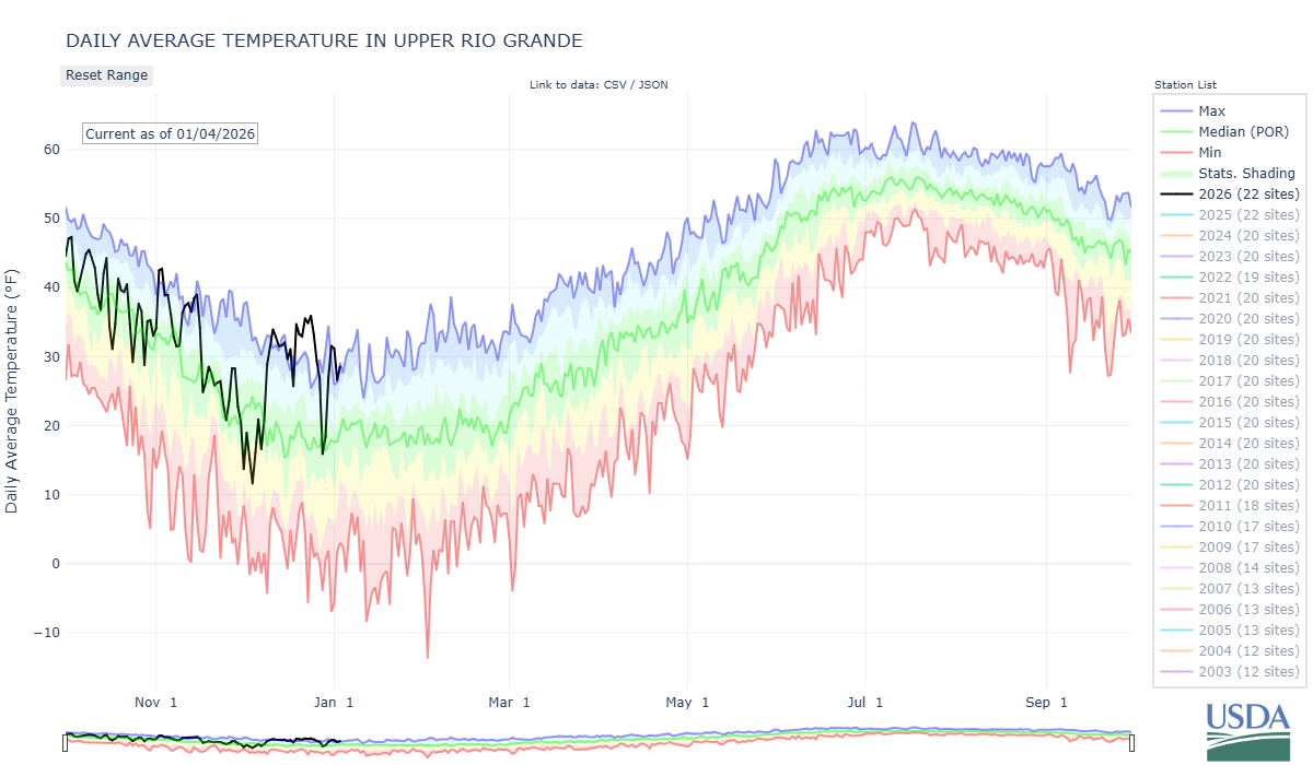
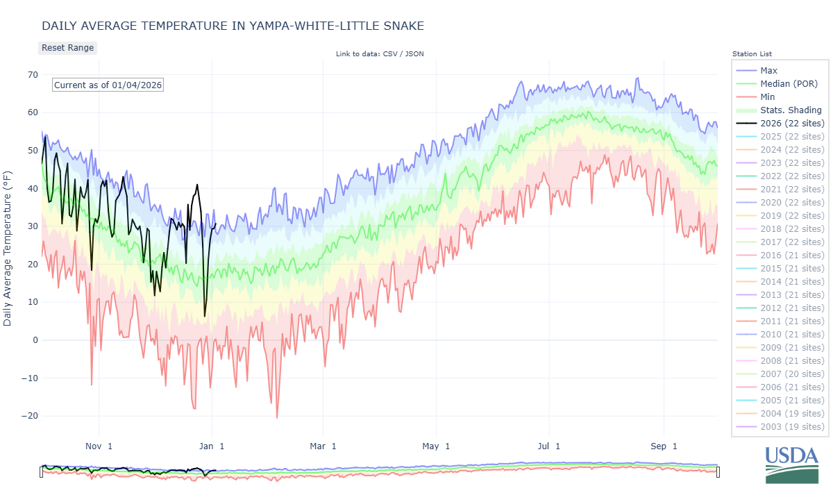
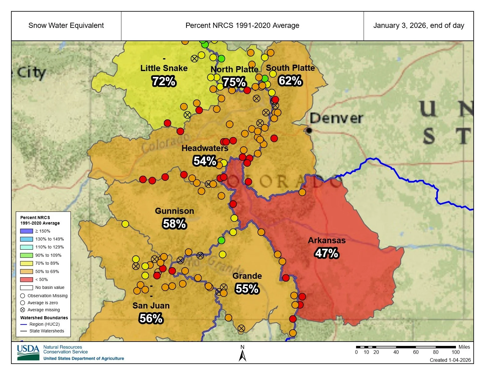
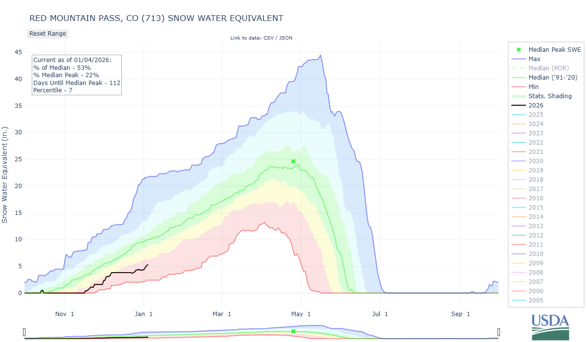
Above: The Colorado snowpack is seriously struggling. The situation is worrisome, but not yet at a point in the season to despair.
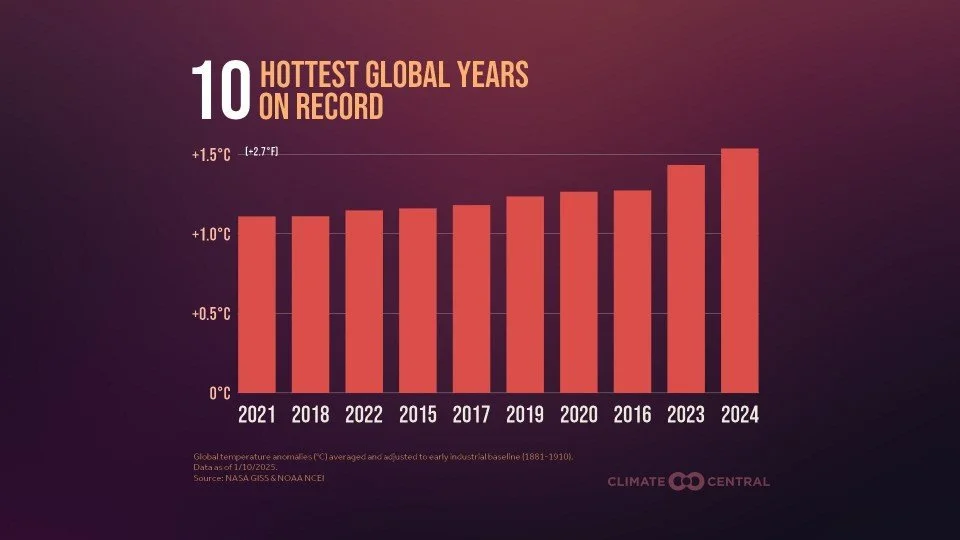
Above: The recent record setting temperatures is of course part of a trend we have been seeing for a good long time now.