

CODOS UPDATE February 17, 2023: Snowpack Update
Greetings from Silverton,
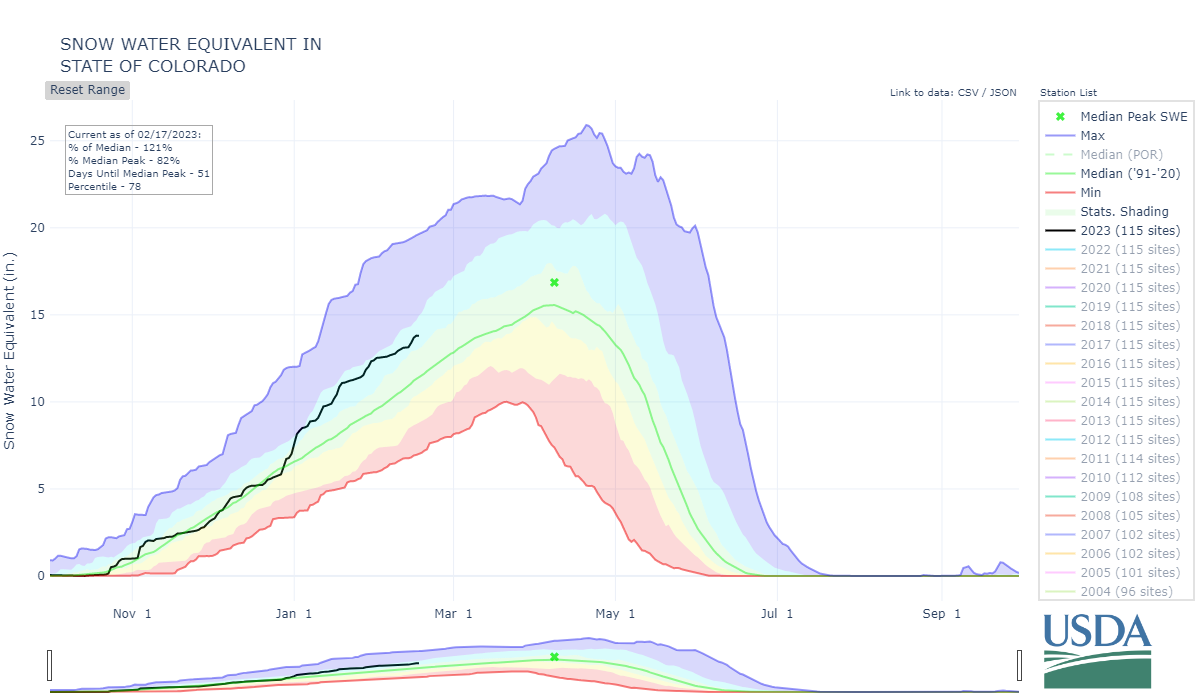
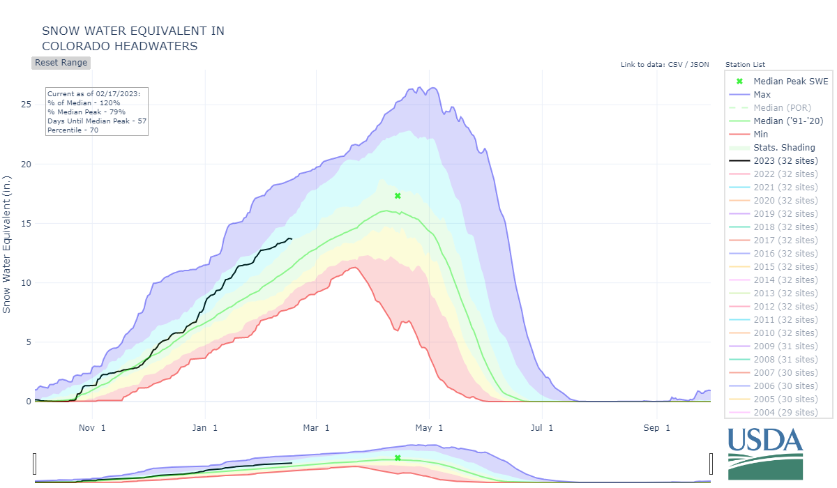
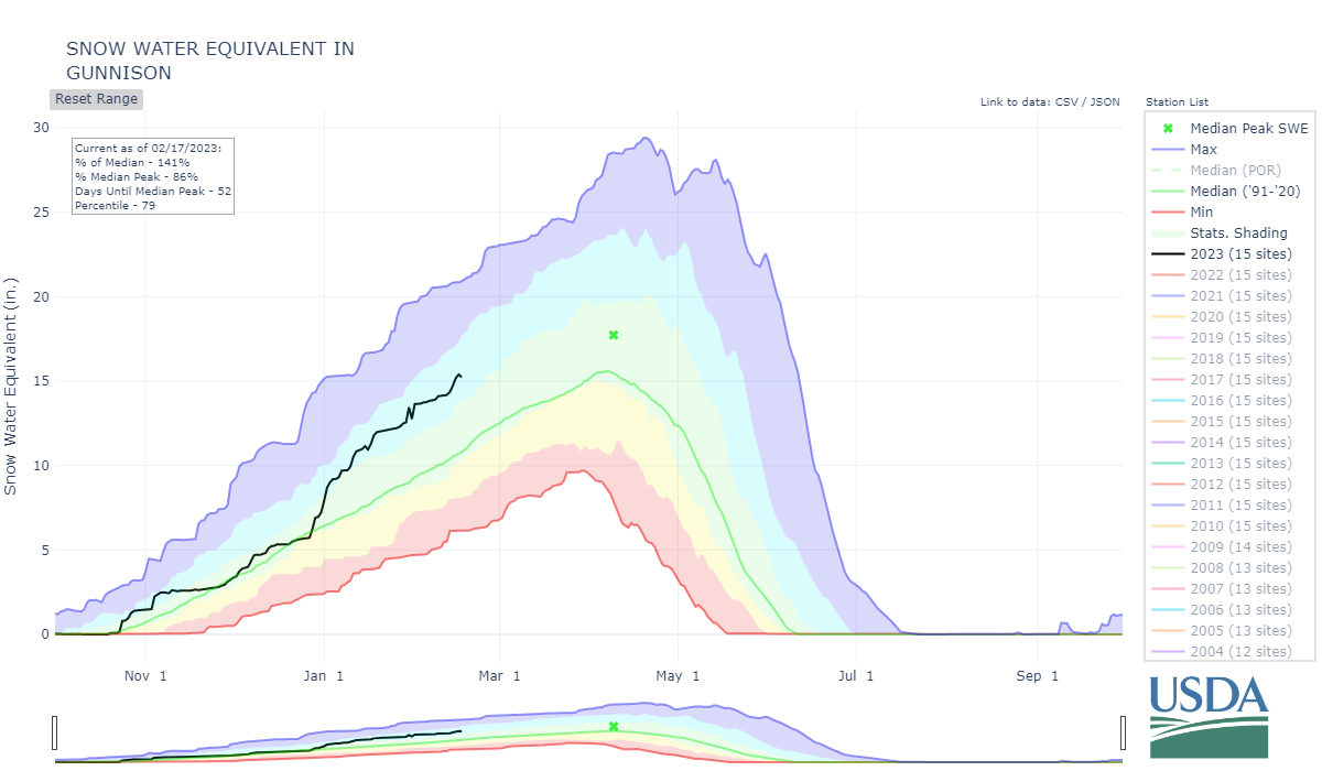
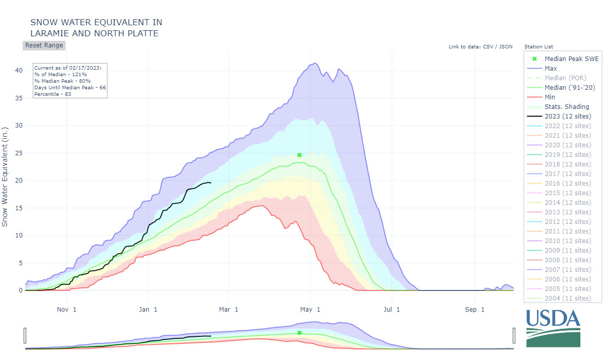
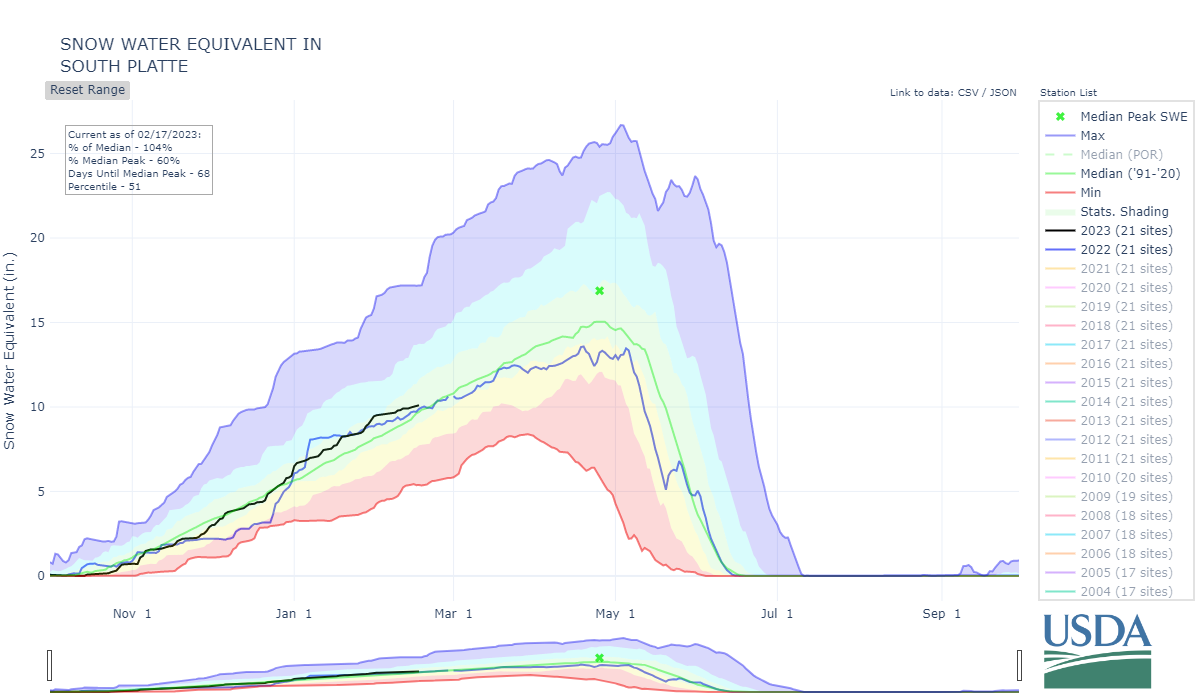
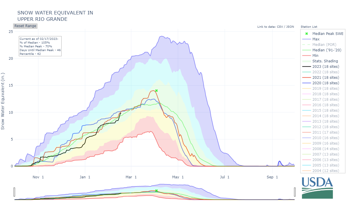
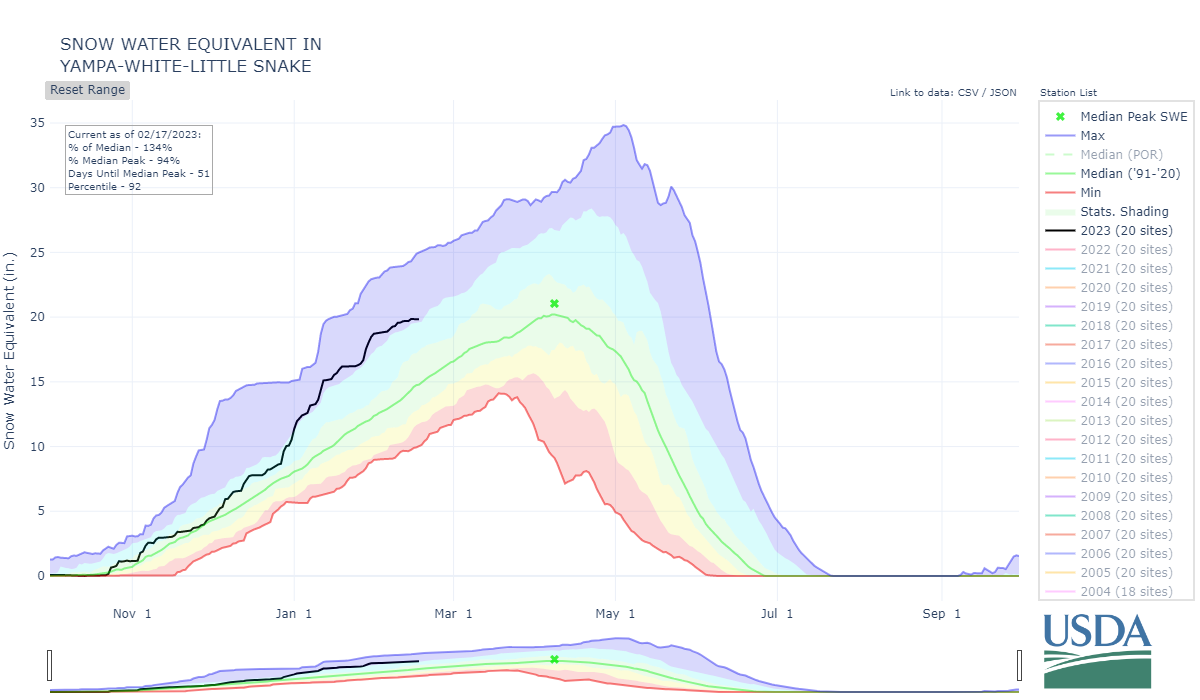
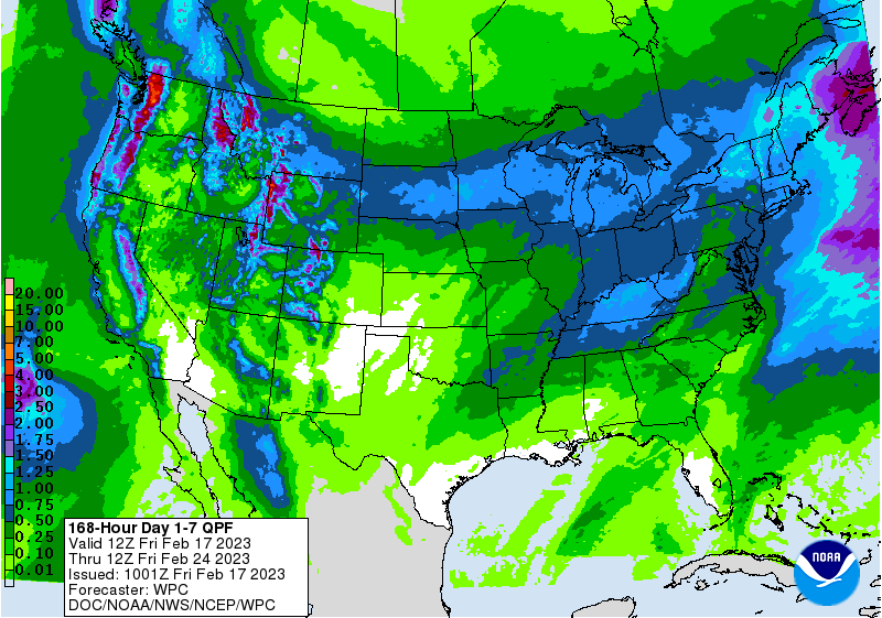
Snowpack Update: After a pretty mellow couple weeks this past Monday ushered in three days of snowfall here in Silverton, adding ~2” precipitation to the San Juan snowpack. We have seen active weather somewhere in the state most of this winter. A few basins are struggling (Arkansas) while others are holding on (Rio Grande, South Platte) while the remaining are encouragingly 120-135% of normal. The forecast is looking to continue delivering more snow across Colorado cranking up on Monday and lasting over at least a three day period. All very encouraging. We will see where we are at around April 1 but there is potential for a healthy runoff in a number of basins.
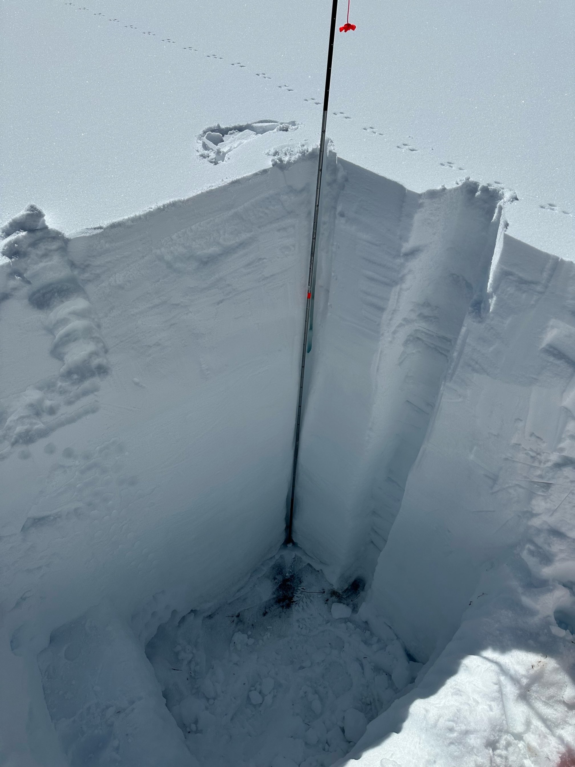
Dust-on-Snow: All is quiet on the dust-on-snow front. We dug a snow profile yesterday and the only dust observed is the early season event that is ~10 cm above the ground. March, April, and May is when Colorado receives the most dust-on-snow events, which puts the dust at/near the surface of the snowpack. Still, encouraging so far. It would be an interesting case to see a big snowpack with little to no dust, we don’t have that in the record books. You can view our snow profile forms on the codos.org website. And our storm reports at snowstudies.org.
Soon we will post our usual March 1st update looking in detail at current snowpack conditions, dust conditions, spring weather forecast and what this might mean for snowpack ablation and streamflow.
CSAS/CSU Workshop Follow-Up: The Workshop “Snow Research Meets Water Resources Operations in the San Juans” was a big success and we thank you for participating. We had wonderful science talks ranging from groundwater to the Airborne Snow Observatory. The panels of water professionals was insightful and provided many seeds for thought and future projects to assist the water community with managing a scarce and changing resource. The Workshop was recorded and that will be available on the Workshop webpage very soon, as well as a summary of the talks and panels. We are already talking about a follow-up meeting to build on what has begun.

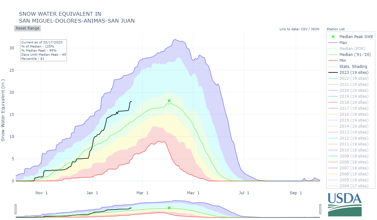
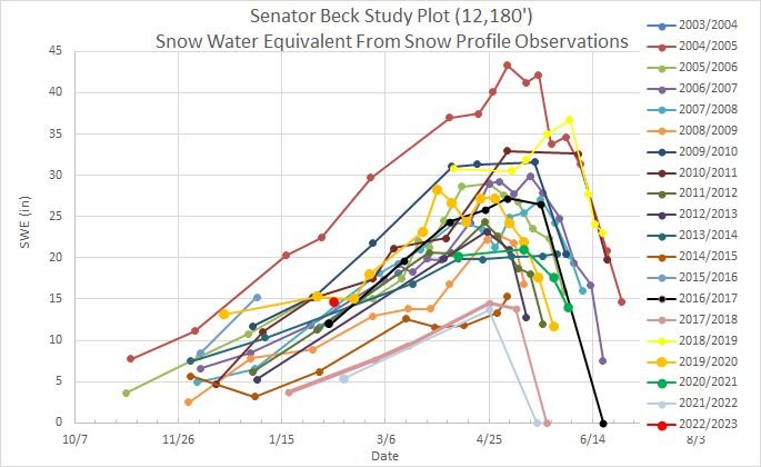
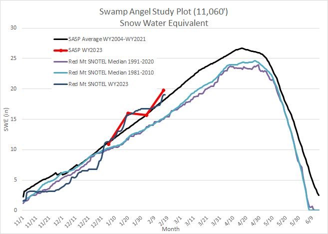
Below: Our Senator Beck site at 12,200’ has about 1.5” more SWE than average. Swamp Angel (11,060’) is about 1” SWE above average. Red Mt Snotel is about 3.5” SWE above average.
Below: Snow profile at Swamp Angel Study Plot. Looking good so far with no apparent dust deposition (besides the early season event that is 10 cm off ground)
Take Care,
Jeff Derry