CODOS Update April 10, 2021: Dry, Hot, and Dusty
Greetings from Silverton,
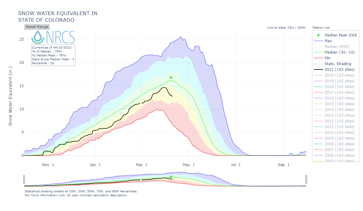
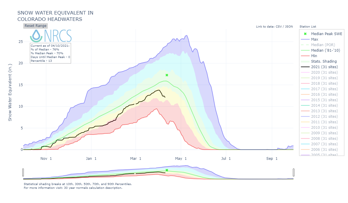
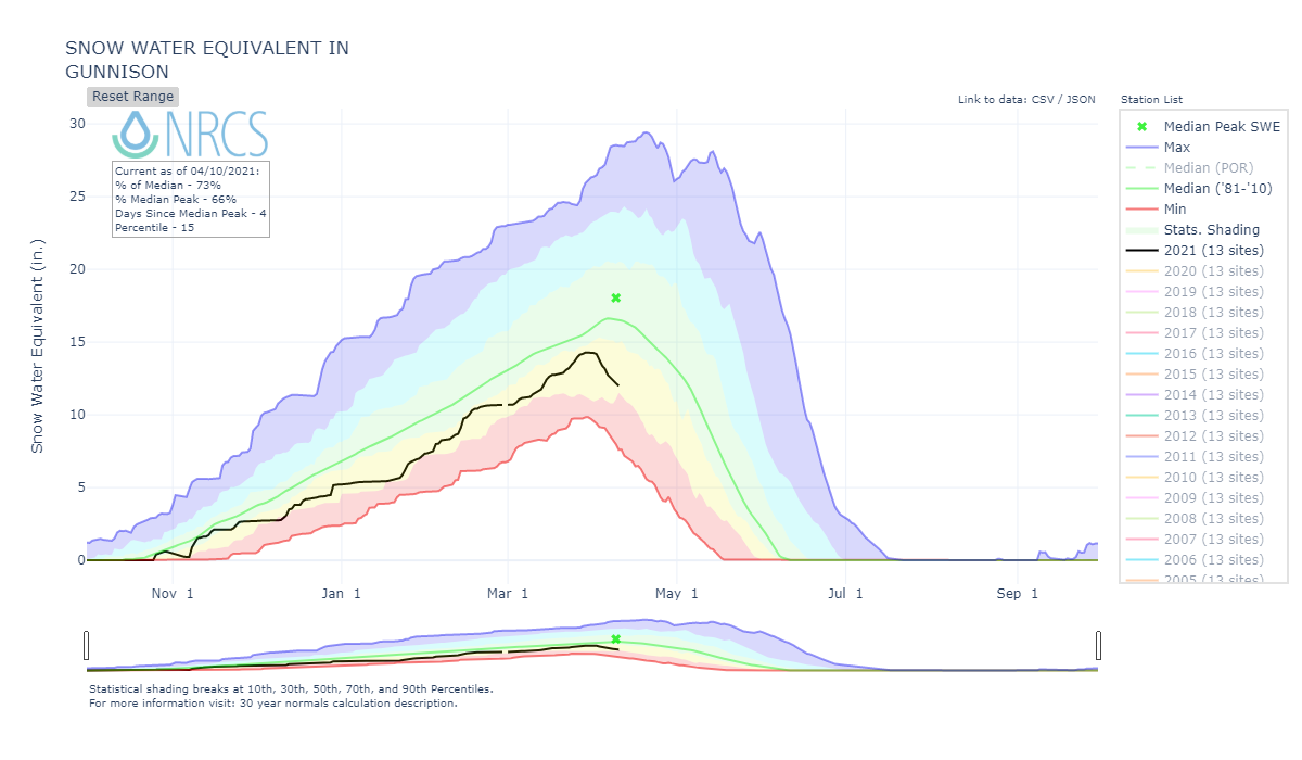
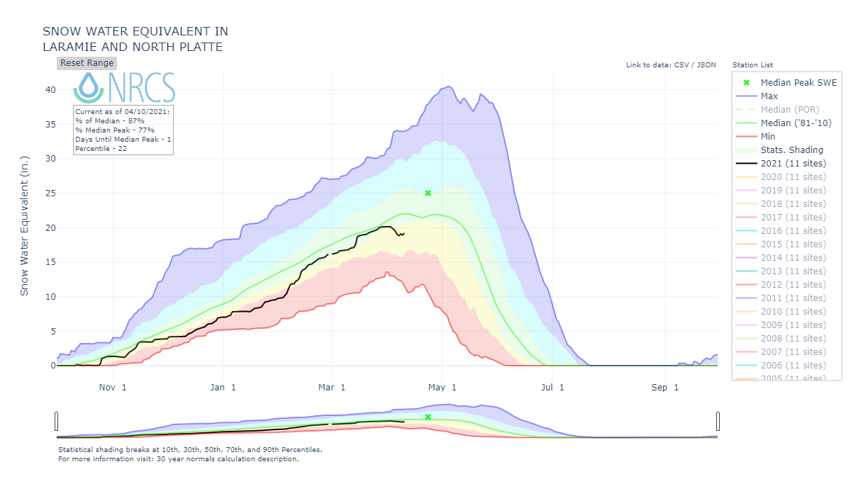
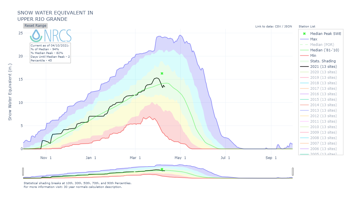
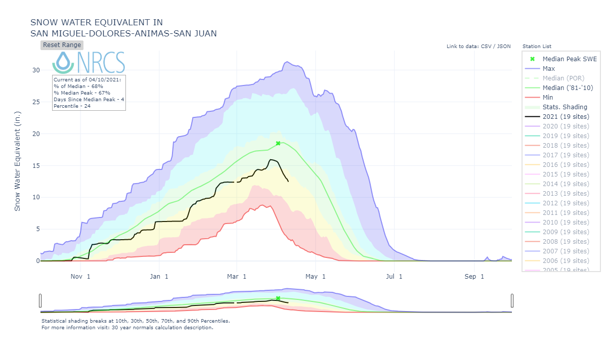
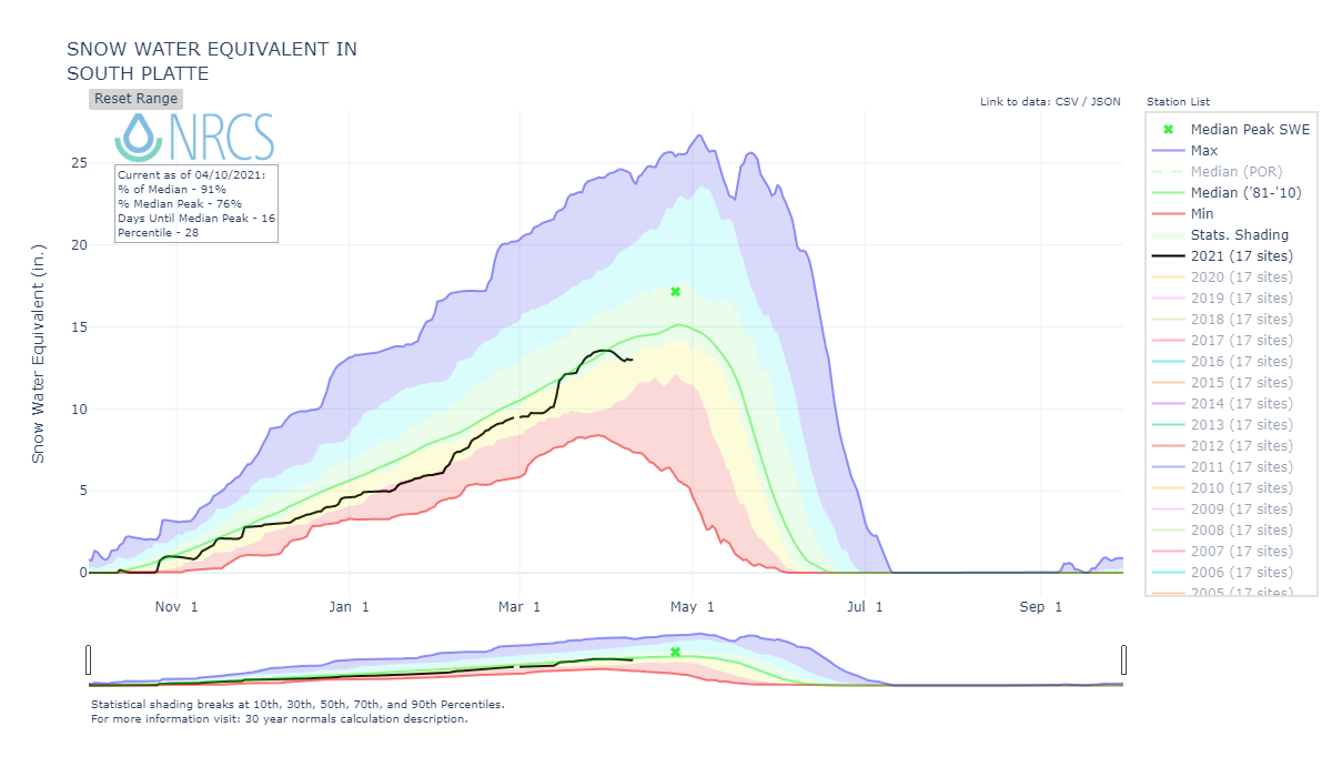
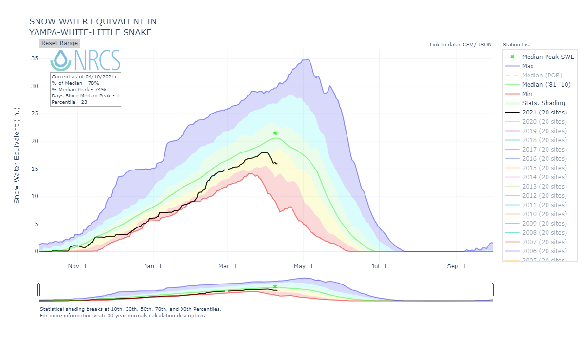
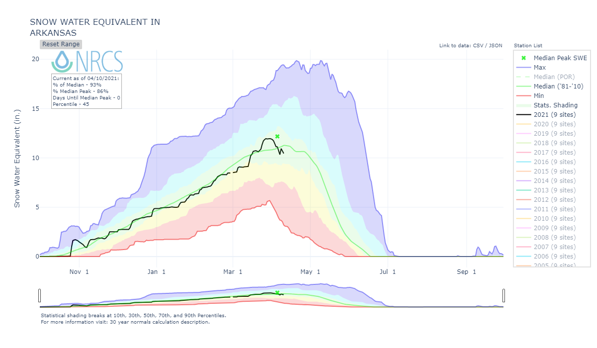
Spring ramped up quickly since our last storm March 23-26. Following that storm ~14 days ago hot and sunny conditions set in and it has mostly continued. Obviously, with the melt that has already taken place at lower elevations, and given the forecast, peak SWE has occurred for major basins throughout Colorado. Even for basins that were near normal 2 weeks ago the dust on the surface, lack of precipitation, and heat has rapidly depleting the snowpack, resulting in well below SWE percentages currently.
Along with the hot/dry there have been a multitude of high wind advisories, red flag and dust warnings throughout Colorado and adjacent states these past 10 days. Individual reports and satellite imagery both attest to airborne dust in or making its way to Colorado. Thursday I was sampling dust at Swamp Angel and looked up to see what looked like more dust being brought in. It is more common to see the dust come out of the SW but there were at least two occasions, Tuesday and Thursday, it came W-NW. Observations in and around Red Mountain Pass reveal dust is very apparent on the surface at all elevations and severity is about “normal”, not light, and not severely darkened. Normal is still significant, and there are also two moderate dust layers beneath the San Juan Mountain snowpack that have yet to surface. When they do the snow surface will darken even more so. If we do not get snow this spring this dust (plus whatever else we get) will very much quicken snowmelt, making for an early runoff.
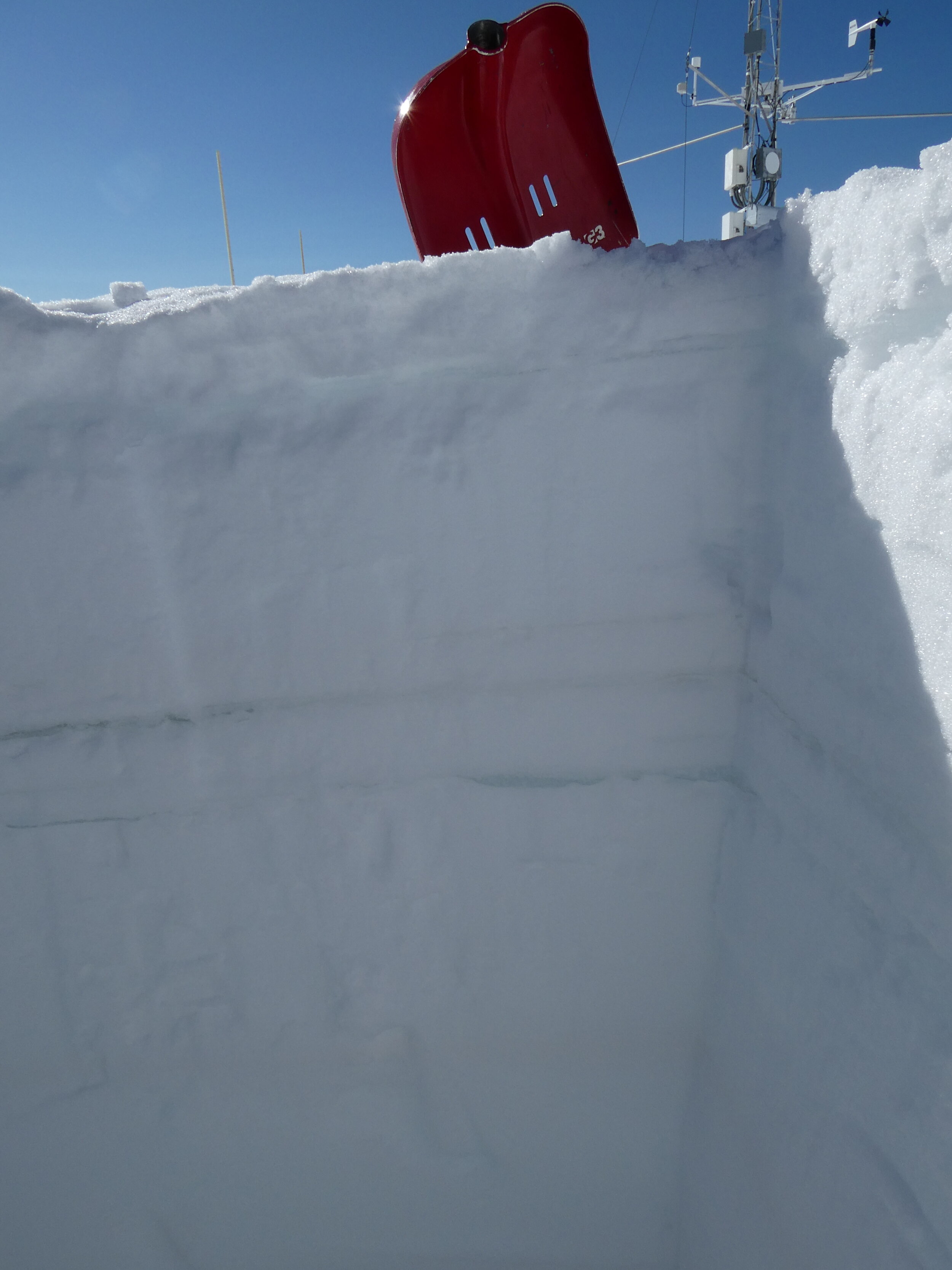
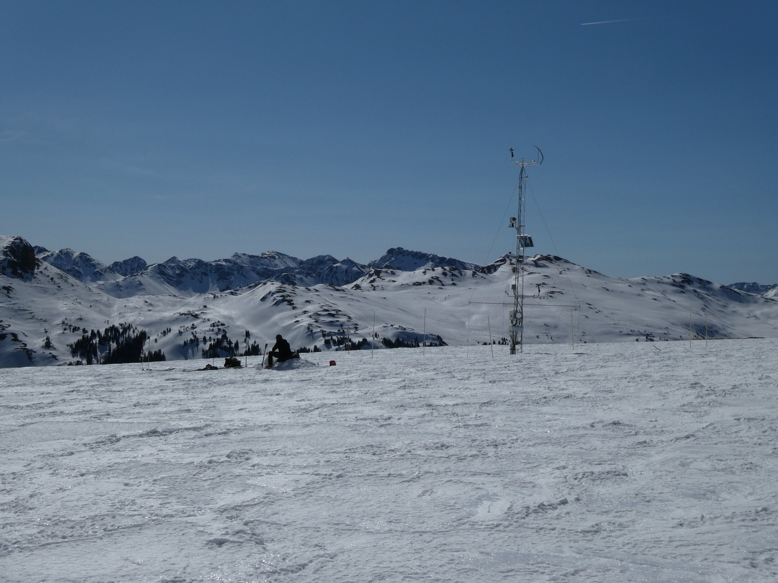
At 11,000’, at Swamp Angel, the snowpack is isothermal (0 degrees C) and snow depth is around 5’. The snowpack is dense, moist but not saturated. SWE is 22.4”. Dust is on surface and 7.9” below, and 26” below surface. See SASP pit form here
At 12,200’, at Senator Beck total SWE was 20.2”and snowpack temperature is still coolish at around -1.5 C. Snow depth of the snow profile was 4’. Dust is located on the surface, 12” below surface, 26” below the surface generally. See SBSP pit form here
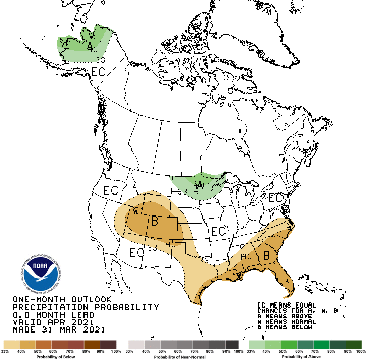
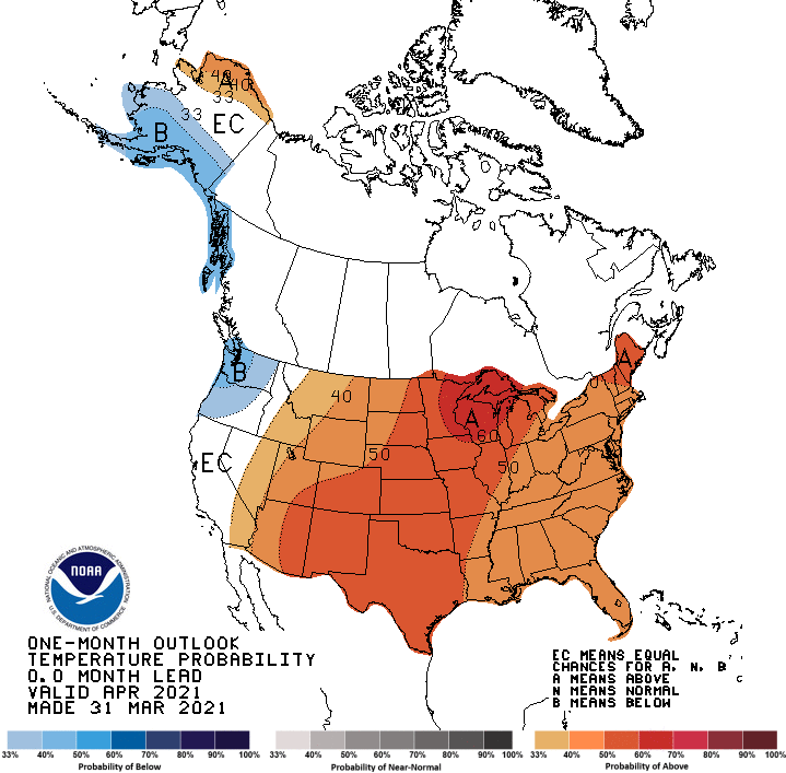
This April is shaping up to be drier than last year, April 2020, where that month kicked off a very dry and warm ablation season that depleted the snowpack rapidly. At Senator Beck last April for the month we observed 2.3” precipitation, this April we have seen 0 so far. The forecast for the next week calls for unsettled weather with spots of precipitation around the state, we could see nice totals in certain locales (the forecast needs to come into focus) but it is mostly centered around the northwest quadrant of the state. The longer term forecast is the usual, increased chance of higher temperatures and less than normal precipitation.
With the lack of snow accumulation and hot/dry conditions so far this April we will do another CODOS statewide tour soon, starting next week, to see the location of existing dust that we noted last CODOS trip and determine the location and severity of dust-on-snow after these dry and windy last couple weeks.
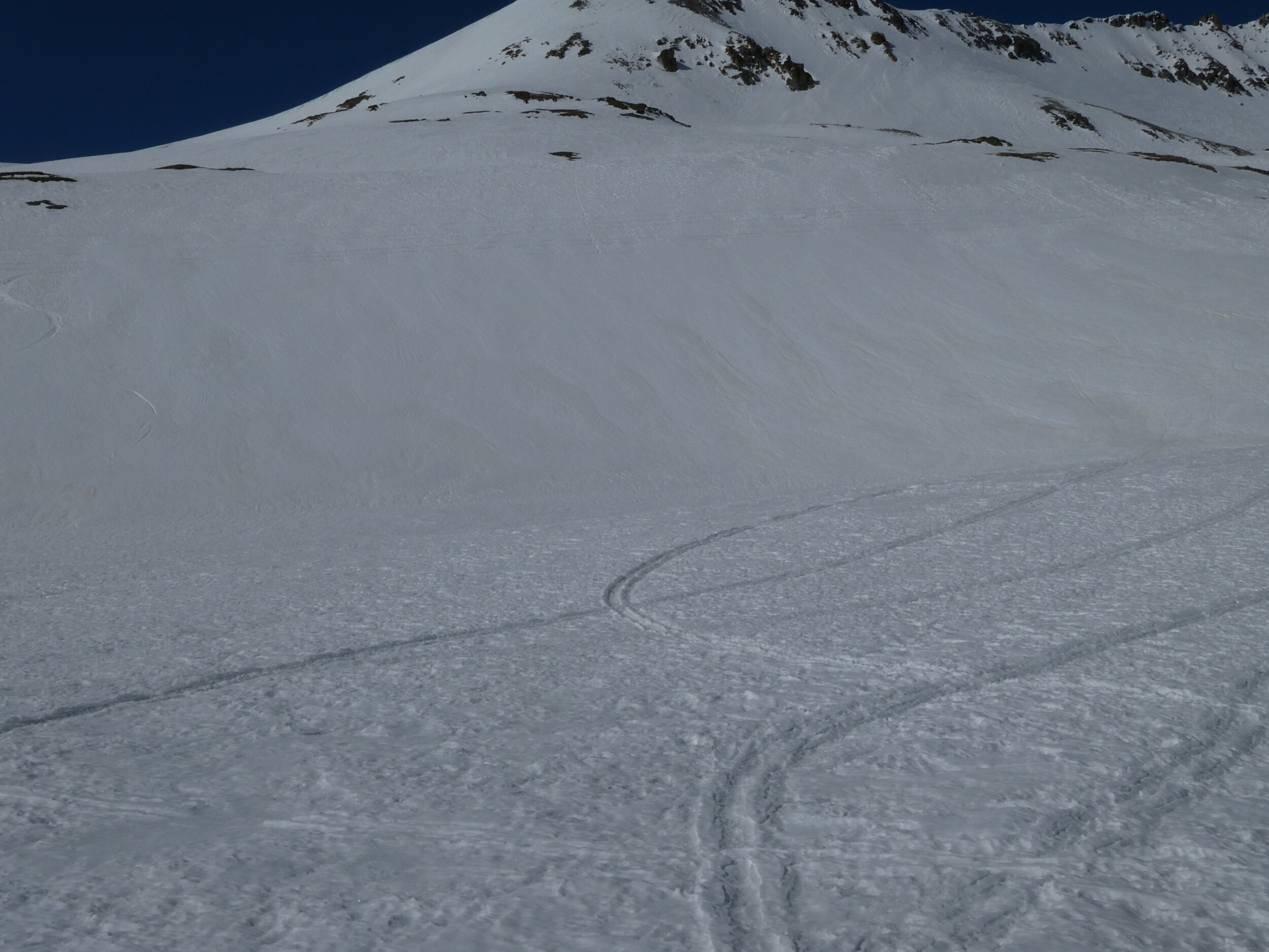
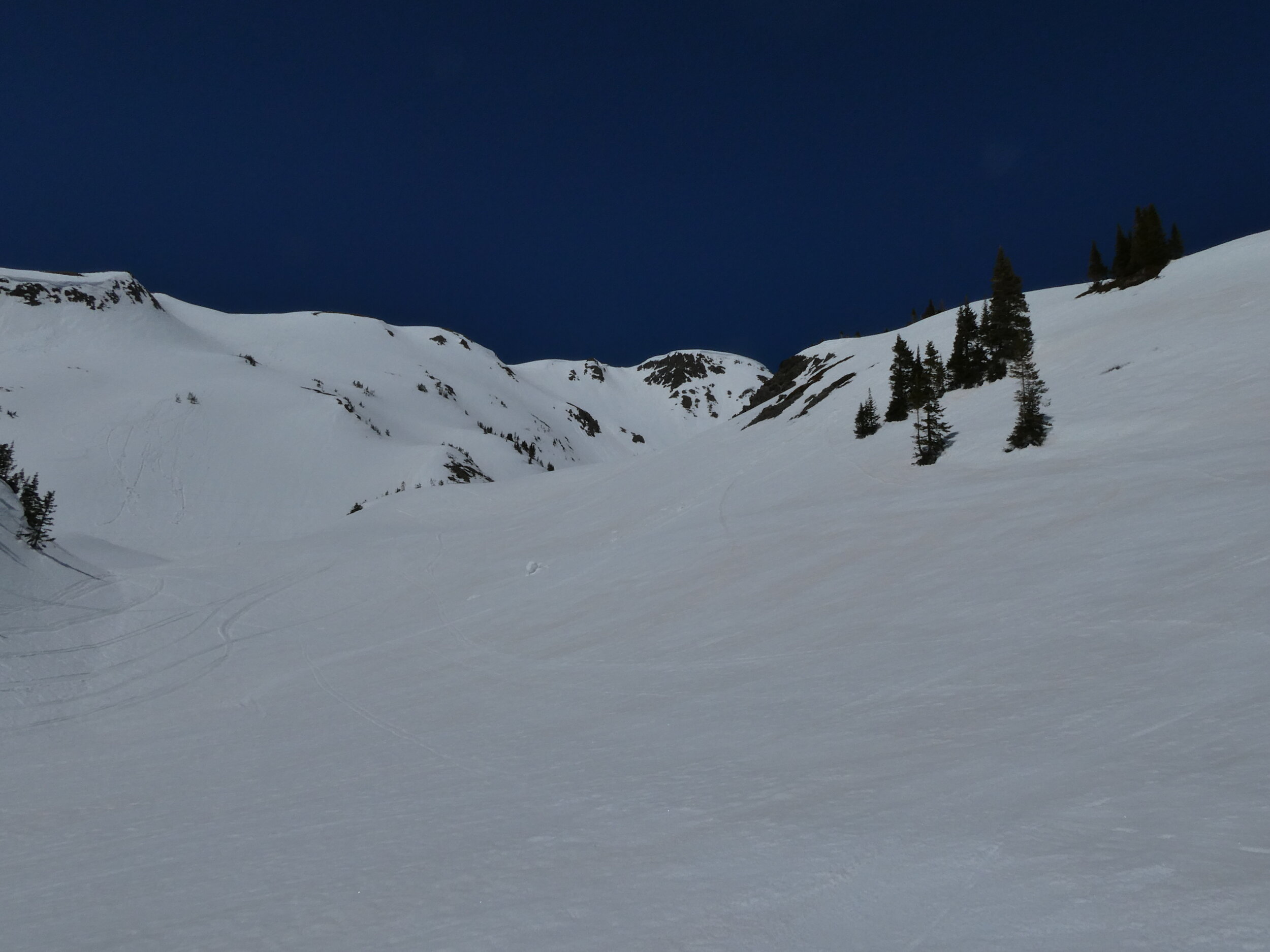
Please see pictures below.
Take Care


So far April has been hot and dry.